Are you sure you want to delete image ?

To Search, simply enter a word or phrase in the search box and click on the Search button (or hit Enter).
In the search results, the search term is highlighted to indicate where the match was made.
Clicking on the thumbnail image opens a larger version of the image (zoomable), with that image being part of a slideshow of all of the images on the page.
The bookmark icon can be selected to flag the image to be included in a "bookmark" list.
The collection name is linked to a search of all of the images in that collection, and if a PDF finding aid for the collection exists, an icon is displayed that links to that file.
In the search results, the search term is highlighted to indicate where the match was made.
To view a list of collections click on the  icon in the top-right of the screen:

You can search for a collection by entering text in the search field, or you can view a list of collections by year by clicking on item in the list:

Clicking on a collection name will display all of the images from that collection. The number of images in the collection is displayed in parentheses. Clicking on the  icon will display the finding aid for the collection (if available):

To view a list of collections click on the  icon in the top-right of the screen:

You can search for a collection by entering text in the search field, or you can view a list of collections by year by clicking on item in the list:

Images may be bookmarked to simplify finding them at a later time. To bookmark an image, click on the  icon located next to the image number:

The bookmark icon will change to black to indicate that the image has been bookmarked, and the bookmark icon in the top-right of the screen will turn white, with the number of bookmarked images indicated to the left:

To view your bookmarked images, click on the white bookmark icon in the top-right of the screen with the number next to it.
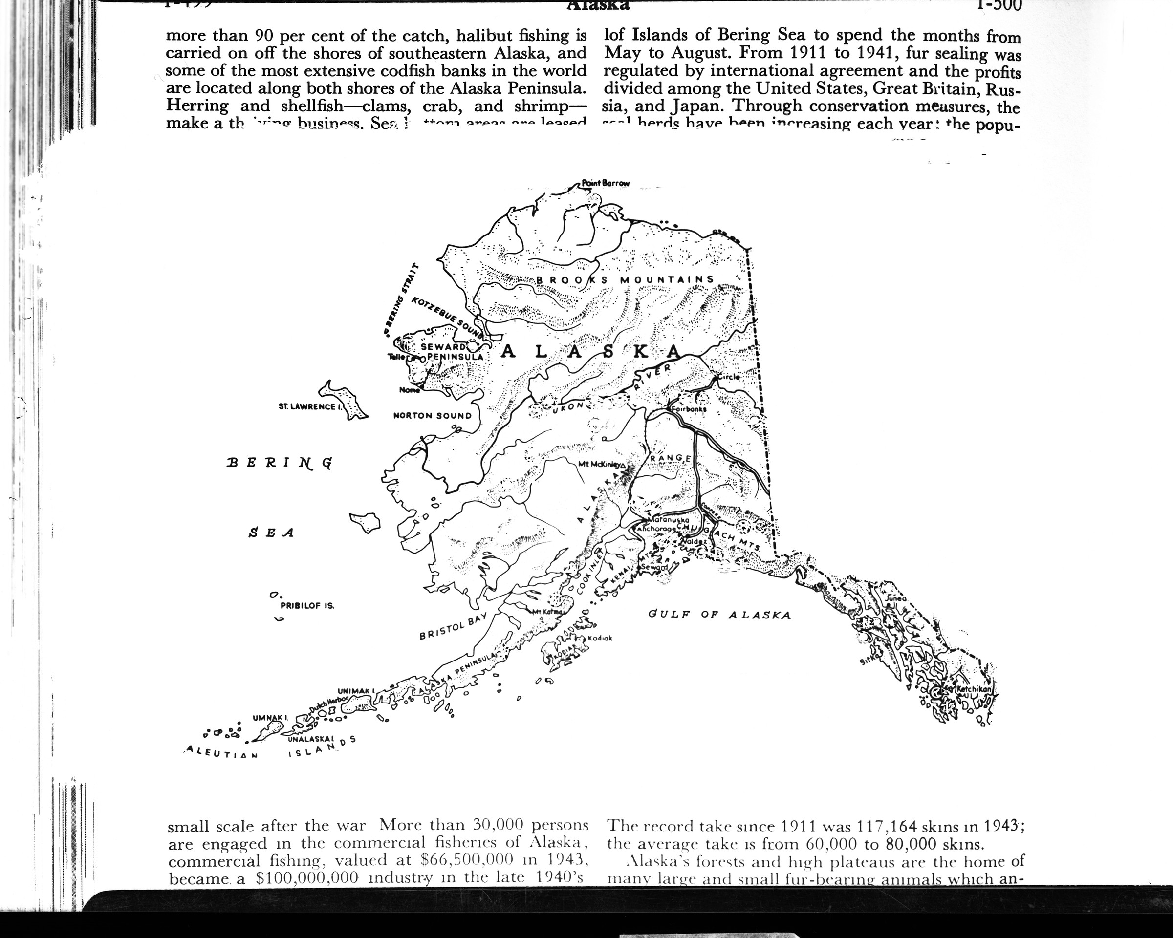
The Anchorage Museum library includes books, maps, and print resources focused on Alaska and the Circumpolar North. The public is welcome to access the collection and conduct research on-site during open hours, or by appointment.
The Anchorage Museum archives include historic photographs and print materials covering a broad range of topics related to Alaska and the Circumpolar North. Some materials are available online, while others are available for detailed research on site at the Bob and Evangeline Atwood Alaska Resource Center.
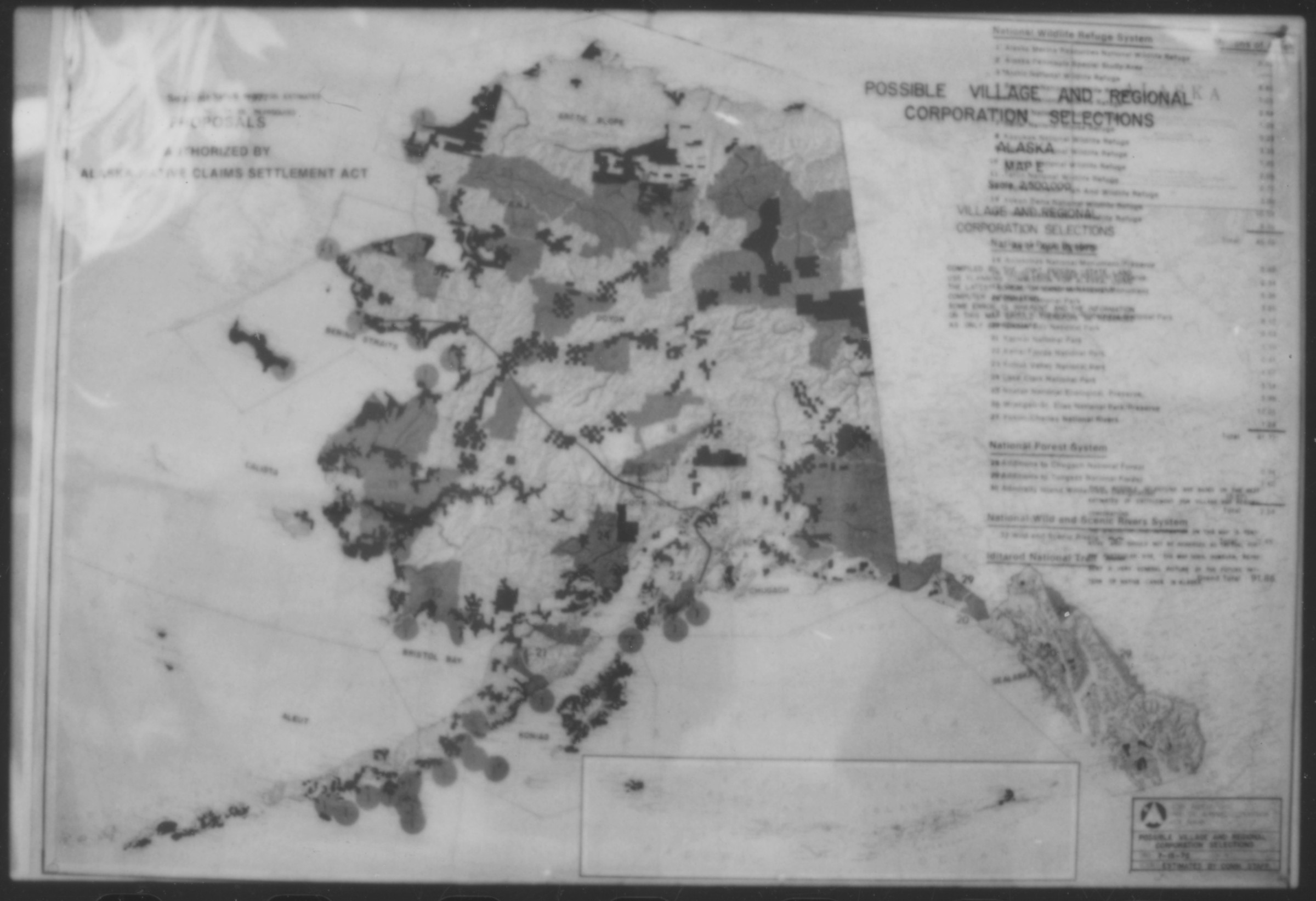
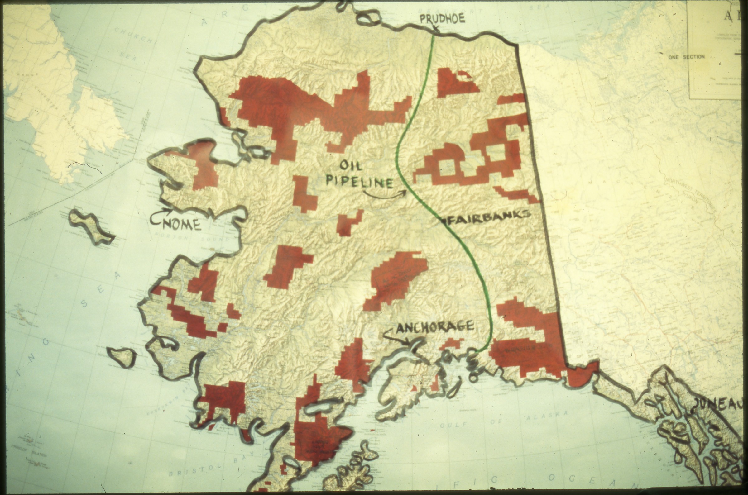
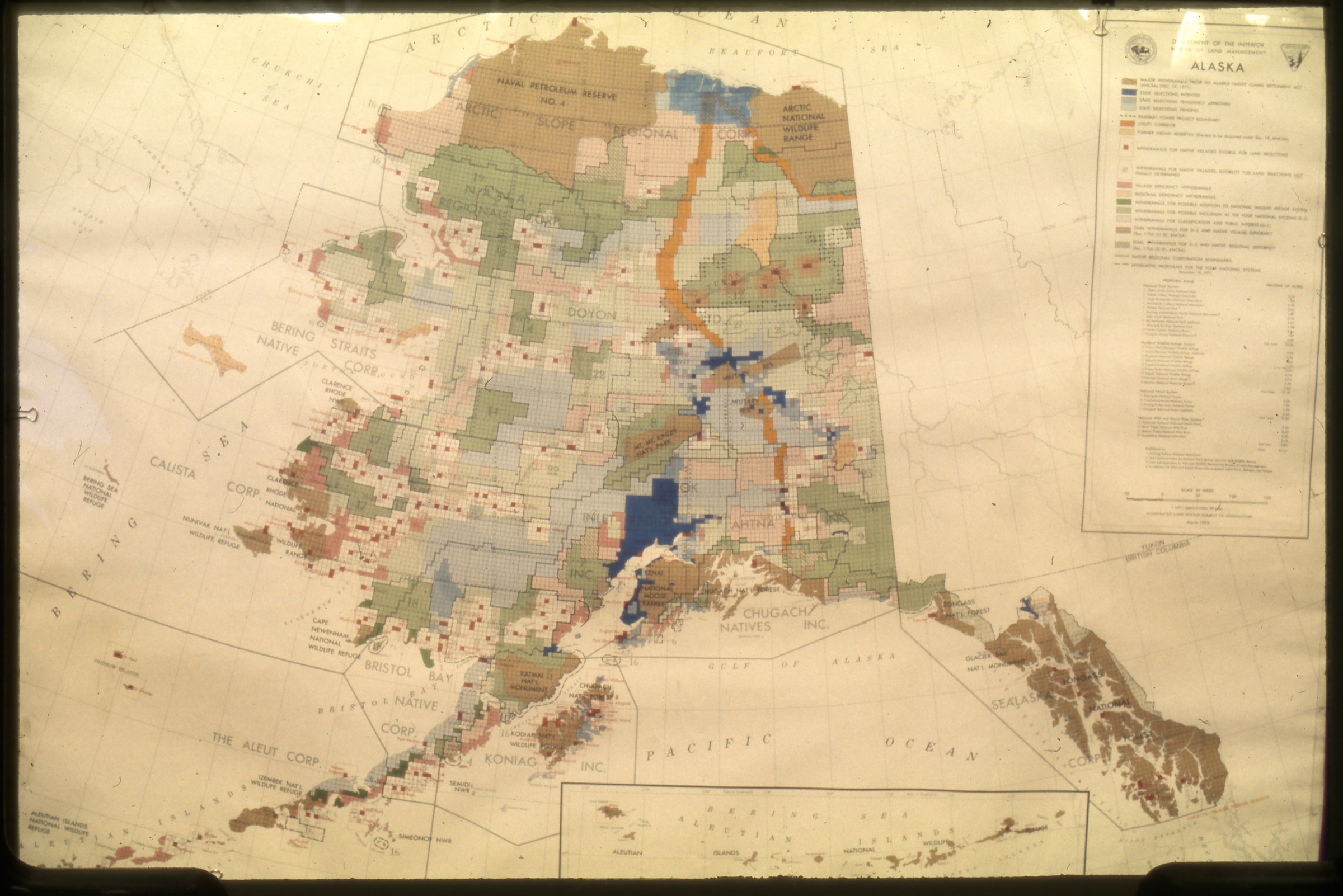
B1994.008.149.08
(maps of possible village and regional corporations selections)
Keywords: map
Collection: B1994.008
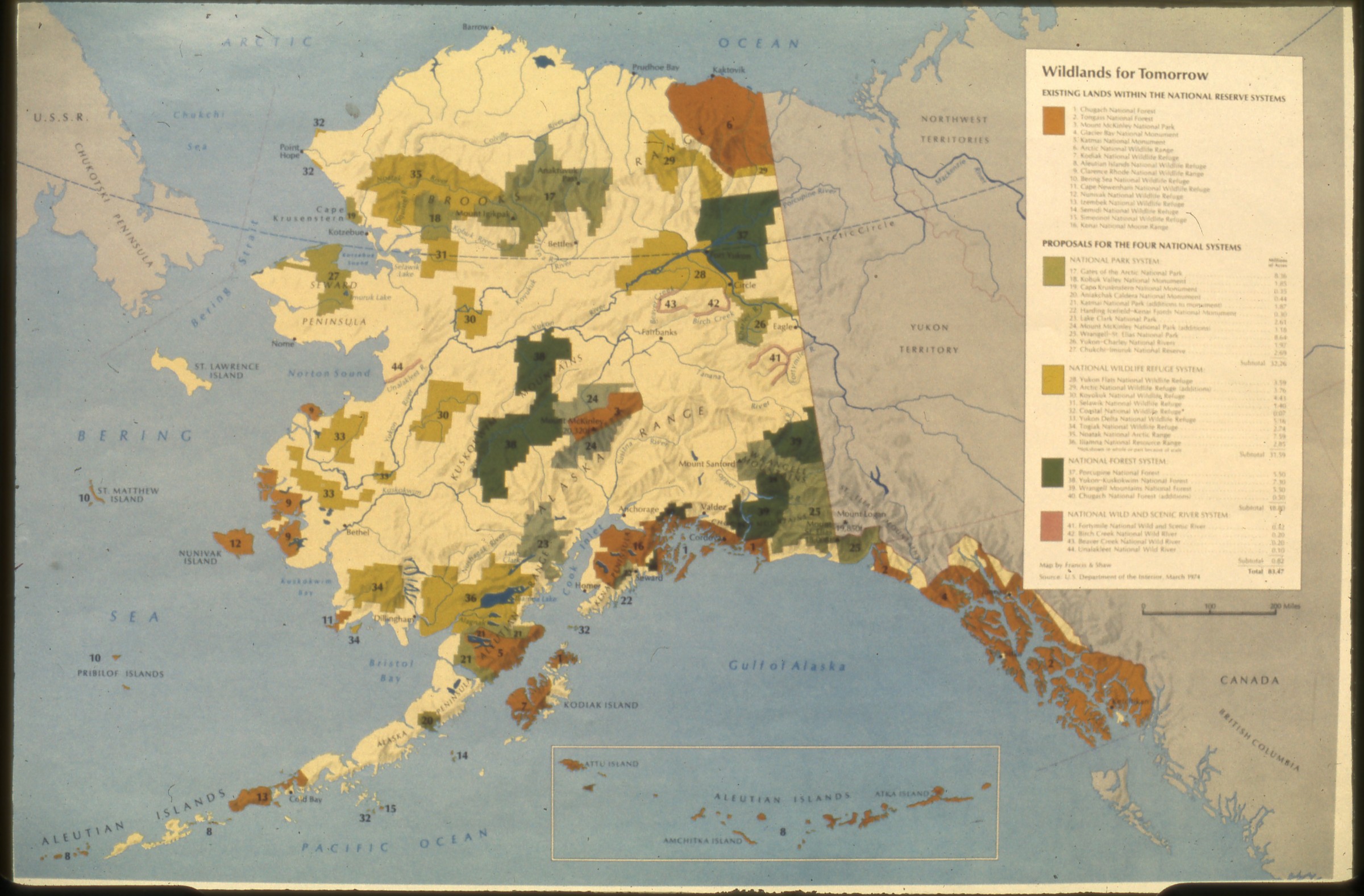
B1994.008.266.slide
(map of Alaska lands within national preserve system)
Keywords: map
Collection: B1994.008
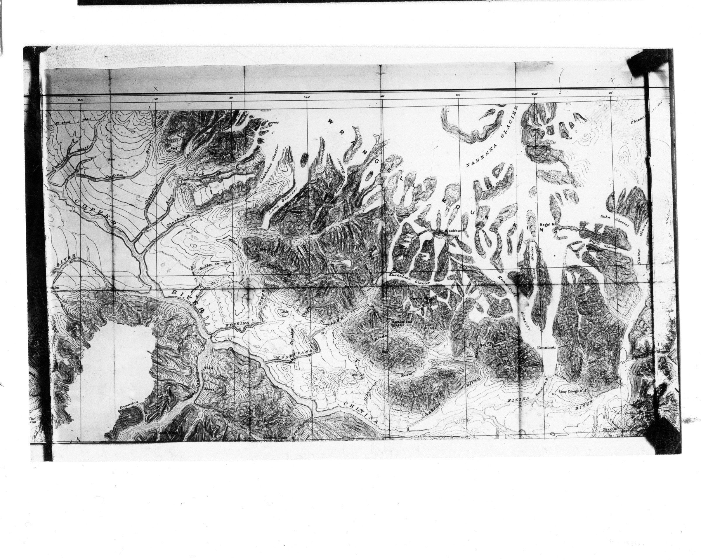
B2015.008.963
[map with Copper River on west and Kennicott Glacier on east]
Keywords: map
Collection: B2015.008
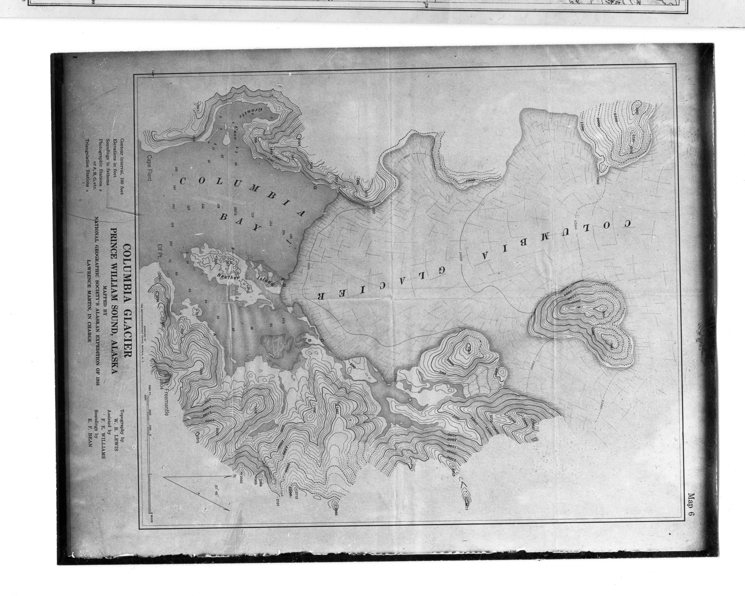
B2015.008.960
[map of Columbia Glacier, Prince William Sound, Alaska (1910)]
Keywords: map
Collection: B2015.008
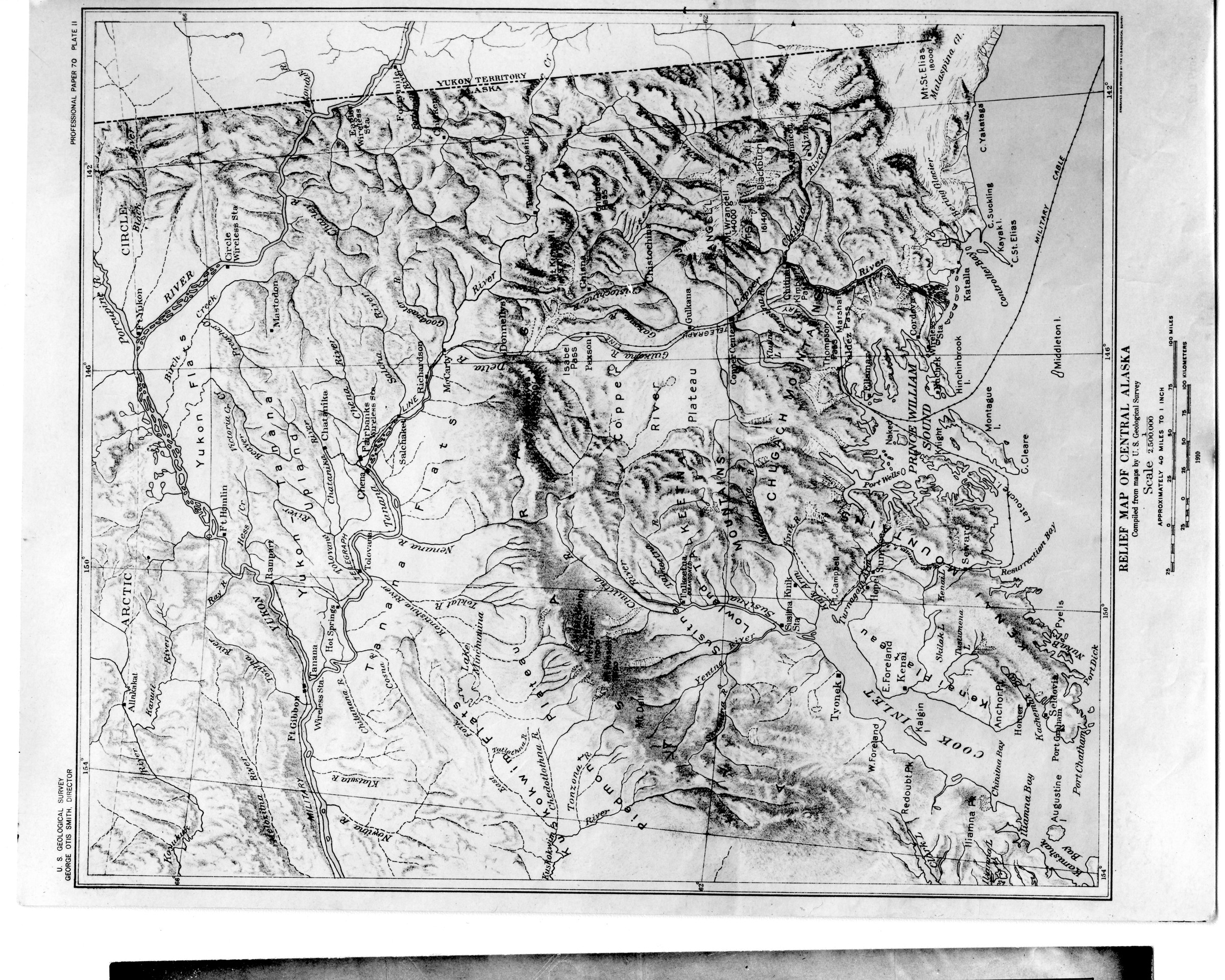
B2015.008.957
4 [Relief map of Central Alaska (1910). With stamp of Dora Keen]
Keywords: map
Collection: B2015.008
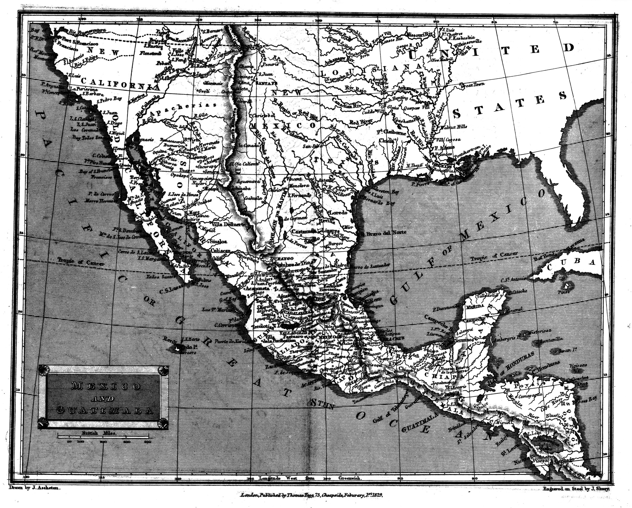
B1998.014.1.2592
"Map of Mexico Guatimala [sic]" [1829 map; Guatemala]
Collection: B1998.014 Brickley
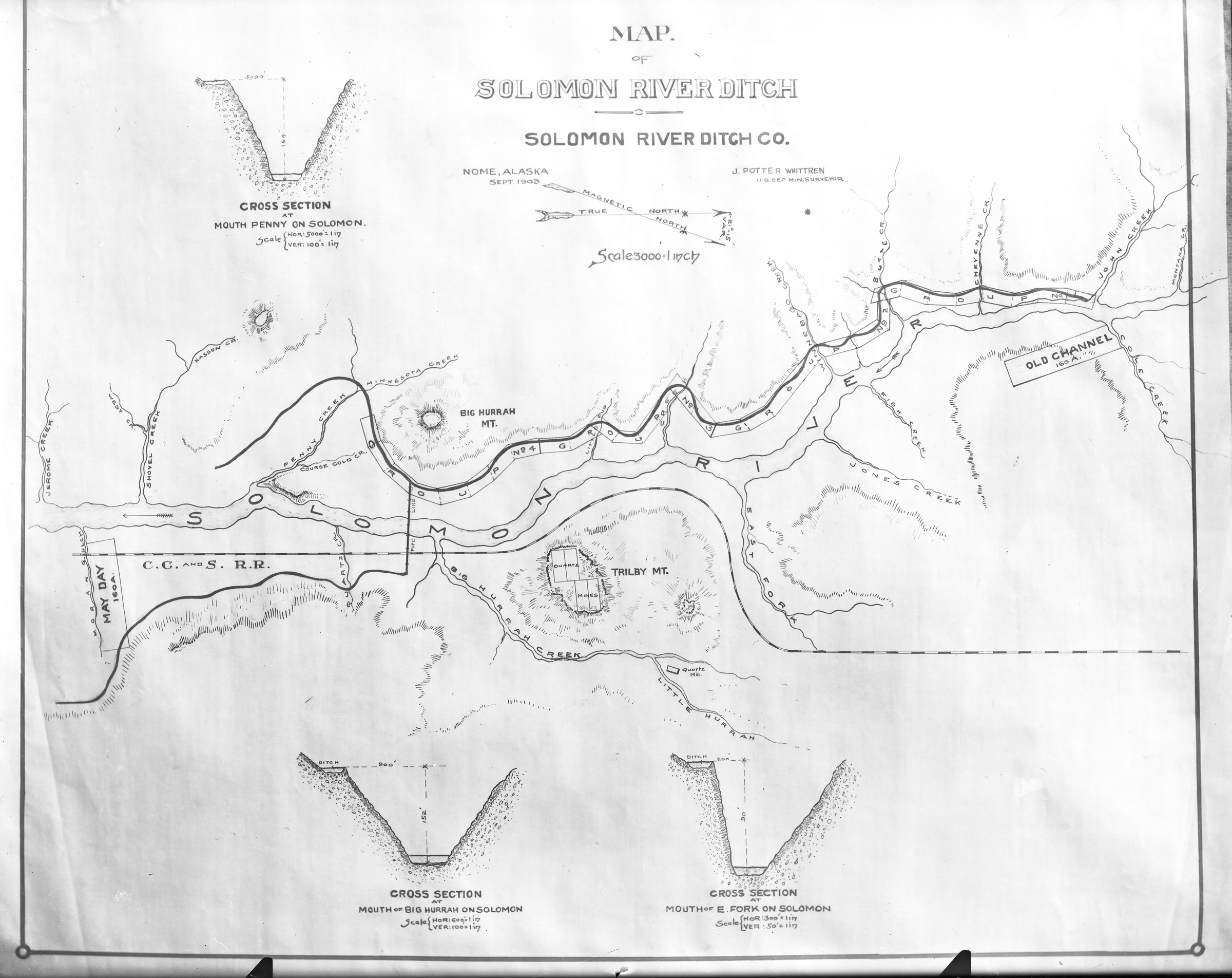
B2001.041.268
Map of Solomon Ditch
Keywords: mining, map, navigation, gold mining, gold rush, mining claim
Collection: B2001.041 Goetze
B2015.008.961
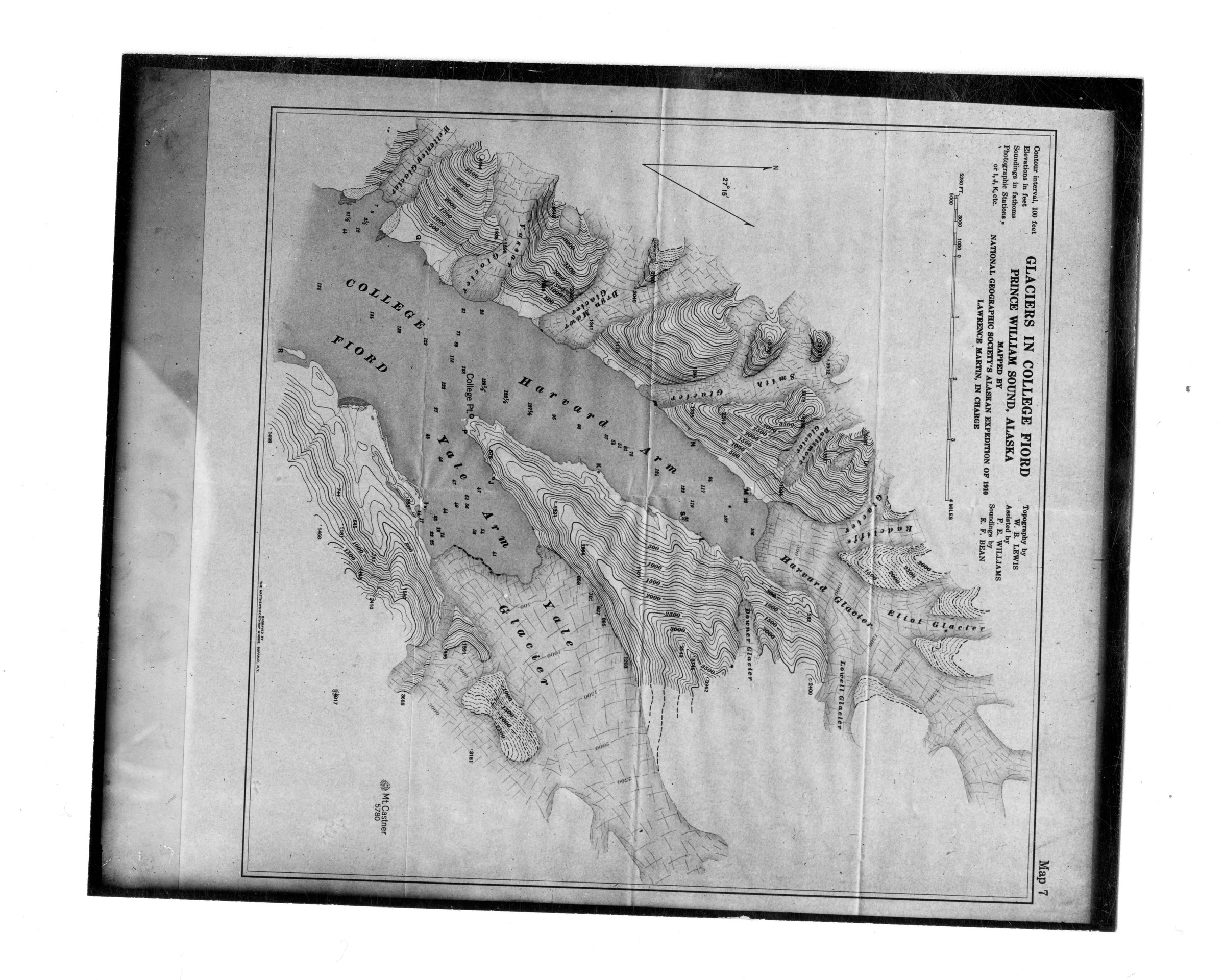
[map of Glaciers in College Fiord, Prince William Sound, Alaska (1910). With stamp of
Dora Keen]
Keywords: map
Collection: B2015.008
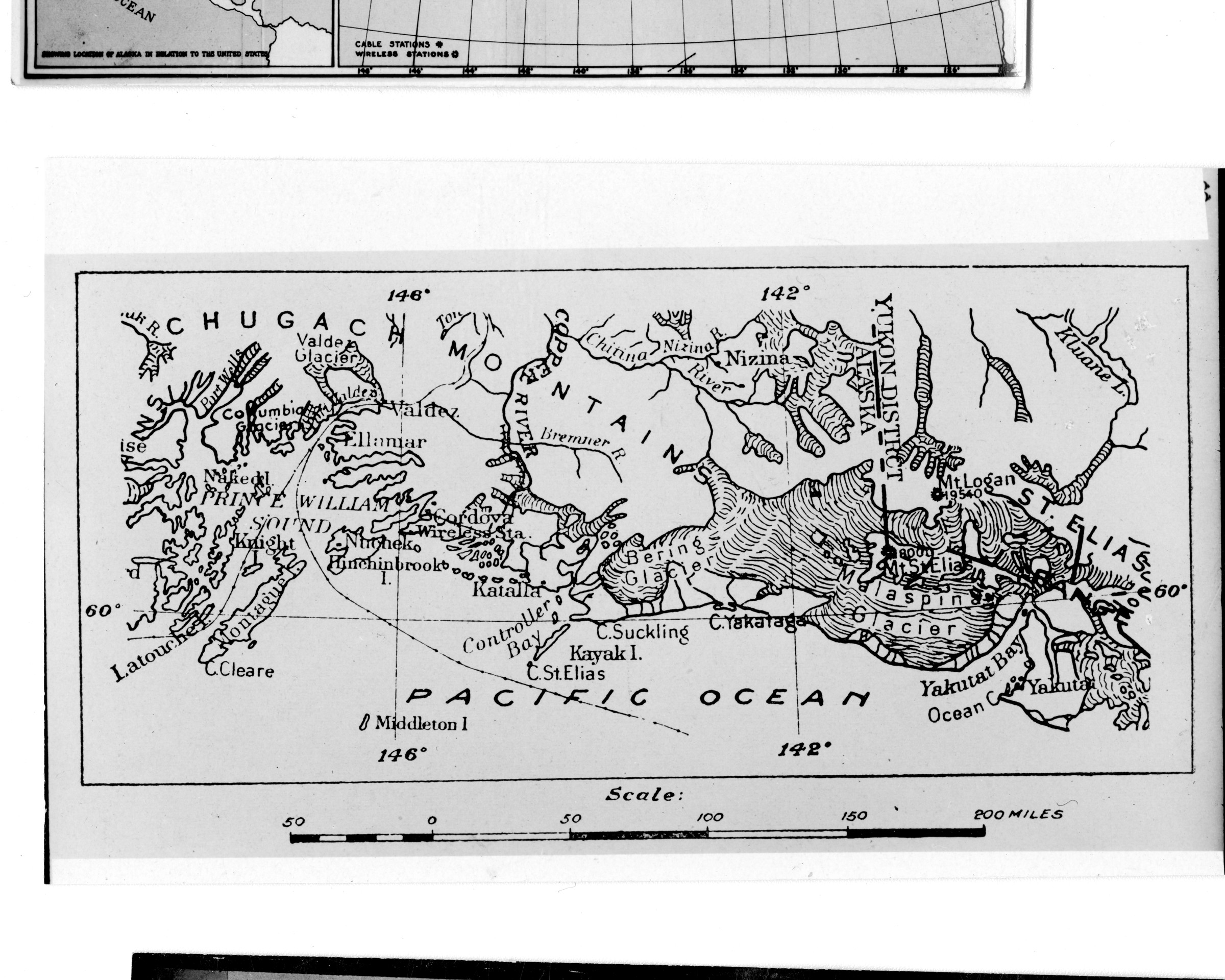
B2015.008.958
[map of upper Gulf of Alaska region from Latouche and Columbia Glacier on west to
Yakutat and Kluane Lake on east]
Keywords: map
Collection: B2015.008
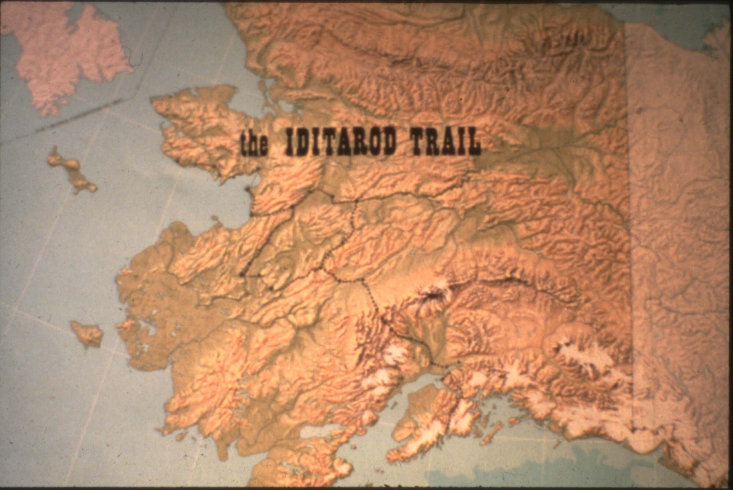
B2006.023.2379.jpg
The Iditarod Trail. Relief map.
Collection: B2006.023 Redington / for Joe Jr to review / 2001-3000
B2015.008.962
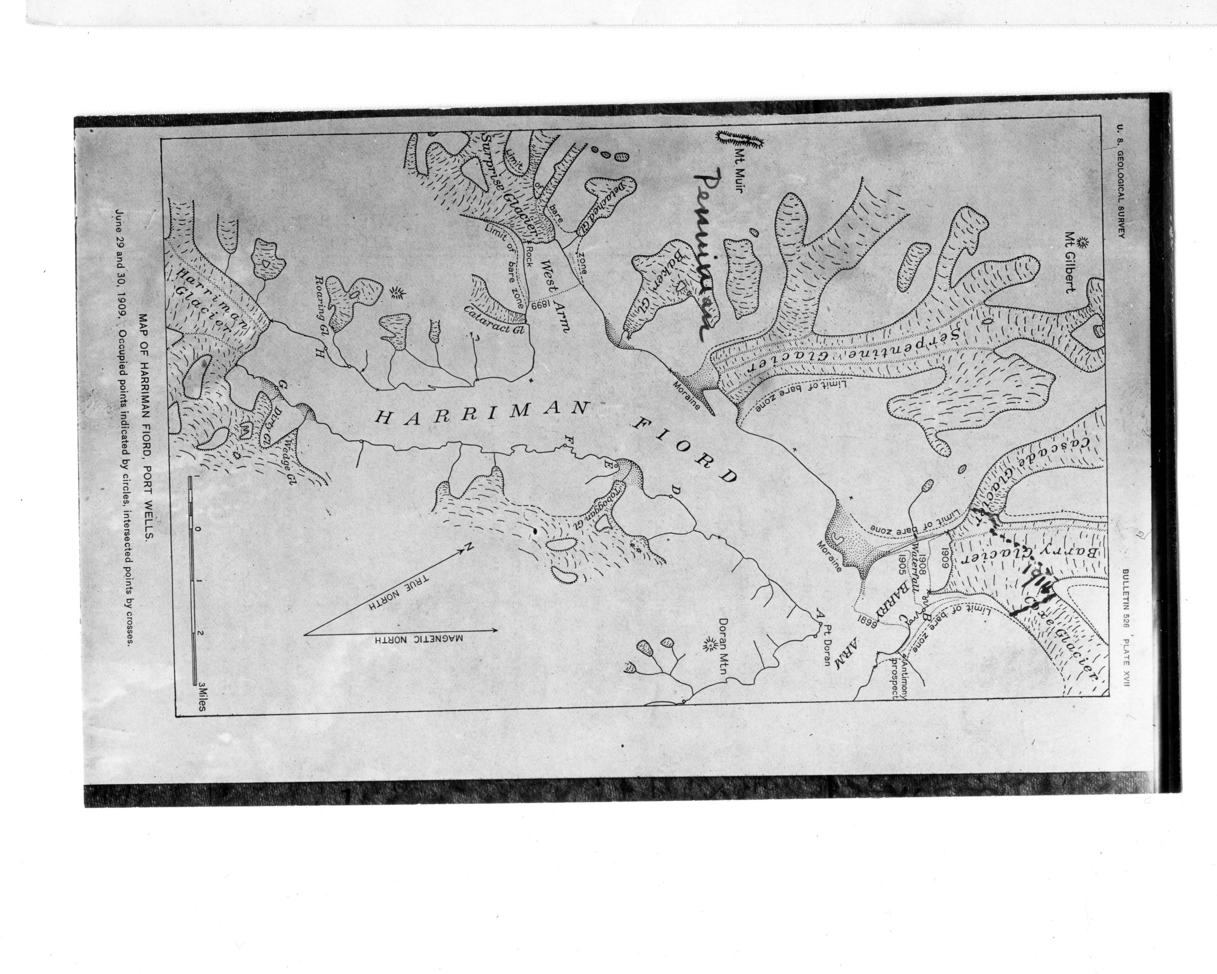
Note especially the heavy 1914 line of the Barry Glacier and former tributaries and
progressive recession shown by lines of previous years. Letters show the photographic
stations of Grant and Page whose map it is. (Enlarge if possible) [Map of Harriman Fiord, Port
Wells (1909)]
Keywords: map
Collection: B2015.008
B1998.014.1.1305
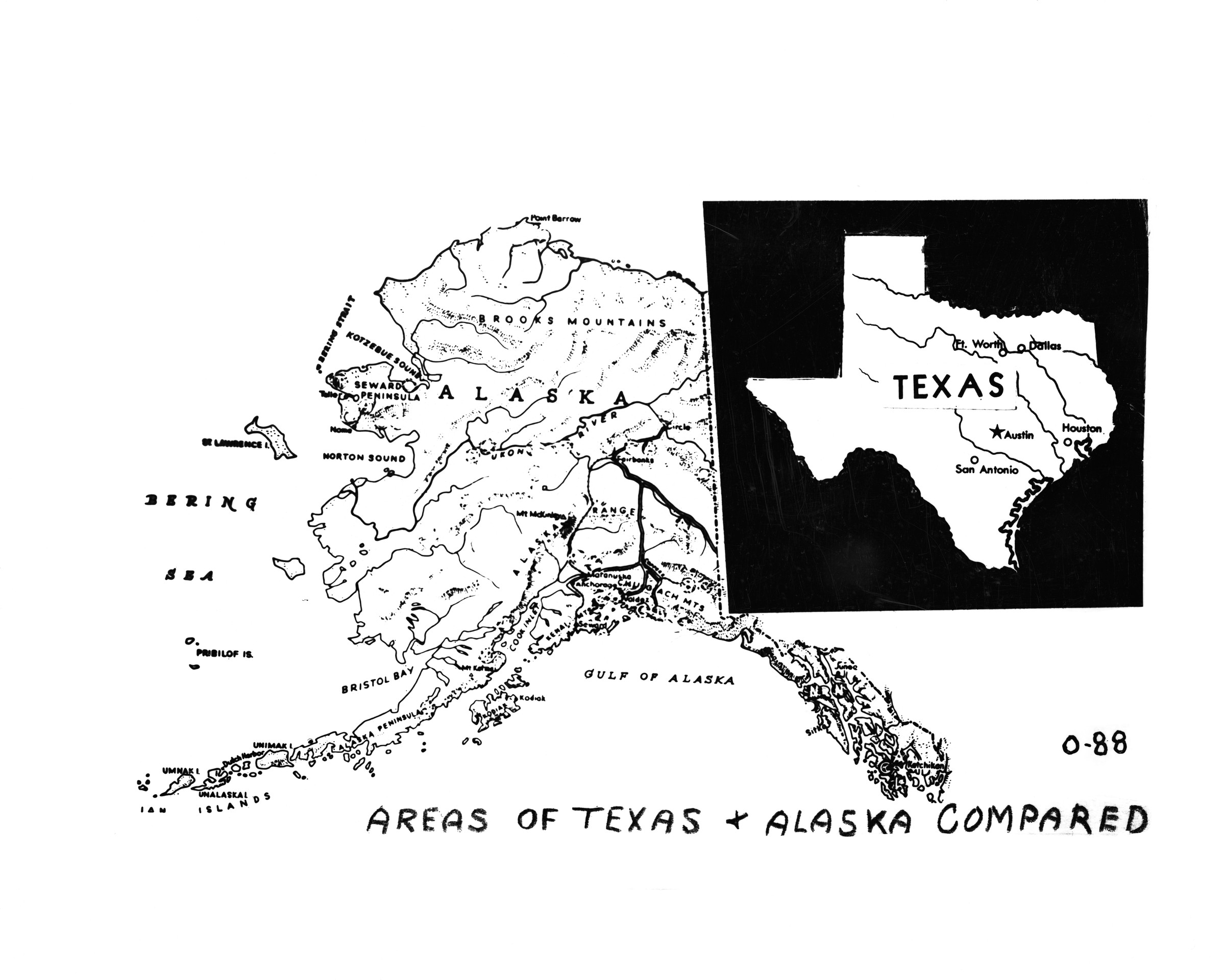
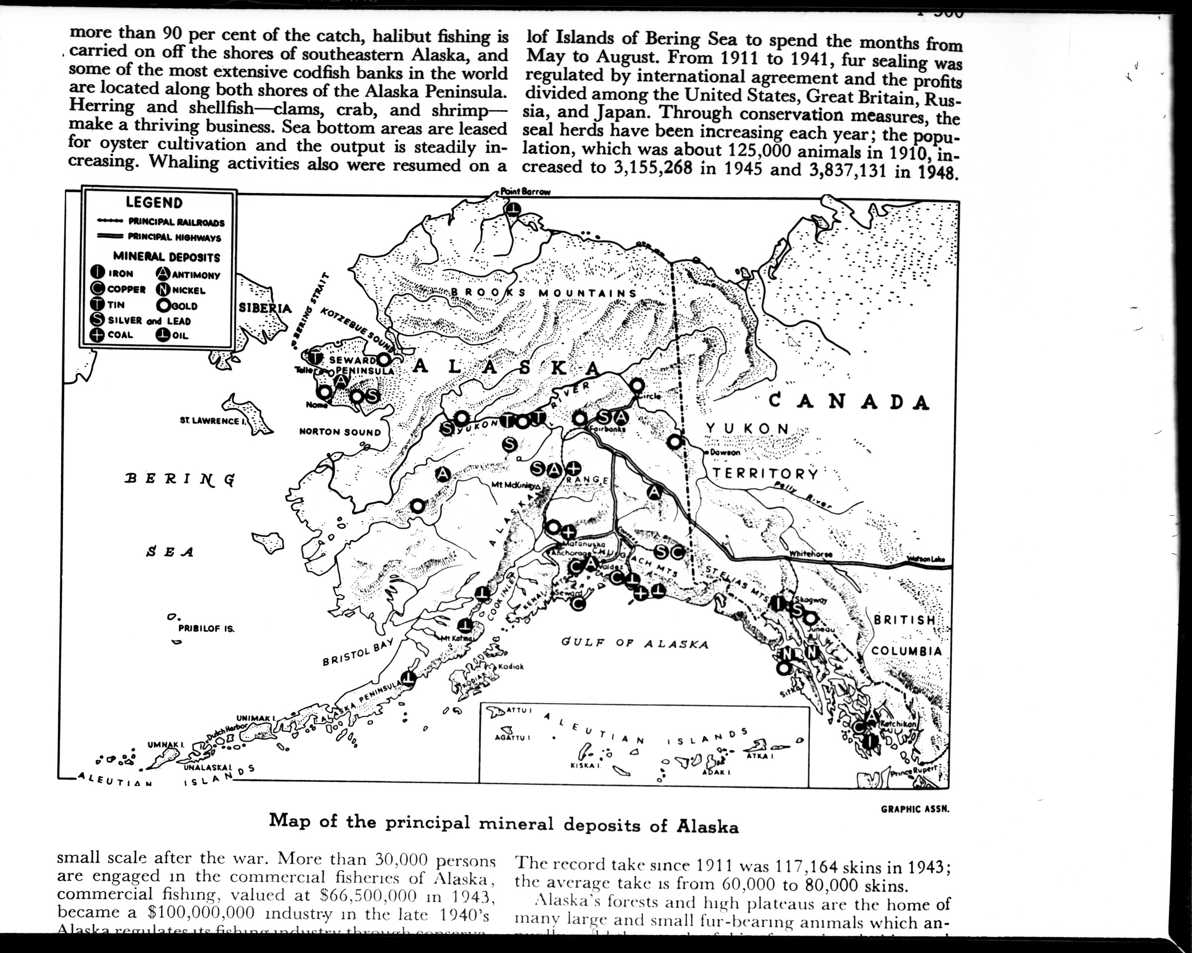
(O88 Alaska & Texas maps compared) [map of Alaska indicating mineral deposits taken from book page - same map as .1304]
Collection: B1998.014 Brickley
B1998.014.1.2590
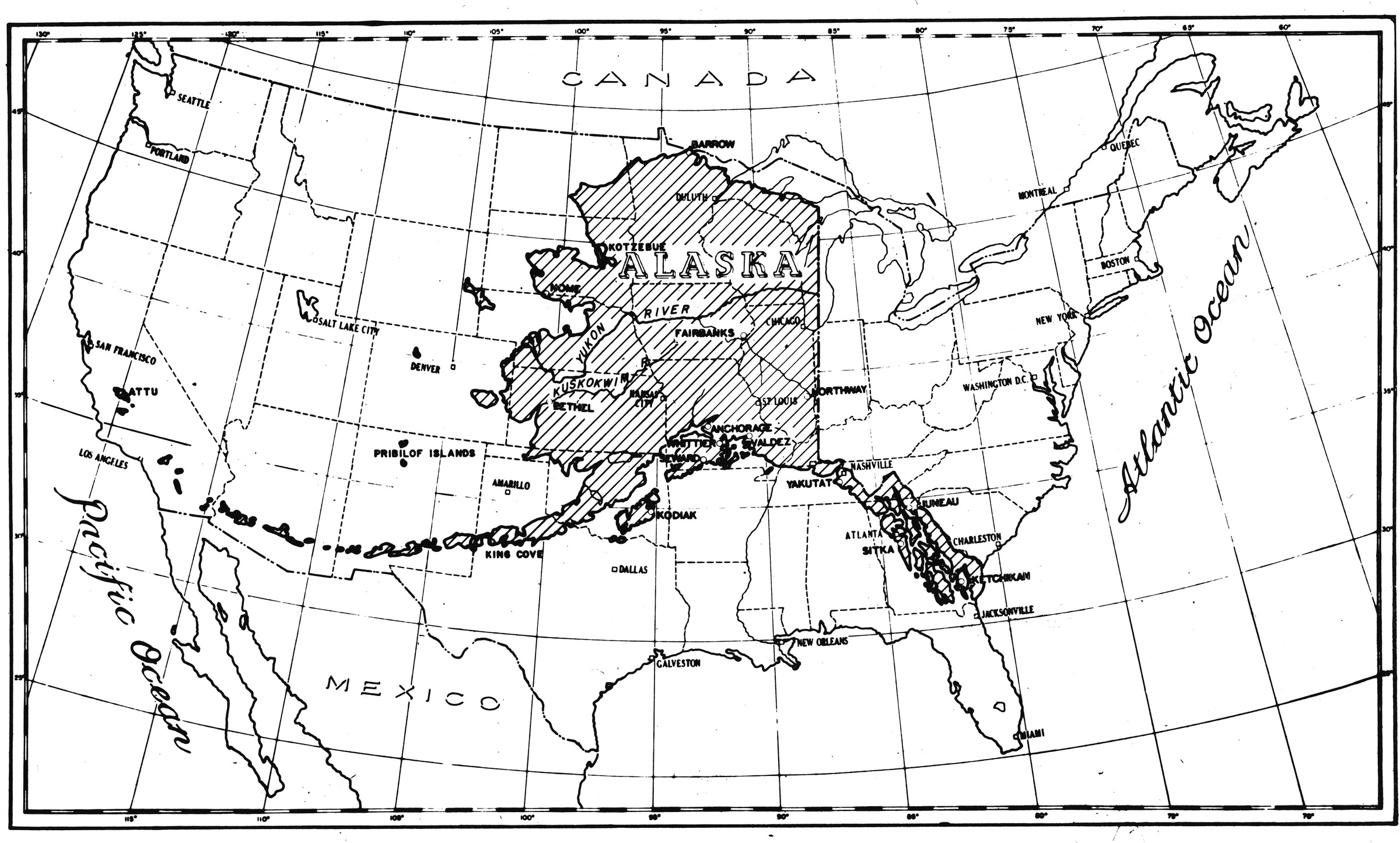
"Map of AK over USA" [map of Alaska superimposed over Lower-48 states]
Collection: B1998.014 Brickley

B1998.014.1.2591
"Map of AK over USA" [map of Alaska superimposed over Lower-48 states; neg had been touched-up]
Collection: B1998.014 Brickley
B1998.014.1.1303
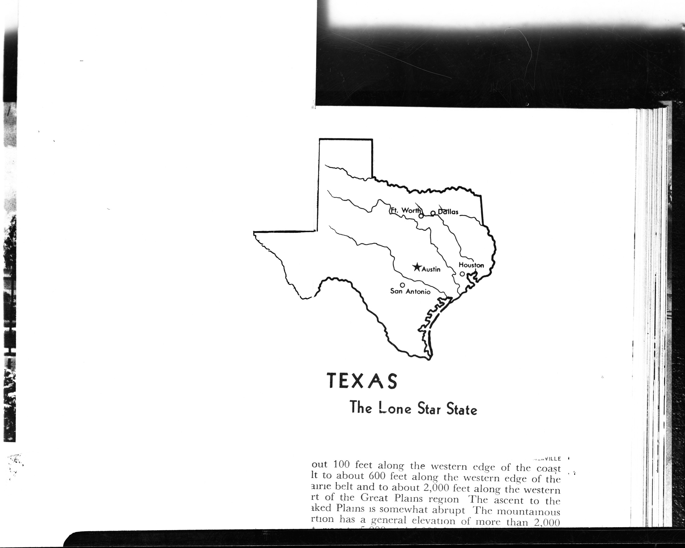
(O88 Alaska & Texas maps compared) [image of Texas map and text from book. "Texas, the Lone Star State"]
Collection: B1998.014 Brickley
B2015.008.955
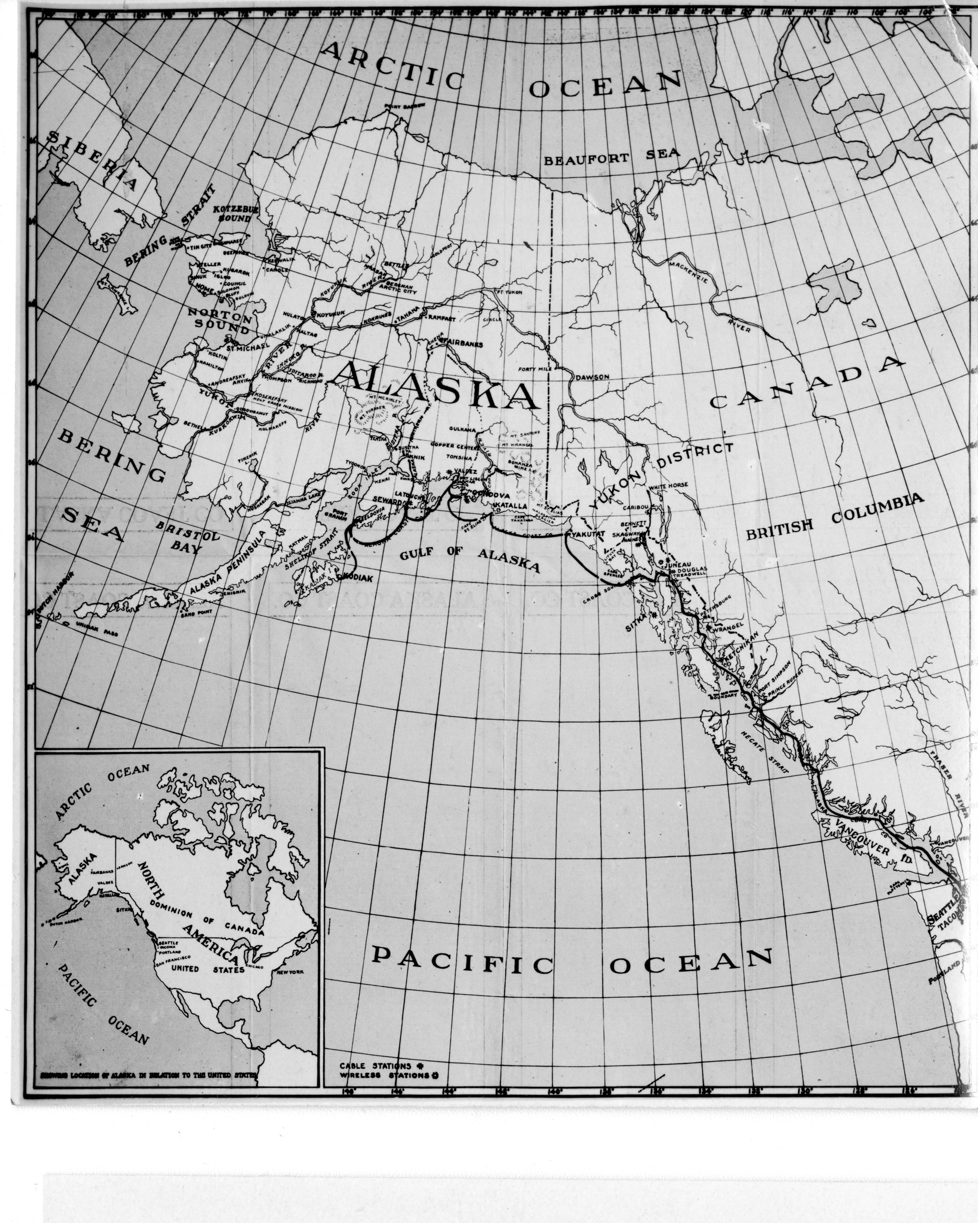
(Enlarge) Alaska is 1/5 the size of the U.S., but has only 65,000 pop., because its vast
resources cannot well be developed until railways are built, and this is too costly for private
capital [map of Alaska with passenger ship route, cable and wireless stations, inset of United
States. With stamp of Dora Keen]
Keywords: map
Collection: B2015.008

B2015.008.959
(Enlarge) Prince Wm. Sound. College Fjord & Harriman Fjord are at the head of Port
Wells (left, top). Valdez & glacier e. of top centre. Columbia Glacier w. of Valdez. The glaciers
once filled the sound [Map of Prince William Sound, Alaska (1913). With stamp of Dora Keen]
Keywords: map
Collection: B2015.008

B1998.014.1.1301
(O88 Alaska & Texas maps compared) [map of Texas and text from published book; touched up to create composite image in .1302]
Collection: B1998.014 Brickley
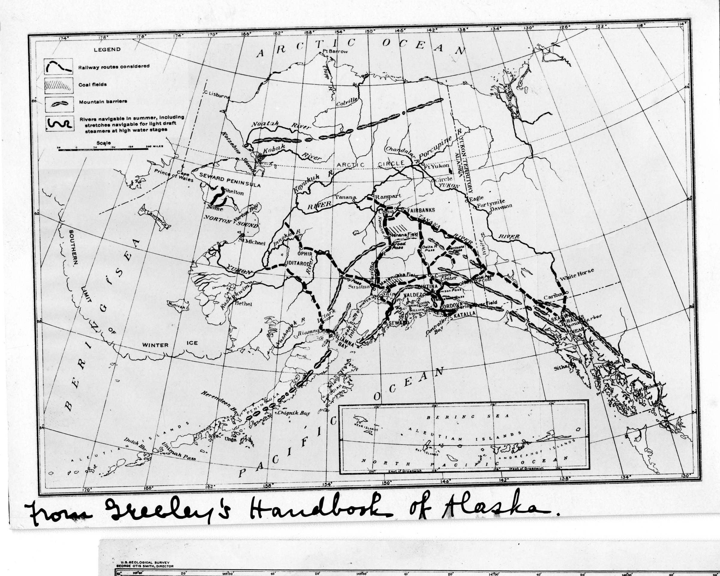
B2015.008.956
From Greeley’s Handbook of Alaska. 1. (Enlarge) Proposed gov’t. ry. routes. Note limit
of winter ice, showing ice free harbors only where mountains and glaciers bar the way to the
Yukon Valley. Valdez is seen at the head of the Gulf of Alaska. The two existing railways run
from Cordova (for 196 m.) and Seward (for 72 m.) [map of Alaska with inset of Aleutian
Islands]
Keywords: map
Collection: B2015.008
B1998.014.1.1304
(O88 Alaska & Texas maps compared) [image of Alaska map taken from book, hand modified by photographer to remove mineral data and adjacent territories]
Collection: B1998.014 Brickley
B1998.014.1.2589
"Maps of AK over USA; 2 negs" ["Relative areas Alaska and United States" map shows Alaska superimposed over Lower-48 states]
Collection: B1998.014 Brickley
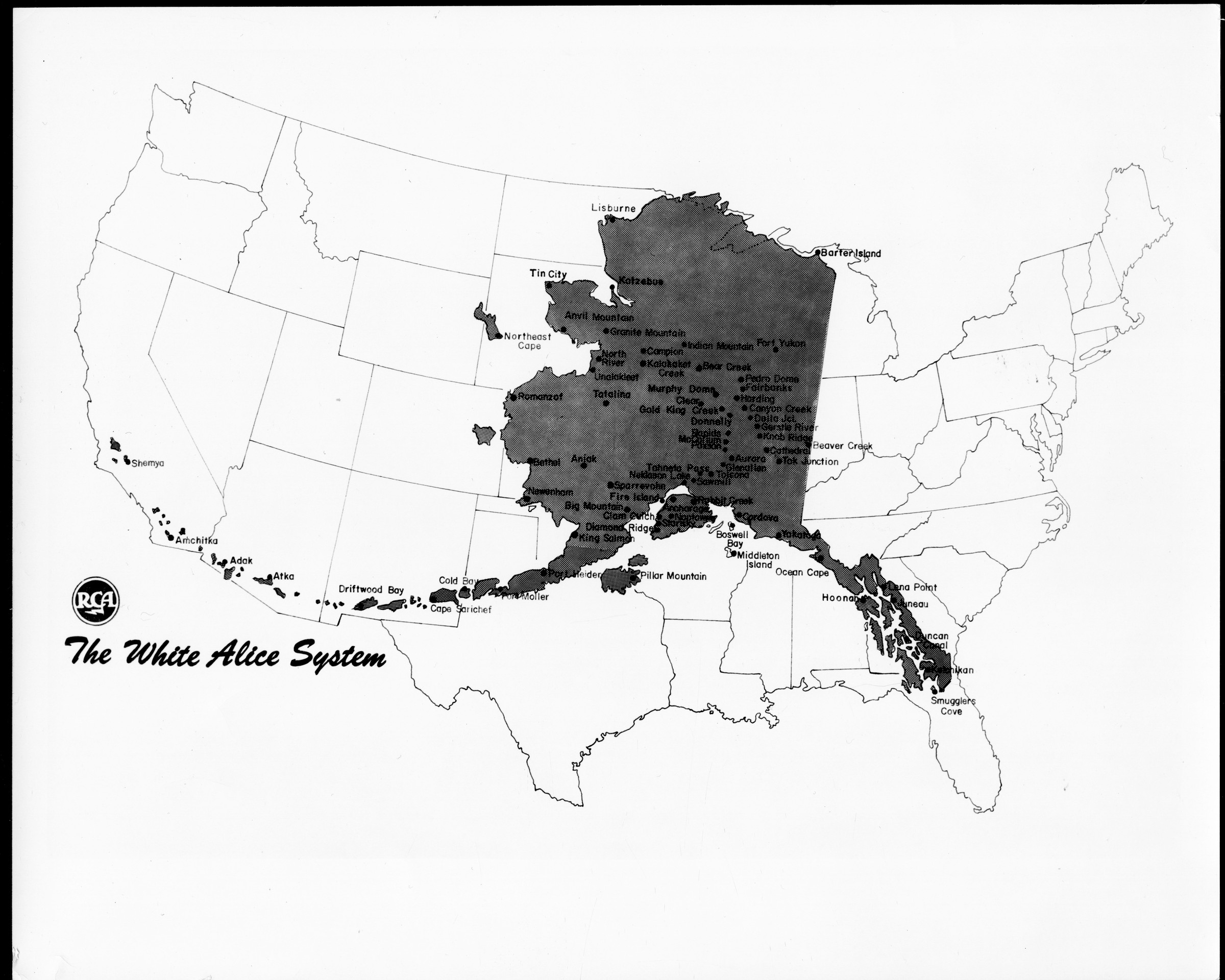
B1994.009.1428
The White Alice System. RCA. Official photograph USAFH 4420 [map]
Keywords: Cold War, communications
Collection: B1994.009 Ray
B1995.014.65.12
[soldiers stopped on ascent, two consulting map, McKinley rescue squad operation]
Keywords: military, mountaineering
Collection: B1995.014
B2015.008.955a
(Enlarge) Alaska is 1/5 the size of the U.S., but has only 65,000 pop., because its vast
resources cannot well be developed until railways are built, and this is too costly for private
capital [map of Alaska with passenger ship route, cable and wireless stations, inset of United
States. With stamp of Dora Keen]
Keywords: map note
Collection: B2015.008
B2013.074.439
[city planning meeting, three people looking at colored map of Proposed Land Use in office; 1980s]
Collection: B2013.074
B1995.014.124.12
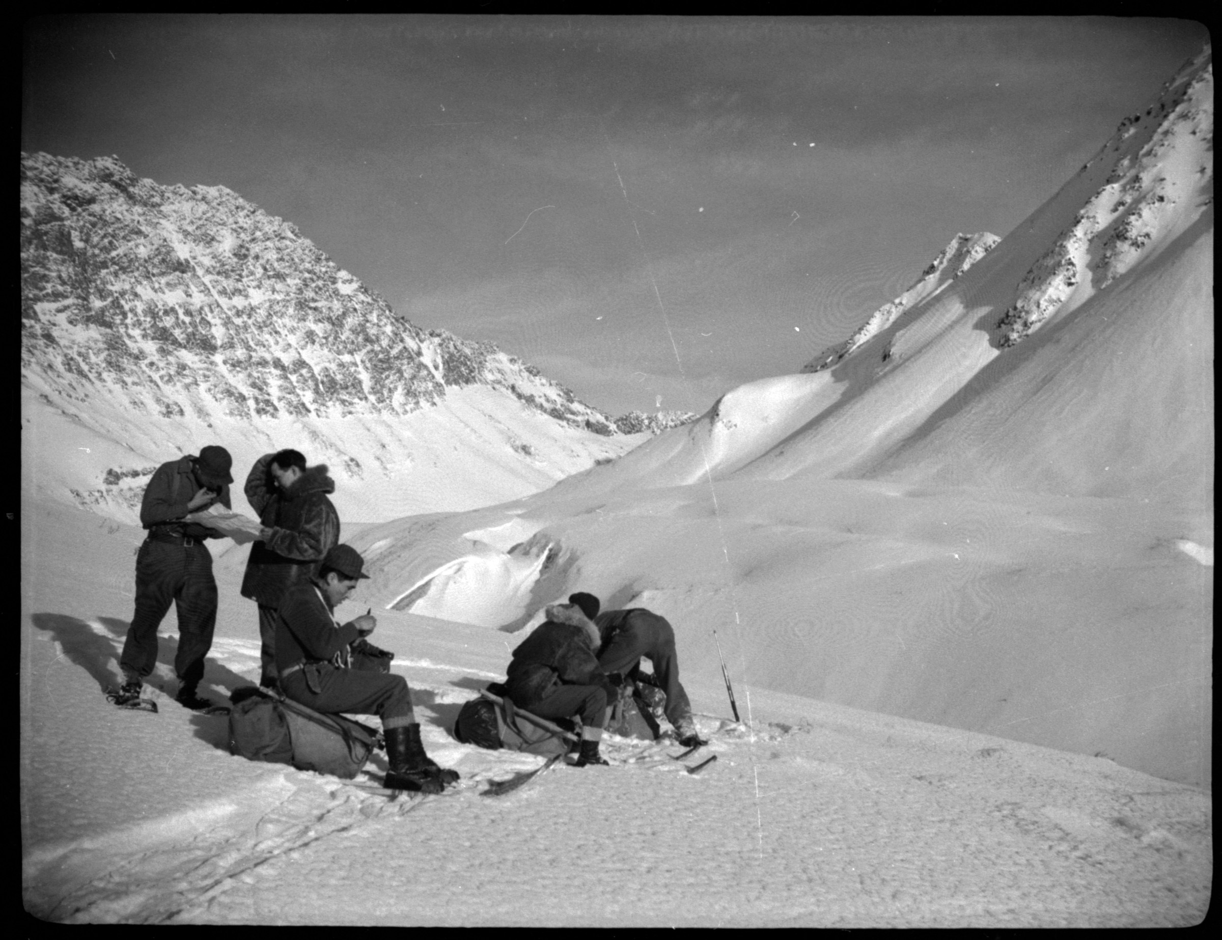
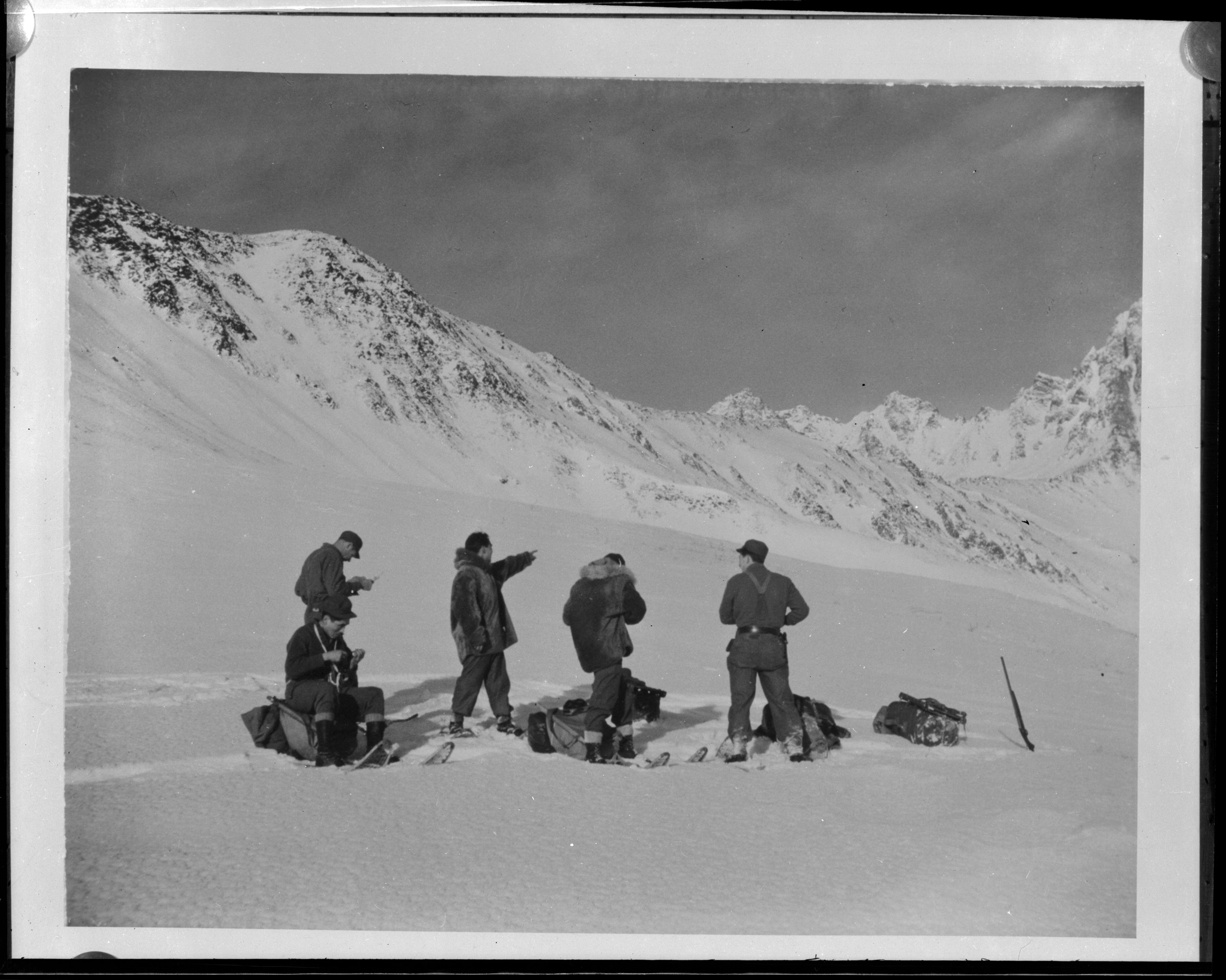
Going out to McKinley [soldiers making traverse on snowshoes stopped to consult map, McKinley rescue squad operation]
Keywords: military, mountaineering, transportation
Collection: B1995.014
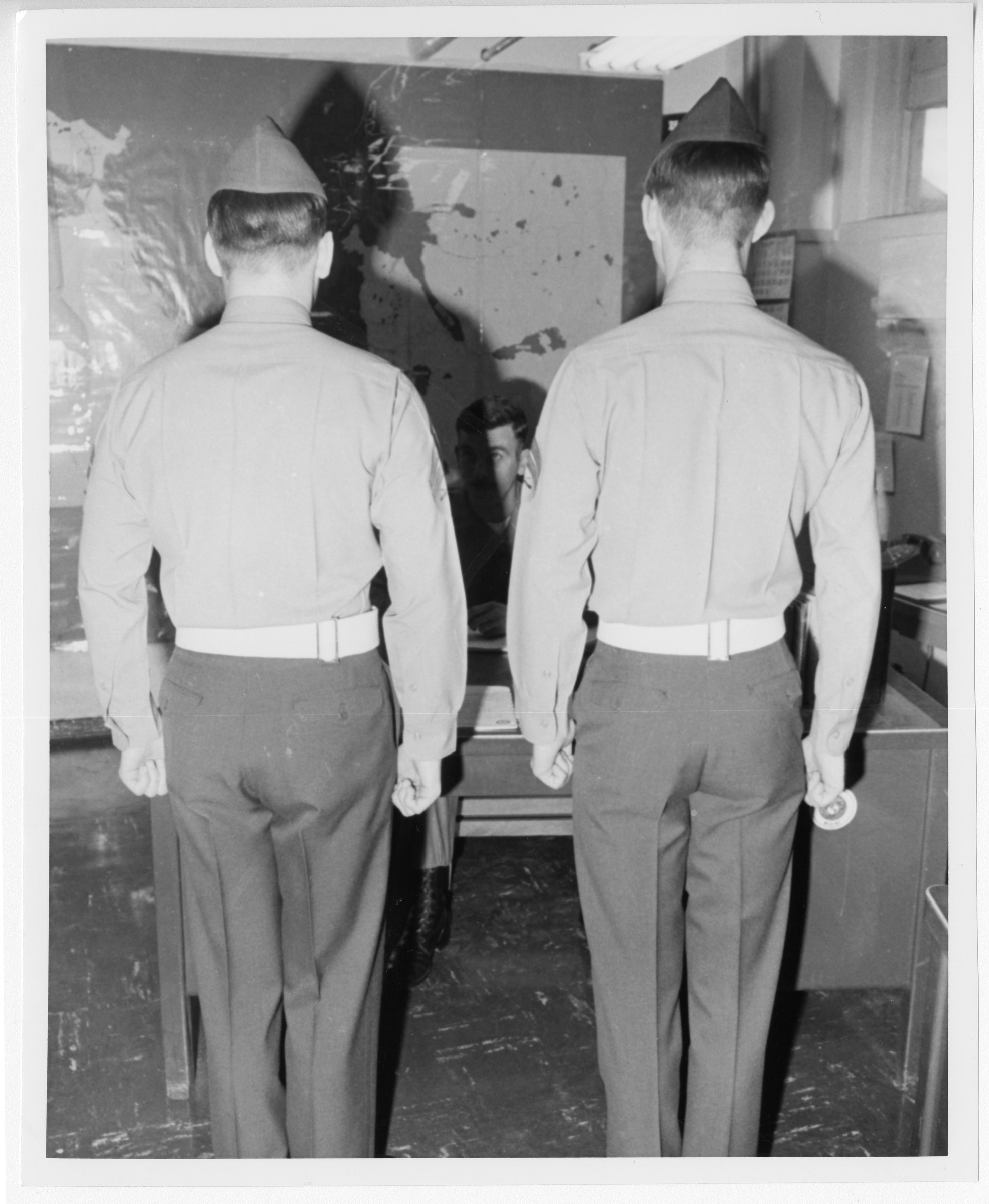
B1996.035.1.241
Adak [rear view of two servicemen standing at attention in front of desk where third man is seated; map on wall]
Collection: B1996.035 Adak Historical Society
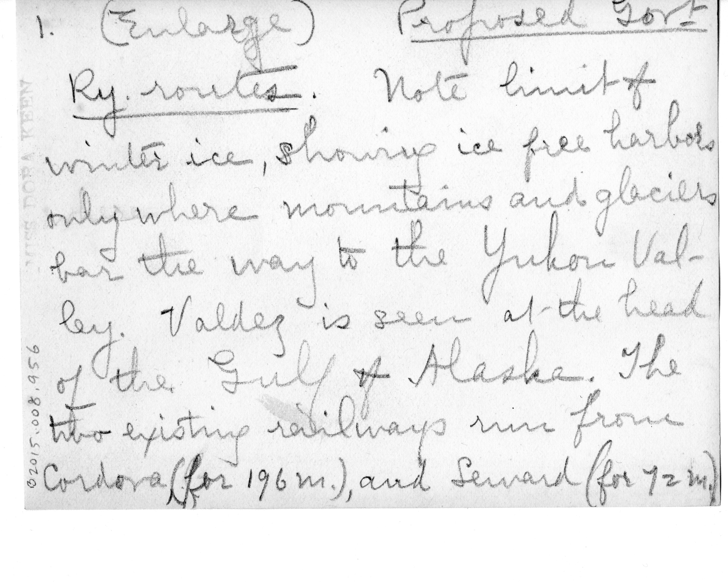
B2015.008.956a
From Greeley’s Handbook of Alaska. 1. (Enlarge) Proposed gov’t. ry. routes. Note limit
of winter ice, showing ice free harbors only where mountains and glaciers bar the way to the
Yukon Valley. Valdez is seen at the head of the Gulf of Alaska. The two existing railways run
from Cordova (for 196 m.) and Seward (for 72 m.) [map of Alaska with inset of Aleutian
Islands]
Keywords: map note
Collection: B2015.008
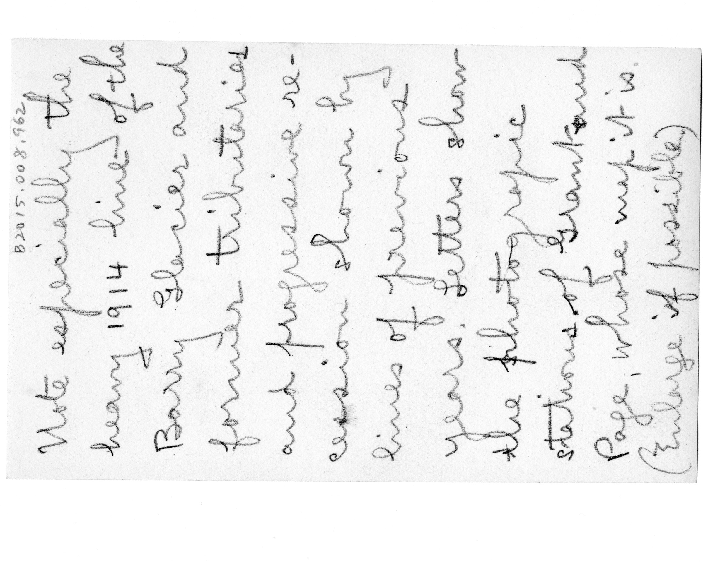
B2015.008.962a
Note especially the heavy 1914 line of the Barry Glacier and former tributaries and
progressive recession shown by lines of previous years. Letters show the photographic
stations of Grant and Page whose map it is. (Enlarge if possible) [Map of Harriman Fiord, Port
Wells (1909)]
Keywords: note
Collection: B2015.008
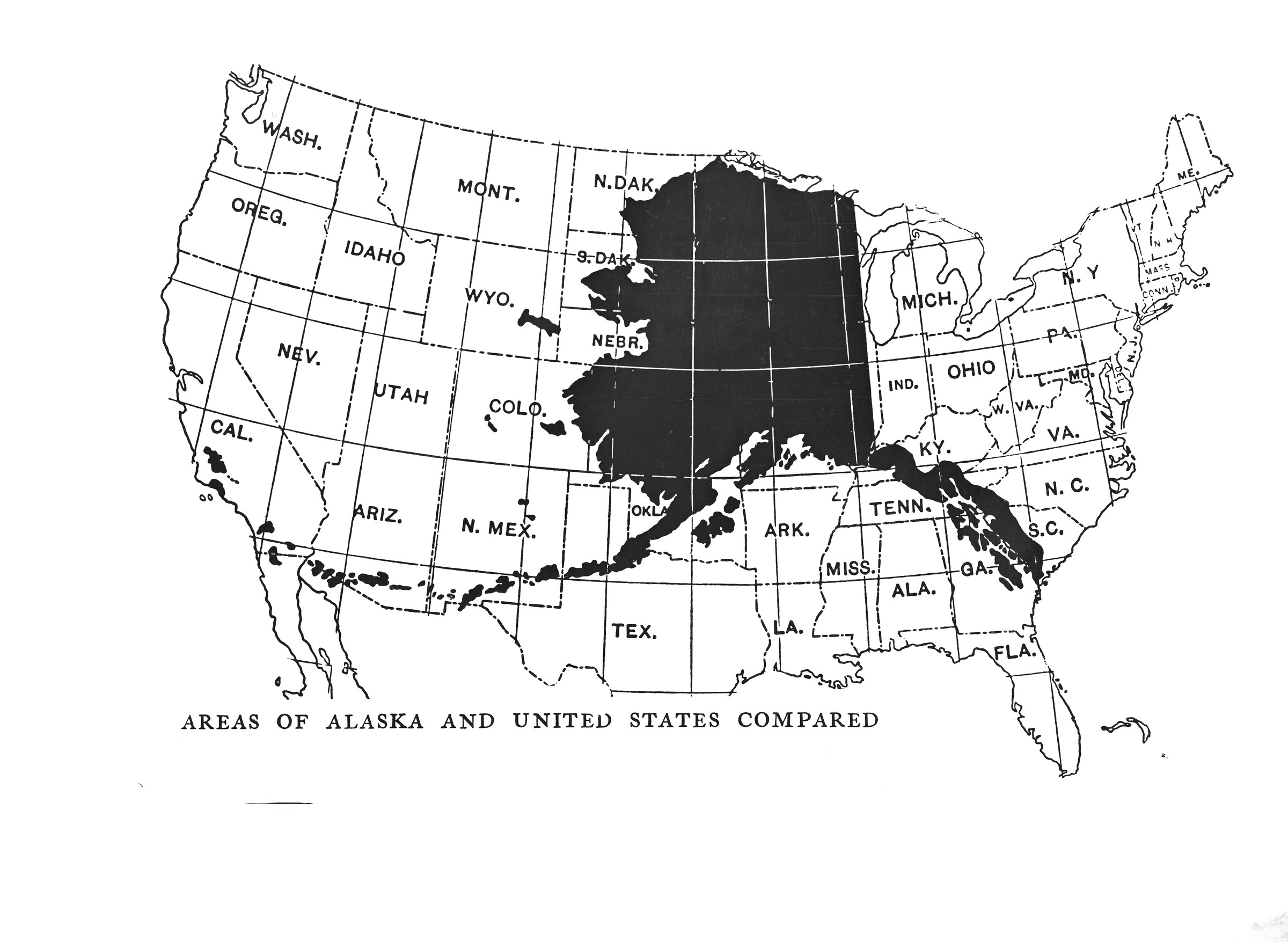
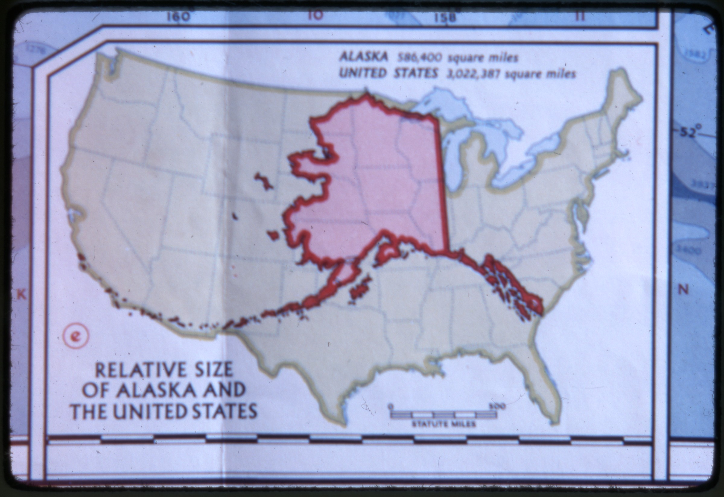
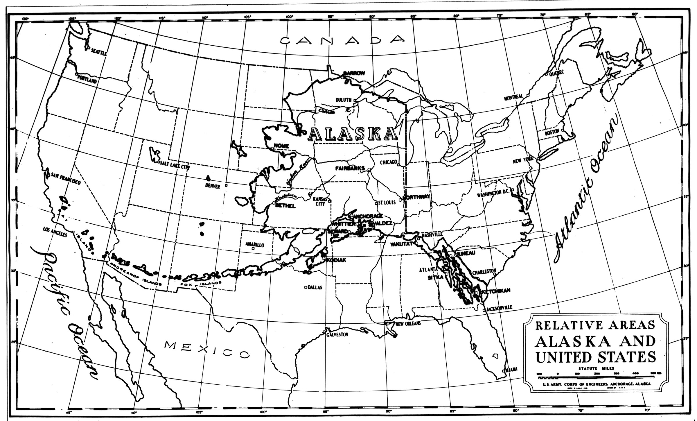
B1998.014.1.1300
Areas of Alaska and United States compared (O87, transparency) [Alaska silhouette superimposed over map of lower-48 states]
Collection: B1998.014 Brickley
B1995.014.131
Army 1944 [soldiers making traverse on snowshoes stopped to consult map, Mt. McKinley rescue squad operation. Cf. .124.12]
Keywords: military, mountaineering, footwear
Collection: B1995.014
B1989.016.1084.9
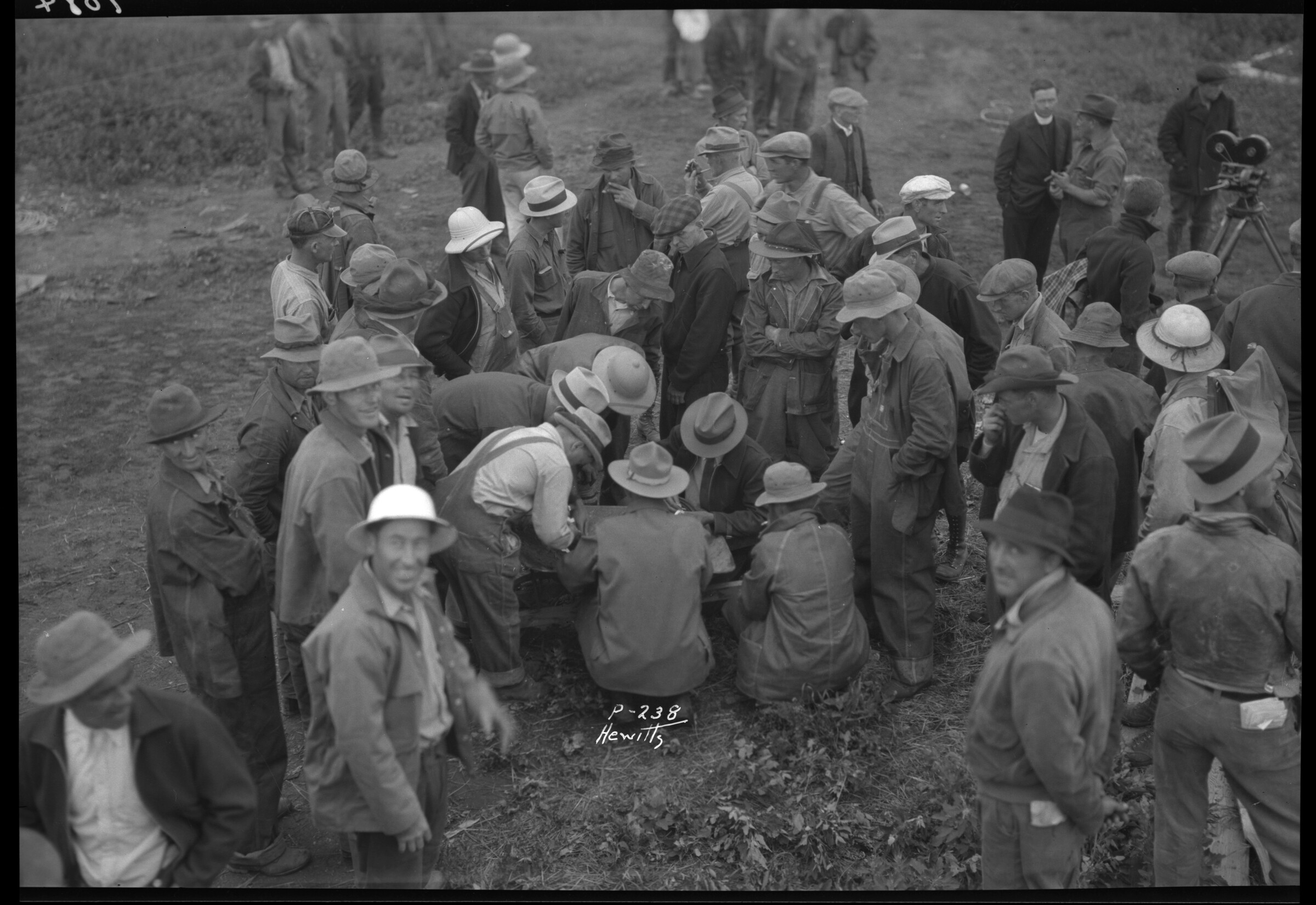
P-238. Hewitt's (Palmer, July 3, 1936) [group of men crowded around man writing on paper, or possibly looking at map]
Collection: B1989.016 Lu Liston Collection
B1989.016.1923
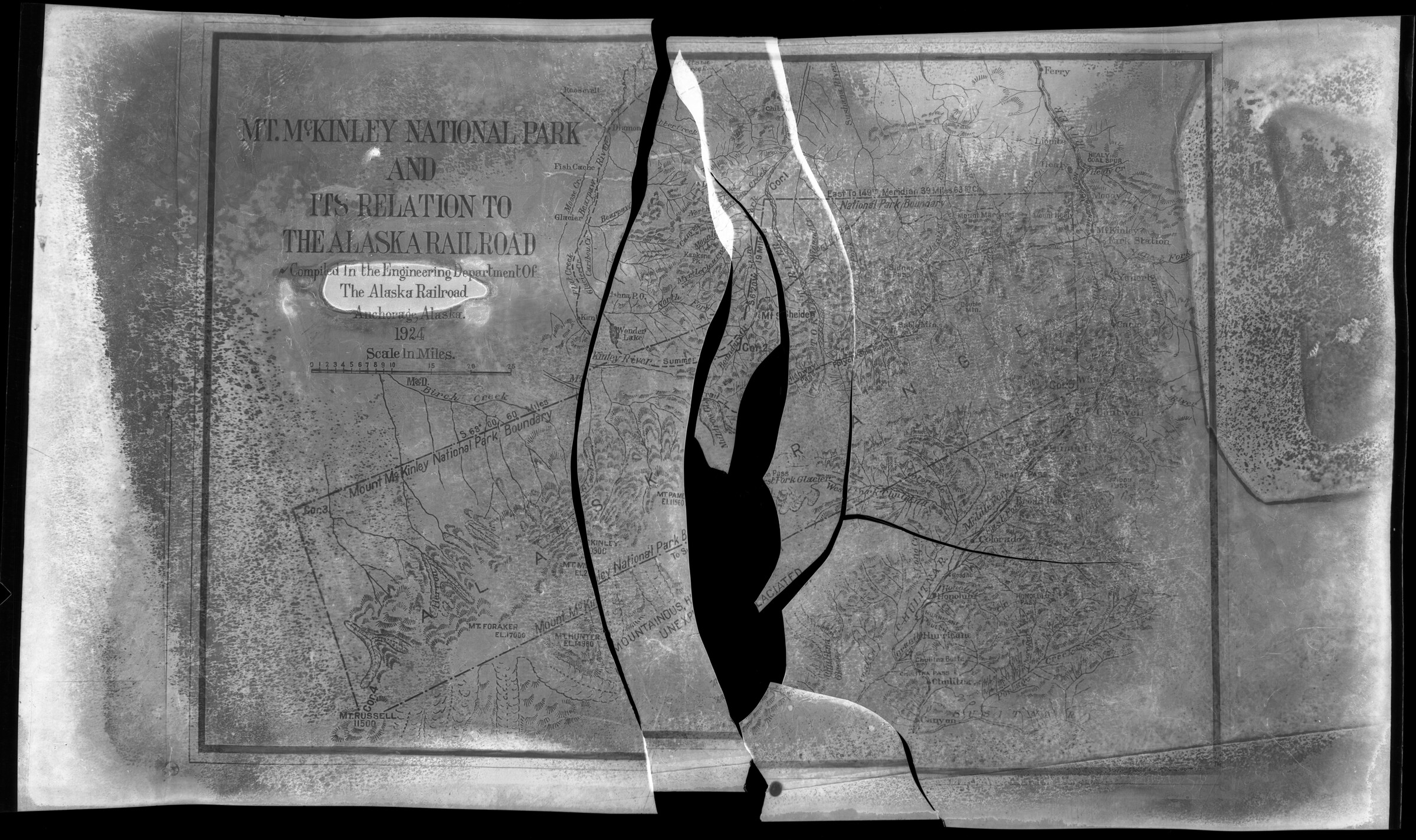
Mt. McKinley National Park and Its Relation to the Alaska Railroad, 1924 [map. 5 x 7 nitrate negative. Cracked. Discarded after scanning]
Collection: B1989.016 Lu Liston Collection

B2009.017.1984.09.22
©1984 Saturday Sept. 22, 1984 [USSR/US border on map of Bering Sea, with sailing ship on American side, dragon on Soviet side]
Collection: B2009.017
B1979.002.Album1.314
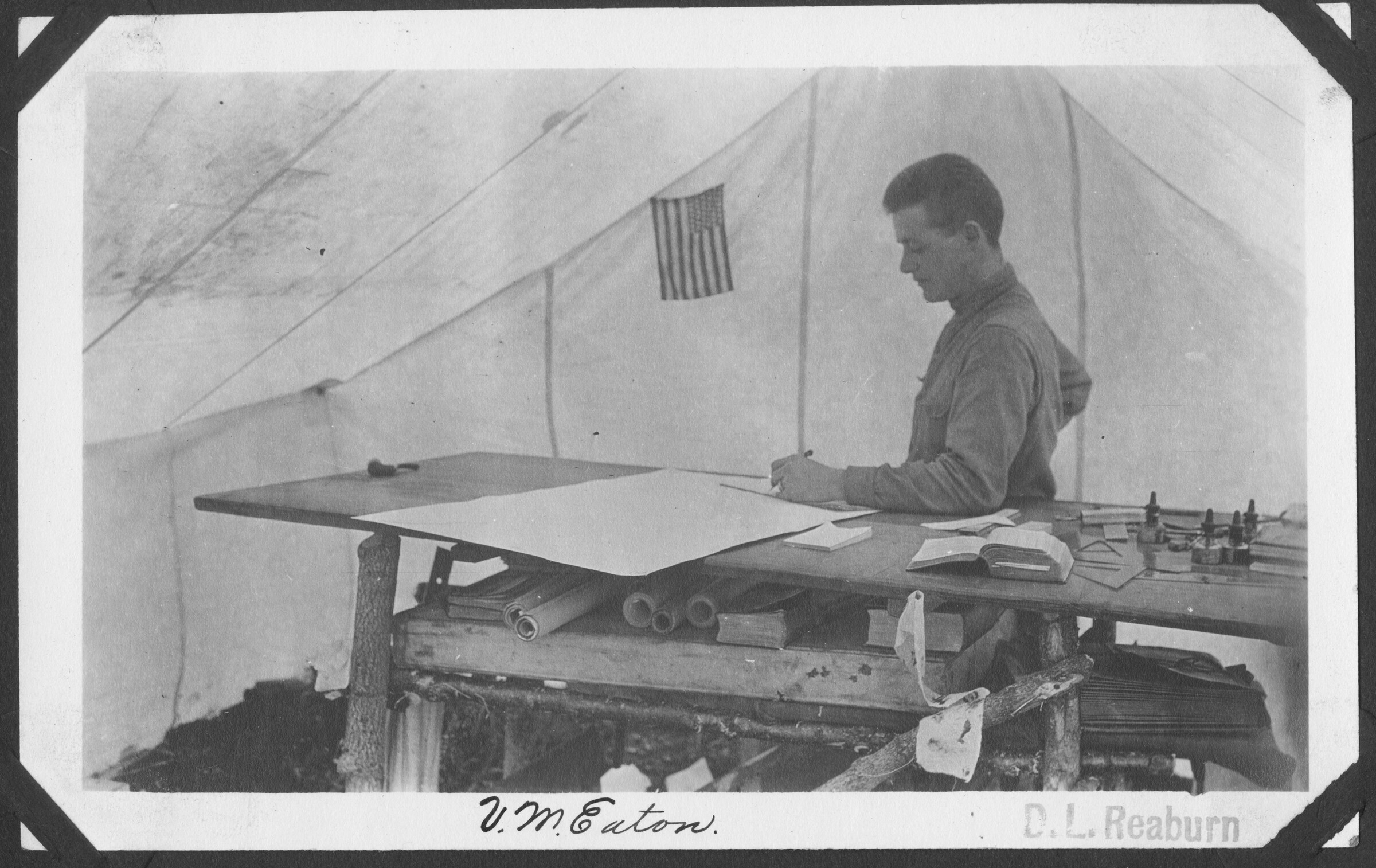
V. M. Eaton. D. L. Reaburn [man standing in tent at table with rolled maps, books, ink bottles, railroad exploration, circa 1914]
Keywords: Alaska Railroad
Collection: B1979.002 AK Railroad and AEC / Album 1

B1980.106.27
Night Life Anchorage Alaska Anchorage 1940-49 Official Photograph Air Corps U.S. Army 2nd Mapping Squadron Felts Field, Washington
Collection: B1980.106 John Tweedy Photograph Collection
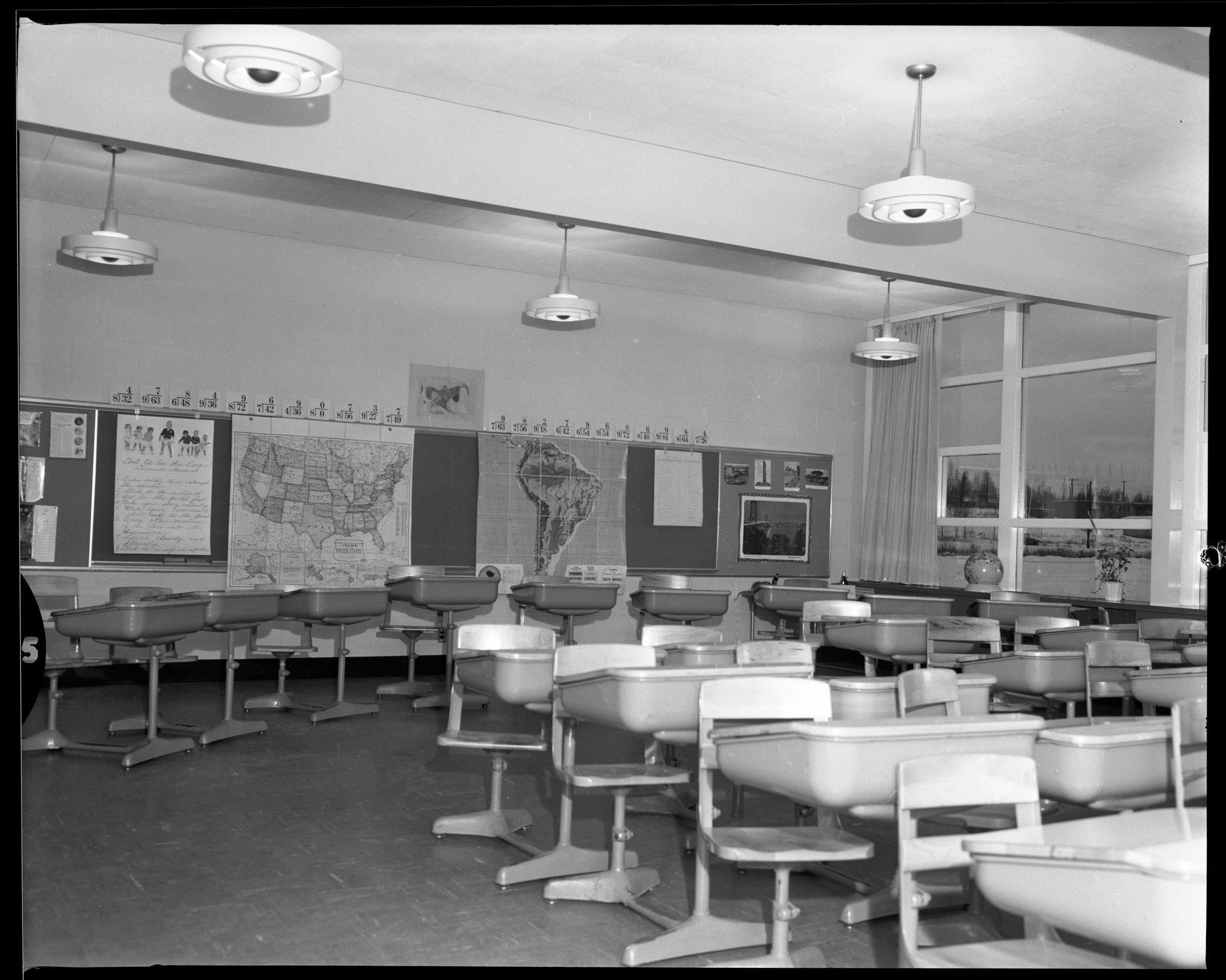
B1990.014.5.Ed.2.18
"6840 - Education; Inlet school room; 4 ea 8x10 Crittendon; 14 November 1957" [school room with desks, maps, view out windows]
Collection: B1990.014 McCutcheon Collection / B1990_014_5 / B1990_014_5_Ed
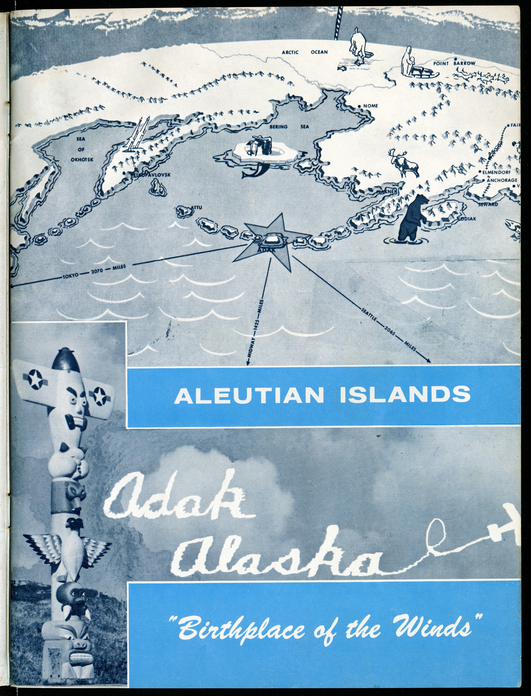
B1996.035.6.welcomeAboard.p1
Welcome Aboard / U.S. Naval Station Adak, Alaska / Birthplace of the Winds [1961, page 1 includes map, totem, sky writing]
Collection: B1996.035 Adak Historical Society
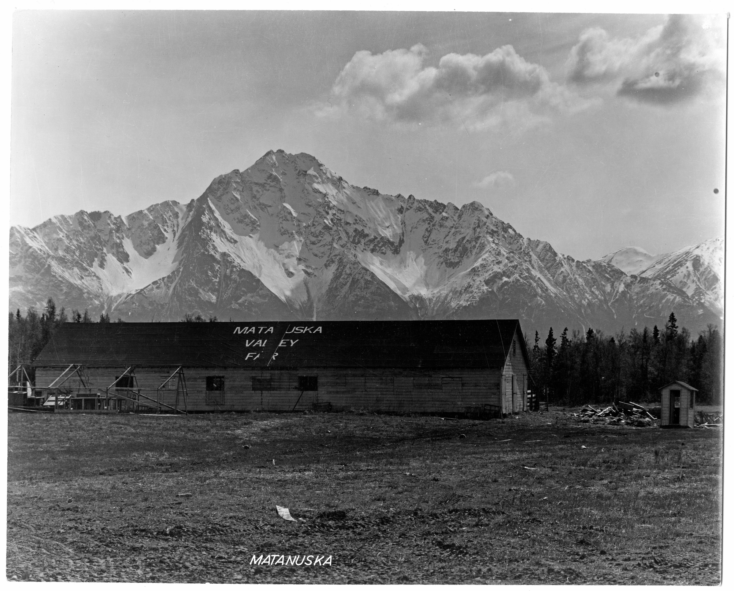
B2001.042.33
[Matanuska Valley Fair Building, Palmer. Stamp on verso: Official photograph, Air Corps, U.S. Army, 2nd Mapping Squadron, Felt Field, Washington]
Collection: B2001.042
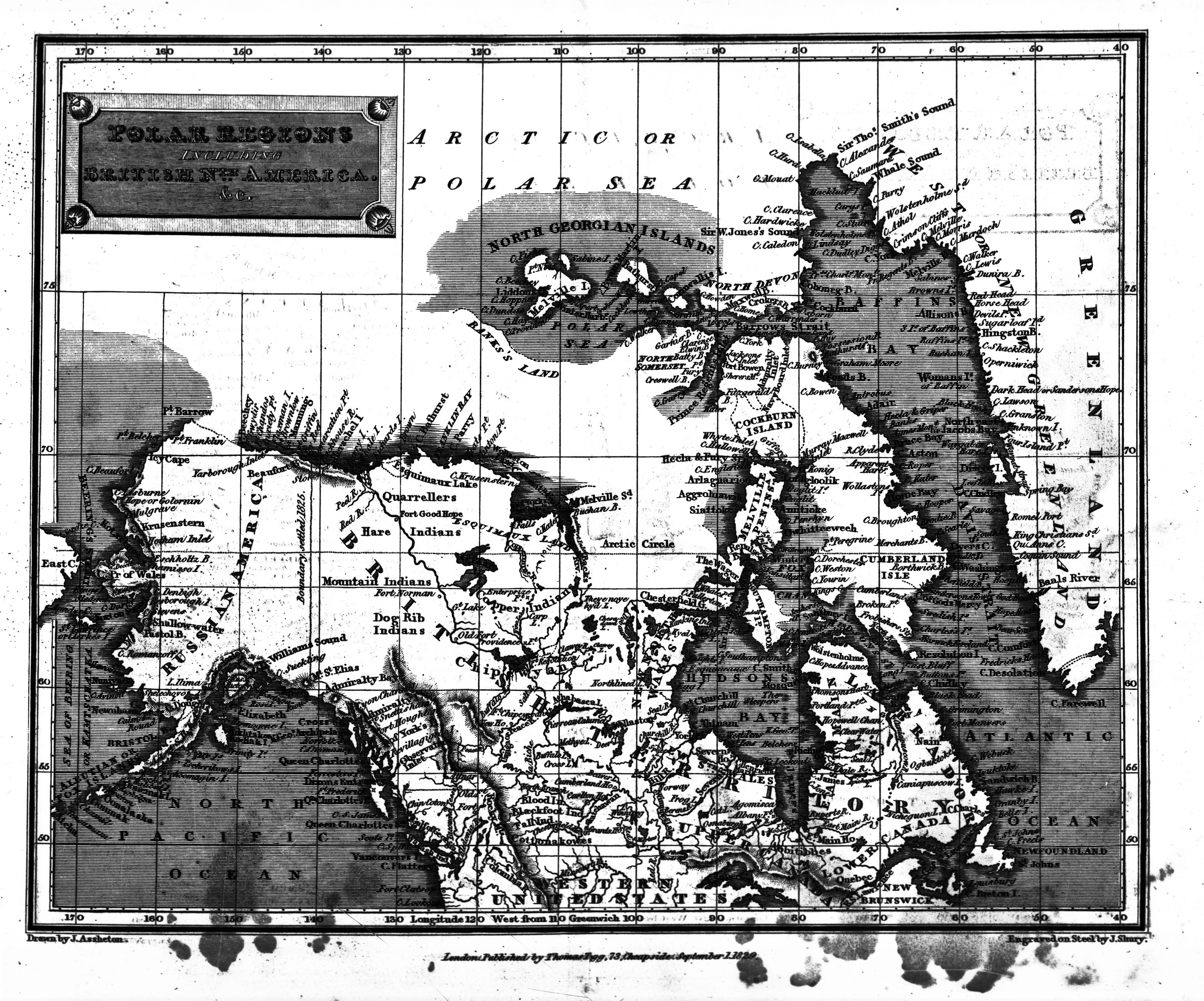
B1998.014.1.2315
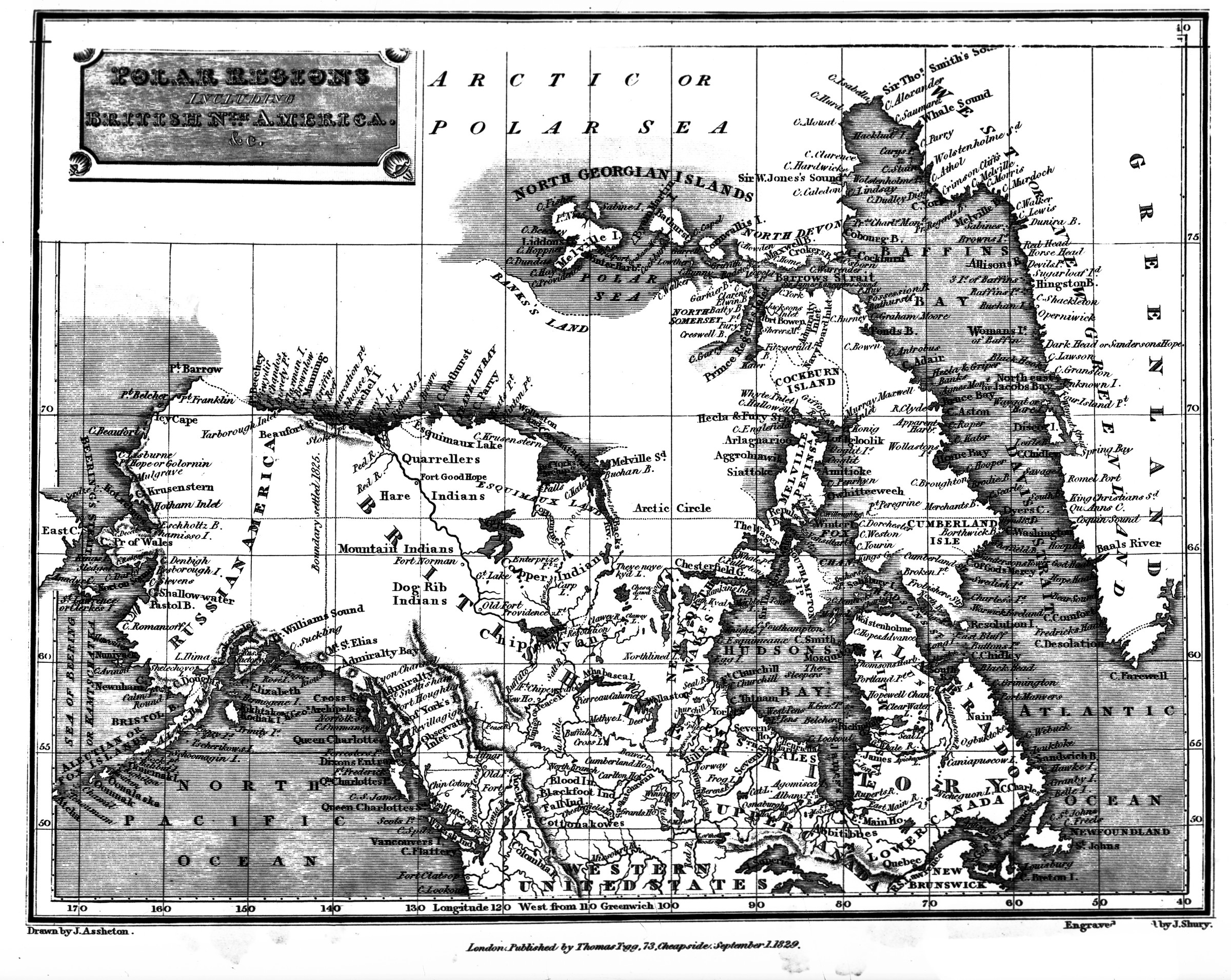
"Map of Polar Regions" [copy neg; Polar Regions including British Nth America &c.' published by Thomas Tegg, September 1, 1829; "Engraved on Steel by J. Shury"]
Collection: B1998.014 Brickley

B1986.096.90
Mayor George Sharrock, City Mgr Robt Oldland, Apr. 63 [City council meetings, old. Two men next to map with label "These streets will be paved if you vote for Proposition No. 2"]
Collection: B1986.096 Anchorage Public Information Office