Are you sure you want to delete image ?

To Search, simply enter a word or phrase in the search box and click on the Search button (or hit Enter).
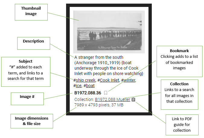
In the search results, the search term is highlighted to indicate where the match was made.
Clicking on the thumbnail image opens a larger version of the image (zoomable), with that image being part of a slideshow of all of the images on the page.
The bookmark icon can be selected to flag the image to be included in a "bookmark" list.
The collection name is linked to a search of all of the images in that collection, and if a PDF finding aid for the collection exists, an icon is displayed that links to that file.
In the search results, the search term is highlighted to indicate where the match was made.
To view a list of collections click on the  icon in the top-right of the screen:

You can search for a collection by entering text in the search field, or you can view a list of collections by year by clicking on item in the list:

Clicking on a collection name will display all of the images from that collection. The number of images in the collection is displayed in parentheses. Clicking on the  icon will display the finding aid for the collection (if available):

To view a list of collections click on the  icon in the top-right of the screen:

You can search for a collection by entering text in the search field, or you can view a list of collections by year by clicking on item in the list:

Images may be bookmarked to simplify finding them at a later time. To bookmark an image, click on the  icon located next to the image number:

The bookmark icon will change to black to indicate that the image has been bookmarked, and the bookmark icon in the top-right of the screen will turn white, with the number of bookmarked images indicated to the left:

To view your bookmarked images, click on the white bookmark icon in the top-right of the screen with the number next to it.
The Anchorage Museum library includes books, maps, and print resources focused on Alaska and the Circumpolar North. The public is welcome to access the collection and conduct research on-site during open hours, or by appointment.
The Anchorage Museum archives include historic photographs and print materials covering a broad range of topics related to Alaska and the Circumpolar North. Some materials are available online, while others are available for detailed research on site at the Bob and Evangeline Atwood Alaska Resource Center.
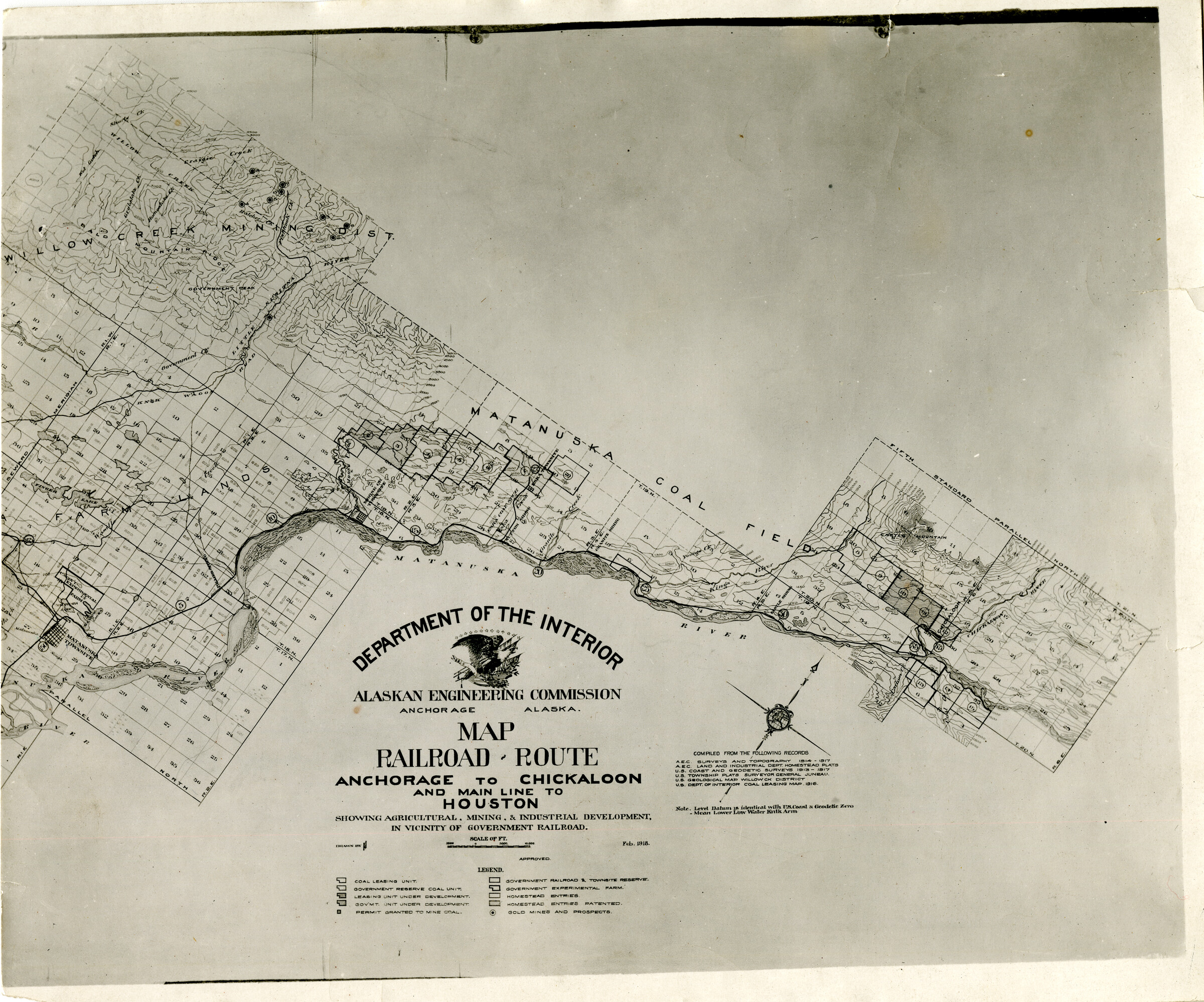
B1957.005.182
Map, railroad route, Anchorage to Chickaloon and main line to Houston showing agricultural mining & industrial development, in vicinity of government railroad. Feb. 1918 Verso: Alaska Railroad - Matanuska Branch [AEC H55. cf. .33] [3 copies]
Keywords: Railroad route, Railroad route map, Railroad map, Chickaloon, Route to Chickaloon, Anchorage to Chickaloon, Anchorage to Chickaloon route, Houston, Railroad main line, Main line to Houston, Agricultural development, Mining development, Industrial development, Government railroad, Alaskan Engineering Commission, Alaskan Engineering Commission H55. cf. .33, AEC, AEC H55. cf. .33, Department of the Interior, Dept. of the Interior, Willow Creek Mining Dist., Willow Creek Mining District, Matanuska Coal Field, Matanuska River, Alaskan Engineering Commission, Matanuska Branch
Collection: B1957.005 Jack H Floyd
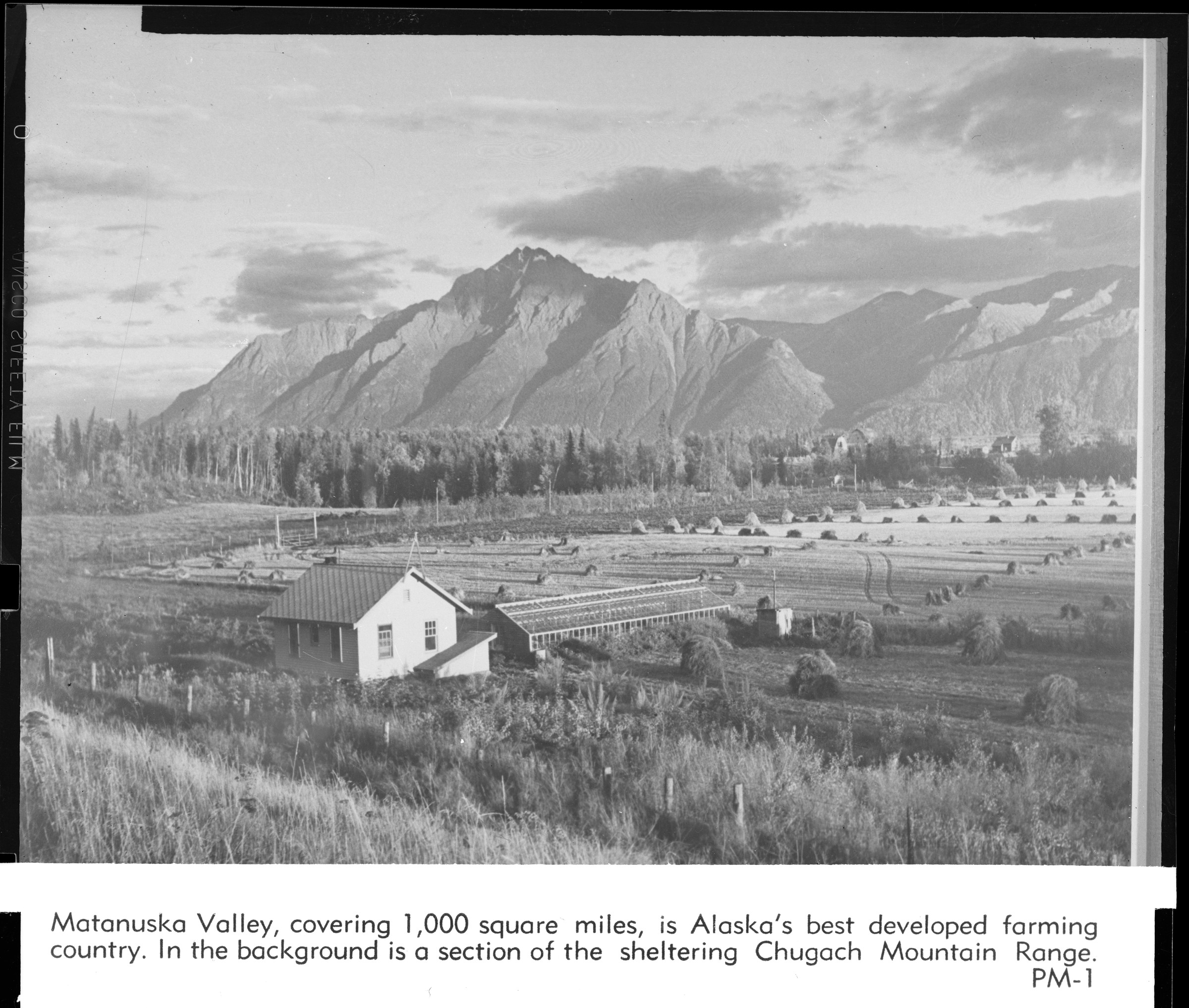
B1998.014.1.1357
PM1 Matanuska Valley, covering 1,000 square miles, is Alaska's best developed farming country. In the background is a section of the sheltering Chugach Mountain Range (Pioneer Peak, Palmer) [scenic view, agriculture, fields, haystacks, structures, dwellings, barn in distance; possible greenhouse, fences.]
Collection: B1998.014 Brickley