| 1 — | [aerial of coastal mountains with snow] | |
| 2 — | [aerial of coastal mountains and glacier] | |
| 3 — | [aerial of Glacier Creek emptying into Turnagain Arm at Girdwood] | |
| 4 — | [close-up of small stream through grass] | |
| 5 — | [close-up of small stream through grass] | |
| 6 — | [close-up of small stream through grass] | |
| 7 — | [view down gravel road through low brush, houses and automobile visible at right] | |
| 8 — | [trees and low brush, with debris piled at right] | |
| 9 — | [view around curve on gravel road, automobile parked at left, possibly driveway entrance at right] | |
| 10 — | [close-up of man collecting water sample from small stream running through grass] | |
| 11 — | [small creek running into culvert] | |
| 12 — | [creek in area of trees and low brush] | |
| 13 — | [creek in area of trees and low brush] | |
| 14 — | [automobiles, camper, and tent in gravel parking area next to creek] | |
| 15 — | [storm drain outlet pouring runoff water into creek, three people walking along creek at left] | |
| 16 — | [automobiles and camper in gravel parking area next to creek] | |
| 17 — | [view down side of road embankment, creek at left, paved street at right] | |
| 18 — | [close-up of flooded area along creek at base of road embankment] | |
| 19 — | [view down gravel road to floatplanes on lake] | |
| 20 — | [creek exiting lake, floatplanes in background, Chugach Mountains in distance. Cf. .22] | |
| 21 — | [disturbed ground along creek through grassy flats near Cook Inlet] | |
| 22 — | [creek exiting lake, Chugach Mountains in distance. Cf. .20] | |
| 23 — | [close-up of storm drain runoff into creek] | |
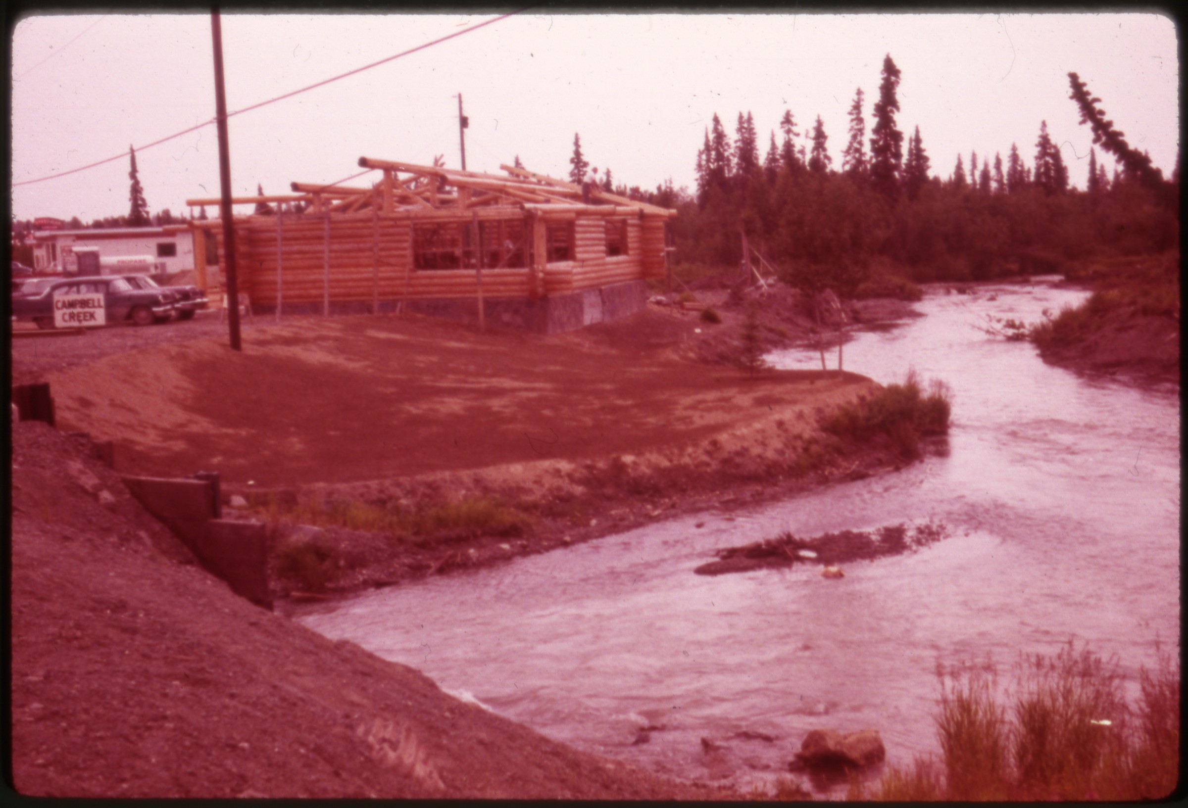 | 24 — | [Campbell Creek at Old Seward Highway, with Peanut Farm building under construction] |
| 25 — | [Campbell Creek at Old Seward Highway, with Peanut Farm building under construction, automobiles on road] | |
| 26 — | [close-up of grassy creek banks] | |
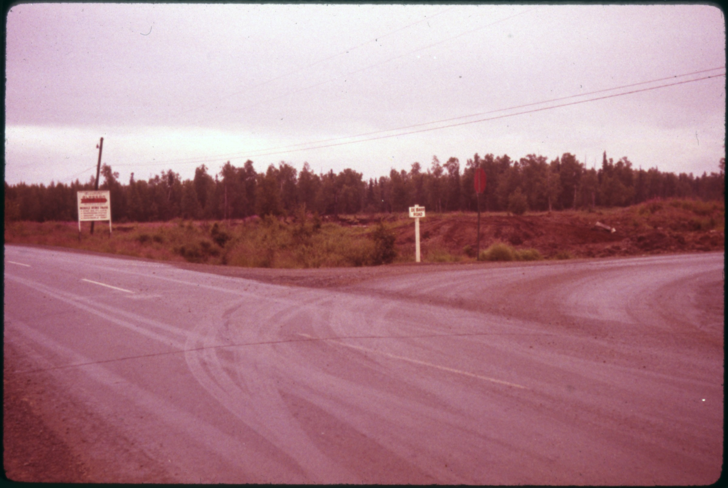 | 27 — | [road intersection, sign at right for Debarr Road, sign at left for “Beautiful Alaskan Village Mobile Home Park.” Alaskan Village was at 7800 Debarr; possibly Debarr at Muldoon Road] |
| 28 — | [storm drain outlet into creek near road intersection, with sign for Alaskan Village Mobile Home Park. Cf. .27] | |
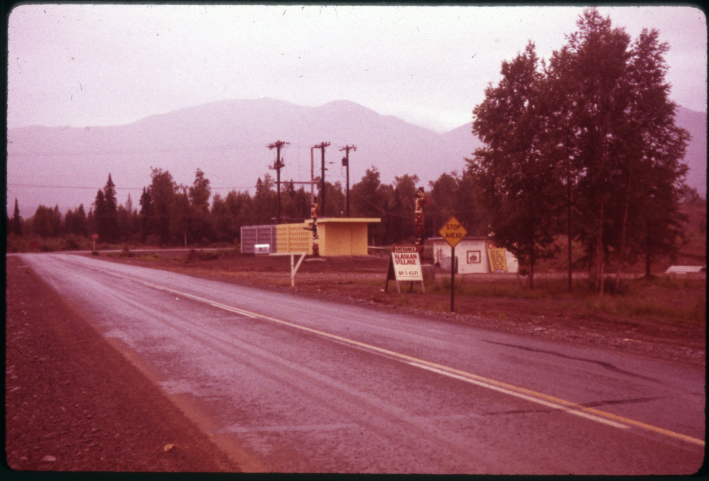 | 29 — | [view down paved road, sign at left for entrance to Alaskan Village, totem poles in background next to small building, Debarr Road intersection with Muldoon Road in left background] |
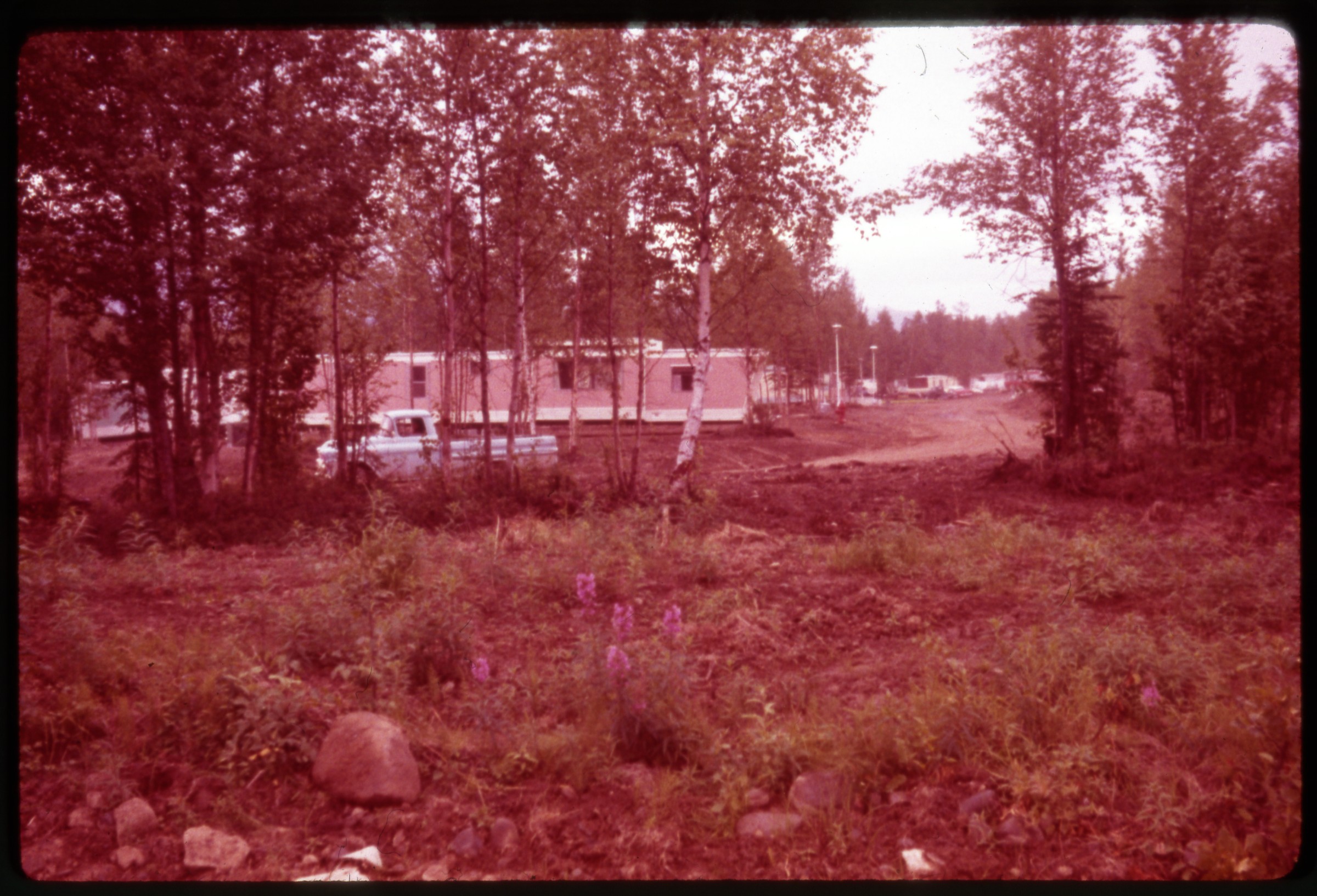 | 30 — | [view through trees to Alaskan Village mobile home park, fireweed in foreground] |
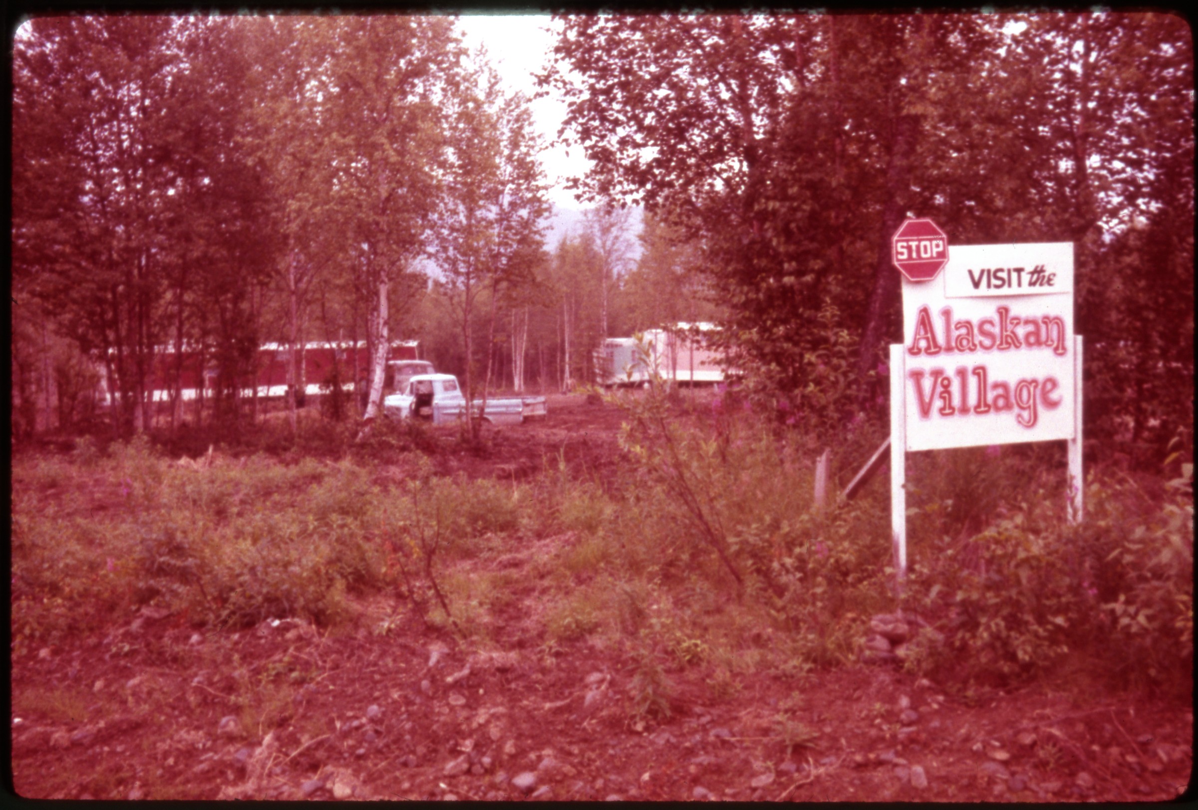 | 31 — | [view through trees to mobile home park, sign at right reads “Stop Visit the Alaskan Village”] |
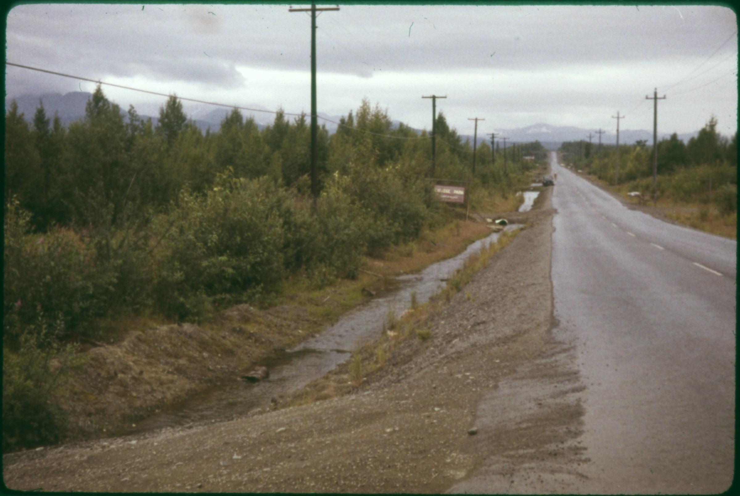 | 32 — | [view down paved road looking southeast to Chugach Mountains, sign at left for College Park, drainage ditches along road, possibly Boniface Road] |
| 33 — | [crane and pickup truck clearing right of way through swampy land] | |
 | 34 — | [view down paved road with culvert for creek or pond outflow, automobiles on road, buildings on rise in distance, possibly Lake Otis Parkway between Northern Lights Blvd. and 15 th Avenue. Cf. .35] |
| 35 — | [view across paved road to small lake. Cf. .34] | |
| 36 — | [view across paved road to small lake. Cf. .34] | |
| 37 — | [close-up of creek bank with downed tree caught up on shore. Cf. .38] | |
| 38 — | [view down creek, bank at left, industrial area with trucks and crane visible through trees on opposite bank, Campbell Creek?] | |
| 39 — | [view from road looking down creek, with elevated pipe crossing, crane visible through trees at right, Campbell Creek? Cf. .38] | |
| 40 — | [view from above road culvert along small creek in area of disturbed ground, second road culvert in background, metal barrels in water] | |
| 41 — | [mouth of small creek running into mudflats on Cook Inlet, point in distance] | |
| 42 — | [distant view of family with dog playing in mouth of small creek running into mudflats on Cook Inlet] | |
| 43 — | [close-up of disturbed, muddy wetland area, with uprooted stumps] | |
| 44 — | [view down creek through residential area, low fence in foreground, road culvert in background, with houses and automobiles on road] | |
| 45 — | [view from above road culvert of small dam on pond outflow] | |
| 46 — | [view down disturbed path in wooded area, concrete structure in foreground possibly part of storm drain] | |
| 47 — | [view from road down small creek in residential area, house at left, mobile home in background] | |
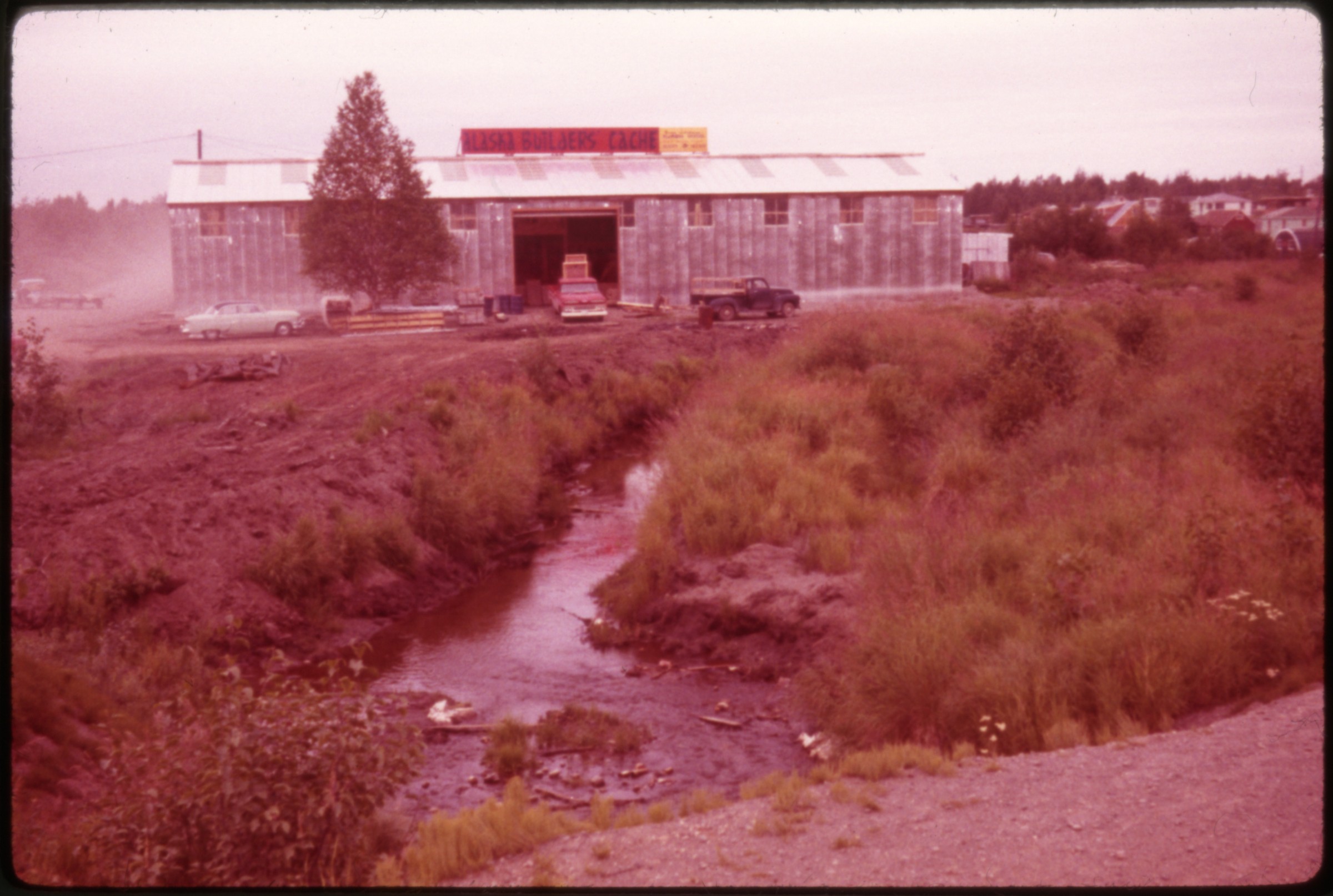 | 48 — | [small stream, probably Fish Creek, through disturbed area in front of Alaska Builders Cache building, houses and Quonset hut in right background. Alaska Builders Cache was located at 4105 East Turnagain Blvd] |
| 49 — | [view down ramp at Lake Hood, floatplane at right] | |
| 50 — | [view along bank of Lake Hood, with seven floatplanes parked along shore] | |
| 51 — | [view down creek to road culvert, roads or rights-of-way cleared on both sides of creek, railroad crossing in background left] | |
| 52 — | [view along bank of Lake Hood, with floatplanes parked along shore] | |
| 53 — | [floatplanes and hangars at Lake Hood, including Alaska Bush Carrier and Sea Airmotive] | |
| 54 — | [view across Lake Hood] | |
| 55 — | [floatplanes and hangars at Lake Hood] | |
| 56 — | [view down creek in residential area, buildings at left, fireweed in foreground] | |
| 57 — | [close-up of road culvert, debris in water, small building at right with sign on wall for Westchester Urban Renewal Project. Cf. .58] | |
| 58 — | [view down creek, small building at right with sign on wall for Westchester Urban Renewal Project] | |
| 59 — | [view past crane to ditch freshly dug in marshy taiga] | |
| 60 — | [view across Ship Creek to storm drain outflow on opposite bank, Knik Arm Power Plant in background] | |
| 61 — | [view up Ship Creek from just below Knik Arm Power Plant dam, Chugach Mountains in background] | |
| 62 — | [view up Ship Creek from just below Knik Arm Power Plant dam, Chugach Mountains in background] | |
| 63 — | [view along curving bank of Ship Creek, Alaska Railroad yards at right, water tower and Alaska Native Service Hospital in left background, McKinley Apartments in right background] | |
| 64 — | [close-up of storm drain outflow] | |
| 65 — | [view up creek, possibly Ship Creek, with warehouse at right, heavy equipment visible in distance. Original image blurry] | |
| 66 — | [view across Ship Creek to Northern Supply building on Post Road, automobiles parked at left] | |
| 67 — | [view across paved road to creek, construction site or industrial area at left, trees falling into water from eroded bank, garbage on road in foreground] | |
| 68 — | [view across creek to park area with picnic tables. Cf. .70] | |
| 69 — | [view up creek from road overpass, trees falling into water from eroded bank, Chugach Mountains in background] | |
| 70 — | [view up creek in park area, trees falling into water from eroded banks, picnic tables at right, sign reading “Open to All Trout Fishing, Closed to All Salmon Fishing.” Cf. .124] | |
| 71 — | [view down paved road through taiga, military Jeep at left, Chugach Mountains in background, Arctic Valley Road?] | |
| 72 — | [distant view of creek in mountains, possibly Ship Creek] | |
| 73 — | [distant view of buildings at base of cut on mountain side at Arctic Valley] | |
| 74 — | [distant view of buildings at base of cut on mountain side at Arctic Valley] | |
| 75 — | [view of Cook Inlet from Arctic Valley] | |
| 76 — | [view of Cook Inlet from Arctic Valley, building under construction at left] | |
| 77 — | [bird’s eye view of Anchorage bowl] | |
| 78 — | [bird’s eye view of Anchorage bowl] | |
| 79 — | [bird’s eye view of Anchorage bowl, Elmendorf Air Force Base in foreground] | |
| 80 — | [spillway at Eklutna Dam] | |
| 81 — | [close-up of man holding frog] | |
| 82 — | [creek coming out of road culvert, two men getting out of pickup truck at right, pickup truck on road in background] | |
| 83 — | [two men walking along shoulder of road near creek culvert] | |
| 84 — | [two men standing next to concrete structure on side of road, part of storm drainage system] | |
| 85 — | [man descending into storm drain, second man standing at right] | |
| 86 — | [man collecting soil sample next to storm drain, second man standing at left] | |
| 87 — | [man pouring water from pan into bottle and holding small rock] | |
| 88 — | [man holding pan full of water over bottle] | |
| 89 — | [man wading into creek to collect samples] | |
| 90 — | [two men collecting samples from creek] | |
| 91 — | [two men collecting samples from creek] | |
| 92 — | [man collecting samples from creek] | |
| 93 — | [man collecting samples from creek] | |
| 94 — | [man collecting samples from creek, large culvert in background] | |
| 95 — | [man collecting samples from creek] | |
| 96 — | [view down gravel path to man walking into low brush] | |
| 97 — | [two men standing next to small stream through grass] | |
| 98 — | [two men collecting samples from small stream through grass] | |
| 99 — | [two men collecting samples from small stream through grass] | |
| 100 — | [two men collecting samples from small stream through grass] | |
| 101 — | [close-up of pollution in small stream through grass] | |
| 102 — | [close-up of pollution in small stream through grass] | |
| 103 — | [close-up of pollution in small stream through grass] | |
| 104 — | [close-up man reaching down to pollution in small stream through grass] | |
| 105 — | [man walking down gravel embankment next to creek in wooded area] | |
| 106 — | [two men walking down gravel embankment next to stream in wooded area] | |
| 107 — | [men walking down gravel path through wooded area toward houses in background] | |
| 108 — | [man collecting samples from creek next to large culvert, second man standing next to pickup truck] | |
| 109 — | [base of spillway at Eklutna Dam] | |
| 110 — | [bird’s eye view of man walking on exterior stairway at Eklutna Dam] | |
| 111 — | [bird’s eye view of man walking on exterior stairway at Eklutna Dam] | |
| 112 — | [bird’s eye view of man descending ladder at Eklutna Dam] | |
| 113 — | [bird’s eye view of man descending ladder at Eklutna Dam] | |
| 114 — | [bird’s eye view of man standing next to Eklutna River just below dam] | |
| 115 — | [bird’s eye view of man collecting sample from Eklutna River just below dam] | |
| 116 — | [bird’s eye view of man standing next to Eklutna River just below dam] | |
| 117 — | [bird’s eye view of man collecting sample from Eklutna River just below dam] | |
| 118 — | [man walking on exterior stairway at Eklutna Dam] | |
| 119 — | [two men getting out of pickup truck on creek bank, road overpass in background] | |
| 120 — | [man wading into creek to collect sample, road overpass in background] | |
| 121 — | [man collecting sample from creek] | |
| 122 — | [man collecting sample from creek] | |
| 123 — | [man collecting sample from creek] | |
| 124 — | [close-up of sign reading “Open to All Trout Fishing [...], Closed to All Salmon Fishing, [...] Courtesy of Elmendorf AFB Wildlife Conservation Office.” Cf. .70] | |
| 125 — | [two men posed at Greater Anchorage Health District Health Center entrance, man at left with pocket protector in shirt] | |
| 126 — | [two men posed at Greater Anchorage Health District Health Center entrance] | |
| 127 — | [exterior of building with sign “Health Center, Greater Anchorage Health District”, man standing at left. Building was at 217 E Street] | |
| 128 — | [close-up of sign for Greater Anchorage Health District Health Center] | |
| 129 — | [sign reading “No Parking, Doctors and Nurses Only”] | |
| 130 — | [sign reading “City of Anchorage Port Facilities [...]”] | |
| 131 — | [view across mudflats, communications tower in background, Chugach Mountains in distance] | |
| 132 — | [close-up of stream through mudflats] | |
| 133 — | [view down dock at Port of Anchorage, Alaska Railroad freight cars at right, ship at left] | |
| 134 — | [gantry crane above Alaska Railroad freight cars at Port of Anchorage] | |
| 135 — | [view down dock at Port of Anchorage, pilings in mudflats at lower right, Alaska Railroad freight cars on pier, storage tanks in background] | |
| 136 — | [view down dock at Port of Anchorage, with pilings in mudflats, Alaska Railroad freight cars on pier, storage tanks in background, second pier at right] | |
| 137 — | [view from dock across mudflats to pier, storage tanks in left background, downtown Anchorage in distance] | |
| 138 — | [view from dock of dredge at floating dock, pier at left] | |
| 139 — | [view down Alaska Railroad tracks underneath gantry cranes on Port of Anchorage dock] | |
| 140 — | [automobiles parked on dock in front of building with Port of Anchorage sign, gantry cranes in background] | |
| 141 — | [view looking northwest across Alaska Railroad yards at Ship Creek to Port of Anchorage, large Foss barge at dock closest to viewer] | |
| 142 — | [view looking northeast across Alaska Railroad yards at Ship Creek, Port of Anchorage at left] | |
| 143 — | [close-up of rocks and possibly remnants of pier, probably along Ship Creek] | |
| 144 — | [close-up of rocks and possibly remnants of pier, probably along Ship Creek] | |
| 145 — | [close-up of rocks and possibly remnants of pier, probably along Ship Creek] | |
| 146 — | [close-up of stream through mudflats] | |
| 147 — | [view down Alaska Railroad track along Cook Inlet] | |
| 148 — | [view down Alaska Railroad track along Cook Inlet, locomotive approaching, Port of Anchorage in background] | |
| 149 — | [view down side of Alaska Railroad tank cars on track along Cook Inlet] | |
| 150 — | [close-up of concrete culvert sinking into mudflats] | |
| 151 — | [view along Cook Inlet shoreline, with driftwood and possibly concrete storm drain outflow] | |
| 152 — | [view along Cook Inlet shoreline with driftwood, building on bluff above] | |
| 153 — | [view along Cook Inlet shoreline with driftwood, man standing at left near creek outlet] | |
| 154 — | [view down bluff to Cook Inlet shoreline at returning tide] | |
| 155 — | [close-up of stream through mudflats] | |
| 156 — | [Cook Inlet shoreline with driftwood, garbage in creek outlet] | |
| 157 — | [close-up of driftwood next to stream through mudflats] | |
| 158 — | [close-up of grass and mudflats] | |
| 159 — | [pickup truck parked outside building with sign for U.S. Department of Health Education and Welfare Public Health Service Arctic Health Research Center, street signs at the corner of 6 th Avenue and K Street] | |
| 160 — | [pickup truck parked at meter outside building with sign for U.S. Department of Health Education and Welfare Public Health Service Arctic Health Research Center] | |
| 161 — | [aerial of horseshoe-shaped pond or wetland depression] Anchorage scenes | |
| 162 — | Eklutna Russian Orthodox church, May 1947 [five people standing next to Jeep parked at old St. Nicholas Russian Orthodox Church] | |
| 163 — | [bird’s eye view of houses and automobiles in Anchorage in summer, Cook Inlet in background, Denali in distance] | |
| 164 — | [Fourth Avenue street scene near I Street looking east to McKinley Apartments and Chugach Mountains, automobiles in front of businesses with signs including Carol’s, Alaska Fur Factory, Alaska Printing, 4 th Avenue Theater, Paddock Furniture, B & B Liquor Store; after 1952] | |
| 165 — | Anchorage [view across gravel road intersection to Alaska Native Service hospital, man with arm in sling walking on sidewalk near street signs for 3 rd Avenue and Gambell Street; after 1953] | |
| 166 — | [bird’s eye view of Port of Anchorage, with Alaska Railroad yards in foreground, damaged dock in middle ground, SS Sackett’s Harbor ship power plant in center, barge on mudflats next to cannery buildings at left; circa 1955] | |
| 167 — | [bird’s eye view of Port of Anchorage, with Alaska Railroad yards in foreground, mouth of Ship Creek in middle ground, buildings on bluff in background] | |
| 168 — | [bird’s eye view through trees of Port of Anchorage, with Alaska Railroad track leading to pier in center] | |
| 169 — | [bird’s eye view of Alaska Railroad yards, buildings on Government Hill in background] | |
| 170 — | [bird’s eye view of Alaska Railroad yards, federal building in background] | |
| 171 — | [bird’s eye view of Ship Creek, Alaska Railroad yards in background, railroad water tank in center on Government Hill] | |
| 172 — | [bird’s eye view of Ship Creek and Alaska Railroad yards, aboveground water pipe in foreground, building at base of bluff, railroad cars and Quonset huts in background] | |
| 173 — | [bird’s eye view of Alaska Railroad yard and shops, water tower in background, Chugach Mountains in distance] | |
| 174 — | [view down gravel road to rows of housing and Quonset huts, probably Elmendorf Air Force Base] | |
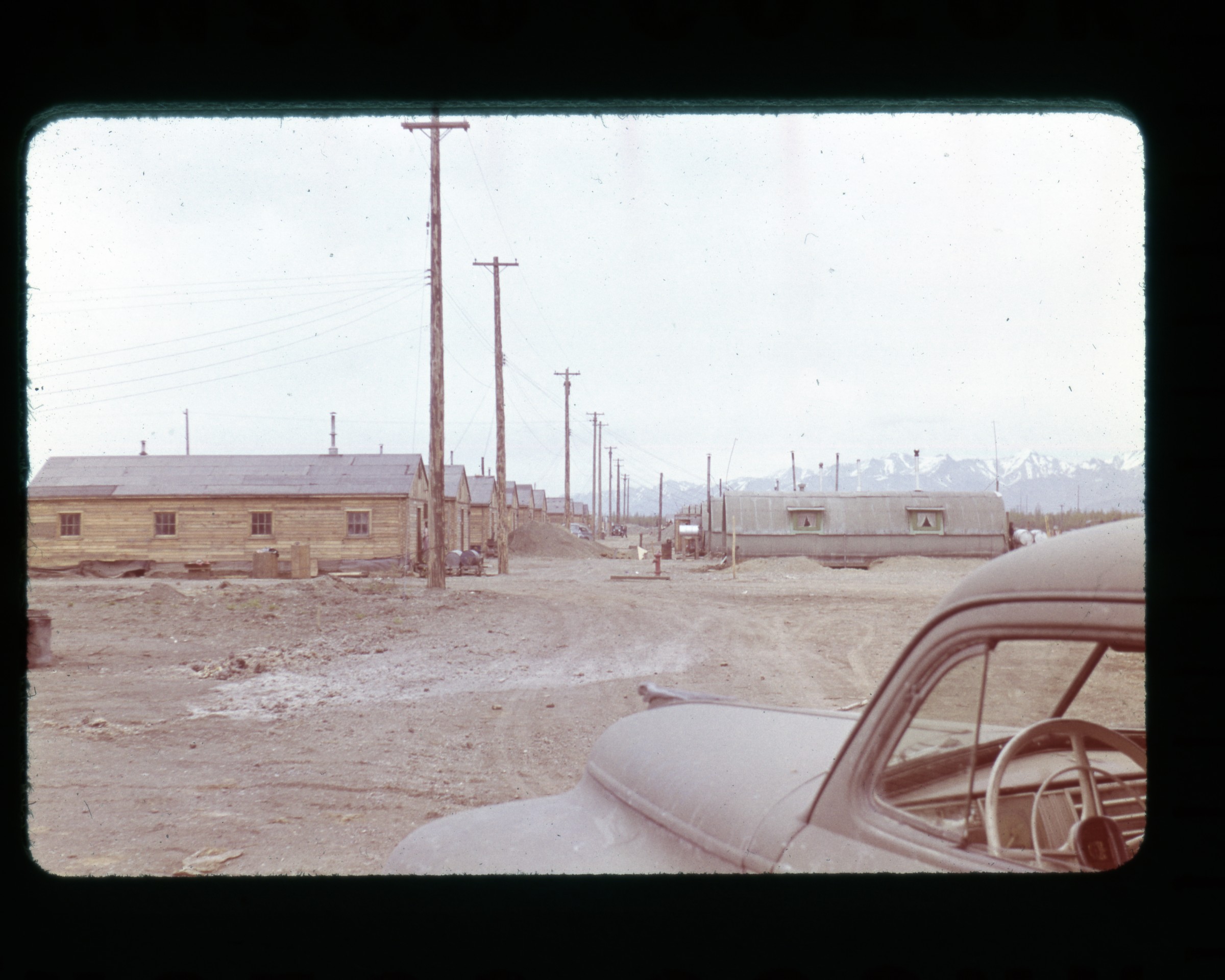 | 175 — | [view down gravel road to rows of housing and Quonset huts, probably Elmendorf Air Force Base] |
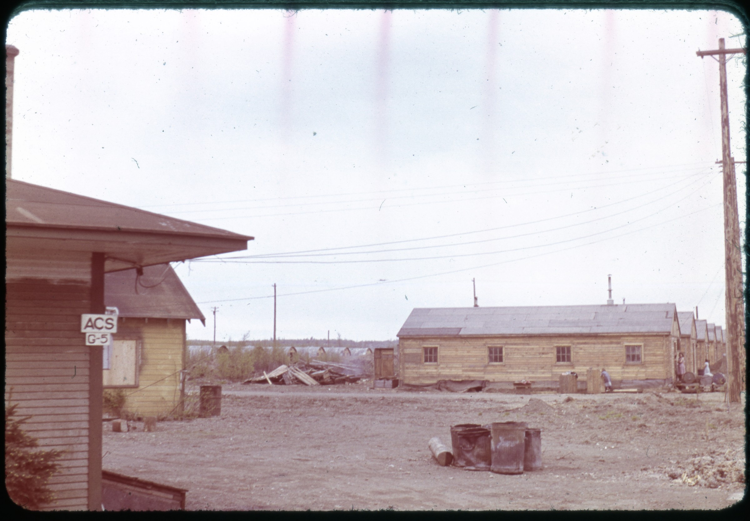 | 176 — | [view past building with sign “ACS G-5” to metal barrels in clearing, rows of housing and Quonset huts in background, probably Elmendorf Air Force Base] |
| 177 — | [residential area, with low fence around yard in foreground, automobile on blocks next to house at left, debris pile in center, utility poles and houses in background] | |
| 178 — | [street scene looking down dirt road past houses, automobiles, and pedestrians, business district in distance, possibly west Fourth Avenue] | |
| 179 — | [street scene looking east at Fourth Avenue and E Street, driver in automobile in foreground, taxi cab across street, signs for businesses including Cheechako Tavern, Logemann Building, Anchorage Grill, Anchorage Photo Supply, Bus Terminal, The Hub Clothing Co.] | |
| 180 — | [street scene looking west at Fourth Avenue near F Street, federal building and signs for businesses including 4 th Avenue Theater, Crocker’s, The Gitchell, Anchorage Jewelers, L. Seidenverg Clothiers, Food Center] Guide written: March 5, 2018 |