| 1 — | 1. Prince Rupert is a modern city with a major Canadian port [totem poles and automobiles outside Besner Block building] | |
| 2 — | 2. The waterfront of Prince Rupert, southern terminus of the Alaska ferry [view of docks from ship deck] | |
| 3 — | 3. Cars boarding the ferry [view from ship deck] | |
| 4 — | 4. Sailing from the Prince Rupert dock (on the “Matanuska”) [view of dock from ship] | |
| 5 — | 5. Underway north from Prince Rupert [passengers on deck] | |
| 6 — | 6. Passing Canadian passenger vessel “Prince Robert” | |
| 7 — | 7. Seagulls following the ship | |
| 8 — | 8. Through the Inside Passage [scenic, American flag in foreground; print date Jun 66] | |
| 9 — | 9. Ketchikan, the first city and port in Alaska [waterfront as seen from ship; print date Jun 66] | |
| 10 — | 10. North from Ketchikan, passing sister ship “Malaspina” [print date Jun 66] | |
| 11 — | 11. Wrangell at the mouth of the Stikine River [ferry dock and parking area as seen from ship; print date Jun 66] | |
| 12 — | 12. Passing the sister ship “Taku” in Stephens Passage [print date Jun 66] | |
| 13 — | 13. Entering Taku Inlet, with the Canadian steamer “Prince George” in view [print date Jun 66] | |
| 14 — | 14. Entering Gastineau Channel and Juneau harbor [print date Jun 66] | |
| 15 — | 15. Lifeboat drill in Juneau harbor [view from deck of two manned lifeboats in harbor; print date Jun 66. Cf. .1493 et seq.] | |
| 16 — | 16. Sailing out of Juneau [waterfront as seen from ship; print date Jun 66] | |
| 17 — | 17. North into Lynn Canal [print date Jun 66] | |
| 18 — | 18. North in Lynn Canal [print date Jun 66] | |
| 19 — | 19. Snow capped mountains in Lynn Canal [ship lifeboats in foreground; print date Jun 66] | |
| 20 — | 20. Approaching Haines, Alaska (oil storage tanks of Canol Pipeline on the hill) [print date Jun 66] | |
| 21 — | Haines dock, debark here to connect with the Alaska Highway [ferry dock as seen from ship; print date Jun 66] Alaska’s fishing is best described by this series of pictures of Petersburg | |
| 22 — | 22. Petersburg, at the north end of the Wrangell Narrows [aerial of town; print date Jun 67] | |
| 23 — | 23. The Alaska ferry docks at Petersburg daily (usually midnight) [distant view of ferry at dock; print date Jul 63] | |
| 24 — | 24. Fishing fleet in Petersburg harbor [small boat harbor, KD building; print date Jul 63] | |
| 25 — | 25. Halibut boats at the float [Kristine and Sea Lad at dock; print date Jul 63] | |
| 26 — | 26. Unloading salmon from a seiner [bird’s eye view of crew on deck; print date Jul 63] | |
| 27 — | 27. Grading salmon before processing [men on dock sorting fish; print date Jul 63] | |
| 28 — | 28. Large halibut are hoisted for butchering [female workers cutting fish] | |
| 29 — | 29. Beginning of the butchering [female workers cutting fish; print date Jul 63] | |
| 30 — | 30. More of the filleting [print date Jul 63] | |
| 31 — | 31. More of the same [print date Jul 63] | |
| 32 — | 32. Mostly skeleton remains of a 30 lb. halibut [woman looking at camera has apron labeled “Gloria”; print date Jul 63] | |
| 33 — | 33. Basket of live crab waiting to be cooked in live steam before picking [crab traps at right; print date Jul 67] | |
| 34 — | 34. This is Ketchikan’s rain gauge on the Alaska Coastal dock | |
| 35 — | 35. Planes of Alaska Coastal Airlines, a certificated carrier servicing the small towns and villages with amphibious craft. AK Airlines used little, not on main runs [several float planes at dock, including tail number N4772C; print date Jun 67] | |
| 36 — | 36. A Coastal “Goose” has just unloaded cargo and is departing Duncan Canal [Grumman Goose amphibious airplane on gravel beach, storage tanks at right; print date Aug 66] | |
| 37 — | 37. Down the beach ramp [Alaska Coastal Airlines Grumman Goose tail number N2751A; print date Aug 66] | |
| 38 — | 38. Into the waters of Duncan Canal for take-off [Alaska Coastal Airlines Grumman Goose tail number N2751A; print date Aug 66] | |
| 39 — | 39. Passing over the bays and inlets of S.E. Alaska [aerial; print date Aug 66] | |
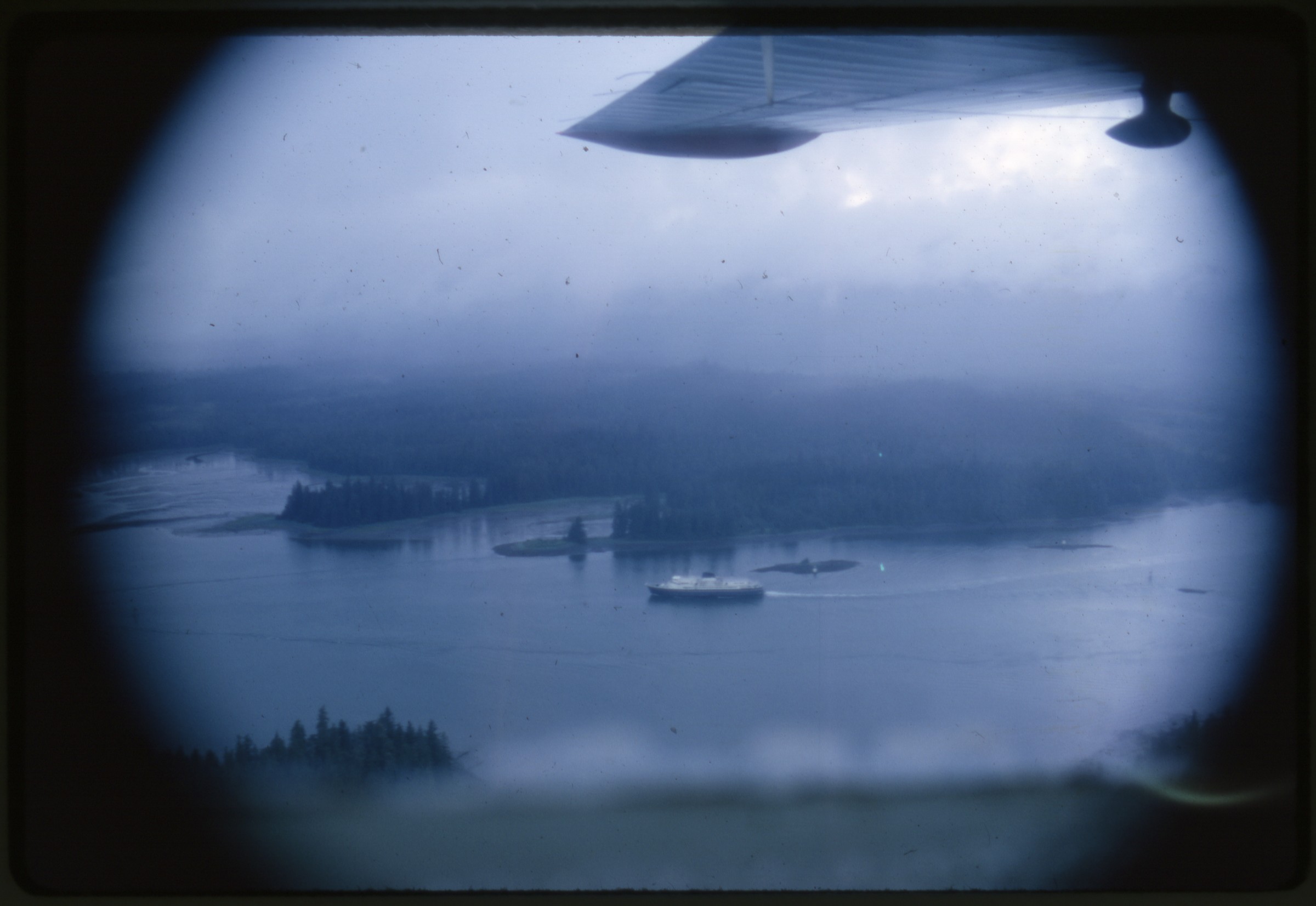 | 40 — | 40. And there’s the ferry “Taku” below in the Wrangell Narrows [aerial; print date Aug 66] |
| 41 — | 41. There are scattered canneries to pack the silver horde of salmon [aerial of cannery; print date Oct 66] | |
| 42 — | 42. A resident of Hoonah watches as Alaska Coastal delivers the morning mail [young boy on dock, boats and float plane at docks on background; print date Aug 66] | |
| 43 — | 43. An orphan fawn (Sitka black tail deer) nuzzles a friend at Duncan Canal [man and dog with fawn in yard; print date Aug 66. Cf. .2893 et seq.] | |
 | 44 — | 44. And the Russian Orthodox churches are reminder that one of the Ivans was here [wooden church with helmet dome and outbuilding. At AFN 2017, identified as Holy Resurrection Orthodox Cathedral in Kodiak] |
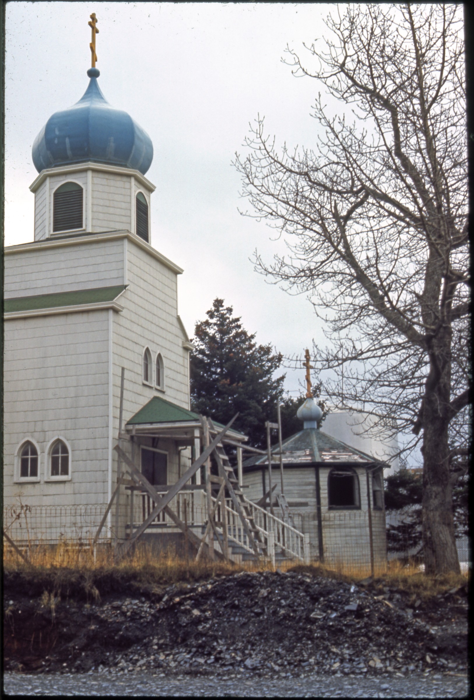
| 45 — | 45. Hughes is an Indian village on the banks of the Koyukuk River [aerial of village and airstrip] | |
| 46 — | 46. The Wien Airlines bush pilot (in sweater) looks over the outbound mail [man looking at crate set down by man on forklift, de Havilland Canada DHC-2 Beaver airplane on tarmac at left, tail number N3790G, Hughes] | |
| 47 — | 47. The roadhouse, and center of the village [Wien pilot walking into two-story log building, Hughes] | |
| 48 — | 48. Salmon drying in the sun (for winter dog food) [man and dog next to fish drying rack on riverbank, Hughes] | |
| 49 — | 49. A future dog team [young dogs next to log cabin, Hughes] | |
 | 50 — | 50. And future dog team drivers [two young Alaska Native boys outdoors, boy with bicycle in background, buildings at right, Hughes] The gold rush of 98 centered on Dawson, Yukon Territory and many other places in Alaska. But today the most colorful remnant left is Dawson City on the Yukon |
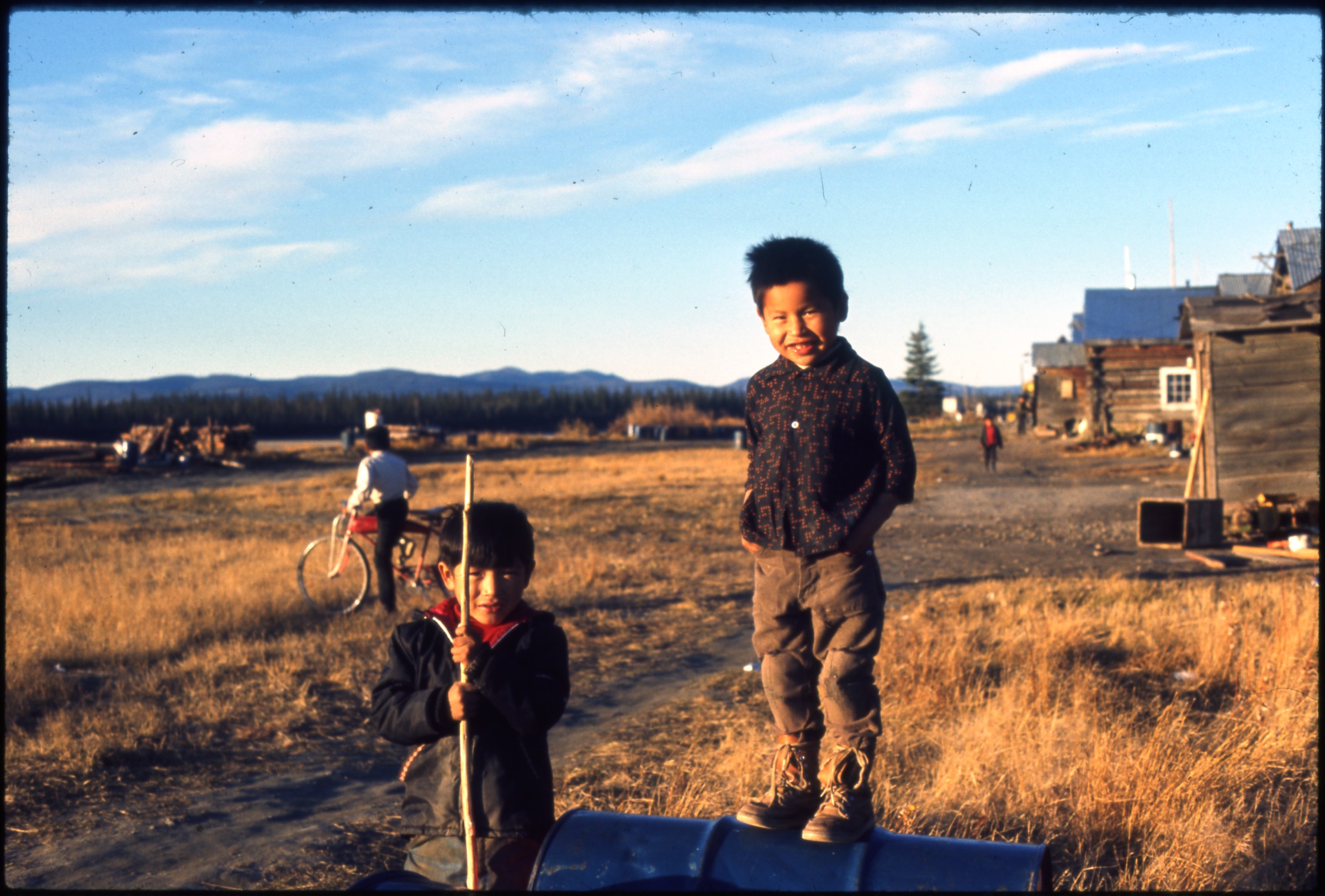
| 51 — | 51. Looking down on Dawson City on the Yukon River where it is joined by the Klondike [bird’s eye view of town; print date Jul 64] | |
| 52 — | 52. The Klondike River joining the Yukon at Dawson City [bird’s eye view of town; print date Jul 64] | |
| 53 — | 53. Along El Dorado, Klondike, and Hunter Creeks the tailing piles are evidence of the digging search for gold [bird’s eye view; print date Jul 64] | |
| 54 — | 54. The “Keno” in her last resting place in Dawson after 50 years of sailing the rivers of Alaska [paddle steamer S.S. Keno in dry dock next to Bank of Commerce; print date Jul 64] | |
| 55 — | 55. The “Keno” is now a tourist attraction, one of the few sternwheelers remaining intact [print date Jul 64] | |
| 56 — | 56. Slowly falling down are many once prominent buildings in Dawson [dilapidated business on street corner, with “Prevent Fires” sign on façade; print date Jul 64] | |
| 57 — | 57. One of the famous hotels of the gold rush [Bonanza Hotel; print date Jul 64] | |
| 58 — | 58. Madam Tremblay’s store in the center of Dawson [woman standing in entrance to Mme. Tremblay’s Store; print date Jul 64] | |
| 59 — | 59. The remnants of the main street of Dawson [street scene with Third Avenue Blacksmith Shop, Red Feather Saloon; print date Jul 64] | |
| 60 — | 60. The auditorium, the center of gold rush entertainment, now restored [print date Jul 64] | |
| 61 — | 61. The story of the auditorium [Palace Grand interpretive panel; print date Jul 64] | |
| 62 — | 62. Robert Service’s cabin in Dawson where he lived during the gold rush days, working as a bank teller and writing his now famous poems [print date Jul 64] | |
| 63 — | 63. Deserted river craft [river boat in dry dock next to gravel road, canoe in grass next to it; print date Jul 64] | |
| 64 — | 64. Assorted gold rush mining relics assembled for tourists [sluice box and other equipment in yard; print date Jul 64] | |
| 65 — | 65. More early day relics, stage coach [print date Jul 64] | |
| 66 — | 66. Pilot house of the steamer Nasutlin [print date Jul 64] | |
| 67 — | 67. More mining relics [print date Jul 64] | |
| 68 — | 68. The early day fire dept. [steam pumper fire engine with sign “The Pride of Dawson City F.D. 1898”; print date Jul 64] | |
| 69 — | 69. Klondike Mining R.R. locomotive recovered from abandoned location on the Klondike River to be restored. Tea kettle engines [railroad engines in yard; print date Jul 64] | |
| 70 — | 70. Same place, but this locomotive has been restored [K.M.R.Y. Brooks engine; print date Jul 64] | |
| 71 — | 71. Another locomotive awaiting restoration [print date Jul 64] A-67 was the central celebration of the Alaska’s Purchase Centennial in Fairbanks. This series was taken a few days before the Chena and Tanana Rivers flooded the place on August 13, 1967. A-67 survived remarkably well and will be open in 1968 as “Alaskaland” for visitors. | |
| 72 — | 72. A balloon ascension opened each day at A-67 | |
| 73 — | 73. A-67 was composed largely of historic buildings and articles assembled from all over Alaska at considerable cost and effort [bird’s eye view of fairgrounds] | |
| 74 — | 74. Some of the historic buildings removed intact [two girls walking through fairgrounds] | |
| 75 — | 75. More of the same [Northern Commercial Co., Palace Café, and Saloon] | |
| 76 — | 76. Ditto [Big Stampede, Pioneer Hall, carpenter shop] | |
| 77 — | 77. And some more from the waterfront [bird’s eye view of fairgrounds] | |
| 78 — | 78. Trapper’s cabin and cache removed intact at considerable effort [log cabin] | |
| 79 — | 79. Valdez-Fairbanks freight wagon and cache | |
| 80 — | 80. Sternwheeler “Nenana” afloat in her own “river” [print date Jun 67] | |
| 81 — | 81. Some of the colorful passengers on the “Nenana” [cast in costume on deck of paddle steamer] | |
| 82 — | 82. More of her passengers and crew [captain and two women in costume; print date Jun 67] | |
| 83 — | 83. Indian cabin and dog sled [woman in fur-trimmed parka standing with tourists in front of King Island Summer House; print date Jun 67] | |
| 84 — | 84. More Indian cabin and drying rack for seine & fish [side view of King Island Summer House; print date Jun 67] | |
| 85 — | 85. Indian tribal hall [two women in fur parkas, two women doing crafts at card table in front of [?]ce Plank Summer House; print date Jun 67] | |
| 86 — | 86. More Indian cabin on the banks of the Chena (note high water) | |
| 87 — | 87. Gold mining (placer) mound with sluice box and riffle box | |
| 88 — | 88. A tourist checking out the gold mining [woman standing next to sign for Crooked Creek Gold Panning] | |
| 89 — | 89. Same tourist looking over model dredge | |
| 90 — | 90. More gold mining cabins and stream | |
| 91 — | 91. A prospector’s relic [automobile loaded with supplies] | |
| 92 — | 92. Caribou and reindeer at A-67 | |
| 93 — | 93. Bush airplanes, Norseman (red) and Stinson (blue) [1943 Noorduyn Norseman tail number N725E, Stinson SR-10 Reliant “Gullwing” tail number N13482; print date Jun 67] Anchorage | |
| 94 — | 1945 [Presbyterian Church] | |
| 95 — | C-124 crash, Jan. 1957 [Douglas C-124C Globemaster II in Cook Inlet] | |
| 96 — | C-124 crash, Jan. 1957 [Douglas C-124C Globemaster II in Cook Inlet] | |
| 97 — | C-124 crash, Jan. 1957 [Douglas C-124C Globemaster II in Cook Inlet] | |
| 98 — | C-124 crash, Jan. 1957 [Douglas C-124C Globemaster II in Cook Inlet] | |
| 99 — | C-124 crash, Jan. 1957 [military personnel mobilizing to recover crashed airplane] | |
| 100 — | C-124 crash, Jan. 1957 [Douglas C-124C Globemaster II in Cook Inlet] | |
| 101 — | C-124 crash, Jan. 1957 [fuselage on shoreline during dismantling process] | |
| 102 — | C-124 crash, Jan. 1957 [fuselage on shoreline during dismantling process] | |
| 103 — | 1958 [crowd gathered outside of federal building, large flag with 49 th star hanging from façade, statehood celebration] | |
| 104 — | Bonfire, 1958 [view of crowd seen across expanse of park strip and gardens, statehood celebration] | |
| 105 — | Bonfire, 1958 [bird’s eye view of bonfire, statehood celebration] | |
| 106 — | Bonfire, 1958 [bird’s eye view of bonfire, statehood celebration] | |
| 107 — | Bonfire, 1958 [bird’s eye view of bonfire, statehood celebration] | |
| 108 — | Bonfire, 1958 [bird’s eye view of bonfire, statehood celebration] | |
| 109 — | Bonfire, 1958 [bird’s eye view of bonfire, statehood celebration] | |
| 110 — | 1959 [bird’s eye view of town, possibly from Spenard fire tower, Import Auto Center at 1101 Fireweed Lane visible at left] | |
| 111 — | 1959 [bird’s eye view of Spenard, Stratton’s Union Service at 2402 Spenard Road visible at right] | |
| 112 — | 1959 [bird’s eye view of Spenard, with businesses including Arctic Realty, Pioneer Real Estate, Piggly Wiggly, Sears, Montgomery Ward] | |
| 113 — | Eisenhower visit, 1960 [motorcade traveling on Fifth Avenue] | |
| 114 — | Eisenhower visit, 1960 [motorcade traveling on Fifth Avenue] | |
| 115 — | Eisenhower visit, 1960 [motorcade traveling on Fifth Avenue, Eisenhower and Bill Egan visible in first car] | |
| 116 — | Eisenhower visit, 1960 [motorcade traveling on Fifth Avenue, Eisenhower and Bill Egan visible in first car] | |
| 117 — | Eisenhower visit, 1960 [motorcade traveling on Fifth Avenue, past Federal Electric Corp. and LaBow Haynes] | |
| 118 — | Eisenhower visit, 1960 [motorcade traveling on Fifth Avenue, past Federal Electric Corp. and Club 210] | |
| 119 — | Eisenhower visit, 1960 [motorcade traveling on Fifth Avenue, past Spenard Pet Shop and Cole’s Cleaners] | |
| 120 — | Eisenhower visit, 1960 [motorcade traveling on Fifth Avenue, past Spenard Pet Shop] | |
| 121 — | Eisenhower visit, 1960 [spectators standing on rooftop of LaBow Haynes] | |
| 122 — | [automobiles parked next to RCA Building at 7 th Avenue and E Street] | |
| 123 — | [man walking near RCA Building at 7 th Avenue and E Street in winter] | |
| 124 — | [Ray residence in winter, Brookside Drive?] | |
| 125 — | [Ray residence in winter, Brookside Drive?] | |
| 126 — | [Ray residence in winter, Brookside Drive?] | |
| 127 — | [view down road in winter, Brookside Drive?] | |
| 128 — | [construction crew replacing siding on commercial building in downtown area, probably Anchorage Radio Television on Fifth Avenue, post-1964 earthquake] | |
| 129 — | [construction crew replacing siding on commercial building in downtown area, probably Anchorage Radio Television on Fifth Avenue, post-1964 earthquake] | |
| 130 — | [construction crew replacing siding on commercial building in downtown area, probably Anchorage Radio Television on Fifth Avenue, post-1964 earthquake] | |
| 131 — | [construction crew replacing siding on commercial building in downtown area, probably Anchorage Radio Television on Fifth Avenue, post-1964 earthquake] | |
| 132 — | [construction crew replacing siding on commercial building in downtown area, probably Anchorage Radio Television on Fifth Avenue, post-1964 earthquake] | |
| 133 — | [construction crew replacing siding on commercial building in downtown area, probably Anchorage Radio Television on Fifth Avenue, post-1964 earthquake] | |
| 134 — | [construction crew replacing siding on commercial building in downtown area, probably Anchorage Radio Television on Fifth Avenue, post-1964 earthquake] | |
| 135 — | West Hi basketball [West playing East Thunderbirds, player shooting free throw, spectators in stands; print date Mar 69] | |
| 136 — | [people standing in line to buy tickets for Anchorage Zoo; print date Oct 81] | |
| 137 — | [visitors on zoo grounds; print date Oct 81] | |
| 138 — | [visitors in front of polar bear cage at zoo, possibly Binky seen between bars; print date Oct 81] | |
| 139 — | [elephant in house at zoo; print date Oct 81] | |
| 140 — | Tent City, Ship Creek [visitors in front of tents with sign “Spenard Row”, Anchorage 80 th anniversary; print date July 19, 1990] | |
| 141 — | Tent City, Ship Creek [visitors in front of tents including Window Gallery, Anchorage 80 th anniversary; print date July 19, 1990] | |
| 142 — | Tent City, Ship Creek [visitors at picnic tables under awning, Anchorage 80 th anniversary; print date July 19, 1990] | |
| 143 — | Tent City, Ship Creek [visitors in area with sign “Ship Creek Landing”, Anchorage 80 th anniversary; print date July 19, 1990] | |
| 144 — | Tent City, Ship Creek [visitors in front of tents including Mad Hatter, Anchorage 80 th anniversary; print date July 19, 1990] | |
| 145 — | Tent City, Ship Creek [visitors in front of tents including Peggy’s Café, Anchorage 80 th anniversary; print date July 19, 1990] | |
| 146 — | Tent City, Ship Creek [visitors in front of tents including Alaska Tent for the Performing Arts, Anchorage 80 th anniversary; print date July 19, 1990] | |
| 147 — | [food tents set up on park strip near Unocal Building; print date Jul 92] | |
| 148 — | [food tents set up on park strip near Unocal Building; print date Jul 92] | |
| 149 — | [view up line of stopped automobiles to car accident on Seward Highway along Turnagain Arm] | |
| 150 — | [view up line of stopped automobiles to car accident on Seward Highway along Turnagain Arm] Anchorage Fur Rendezvous | |
| 151 — | 1955 or 1957 [musher wearing bib #1 racing team down city street; Fur Rendezvous World Championship Sled Dog Race] | |
| 152 — | 1955 or 1957 [musher wearing bib #8 racing team down city street; Fur Rendezvous World Championship Sled Dog Race] | |
| 153 — | 1955 or 1957 [musher wearing bib #4 racing team down city street; Fur Rendezvous World Championship Sled Dog Race] | |
| 154 — | 1955 or 1957 [musher wearing bib #10 racing team down city street; Fur Rendezvous World Championship Sled Dog Race] | |
| 155 — | 1955 or 1957 [crowds on Fourth Avenue in front of City Hall, with Fur Rendezvous banner and furs hanging over street] | |
| 156 — | 1955 or 1957 [two mushers racing teams through wooded area; Fur Rendezvous World Championship Sled Dog Race] | |
| 157 — | 1955 or 1957 [musher wearing bib #5 racing team through wooded area; Fur Rendezvous World Championship Sled Dog Race] | |
| 158 — | 1955 or 1957 [four young women wearing fur parkas posed next to Log Cabin Visitors’ Center, Fur Rendezvous Queen and court] | |
| 159 — | 1955 or 1957 [four young women wearing fur parkas posed next to Log Cabin Visitors’ Center, Fur Rendezvous Queen and court] | |
| 160 — | 1955 or 1957 [musher racing team down Fourth Avenue west of E Street; Fur Rendezvous World Championship Sled Dog Race] | |
| 161 — | 1955 or 1957 [musher wearing bib #7 racing team down Fourth Avenue west of E Street; Fur Rendezvous World Championship Sled Dog Race] | |
| 162 — | 1955 or 1957 [six young women on stage wearing evening gowns and flower lei, furs mounted to wall in back, Fur Rendezvous Queen and court] | |
| 163 — | 1955 or 1957 [five young women wearing evening gowns and flower lei being escorted onto dance floor, Fur Rendezvous Queen and court] | |
| 164 — | 1958 [automobiles on parade on Fifth Avenue, passing Hilstrand & Crusey, Western Auto, Alaska Floors, 5 th Avenue Variety & Jr. Department Store, City National Bank, and Kimball’s] | |
| 165 — | 1958 [fire truck on parade on Fifth Avenue, passing Western Auto, Alaska Floors, 5 th Avenue Variety & Jr. Department Store, City National Bank, and Kimball’s, banner over street for Consumer’s Carnival] | |
| 166 — | 1958 [Fur Rendezvous Queen riding in automobile on parade on Fifth Avenue, passing Hoyt Motor Co., Hilstrand & Crusey, Western Auto, Alaska Floors, and 5 th Avenue Variety & Jr. Department Store] | |
| 167 — | 1958 [military marching band and unit in winter uniforms on parade on Fifth Avenue, passing 5 th Avenue Variety & Jr. Department Store, City National Bank, and Kimball’s, banner over street for Consumer’s Carnival] | |
| 168 — | 1958 [Weaver Bros. flatbed truck pulling float on Fifth Avenue, second float sponsored by 6 th Ave. USO, passing 5 th Avenue Variety & Jr. Department Store, City National Bank, and Kimball’s, banner over street for Consumer’s Carnival] | |
| 169 — | 1958 [antique automobile sponsored by Alaska Sales & Service on parade on Fifth Avenue, passing Hilstrand & Crusey, Western Auto, Alaska Floors, 5 th Avenue Variety & Jr. Department Store, and City National Bank] | |
| 170 — | 1958 [musher wearing bib #13 racing team down city street; Fur Rendezvous World Championship Sled Dog Race] | |
| 171 — | 1958 [mushers wearing bib #11 and bib #12 with dog teams tangled along Tudor Road; Fur Rendezvous World Championship Sled Dog Race] | |
| 172 — | 1958 [musher wearing bib #6 racing team through wooded area; Fur Rendezvous World Championship Sled Dog Race] | |
| 173 — | 1958 [musher wearing bib #4 racing team through wooded area; Fur Rendezvous World Championship Sled Dog Race] | |
| 174 — | 1958 [musher racing team through wooded area; Fur Rendezvous World Championship Sled Dog Race] | |
| 175 — | 1958 [musher wearing bib #4 racing team through wooded area; Fur Rendezvous World Championship Sled Dog Race] | |
| 176 — | [musher wearing bib #1 racing team across road in wooded area, spectators lining route; Fur Rendezvous World Championship Sled Dog Race; print date Apr 62] | |
| 177 — | [musher wearing bib #4 racing team across road in wooded area, spectators lining route; Fur Rendezvous World Championship Sled Dog Race; print date Apr 62] | |
| 178 — | [musher wearing bib #1 racing team down city street, spectators lining route; Fur Rendezvous World Championship Sled Dog Race; print date Mar 65] | |
| 179 — | [Saint Bernard dog on downtown street, possibly for dog weight pull, voter registration booth at right; print date Mar 65] | |
| 180 — | [Saint Bernard dog on downtown street, possibly for dog weight pull, voter registration booth at right; print date Mar 65] | |
| 181 — | [two women office workers dressed in costume; print date Feb 67] | |
| 182 — | [women office workers dressed in costume, standing on desks; print date Feb 67] | |
| 183 — | [women dressed in costume, standing in hallway; print date Feb 67] | |
| 184 — | [two women office workers dressed in costume; print date Feb 67] | |
| 185 — | [woman office worker dressed in costume, 1967?] | |
| 186 — | [musher wearing bib #1 racing team across road in wooded area, spectators lining route, Fur Rendezvous World Championship Sled Dog Race; 1960s?] | |
| 187 — | [spectators and automobiles lined up along road in wooded area, Fur Rendezvous World Championship Sled Dog Race; 1960s?] | |
| 188 — | [spectators and automobiles lined up along road in wooded area, Fur Rendezvous World Championship Sled Dog Race; 1960s?] | |
| 189 — | [Fur Rendezvous Queen Regent posed next to Pioneers of Alaska banner; print date Mar 81] | |
| 190 — | [Fur Rendezvous King Regent posed next to Christmas tree; print date Mar 81] | |
| 191 — | [Fur Rendezvous King Regent posed next to Pioneers of Alaska banner; print date Mar 81] | |
| 192 — | [Fur Rendezvous Queen Regent posed next to Pioneers of Alaska banner; print date Mar 81] | |
| 193 — | [Ladies Shrine Clownettes in automobile on parade; print date Mar 81] | |
| 194 — | [Alaskan Nebraskans on parade passing Captain Cook Hotel; print date Mar 81] | |
| 195 — | [Ronald McDonald in automobile on parade; print date Mar 81] | |
| 196 — | [Iditarod Race float on parade; print date Mar 81] | |
| 197 — | [Anchorage Board of Realtors float on parade passing Arctic First Federal Savings & Loan; print date Feb 81] | |
| 198 — | [King & Queen Regent automobile on parade passing Dean Witter Reynolds Inc., Gaslight Lounge, and Novosel’s Jewelry; print date Feb 81] | |
| 199 — | [military color guard in dress uniform on parade passing Pioneer Club and Dean Witter Reynolds Inc.; print date Feb 81] | |
| 200 — | [military color guard in winter uniform on parade passing Dean Witter Reynolds Inc.; print date Feb 81] | |
| 201 — | [majorette on parade passing Gaslight Lounge, Novosel’s Jewelry, and the Gilded Cage; print date Feb 81] | |
| 202 — | [float on parade passing the Gilded Cage, Klondike Palace, and Arctic First Federal Savings & Loan; print date Feb 81] | |
| 203 — | [llamas pulling carts past Pioneer Club, Allen’s Nugget Jewelry, Dean Witter Reynolds Inc., and Gaslight Lounge; print date Feb 81] | |
| 204 — | [Russian Orthodox float on parade; print date Feb 81] | |
| 205 — | [Russian Orthodox float on parade passing Gaslight Lounge; print date Feb 81] | |
| 206 — | [Footprints in the Snow float on parade passing Pioneer Club and Allen’s Nugget Jewelry; print date Feb 81] B1/B2 | |
| 207 — | [marching band on parade passing Chugach Optical, Pioneer Club, Allen’s Nugget Jewelry, and Dean Witter Reynolds Inc.; print date Feb 81] | |
| 208 — | [antique automobile sponsored by Cordova Airlines and people wearing Rainier Beer costumes on parade passing Chugach Optical, Pioneer Club, Allen’s Nugget Jewelry, and Dean Witter Reynolds Inc.; print date Feb 81] | |
| 209 — | [people wearing Rainier Beer costumes on parade passing Pioneer Club, Allen’s Nugget Jewelry, and Dean Witter Reynolds Inc.; print date Feb 81] | |
| 210 — | [Alaska’s Junior Miss and Anchorage Youth for Christ on parade passing Pioneer Club, Allen’s Nugget Jewelry, and Dean Witter Reynolds Inc.; print date Feb 81] | |
| 211 — | [intercultural float on parade passing Dean Witter Reynolds Inc. and Novosel’s Jewelry; print date Feb 81] | |
| 212 — | [intercultural float on parade passing Arctic First Federal Savings & Loan; print date Feb 81] | |
| 213 — | [Shriners on parade passing Chugach Optical, Pioneer Club, Allen’s Nugget Jewelry, and Dean Witter Reynolds Inc.; print date Feb 81] | |
| 214 — | [bagpipers on parade passing Chugach Optical, Pioneer Club, Allen’s Nugget Jewelry, and Dean Witter Reynolds Inc.; print date Feb 81] | |
| 215 — | [float on parade passing the Gilded Cage, Klondike Palace, and Arctic First Federal Savings & Loan; print date Feb 81] | |
| 216 — | 1987 [snow sculpture competition] | |
| 217 — | 1987 [snow sculpture competition] | |
| 218 — | 1987 [snow sculpture competition] | |
| 219 — | 1987 [snow sculpture competition] | |
| 220 — | 1987 [snow sculpture competition] | |
| 221 — | 1987 [snow sculpture competition] | |
| 222 — | 1987 [snow sculpture competition] | |
| 223 — | 1987 [snow sculpture competition] | |
| 224 — | 1987 [snow sculpture competition] | |
| 225 — | 1987 [snow sculpture competition] | |
| 226 — | [snow sculpture competition; print date Feb 88] | |
| 227 — | [snow sculpture competition; print date Feb 88] | |
| 228 — | [snow sculpture competition; print date Feb 89] | |
| 229 — | [snow sculpture competition; print date Feb 89] | |
| 230 — | [snow sculpture competition; print date Feb 89] | |
| 231 — | [snow sculpture competition; print date Feb 89] | |
| 232 — | [cast in costumes on stage, Fur Rondy Melodrama?; print date Feb 90] | |
| 233 — | [cast in costumes on stage, Fur Rondy Melodrama?; print date Feb 90] | |
| 234 — | [cast in costumes on stage, Fur Rondy Melodrama?; print date Feb 90] | |
| 235 — | [cast in costumes on stage, Fur Rondy Melodrama?; print date Feb 90] | |
| 236 — | [audience packing up after show; print date Feb 90] | |
| 237 — | [snow sculpture competition; print date Feb 90] | |
| 238 — | [snow sculpture competition; print date Feb 90] | |
| 239 — | [snow sculpture competition; print date Feb 90] | |
| 240 — | [snow sculpture competition; print date Feb 90] | |
| 241 — | [snow sculpture competition; print date Feb 90] | |
| 242 — | [snow sculpture competition; print date Feb 90] | |
| 243 — | [snow sculpture competition; print date Feb 90] | |
| 244 — | [mock igloos set up in Ship Creek area; print date Apr 91] | |
| 245 — | [snow igloo set up in Ship Creek area; print date Apr 91] | |
| 246 — | [snow sculpture competition; print date Apr 91] | |
| 247 — | [snow sculpture competition; print date Apr 91] | |
| 248 — | [snow sculpture competition; print date Apr 91] | |
| 249 — | [snow sculpture competition; print date Feb 92] | |
| 250 — | [snow sculpture competition; print date Feb 92] | |
| 251 — | [snow sculpture competition; print date Feb 92] | |
| 252 — | [snow sculpture competition; print date Feb 92] | |
| 253 — | [snow sculpture competition; print date Feb 92] | |
| 254 — | [snow sculpture competition; print date Feb 92] | |
| 255 — | [musher wearing bib #8 racing team on Fifth Avenue near Action Locksmiths, Fur Rendezvous World Championship Sled Dog Race; print date Mar 93] | |
| 256 — | [two mushers racing teams on Fifth Avenue near Action Locksmiths, Fur Rendezvous World Championship Sled Dog Race; print date Mar 93] | |
| 257 — | [musher wearing bib #10 racing team on Fifth Avenue past Snow White Cleaners and Days Inn, Fur Rendezvous World Championship Sled Dog Race; print date Mar 93] | |
| 258 — | [musher wearing racing team on Fifth Avenue past Days Inn, Fur Rendezvous World Championship Sled Dog Race; print date Mar 93] Anchorage Fourth of July Celebration | |
| 259 — | [woman riding on hood of Stewart’s Photo Shop automobile on parade on Fourth Avenue passing Pioneer Club and The Club Bar & Café; 1950s] | |
| 260 — | [women riding on hood of Stewart’s Photo Shop automobile on parade on Fourth Avenue passing Anchorage Grocery; 1950s] | |
| 261 — | [automobile sponsored by Spenard Hobby Shop with other automobiles and horseback riders on parade on Fourth Avenue passing businesses including Mona Lea’s, OK Cleaners, and Richmond’s; 1950s] | |
| 262 — | [antique automobile sponsored by Kennicott Ghost Town Special on parade on Fourth Avenue passing Mona Lea’s, Pioneer Club and The Club Bar & Café; 1950s] | |
| 263 — | [young girl and dog on parade; print date Jul 64] | |
| 264 — | [YMCA on parade; print date Jul 64] | |
| 265 — | [American Womanhood float on parade; print date Jul 64] | |
| 266 — | [military color guard and marching band on parade on Fifth Avenue passing Northern Commercial Co.; print date Jul 64] | |
| 267 — | [Declaration of Independence float and automobiles on parade; print date Jul 64] | |
| 268 — | [three women wearing roller skates sitting on hood of automobile on parade; print date Jul 64] | |
| 269 — | [people preparing food in a picnic shelter; print date Jul 66] | |
| 270 — | [small red-and-white candy stripe car pulling two wooden wagon loads of children down unpaved street; print date Jul 66] | |
| 271 — | [clowns on parade passing spectators and houses; print date Jul 66] | |
| 272 — | [4-H Busy Bee Club and children on bicycles on parade; print date Jul 66] | |
| 273 — | [Land of Progress float on parade on L Street passing Presbyterian Community Hospital; print date Jul 66] | |
| 274 — | [Knights of Columbus float on parade; print date Jul 66] | |
| 275 — | [Antique Auto Mushers on parade; print date Jul 66] | |
| 276 — | [Nugget #13 Rainbow Girls on parade on L Street passing Presbyterian Community Hospital; print date Jul 66] | |
| 277 — | [Nugget #13 Rainbow Girls on parade on L Street passing Presbyterian Community Hospital; print date Jul 66] | |
| 278 — | [NAACP on parade on L Street passing Presbyterian Community Hospital; print date Jul 66] | |
| 279 — | [group on horseback on parade on L Street passing Presbyterian Community Hospital; print date Jul 66] | |
| 280 — | [man wearing Native American regalia sitting on hood of automobile on parade; print date Jul 66] | |
| 281 — | [Chugach Gem & Mineral Society on parade; print date Jul 66] | |
| 282 — | [military color guard and automobiles on parade; print date Sep 70] | |
| 283 — | [Miss Anchorage riding on hood of automobile on parade; print date Sep 70] | |
| 284 — | [Bill Egan float on parade; print date Sep 70] | |
| 285 — | [Alaskanettes on parade; print date Sep 70] | |
| 286 — | [reindeer and Boy Scouts on parade; print date Sep 70] | |
| 287 — | [men on horseback and women carrying Pollock political signs on parade; print date Sep 70] | |
| 288 — | 1977 [clowns on parade on Northern Lights passing Firestone Tires] | |
| 289 — | 1977 [Armed Forces Benefit Association on parade on Northern Lights passing Firestone Tires] | |
| 290 — | 1977 [Miss Anchorage riding on hood of automobile on parade on Northern Lights passing Firestone Tires] | |
| 291 — | 1977 [Miss Alaska National Teenager Stacie Rounds riding on automobile on parade on Northern Lights passing Medical Arts Building] | |
| 292 — | 1977 [Miss Alaska riding on automobile on parade on Northern Lights passing Medical Arts Building] | |
| 293 — | 1977 [Alaskanettes on parade on Northern Lights passing Firestone Tires] | |
| 294 — | 1977 [Anchorage Figure Skating Club on parade on Northern Lights passing Firestone Tires] | |
| 295 — | 1977 [Anchorage Figure Skating Club float on parade on Northern Lights passing Firestone Tires] | |
| 296 — | 1977 [McDonald’s characters on parade on Northern Lights passing Firestone Tires] | |
| 297 — | 1977 [Wien Airlines float on parade on Northern Lights passing Firestone Tires] | |
| 298 — | 1977 [21 st Civil Engr. Squadron riding in antique fire engine on parade on Northern Lights passing Firestone Tires] | |
| 299 — | [float on parade with banner “We have found our pot of gold – it’s Alaska!”; print date Jul 79] | |
| 300 — | [color guard on parade on Northern Lights passing Kentucky Fried Chicken and Anchorage Beauty School; print date Aug 80] | |
| 301 — | [person on tricycle on parade on Northern Lights passing Proctor’s Country Market; print date Aug 80] | |
| 302 — | [person on motorized wheelchair on parade on Northern Lights passing Kentucky Fried Chicken and Anchorage Beauty School; print date Aug 80] | |
| 303 — | [bed race on Northern Lights passing Kentucky Fried Chicken and Anchorage Beauty School; print date Aug 80] | |
| 304 — | [military color guard and marching band on parade on Northern Lights passing Proctor’s Country Market and Bailey’s Rent-All; print date Jul 81] | |
| 305 — | [motorcycles on parade on Northern Lights passing Queen’s Laundromat; print date Jul 81] | |
| 306 — | [Miss Anchorage riding in antique automobile on parade on Northern Lights passing Queen’s Laundromat; print date Jul 81] | |
| 307 — | [ultralight aircraft on float on parade on Northern Lights; print date Jul 81] | |
| 308 — | [Pearl Harbor Survivors Association North Star Chapter in antique automobile on parade on Northern Lights passing Proctor’s Country Market; print date Jul 81] | |
| 309 — | [women pulling float accompanied by men on roller skates on parade on Northern Lights passing gun store, Pet Emporium, and Proctor’s Country Market; print date Jul 81] | |
| 310 — | [bagpipers on parade on Northern Lights passing Queen’s Laundromat; print date Jul 81] | |
| 311 — | [Viet Nam veterans on float on parade on Northern Lights; print date Jul 81] | |
| 312 — | [Shriners in Arab costume on parade on Northern Lights passing Queen’s Laundromat and Bailey’s Rent-All; print date Jul 81] | |
| 313 — | [baton twirlers on parade on Northern Lights passing gun store, Pet Emporium, and Proctor’s Country Market; print date Jul 81] | |
| 314 — | [Mush Inn Motel float on parade on Northern Lights; print date Jul 82] | |
| 315 — | [cheerleaders on parade on Northern Lights passing Crab Cab and Queen’s Laundromat; print date Jul 82] | |
| 316 — | [Miss Anchorage riding in Corvette on Northern Lights passing Crab Cab and Queen’s Laundromat; print date Jul 82] | |
| 317 — | [clown on Northern Lights passing Foodland; print date Jul 82] | |
| 318 — | [bagpipers on Northern Lights passing Queen’s Laundromat; print date Jul 82] | |
| 319 — | [gymnasts on Northern Lights passing Queen’s Laundromat; print date Jul 82] | |
| 320 — | [unicycle riders on parade on Northern Lights passing Queen’s Laundromat; print date Jul 82] | |
| 321 — | [Anchorage Pioneers Home float on parade on Northern Lights; print date Jul 82] | |
| 322 — | [king and queen riding in automobile on parade on Northern Lights passing Queen’s Laundromat; print date Jul 82] | |
| 323 — | [Doug Schmedlen riding in antique automobile on parade on Northern Lights passing Queen’s Laundromat; print date Jul 82] | |
| 324 — | [baton twirlers on parade on Northern Lights passing Anchorage Beauty School, B & J, and Travel Enterprises; print date Jul 82] | |
| 325 — | [miniature pony pulling trap on parade on Northern Lights passing Foodland; print date Jul 82] | |
| 326 — | [float on cherry picker truck on parade on Northern Lights passing Anchorage Beauty School, B & J, and Travel Enterprises; print date Jul 82] | |
| 327 — | [military color guard and marching band on parade on Northern Lights passing Kentucky Fried Chicken; print date Jul 83] | |
| 328 — | [reindeer on parade on Northern Lights passing gun store and Pet Emporium; print date Jul 83] | |
| 329 — | [Shriners float on parade on Northern Lights passing Pet Emporium and Price Mart; print date Jul 83] | |
| 330 — | [bagpipers on parade on Northern Lights passing Price Mart and Queen’s Laundromat; print date Jul 83] | |
| 331 — | [Pearl Harbor Survivors Association riding in automobile on parade on Northern Lights passing Price Mart; print date Jul 83] | |
| 332 — | [Anchorage Convention & Visitors Bureau float on parade; print date Jul 83] | |
| 333 — | [Miss Anchorage Maryline Blackburn riding in automobile on parade on Northern Lights passing Pet Emporium and Price Mart; print date Jul 83] | |
| 334 — | [Mush Inn employees on parade on Northern Lights passing Queen’s Laundromat and Natural Pantry; print date Jul 83] | |
| 335 — | [women playing soccer on park strip; print date Jul 83] | |
| 336 — | 1984 [man on horseback on parade on Northern Lights passing Price Mart, Queen’s Laundromat and Natural Pantry] | |
| 337 — | 1984 [Miss Alaska National Teenager riding in automobile on parade on Northern Lights passing Price Mart and Natural Pantry] | |
| 338 — | 1984 [Shriners in Arab costume on parade on Northern Lights passing Queen’s Laundromat and Natural Pantry] | |
| 339 — | 1984 [reindeer on parade on Northern Lights passing Price Mart] | |
| 340 — | 1984 [Singles Support Network on parade on Northern Lights passing Price Mart] | |
| 341 — | 1984 [automobile and float on parade on Northern Lights passing Queen’s Laundromat] | |
| 342 — | 1984 [people in Rainier Beer costumes on Northern Lights passing Queen’s Laundromat and Natural Pantry] | |
| 343 — | 1984 [Cook Inlet Native Association on parade on Northern Lights] | |
| 344 — | 1984 [Mrs. Alaska riding in automobile on parade on Northern Lights passing Price Mart] | |
| 345 — | 1984 [Don Young automobile on parade on Northern Lights passing Queen’s Laundromat and Natural Pantry] | |
| 346 — | 1984 [horse-drawn political float on parade on Northern Lights passing Queen’s Laundromat and Natural Pantry] | |
| 347 — | 1984 [Alaska Draft Horse & Mule Association on parade on Northern Lights passing gun store and Pet Emporium] | |
| 348 — | 1984 [float with signs for both Birchwood Methodist Camp and Jones Tool Rental- Hardware on parade on Northern Lights passing Queen’s Laundromat] | |
| 349 — | 1984 [toy train on parade on Northern Lights passing Queen’s Laundromat and Natural Pantry] | |
| 350 — | [antique automobile on parade on Northern Lights passing Lucky Strike Bingo, Cheers Deli, and sign “Bennett for Lieutenant”; print date Aug 86] | |
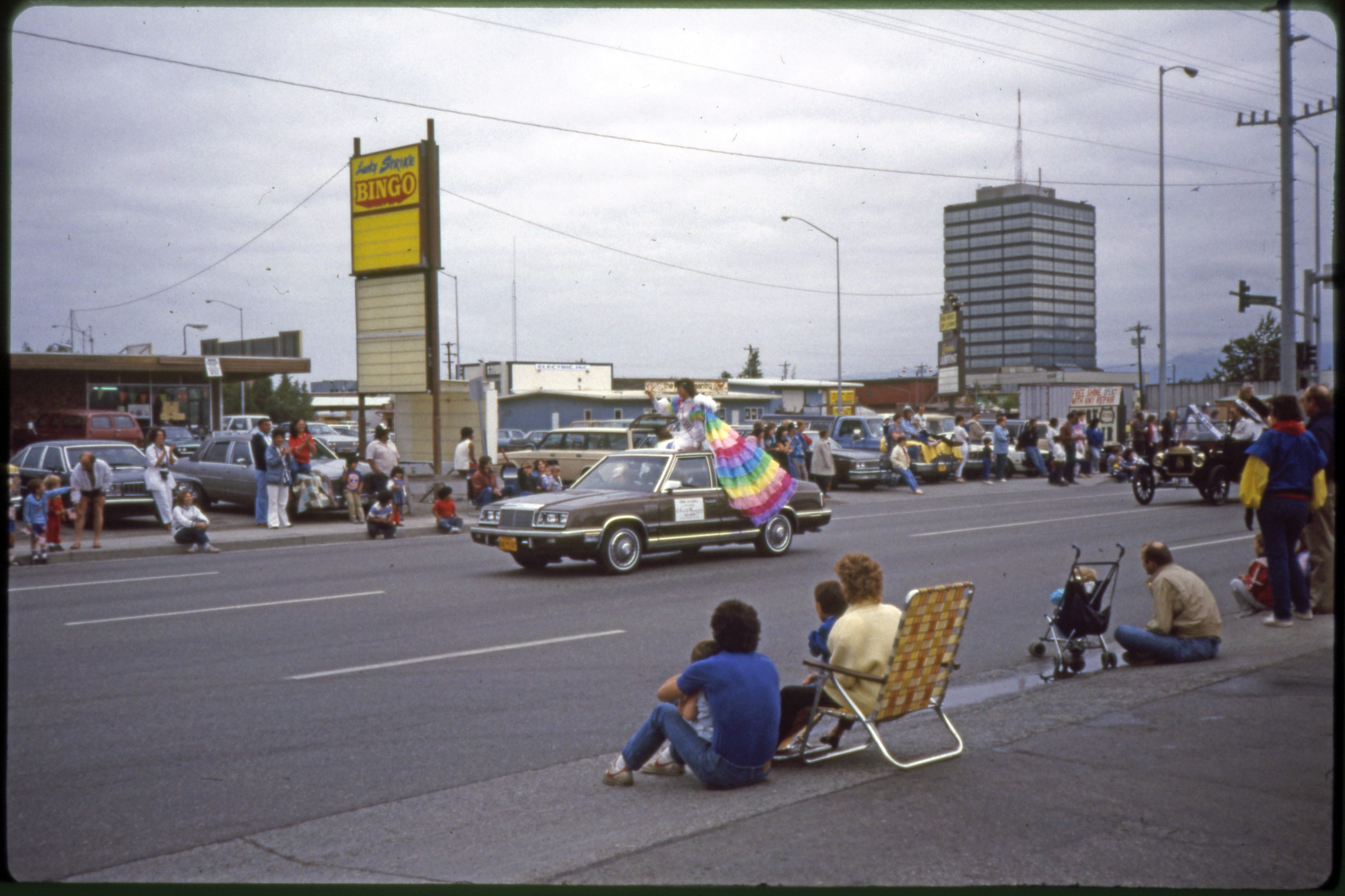
| 351 — | [“Liberty and Justice for All” float on parade on Northern Lights passing Lucky Strike Bingo; print date Aug 86] | |
| 352 — | [baton twirlers on parade on Northern Lights passing Western Shoe Repair, Pet Emporium, Lucky Strike Bingo, Cheers Deli, and sign “Bennett for Lieutenant”; print date Aug 86] | |
| 353 — | [baton twirlers on parade on Northern Lights passing Anchorage Beauty School and B & J; print date Aug 86] | |
| 354 — | [automobiles on parade on Northern Lights passing Lucky Strike Bingo and Natural Pantry; print date Aug 86] | |
| 355 — | [Joe Hayes for Governor float on parade on Northern Lights passing Lucky Strike Bingo, and Cheers Deli; print date Aug 86] | |
| 356 — | [reindeer on parade on Northern Lights passing Lucky Strike Bingo, Cheers Deli, and sign “Bennett for Lieutenant”; print date Aug 86] | |
| 357 — | [Alaskanettes on parade on Northern Lights passing Natural Pantry; print date Aug 86] | |
| 358 — | [woman in costume posed in parking lot; print date Aug 86] | |
 | 359 — | [Miss Alaska? riding in automobile on parade on Northern Lights passing Lucky Strike Bingo and Natural Pantry; print date 7/86] |
| 360 — | [Miss Alaska and American Legion king and queen Pat and Leon Bertram riding in automobile on parade on Northern Lights passing Lucky Strike Bingo and Natural Pantry; print date 7/86] | |
| 361 — | [woman on unicycle on parade on Northern Lights passing Kentucky Fried Chicken; print date Jul 88] | |
| 362 — | [reindeer on parade on Northern Lights passing Kentucky Fried Chicken, Barber & Beauty School, Anchorage Beauty School, and B & J; print date Jul 88] | |
| 363 — | [Anchorage Fur Rendezvous float on parade; print date Jul 88] | |
| 364 — | [KYAK Radio float on parade on Northern Lights passing Barber & Beauty School, Anchorage Beauty School, and B & J; print date Jul 88] | |
| 365 — | [Sunshine Generation float on parade on Northern Lights passing Barber & Beauty School, Anchorage Beauty School, and B & J; print date Jul 88] | |
| 366 — | [John Suter’s Poodle Iditarod Team on parade on Northern Lights passing Barber & Beauty School, Anchorage Beauty School, and B & J; print date Jul 88] | |
| 367 — | [John Suter’s Poodle Iditarod Team on parade on Northern Lights passing National Bank of Alaska; print date Jul 88] | |
| 368 — | [women riding in automobiles on parade on Northern Lights passing Kentucky Fried Chicken, Barber & Beauty School, and Anchorage Beauty School; print date July 19, 1990] | |
| 369 — | [Miss American Coed contestants riding in automobiles on parade on Northern Lights passing Kentucky Fried Chicken, Barber & Beauty School, and Anchorage Beauty School; print date July 19, 1990] | |
| 370 — | [baton twirlers on parade on Northern Lights passing Barber & Beauty School, Anchorage Beauty School, and Bishop’s Attic; print date July 19, 1990] | |
| 371 — | [Bringing the World to Anchorage float on parade on Northern Lights passing Kentucky Fried Chicken and B & J; print date July 19, 1990] | |
| 372 — | [Mystrom for Mayor automobile on parade on Northern Lights passing Barber & Beauty School and Anchorage Beauty School; print date July 19, 1990] | |
| 373 — | [automobile with banner for “Oil City Symphony” on parade on Northern Lights passing Kentucky Fried Chicken, Barber & Beauty School, Anchorage Beauty School, and Bishop’s Attic; print date July 19, 1990] | |
| 374 — | [Fur Rendezvous Queen riding in automobile on parade on Northern Lights passing Kentucky Fried Chicken, Barber & Beauty School, Anchorage Beauty School, and Bishop’s Attic; print date July 19, 1990] | |
| 375 — | [wheelchair-bound residents of the Anchorage Pioneer Home on parade on Northern Lights passing Barber & Beauty School, Anchorage Beauty School, and Bishop’s Attic; print date July 19, 1990] | |
| 376 — | [Boy Scouts on parade on Northern Lights passing National Bank of Alaska, Kentucky Fried Chicken and B & J; print date July 19, 1990] | |
| 377 — | [Sunshine Generation float on parade on Northern Lights passing Barber & Beauty School, Anchorage Beauty School, and Bishop’s Attic; print date July 19, 1990] | |
| 378 — | [bagpipers on parade on Northern Lights passing Lucky Strike Bingo and Deli and Cinnamons Bakery; print date Jul 92] | |
| 379 — | [cheerleaders on parade on Northern Lights passing Cinnamons Bakery and Arctic Alignment; print date Jul 92] | |
| 380 — | [Ronald McDonald and man on horseback on parade on Northern Lights passing Cinnamons Bakery and Arctic Alignment; print date Jul 92] | |
| 381 — | [American Legion king and queen riding in automobile on parade on Northern Lights passing Arctic Alignment; print date Jul 92] | |
| 382 — | [reindeer on parade on Northern Lights passing Arctic Alignment; print date Jul 92] | |
| 383 — | [Miss American Coed contestant riding in automobile on parade on Northern Lights passing Colortyme, liquor store, and Lucky Strike Bingo; print date Jul 92] | |
| 384 — | [Precision Power pickup trucks on parade on Northern Lights passing Colortyme, liquor store, and Lucky Strike Bingo; print date Jul 92] | |
| 385 — | [Crazy Horse Saloon limousine with hot tub on parade on Northern Lights; print date Jul 92] | |
| 386 — | [Lt. Governor Coghill riding in automobile on parade; print date Aug 92] | |
| 387 — | [antique automobile on parade; print date Aug 92] | |
| 388 — | [young girls in costume riding in antique automobile on parade; print date Aug 92] | |
| 389 — | [antique automobile on parade, Bridgewater Hotel in distance; print date Aug 92] | |
| 390 — | [amphibious craft on parade; print date Aug 92] | |
| 391 — | [Fairbanks Golden Days float on parade; print date Aug 92] Anchorage 3 Barons Renaissance Fair | |
| 392 — | [man and dog in costume, bagpipers at left; print date Aug. 15, 1990] | |
| 393 — | [women in costume; print date Aug. 15, 1990] | |
| 394 — | [people in costume carrying flags; print date Aug. 15, 1990] | |
| 395 — | [people in costume carrying flags; print date Aug. 15, 1990] | |
| 396 — | [spectators lined up near llama enclosure; print date Jun 91] | |
| 397 — | [person dressed in black holding sword standing atop platform near food tents; print date Jun 91] | |
| 398 — | [people in costume in tent; print date Jun 91] | |
| 399 — | [people in costume dancing in tent; print date Jun 91] | |
| 400 — | [people in costume dancing in tent; print date Jun 91] Anchorage People | |
| 401 — | 1 st ACC graduate, 1956? [graduation ceremony, Anchorage Community College] | |
| 402 — | [similar to .401] | |
| 403 — | 17 ACC, F. Ray, 1 st director Leroy Good [people talking in foyer after graduation ceremony, Anchorage Community College] | |
| 404 — | 1. Betty Park, 2. Helen Bierne [two women at buffet table; print date Sep 71] | |
| 405 — | Joan & R. Kickbush, Crystal Ball, Mar. 13, 1965 [man and woman in evening dress; print date Mar 65] | |
| 406 — | Barbara Dimick [i.e. Dimock?] [people in evening dress seated at table; print date Mar 65] | |
| 407 — | Mr. & Mrs. Fred Chei (sp?) [Fred Chiei and wife in evening dress seated at table; print date Mar 65] | |
| 408 — | Doty Irwin [woman in evening dress; print date Mar 65] | |
| 409 — | Doty Irwin [women in evening dress in living room; print date Mar 65] | |
| 410 — | Military guy & Doc Walkowski [August “Wally” Walkowski] [two men holding drinks, talking; print date Mar 65] | |
| 411 — | Barbara Dimick [i.e. Dimock?] [women in evening dress in living room; print date Mar 65] | |
| 412 — | Sally Monserud [two women talking in office area; print date Feb 84] B1/B3 1964 Earthquake, Anchorage | |
| 413 — | [woman picking up broken china in Ray residence; print date Apr 64] | |
| 414 — | [damage in kitchen; print date Apr 64] | |
| 415 — | [woman picking up dishes from the kitchen floor; print date Apr 64] | |
| 416 — | [damage in kitchen; print date Apr 64] | |
| 417 — | Left end of our living room [print date Apr 64] | |
| 418 — | [woman in kitchen area; print date Apr 64] | |
| 419 — | Don’t you dare say it always looked like this! Our kitchen [print date Apr 64] | |
| 420 — | Right end of our living room [print date Apr 64] | |
| 421 — | [damage in office area; print date Apr 64] | |
| 422 — | [woman picking up broken china; print date Apr 64] | |
| 423 — | [damage in office area; print date Apr 64] | |
| 424 — | [damage in kitchen; print date Apr 64] | |
| 425 — | [damage in kitchen; print date Apr 64] | |
| 426 — | [damage in bedroom; print date Apr 64] | |
| 427 — | [damage in kitchen; print date Apr 64] | |
| 428 — | [crew with dump truck and bulldozer in Turnagain area] | |
| 429 — | [damaged houses in Turnagain area, Cook Inlet in background; print date May 64] | |
| 430 — | [soldier in uniform looking down on damaged house in Turnagain area; print date May 64] | |
| 431 — | [man carrying chair away from Denali Theater on Fourth Avenue; print date May 64] | |
| 432 — | [sidewalk-level view of damage to Anchorage Pawn Shop and Denali Theater] | |
| 433 — | [trucks and heavy equipment outside damaged businesses on Fourth Avenue. Copy slide, printed in reverse] | |
| 434 — | [soldier at roadblock outside Dalton & Co. in Ship Creek area] | |
| 435 — | [view down street to damaged J.C. Penney parking garage; print date Apr 64] | |
| 436 — | [view down street to damaged J.C. Penney parking garage; print date Apr 64] | |
| 437 — | [view down street to damaged J.C. Penney parking garage; print date Apr 64] | |
| 438 — | [looking east down downtown street, showing damage to houses; print date Apr 64] | |
| 439 — | [two men carrying cameras standing near damaged houses; print date Apr 64] | |
| 440 — | [damaged houses in downtown area; print date Apr 64] | |
| 441 — | [damaged houses, toppled Four Seasons Apartments in background; print date Apr 64] | |
| 442 — | [people walking near damaged houses, Providence Hospital in background; print date Apr 64] | |
| 443 — | [damage to 5 th Avenue Chrysler Center; print date Apr 64] | |
| 444 — | [damage to 5 th Avenue Chrysler Center; print date Apr 64] | |
| 445 — | [damage to Alaska Sales & Service; print date Apr 64] | |
| 446 — | [damage to Alaska Sales & Service; print date Apr 64] | |
| 447 — | [damage to Alaska Sales & Service; print date Apr 64] | |
| 448 — | [damage to Alaska Sales & Service; print date Apr 64] | |
| 449 — | [view down downtown street, showing building damage; print date Apr 64] | |
| 450 — | [damage to houses and multi-story building in downtown; print date Apr 64] | |
| 451 — | [damage to Cordova Building; print date Apr 64] | |
| 452 — | [damage to Cordova Building; print date Apr 64] | |
| 453 — | [damage to West Anchorage High School; print date Apr 64] | |
| 454 — | [distant view of damage to Government Hill School; print date Apr 64] | |
| 455 — | [bird’s eye view of buildings from Government Hill; print date Apr 64] | |
| 456 — | [damage to houses along inlet bluff in downtown; print date Apr 64] | |
| 457 — | [damage on park strip west of L Street; print date Apr 64] | |
| 458 — | [damage to houses along inlet bluff in downtown; print date Apr 64] | |
| 459 — | [view at intersection of Ninth Avenue and N Street; print date Apr 64] | |
| 460 — | [view down Fifth Avenue to McKinley Apartments in distance; print date Apr 64] | |
| 461 — | [damage to Cordova Building; print date Apr 64] | |
| 462 — | [view down Fifth Avenue at C Street to J.C. Penney garage, with signs for Norene Realty, Santa Claus Land, Uptown Beauty Salon, and Golden Horseshoe Cocktails; print date Apr 64] | |
| 463 — | [damage to J.C. Penney garage; print date Apr 64] | |
| 464 — | [view down Fifth Avenue at C Street to J.C. Penney garage, with signs for 5 th Ave. Hotel, Norene Realty, Santa Claus Land, and Uptown Beauty Salon; print date Apr 64] | |
| 465 — | [view at Fifth Avenue and C Street with Golden Horseshoe Cocktails; print date Apr 64] | |
| 466 — | [relocated Mac’s Foto Shop in McCutcheon house, with sign “Mac’s Foto Business as Usual (More or Less) in Spite of Early Breakup!”; print date Apr 64] | |
| 467 — | [damage to West Anchorage High School; print date Apr 64] | |
| 468 — | EQ West High [damage to West Anchorage High School; print date Apr 64] | |
| 469 — | [view down Fifth Avenue with Wolfe’s Department Store; print date Apr 64] | |
| 470 — | [view down C Street, with May’s Café and Alley Cat Bar; print date Apr 64] | |
| 471 — | [demolition of businesses on Fourth Avenue looking east; print date Apr 64] | |
| 472 — | [demolition of businesses on Fourth Avenue near E Street; print date Apr 64] | |
| 473 — | [demolition of businesses on Fourth Avenue, looking east from E Street; print date Apr 64] | |
| 474 — | [demolition work on J.C. Penney garage, with large sign for Book Cache on fence in foreground; print date Apr 64] | |
| 475 — | [demolition of businesses on Fourth Avenue, looking east from E Street; print date Apr 64] | |
| 476 — | [view down street to McKinley Apartments; print date Apr 64] | |
| 477 — | [damage to house; print date Apr 64] | |
| 478 — | [damage to house; print date Apr 64] | |
| 479 — | [damage to Inlet Hotel; print date Apr 64] | |
| 480 — | [damage at intersection of D Street and Second Avenue; print date Apr 64] | |
| 481 — | [damage to Dalton & Co. building; print date Apr 64] | |
| 482 — | [damage to Government Hill school; print date Apr 64] | |
| 483 — | [damage to buildings in Government Hill area; print date Apr 64] | |
| 484 — | [damage to buildings in Government Hill area, Alaska Native Services Hospital in background; print date Apr 64] | |
| 485 — | [damage to house; print date Apr 64] | |
| 486 — | [damage to houses; print date Apr 64] | |
| 487 — | [damage to houses; print date Apr 64] | |
| 488 — | [damage at intersection of H Street and 16 th Avenue; print date Apr 64] | |
| 489 — | [damage on 16 th Avenue; print date Apr 64] | |
| 490 — | [damage to Hillside Apartments; print date Apr 64] | |
| 491 — | [damage along Cook Inlet shoreline; print date Apr 64] | |
| 492 — | [damage to bluff in Government Hill area; print date Apr 64] | |
| 493 — | [damage to bluff in Government Hill area; print date Apr 64] | |
| 494 — | [damage to houses; print date Apr 64] | |
| 495 — | [damage to houses; print date Apr 64] | |
| 496 — | [men and heavy equipment on bluff, Turnagain area?; print date Apr 64] | |
| 497 — | [house with debris in yard; print date Apr 64] | |
| 498 — | [men and heavy equipment on bluff, Turnagain area?; print date Apr 64] | |
| 499 — | [replacing sections of pipeline, Turnagain area?; print date Apr 64] | |
| 500 — | [excavator, Turnagain area?; print date Apr 64] | |
| 501 — | [debris and flooded area below bluff; print date Apr 64] | |
| 502 — | [flooded area between houses; print date Apr 64] | |
| 503 — | [men and heavy equipment on bluff, Turnagain area?; print date Apr 64] | |
| 504 — | [view from Government Hill across Ship Creek yards to downtown; print date Apr 64] | |
| 505 — | [bird’s eye view of mouth of Ship Creek; print date Apr 64] | |
| 506 — | [view from Government Hill across Ship Creek yards to downtown; print date Apr 64] | |
| 507 — | [view from Government Hill across Ship Creek yards to downtown; print date Apr 64] | |
| 508 — | Railroad shop & warehouse [view from Government Hill to Alaska Railroad yards, Alaska Native Service Hospital in distance; print date Apr 64] | |
| 509 — | [Volkswagen bus parked next to barricade in residential area; print date Apr 64] | |
| 510 — | [people walking past houses on K Street; print date Apr 64] | |
| 511 — | L Street drop [view down street to large fissure; print date Apr 64] | |
| 512 — | [looking west on Fourth Avenue from A Street, with signs for businesses including Monty’s, Bowling Emporium, Denali Theater, Green Furs, Hertz Rent-a-Car; print date Apr 64] | |
| 513 — | 4 th & A [damage to businesses including Monty’s; print date Apr 64] | |
| 514 — | 5 & A, Alaska Auto [damage to Alaska Sales & Service; print date Apr 64] | |
| 515 — | [view down D Street, with damage to businesses including LaBow & Haynes at right; print date Apr 64] | |
| 516 — | 5 th Ave, JC Penney [military personnel at barricade in foreground, Nerland’s and National Bank of Alaska at left; print date Apr 64] | |
| 517 — | [view from F Street looking east down Fourth Avenue, with businesses including Mode O’Day, McKinley Gifts, Stewart’s Photo Shop, Vic Brown & Sons Jewelers, 515 Club; print date Apr 64] | |
| 518 — | [damage to houses in Turnagain area; print date Apr 64] | |
| 519 — | [damage to houses in Turnagain area; print date Apr 64] | |
| 520 — | [damage to houses in Turnagain area; print date Apr 64] | |
| 521 — | Turnagain [damage to houses in Turnagain area, man with video camera at left; print date Apr 64] | |
| 522 — | [damage to houses in Turnagain area, workmen walking in foreground; print date Apr 64] | |
| 523 — | [damage to houses in Turnagain area; print date Apr 64] | |
| 524 — | [fissures in Turnagain area; print date Apr 64] | |
| 525 — | Turnagain [damage to houses in Turnagain area; print date Apr 64] | |
| 526 — | [damage to houses in Turnagain area; print date Apr 64] | |
| 527 — | [damage to houses in Turnagain area; print date Apr 64] | |
| 528 — | Turnagain [damage to houses in Turnagain area; print date Apr 64] | |
| 529 — | [damage to houses in Turnagain area; print date Apr 64] | |
| 530 — | [residents gathered outside homes on Foraker Street, solider in uniform walking at left; print date Apr 64] | |
| 531 — | [bulldozer on Alaska Railroad tracks; print date Apr 64] | |
| 532 — | [damage to houses, Government Hill area?; print date Apr 64] | |
| 533 — | [view up B Street towards Fourth Avenue; print date Apr 64] | |
| 534 — | [damage to businesses in downtown area; print date Apr 64] | |
| 535 — | [three men surveying damage on Alaska Railroad tracks; print date Apr 64] | |
| 536 — | [damage along Cook Inlet shoreline; print date Apr 64] | |
| 537 — | [damage to houses in downtown area; print date Apr 64] | |
| 538 — | [street view near Providence Hospital; print date Apr 64] | |
| 539 — | [view down residential street in downtown area; print date Apr 64] | |
| 540 — | [damage at intersection of 5 th Avenue and K Street; print date Apr 64] | |
| 541 — | [damage to Government Hill housing units; print date Apr 64] | |
| 542 — | [damage to houses, Government Hill area?; print date Apr 64] | |
| 543 — | [damage to Inlet Hotel and Bob Seaman’s Sport Shop; print date Apr 64] | |
| 544 — | [damage in downtown residential area; print date Apr 64] | |
| 545 — | [damage in downtown residential area; print date Apr 64] | |
| 546 — | [damaged Ford pickup truck in parking lot; print date May 64] | |
| 547 — | [damage to building, Ford pickup in .546 parked at left; print date May 64] | |
| 548 — | [man, woman, and young girl inspecting damage to corner of house; print date May 64] | |
| 549 — | [man and woman standing next to fissure in yard; print date May 64] | |
| 550 — | [family standing outside house, young girl standing on board laid over fissure in lawn; print date May 64] | |
| 551 — | [fissure in yard; print date May 64] | |
| 552 — | [view around street corner in residential area, with sign in foreground “Danger Area Enter at Your Own Risk”; print date May 64] | |
| 553 — | [damage to houses, Turnagain area; print date May 64] | |
| 554 — | [damage to houses, man and woman standing in foreground, Turnagain area; print date May 64] | |
| 555 — | [damage to houses, Turnagain area; print date May 64] | |
| 556 — | [damage to houses, woman standing at left, Turnagain area; print date May 64] | |
| 557 — | [damage to houses, Turnagain area; print date May 64] | |
| 558 — | [damage to houses, Turnagain area; print date May 64] | |
| 559 — | [damage to houses, Turnagain area; print date May 64] | |
| 560 — | [damage to houses, Turnagain area; print date May 64] | |
| 561 — | [damage to houses, Turnagain area; print date May 64] | |
| 562 — | [damage to houses, Turnagain area; print date May 64] | |
| 563 — | [damage to houses, Turnagain area; print date May 64] | |
| 564 — | [damage to houses, man and woman walking on road, Turnagain area; print date May 64] | |
| 565 — | [damage to houses, Turnagain area; print date May 64] | |
| 566 — | [damage to bluff, Turnagain area; print date May 64] | |
| 567 — | [damage to bluff, Turnagain area; print date May 64] | |
| 568 — | [damage to houses, Turnagain area; print date May 64] | |
| 569 — | [man and woman standing on lawn looking out over Cook Inlet, Turnagain area; print date May 64] | |
| 570 — | [damage to bluff, Turnagain area; print date May 64] | |
| 571 — | [damage to houses, woman standing in foreground, Turnagain area; print date May 64] | |
| 572 — | [damage to houses, Turnagain area; print date May 64] | |
| 573 — | [damage to houses, Turnagain area; print date May 64] | |
| 574 — | [man and two women standing on bluff, one woman holding camera, Turnagain area; print date May 64] | |
| 575 — | [damage to houses, Turnagain area; print date May 64] | |
| 576 — | [damage to buildings in industrial area, Elmendorf Air Force Base?; print date May 64] | |
| 577 — | [view looking west on Fourth Avenue from A Street, showing demolition; print date May 64] | |
| 578 — | [damage to houses along L Street; print date May 64] | |
| 579 — | [damage to Four Seasons Apartments; print date May 64] | |
| 580 — | [damage to houses in downtown area; print date May 64] | |
| 581 — | [damage to houses in downtown area; print date May 64] | |
| 582 — | [damage to houses in downtown area; print date May 64] | |
| 583 — | [damage to houses in downtown area; print date May 64] | |
| 584 — | [view looking north up Alaska Railroad tracks along Cook Inlet, Port of Anchorage in distance; print date May 64] | |
| 585 — | [damage to houses in downtown area; print date May 64] | |
| 586 — | [damage to houses in downtown area, Knik Arms Apartments in background; print date May 64] | |
| 587 — | [damage to houses in downtown area, Knik Arms Apartments in background; print date May 64] | |
| 588 — | [damage to houses in downtown area; print date May 64] | |
| 589 — | [damage to apartment building on 6 th Avenue; print date May 64] | |
| 590 — | [demolition on Fourth Avenue; print date May 64] | |
| 591 — | [damage to J.C. Penney garage; print date Jun 64] | |
| 592 — | [damage to J.C. Penney garage, Book Cache at left; print date Jun 64] | |
| 593 — | [damage to J.C. Penney garage, sign for Book Cache in foreground; print date Jun 64] | |
| 594 — | [view looking east down Fourth Avenue, with cleared area at right, businesses at left including The Hub and Alaska Treasure Shop; print date Jun 64] | |
| 595 — | [view looking east down Fourth Avenue, with cleared area at right, businesses at left including Army/Navy Store; print date Jun 64] | |
| 596 — | [demolition in downtown; print date Jun 64] | |
| 597 — | [demolition of J.C. Penney garage; print date Jun 64] | |
| 598 — | [demolition of J.C. Penney garage; print date Jun 64] | |
| 599 — | [demolition of J.C. Penney garage, Stanfield’s at left; print date Jun 64] | |
| 600 — | [view down Fourth Avenue looking west, cleared area at right; print date Jun 64] | |
| 601 — | [exterior of Bowling Emporium after demolition; print date Jun 64] | |
| 602 — | [view down Fourth Avenue looking west, cleared area at right, businesses at left including Montana Club, Brass Rail Bar, Hotel Lane, Hunter Bar; print date Jun 64] | |
| 603 — | [damage to West Anchorage High School; print date Jun 64] | |
| 604 — | [damage to West Anchorage High School; print date Jun 64] | |
| 605 — | [damage to West Anchorage High School; print date Jun 64] | |
| 606 — | [damage to Physicians Optical business in L Street Building; print date Jun 64] | |
| 607 — | [damage to McKinley Apartments; print date Jun 64] | |
| 608 — | [damage to McKinley Apartments; print date Jun 64] | |
| 609 — | [damage to McKinley Apartments; print date Jun 64] | |
| 610 — | [damage to houses; print date Jun 64] | |
| 611 — | [damage to houses; print date Jun 64] | |
| 612 — | [damage to Hillside Apartments; print date Jun 64] | |
| 613 — | [damage to houses; print date Jun 64] | |
| 614 — | [damage to Hillside Apartments; print date Jun 64] | |
| 615 — | [fissure in yard next to log cabin in downtown area; print date Jun 64] | |
| 616 — | [damage to house; print date Jun 64] B1/B4 | |
| 617 — | [damage to Materiel Facilities Branch Base Procurement Service Store, Elmendorf Air Force Base; print date Aug 64] | |
| 618 — | [damage to industrial buildings, Elmendorf Air Force Base?; print date Aug 64] | |
| 619 — | [damage to industrial buildings, Elmendorf Air Force Base?; print date Aug 64] | |
| 620 — | [damage to industrial buildings, Elmendorf Air Force Base?; print date Aug 64] | |
| 621 — | [crew working next to damaged industrial buildings, Elmendorf Air Force Base?; print date Aug 64] | |
| 622 — | [damage to industrial buildings, Elmendorf Air Force Base?; print date Aug 64] | |
| 623 — | [damage to houses, Turnagain area; print date Aug 64] | |
| 624 — | [damage to houses, Turnagain area; print date Aug 64] | |
| 625 — | [damage to houses, Turnagain area; print date Aug 64] | |
| 626 — | [damaged houses on mudflats, Turnagain area; print date Aug 64] | |
| 627 — | [damaged houses on bluff, Turnagain area; print date Aug 64] | |
| 628 — | [debris pile burning near damaged houses, Turnagain area; print date Aug 64] | |
| 629 — | [damage to bluff, Turnagain area; print date Nov 64] | |
| 630 — | [damage to bluff, Turnagain area; print date Nov 64] | |
| 631 — | [damage to houses, Turnagain area; print date Nov 64] | |
| 632 — | [damage to West Anchorage High School; print date Nov 64] | |
| 633 — | [damage to West Anchorage High School; print date Nov 64] | |
| 634 — | [damage to unidentified school; print date Nov 64] | |
| 635 — | Buttress & earthquake repairs [buttress work along Fourth Avenue, looking northwest, with Mount Susitna, Alaska Railroad yards and Port of Anchorage in distance; print date Jul 66] | |
| 636 — | Buttress & earthquake repairs [buttress work along Fourth Avenue, looking northwest, with Mount Susitna, Alaska Railroad yards and Port of Anchorage in distance; print date Jul 66] | |
| 637 — | Buttress & earthquake repairs [buttress work along Third Avenue, looking west, with Anchorage Westward Hotel in distance; print date Aug 66] | |
| 638 — | Buttress & earthquake repairs [buttress work along Fourth Avenue, looking east, with D & D Café at right, McKinley Apartments in distance; print date Aug 66] | |
| 639 — | Buttress & earthquake repairs [buttress work along Fourth Avenue, looking south, with businesses including National Bank of Alaska, Stolt Gift Center, Audiocam, Alaska Treasure Shop, Uptown Beauty Salon; print date Aug 66] | |
| 640 — | Buttress & earthquake repairs [buttress work along Third Avenue, looking northeast; print date Aug 66] | |
| 641 — | Buttress & earthquake repairs [buttress work along Third Avenue, looking northeast, showing Alaska Railroad yards; print date Aug 66] | |
| 642 — | Buttress & earthquake repairs [buttress work along Third Avenue, looking east, with McKinley Apartments in distance; print date Aug 66] | |
| 643 — | Buttress & earthquake repairs [buttress work along Second Avenue, looking southeast, with Tide’s Inn and Chevron Standard gas station; print date Aug 66] | |
| 644 — | Buttress & earthquake repairs [buttress work along Second Avenue, looking southeast, with McKinley Apartments in distance; print date Aug 66] | |
| 645 — | Buttress & earthquake repairs [damage to McKinley Apartments; print date Sep 66] | |
| 646 — | Buttress & earthquake repairs [damage to McKinley Apartments; print date Sep 66] | |
| 647 — | Buttress & earthquake repairs [view down Third Avenue looking west, with Anchorage Travelodge on right, Anchorage Westward Hotel in distance; print date Sep 66] | |
| 648 — | Buttress & earthquake repairs [damage to McKinley Apartments; print date Sep 66] | |
| 649 — | Buttress & earthquake repairs [damage to McKinley Apartments; print date Sep 66] | |
| 650 — | Earthquake Park, 1969 [sign for park] | |
| 651 — | Earthquake Park, 1969 [man and woman standing next to automobile on overlook, second man taking photograph of park sign] | |
| 652 — | Earthquake Park, 1969 [view of mud flats and Cook Inlet] | |
| 653 — | Earthquake Park, 1969 [view of mud flats and Cook Inlet, downtown Anchorage in distance] Bird House (Bird Creek) | |
| 654 — | [woman holding child posed outside Bird House Bar, man with camera kneeling to take their photograph; print date Jun 84] | |
| 655 — | [two women inside Bird House Bar; print date Jun 84] | |
| 656 — | [woman inside Bird House Bar; print date Jun 84] | |
| 657 — | [man and woman inside Bird House Bar; print date Jun 84] Portage | |
| 658 — | 1953 [scenic of Portage Glacier] | |
| 659 — | 1953 [scenic of Portage Glacier] | |
| 660 — | 1953 [scenic of Portage Glacier] | |
| 661 — | 1953 [people walking down gravel trail in Portage Valley] | |
| 662 — | 1953 [people walking on Portage Glacier moraine] | |
| 663 — | 1953 [people walking on Portage Glacier moraine] | |
| 664 — | 1953 [people walking down gravel trail in Portage Valley, one man carrying rifle] | |
| 665 — | 1953 [people walking down gravel trail in Portage Valley] | |
| 666 — | 1953 [people walking on Portage Glacier moraine, woman with camera taking photograph] | |
| 667 — | 1953 [scenic of Portage Glacier, woman in foreground] | |
| 668 — | July 58, Portage Glacier [aerial] | |
| 669 — | July 1959 [young girl using stick to retrieve ice from Portage Lake] | |
| 670 — | [Union 76 gas station at Portage; print date Aug 65] | |
| 671 — | [Chevron Standard gas station at Portage, sections of pipe piled along highway in foreground; print date Aug 65] | |
| 672 — | [view down gravel section of Seward Highway near Portage, with bridge under repair in distance; print date Aug 65] | |
| 673 — | [view down gravel section of Seward Highway, abandoned Portage House Food & Groc at left; print date Aug 65] | |
| 674 — | [view down gravel section of Seward Highway near Portage, with repaired bridge in distance; print date Aug 65] | |
| 675 — | [view down gravel section of Seward Highway abandoned Portage Garage at left; print date Aug 65] | |
| 676 — | [view down gravel section of Seward Highway at Portage, with automobile parking area in distance; print date Aug 65] | |
| 677 — | [scenic of Portage Glacier; print date Jun 79] | |
| 678 — | [two men standing in parking lot at edge of Portage Lake; print date Sep 79] | |
| 679 — | [woman with camera taking photograph in parking lot at edge of Portage Lake; print date Sep 79] | |
| 680 — | [woman holding camera in parking lot at edge of Portage Lake; print date Sep 79] | |
| 681 — | [man standing and woman holding camera in parking lot at edge of Portage Lake; print date Sep 79] Whittier | |
| 682 — | From SS Aleutian, 1947 [Alaska Railroad yard and docks as seen from ship] | |
| 683 — | [passengers standing in gravel parking area next to Alaska Railroad tracks, train loaded with automobiles for Whittier Tunnel; print date Jun 84] | |
| 684 — | [passengers standing in gravel parking area next to Alaska Railroad train bound for Whittier Tunnel; print date Jun 84] | |
| 685 — | [passengers standing in gravel parking area next to Alaska Railroad tracks, train loaded with automobiles for Whittier Tunnel; print date Jun 84] | |
| 686 — | [Portage Lake as seen from train; print date Jun 84] | |
| 687 — | [distant view of Glacier Queen II at dock, bus unloading passengers; print date Jun 84] | |
| 688 — | [automobiles debarking from ferry E.L Bartlett at ferry dock; print date Jun 84] | |
| 689 — | [automobiles debarking from ferry E.L Bartlett at ferry dock; print date Jun 84] | |
| 690 — | [ferry E.L Bartlett at ferry dock; print date Jun 84] | |
| 691 — | [customers standing in line at The Dog House food truck; print date Jun 84] | |
| 692 — | [woman standing in front of The Dog House food truck, menu visible; print date Jun 84] | |
| 693 — | [oil storage tanks along Passage Canal; print date Jun 84] | |
| 694 — | [Portage Lake as seen from train; print date Jun 84] | |
| 695 — | [Portage Lake as seen from train; print date Jun 84] | |
| 696 — | [ferry Matanuska at dock] | |
| 697 — | [view from automobile on Alaska Railroad train heading into tunnel, with Portage Lake at right, other loaded vehicles visible; print date Aug 92] | |
| 698 — | [automobiles lined up next to train on Alaska Railroad tracks; print date Aug 92] Hope | |
| 699 — | [view down dirt road to Turnagain Arm; print date Dec 58] | |
| 700 — | [view along shoreline, looking up Turnagain Arm; print date Dec 58] | |
| 701 — | [small wooden bridge across Resurrection Creek in foreground, buildings in background; print date Dec 58] | |
| 702 — | [distant view of buildings; print date Dec 58] | |
| 703 — | [view down Main Street; print date Dec 58] Seward | |
| 704 — | [ship Albatross washed onto waterfront, fires burning at left, post-earthquake; print date May 64] | |
| 705 — | [ship run aground, post-earthquake; print date May 64] | |
| 706 — | [ships washed onto waterfront, post-earthquake; print date May 64] | |
| 707 — | [wrecked automobiles, fire burning in background, post-earthquake; print date May 64] | |
| 708 — | [damaged oil tanks and railcars in Alaska Railroad yard, post-earthquake] | |
| 709 — | [man walking near damaged railcars in Alaska Railroad yard, post-earthquake] | |
| 710 — | [hull of ship washed ashore, post-earthquake] | |
| 711 — | [Alaska Railroad yard, post-earthquake] | |
| 712 — | [ship run aground in shallow water, post-earthquake] | |
| 713 — | [ships washed ashore, post-earthquake] | |
| 714 — | [ship Celtic washed ashore, post-earthquake] | |
| 715 — | [damaged equipment, Alaska Railroad yard, post-earthquake] | |
| 716 — | [damage to docks, post-earthquake] | |
| 717 — | [damage to docks, post-earthquake] | |
| 718 — | [damage to docks, post-earthquake] | |
| 719 — | [damaged pilings along shoreline, post-earthquake; print date Aug 65] | |
| 720 — | [damaged oil tanks, post-earthquake; print date Aug 65] | |
| 721 — | [damaged equipment in Alaska Railroad yards, post-earthquake; print date Aug 65] | |
| 722 — | [damaged tanker car in Alaska Railroad yards, post-earthquake; print date Aug 65] | |
| 723 — | [debris along shoreline in Alaska Railroad yards, post-earthquake; print date Aug 65] | |
| 724 — | [distant view of damaged oil tanks and dock pilings, boat on trailer in launch area in foreground, post-earthquake; print date Aug 65] | |
| 725 — | [debris along shoreline in Alaska Railroad yards, post-earthquake; print date Aug 65] | |
| 726 — | [damaged tanks in Alaska Railroad yards, post-earthquake; print date Aug 65] | |
| 727 — | [damage to docks, post-earthquake; print date Aug 65] | |
| 728 — | [waterfront as seen from ferry Tustumena; print date Aug 65] | |
| 729 — | [damage to docks as seen from ferry Tustumena; print date Aug 65] | |
| 730 — | [damage to docks, post-earthquake; print date Aug 65] | |
| 731 — | [damage to docks, post-earthquake; print date Aug 65] | |
| 732 — | [waterfront as seen from ship; print date Aug 65] | |
| 733 — | [waterfront as seen from ship; print date Aug 65] | |
| 734 — | [waterfront as seen from ship; print date Aug 65] | |
| 735 — | [triple-decker bus parked along residential street] | |
| 736 — | [people eating in picnic area next to triple-decker bus] | |
| 737 — | [people eating in picnic area next to triple-decker bus] Kenai | |
| 738 — | [view up road along Cook Inlet in winter, with automobiles and buildings in distance, 1950s] | |
| 739 — | [view down road in winter, top of Holy Assumption of the Virgin Mary Russian Orthodox Church visible behind trees in distance; 1950s] | |
| 740 — | [Holy Assumption of the Virgin Mary Russian Orthodox Church visible behind trees covered in hoar frost; 1950s] | |
| 741 — | [cemetery or Russian Orthodox marker covered with snow in clearing; 1950s] | |
| 742 — | Jan. 1957 [Church of the Dormition in winter] | |
| 743 — | Jan. 1957 [distant view of small buildings] | |
| 744 — | Jan. 1957 [automobiles parked outside of Sully’s Bar and Liquor Store] | |
| 745 — | Jan. 1957 [residential neighborhood in winter] | |
| 746 — | Soldotna & Kenai, June ’66 [family having picnic in grassy area; print date Jul 66] | |
| 747 — | [family having picnic in grassy area; print date Jul 66] | |
| 748 — | [woman weighing cucumber on scale in greenhouse; 1960s] | |
| 749 — | [woman holding tomato in large greenhouse; 1960s] | |
| 750 — | [two men standing next to plants in large greenhouse, one holding cucumber; 1960s] | |
| 751 — | [boy posed next to beaver-chewed tree; 1960s] | |
| 752 — | [man and boy wearing Boy Scout uniform riding in riverboat, floatplanes in background; 1960s] | |
| 753 — | [woman seated in riverboat eating cherry; 1960s] | |
| 754 — | [woman reclining in riverboat; 1960s] | |
| 755 — | [woman reclining in riverboat; 1960s] | |
| 756 — | [people in riverboat tied to shore; 1960s] | |
| 757 — | [people in riverboat tied to shore; 1960s] | |
| 758 — | [people and two riverboats next to small floating dock on river; 1960s] | |
| 759 — | [people, dogs, and riverboat next to small floating dock, swimming platform in background; 1960s] | |
| 760 — | [riverboat next to small floating dock, swimming platform in background; 1960s] | |
| 761 — | [woman and young boy by riverboat tied to shore; 1960s] | |
| 762 — | [two women in riverboat next to small floating dock, boy floating on inflatable raft next to boat; 1960s] | |
| 763 — | [people in riverboat Top Cat, with two swimmers in water nearby; 1960s] | |
| 764 — | [riverboat near swimming platform; 1960s] | |
| 765 — | [distant view of water skier being pulled by motor boat; 1960s] | |
| 766 — | [woman standing on bluff next to bench and parking area, Alaska Range mountains in distance; print date Oct 81] | |
| 767 — | [woman standing on bluff next to bench and parking area, Alaska Range mountains in distance; print date Oct 81] | |
| 768 — | [Church of the Dormition and second small building in summer; print date Oct 81] | |
| 769 — | [homestead with house, log cabin, and outbuilding on gravel drive marked “Private”; print date Oct 81] Ninilchik | |
| 770 — | April 1956 [bird’s eye view of town in winter, Transfiguration of Our Lord Chapel on bluff at right] | |
| 771 — | April 1956 [bird’s eye view of town in winter] | |
| 772 — | April 1956 [bird’s eye view of town in winter, Transfiguration of Our Lord Chapel on bluff at right] | |
| 773 — | April 1956 [bird’s eye view of town in winter] | |
| 774 — | 1954 [woman standing next to bell on wooden tripod] | |
| 775 — | 1954 [Transfiguration of Our Lord Chapel] | |
| 776 — | 1954 [bird’s eye view of town] | |
| 777 — | 1954 [bird’s eye view of town] | |
| 778 — | [bird’s eye view of town; print date Oct 66] | |
| 779 — | [bird’s eye view of town; print date Oct 66] | |
| 780 — | [town interpretive marker, buildings in background; print date Sep 88] | |
| 781 — | [recreational vehicles parked along shoreline; print date Sep 88] | |
| 782 — | [boat trailers, pickup trucks, and recreational vehicles parked along shoreline; print date Sep 88. Actually Homer?] | |
| 783 — | [Transfiguration of Our Lord Chapel; print date Sep 88] | |
| 784 — | [cemetery next to Transfiguration of Our Lord Chapel; print date Sep 88] | |
| 785 — | [sign for Transfiguration of Our Lord Church; print date Sep 88] | |
| 786 — | [bird’s eye view of town; print date Sep 88] | |
| 787 — | [bird’s eye view of town; print date Sep 88] | |
| 788 — | [bird’s eye view of town; print date Sep 88] | |
| 789 — | [cemetery and Transfiguration of Our Lord Church; print date Sep 88] Homer | |
| 790 — | 1954 [two women standing on dock, spit stretching out to distance] | |
| 791 — | 1954 [bird’s eye view of spit] | |
| 792 — | Apr. 1956 [bird’s eye view of spit in winter] | |
| 793 — | Apr. 1956 [bird’s eye view of spit in winter] | |
| 794 — | Homer spit, Oct/Nov ’56 [bird’s eye view of spit] | |
| 795 — | [view down empty dock; 1950s] | |
| 796 — | [boats resting on mud flats at low tide; 1950s] | |
| 797 — | [woman looking at paintings mounted on exterior wall of cabin; print date Jul 68] | |
| 798 — | [woman looking at paintings mounted on exterior wall of cabin, small sign indicating building was formerly post office; print date Jul 68] | |
| 799 — | [two women looking at paintings mounted on exterior wall of cabin; print date Jul 68] | |
| 800 — | [woman in doorway of cabins next to paintings on exterior wall; print date Jul 68] | |
| 801 — | [woman standing near tent pitched on beach, driftwood windbreak in center; print date Aug. 8, 1983] | |
| 802 — | [tents and recreational vehicles on spit; print date Aug. 8, 1983] | |
| 803 — | [tents and recreational vehicles on spit; print date Aug. 8, 1983] | |
| 804 — | [tent on spit; print date Aug. 8, 1983] | |
| 805 — | [woman walking on boardwalk in front of Ship Ahoy Ice Cream & Deli; print date July 10, 1990] Kenai Peninsula | |
| 806 — | 1952 [gravel riverbed in autumn, Portage Valley?] | |
| 807 — | 1952 [valley glaciers, possibly seen from Seward Highway] | |
| 808 — | 1952 [river canyon in autumn, Sixmile River?] | |
| 809 — | 1952 [scenic autumn landscape] | |
| 810 — | 1952 [scenic autumn foliage, automobile parked along gravel road in foreground] | |
| 811 — | 1952 [automobile approaching on gravel road through pass in autumn, Turnagain Pass?] | |
| 812 — | 1952 [view down gravel road along lakeshore] | |
| 813 — | 1952 [view down gravel road in autumn, automobile in foreground] B1/B5 Seldovia | |
| 814 — | [fishing boats at docks; print date Jul 74] | |
| 815 — | [fishing boats at docks, Watusi of Juneau in foreground; print date Jul 74] | |
| 816 — | [street scene on Main Street, with post office and Linwood; print date Jul 74] | |
| 817 — | [automobiles parked outside building with signs for Laundro-mat, Sauna Bath, and Knight Spot; print date Jul 74] | |
| 818 — | [house for sale on waterfront; print date Jul 74] | |
| 819 — | [beach scene with driftwood; print date Jul 74] | |
| 820 — | [scenic overlooking water; print date Jul 74] | |
| 821 — | [scenic overlooking water; print date Jul 74] | |
| 822 — | [beach scene near lumber mill, with timber on shore; print date Jul 74] | |
| 823 — | [scenic overlooking water; print date Jul 74] | |
| 824 — | [crab pots piled on shore next to dock area; print date Jul 74] | |
| 825 — | [St. Nicholas Russian Orthodox Church; print date Jul 74] | |
| 826 — | [view overlooking small boat harbor; print date Jul 74] | |
| 827 — | [St. Nicholas Russian Orthodox Church; print date Jul 74] Port San Juan | |
| 828 — | [docks as seen from ferry; print date Jul 81] | |
| 829 — | [fishing fleet in harbor; print date Jul 81] | |
| 830 — | [docks as seen from ferry, with hand-lettered sign reading “Welcome to Port San Juan”; print date Jul 81] | |
| 831 — | [docks as seen from ferry, with hand-lettered sign reading “Welcome to Port San Juan”; print date Aug 81] | |
| 832 — | [passengers on ferry deck, woman with camera taking photograph, fishing fleet in harbor at right; print date Aug 81] | |
| 833 — | [fishing fleet in harbor; print date Aug 81] | |
| 834 — | [view down to lower deck on ferry coming in to dock; print date Aug 81] | |
| 835 — | [waterfront as seen from departing ferry, rigging in foreground; print date Aug 81] Eklutna | |
| 836 — | 1945-46 [spirit houses in cemetery] | |
| 837 — | 1945-46 [spirit houses in cemetery] | |
| 838 — | 1945-46 [old Russian Orthodox church] | |
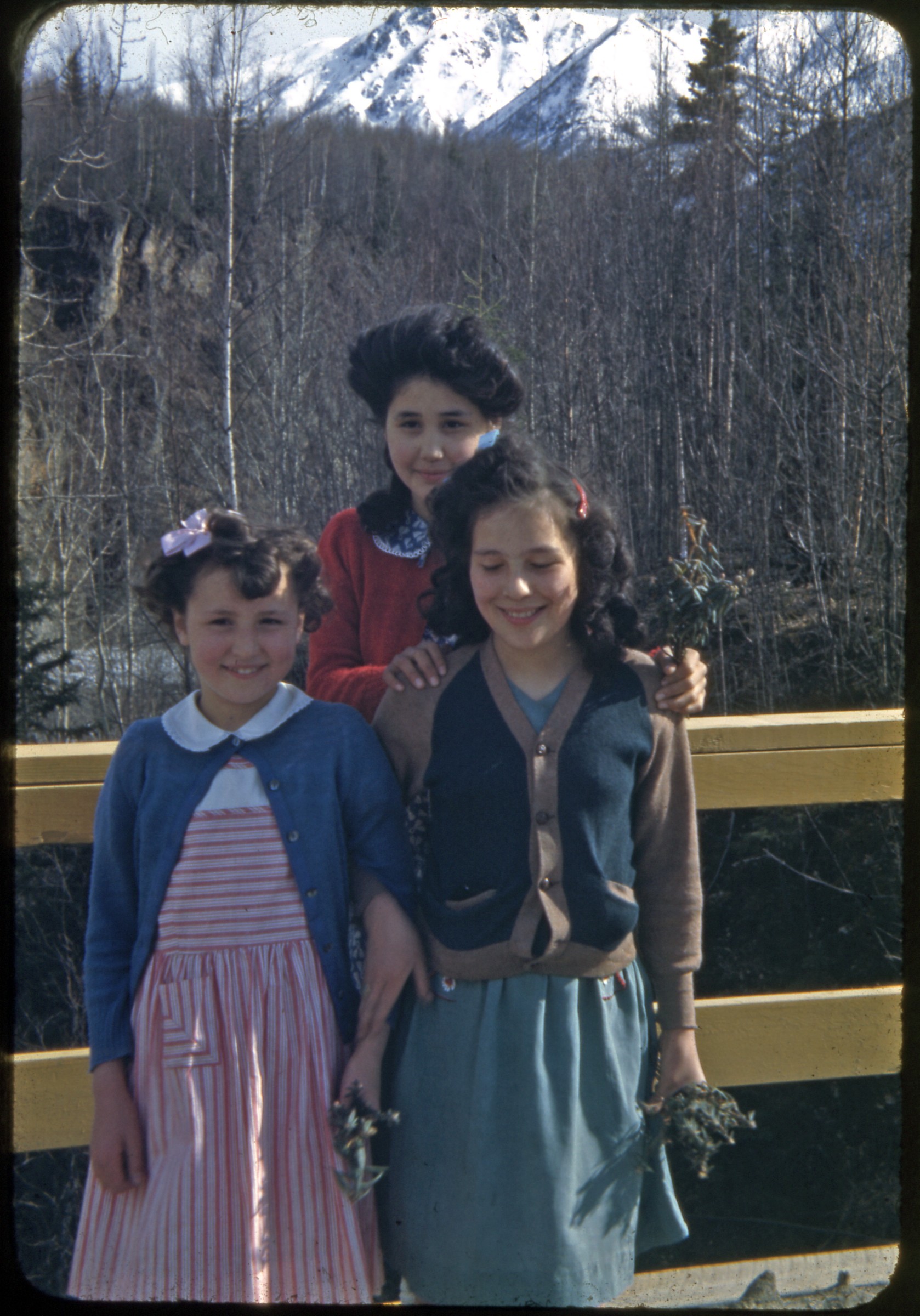 | 839 — | 1945-46 [three Alaska Native girls standing on deck. At AFN 2017, location identified as Thunderbird Falls, girls holding bundles of Labrador tea] |
| 840 — | 1945-46 [Eklutna Lake] | |
| 841 — | [Eklutna Lake, two people standing on shore in foreground, 1940s] | |
| 842 — | 1945-46 [bird’s eye view of five communications towers on Eklutna flats] | |
| 843 — | 1945-46 [bird’s eye view of five communications towers on Eklutna flats] | |
| 844 — | [people walking among spirit houses in cemetery; print date Sep 70] | |
| 845 — | [people walking among spirit houses in cemetery; print date Sep 70] | |
| 846 — | [man and woman standing in front of old Russian Orthodox church; print date Sep 70] | |
| 847 — | [spirit houses in cemetery; print date Sep 79] | |
| 848 — | [people sunbathing and picnicking along shore; print date Jun 79] | |
| 849 — | [spirit houses in cemetery; print date Jun 79] | |
| 850 — | [entranceway to cemetery and old Russian Orthodox church; print date Jun 79] Palmer | |
| 851 — | 1945-46 [view down road to school, gymnasium and another building] | |
| 852 — | 1945-46 [barn on homestead in Matanuska Colony, mountains in background] | |
| 853 — | 1945-46 [possibly community lodge, Matanuska Colony] | |
| 854 — | 1945-46 [school] | |
| 855 — | 1945-46 [depot, Alaska Railroad] | |
| 856 — | 1945-46 [cattle grazing in pasture in foreground, homestead in distance. Possibly commercial slide] | |
| 857 — | 1945-46 [cattle grazing in pasture in foreground, homestead and Pioneer Peak in distance. Possibly commercial slide] | |
| 858 — | 1945-46 [United Protestant Church, log church] | |
| 859 — | 1945-46 [United Protestant Church, log church] | |
| 860 — | 1945-46 [automobiles parked outside businesses on main street, including Bert’s Drugs and Palmer Cocktail Bar, O’Harra Bus Lines bus parked at end of row] | |
| 861 — | 1945-46 [Trading Post and water tower] | |
| 862 — | 1945-46 [homesteads, with hay field in foreground, snow-capped mountains in distance] | |
| 863 — | 1945-46 [farm equipment in field next to small pond, homestead in background and mountains in distance] | |
| 864 — | 1945-46 [homestead with log cabin at left, mountains in background] | |
| 865 — | 1945-46 [hay field in foreground, homestead and snow-capped mountains in background] | |
| 866 — | 1945-46 [bird’s eye view of haystacks in field, snow-capped mountains in distance] | |
| 867 — | 1945-46 [view down bend in gravel road to homesteads] | |
| 868 — | 1945-46 [farm fields in foreground, snow-capped mountains in distance] | |
| 869 — | 1969 [view down main street, with pedestrians walking past businesses including Palmer Bar and Donn’s, automobiles parked along street and at Alaska Railroad depot in background, water tower at right] | |
| 870 — | 1969 [Colony Days parade, boys riding in pickup truck sponsored by Lil Mat Valley Farmers, passing Palmer Bar, Betty’s, and Matanuska Valley Bank] | |
| 871 — | 1969 [Colony Days parade, two people picking up horse manure from street outside Betty’s, Matanuska Valley Bank, and Rexall Drugs] | |
| 872 — | 1969 [Colony Days parade, woman wearing “Alaska State Fair” sash riding on hood of automobile passing Lea’s and Thrifty Variety] | |
| 873 — | 1969 [Colony Days parade, woman wearing “Alaska State Fair” sash riding on hood of automobile passing Tropical Gardens] | |
| 874 — | 1969 [Colony Days parade, 4-H members and children on bicycles passing Thrifty Variety] | |
| 875 — | 1969 [Colony Days parade, automobile possibly carrying Max Sherrod at left, motorcade in background] | |
| 876 — | 1969 [Colony Days parade, antique automobile sponsored by Anderson Garbage Service and people in costume passing Lea’s and Thrifty Variety] | |
| 877 — | 1969 [Colony Days parade, man and woman riding in automobile sponsored by Alaska Sales & Service passing Lea’s and Thrifty Variety] | |
| 878 — | 1969 [Colony Days parade, children riding on farm machinery sponsored by Matanuska Maid Inc. passing Lea’s] | |
| 879 — | 1969 [Colony Days parade, military color guard and uniformed units marching] | |
| 880 — | [log building housing Matanuska Valley Visitors Information Center and Historical Museum; print date Sep 79] | |
| 881 — | [clown posing with children on midway, Alaska State Fair; print date Sep 80] | |
| 882 — | [food stands and midway, woman in center carrying several bags of cotton candy, Alaska State Fair; print date Sep 80] | |
| 883 — | [spectators gathered around cows in outdoor pen; Alaska State Fair; print date Sep 80] | |
| 884 — | [winning cabbages, first place grown by Mark Dinkel, Alaska State Fair; print date Sep 80] | |
| 885 — | [winning vegetables, Alaska State Fair; print date Sep 80] | |
| 886 — | [winning vegetables, Alaska State Fair; print date Sep 80] | |
| 887 — | [winning vegetables, Alaska State Fair; print date Sep 80] | |
| 888 — | [contestants showing pigs in outdoor pen, Alaska State Fair; print date Sep 80] | |
| 889 — | [man and child looking at cows in indoor enclosures, Alaska State Fair; print date Aug 81] | |
| 890 — | [woman wearing rain gear walking towards “Hawk Haven” stand, billboard advertisement for Kobuk Fuel & Feed at left; Alaska State Fair; print date Aug 81] | |
| 891 — | [crowd gathered around Pied Piper of Alaska stand, Alaska State Fair; print date Aug 81] | |
| 892 — | [band playing Ferguson Field Stage, Alaska State Fair; print date Aug 81] | |
| 893 — | [men looking at ultralight aircraft, Alaska State Fair; print date Nov 81] | |
| 894 — | [quilt display, Alaska State Fair; print date Nov 81] | |
| 895 — | [woman wearing rain gear looking at cabbage entries set along exterior wall, with advertisement for Tanana Valley Fair, Alaska State Fair; print date Nov 81] | |
| 896 — | [woman wearing rain gear posed next to winning vegetables, Alaska State Fair; print date Nov 81] | |
| 897 — | [fairgrounds scene, with fairgoers and buildings, Alaska State Fair; print date Nov 81] | |
| 898 — | [people on horseback in penned area, advertisement for KYAK in background, Alaska State Fair; print date Jul 81] | |
| 899 — | [bull riding in penned area, advertisements for KYAK, Palmer Texaco, Alaska Distributors, and Mt. McKinley View Lodge, along fence, Alaska State Fair; print date Jul 81] | |
| 900 — | [bull roping in penned area, Alaska State Fair; print date Jul 81] | |
| 901 — | [quilt display, Alaska State Fair; print date Nov 87] | |
| 902 — | [crowd gathered to watch pig races, Alaska State Fair; print date Nov 87] | |
| 903 — | [pig races, Alaska State Fair; print date Nov 87] | |
| 904 — | [pig races, Alaska State Fair; print date Nov 87] | |
| 905 — | [Alaska Native dance group performing at Chevak Tanqik Theatre, Alaska State Fair; print date Nov 87] | |
| 906 — | [blanket toss at Chevak Tanqik Theatre, Alaska State Fair; print date Nov 87] | |
| 907 — | [fairgoers walking past pen with banners for All-Alaskan Racing Pigs and Matanuska Maid, Alaska State Fair; print date Oct 89] | |
| 908 — | [women performing on Janice Rene’s Dance Center stage, Alaska State Fair; print date Oct 89] | |
| 909 — | [pig races, Alaska State Fair; print date Sept 21, 1990] | |
| 910 — | [pig races, Alaska State Fair; print date Sept 21, 1990] | |
| 911 — | [man calling pig races, Fair Exchange Building in background, advertisement for Oscar Meyer, Alaska State Fair; print date Sept 21, 1990] | |
| 912 — | [fairgrounds scene, with fairgoers picnicking at left, midway and food stands in background, Alaska State Fair; print date Sep 91] | |
| 913 — | [lumberjack show, Alaska State Fair; print date Sep 91] | |
| 914 — | [lumberjack show, Alaska State Fair; print date Sep 91] | |
| 915 — | [winning vegetables, Alaska State Fair; print date Sep 91] | |
| 916 — | [winning vegetables, Alaska State Fair; print date Sep 91] Wasilla | |
| 917 — | Williwaw Lodge & Fair, Labor Day [view of A-frame building from water; print date Sep 63] | |
| 918 — | Williwaw Lodge & Fair, Labor Day [Chevron gasoline pump on beach next to water; print date Sep 63] | |
| 919 — | Williwaw Lodge & Fair, Labor Day [young people on docks near boats; print date Sep 63] | |
| 920 — | Williwaw Lodge & Fair, Labor Day [woman sitting in chair mounted on motorboat; print date Sep 63] | |
| 921 — | Williwaw Lodge & Fair, Labor Day [people and docks in front of building, as seen from water; print date Sep 63] | |
| 922 — | Williwaw Lodge & Fair, Labor Day [man sitting on platform next to reindeer in cage, Chugach Mountains in background; print date Sep 63] Hatcher Pass | |
| 923 — | 1945-46 [Pioneer Peak as seen from gravel Palmer Road. Possibly commercial slide] | |
| 924 — | 1945-46 [scenic with stream, possibly Little Susitna River. Possibly commercial slide] | |
| 925 — | 1945-46 [scenic landscape. Possibly commercial slide] | |
| 926 — | 1945-46 [rock formations on Fishhook Road. Possibly commercial slide] | |
| 927 — | 1945-46 [rock formations on Fishhook Road. Possibly commercial slide] | |
| 928 — | 1945-46 [sign for Little Susitna Lodge] | |
| 929 — | 1945-46 [scenic of stream, possibly Little Susitna River] | |
| 930 — | 1945-46 [scenic of stream, possibly Little Susitna River] | |
| 931 — | 1945-46 [scenic with stream, possibly Little Susitna River. Possibly commercial slide] | |
| 932 — | 1945-46 [scenic of stream, possibly Little Susitna River] | |
| 933 — | 1945-46 [scenic with stream, possibly Little Susitna River. Possibly commercial slide] | |
| 934 — | 1945-46 [automobile parked outside roadhouse, possibly Little Susitna Lodge] | |
| 935 — | 1945-46 [scenic of Hatcher Pass Road, Little Susitna Lodge in distance] | |
| 936 — | 1945-46 [scenic of Hatcher Pass Road] | |
| 937 — | 1945-46 [automobile on Hatcher Pass Road] | |
| 938 — | 1945-46 [distant view of mining operations along Hatcher Pass Road] | |
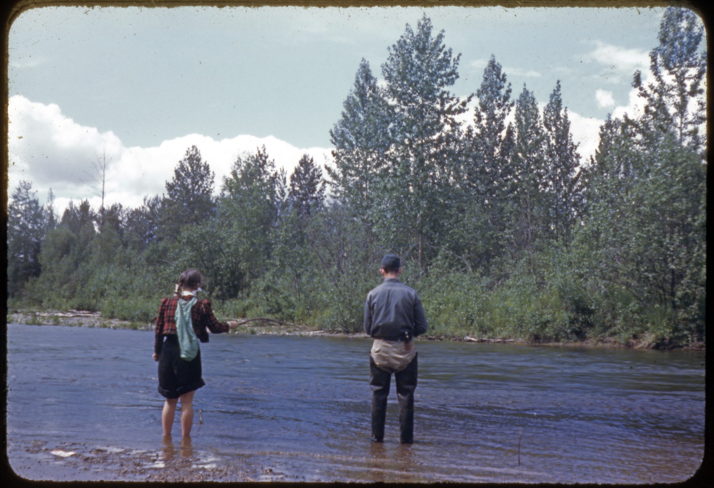 | 939 — | 1945-46 [man and woman fishing in river, woman wearing skirt and cloth sack on back, man wearing hip waders] |
| 940 — | [scenic of Hatcher Pass area, small lake in foreground possibly Summit Lake, 1940s] | |
| 941 — | [sign for Willow along Alaska Railroad tracks, 1940s] | |
| 942 — | [two women sitting on rocks in stream, 1940s?] | |
| 943 — | [two women and young man sitting on rocks in stream, 1940s?] | |
| 944 — | [people sitting on rocks in stream, mining buildings at right, 1940s?] | |
| 945 — | [distant view of mining operation, fireweed in foreground, 1940s?] | |
| 946 — | [scenic of Matanuska Valley from Hatcher Pass, 1940s? | |
| 947 — | [scenic landscape, 1940s?] | |
| 948 — | [distant view of Independence Mine buildings, 1950s?] | |
| 949 — | Willow Pass, 1956 [man and woman sitting at table outside log cabin eating meal, can of Allstate Motor Oil at left] | |
| 950 — | Willow Pass, 1956 [woman standing at doorway of log cabin] | |
| 951 — | Willow Pass, 1956 [automobile parked next to log cabin] | |
| 952 — | Willow Pass, 1956 [distant view of abandoned mining operation and tailings pile] | |
| 953 — | Willow Pass, 1956 [distant view of abandoned mining operation and tailings pile] | |
| 954 — | Willow Pass, 1956 [distant view of abandoned mining operation and tailings pile] | |
| 955 — | Willow Pass, 1956 [distant view of abandoned mining operation and tailings pile] | |
| 956 — | Willow Pass, 1956 [bird’s eye view of automobiles on road through pass] | |
| 957 — | Willow Pass, 1956 [scenic landscape, with fireweed in foreground] | |
| 958 — | Willow Pass, 1956 [scenic view along paved road] Nancy Lake | |
| 959 — | [men constructing wooden dock or swimming platform; print date Jul 71] | |
| 960 — | [men launching wooden dock or swimming platform; print date Jul 71] | |
| 961 — | [girl and dog in water, woman sitting on lakeshore, cabin at right; print date Jul 71] | |
| 962 — | [girl swimming in lake, woman seated on tree trunk; print date Jul 71] | |
| 963 — | [woman standing on dock at sunset, two boats tied to dock; print date Jul 71] | |
| 964 — | [woman wearing bathrobe standing on dock, seen from water, boat tied at left; print date Jul 71] | |
| 965 — | [distant view of sailboat and riverboats along opposite shore; print date Aug 74] | |
| 966 — | [two girls in water next to small sailboat near dock; print date Aug 74] | |
| 967 — | [sailboat and riverboats next to dock, as seen from water; print date Aug 74] | |
| 968 — | [view along shoreline of small docks; print date Sep 91] Talkeetna | |
| 969 — | Talkeetna, 1963 [people riding on trailer being pulled by antique tractor outside Fairview Inn] | |
| 970 — | Talkeetna, 1963 [people gathered around piano outside Fairview Inn] | |
| 971 — | Talkeetna, 1963 [people gathered along Alaska Railroad tracks, several holding cameras] | |
| 972 — | Talkeetna, 1963 [people riding in Jeep on gravel road, another group of people walking] | |
| 973 — | Talkeetna, 1963 [people walking on gravel road, woman at left holding camera] | |
| 974 — | Talkeetna, 1963 [woman holding camera walking on gravel road, cabin at left] | |
| 975 — | Talkeetna, 1963 [people picnicking on river flats, man in foreground taking photograph of Mount Denali in distance] | |
| 976 — | Eclipse, July 21, 1963 [people gathered on river flats, Alaska Range in distance] | |
| 977 — | Eclipse, July 21, 1963 [people gathered on river flats, Alaska Range in distance] | |
| 978 — | Eclipse, July 21, 1963 [nearly dark sky, Alaska Railroad train at right, Alaska Range in distance] | |
| 979 — | [A frame cabins along river; print date May 65] | |
| 980 — | [automobiles parked outside building, possibly lodge or restaurant; print date May 65. Cf. .989] | |
| 981 — | [street view down dirt road, sign for Roadhouse in distance; print date May 65] | |
| 982 — | [Fran’s Barn Café; print date May 65] | |
| 983 — | [street view, with automobiles and signs for businesses including Fairview Inn, Talkeetna Air Service, and Roadhouse; print date May 65] | |
| 984 — | [street view, with automobiles and signs for businesses including B & K Trading Co., Talkeetna Air Service, and Roadhouse; print date May 65] | |
| 985 — | [airplanes parked on airstrip, including Piper PA-20 tail number N7452K and Cessna 170B tail number N2769A; print date May 65] | |
| 986 — | [pickup truck and pickup truck with camper parked along Montana Creek; print date May 65] | |
| 987 — | [B & K Trading Co.; print date Sep 65] | |
| 988 — | [buildings in winter, dog at left; 1960s?] | |
| 989 — | [buildings in winter, Volkswagen Beetle parked at left; 1960s? cf. 980] | |
| 990 — | [street view in winter, with businesses including B & K Trading Co., U.S. Post Office, Liquor Store, and Talkeetna Air Service; 1960s?] | |
| 991 — | [street view in winter, with businesses including Fairview Inn and Union 76; 1960s?] | |
| 992 — | [entrance to Fairview Inn, with signs “Hippies Use Side Door,” “Herald Square,” and “Kertulla,” parking meters in foreground; print date Jan 81] | |
| 993 — | [exterior of Fairview Inn with sign for Talkeetna Riverboat Service; print date Jan 81] | |
| 994 — | [street scene with automobiles parked outside businesses including Union 76, Roadhouse, and K2 Aviation; print date Jan 81] | |
| 995 — | [automobiles parked outside building housing B & K Trading Post, Liquor Store, and Noah’s Art; print date Jan 81] | |
| 996 — | [customers and dog in line at food stand, Moose Dropping Festival; print date Aug 81] | |
| 997 — | [woman wearing rain gear talking to man setting up food stand, Moose Dropping Festival; print date Aug 81] | |
| 998 — | [Moose Dropping Toss booth, Moose Dropping Festival; print date Aug 81] | |
| 999 — | [people riding in antique automobile with sign for Royal Family of the Moose Dropping Festival; print date Aug 81] | |
| 1000 — | [people on parade, Moose Dropping Festival; print date Aug 81] | |
| 1001 — | [Talkeetna Children’s Ballet on parade, Moose Dropping Festival; print date Aug 81] | |
| 1002 — | [people with banner “Vote No Against Incorporation of Talkeetna” on parade, Moose Dropping Festival; print date Aug 81] | |
| 1003 — | [bagpipers on parade, Moose Dropping Festival; print date Aug 81] | |
| 1004 — | [children on bicycles on parade, Moose Dropping Festival; print date Aug 81] | |
| 1005 — | [automobile with model airplane on roof on parade, Moose Dropping Festival; print date Aug 81] | |
| 1006 — | [man dressed as moose dropping on parade, Moose Dropping Festival; print date Aug 81] | |
| 1007 — | [person in moose costume on parade, Moose Dropping Festival; print date Aug 81] | |
| 1008 — | [bagpipers on parade, Moose Dropping Festival; print date Aug 81] B1/B6 | |
| 1009 — | [people in moose dropping costumes on parade, Moose Dropping Festival; print date Aug 81] | |
| 1010 — | [people in moose dropping costumes on parade, Moose Dropping Festival; print date Aug 81] | |
| 1011 — | [street scene after parade, signs for Talkeetna Grocery at left and Roadhouse on right; print date Aug 81] | |
| 1012 — | [street scene with businesses including Fairview Inn and Union 76; print date Aug 81] | |
| 1013 — | [antique automobile with sign for Bradey Meeks on parade, Moose Dropping Festival; print date Jul 88] | |
| 1014 — | [dog team on parade, Moose Dropping Festival; print date Jul 88] | |
| 1015 — | [antique tractor and cart sponsored by the Hope & Sunrise Historical Society on parade, Moose Dropping Festival; print date Jul 88] | |
| 1016 — | [children on bicycles on parade, Moose Dropping Festival; print date Jul 88] | |
| 1017 — | [man and woman with goat-drawn cart, men on all-terrain vehicles on parade, Moose Dropping Festival; print date Jul 88] | |
| 1018 — | [National Park Service pickup truck with Smokey the Bear on parade, Moose Dropping Festival; print date Jul 88] | |
| 1019 — | [people riding in pickup truck on parade, Moose Dropping Festival; print date Jul 89] | |
| 1020 — | [women dressed as gold rush-era prostitutes riding in pickup truck on parade, Moose Dropping Festival; print date Jul 89] | |
| 1021 — | [women dressed as gold rush-era prostitutes riding in pickup truck sponsored by Latitude 62° on parade, Moose Dropping Festival; print date Jul 89] | |
| 1022 — | [emergency vehicles passing K2 Aviation and Fairview Inn on parade, Moose Dropping Festival; print date Jul 89] | |
| 1023 — | [Mt. McKinley Post 3836 VFW color guard on parade, Moose Dropping Festival; print date Jul 89] | |
| 1024 — | [people, possibly Lions Club members, wearing purple jackets on parade passing B & K Trading Post, Moose Dropping Festival; print date Jul 89. Cf. .1042] | |
| 1025 — | [women dancing on stage, Moose Dropping Festival; print date Jul 89] | |
| 1026 — | [food stands set up outside Fairview Inn, Moose Dropping Festival; print date Jul 89] | |
| 1027 — | [street view, with sign for Roadhouse on right in distance; print date Jul 89] | |
| 1028 — | [people outside Village Arts-n-Crafts, sign at left for Talkeetna Riverboat Service; print date Jul 89] | |
| 1029 — | [exterior of Roadhouse, man talking on pay telephone at right; print date Jul 89] | |
| 1030 — | [street scene with signs for businesses including Fairview Inn and K2 Aviation; print date Jul 89] | |
| 1031 — | [people and automobiles outside building housing B & K Trading Post, Liquor Store, and McKinley Flightseeing; print date Jul 89] | |
| 1032 — | [Visitor Information log cabin; print date Jul 89] | |
| 1033 — | [Moose Nugget Factory; print date Jul 89] | |
| 1034 — | [crowd gathered around man playing guitar and woman playing fiddle next to recreational vehicles in parking area; print date Jul 89] | |
| 1035 — | [street scene with businesses including B & K Trading Post, Liquor Store, Ice Cream Shoppe, Talkeetna Historical Society, and Roadhouse, Moose Dropping Festival; print date July 19, 1990] | |
| 1036 — | [vendor stalls, picnic table in center, pavilion stage at right, Moose Dropping Festival; print date July 19, 1990] | |
| 1037 — | [street scene with businesses including Fairview Inn and Tesoro, Moose Dropping Festival; print date July 19, 1990] | |
| 1038 — | [VFW post color guard on parade, woman in foreground taking photograph, Moose Dropping Festival; print date July 19, 1990] | |
| 1039 — | [bagpipers on parade, Moose Dropping Festival; print date July 19, 1990] | |
| 1040 — | [Curt Menard for Senate supporters on parade, Moose Dropping Festival; print date July 19, 1990] | |
| 1041 — | [man leading reindeer pulling cart sponsored by Mountain Gift Shop on parade, Moose Dropping Festival; print date July 19, 1990] | |
| 1042 — | [people, possibly Lions Club members, wearing purple jackets on parade, Moose Dropping Festival; print date July 19, 1990. Cf. .1024, 1047] | |
| 1043 — | [people dressed in chicken costumes on parade, Moose Dropping Festival; print date July 19, 1990] | |
| 1044 — | [woman with dog sled with sign for “Ichickenrod” on parade, Moose Dropping Festival; print date July 19, 1990] | |
| 1045 — | [women in costume on horseback on parade passing Fairview Inn and Tesoro, Moose Dropping Festival; print date July 19, 1990] | |
| 1046 — | [Doyle Holmes for House pickup truck on parade, Moose Dropping Festival; print date July 19, 1990] | |
| 1047 — | [clown and people, possibly Lions Club members, wearing purple jackets on parade, one woman holding Good Sam Club flag, Moose Dropping Festival; print date July 19, 1990] | |
| 1048 — | [people wearing purple jackets, possibly Lions Club members, on parade, one woman holding Good Sam Club flag, Moose Dropping Festival; print date July 19, 1990] | |
| 1049 — | [woman selling jewelry and food at vendor stand, Moose Dropping Festival; print date July 19, 1990] | |
| 1050 — | [man walking past teepee, Moose Dropping Festival; print date Aug 15, 1990] | |
| 1051 — | [exterior of Three Rivers roadhouse; print date Aug 15, 1990] McKinley Park | |
| 1052 — | [scenic landscape, automobile parked along road in foreground; 1950s?] | |
| 1053 — | [Cantwell post office; 1950s?] | |
| 1054 — | [Mount Denali; 1950s?] | |
| 1055 — | [view down dirt road, Camp Eielson in distance; 1950s?] | |
| 1056 — | [sign for Camp Denali; 1950s?] | |
| 1057 — | [scenic of river valley, woman walking on gravel trail in foreground; 1950s?] Glenn Highway | |
| 1058 — | Feb. 1944 [milepost showing Glennallen and Fairbanks] | |
| 1059 — | Feb. 1944 [cabins and tent in winter. Possibly commercial slide] | |
| 1060 — | Feb. 1944 [man getting into automobile stopped on winter road] | |
| 1061 — | Feb. 1944 [scenic view down winter road] | |
| 1062 — | Feb. 1944 [scenic of mountains] | |
| 1063 — | Feb. 1944 [scenic view down winter road] | |
| 1064 — | Feb. 1944 [Quonset huts, low buildings, and automobile parking lot] | |
| 1065 — | Feb. 1944 [view down road to small bridge] | |
| 1066 — | Feb. 1944 [cabin and cache in winter. Possibly commercial slide] | |
| 1067 — | Feb. 1944 [scenic of mountains. Possibly commercial slide] | |
| 1068 — | Feb. 1944 [cabin in winter] | |
| 1069 — | Feb. 1944 [MVFCA Garage tow truck hauling automobile out of ditch alongside icy road] | |
| 1070 — | Feb. 1944 [tow truck driver standing next to damaged automobile] | |
| 1071 — | Feb. 1944 [close-up of damage from automobile accident] | |
| 1072 — | [scenic view down winter road; 1940s] | |
| 1073 — | [scenic view down winter road; 1940s] | |
| 1074 — | [men standing on ice on side of road, hose from steam heating equipment to ice, possibly thawing culvert, automobile parked at left; 1940s. Possibly commercial slide] | |
| 1075 — | [man standing on ice on side of road, hose from steam heating equipment to ice, possibly thawing culvert; 1940s. Possibly commercial slide] | |
| 1076 — | [log cabin and cache in summer; 1940s] | |
| 1077 — | [view down road to log cabin and town buildings, speed limit sign at right; 1940s] | |
| 1078 — | [woman posed with moose antlers next to tent; 1940s] | |
| 1079 — | [scenic view down road, man standing next to automobile in foreground; 1940s] | |
| 1080 — | [scenic view down road, possibly near Matanuska Glacier; 1940s. Possibly commercial slide] | |
| 1081 — | [scenic view down road; 1940s] | |
| 1082 — | [Matanuska Glacier; 1940s] | |
| 1083 — | [scenic of creek; 1940s] | |
| 1084 — | [scenic view down road paralleling river; 1940s] | |
| 1085 — | [scenic landscape; 1940s] | |
| 1086 — | [scenic of river valley; 1940s] | |
| 1087 — | [scenic landscape; 1940s. Possibly commercial slide] | |
| 1088 — | [scenic of river valley; 1940s] | |
| 1089 — | [scenic of lake; 1940s] | |
| 1090 — | [scenic of road paralleling lake; 1940s] | |
| 1091 — | [scenic of river valley; 1940s] | |
| 1092 — | [scenic of lake; 1940s] | |
| 1093 — | [scenic landscape; 1940s] | |
| 1094 — | [Meekin’s Lodge at Sheep Mountain; print date Oct 63] Eureka | |
| 1095 — | Feb. 1944 [woman standing outside Eureka Roadhouse in winter, with advertisement for Coca-Cola] | |
| 1096 — | [woman and horse standing in doorway of Eureka Roadhouse, man in military uniform at right; 1940s] | |
| 1097 — | [woman standing in doorway of Eureka Roadhouse; 1940s] | |
| 1098 — | [man standing in doorway of Eureka Roadhouse; 1940s] | |
| 1099 — | [man standing in doorway of Eureka Roadhouse; 1940s] | |
| 1100 — | [Eureka Roadhouse and Chevron gas station; 1950s] | |
| 1101 — | [Eureka Roadhouse and liquor store; 1950s] | |
| 1102 — | [Eureka Roadhouse, liquor store, and Chevron gas station; 1950s] | |
| 1103 — | [O’Harra Bus Lines bus outside Eureka Roadhouse, with advertisement for Coca-Cola; 1940s] | |
| 1104 — | [airplane tail number NC70719 and automobile parked next to Eureka Roadhouse; 1940s] Lake Louise | |
| 1105 — | 1956 [two men getting into boat with outboard motor at small dock next to log building] | |
| 1106 — | 1956 [scenic of lake] | |
| 1107 — | 1956 [two men fishing from boat with outboard motor] | |
| 1108 — | 1956 [two men fishing from boat with outboard motor] | |
| 1109 — | 1956 [scenic of valley glacier] | |
| 1110 — | 1956 [scenic of landscape] | |
| 1111 — | [man walking on road, Denali in distance; 1950s] | |
| 1112 — | [people preparing to launch boat from trailer being towed by automobile; 1950s] | |
| 1113 — | [people preparing to launch boat from trailer being towed by automobile; 1950s] | |
| 1114 — | [people preparing to launch boat from trailer being towed by automobile; 1950s] | |
| 1115 — | [man holding coffee cup standing in brush next to water pipe; 1950s] Tyone River | |
| 1116 — | July/August 1957 [dilapidated homestead with cabin and outbuildings on riverbank] | |
| 1117 — | July/August 1957 [man, woman, and young girl on porch of log cabin] | |
| 1118 — | July/August 1957 [man and two women in front of log cabin] | |
| 1119 — | July/August 1957 [two men, woman, and dog on porch of log cabin] | |
| 1120 — | July/August 1957 [log cabin as seen from water, with dock and two boats] | |
| 1121 — | July/August 1957 [man wearing eyeglasses and brimmed cap driving boat with outboard motor] Copper Center | |
| 1122 — | Feb. 1944 [two men standing on winter road next to automobile, both holding cameras and taking photographs of mountains in distance, sign for Copper Center Roadhouse at left] | |
| 1123 — | Feb. 1944 [automobile parked outside Copper Center Roadhouse and Trading Post] | |
| 1124 — | [view down road to Copper Center Roadhouse; print date Dec 58] | |
| 1125 — | [fish wheel on river; print date Dec 58] | |
| 1126 — | [fish wheel on river; print date Dec 58] | |
| 1127 — | [woman standing next to fish wheel on river; print date Dec 58] | |
| 1128 — | [Grizzly Gift Shop; print date Nov 63] | |
| 1129 — | [sign and cache at Grizzly Gift Shop; 1960s] | |
| 1130 — | [woman walking past log buildings at Grizzly Gift Shop, moose hides with attached horns mounted to exterior walls; 1960s] | |
| 1131 — | [automobile parked outside log building; 1960s] | |
| 1132 — | [woman standing in entrance to Grizzly Gift Shop, hides and bones mounted to exterior of outbuilding at left; 1960s] | |
| 1133 — | [woman standing in front of Grizzly Gift Shop; 1960s] | |
| 1134 — | [view down road to river and bridge under construction, with sign “No unauthorized vehicles beyond this point, boat launching only;” 1960s] | |
| 1135 — | [bird’s eye view of river valley and bridge construction; 1960s] | |
| 1136 — | [scenic of river valley and mountains; 1960s] | |
| 1137 — | [two women in front of Grizzly Gift Shop; print date Aug 74] | |
| 1138 — | [man looking at antique wagon in Grizzly Gift Shop parking lot; print date Aug 74] | |
| 1139 — | [man and woman collecting berries in wooded area; print date Aug 74] | |
| 1140 — | [Copper Center Roadhouse; print date Jul 81] Chitina | |
| 1141 — | 1953 [scenic landscape] | |
| 1142 — | 1953 [float plane landing on river, glacier in distance] | |
| 1143 — | 1953 [scenic of Copper River] | |
| 1144 — | 1953 [high wooden trestle railroad bridge, two people visible on top] | |
| 1145 — | 1953 [view down old railroad right-of-way, with wooden ties in foreground] | |
| 1146 — | 1953 [bird’s eye view of high wooden trestle railroad bridge, river at left] | |
| 1147 — | 1953 [people walking along gravel roadway paralleling river, one man carrying rifle] | |
| 1148 — | 1953 [distant view of buildings along lakeshore. Cf. .1157] | |
| 1149 — | 1953 [automobiles parked in front of Spooks’ Nook] | |
| 1150 — | 1953 [dilapidated buildings and abandoned railcar] | |
| 1151 — | 1953 [view down old railroad right of way through cut in rock bed, buildings at right] | |
| 1152 — | 1953 [bird’s eye view of town, four people sitting on hill in foreground] | |
| 1153 — | 1953 [distant view of town buildings, two people standing in foreground, Chitina Lake at left] | |
| 1154 — | 1953 [automobile parked in front of Lower Tonsina Roadhouse] | |
| 1155 — | 1953 [view across small bridge to town, with ghosts painted on building at left, Chitina Cash Store in distance] | |
| 1156 — | Oct. 1954 [homestead with barn, mountains in background] | |
| 1157 — | Oct. 1954 [distant view of buildings on lakeshore. Cf. .1148] | |
| 1158 — | Oct. 1954 [distant view of buildings on lakeshore, mountains in distance] | |
| 1159 — | Oct. 1954 [two women standing on riverbank, one holding camera] | |
| 1160 — | Oct. 1954 [bird’s eye view of town] | |
| 1161 — | Oct. 1954 [distant view of town, water in foreground] | |
| 1162 — | Oct. 1954 [scenic of lake, woman seated in foreground] | |
| 1163 — | Oct. 1954 [scenic of lake] | |
| 1164 — | Oct. 1954 [log cabin with sod roof, mountains in background] | |
| 1165 — | Oct. 1954 [woman reaching up to touch one of two log caches] | |
| 1166 — | Oct. 1954 [two women walking down gravel road past autumn foliage, snow-capped mountains in distance] | |
| 1167 — | O.A. Nelson, Chitina [Otto Adrian Nelson standing behind store counter, talking to two customers] | |
| 1168 — | [interpretive sign for Chitina; 1960s?] | |
| 1169 — | [Chitina Cash Store; 1960s?] | |
| 1170 — | [log house and garage, laundry on clothesline at left; 1960s?] | |
| 1171 — | [log building with ghost painted on wall; 1960s?] | |
| 1172 — | [log cabin; 1960s?] | |
| 1173 — | [woman walking into Chitina Museum building; 1960s?] | |
| 1174 — | [street scene, with Chitina Hotel in right background; 1960s?] | |
| 1175 — | [two red-and-white painted buildings; 1960s? cf. .1195] | |
| 1176 — | [buildings and outhouse; 1960s?] | |
| 1177 — | [Chitina Bar; 1960s?] | |
| 1178 — | [dilapidated buildings; 1960s?] | |
| 1179 — | [distant view of town buildings, woman walking in foreground; 1960s?] | |
| 1180 — | [view down gravel road to town, Chitina Lake at left; 1960s?] | |
| 1181 — | [sign for Chitina Lake; 1960s?] | |
| 1182 — | [street scene, man working on antique automobile at right; print date Aug 83. Cf. .1188] | |
| 1183 — | [street scene; print date Aug 83] | |
| 1184 — | [recreational vehicle parked next to building; print date Aug 83] | |
| 1185 — | [equipment in clearing in foreground, town buildings in background; print date Aug 83] | |
| 1186 — | [rusting equipment in clearing; print date Aug 83] | |
| 1187 — | [street scene with Chitina Bar at right; print date Aug 83] | |
| 1188 — | [street scene; print date Sep 89. Cf. .1182] | |
| 1189 — | [recreational vehicle parked in front of building; print date Sep 89] | |
| 1190 — | [street scene with Spirit Mountain Artworks and sign for tire repair; print date Sep 89] | |
| 1191 — | [street scene; print date Sep 89] | |
| 1192 — | [man and woman on porch of Spirit Mountain Artworks; print date Sep 89] | |
| 1193 — | [Spirit Mountain Artworks; print date Sep 89] | |
| 1194 — | [distant view of buildings on lakeshore; print date Sep 89] | |
| 1195 — | [two red-and-white painted buildings; print date Sep 89. Cf. .1175] | |
| 1196 — | [person fishing on lakeshore across from building which has collapsed into lake; print date Sep 89] McCarthy Road | |
| 1197 — | [distant view of airplane on airstrip; print date Oct 89] | |
| 1198 — | [wooden trestle railroad bridge over creek; print date Oct 89] | |
| 1199 — | [automobiles in parking area, glacier in distance; print date Sep 89] | |
| 1200 — | [automobiles in parking area, glacier in distance; print date Sep 89] | |
| 1201 — | [tram across Chitina River, parking area on opposite riverbank; print date Sep 89] | |
| 1202 — | [tram across Chitina River, parking area on opposite riverbank; print date Sep 89] | |
| 1203 — | [people debarking from tram across Chitina River; print date Sep 89] | |
| 1204 — | [people debarking from tram across Chitina River; print date Sep 89] | |
| 1205 — | [tram across Chitina River; print date Sep 89] | |
| 1206 — | [tram across Chitina River; print date Sep 89] | |
| 1207 — | [operator on platform for tram across Chitina River; print date Sep 89] | |
| 1208 — | [tram across Chitina River; print date Sep 89] | |
| 1209 — | [tram across Chitina River, parking area on opposite riverbank; print date Sep 89] | |
| 1210 — | [sign for Kuskulana River; print date Sep 89] | |
| 1211 — | [man standing beneath high wooden trestle railroad bridge; print date Sep 89] | |
| 1212 — | [woman standing next to six-door automobile beneath high wooden trestle railroad bridge; print date Sep 89] | |
| 1213 — | [river beneath high wooden trestle railroad bridge; print date Sep 89] | |
| 1214 — | [sign “Welcome to McCarthy/Kennicott” next to parking area; print date Sep 89] | |
| 1215 — | [women outside McCarthy-Kennicott Historical Museum; print date Sep 89] | |
| 1216 — | [Bunkhouse Lodging, McCarthy; print date Sep 89] B2/B1 | |
| 1217 — | [McCarthy Store and Lodge; print date Sep 89] | |
| 1218 — | [women outside Ma Johnson Hotel; print date Sep 89] | |
| 1219 — | [antique wagon next to hotel; print date Sep 89] | |
| 1220 — | [street scene, with McCarthy Store and Lodge at left; print date Sep 89] | |
| 1221 — | [Bunkhouse Lodging; print date Sep 89] | |
| 1222 — | [antique wagon next to small building; print date Sep 89] | |
| 1223 — | [Ro. G. Watsjold Groceries & Meat Hardware store; print date Sep 89] | |
| 1224 — | [dilapidated building; print date Sep 89] | |
| 1225 — | [log house with snowshoes, skis, and antlers mounted to front; print date Sep 89] | |
| 1226 — | [St. Elias Alpine Guides Bed & Breakfast; print date Sep 89] | |
| 1227 — | [Kennecott Copper Mine complex and railroad tracks; print date Sep 89] | |
| 1228 — | [tailings pile and Root Glacier; print date Sep 89] | |
| 1229 — | [tailings pile and Root Glacier; print date Sep 89] | |
| 1230 — | [Kennecott Copper Mine complex; print date Sep 89] | |
| 1231 — | [scenic of tailings piles; print date Sep 89] | |
| 1232 — | [Kennecott Copper Mine complex buildings and tailings pile; print date Sep 89] | |
| 1233 — | [Kennecott Copper Mine complex, people walking in foreground; print date Sep 89] | |
| 1234 — | [Kennecott Copper Mine complex, people walking in foreground; print date Sep 89] | |
| 1235 — | [tailings piles and abandoned mine entrance; print date Sep 89] | |
| 1236 — | [dilapidated mine building collapsing onto tailings pile; print date Sep 89] | |
| 1237 — | [Kennecott Copper Mine complex, people walking in foreground; print date Sep 89] | |
| 1238 — | [dilapidated mine building; print date Sep 89] | |
| 1239 — | [Kennecott Copper Mine complex, people walking in foreground; print date Sep 89] | |
| 1240 — | [storage tanks and fuel wood pile next to mine building, people walking in foreground; print date Sep 89] | |
| 1241 — | [Kennecott Copper Mine complex; print date Sep 89] | |
| 1242 — | [Kennecott Copper Mine complex; print date Sep 89] | |
| 1243 — | [scenic of tailings piles; print date Sep 89] | |
| 1244 — | [Kennicott Glacier Lodge and sign; print date Sep 89] Valdez | |
| 1245 — | 1954 [man and woman next to automobile on road, Worthington Glacier in distance] | |
| 1246 — | 1954 [man and woman walking beneath Bridal Veil Falls] | |
| 1247 — | 1954 [three people walking along road through Keystone Canyon, Lowe River at left] | |
| 1248 — | 1954 [woman walking along road paralleling Lowe River, waterfall at left. Cf. .1272] | |
| 1249 — | 1954 [Worthington Glacier] | |
| 1250 — | 1954 [three people standing next to automobile on road, looking out over river valley] | |
| 1251 — | 1954 [scenic view down road in Thompson Pass area] | |
| 1252 — | 1954 [two men standing on iceberg next to glacier] | |
| 1253 — | 1954 [two women wearing shorts and strapless tops standing on iceberg next to glacier] | |
| 1254 — | 1954 [two women sitting on glacier] | |
| 1255 — | 1954 [two women at base of glacier, automobile parked at left] | |
| 1256 — | 1956 [glacier terminus] | |
| 1257 — | 1956 [Worthington Glacier, automobile in foreground] | |
| 1258 — | 1956 [Worthington Glacier, automobile at left] | |
| 1259 — | [Alaska Coastal Airlines floatplane dock, with airplanes being lifted into hangar; print date Apr 62] | |
| 1260 — | [Alaska Coastal Airlines floatplane at dock in foreground, houses along shoreline at left, small boat harbor in background; print date May 62] | |
| 1261 — | [small boat harbor as seen from dock down shore; print date May 62] | |
| 1262 — | [docks, with storage tanks on hillside above; print date May 62] | |
| 1263 — | [bird’s eye view of dock area under construction; print date Jul 66] | |
| 1264 — | [bird’s eye view of construction area; print date Jul 66] | |
| 1265 — | [bird’s eye view of dock area under construction; print date Jul 66] | |
| 1266 — | [automobiles parked outside Valdez Motel; print date Jul 66] | |
| 1267 — | [Chevron Service Center; print date Jul 66] | |
| 1268 — | [street scene; print date Jul 66] | |
| 1269 — | [concrete block building showing cracks, possibly from 1964 earthquake; print date Jul 66] | |
| 1270 — | [street scene with Gilson’s Café at left; print date Jul 66] | |
| 1271 — | [scenic along Lowe River, automobile on road at left; print date Jul 66] | |
| 1272 — | [scenic along Lowe River, waterfall at left; print date Jul 66]. Cf. .1248] | |
| 1273 — | [scenic of river valley; print date Jul 66] | |
| 1274 — | [woman next to pickup truck with camper at base of Worthington Glacier; print date Jul 66] | |
| 1275 — | [view down road to Worthington Glacier, woman walking near automobile at left; print date Jul 66] | |
| 1276 — | [Worthington Glacier; print date Jul 66] | |
| 1277 — | [street scene in Old Valdez, showing earthquake-damaged buildings; print date Jul 66] | |
| 1278 — | [street scene in Old Valdez, showing earthquake-damaged buildings; print date Jul 66] | |
| 1279 — | [street scene in Old Valdez, showing earthquake-damaged buildings; print date Jul 66] | |
| 1280 — | [Old Valdez, showing earthquake-damaged buildings, woman walking near sign reading “Caution High Tide”; print date Jul 66] | |
| 1281 — | [beached boat, sign reading “Caution High Tide” at right; print date Jul 66] | |
| 1282 — | [woman walking near burned automobile, beached boat, and earthquake-damaged buildings in Old Valdez; print date Jul 66] | |
| 1283 — | [earthquake-damaged oil tanks, Old Valdez; print date Jul 66] | |
| 1284 — | [earthquake-damaged docks, Old Valdez; print date Jul 66] | |
| 1285 — | [earthquake-damaged oil tanks, Old Valdez; print date Jul 66] | |
| 1286 — | [street scene in Old Valdez, showing earthquake-damaged buildings; print date Jul 66] | |
| 1287 — | [street scene in Old Valdez, showing earthquake-damaged buildings; print date Jul 66] | |
| 1288 — | [beached boat in Old Valdez; print date Jul 66] | |
| 1289 — | [street scene in Old Valdez, showing earthquake-damaged buildings; print date Jul 66] | |
| 1290 — | [street scene in Old Valdez, showing earthquake-damaged buildings; print date Jul 66] | |
| 1291 — | [street scene in Old Valdez, showing earthquake-damaged buildings; print date Jul 66] | |
| 1292 — | [waterfront in Old Valdez, showing earthquake-damaged buildings; print date Jul 66] | |
| 1293 — | [waterfront in Old Valdez, showing earthquake-damaged buildings; print date Jul 66] | |
| 1294 — | [street scene in Old Valdez, showing earthquake-damaged buildings; print date Jul 66] | |
| 1295 — | [street scene in Old Valdez, showing earthquake-damaged buildings including Hotel Valdez at center, couple crossing street; print date Jul 66] | |
| 1296 — | [street scene in Old Valdez, showing earthquake-damaged buildings including Woodford’s; print date Jul 66] | |
| 1297 — | [street scene in Old Valdez, showing earthquake-damaged buildings including Pinzon Bar; print date Jul 66] | |
| 1298 — | [street scene in Old Valdez, showing earthquake-damaged buildings including Woodford’s; print date Jul 66] | |
| 1299 — | [street scene with new sidewalk; print date Jul 66] | |
| 1300 — | [new maintenance yard with storage tanks; print date Jul 66] | |
| 1301 — | [street scene in Old Valdez, showing earthquake-damaged buildings including Valdez Dock Company; print date Jul 66] | |
| 1302 — | [view down newly paved street to construction area; print date Jul 66] | |
| 1303 — | [view down newly paved street with sidewalks; print date Jul 66] | |
| 1304 — | [view down street under construction with sidewalks; print date Jul 66] | |
| 1305 — | [sign for Municipal Building reconstruction; print date Jul 66] | |
| 1306 — | [street scene in Old Valdez, showing earthquake-damaged buildings including Hotel Valdez; print date Jul 69] | |
| 1307 — | 1969 [Worthington Glacier, people standing next to automobile in foreground] | |
| 1308 — | 1969 [woman standing at glacier terminus] | |
| 1309 — | 1969 [woman standing near picnic table and automobile parked at glacier terminus] | |
| 1310 — | 1969 [tourists at glacier terminus] | |
| 1311 — | [street scene in Old Valdez, showing earthquake-damaged buildings, debris fire burning at left; 1964?] | |
| 1312 — | [street scene in Old Valdez, showing earthquake-damaged buildings, structure fire burning at left; 1964?] | |
| 1313 — | [street scene in Old Valdez, showing earthquake-damaged buildings; 1964?] | |
| 1314 — | [street scene in Old Valdez, showing earthquake-damaged buildings, smoke from fire burning in distance; 1964?] | |
| 1315 — | [street scene in Old Valdez, showing earthquake-damaged buildings including Hotel Valdez, smoke from fire burning in distance; 1964?] | |
| 1316 — | [street scene in Old Valdez, showing earthquake-damaged buildings; 1960s?] | |
| 1317 — | [street scene in Old Valdez, showing earthquake-damaged buildings; 1960s?] | |
| 1318 — | [street scene in Old Valdez, showing earthquake-damaged buildings including Switzerland Inn; 1960s?] | |
| 1319 — | [building in Old Valdez, with interpretive sign “Oldest Building”; 1960s?] | |
| 1320 — | [street scene in Old Valdez, showing earthquake-damaged buildings; 1960s?] | |
| 1321 — | [street scene in Old Valdez, showing earthquake-damaged buildings; 1960s?] | |
| 1322 — | [street scene in Old Valdez, showing earthquake-damaged buildings including Hotel Valdez at left; 1960s?] | |
| 1323 — | [Old Church building in Old Valdez; 1960s?] | |
| 1324 — | [close-up of interpretive sign for Old Church building; 1960s?] | |
| 1325 — | [damaged water tower in Old Valdez; 1960s?] | |
| 1326 — | [street scene in Old Valdez, showing earthquake-damaged buildings; 1960s?] | |
| 1327 — | [street scene in Old Valdez, showing earthquake-damaged buildings; 1960s?] | |
| 1328 — | [street scene in Old Valdez, showing earthquake-damaged buildings; 1960s?] | |
| 1329 — | [street scene in Old Valdez, showing earthquake-damaged buildings; 1960s?] | |
| 1330 — | [Old Cable Office, Old Valdez; 1960s?] | |
| 1331 — | [ferry Chilkat at dock; 1960s?] | |
| 1332 — | [small boat harbor; 1960s?] | |
| 1333 — | [view of ferry terminal from ferry; print date Sep 73] | |
| 1334 — | [Worthington Glacier, pickup truck with camper in foreground; print date Sep 73] | |
| 1335 — | [Worthington Glacier, pickup truck with camper in foreground; print date Sep 73] | |
| 1336 — | [plaque for Valdez Trans-Alaska Pipeline memorial Work Force by Malcolm Alexander; print date Jul 81] | |
| 1337 — | [Valdez Trans-Alaska Pipeline memorial Work Force by Malcolm Alexander; print date Jul 81] | |
| 1338 — | [Valdez Trans-Alaska Pipeline memorial Work Force by Malcolm Alexander; print date Jul 81] | |
| 1339 — | [apartment building, with glacier in background; print date Oct 13, 1983] | |
| 1340 — | [small boat harbor; print date Oct 13, 1983] | |
| 1341 — | [recreational vehicles and campers in parking area; print date Oct 13, 1983] | |
| 1342 — | [Harbor Fuel Co. antique automobile in parking area, Village Inn in background; print date Oct 13, 1983] | |
| 1343 — | [antique automobile with skis and tracks in parking area; print date Oct 13, 1983] | |
| 1344 — | [Trans-Alaska Pipeline terminal storage tanks seen from across water; print date Oct 13, 1983] | |
| 1345 — | [view down docks along shoreline; print date Oct 13, 1983] | |
| 1346 — | [hydrofoil boat Victory I in dry dock; print date Oct 13, 1983] | |
| 1347 — | [line of recreational vehicles stopped at construction flagger on highway; print date Oct 13, 1983] Cordova | |
| 1348 — | Sept. 1957 [view down dirt road along shore to docks in distance] | |
| 1349 — | Sept. 1957 [distant view of cannery complex] | |
| 1350 — | Sept. 1957 [closer view of cannery complex] | |
| 1351 — | Sept. 1957 [bird’s eye view of cannery complex, breakwater in background] | |
| 1352 — | Sept. 1957 [bird’s eye view of cannery complex] | |
| 1353 — | Sept. 1957 [street scene, First Street] | |
| 1354 — | Sept. 1957 [view of town buildings on hillside] | |
| 1355 — | Aug. 12, 1959 [people walking on dock in small boat harbor] | |
| 1356 — | Aug. 12, 1959 [small boat harbor, town in background] | |
| 1357 — | Aug. 12, 1959 [truck crossing shallow waterway] | |
| 1358 — | [street scene with buildings and storage tanks; print date Aug 65] | |
| 1359 — | [street scene, First Street; print date Aug 65] | |
| 1360 — | [woman standing on dock pointing to two-story building; print date Aug 65] | |
| 1361 — | [street scene, First Street, with Alaskan Hotel at right; print date Aug 65] | |
| 1362 — | [small boat harbor, Anchor Bar in background; print date Aug 65] | |
| 1363 — | [small boat harbor, town in background; print date Aug 65] | |
| 1364 — | [remains of small pier or fish weir; print date Aug 65] | |
| 1365 — | [dump truck dumping dirt next to breakwater, family walking on dock at right; print date Aug 65] | |
| 1366 — | [small boat harbor, town in background; print date Aug 65] | |
| 1367 — | [parking area in foreground, Orca Cannery complex in background; print date Aug 65] | |
| 1368 — | [small boat harbor, town in background; print date Aug 65] | |
| 1369 — | [family walking past small boat harbor, town in background; print date Aug 65] | |
| 1370 — | [small boat harbor; print date Aug 65] | |
| 1371 — | [bird’s eye view of small boat harbor from First Street; print date Aug 65] | |
| 1372 — | [view down gravel riverbed to small bridge, glacier in background; print date Aug 73] | |
| 1373 — | [scenic view down gravel road, Copper River Highway?; print date Aug 73] | |
| 1374 — | [scenic of river; print date Aug 73] | |
| 1375 — | [scenic of hanging glacier; print date Aug 73] | |
| 1376 — | [scenic of Miles or Childs Glacier; print date Aug 73] | |
| 1377 — | [scenic of Miles of Childs Glacier; print date Aug 73] | |
| 1378 — | [view across Miles Glacier Bridge; print date Aug 73] | |
| 1379 — | [scenic of Miles or Childs Glacier; print date Aug 73] | |
| 1380 — | [scenic of Miles or Childs Glacier; print date Aug 73] | |
| 1381 — | [scenic of Miles or Childs Glacier; print date Aug 73] | |
| 1382 — | [distant view of Miles Glacier Bridge; print date Aug 73] | |
| 1383 — | [view down road to Miles Glacier Bridge; print date Aug 73] | |
| 1384 — | [interpretive sign for Miles Glacier Bridge; print date Aug 73] | |
| 1385 — | [view across Miles Glacier Bridge, automobile parked at left; print date Aug 73] | |
| 1386 — | [Miles Glacier Bridge; print date Aug 73] | |
| 1387 — | [Miles Glacier Bridge; print date Aug 73] | |
| 1388 — | [Miles Glacier Bridge; print date Aug 73] | |
| 1389 — | [scenic of Copper River; print date Aug 73] | |
| 1390 — | [view across Miles Glacier Bridge; print date Aug 73] | |
| 1391 — | [bridge on Copper River Highway, including new bridge and old bridge damaged in 1964 earthquake; print date Aug 73] | |
| 1392 — | [scenic of Copper River and valley glacier in distance; print date Aug 73] | |
| 1393 — | [Miles Glacier Bridge?; print date Aug 73] | |
| 1394 — | [scenic of valley glacier; print date Aug 73] | |
| 1395 — | [view down Copper River Highway to buildings along shore, possibly Eyak Lake; print date Aug 73] | |
| 1396 — | [scenic of marshy area, automobile parked at right; print date Aug 73] | |
| 1397 — | [distant view of town from southern point on shoreline; print date Aug 73] | |
| 1398 — | [small boat harbor; print date Aug 73] | |
| 1399 — | [dilapidated buildings along southern shoreline; print date Aug 73] | |
| 1400 — | [view down road to Miles Glacier Bridge; print date Sep 73] | |
| 1401 — | [distant view of railroad bridge as seen from highway; print date Sep 73] | |
| 1402 — | [scenic landscape; print date Sep 73] | |
| 1403 — | [view down road to Miles Glacier Bridge, automobile at right; print date Sep 73] | |
| 1404 — | [terminus of Miles or Childs Glacier, woman standing in foreground; print date Sep 73] | |
| 1405 — | [terminus of Miles or Childs Glacier, automobile in foreground; print date Sep 73] | |
| 1406 — | [ferry E.L. Bartlett at dock; print date Jul 81] | |
| 1407 — | [street scene, First Street; print date Jul 81] | |
| 1408 — | [docks, with cargo ship Aleutian Developer; print date Jul 81] | |
| 1409 — | [small damaged bridge surrounded by low brush; print date Jul 81] | |
| 1410 — | [view down road to damaged bridge; print date Jul 81] | |
| 1411 — | [view down road to damaged bridge; print date Jul 81] | |
| 1412 — | [view across small wooden bridge at Alaganik Slough, automobiles parked on far side; print date Jul 81] | |
| 1413 — | [view across small wooden bridge at Alaganik Slough; print date Jul 81] | |
| 1414 — | [valley glacier terminus, woman standing in foreground; print date Jul 81] | |
| 1415 — | [small boat harbor; print date Jul 81] | |
| 1416 — | [small boat harbor; print date Jul 81] | |
| 1417 — | [small boat harbor; print date Jul 81] | |
| 1418 — | [small boat harbor; print date Jul 81] | |
| 1419 — | [woman walking on Miles Glacier Bridge; print date Aug 87] | |
| 1420 — | [view across Miles Glacier Bridge; print date Aug 87] B2/B2 | |
| 1421 — | [bird’s eye view of pavilion and pedestrian bridge, Odiak Pond; print date Aug 87] | |
| 1422 — | [lighthouse, pavilion and pedestrian bridge, Odiak Pond; print date Aug 87] | |
| 1423 — | [bird’s eye view of lighthouse, pavilion and pedestrian bridge at Odiak Pond, private greenhouse in foreground; print date Aug 87] | |
| 1424 — | [bird’s eye view of lighthouse and pavilion at Odiak Pond, private greenhouse in foreground; print date Aug 87] | |
| 1425 — | [recreational vehicles in parking area; print date Aug 87] | |
| 1426 — | [view down road to Miles Glacier Bridge; print date Aug 87] | |
| 1427 — | [terminus of Miles or Childs Glacier, people and automobiles at left; print date Aug 87] | |
| 1428 — | [tourists at terminus of Miles or Childs Glacier, several holding cameras; print date Aug 87] | |
| 1429 — | [close-up of calving glacier; print date Aug 87] | |
| 1430 — | [memorial to workers who died during the building of the Copper River & Northwestern Railway; print date Aug 87] | |
| 1431 — | [interpretive marker for Miles Glacier Bridge; print date Aug 87] | |
| 1432 — | [Miles Glacier Bridge; print date Aug 92] Yakutat | |
| 1433 — | [Yakutat Lodge-Restaurant in winter; print date Apr 59] | |
| 1434 — | [Pacific Northwestern Airlines airplane on tarmac; print date Apr 59] | |
| 1435 — | [buildings and docks seen from across water; 1960s?] | |
| 1436 — | [view out across water, docks at left, Quonset hut at right; 1960s?] | |
| 1437 — | [buildings and docks seen from across water, possibly cannery at right; 1960s?] | |
| 1438 — | [buildings and docks seen from across water, Quonset hut at left; 1960s?] | |
| 1439 — | [bird’s eye view of dock, with small fighter airplane and abandoned vehicles; 1960s?] | |
| 1440 — | [buildings and docks seen from across water, Quonset hut at left; 1960s?] | |
| 1441 — | [boats and equipment, possibly cannery dock; 1960s?] | |
| 1442 — | [crab boat Euna Marie headed away from town; 1960s?] | |
| 1443 — | [crab boat tied to tender Josy; 1960s?] | |
| 1444 — | [former Navy vessel APc-45, now fishing boat Halawai of Westport coming into cannery docks; 1960s?] | |
| 1445 — | [military hangar; 1960s?] | |
| 1446 — | [sign, Quonset hut terminal, and fuel truck at airport; 1960s?] | |
| 1447 — | [view along waterfront, Quonset hut in distance; 1960s?] | |
| 1448 — | [view across water to tender and other boats at dock, storage tanks at left; 1960s?] Prince William Sound | |
| 1449 — | 1965 [view from ship of cannery] | |
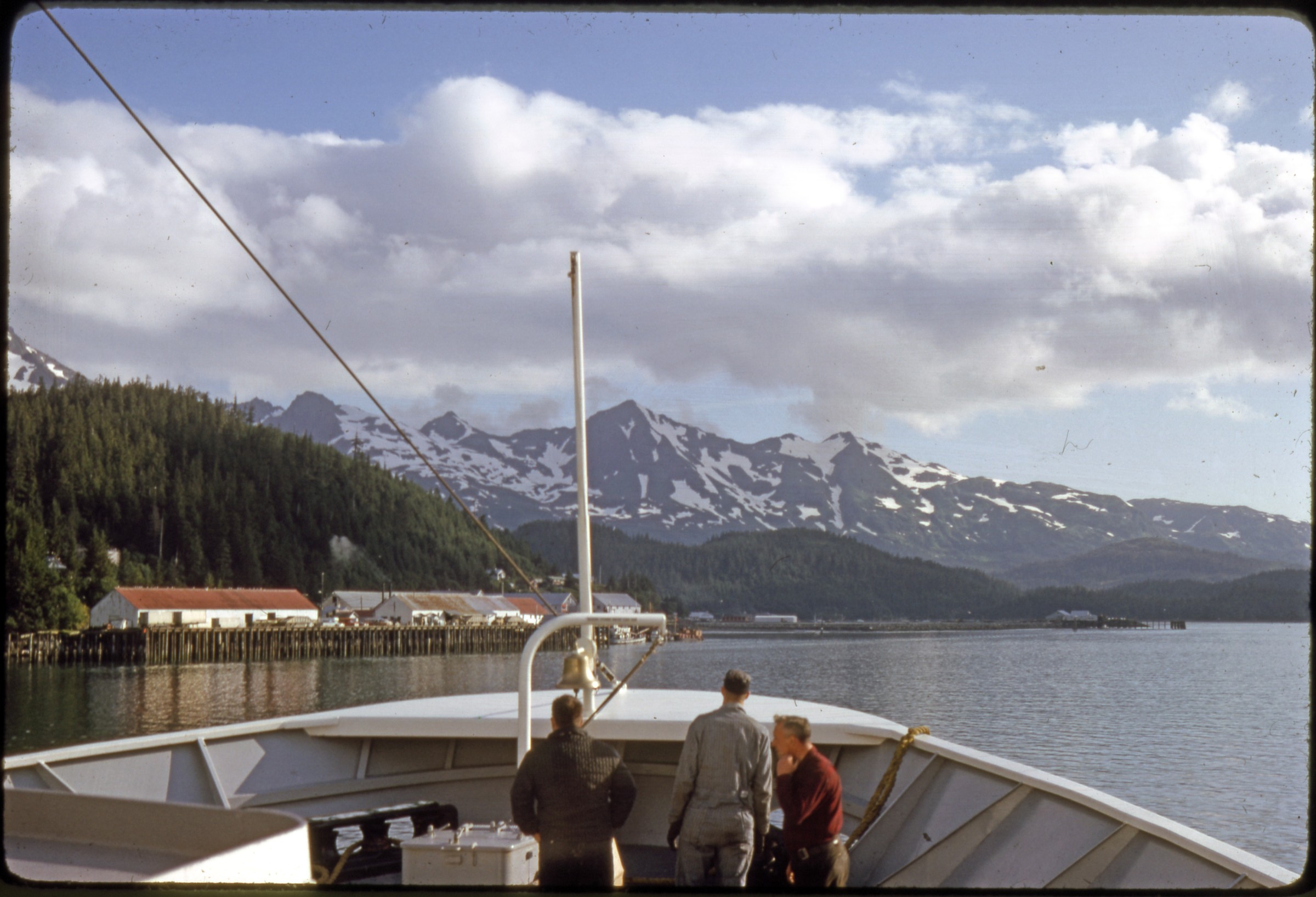 | 1450 — | [view from ship of cannery; print date Aug 65] |
| 1451 — | [view from ship of cannery; print date Aug 65] | |
| 1452 — | [view from ship of cannery; print date Aug 65] | |
| 1453 — | [view of docks from ship coming in, passengers waiting next to trucks; print date Aug 65] Haines | |
| 1454 — | 1947 [“Welcome to Haines” road sign] | |
| 1455 — | [view along shoreline to town in distance; print date Aug 73] | |
| 1456 — | [bird’s eye view of docks and waterfront at Fort William H. Seward, with Chilkoot Barracks in background; print date Aug 73] | |
| 1457 — | [damaged windows in entrance to Haines School; print date Aug 73] | |
| 1458 — | [tourists hitchhiking on street corner; print date Aug 73] | |
| 1459 — | [passengers on ferry dock, Japanese freighter coming in; print date Aug 73] | |
| 1460 — | [ferry Malaspina coming into dock; print date Aug 73] | |
| 1461 — | [view down road in front of Chilkoot Barracks; 1960s?] | |
| 1462 — | [rear view of Chilkoot Barracks; 1960s?] | |
| 1463 — | [bird’s eye view of Chilkoot Inlet and docks from behind Chilkoot Barracks; 1960s?] Skagway | |
| 1464 — | [street scene with horse-drawn carriage, automobiles, businesses including The Trail Bench, Klondike Gold Rush Visitor Center, and The Mascot; print date Aug 80] | |
| 1465 — | [Russian-flagged cruise ship at dock as seen from outgoing ship; print date Aug 80] | |
| 1466 — | [freighter at dock as seen from outgoing ship; print date Aug 80] | |
| 1467 — | [street scene with automobiles and businesses including Arctic Brotherhood, Red Onion Saloon, Golden North Hotel; print date Aug 80] | |
| 1468 — | [street scene with automobiles and businesses including Richter’s; print date Aug 80] Gustavus | |
| 1469 — | [crew unloading baggage from L.A.B. Flying Service airplane tail number N29884; print date June 4, 1990] | |
| 1470 — | [L.A.B. Flying Service Britten-Norman BN-2A Islander airplane tail number N29884; print date June 4, 1990] | |
| 1471 — | [L.A.B. Flying Service Britten-Norman BN-2A Islander airplane tail number N29884 on tarmac, other airplanes at right; print date June 4, 1990] | |
| 1472 — | [Alaska Airlines terminal at airport; print date June 4, 1990] | |
| 1473 — | [tourists in front of two buildings with sign “Puffin Mall;” print date June 4, 1990] | |
| 1474 — | [Glacier Bay Airways A-frame, with outdoor grill and picnic tables out front, automobiles parked at left; print date June 4, 1990] | |
| 1475 — | [tourists standing next to Glacier Bay Lodge bus; print date June 4, 1990] | |
| 1476 — | [boat Gold Rush out of San Francisco at dock; print date June 4, 1990] | |
| 1477 — | [boat Spirit of Adventure at dock; print date June 4, 1990] Juneau | |
| 1478 — | [Orme Transfer truck at building at left, automobiles parked in lot in center, communications towers at right, Mendenhall Glacier in distance; 1940s?] | |
| 1479 — | [Pan American airplane at airport; 1940s?] | |
| 1480 — | [airplanes on tarmac at airport, Mendenhall Glacier in distance; 1940s?] | |
| 1481 — | [street scene with automobiles and businesses; 1940s? Possibly commercial slide] | |
| 1482 — | [street scene with automobiles and businesses including Juneau Drug in distance; 1940s? Possibly commercial slide] | |
| 1483 — | Summer 1946 [spectators gathered at fire at Alaska Steamship docks, sign for Odom & Company at right] | |
| 1484 — | [fire at Alaska Steamship docks; 1946] | |
| 1485 — | [spectators gathered at fire at Alaska Steamship docks, sign for Odom & Company at right; 1946] | |
| 1486 — | [fire at Alaska Steamship docks; 1946] | |
| 1487 — | [fire at Alaska Steamship docks, Juneau Fire Department firetruck in foreground; 1946] | |
| 1488 — | [waterfront as seen from ship; print date Jun 66] | |
| 1489 — | [waterfront as seen from ship; print date Jun 66] | |
| 1490 — | [waterfront as seen from ship, Alaska Coastal-Ellis Airlines floatplane docks in center; print date Jun 66] | |
| 1491 — | [view from ship of taxiing floatplane; print date Jun 66] | |
| 1492 — | [lifeboat on the ferry Matanuska; print date Jun 66] | |
| 1493 — | [crew lowering in lifeboat for drill; print date Jun 66. Cf. .15] | |
| 1494 — | [crew in lifeboat; print date Jun 66] | |
| 1495 — | [crew in lifeboat; print date Jun 66] | |
| 1496 — | [A-J Mine as seen from water; print date Jun 66] | |
| 1497 — | [waterfront as seen from ship; print date Jun 66] | |
| 1498 — | [flatbed truck hauling small tent and motorcycle; print date Jul 81] | |
| 1499 — | [flatbed truck hauling small tent and motorcycle; print date Jul 81] | |
| 1500 — | [Mendenhall Glacier; print date Jun 81] Hoonah | |
| 1501 — | [ship Tatalina out of Seattle at dock; print date Nov 64] | |
| 1502 — | [waterfront and dock; print date Nov 64] | |
| 1503 — | [waterfront; print date Dec 64] | |
| 1504 — | [docks; print date Dec 64] | |
| 1505 — | [Coastal-Ellis floatplane at dock, passenger and baggage on dock; print date Dec 64] | |
| 1506 — | [cruise ship Glacier Queen under way; print date Oct 66] | |
| 1507 — | [waterfront; print date Oct 66] | |
| 1508 — | [waterfront and docks, Presbyterian Mission church at right; print date Oct 66] | |
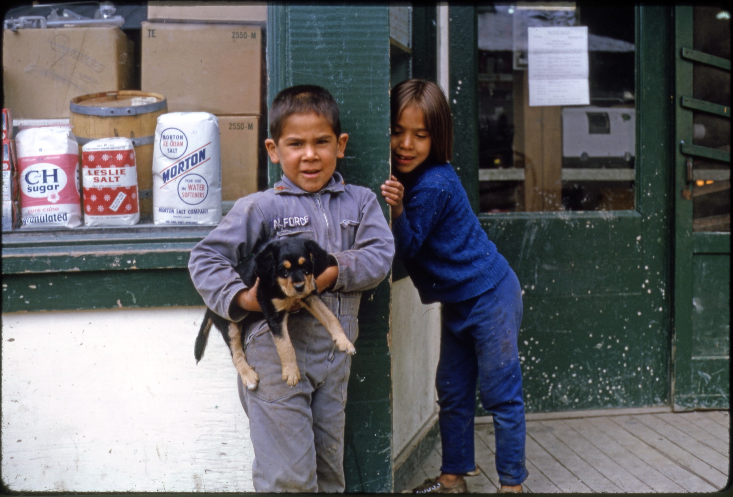 | 1509 — | [young Alaska Native boy and girl with puppy dog outside store; print date Oct 66. At AFN 2016, young boy identified as Robert Wolf, location as Grandy’s store, date suggested as before 1960] |
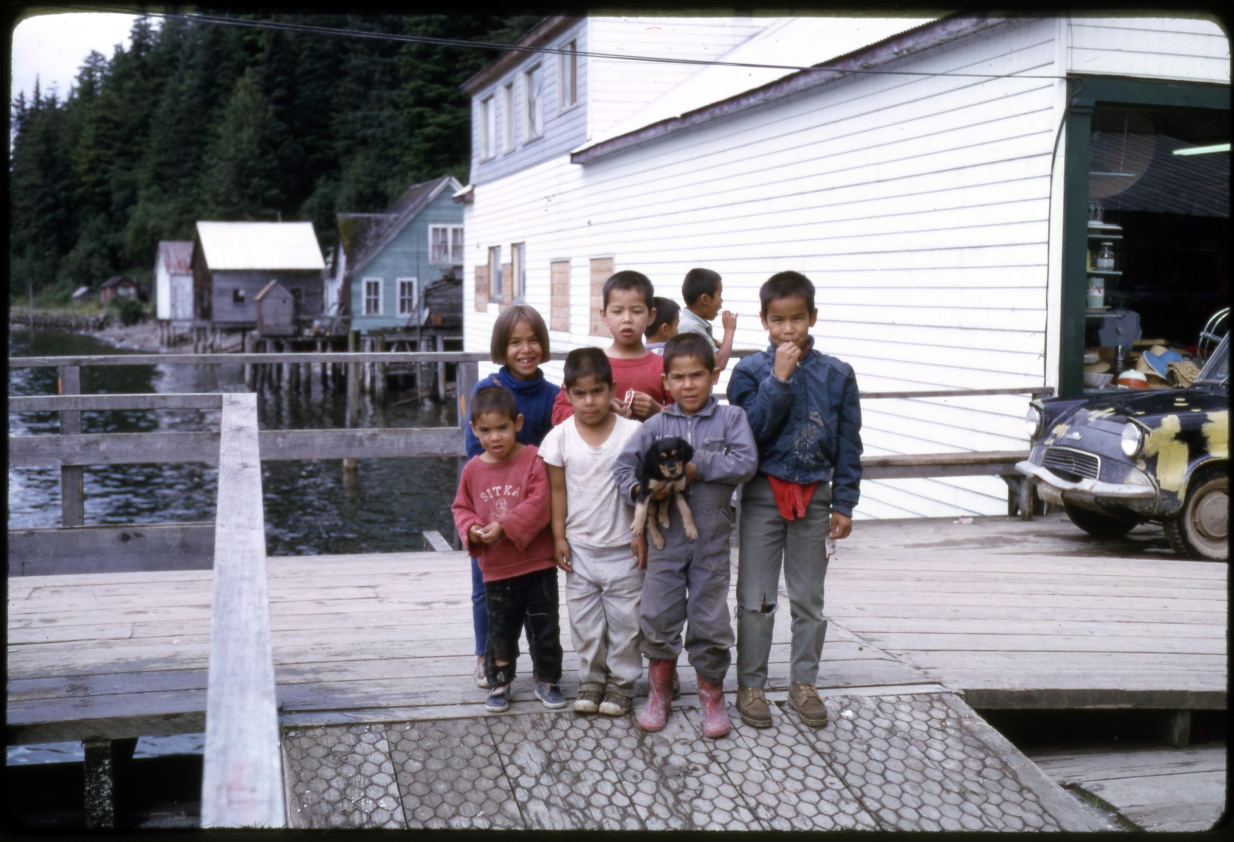 | 1510 — | [Alaska Native children with puppy dog on docks; print date Oct 66. At AFN 2016, location identified as Hoonah Seafoods dock, with Grandy’s store and George Dalton Sr.’s house in background, two boys in center front as Bernard Wolf and Robert Wolf holding puppy] |
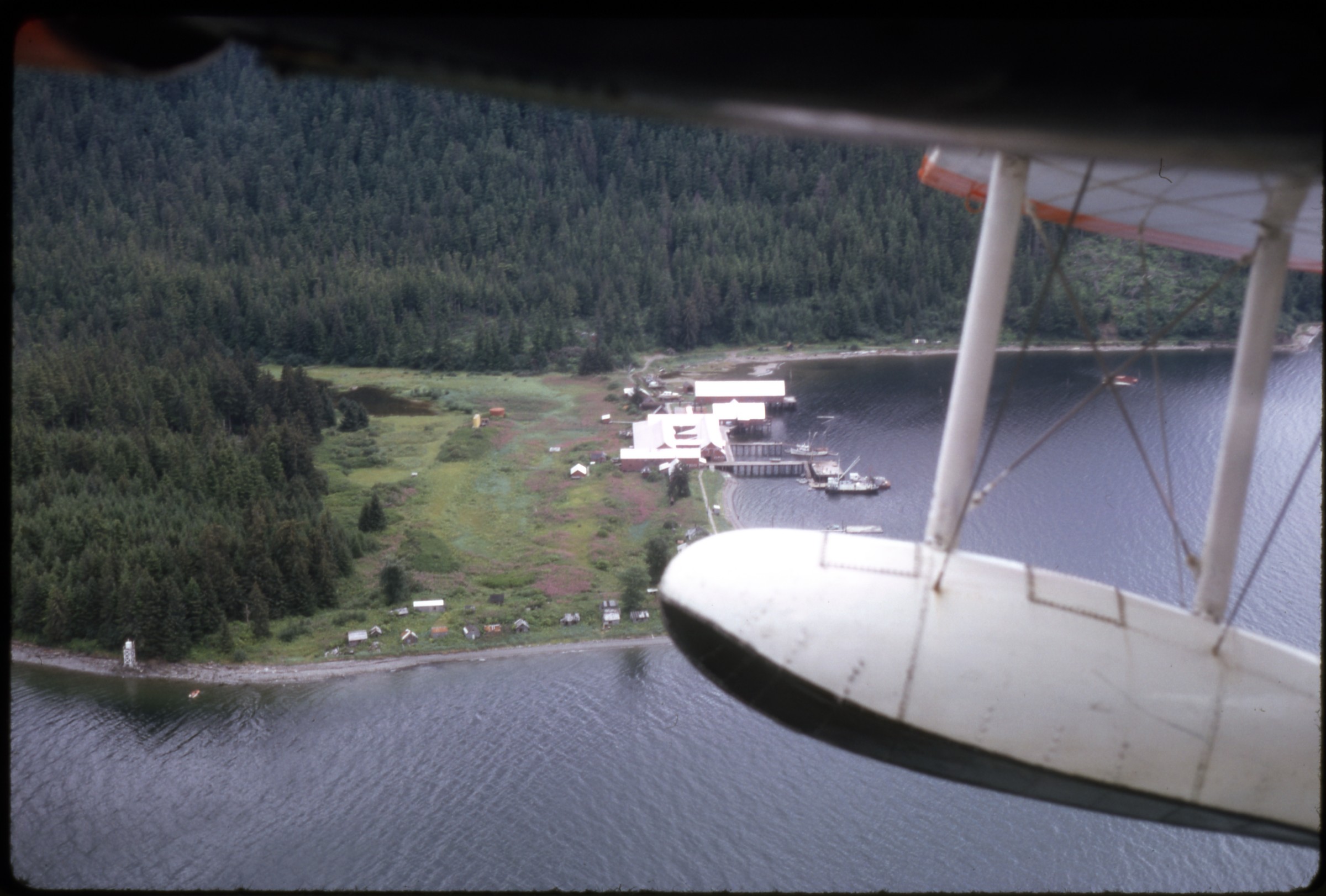 | 1511 — | [aerial of buildings and docks; print date Oct 66. At AFN 2016, identified as Hoonah cannery at Icy Strait Point, date suggested as before 1966] |
| 1512 — | [Coastal-Ellis floatplane at dock; print date Aug 66] | |
| 1513 — | [docks, Coastal-Ellis floatplane at dock at right; print date Aug 66] | |
| 1514 — | [three Alaska Native children outside building; print date Aug 66] Sitka | |
| 1515 — | 1947-50 [Pioneer Home] | |
| 1516 — | 1947-50 [Russian blockhouse] | |
| 1517 — | 1947-50 [totem pole next to blockhouse] | |
| 1518 — | 1947-50 [freshly painted totem pole next to low building] | |
| 1519 — | 1947-50 [totem pole in Totem Square] | |
| 1520 — | 1947-50 [St. Michael the Archangel Cathedral] | |
| 1521 — | 1947-50 [woman standing on steps of Sheldon Jackson Museum] | |
| 1522 — | 1947-50 [Sheldon Jackson campus] | |
| 1523 — | 1947-50 [Sheldon Jackson campus] | |
| 1524 — | 1947-50 [Russian orphanage] | |
| 1525 — | 1947-50 [sign for Russian orphanage] | |
| 1526 — | 1947-50 [house and docks on waterfront] | |
| 1527 — | 1947-50 [waterfront and docks, barge loading lumber in foreground] | |
| 1528 — | [ferry Malaspina at dock; print date Aug 73] | |
| 1529 — | [Pioneer Home; print date Aug 73] | |
| 1530 — | [Lincoln Street scene with automobiles and businesses including American Legion and Colonial Liquors, St. Michael the Archangel Cathedral in distance; print date Aug 73] | |
| 1531 — | [Lincoln Street scene with rear view of St. Michael the Archangel Cathedral; print date Aug 73] | |
| 1532 — | [view of waterfront from Castle Hill; print date Aug 73] | |
| 1533 — | [view across water to Japonski Island; print date Aug 73] | |
| 1534 — | [bird’s eye view of docks, Pioneer Home in background at right; print date Aug 73] | |
| 1535 — | [bird’s eye view of docks, Pioneer Home in center background; print date Aug 73] | |
| 1536 — | [Castle Hill; print date Aug 73] | |
| 1537 — | [“The Prospector” statue outside Pioneer Home; print date Aug 73] | |
| 1538 — | 1977 [Pioneer Home from steps to Castle Hill] | |
| 1539 — | 1977 [rear view of St. Michael the Archangel Cathedral] | |
| 1540 — | 1977 [Lincoln Street scene with automobiles and businesses including Sitka Bazaar, St. Michael the Archangel Cathedral in distance] | |
| 1541 — | 1977 [Maksoutoff Street scene with side view of cathedral] | |
| 1542 — | 1977 [street view from O’Connell Bridge] | |
| 1543 — | 1977 [view from Castle Hill] | |
| 1544 — | 1977 [view from Castle Hill] | |
| 1545 — | 1977 [houses on stilts on waterfront] | |
| 1546 — | 1977 [view across water to Japonski Island, storage tanks in foreground] | |
| 1547 — | 1977 [ferry Taku at dock] Petersburg | |
| 1548 — | 1947-50 [waterfront and docks in winter] | |
| 1549 — | 1947-50 [street scene in winter. Possibly commercial slide] | |
| 1550 — | 1947-50 [man walking down street in winter. Possibly commercial slide] | |
| 1551 — | 1947-50 [view down street in winter] | |
| 1552 — | 1947-50 [men digging trench in winter] | |
| 1553 — | 1947-50 [distant view of town. Possibly commercial slide] | |
| 1554 — | 1947-50 [docks] | |
| 1555 — | 1947-50 [docks, houseboats in foreground] | |
| 1556 — | 1947-50 [view down street paralleling waterfront, ship under way at left] | |
| 1557 — | 1947-50 [small boat harbor. Possibly commercial slide] | |
| 1558 — | 1947-50 [iceberg floating close to floatplane hangar] | |
| 1559 — | Halibut fisherman working on gear, 1947-50 [possibly commercial slide] | |
| 1560 — | Fishing salmon at Fall Creek, fish flipping top center, 1947-50 [possibly commercial slide] | |
| 1561 — | Trout stream, Thomas Bay, 1947-50 [two men angling from riverbank] | |
| 1562 — | Thomas Bay, 1947-50 [scenic] | |
| 1563 — | 1947-50 [people picnicking on gravel beach] | |
| 1564 — | 1947-50 [people picnicking on gravel beach, several boats drawn onshore] | |
| 1565 — | 1947-50 [Tongass National Forest sign] | |
| 1566 — | 1947-50 [two hunters with rifles sitting in low brush] | |
| 1567 — | 1947-50 [scenic of sunset over lake. Possibly commercial slide] | |
| 1568 — | 1947-50 [scenic of sunset over lake. Possibly commercial slide] | |
| 1569 — | Shrimp fishing, Petersburg [boat with rear net hoisted over water; 1950s] | |
| 1570 — | [shrimp boat with rear net hoisted over water; 1950s. Possibly commercial slide] | |
| 1571 — | [two men hauling shrimp out of nets onto boat; 1950s. Possibly commercial slide] | |
| 1572 — | [shrimp boat crewmen unloading net; 1950s] | |
| 1573 — | [shrimp boat crewman unloading net into hold; 1950s] | |
| 1574 — | [shrimp boat crewmen hosing off shrimp in hold; 1950s] | |
| 1575 — | [shrimp boat crewman and female photographer leaning over hold; 1950s] | |
| 1576 — | [shrimp boat crewman unloading net, female photographer taking photos; 1950s] | |
| 1577 — | [shrimp boat crewmen next to hold, female photographer at left; 1950s] | |
| 1578 — | [shrimp boat crewman holding skate by-catch, female photographer taking photo; 1950s] | |
| 1579 — | [shrimp of various sizes laid out on board; 1950s] | |
| 1580 — | [shrimp and by-catch laid out on board; 1950s] | |
| 1581 — | [crab laid out on board; 1950s] | |
| 1582 — | [Alaska Steamship Co. ship Denali at dock; prior to 1954] | |
| 1583 — | [Alaska Steamship Co. ship Denali at dock, signs at right for Public Dock and Petersburg Cold Storage; prior to 1954. Possibly commercial slide] | |
| 1584 — | [steamship at public dock; 1950s] | |
| 1585 — | [steamship at Alaska Steamship Co. dock, passengers at right; 1950s] | |
| 1586 — | [Alaska Steamship Co. ship Alaska at dock, floatplane hangar at right; 1950s] | |
| 1587 — | [distant view of Alaska Steamship Co. ship coming into docks; 1950s] | |
| 1588 — | [cargo ship Square Sinnet at dock; 1950s] | |
| 1589 — | [steamship at public dock, floatplane hangar at right; 1950s. Possibly commercial slide] | |
| 1590 — | [wooden boat M/V Deerleap under way; prior to 1957] | |
| 1591 — | [floatplane at dock; 1950s] | |
| 1592 — | [bird’s eye view of floatplane taxiing away from dock; 1950s] | |
| 1593 — | [Alaska Coastal-Ellis floatplane hangar; print date Nov 64] | |
| 1594 — | 1965 [bird’s eye view of ferry Tustumena at dock] | |
| 1595 — | 1965 [bird’s eye view of small boat harbor; actually Valdez?] | |
| 1596 — | 1965 [bird’s eye view of ferry Tustumena at dock] | |
| 1597 — | 1965 [ferry Tustumena at dock] | |
| 1598 — | 1965 [view of docks from ferry Tustumena, captain at left] | |
| 1599 — | 1965 [view of docks from ferry Tustumena] | |
| 1600 — | 1969 [aerial of town, lumber mill operation at lower right] | |
| 1601 — | 1969 [closer aerial of town] | |
| 1602 — | 1969 [aerial of small boat harbor] | |
| 1603 — | 1969 [low aerial of town looking towards Kupreanof Island] | |
| 1604 — | 1969 [baggage being loaded onto Alaska Airlines de Havilland Canada DHC-6 Twin Otter airplane tail number N711AS on tarmac] | |
| 1605 — | 1969 [Lon’s Flying Service Grumman Goose airplane tail number NS8157 on beach, storage tanks at right] | |
| 1606 — | 1969 [Lon’s Flying Service Grumman Goose airplane tail number NS8157 taxiing off beach] | |
| 1607 — | 1969 [three airplanes on gravel airstrip along water, including one floatplane] | |
| 1608 — | [people picnicking next to slough, Little Norway Festival?; print date Jul 69] | |
| 1609 — | [people picnicking next to slough, man and woman in center dressed in traditional costume, Little Norway Festival?; print date Jul 69] | |
| 1610 — | [family dressed in traditional costume, Little Norway Festival?; print date Jul 69] | |
| 1611 — | [people picnicking next to slough, Little Norway Festival?; print date Jul 69] | |
| 1612 — | [swimmers and people picnicking next to slough, Little Norway Festival?; print date Jul 69] | |
| 1613 — | [aerial view of town; print date Jul 69] | |
| 1614 — | [street scene, with Tides Inn Hotel at left; print date Jun 70] B2/B3 | |
| 1615 — | [Main Street scene, with Cornelius Mercantile Co. and Cornelius Book Store; print date Jun 70] | |
| 1616 — | [Main Street scene, with Cornelius Mercantile Co. and Cornelius Book Store; print date Jun 70] | |
| 1617 — | [street scene, view down alley next to Cornelius Book Store; print date Jun 70] | |
| 1618 — | [street scene behind Cornelius Book Store; print date Jun 70] | |
| 1619 — | [street scene behind Cornelius Book Store; print date Jun 70] | |
| 1620 — | [street scene with Mabel Liquor Store; print date Jun 70] | |
| 1621 — | [houses on slough, house or dock under construction at center; print date Jul 79] | |
| 1622 — | [people walking on narrow dock towards house on slough; print date Jul 79] | |
| 1623 — | [scaffolding around chimney or tower on rocky shore; print date Jul 79] | |
| 1624 — | [scenic of narrows from rear of boat, buildings on both shores; print date Jul 79] | |
| 1625 — | [heavy equipment being barged in to beach; print date Oct 80] | |
| 1626 — | [heavy equipment being barged in to beach; print date Oct 80] | |
| 1627 — | [heavy equipment being barged in to beach; print date Oct 80] | |
| 1628 — | [heavy equipment being barged in to beach; print date Oct 80] | |
| 1629 — | [heavy equipment being barged in to beach, house in foreground; print date Oct 80] | |
| 1630 — | [man sitting on bow of boat in small boat harbor; print date Oct 81] | |
| 1631 — | [two pigs on gravel beach, dock in background; print date Oct 81] | |
| 1632 — | [view down small gravel road paralleling beach; print date Oct 81] | |
| 1633 — | 17 th of Norway Celebration [people in Viking costume posed in parking lot; print date Oct 81] | |
| 1634 — | 17 th of Norway Celebration [passengers debarking from Alaska Airlines airplane; print date Oct 81] | |
| 1635 — | 17 th of Norway Celebration [passengers and people in costume standing next to baggage claim at airport; print date Oct 81] | |
| 1636 — | 17 th of Norway Celebration [woman holding shield and spear posed on dock; print date Oct 81] | |
| 1637 — | 17 th of Norway Celebration [replica Viking ship at small dock with another boat; print date Oct 81] | |
| 1638 — | 17 th of Norway Celebration [people picnicking on slough; print date Oct 81] | |
| 1639 — | 17 th of Norway Celebration [people picnicking on slough, woman in center wearing traditional costume; print date Oct 81] | |
| 1640 — | 17 th of Norway Celebration [people picnicking on slough; print date Oct 81] | |
| 1641 — | 17 th of Norway Celebration [people picnicking on slough, large barbeque set up on beach; print date Oct 81] | |
| 1642 — | [sign for Mosquito Lake Wayside, lake in background; print date Jul 82] | |
| 1643 — | [view down small gravel road paralleling beach, house at right; print date Jul 82] | |
| 1644 — | [view down small gravel road paralleling beach, fireweed at right; print date Jul 82] | |
| 1645 — | [view down small gravel road paralleling beach, houses at right, boats at left; print date Jul 82] | |
| 1646 — | [view across narrows to houses on opposite shore; print date Jul 82] | |
| 1647 — | [view from behind houses to narrows in front; print date Oct 84] | |
| 1648 — | [view from behind house to narrows in front, trailer at right; print date Oct 84] | |
| 1649 — | [cabin or outbuilding in tall brush; print date Oct 84] | |
| 1650 — | [van parked next to two houses on small gravel road paralleling beach; print date Oct 84] | |
| 1651 — | [damaged ferry dock under reconstruction; print date Dec 84] | |
| 1652 — | [newly constructed house on small gravel road paralleling beach; print date Dec 84] | |
| 1653 — | [automobiles parked on small gravel road paralleling beach, newly constructed house at left next to small log outbuilding; print date Dec 84] | |
| 1654 — | [newly constructed house on small gravel road paralleling beach; print date Dec 84] | |
| 1655 — | [marine ferry under way in narrows; print date Dec 84. Cf. .1663] | |
| 1656 — | [man on bulldozer in front of newly constructed house on small gravel road paralleling beach; print date Dec 84] | |
| 1657 — | [van parked in front of house on small gravel road paralleling beach; print date Jun 88] | |
| 1658 — | [van parked on small gravel road paralleling beach, partially cut log in center, dock in background; print date Jun 88] | |
| 1659 — | [heavy equipment at lumber mill, timber on beach, rainbow in background; print date Sep 88] | |
| 1660 — | [log rafts at lumber mill, rainbow in background; print date Sep 88] | |
| 1661 — | [scenic of narrows; print date Sep 88] | |
| 1662 — | [view from dock of van parked in front of house; print date Sep 88] | |
| 1663 — | Papke’s Landing [marine ferry under way in narrows; print date May 91. Cf. .1655] | |
| 1664 — | Papke’s Landing [view from dock of houses along beach; print date May 91] | |
| 1665 — | Papke’s Landing [view up road with fresh gravel; print date May 91] Ketchikan | |
| 1666 — | 1947-50 [passengers boarding boat Eagle in small boat harbor, people in boats nearby] | |
| 1667 — | 1947-50 [bird’s eye view of people in motorboats tied to dock, wharves in background] | |
| 1668 — | 1947-50 [bird’s eye view of people in motorboats tied to dock, wharves in background] | |
| 1669 — | 1947-50 [bird’s eye view of people in boat Eagle and in motorboats tied to dock, wharves in background] | |
| 1670 — | 1947-50 [passengers boarding boat Eagle in small boat harbor, Ketchikan Spruce Mill in background] | |
| 1671 — | July 4, 1950 [CN steamship Prince George under way] | |
| 1672 — | July 4, 1950 [Shriners marching band on parade, possibly passing Latin’s? Fourth of July celebration] | |
| 1673 — | July 4, 1950 [street scene with spectators watching parade] | |
| 1674 — | July 4, 1950 [Queen and court on float in parade] | |
| 1675 — | July 4, 1950 [street scene with parade passing businesses including Bon Marche] | |
| 1676 — | July 4, 1950 [women in purple uniforms with yellow scarves on parade passing Eddystone Electric] | |
| 1677 — | July 4, 1950 [woman in colonial costume on float in parade passing Eddystone Electric] | |
| 1678 — | July 4, 1950 [Lions club float passing Ingersoll Hotel] | |
| 1679 — | July 4, 1950 [people dressed in horse costumes pulling wagon in parade, passing Pan American World Airways ticket office and Welcome to Ketchikan sign] | |
| 1680 — | Dec. 13-15, 1960 [waterfront as seen from floatplane coming in for landing; print date Jan 61] | |
| 1681 — | Dec. 13-15, 1960 [waterfront as seen from floatplane coming in for landing; print date Jan 61] | |
| 1682 — | Dec. 13-15, 1960 [waterfront as seen from floatplane coming in for landing; print date Jan 61] | |
| 1683 — | 1967 [Liquid Sunshine Gauge; print date Jul 67] | |
| 1684 — | 1967 [waterfront as seen from water, small boat harbor at right] | |
| 1685 — | 1967 [K line cargo ship at dock, possibly Ketchikan Spruce Mill] | |
| 1686 — | 1967 [totem pole in residential area with sign “Kicksetti Totem”] | |
| 1687 — | 1967 [two totem poles next to tribal house, with signs “Sea Serpent Totem” and “Bear of Mountain Totem”] | |
| 1688 — | 1967 [two totem poles in clearing, new Duk-Toothl (Black Skin) or Ka-Ha-Si mortuary pole at right. Actually Wrangell] | |
| 1689 — | 1967 [two totem poles at end of pedestrian bridge, with signs “Kadashan Redsnapper Totem” and “Kadashan Crane Totem.” Actually Wrangell] | |
| 1690 — | 1967 [totem mortuary posts next to tribal house. Actually Wrangell] | |
| 1691 — | 1969 [Alaska Airlines floatplanes at dock, including Grumman Goose airplane tail number N74676] | |
| 1692 — | [flight attendant carrying Air France bag on dock; print date Jun 70] | |
| 1693 — | [passengers and baggage on dock next to Southeast Skyways de Havilland Canada DHC-2 Beaver floatplane tail number N9770Z; print date Jun 70] | |
| 1694 — | [passengers and baggage on dock next to Southeast Skyways de Havilland Canada DHC-2 Beaver floatplane tail number N9770Z; print date Jun 70] | |
| 1695 — | [Alaska Airlines floatplanes at dock including Grumman Goose airplane tail number N2751A, sign at right for McKay Marine Ways; print date Jun 70] | |
| 1696 — | [bird’s eye view of town; print date Jun 70] | |
| 1697 — | [aerial view of town; print date Jun 70] | |
| 1698 — | [aerial view of town; print date Jun 70] | |
| 1699 — | [aerial view of town; print date Jun 70] | |
| 1700 — | [man standing in cemetery next to grave marker for Hogue, can of cut fireweed on top of headstone; print date Sep 80] | |
| 1701 — | [Chief Shakes Tribal House; print date Sep 80. Actually Wrangell] | |
| 1702 — | [two totem poles in clearing, with signs “Kadashan Redsnapper Totem” and “Kadashan Crane Totem”; print date Sep 80. Actually Wrangell] | |
| 1703 — | [tourists standing in front of two totem poles in clearing, Duk-Toothl (Black Skin) or Ka- Ha-Si mortuary pole at right; print date Sep 80. Actually Wrangell] | |
| 1704 — | [totem mortuary posts next to tribal house; print date Sep 80. Actually Wrangell] | |
| 1705 — | [tourists in front of tribal house with sign “Chief Shakes Community House”; print date Sep 80. Actually Wrangell] | |
| 1706 — | [Three Frogs Totem; print date Sep 80. Actually Wrangell] | |
| 1707 — | [totem mortuary posts next to tribal house; print date Sep 80. Actually Wrangell] | |
| 1708 — | [street scene with automobiles and businesses; print date Aug 80] | |
| 1709 — | [view down street paralleling waterfront, six totem or mortuary poles in clearing in foreground; print date Aug 80] | |
| 1710 — | [three totem or mortuary poles in clearing; print date Aug 80] | |
| 1711 — | [five totem or mortuary poles in clearing, street paralleling waterfront in background; print date Aug 80] | |
| 1712 — | [view up drive to totem poles in clearing, Saxman Totem Park; print date Jul 82] | |
| 1713 — | [woman standing next to recreational vehicle parked beside a Blackfish totem pole along a street; print date Jul 82] | |
| 1714 — | [Bear totem, Eagle totem pole, and fallen Three Frogs totem lying in grass, Saxman Totem Park?; print date Jul 82] | |
| 1715 — | [base of Abraham Lincoln totem pole next to Cape Fox Corp. building, interpretive marker at left; print date Jul 82] | |
| 1716 — | [Abraham Lincoln totem pole next to Cape Fox Corp. building, interpretive marker at left; print date Jul 82] | |
| 1717 — | [Seward totem pole and Loon Tree totem pole, Saxman Totem Park; print date Jul 82] | |
| 1718 — | [woman standing next to Bear post, Saxman Totem Park; print date Jul 82] | |
| 1719 — | [Owl Memorial Pole and Raven Pole totem poles, Saxman Totem Park; print date Jul 82] | |
| 1720 — | [view down street with totem poles on both sides, water in distance, Saxman Totem Park; print date Jul 82] | |
| 1721 — | [Bear post, Raven Pole, and Eagle and Beaver Pole totems, Saxman Totem Park; print date Jul 82] | |
| 1722 — | [Dogfish Pole and Raven Pole totem poles, Saxman Totem Park; print date Jul 82] | |
| 1723 — | [view down street with totem poles on both sides, water in distance, Saxman Totem Park; print date Jul 82] | |
| 1724 — | [Owl Memorial Pole, Eagle and Beaver Pole, and posts, Saxman Totem Park; print date Jul 82] | |
| 1725 — | [street scene, looking down towards water, large cruise ship at end of street; print date Aug 82] | |
| 1726 — | [cruise ship pulling away from dock; print date Aug 82] | |
| 1727 — | [Princess Cruises Island Princess cruise ship at dock; print date Aug 82] | |
| 1728 — | [Princess Cruises Island Princess cruise ship at dock; print date Aug 82] | |
| 1729 — | [small boat harbor and Ketchikan Spruce Mills; print date Aug 88] | |
| 1730 — | [small boat harbor; print date Aug 88] | |
| 1731 — | [fishing fleet at docks; print date Aug 88] | |
| 1732 — | [small boat harbor; print date Aug 88] | |
| 1733 — | [small boat harbor with town in background, signs for Salvation Army and The Potlatch; print date Aug 88] | |
| 1734 — | [small boat harbor with town in background; print date Aug 88] | |
| 1735 — | [small boat harbor; print date Aug 88] | |
| 1736 — | [scaffolding around Chief Johnson’s totem pole on street corner, Reach Inn Grill at left, The Family Store at right, U.S. Café in center background; print date Aug 88] | |
| 1737 — | [small boat harbor; print date Aug 88] | |
| 1738 — | [fishing fleet at docks; print date Aug 88] | |
| 1739 — | [view from fishing fleet docks of buildings on waterfront and hillside, sign for Paul M. Hansen Co. in background; print date Aug 88] | |
| 1740 — | [floatplanes at Alaska Coastal-Ellis docks, including Grumman Goose airplane tail number N48550; print date Aug 88] | |
| 1741 — | [view of waterfront from floatplane; print date Aug 88] | |
| 1742 — | [view of waterfront from floatplane; print date Aug 88] Metlakatla | |
| 1743 — | Dec. 13-15, 1960 [aerial of town; print date Jan 61] | |
| 1744 — | Dec. 13-15, 1960 [aerial of town; print date Jan 61] Port Moller | |
| 1745 — | [view across water, fishing boats in foreground, structures on opposite shore possibly White Alice radar site; print date Jul 70] | |
| 1746 — | [fishing boats at dock; print date Jul 70] | |
| 1747 — | [view across water from dock; print date Jul 70] | |
| 1748 — | [view from dock of fishing boats and tender; print date Jul 70] | |
| 1749 — | [view of buildings from dock; print date Jul 70] | |
| 1750 — | [view along waterfront from dock; print date Jul 70] | |
| 1751 — | [view down beach, with helicopter and buildings at right; print date Jul 70] | |
| 1752 — | [buildings, storage tank, and communications tower; print date Jul 70] | |
| 1753 — | [view down beach, man possibly wearing military uniform in right foreground walking towards large flock of birds; print date Jul 70] | |
| 1754 — | [houses along beach, Alaska Native boy walking in distance; print date Jul 70] | |
| 1755 — | [houses on beach; print date Jul 70] | |
| 1756 — | [two crosses on tundra, cemetery; print date Jul 70] | |
| 1757 — | [view down road, bird’s eye view of docks in distance; print date Jul 70] | |
| 1758 — | July 1970 [Reeve Aleutian Airways airplane next to hangar] | |
| 1759 — | July 1970 [pickup truck parked next to terminal building at airport] | |
| 1760 — | July 1970 [aerial of White Alice radar site] | |
| 1761 — | July 1970 [aerial of river delta] | |
| 1762 — | July 1970 [aerial of cannery] | |
| 1763 — | July 1970 [Reeve Aleutian Airways Douglas DC-3 airplane N19906 on beach] | |
| 1764 — | July 1970 [man standing next to cross on tundra, cemetery] | |
| 1765 — | July 1970 [Jeep and pickup truck parked next to small outbuildings, one with sign “Welcome to Port Moller Intl. Airport”] | |
| 1766 — | July 1970 [view across water to White Alice radar site on opposite shore] | |
| 1767 — | July 1970 [cannery as seen from beach] | |
| 1768 — | July 1970 [view down beach, flock of birds in foreground, beached barge in background] | |
| 1769 — | July 1970 [view inland from cannery dock area, buildings in background] | |
| 1770 — | July 1970 [tender Mary Jane and fishing boats in water, man on dock in foreground] | |
| 1771 — | July 1970 [fishing boats at dock] | |
| 1772 — | July 1970 [fishing boats at dock, tender and boats in water in background] Kodiak | |
| 1773 — | 1967 [street scene with Kodiak Hotel and B & B Bar] | |
| 1774 — | 1967 [street scene with Kodiak Hotel and B & B Bar at right, automobiles parked next to gravel area construction in center, new site of Baranov Museum at left] | |
| 1775 — | 1967 [new site of the Baranov Museum] | |
| 1776 — | 1967 [new site of Baranov Museum, storage tanks at right] | |
| 1777 — | 1967 [automobiles parked next to cannery ship Star of Kodiak at dock] | |
| 1778 — | 1967 [street scene] | |
| 1779 — | 1967 [small boat harbor] | |
| 1780 — | 1967 [small boat harbor and fishing boat docks] | |
| 1781 — | 1967 [street scene, with parking lot in foreground, Breakers Liquor Store in left background] | |
| 1782 — | 1967 [street scene with Fishermen’s Memorial and possibly harbormaster’s office] | |
| 1783 — | 1967 [bird’s eye view of docks with Ursin Seafoods at left and cannery ship Princess Roxane at right] | |
| 1784 — | 1967 [bird’s eye view of docks with Ursin Seafoods at right and Reefer King cannery ship at left] | |
| 1785 — | 1967 [bird’s eye view of B & B Fisheries warehouse] | |
| 1786 — | 1967 [street scene with Kodiak Inn at left, Sutliff’s in center, storage tanks on hill at right] | |
| 1787 — | 1967 [bird’s eye view of small boat harbor] | |
| 1788 — | 1967 [bird’s eye view of small boat harbor] | |
| 1789 — | 1967 [bird’s eye view of small boat harbor] Bethel | |
| 1790 — | [aerial of airstrip; print date Aug 59] | |
| 1791 — | [aerial of airstrip; print date Aug 59] | |
| 1792 — | [aerial of airstrip; print date Aug 59] | |
| 1793 — | [two men standing on beach next to fish wheel; print date Aug 59] | |
| 1794 — | [dog yard and fish drying racks on gravel beach; print date Aug 59] Platinum | |
| 1795 — | June 30, 1959 [Platinum Commercial Co. truck parked outside Platinum Radio building, men walking at right, some wearing hard hats; print date Jul 59] | |
| 1796 — | [Platinum Radio, snowshoes mounted to exterior wall; print date Jul 59] | |
| 1797 — | [street scene, with laundry hanging on clothesline at left; print date Aug 59] | |
| 1798 — | [street scene; print date Aug 59] | |
| 1799 — | [man walking towards Monarch Airways Inc. Lockheed 10B Electra airplane tail number N16054, metal barrels and storage tank at right; print date Aug 59] | |
| 1800 — | [houses along road; print date Aug 59] Aniak | |
| 1801 — | 1 July 1959 [bird’s eye view of two men on small floating dock with fish drying racks; print date Aug 59] | |
| 1802 — | 1 July 1959 [two men on small floating dock with drying racks, two men carrying pole with dried fish off dock onto beach; print date Aug 59] | |
| 1803 — | 1 July 1959 [two men on small floating dock with drying racks, two men carrying pole with dried fish off dock onto beach; print date Aug 59] | |
| 1804 — | 1 July 1959 [man on small floating dock holding up fish; print date Aug 59] | |
| 1805 — | 1 July 1959 [view down beach, with boats pulled onto shore, possibly fish wheel in distance; print date Aug 59] | |
| 1806 — | 1 July 1959 [view down dirt road to houses; print date Aug 59] | |
| 1807 — | 1 July 1959 [view down dirt road, metal barrels at left, airplane at right, buildings in distance; print date Aug 59] | |
| 1808 — | 1 July 1959 [small Quonset huts and heavy equipment, possibly maintenance yard; print date Aug 59] Unalakleet | |
| 1809 — | May 1957 [view across airstrip, small airplane at right, military airplane in center, terminal at right, buildings near water in background] | |
| 1810 — | May 1957 [view across airstrip to buildings, truck passing on road in middle ground] | |
| 1811 — | May 1957 [low aerial of town, river delta in foreground] | |
| 1812 — | Sept. 1960 [low aerial of buildings; print date Oct 60] | |
| 1813 — | Sept. 1960 [low aerial of buildings; print date Oct 60] | |
| 1814 — | Sept. 1960 [low aerial of buildings; print date Oct 60] B2/B4 Nome | |
| 1815 — | May 1957 [view across river to airstrip, dredge in center distance] | |
| 1816 — | May 1957 [people and dog on steps of Pan American World Airways terminal] | |
| 1817 — | May 1957 [people and dog on steps of Pan American World Airways terminal] | |
| 1818 — | [man on steps of Pan American World Airways terminal; 1950s] | |
| 1819 — | [U.S. Mercantile Co. store, with signs for food products including salmon, reindeer, beef heart and mutton carcass; 1950s] | |
| 1820 — | [women walking past U.S. Mercantile Co. store; 1950s] | |
| 1821 — | [street scene, with pedestrians, U.S. Mercantile Co. truck at left, signs for businesses including Alaska Airlines, A. Polet Eskimo Arts & Crafts, Q Cab, Curly Q Railroad, and Arctic Oil; 1950s] | |
| 1822 — | [street scene, with pedestrians, automobiles, signs for businesses including Nome Nugget and Nome Market; 1950s] | |
| 1823 — | [street scene, with pedestrians, automobiles, signs for businesses including Northern Commercial Co., Breakers Bar, and Ice Cream Center; 1950s] | |
| 1824 — | [street scene, with man standing in center of street in foreground, drug store at left; 1950s] | |
| 1825 — | [two women walking down boardwalk in front of C.F. O’Dell and Munz, sign for Dutch Boy Paints in distance; 1950s] | |
| 1826 — | [view down riprap erosion control wall on shoreline; 1950s] | |
| 1827 — | [view down riprap erosion control wall on shoreline; 1950s] | |
| 1828 — | [street scene, Alaska Natives looking in store windows in foreground, young Alaska Native man and dog on boardwalk in background, sign for Johnson in background; 1950s] | |
| 1829 — | [Alaska Natives looking at camera and film products in store window; 1950s] | |
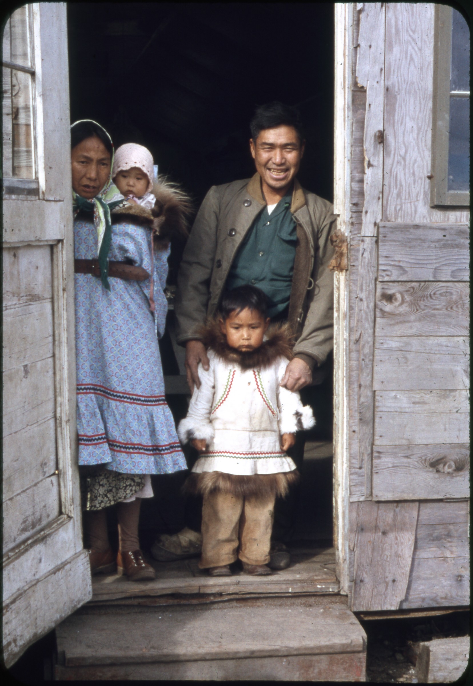 | 1830 — | [Alaska Native family standing in doorway; 1950s. At AFN 2016, identified as Pikunna [?] family] |
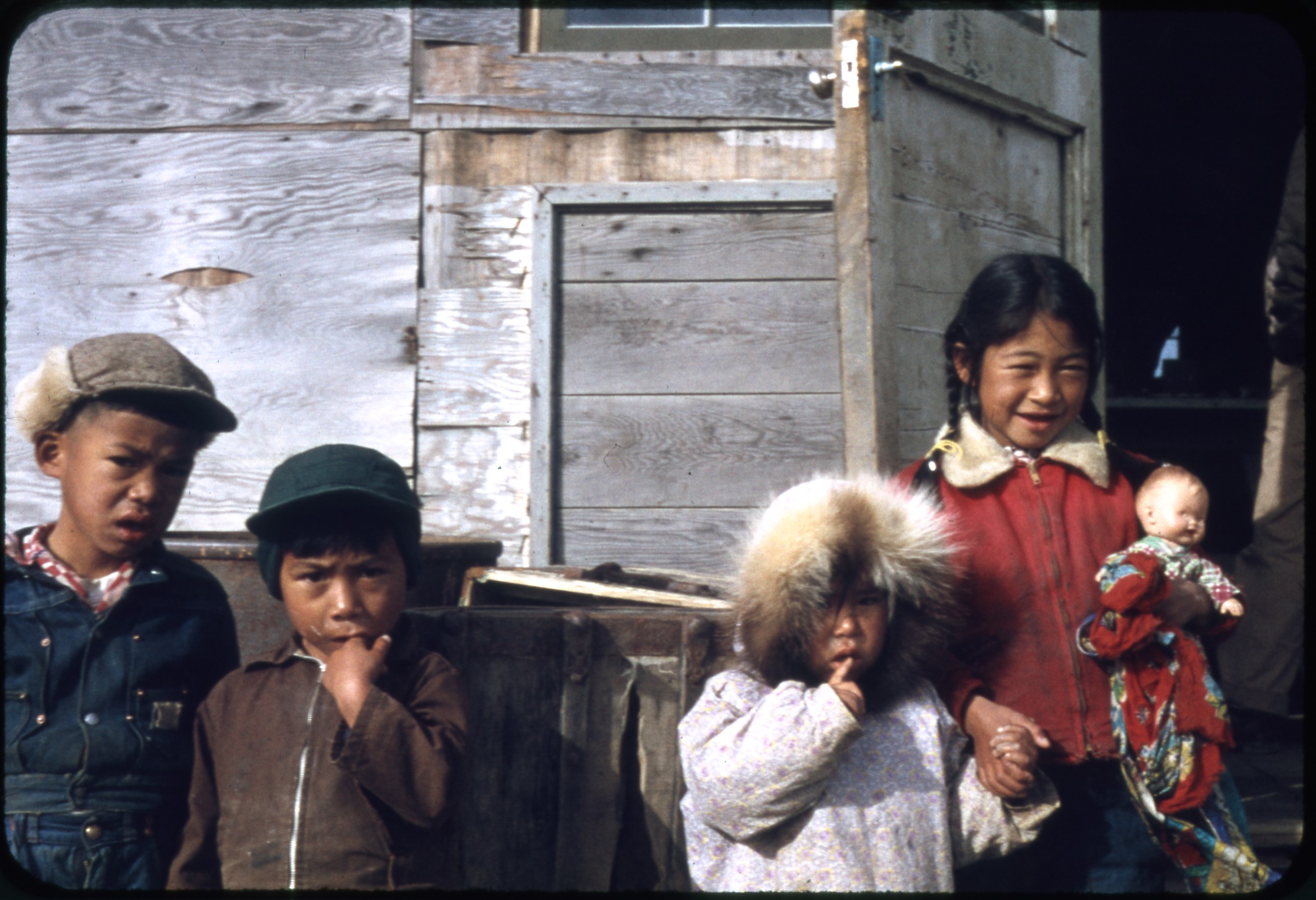 | 1831 — | [four Alaska Native children, one girl holding doll; 1950s. At AFN 2017, identified as King Island Village at east end of Nome] |
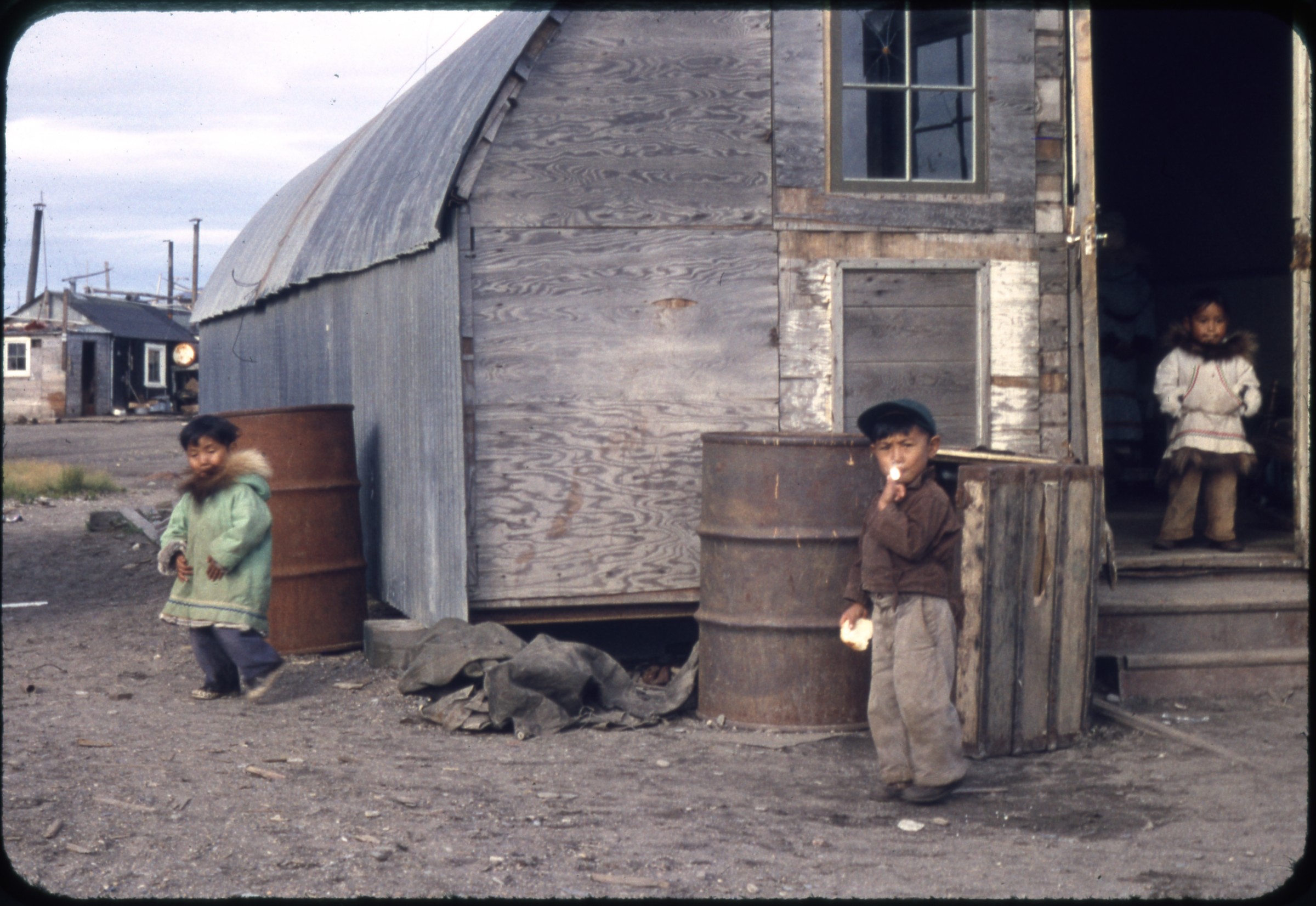 | 1832 — | [Alaska Native children standing next to building, one eating white bread; 1950s. At AFN 2017, identified as King Island Village at east end of Nome] |
 | 1833 — | [six Alaska Native children standing next to building; 1950s. At AFN 2016, identified as King Island village at east end of Nome] |
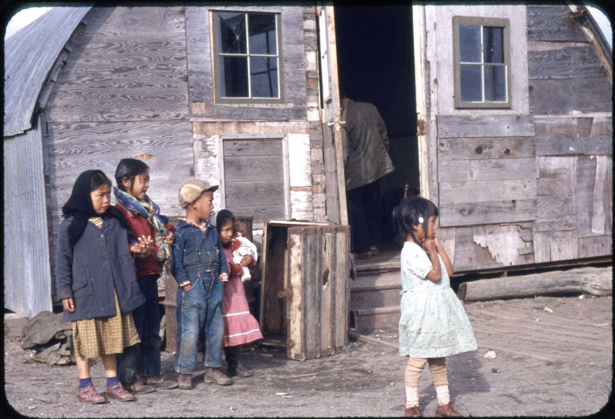 | 1834 — | [five Alaska Native children standing next to building; 1950s. At AFN 2017, identified as King Island Village at east end of Nome] |
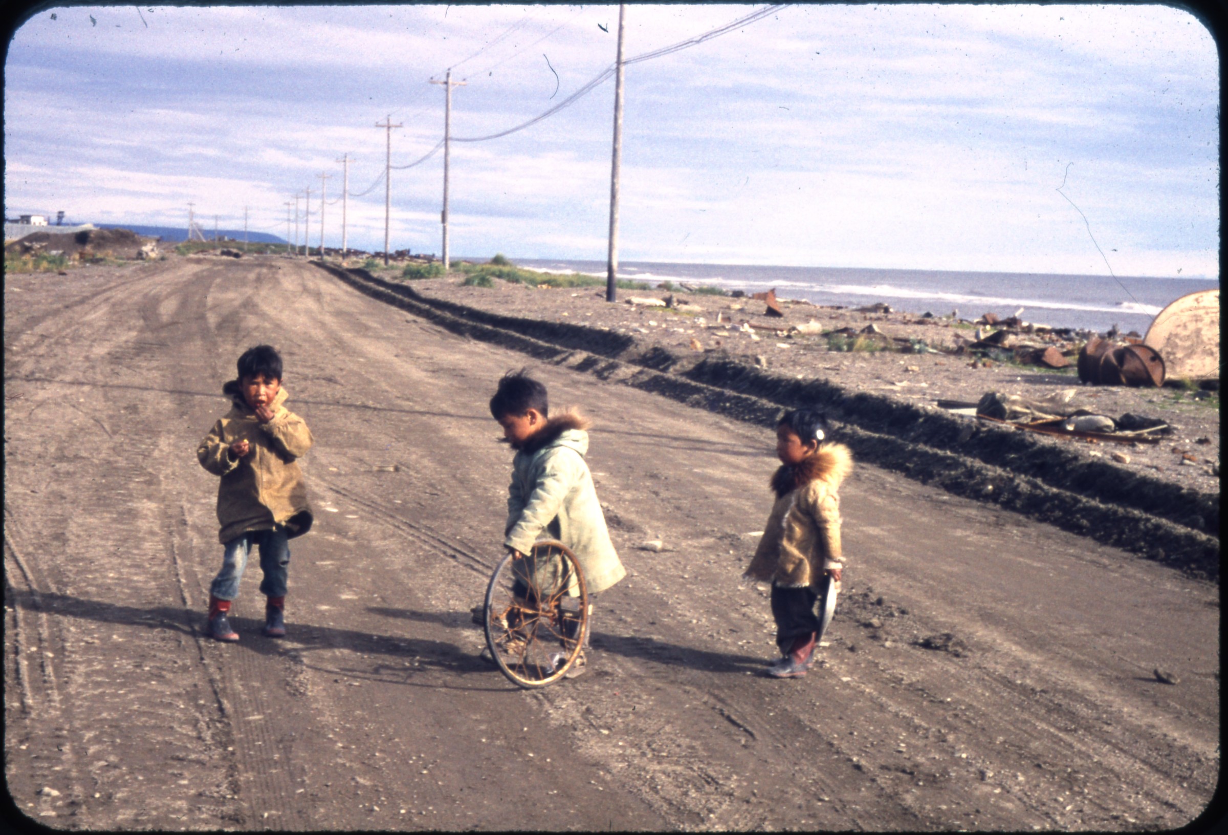 | 1835 — | [three Alaska Native children standing in road, one holding fish, one playing with bicycle wheel; 1950s. At AFN 2017, identified as King Island Village at east end of Nome] |
| 1836 — | [view across gravel area to row of Quonset huts, people standing next to building at left; 1950s] | |
| 1837 — | [woman walking past houses, laundry hanging on clothesline in distance; 1950s] | |
| 1838 — | [white man standing next to umiaks, small sign reading “King Island Village” in background; 1950s] | |
| 1839 — | [view down beach, rusted metal barrels at right, umiaks at left, dredge in background; 1950s] | |
| 1840 — | [white man standing next to umiaks, Bill Ray?; 1950s] | |
| 1841 — | [woman walking next to umiak on beach; 1950s] | |
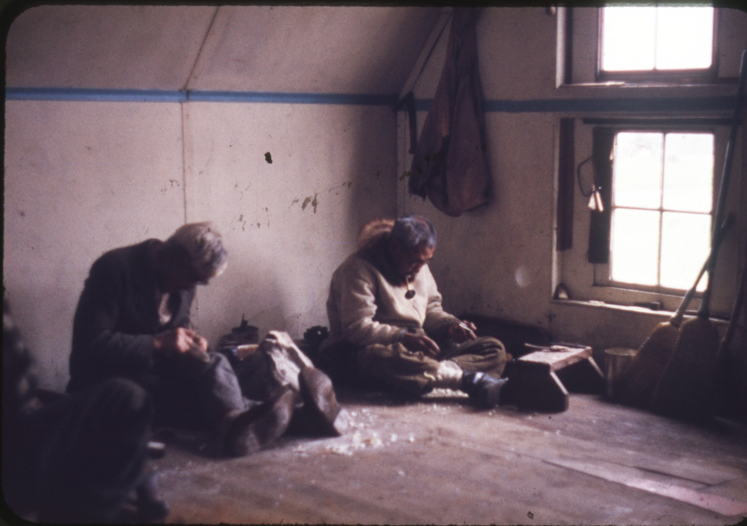 | 1842 — | [carvers working inside building, King Island Chief Aulaġana (John Olarana) at left; 1950s. At AFN 2017, man at right tentatively identified as Big Mike Kazinick or Kuziniq] |
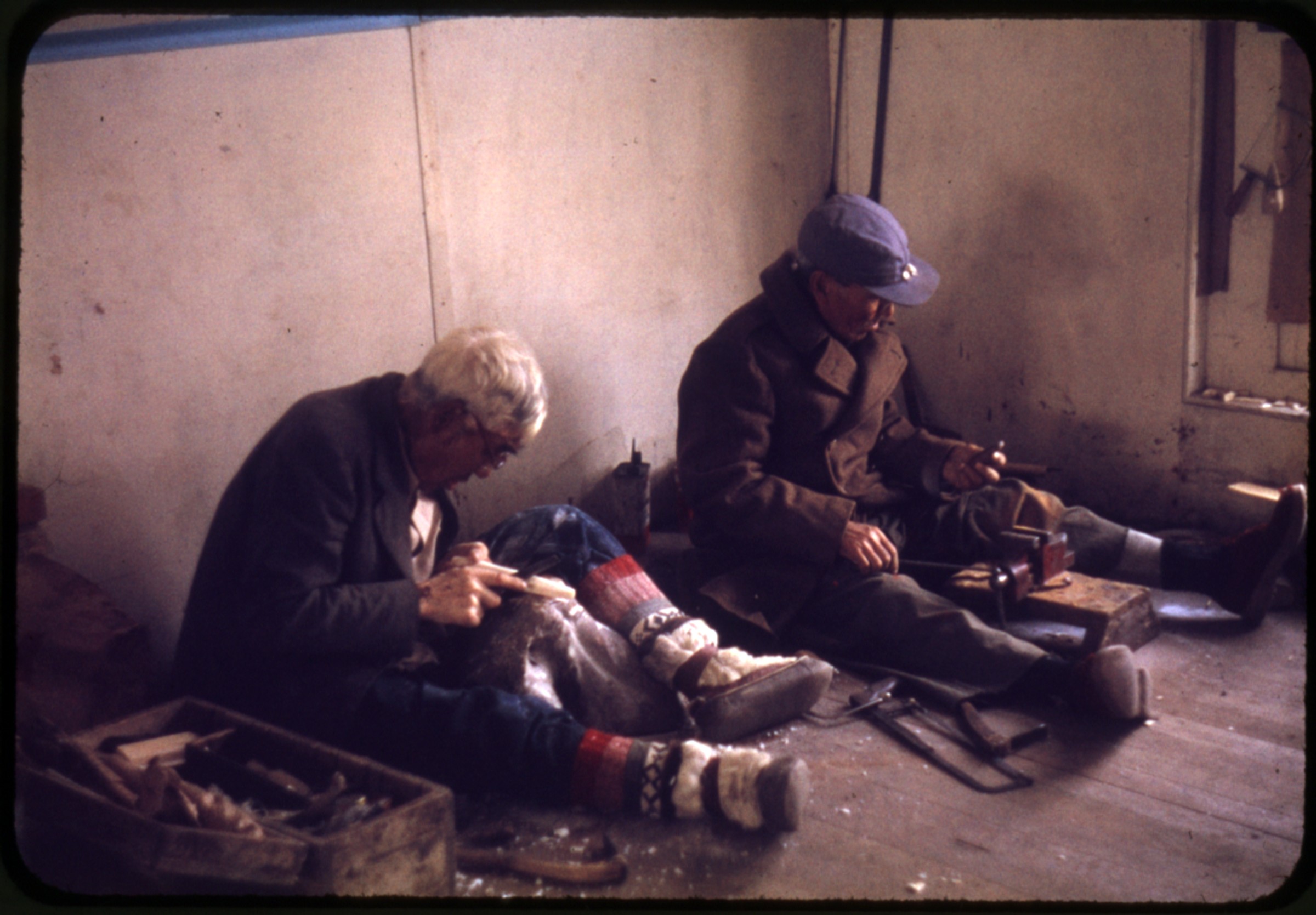 | 1843 — | [carvers working inside building, 1950s. At AFN 2016, man at left identified as King Island Chief Aulaġana (John Olarana)] |
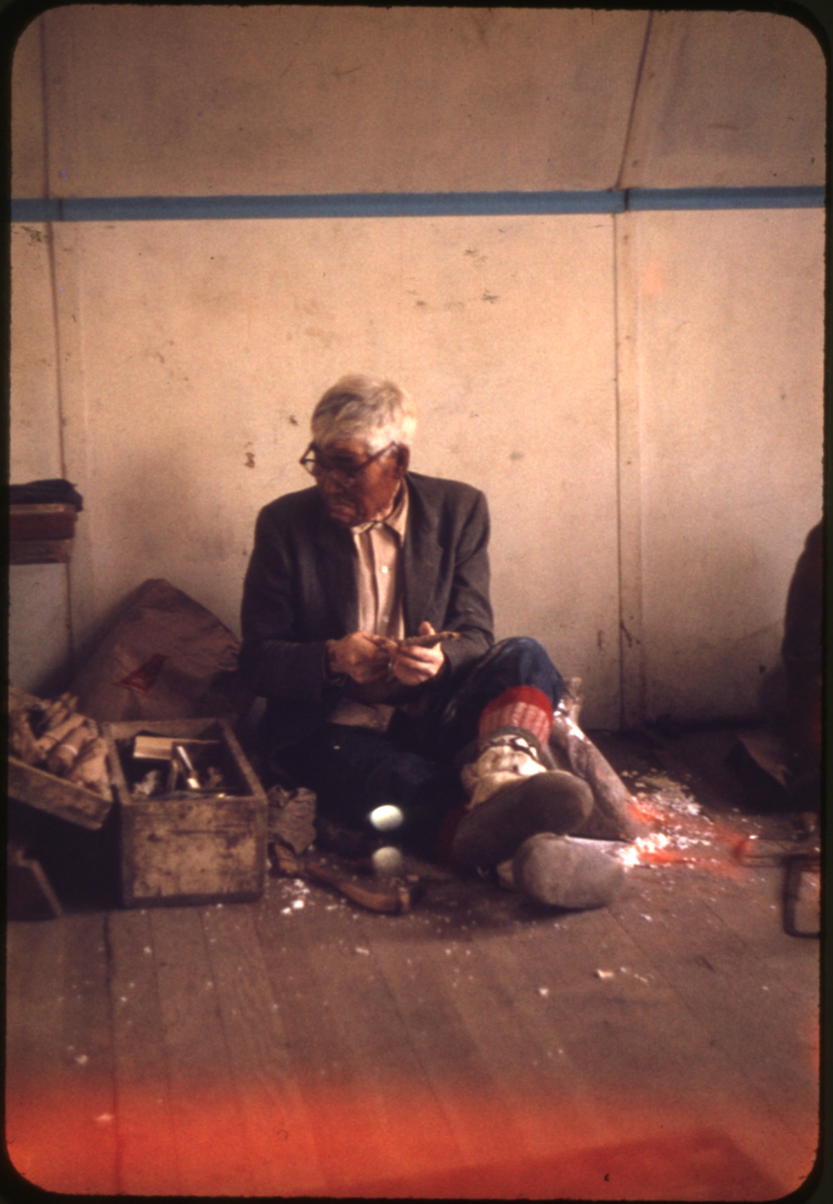 | 1844 — | [carver working inside building, 1950s. At AFN 2016, identified as King Island Chief Aulaġana (John Olarana)] |
| 1845 — | [dredge; 1950s] | |
| 1846 — | [close-up of dredge; 1950s] | |
| 1847 — | [dredge; 1950s] | |
| 1848 — | 95’ dredge, Nome, July ’58 [dredge] | |
| 1849 — | Nome, July ’58 [Pan American World Airways terminal] | |
| 1850 — | King Island village, Nome, July ’58 [women and children sitting outside house, two children playing at right] | |
| 1851 — | From King Island Village, Nome, July ’58 [view of beach, umiak frame in foreground, umiaks at left, barge and buildings in background] | |
| 1852 — | [truck parked outside low building with stone chimney, possibly weather station in foreground; 1950s] | |
| 1853 — | [airport, with hangars and airplanes; 1950s] | |
| 1854 — | [wreckage of 1932 Stinson U Airliner airplane tail number NC1174; 1950s] | |
| 1855 — | [wreckage of 1932 Stinson U Airliner airplane tail number NC1174; 1950s] | |
| 1856 — | [wreckage of 1932 Stinson U Airliner airplane tail number NC1174; 1950s] | |
| 1857 — | [man standing next to wreckage of 1932 Stinson U Airliner airplane tail number NC1174; 1950s] | |
| 1858 — | [man standing next to wreckage of 1932 Stinson U Airliner airplane tail number NC1174; 1950s] Kotzebue | |
| 1859 — | [Don’s Safari Flying Service airplane tail number N1803D on tarmac, military vehicles and fire trucks on background] | |
| 1860 — | Sept. 1960 [view along shoreline, with whalebone in foreground, man standing next to umiak in center, boats and barrels on beach; print date Oct 60] | |
| 1861 — | [view along shoreline, fishing net in foreground, boats and barrels on beach, buildings at right; print date Oct 60] | |
| 1862 — | [beach scene, with umiak in foreground, two men standing next to motorboat with outboard motor in background; print date Oct 60] | |
| 1863 — | [dogs tied next to fish drying rack, buildings in background, tent at left, laundry on clothesline at right; print date Oct 60] | |
| 1864 — | [village scene with sled frame next to drying rack in foreground, small tent at right, large building in background; print date Oct 60] | |
| 1865 — | [automobile parked outside Wien Airlines terminal building at airport; print date Oct 60] | |
| 1866 — | [bird’s eye view of village, probably from airplane landing at airport; print date Oct 60] | |
| 1867 — | [bird’s eye view of village, probably from airplane landing at airport; print date Oct 60] Barrow | |
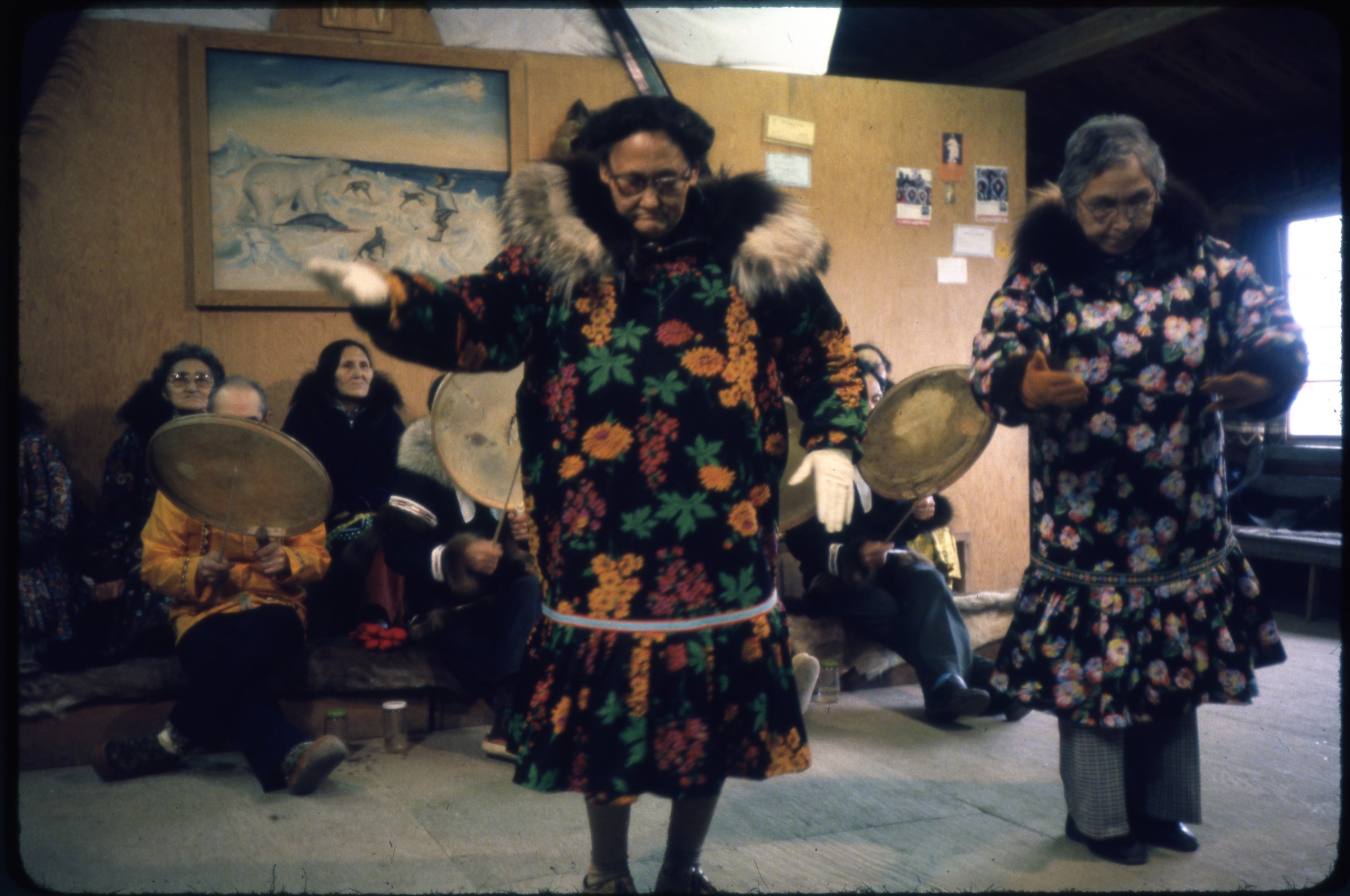 | 1868 — | [two women dancing indoors, other women and male drummers seated behind; print date Aug 79. At AFN 2016, dancers identified as Sadie Nukapigak at left and Helen Kenton at right, female spectators as Rhoda Nageak at left and Jenny Okpeakak at right] |
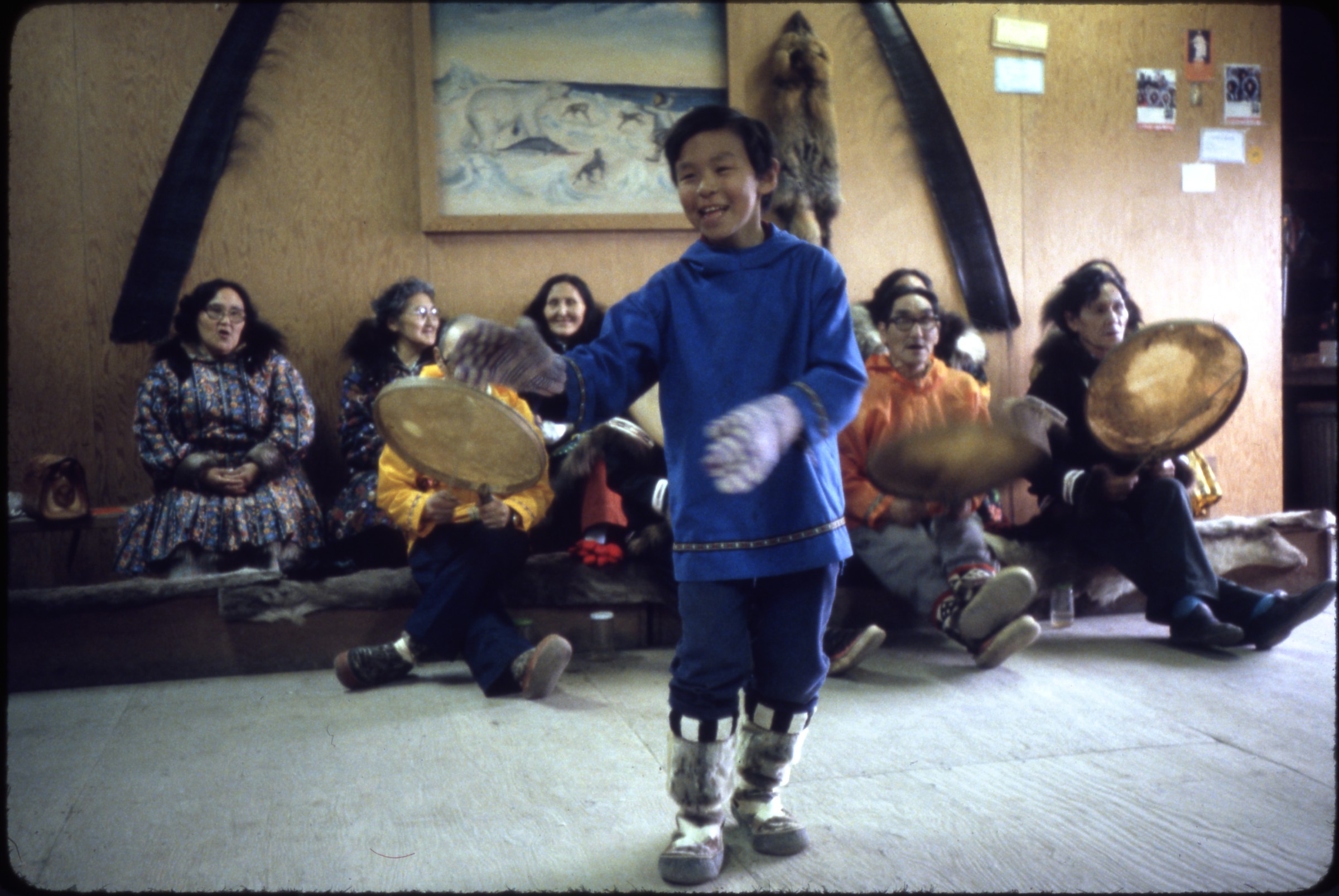 | 1869 — | [young boy dancing indoors, women and male drummers seated behind; print date Aug 79. At AFN 2016, boy identified as Ernest Ekowana, male drummers as Isugaaq Nukapigak at left and possibly Saavgaq at right, female spectators as (left to right) Jane Brower, Rhoda Nageak, Jenny Okpeakak] |
| 1870 — | [spectators watching blanket toss; print date Aug 79] | |
| 1871 — | [female tourist on road, possibly wearing Wien parka, storage tank in right background; print date Aug 79] | |
| 1872 — | [tourists posed with totem pole, with sign reading “POW Main, Point Barrow, Alaska, home of the northern most totem pole in the world,” with radar or telecommunications installation in background; print date Aug 79] | |
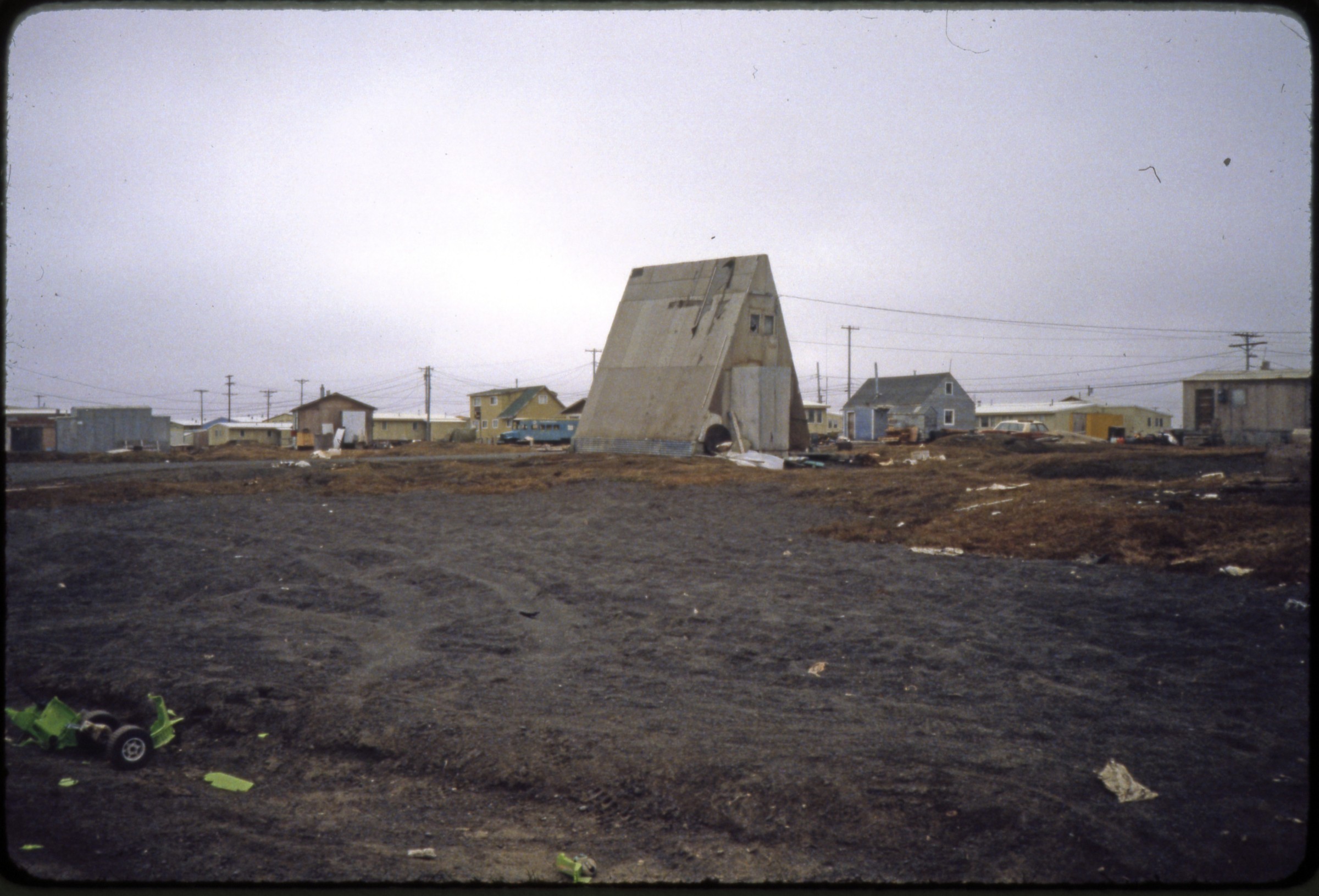 | 1873 — | [village scene with A-frame building in center; print date Aug 79. At AFN 2016, identified as A-frame house, no longer standing as of 2016, with Meryl Solomon’s house at right] |
| 1874 — | [female tourist facing away from camera standing in front of Brower’s Café, whalebones at left; print date Aug 79] | |
 | 1875 — | [fenced enclosure with two flags flying, automobiles at right; print date Aug 79. At AFN 2016, identified as setting up for blanket toss at Nulakatuk, with flags of whaling captains] |
| 1876 — | [house with chain-link fence dog yard, metal barrels piled at left; print date Aug 79] | |
| 1877 — | [man standing outside building with signs for NANA Oilfield Services, Equipment Rental, and North Slope Gift Shoppe; print date Aug 79] | |
| 1878 — | [distant view of tank farm; print date Aug 79] | |
| 1879 — | [female tourist standing next to memorial marker for Prudhoe Bay Field; print date Aug 79] | |
| 1880 — | [distant view of housing, probably oil worker housing, Prudhoe Bay; print date Aug 79] | |
| 1881 — | [automobiles parked in front of building with Sohio and BP logos; print date Aug 79] | |
| 1882 — | [plants growing indoors, probably at Prudhoe Bay corporate facility; print date Aug 79] | |
| 1883 — | [visitors on tour of Prudhoe Bay corporate building; print date Aug 79] | |
| 1884 — | [female tourist in log red coat looking out over Beaufort Sea; print date Aug 79] Fairbanks | |
| 1885 — | Fairbanks 1947 [view down road, with sign “End Alaska Military Highway, entering Fairbanks city limits”] | |
| 1886 — | 1947 [view across river to Northern Commercial Co. building, with floatplane on water in foreground] | |
| 1887 — | 1947 [O’Harra Bus Lines depot] | |
| 1888 — | [view down residential street in winter; 1940s] | |
| 1889 — | [winter street view, Samson Hardware Company at right; 1940s] | |
| 1890 — | [automobile parked outside Glenn Carrington & Co. Mining Equipment building in winter, Alaska Railroad Engine No. 1 at right; 1940s] | |
| 1891 — | [view down Chena River in summer, Northern Commercial Co. at right; 1940s] | |
| 1892 — | [street view, with Service Motor Co. at right, Cushman Street Bridge at end of street; 1940s] | |
| 1893 — | [street scene with automobiles and businesses including Lacey St. Theater and Daily News-Miner; 1940s] | |
| 1894 — | May 1957 [tourists on road next to paddle steamer in dry dock] | |
| 1895 — | [riverboat pushing barge loaded with lumber past buildings on shore, Chena River; 1950s] | |
| 1896 — | [two men in military uniform in small boat on Chena River passing businesses including Roebling and Samson Hardware; 1950s] | |
| 1897 — | [mural on exterior of building, showing mileages to University of Alaska and communities including Fox and Happy, sign at left for The Log Hut, milepost at right for Cleary, Chatanika, and Circle; 1950s] | |
| 1898 — | Fairbanks [view down Chena River, with Northern Commercial Co. at right; 1950s] | |
| 1899 — | April 1961 [view down railroad tracks, Alaska Railroad station at right; print date Jul 61] | |
| 1900 — | [view down railroad tracks to sign, “Fairbanks, Alaska, north end of the main line of the northernmost railroad in North America, the Alaska Railroad”; print date Jul 61] | |
| 1901 — | [riverboat Sour Sarah on boat trailer, Immaculate Conception Catholic Church in background; print date Jul 61] | |
| 1902 — | [automobiles parked outside of log building and Fairview Hotel; print date Jul 61] | |
| 1903 — | May 1962 [pedestrians on sidewalk next to milepost 1523 of Alaska Highway, automobiles on street, signs for Cushman St. and First Ave., man at right holding camera; print date Jun 62] | |
| 1904 — | [view down Chena River, people lounging on grassy area at right, sign for Pioneer Cleaners and Laundry in center, boat on water; print date Jun 62] | |
| 1905 — | [view down Chena River with high water, houses and buildings on both banks; print date Jun 62] | |
| 1906 — | [view down Chena River with high water, mobile homes at right; print date Jun 62] | |
| 1907 — | [pedestrians on sidewalk next to milepost 1523 of Alaska Highway, automobiles on street, sign for First Ave., Yellow Cab taxi at right, Pioneer Cleaners and Laundry in background; print date Jun 62] | |
| 1908 — | [Chena River flooding, with buildings and automobiles in water; print date Jun 62] | |
| 1909 — | [Chena River flooding, with log cabin in water at right; print date Jun 62] | |
| 1910 — | [view down Chena River with high water, people, automobiles, and boats next to buildings on far shore; print date Jun 62] | |
| 1911 — | [pedestrians on sidewalk next to milepost 1523 of Alaska Highway, automobiles on street, signs for businesses including Pioneer Barber Shop, Turf Club Café, Fairview Hotel; print date Jun 62] | |
| 1912 — | [view across Chena River to Immaculate Conception Catholic Church, bridge and signs for businesses including The Carrington Co. and International Hotel at left; print date Jun 62] | |
| 1913 — | [Chena River flooding, with mobile homes at left, airboat on bank at right; print date Jun 62] | |
| 1914 — | [Chena River flooding, with mobile homes at left, men in riverboat on water in center; print date Jun 62] | |
| 1915 — | [Chena River flooding, with water encroaching on buildings and heavy equipment; print date Jun 62] | |
| 1916 — | [paddle steamer Nenana in dry dock; print date Jun 62] | |
| 1917 — | [paddle steamer Nenana in dry dock; print date Jun 62] | |
| 1918 — | [paddle steamer Nenana in dry dock; print date Jun 62] | |
| 1919 — | [construction on campus of University of Alaska Fairbanks; print date Jun 62] | |
| 1920 — | [man riding bicycle on new road in front of Engineering Building, University of Alaska Fairbanks; print date Jun 62] | |
| 1921 — | [Student Union Building, University of Alaska Fairbanks; print date Jun 62] | |
| 1922 — | [view down road on University of Alaska Fairbanks campus; print date Jun 62] | |
| 1923 — | [view down road on University of Alaska Fairbanks campus, sign for Alaska State Assay Office in center; print date Jun 62] | |
| 1924 — | [Observatory building, University of Alaska Fairbanks; print date Jun 62] | |
| 1925 — | [view down road on University of Alaska Fairbanks campus, Mess Hall and Rifle Teams buildings at right; print date Jun 62] | |
| 1926 — | [Wickersham Hall on University of Alaska Fairbanks campus, with U.S. mail box and automobiles parked at curb; print date Jun 62] | |
| 1927 — | [parking lot, buildings, and construction on University of Alaska Fairbanks campus; print date Jun 62] | |
| 1928 — | [view down road on University of Alaska Fairbanks campus, Wickersham Hall in distance; print date Jun 62] | |
| 1929 — | [boxes and other debris piled on curb in front of businesses including Singer, with automobiles and U.S. mail box, automotive service shop across street, probably flood damage from Chena Flood, 1967; print date Sep 67] | |
| 1930 — | [backhoe dumping debris into dump truck on street, automobiles in foreground, sign for Singer at right, probably flood damage from Chena Flood, 1967] | |
| 1931 — | [burned gas station after fire, with charred building, automobile, gasoline pumps with signs for Sky Chief and Fire Chief; 1967?] | |
| 1932 — | [burned gas station after fire, with charred building and automobiles; 1967?] | |
| 1933 — | [caution tape around pit dug next to building housing Northward Drug, possibly flood damage from Chena Flood, 1967] | |
| 1934 — | [exterior of house in residential area, with debris piled in yard, damage to road in foreground, flood damage from Chena Flood, 1967] | |
| 1935 — | [exterior of house, with debris piled in yard, flood damage from Chena Flood, 1967] | |
| 1936 — | [view down sidewalk in residential area, debris piled in yard at left, flood damage from Chena Flood, 1967] | |
| 1937 — | [street scene with debris piled at right, barricades around damaged sidewalk in center, automobiles parked at curb, signs for businesses including Fairbanks Insurance, Nerland’s, and Evelyn’s, flood damage from Chena Flood, 1967] | |
| 1938 — | [debris piled on sidewalk in front of Evelyn’s next to telephone booth, sign at left for Mt. McKinley Mutual Savings Bank, flood damage from Chena Flood, 1967] | |
| 1939 — | [debris piled on sidewalk in downtown area, with parking meters and automobiles, flood damage from Chena Flood, 1967] | |
| 1940 — | [debris pile in wooded area, flood damage from Chena Flood, 1967] | |
| 1941 — | 1971 [view across parking lot to Immaculate Conception Catholic Church and St. Joseph’s Hospital, with white barrier in front of buildings, possibly flood control] | |
| 1942 — | [view across Chena River to Northern Commercial Co. building, showing erosion control along riverbank; 1971] | |
| 1943 — | [view across Chena River to log building and businesses including Speakeasy; 1971] | |
| 1944 — | [view from bridge down Chena River, sign for the Burlap Bucket at right; 1971] | |
| 1945 — | [automobiles parked outside Carrington Co. and International Hotel; 1971] | |
| 1946 — | [view down street to Dollar Day Rentals, with automobiles on road; 1971] | |
| 1947 — | 1978 [exterior of store with sign reading “Northland Taxidermists, Eskimo Museum, Gift Shop,” with polar bear statue; print date Jul 78] Fairbanks: Alaskaland, Alaska 67 Exposition | |
| 1948 — | [narrow gauge railroad train apparently about to hit body on tracks; print date Jun 67] | |
| 1949 — | [visitors in front of storefronts on street; print date Jun 67] | |
| 1950 — | [two girls in uniform eating ice cream cones while sitting on railing for railroad depot, sign at left for Crooked Creek and Whiskey Island R.R.; print date Jun 67] | |
| 1951 — | [Alaska Railroad Engine No. 1 next to railroad station; print date Jun 67] | |
| 1952 — | [flagpole and log cabins, with signs for Billy Mitchell Museum, Telephone-Telegraph Office Alaska Communication System, and United States Air Force Alaska Communication System Long Distance Telephone and Telegraph Service; print date Jun 67] | |
| 1953 — | [view down walking path, with log cabin at left and dome at right; print date Jun 67] | |
| 1954 — | [visitors outside Northern Commercial Co. and Palace Café, one woman carrying cotton candy; print date Jun 67] | |
| 1955 — | [visitors on boardwalk in front of log cabins, including one with sign for Alaska Airlines; print date Jun 67] | |
| 1956 — | [woman wearing costume and stilts leaning against wooden fence with sign for Alaska Airlines; print date Jun 67] | |
| 1957 — | [couples dancing on gazebo; print date Jun 67] | |
| 1958 — | [workers in costume on deck of paddle steamer; print date Jun 67] | |
| 1959 — | [workers in costume posed next to sternwheel of paddle steamer; print date Jun 67] | |
| 1960 — | [man and woman in costume posed next to sternwheel of paddle steamer; print date Jun 67] | |
| 1961 — | [workers in costume posed next to sternwheel of paddle steamer; print date Jun 67] | |
| 1962 — | [workers in costume posed next to sternwheel of paddle steamer; print date Jun 67] | |
| 1963 — | [girl in costume standing in doorway of log cabin, with metal traps hanging from wall, wheels on display in front; print date Jun 67] | |
| 1964 — | [front of trapper’s log cabin, with traps, saw, hatchet, and antlers; print date Jun 67] | |
| 1965 — | [visitors looking at sluice in mining demonstration area; print date Jun 67] | |
| 1966 — | [visitors looking at sluice in mining demonstration area; print date Jun 67] | |
| 1967 — | [bird’s eye view of street, with The Lode and Palace Saloon, hay cart at right; 1967] | |
| 1968 — | [antique automobile loaded with snowshoes and tools, pulling hay cart; 1967] | |
| 1969 — | [amusement rides on midway; 1967] | |
| 1970 — | [large painting hanging from chain-link fence next to area for photographs with walrus backdrop and other props; 1967. Cf. .1984] | |
| 1971 — | [spectators watching blanket toss in birch grove; 1967] | |
| 1972 — | [paddle steamer Nenana; 1967] | |
| 1973 — | [two men dressed as clowns apparently digging grave; 1967] | |
| 1974 — | [entrance for Alaskaland, with one automobile in parking lot; 1967] | |
| 1975 — | [hot air balloon being inflated on fairgrounds; 1967] | |
| 1976 — | [antique automobile in front of Palace Saloon; 1967] | |
| 1977 — | [spectators watching actors reenact death of Soapy Smith on street in front of log cabins; 1967] | |
| 1978 — | [log cabins, including Centennial Print Shop; 1967] | |
| 1979 — | [bird’s eye view of fairgrounds, with gazebo at left; print date Apr 67] | |
| 1980 — | [bird’s eye view of fairgrounds, with gazebo in center; print date Apr 67] | |
| 1981 — | [bird’s eye view of fairgrounds looking towards entrance; print date Apr 67 | |
| 1982 — | [bird’s eye view of fairgrounds, with dome in background; print date Apr 67] | |
| 1983 — | [view of two airplanes on display, taken from railroad car; print date Apr 67] | |
| 1984 — | [man standing next to paintings on display, one hanging on chain-link fence, area for photographs with props at right; print date Apr 67. Cf. .1970] | |
| 1985 — | [view down walking path through birch grove; print date Apr 67] | |
| 1986 — | [visitors walking past log cabins; print date Jun 67] | |
| 1987 — | [view of fairgrounds, with sign for Hickory Farms of Ohio on log cabin at right; print date Jun 67] | |
| 1988 — | [visitors in front of Palace Saloon; print date Jun 67] | |
| 1989 — | [bird’s eye view of storefronts; print date Jun 67] Fairbanks Golden Days | |
| 1990 — | [First National Bank parade float; print date August 1986] | |
| 1991 — | [Dancers and musicians on First National Bank parade float; print date August 1986] | |
| 1992 — | [Pioneers of Alaska King and Queen Regent riding in automobile in parade; print date August 1986] | |
| 1993 — | [military color guard and marching band in parade; print date August 1986] | |
| 1994 — | [Pioneers of Alaska Igloo #4 Auxiliary #8 parade float; print date August 1986] | |
| 1995 — | [women in costume inside the “Golden Days Jail” float; print date August 1986] | |
| 1996 — | [Dancers on parade float “S.S. Heel and Toe;” print date August 1986] | |
| 1997 — | [Miss U.S.A. Christy Fichtner riding in automobile in parade; print date August 1986] | |
| 1998 — | [beauty contestant wearing sash and holding umbrella riding in automobile in parade; print date August 1986] | |
| 1999 — | [Miss Alaska U.S.A. Kim Christopher riding in automobile in parade; print date August 1986] | |
| 2000 — | [truck pulling float, with sign for 13 th Missile Warning Squadron BMEWS Site 11 Clear; print date August 1986] | |
| 2001 — | [Mayor of Chatanika riding in automobile in parade; print date August 1986] | |
| 2002 — | [U.S. Postal Service workers in parade; print date August 1986] | |
| 2003 — | [woman wearing grass skirt and lei waving from back of Island Sleep Center truck; print date August 1986] | |
| 2004 — | [Harvest Queen and court on parade float; print date August 1986] | |
| 2005 — | [beauty contestant wearing sash and holding umbrella riding in automobile in parade; print date August 1986] | |
| 2006 — | [women including Debbie Kracke sitting on race cars on parade float; print date August 1986] | |
| 2007 — | [Miss Alaska holding umbrella riding in automobile in parade; print date August 1986] | |
| 2008 — | [Governor Steve Cowper and wife riding in automobile in parade; print date Aug 87] | |
| 2009 — | [Fairbanks Racing Lions riding in Kodiak Oil Field Haulers truck in parade; print date Aug 87] | |
| 2010 — | [Jazzercise parade float; print date Aug 87] | |
| 2011 — | [Happy Hooker Towing parade float; print date Aug 87] | |
| 2012 — | [men and women riding in “Golden Days Jail” float; print date Aug 87] | |
| 2013 — | [Grasle and Assoc. Electrical Contractors and Engineers parade float; print date Aug 87] | |
| 2014 — | [man in bear costume riding in North-N Lights monster truck in parade; print date Aug 87] | |
| 2015 — | [Klondike Lounge parade float with sign for “Klondike Kuties;” print date Aug 87] | |
| 2016 — | [Triple S Hydroseeding parade float; print date Aug 87] | |
| 2017 — | [First National Bank parade float; print date Aug 87] B2/B5 | |
| 2018 — | [woman waving from window of automobile advertising upcoming concert by Alabama; print date Jul 88] | |
| 2019 — | [Miss Black Heritage riding in automobile in parade; print date Jul 88] | |
| 2020 — | [Santa Claus riding on North Pole Fire Department fire truck in parade; print date Jul 88] | |
| 2021 — | [people on “Alascom Belle” parade float; print date Jul 88] | |
| 2022 — | [mushers with sleds and dogs on Yukon Quest parade float; print date Jul 88] | |
| 2023 — | [Pioneers of Alaska Igloo #4 Auxiliary #8 parade float; print date Jul 88] | |
| 2024 — | [women in costume riding in horse-drawn parade float, spectators watching from roof of recreational vehicle in background; print date Jul 88] | |
| 2025 — | [United Way parade float; print date Jul 88] | |
| 2026 — | [Tanana Valley Special Olympics parade float; print date Jul 88] | |
| 2027 — | [Harvest Queen and court riding on parade float; print date Jul 88] | |
| 2028 — | [Snowshoe Shufflers dance group on parade float; print date Jul 88] | |
| 2029 — | [Jaycees parade float; print date Jul 88] | |
| 2030 — | [Grand Marshals June Carlson and Jack Schleppegrell riding in automobile in parade; print date Sep 89] | |
| 2031 — | [man driving miniature antique automobile in parade, Pioneers of Alaska?; print date Sep 89. Cf. .2037] | |
| 2032 — | [Governor Steve Cowper riding in automobile in parade; print date Sep 89] | |
| 2033 — | [women riding in “Golden Days Jail” parade float; print date Sep 89] | |
| 2034 — | [Fairbanks Country Kickers dance group on parade float; print date Sep 89] | |
| 2035 — | [dancers on Key Bank Express parade float; print date Sep 89] | |
| 2036 — | [women riding in “Golden Days Jail” parade float; print date July 30, 1990] | |
| 2037 — | [man driving miniature antique automobile in parade with sign for Pioneers of Alaska Igloo #4; print date July 30, 1990] | |
| 2038 — | [Pioneers of Alaska King and Queen Regent and court riding on parade float; print date July 30, 1990] | |
| 2039 — | [children riding on parade float with sign “Our mom’s & dad’s won the grand sweepstakes award at the 1990 Fur Rondy!”; print date July 30, 1990] | |
| 2040 — | [Miss Alaska riding in automobile in parade; print date July 30, 1990] | |
| 2041 — | [Miss Firecracker Terri Dunn riding in automobile in parade; print date July 30, 1990] | |
| 2042 — | [person dressed in Ted Stevens costume walking in parade; print date July 30, 1990] | |
| 2043 — | [woman wearing roller skates selling tickets to spectators at parade; print date July 30, 1990] | |
| 2044 — | [dancers on Key Bank Express parade float; print date July 30, 1990] | |
| 2045 — | [Grasle and Assoc. Electrical Contractors and Engineers electric wagon in parade; print date Aug 92] | |
| 2046 — | [Fairbanks Goldenheart Dancers dance group on parade float; print date Aug 92] | |
| 2047 — | [women riding in “Golden Days Jail” float, sponsored by North Pole Coffee Roasting Co.; print date Aug 92] | |
| 2048 — | [Food Factory parade float; print date Aug 92] | |
| 2049 — | [Alaska Highway Patrol car on parade; print date Aug 92] | |
| 2050 — | [German Club parade float; print date Aug 92] | |
| 2051 — | [Mrs. Claus riding on North Pole Fire Department fire truck in parade; print date Aug 92] | |
| 2052 — | [beauty pageant contestants riding in automobile in parade; print date Aug 92] North Pole | |
| 2053 — | [sign for North Pole in front of log cabin] | |
| 2054 — | [sign for North Pole in front of log cabin, metal barrels at left] | |
| 2055 — | [flower garden in front of house] | |
| 2056 — | [automobiles parked in front of small building with sign “Radio Company of Alaska Electronics Sales Service” with totem pole on roof; print date Jul 64] Big Delta-Delta Junction | |
| 2057 — | Big Delta, 1947 [automobile parked outside Bert and Mary’s Roadhouse, with signs “Standard Oil Products” and “Beer-Wine and Coca-Cola”] | |
| 2058 — | Big Delta, 1947 [view down gravel road, with sign “Entering Big Delta – Mt. Hayes – Blair Lakes Game Refuge”] | |
| 2059 — | [woman walking on gravel road past Rika’s Roadhouse; print date Aug 66] | |
| 2060 — | [dilapidated outbuildings at Rika’s Roadhouse; print date Aug 66] | |
| 2061 — | [view down gravel road in front of Rika’s Roadhouse; print date Aug 66] | |
| 2062 — | [view down dirt road past log cabins; print date Aug 66] | |
| 2063 — | [dilapidated log cabins obscured by trees; print date Aug 66] | |
| 2064 — | [exterior of Rika’s Roadhouse; print date Aug 66] | |
| 2065 — | [gravel parking area with picnic table next to river; print date Sep 70] | |
| 2066 — | [sign for Fielding Lake Campground; print date Sep 70] | |
| 2067 — | [pickup truck with camper shell at Field Lake Campground; print date Sep 70] | |
| 2068 — | [view down gravel path along river, with interpretive signage, Rika’s Roadhouse in background, Big Delta State Historical Park; print date Aug 86] | |
| 2069 — | [person walking near interpretive sign in front of Rika’s Roadhouse, Big Delta State Historical Park; print date Aug 86] | |
| 2070 — | [dilapidated dock on riverbank, Big Delta State Historical Park; print date Aug 86] | |
| 2071 — | [restored log buildings and garden plot at Rika’s Roadhouse, Big Delta State Historical Park; print date Aug 86] | |
| 2072 — | [dilapidated truck and interpretive sign, Big Delta State Historical Park; print date Aug 86] | |
| 2073 — | [woman standing next to outhouse, Big Delta State Historical Park; print date Aug 86] | |
| 2074 — | [woman walking toward restored log cabin, with sign for “Museum Blacksmith Shop Delta Historical Society,” Big Delta State Historical Park; print date Aug 86] | |
| 2075 — | [Rika’s Roadhouse, with garden in foreground, Big Delta State Historical Park; print date Aug 86] Ester | |
| 2076 — | [dredge and tailings pile at mining operation, 1940s?] | |
| 2077 — | [dredge, 1950s?] | |
| 2078 — | [dredge and tailings pile, 1950s?] | |
| 2079 — | [dragline excavator, 1950s?] | |
| 2080 — | [dredge and tailings pile, 1950s?] | |
| 2081 — | [dragline excavator, 1950s?] | |
| 2082 — | [distant view of dredge and tailings pile, 1950s?] | |
| 2083 — | [bird’s eye view of mining operation, with automobiles, dredge, dragline excavator, and tailings pile; print date Jul 64] | |
| 2084 — | [man and boy posed with mammoth tusk, buildings in background; print date Jul 64] | |
| 2085 — | [street scene, with Malemute Saloon at left, Crystal Palace at right, sign for 1 Below Discovery Gold Mine in center, woman at left holding camera; print date Jul 64] | |
| 2086 — | [man and two women at entrance to Malemute Saloon; print date Jul 64] | |
| 2087 — | [man with handlebar mustache and man wearing black vest, necktie, and bartender’s apron standing on Malemute Saloon porch, dog sitting nearby, small boy standing at left; print date Jul 64] Nenana | |
| 2088 — | [automobile ferry Yutana crossing river; print date Jul 62] | |
| 2089 — | [automobile ferry Yutana crossing river; print date Jul 62] | |
| 2090 — | [automobile ferry Yutana at riverbank; print date Jul 62] | |
| 2091 — | [automobile driving on to ferry Yutana; print date Jul 62] | |
| 2092 — | [automobile driving on to ferry Yutana; print date Jul 62] | |
| 2093 — | [view down river from deck of ferry Yutana; print date Jul 62] | |
| 2094 — | [automobile on deck of ferry Yutana; print date Jul 62] | |
| 2095 — | [fish wheel on river; print date Jul 62] | |
| 2096 — | [fish camp on riverbank as seen from ferry, Tanana River? print date Jul 62] | |
| 2097 — | [Nenana waterfront as seen from ferry, with Alaska Railroad yard at right, bridge at left; print date Jul 62] | |
| 2098 — | [man and woman walking down Alaska Railroad tracks away from ferry Yutana at dock in background; print date Jul 62] | |
| 2099 — | [automobile next to YBL ferry Yukon at dock, piles of metal barrels at right; print date Jul 62] | |
| 2100 — | [view down Nenana dock area, with pallets of metal barrels and other supplies, Nenana Ice Classic tower in background; print date Jul 62] | |
| 2101 — | [automobiles and heavy equipment next to Nenana Ice Classic tower; print date Jul 62] | |
| 2102 — | [flooded area in front of building and Quonset hut; print date Jul 62] | |
| 2103 — | [street scene, with pedestrians and dog passing automobiles parked on street, signs for Koffee Cup Café, Deke’s, Chuck’s Bar, Pioneers of Alaska Igloo No. 17, Alaska Railroad depot in background; print date Jul 62] | |
| 2104 — | [view down flooded area in front of buildings, two people walking in water at center, rowboat in foreground; print date Jul 62] | |
| 2105 — | [street scene, with automobiles, pedestrians, and signs for Alaska National, Tortella Lodge, and 76 gasoline, Alaska Railroad depot in background; print date Jul 62] | |
| 2106 — | [flooded area next to log building, metal barrels in foreground, young girl jumping fence at right; print date Jul 62] | |
| 2107 — | [view down gravel road to communications tower, sign at right reading “Restricted Area, Unauthorized Personnel Keep Out!” print date Jul 62] | |
| 2108 — | [similar to .2107] | |
| 2109 — | [log cabin and automobile in flooded area; print date Jul 62] | |
| 2110 — | [street scene, with debris at edge of flooded area at right, Alaska Railroad depot in background; print date Jul 62] | |
| 2111 — | [view down flooded area, Quonset hut at right; print date Jul 62] | |
| 2112 — | [view down Alaska Railroad tracks, metal barrels in flooded area at right, depot in center background, railroad cars at left; print date Jul 62] | |
| 2113 — | [paddle steamer ferry Yutana underway, showing sternwheel in action; print date Jul 62] | |
| 2114 — | [paddle steamer ferry Yutana underway, showing sternwheel in action, tractor on riverbank in foreground; print date Jul 62] | |
| 2115 — | [view of clearing with sign for “Parker’s Patch Fresh Produce;” print date Jul 62] | |
| 2116 — | [view across clearing to house and greenhouse, Parker’s Patch; print date Jul 62] | |
| 2117 — | [ferry Yutana under way, storage tanks on far riverbank; print date Sep 64] | |
| 2118 — | [automobiles on deck of ferry Yutana at riverbank; print date Sep 64] | |
| 2119 — | [trucks on riverbank next to ferry Yutana at riverbank; print date Nov 65] | |
| 2120 — | [ferry Yutana at riverbank; print date Nov 65] | |
| 2121 — | [view down river, with floatplane at dock in center, second floatplane coming in for landing or taking off, Alaska Railroad tanker car next to warehouse at right; print date Nov 65] | |
| 2122 — | [ferry Cabna headed to shore; print date Nov 65] | |
| 2123 — | [automobiles about to debark from ferry Cabna; print date Nov 65] | |
| 2124 — | [view from ferry, with bridge in distance, Nenana waterfront and Alaska Railroad yard at right; print date Nov 65] | |
| 2125 — | [fish wheel on river; print date Nov 65] | |
| 2126 — | [riverboat Tanana Chief at riverbank; print date Aug 72] | |
| 2127 — | [view down dirt road, Nenana Ice Classic tower at left, dock area and warning sign in center background, bridge in right background; print date Aug 72] | |
| 2128 — | [people and automobiles on dirt road paralleling river, bridge in background; print date Aug 72] | |
| 2129 — | [speedboats lined up on riverbank before race, bridge in background, pile of abandoned automobiles in foreground; print date Aug 72] | |
| 2130 — | [view through brush to boats along riverbank, bridge in distance; print date Aug 72] | |
| 2131 — | [Nenana Ice Classic tower, man walking at left; print date Aug 72] | |
| 2132 — | [fish wheel on river; print date Aug 72] | |
| 2133 — | [ice on Tanana River, bridge at left, Nenana waterfront across water, mud flats in foreground; print date May 74] | |
| 2134 — | [ice on Tanana River; print date May 74] | |
| 2135 — | [Nenana Ice Classic tower and tripod, railroad handcar on tracks at left, metal canisters on pallets at right; print date May 74] | |
| 2136 — | [Nenana Ice Classic tripod on ice, weather station in foreground; print date May 74] | |
| 2137 — | [Nenana Ice Classic tower; print date May 74] Eagle Summit (Steese Highway) | |
| 2138 — | [log building, Eagle Creek Lodge, with sign reading “Eagle Creek Roadhouse Café” over door, mile 101 Steese Highway; print date Aug 72] | |
| 2139 — | [woman wearing sunglasses, gardening gloves, and rain bonnet with young boy, both holding shovels, probably harvesting wildflowers; print date Aug 64] | |
| 2140 — | [woman wearing hair net, holding camera, squatting down to take photograph; print date Aug 64] | |
| 2141 — | [woman and young boy picking wildflowers in field; print date Aug 64] | |
| 2142 — | [man, woman, and young boy picking wildflowers in field; print date Aug 64] | |
| 2143 — | [man, woman, and young boy picking from bushes on slope; print date Aug 64] | |
| 2144 — | [man loading harvested wildflowers into trunk of automobile, shovel propped against bumper; print date Aug 64] Miller House (Steese Highway) | |
| 2145 — | [view down dirt road past log buildings, small bridge in distance, mile 114.2 Steese Highway; print date Aug 66] | |
| 2146 — | [“For Sale” sign in front of log buildings of roadhouse with signs for Texaco, Tire Repairs, Groceries, Liquor Store, and Café; print date Aug 66] | |
| 2147 — | [man standing in doorway of log building, U.S. Post Office, Miller House, with posted notice “Hunters watch for banded ptarmigan,” man possibly Frank Miller? print date Aug 66] | |
| 2148 — | [man standing next to doorway of Miller House post office, with metal canister and caribou antlers at left; print date Aug 66] | |
| 2149 — | [man sitting in rusted metal chair outside Miller House post office, woman standing next to narrow boardwalk; print date Aug 66] | |
| 2150 — | [woman talking to man sitting in rusted metal chair outside Miller House post office; print date Aug 66] | |
| 2151 — | [woman walking next to Miller House post office, log cabin at left; print date Aug 66] | |
| 2152 — | [man walking outside Miller House post office, woman standing at right looking at antlers; print date Aug 66] | |
| 2153 — | [man and woman in doorway of Miller House post office, Mr. and Mrs. Frank Miller? print date Aug 66] Circle | |
| 2154 — | [bicycles outside of log building with sign for Circle Springs Trading Co., wooden bench out front under signs for Standard Oil Products and Star; 1940s?] | |
| 2155 — | [automobiles parked outside Circle Hot Springs resort; 1940s?] | |
| 2156 — | [log building with signs for U.S. Commissioner and Recorder and Post Office, informational postings on wall, Circle?] | |
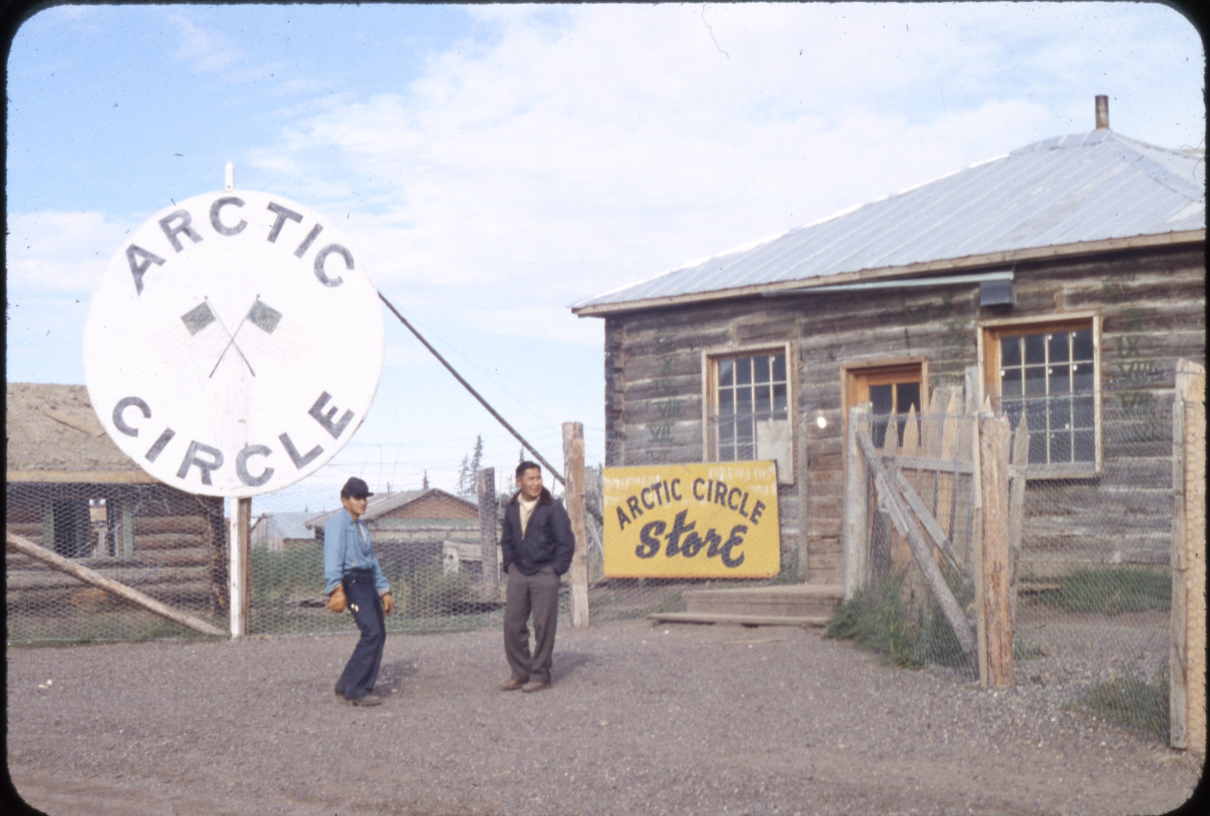 | 2157 — | [two Alaska Native men standing in front of Arctic Circle Store, sign for Arctic Circle at left; 1950s? At AFN 2016, location identified as Fort Yukon, with Thomas Williams at left and Paul Gabriel at right] |
| 2158 — | [people swimming in outdoor pool at Circle Hot Springs; 1950s] | |
| 2159 — | [swimmers with inner tubes in outdoor pool at Circle Hot Springs, buildings in background; 1950s] | |
| 2160 — | [Circle Hot Springs resort, with log building and house to right, garden plot in foreground; 1950s] | |
| 2161 — | [two log cabins, one with moose antlers over doorway, sign in left foreground for Arctic Circle Hot Springs, Alaska; 1950s] | |
| 2162 — | [log cabins along dirt road, man standing in center, sign for Arctic Circle Hot Springs, Alaska at left; 1950s] | |
| 2163 — | [woman kneeling at edge of outdoor pool at Circle Hot Springs, young man at left taking photograph with camera; 1950s] | |
| 2164 — | [vegetable garden] | |
| 2165 — | [row of log cabins along dirt road, Circle; 1950s] | |
| 2166 — | [close-up of signs posted on wall of log building, probably roadhouse or restaurant, signs include “Cocktail Bar No Minors Allowed,” “Get Your Old Mukluk Squeezings Here,” Pepsi-Cola, and notice of special election, Circle?] | |
| 2167 — | [two women sitting on stoop outside resort, one woman smoking cigarette and reading magazine, one sewing, sign on door reads “Non Registered guests must check in and pay at hotel desk before using pools, $1.00 per person”; print date Jul 64] | |
| 2168 — | [woman looking at sign for Arctic Circle Hot Springs, Alaska, greenhouse in background; print date Jul 64] | |
| 2169 — | [two women walking on dirt road, one woman holding camera, automobile parked next to outdoor pool in background; print date Jul 64] | |
| 2170 — | [men working in garden, buildings and hot water pipeline in background; print date Jul 64] | |
| 2171 — | [man and two women standing next to hot spring, one woman holding camera; print date Jul 64] | |
| 2172 — | [man standing next to hot water pipeline and wooden stairs; print date Jul 64] | |
| 2173 — | [man standing on wooden stairs next to water reservoir, woman on dirt path in center, garden, greenhouse, resort, and log cabins in background; print date Jul 64] | |
| 2174 — | [woman wearing bathing suit floating on inflatable raft in indoor pool; print date Aug 66] | |
| 2175 — | [woman wearing bathing suit floating on inflatable raft in indoor pool; print date Aug 66] | |
| 2176 — | [station wagon parked next to Wien Alaska Airlines Pilatus Porter airplane tail number N1409Z, Circle? print date Aug 66] | |
| 2177 — | [Wien Alaska Airlines Pilatus Porter airplane tail number N1409Z, Circle? print date Aug 66] | |
| 2178 — | [distant view of log cabins along dirt road, outdoor pool at far left, Circle; print date Aug 66] | |
| 2179 — | [street scene, with trucks parked outside General Store, other log buildings on road, Circle; print date Aug 66] | |
| 2180 — | [Wien Alaska Airlines Pilatus Porter airplane tail number N1409Z taking off, Circle? print date Aug 66] | |
| 2181 — | [outdoor pool at Circle Hot Springs Resort; print date Aug 66] | |
| 2182 — | [exterior of Circle Hot Springs Resort, with saloon and garden at right; print date Aug 66] | |
| 2183 — | [log structure with sign for Arctic Circle Hot Springs Gold Mine, garden in foreground; print date Aug 66] | |
| 2184 — | [view down dirt road, signs for Gas and Arctic Circle Hot Springs Alaska next to greenhouse at left, log cabin at right, woman sitting in automobile in foreground; print date Aug 66] | |
| 2185 — | [sign, “Welcome to Circle City,” Yukon River in background; print date Aug 66] | |
| 2186 — | [woman standing beside Yukon River, two boats pulled onto gravel riverbank, sign at right reads “4,214 mi. to Sunflower, Kansas”; print date Aug 66] | |
| 2187 — | [view down gravel beach along Yukon River, boat pulled onto riverbank in foreground, houses on bluff above at left; print date Aug 66] | |
| 2188 — | [tug and barge in dry dock, trash barrel next to automobile in foreground; print date Aug 66] | |
| 2189 — | [street scene, automobile pulling trailer parked next to boat in center, Yukon Trading Post and gas station in background, houses at right, wooden wall with sign for Norm’s Resort at left; print date Aug 66] | |
| 2190 — | [view down gravel road, two-story log house and automobile in center background; print date Aug 66] | |
| 2191 — | [woman wearing bathing suit in indoor pool at Circle Hot Springs; print date Aug 72] | |
| 2192 — | [woman wearing bathing suit standing next to indoor pool at Circle Hot Springs; print date Aug 72] | |
| 2193 — | [woman standing next to sign “Welcome to Circle City,” wagon wheels at right and left, Yukon River in background; print date Aug 72] | |
| 2194 — | [view down dirt road, General Store and gas station at right, heavy equipment at left, man and two women in left foreground; print date Aug 72] | |
| 2195 — | [helicopter in field, motorhome next to picnic table in foreground; print date July 10, 1990] | |
| 2196 — | [helicopter in field; print date July 10, 1990] | |
| 2197 — | [view across parking area to Circle Hot Springs Resort; print date July 10, 1990] | |
| 2198 — | [view across parking area to log buildings, cache and two cabins at right, one with cross and antlers over entrance, one with antlers and snowshoes; print date July 10, 1990] Steese Highway | |
| 2199 — | [bird’s eye view of small bridge on dirt road, log cabins on bend in road; print date Aug 66] | |
| 2200 — | [view down creek or drainage ditch to small wooden bridge, dirt road at left; print date Aug 66] | |
| 2201 — | [Davidson Ditch, with dirt road in foreground and building at extreme right; print date Aug 66] | |
| 2202 — | [view down dirt road, Davidson Ditch at left, buildings in distance; print date Aug 66] | |
| 2203 — | [section of Davidson Ditch descending hillside and turning at road, small culvert in foreground; print date Aug 66] | |
| 2204 — | [women and children with dogs outside of Quonset hut, possible dog show? print date Aug 66] | |
| 2205 — | [people standing next to woman on horseback, dog in center; print date Aug 66] Fort Yukon | |
 | 2206 — | [man carrying supplies past James A. Carroll Notions & Clothing, Fort Yukon] |
| 2207 — | [village scene, log building with sign “U.S. Post Office Fort Yukon Alaska 8 mi. north of the Arctic Circle,” log cabin and laundry hanging on clothesline at left, flowers planted in old tire in front of post office] | |
| 2208 — | [Fort Yukon Territorial School, with escape ladder to left of entrance, trash barrel next to bell on short tower at right, log building in distance] | |
| 2209 — | [view across clearing to building and antennas, sign on fence reads “Civil Aeronautics Administration Department of Commerce Ft. Yukon,” airstrip?] | |
| 2210 — | [village scene, with dogs in dog yard at left, sled frame on wooden boat in center, log cache in background] | |
 | 2211 — | [view down dirt road, with pedestrians, sign at right for Roadhouse, buildings along river in distance. At AFN 2016, buildings identified (front to back) as Hazel Ostrich’s log house, Cash & Carry store, and Sourdough Inn owned by James Carroll] |
| 2212 — | [tug and barge on Yukon River coming into dock] | |
| 2213 — | [Wien Alaska Airlines Douglas C-47 airplane tail number N91014 on airstrip, passengers with baggage at right next to two smaller airplanes and automobile] | |
| 2214 — | [man sitting on riverbank next to two floatplanes at dock, buildings in background] | |
| 2215 — | [log cabin and cache, with CAA antenna in background] | |
| 2216 — | [two men standing outside two-story log building with signs “Wien Alaska Airlines Fort Yukon Office” and “U.S. Customs”] | |
| 2217 — | [Wien Alaska Airlines Douglas C-47 airplane tail number N91014 on airstrip, “Arctic Liner Point Barrow” painted on nose] | |
| 2218 — | [Wien Alaska Airlines Douglas C-47 airplane tail number N91014 on airstrip, second airplane at left] | |
| 2219 — | [woman with camera taking photograph of airplane on airstrip, building and supplies in background] | |
| 2220 — | [automobiles parked outside two-story log building, sign at left reading “The Yukon Lodge”] B2/B6 | |
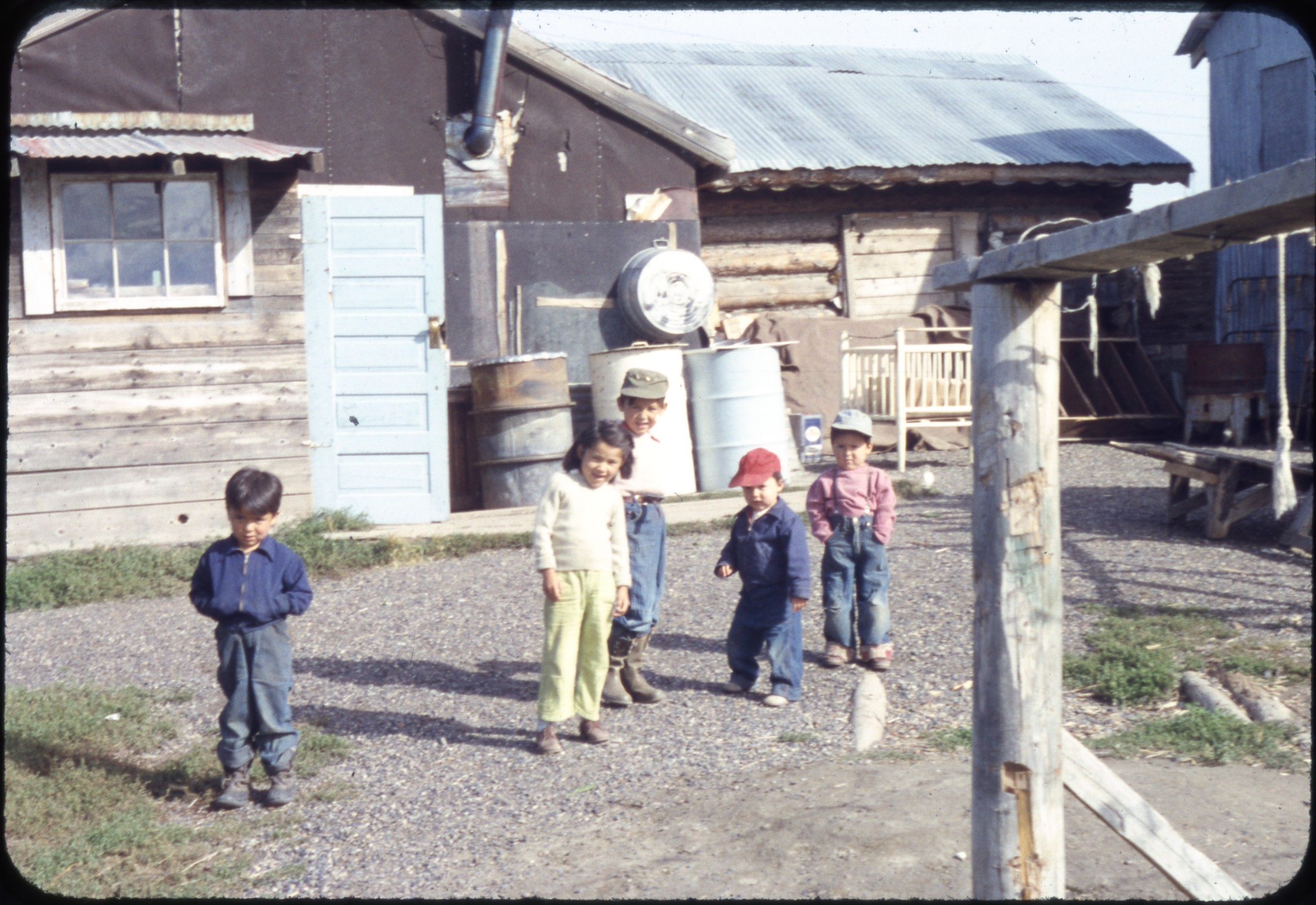 | 2221 — | [five children standing outside house, metal barrels along wall, crib in yard at right. At AFN 2016, identified as James and Fannie Carroll’s house, possibly the Carroll’s five children, Joseph, Clifton, Harry Sr., James Ward Sr., and Mabel] |
| 2222 — | [view down dirt road between log cabins] | |
| 2223 — | [fish wheel out of water in clearing] | |
| 2224 — | [riverboat Tanana at dock on Yukon River, man standing on riverbank in foreground] | |
| 2225 — | [barge and boats at dock on Yukon River] | |
| 2226 — | [man bringing riverboat pushing barge into dock on Yukon River] | |
| 2227 — | Aug 58, Fort Yukon [aerial of village] | |
| 2228 — | Aug 58, Fort Yukon [aerial of landing strip, airplane cockpit in foreground] | |
| 2229 — | Aug 58, Fort Yukon [aerial of village] | |
| 2230 — | Aug 58, Fort Yukon [aerial of village] | |
| 2231 — | Aug 58, Fort Yukon [aerial of White Alice radar site, with radomes] Eagle | |
| 2232 — | [automobile parked outside South Fork Lodge, building at right with sign for “General Store Groceries”] | |
| 2233 — | [building with interpretive sign reading “Eagle first incorporated town on the Yukon River and where first judicial district court was held and presided over by Judge Wickersham,” flagpole at right; print date Aug 72] | |
| 2234 — | [houses along dirt road, weathervane on house at right; print date Aug 72] | |
| 2235 — | [people walking into Eagle Museum, gravel road at right; print date Aug 72] | |
| 2236 — | [people standing on riverbank at right, gravel road in center, buildings including Eagle Museum at left; print date Aug 72] | |
| 2237 — | [view from top of bluff down to riverboats tied to riverbank; print date Aug 72] | |
| 2238 — | [interpretive panel for Fort Egbert next to building; print date Aug 72] | |
| 2239 — | [tourists in clearing, large building in background, fuel tank at right, probably Fort Egbert; print date Aug 72] | |
| 2240 — | [tourists and woman with small dog on gravel road, buildings in background, probably Fort Egbert; print date Aug 72] | |
| 2241 — | [barn with wooden shingles, small sign to left of entrance reading “ARC 3136”[?]; print date Aug 72] | |
| 2242 — | [tourists standing on gravel road, church and windmill at left, automobiles and houses at right, boy on bicycle in foreground; print date Aug 72] | |
| 2243 — | [view across field of wildflowers to houses including log cabin with sod roof and walled tent; print date Aug 72] | |
| 2244 — | [view down dirt road paralleling Yukon River, houses at right; print date Aug 72] | |
| 2245 — | [view down dirt road, church at left, with pickup truck parked next to tripod; print date Aug 72] | |
| 2246 — | [similar to .2245, with Yukon River at right; print date Aug 72] | |
| 2247 — | [exterior of log cabin with peaked roof and blue Alpine trim; print date Aug 72] | |
| 2248 — | [exterior of church, possibly St. Stephen’s Episcopal Church; print date Aug 72] | |
| 2249 — | [exterior of log cabin, with sign “Eagle City Hall built 1901”; print date Aug 72] | |
| 2250 — | [house on corner of Amundsen Street, with street sign in foreground; print date Aug 72] | |
| 2251 — | [distant bird’s eye view of village on Yukon River; print date Aug 72] | |
| 2252 — | [exterior of building, possibly schoolhouse, with bell tower and windmill] | |
| 2253 — | [street scene, building at left with interpretive sign; cf. .2233] | |
| 2254 — | [view across grassy airstrip to CAA building, sign in foreground “Watch for Aircraft,” Yukon River at right] | |
| 2255 — | [woman on steps of Biederman General Store] | |
| 2256 — | [automobiles, metal barrels, and fuel wood pile outside of house, Yukon River at left] | |
| 2257 — | [antique automobile parked next to log cabin, signs for Berry St. and First Ave. in foreground] | |
| 2258 — | [automobiles and bicycles parked outside Borg’s Lodge, with signs for Propane and U.S. Customs] | |
| 2259 — | [Volkswagen automobile parked outside of Eagle post office, houses in background; print date Aug 72] Northway | |
| 2260 — | [exterior of Northway School; print date Nov 63] | |
| 2261 — | [airport, with sign for Federal Aviation Agency Northway at left and buildings and antennas at right; print date Nov 63] | |
| 2262 — | [automobiles parked outside large single-story log building, antenna at far left; print date Nov 63] | |
| 2263 — | [exterior of Northway post office, with flagpole, storage tank, and horse at left; print date Oct 63] | |
| 2264 — | [military Jeep with tundra tires and doors made out of cardboard boxes parked in foreground, Airport Store building in background behind utility poles; print date Oct 63] | |
| 2265 — | [two amphibious airplanes with U.S. Coast Guard markings parked on airstrip next to building; print date Oct 63] Tanacross | |
| 2266 — | [boarded up building with sign “Tanacross Air Base Field Elevation 1544”; print date Jul 61] | |
| 2267 — | [view across Tanana River to village, man in skiff with outboard motor at left; print date Jul 61] | |
| 2268 — | [two men posed with automobile outside log cabin; print date Jul 61] | |
| 2269 — | [exterior of log cabin with sod roof; print date Jul 61] | |
| 2270 — | [log cabins; print date Jul 61] | |
| 2271 — | [view across Tanana River to buildings, including church; print date Jul 61] | |
| 2272 — | [view across Tanana River to buildings; print date Jul 61] | |
| 2273 — | [view across Tanana River to buildings, automobile parked in mud in foreground; print date Jul 61] Black Rapids Lodge | |
| 2274 — | Black Rapids Lodge [exterior of Rapids Hunting Lodge, fireweed in foreground, milepost at right with distances to Valdez, Fairbanks, Miller, and Donnelly; 1940s] | |
| 2275 — | [exterior of Bert and Mary’s Black Rapids Lodge in winter, sled frames on roof, antlers over entrance; print date Jun 60] | |
| 2276 — | [exterior of Black Rapids Lodge in summer, sled frames on roof, antlers over entrance; print date Aug 64] | |
| 2277 — | [dog yard with metal barrels, log building in background; print date Aug 64] | |
| 2278 — | [automobiles parked outside Black Rapids Lodge in summer, sled frames on roof, antlers over entrance; 1960s] Paxson | |
| 2279 — | [exterior of Paxson Lodge; 1940s] | |
| 2280 — | [exterior of Paxson Lodge, with signs for Chesterfield and Viceroy cigarettes and Zebra Sparklers; 1950s] | |
| 2281 — | [exterior of old Paxson Lodge, with sign “New Location 7/8 Mi. [arrow]”; 1950s] | |
| 2282 — | Apr. 1960 [trucks and automobiles parked outside Paxson Lodge in winter, snowshoes propped against wall near entrance] | |
| 2283 — | Apr. 1960 [trucks and helicopter parked outside Paxson Lodge in winter] | |
| 2284 — | [abandoned log building, former site of Paxson Lodge, sinking into permafrost; print date Jun 60] | |
| 2285 — | Paxsons [automobile and Navion A airplane tail number N8688H parked at gasoline pumps in front of Paxson Lodge, lodge and automobiles in background; print date Nov 60] | |
| 2286 — | [exterior of old Paxson Lodge; 1960s] | |
| 2287 — | [exterior of old Paxson Lodge; 1960s] Gakona | |
| 2288 — | Meier’s Lodge, 1954 [exterior of Meier Lodge, with antlers and snowshoes on walls, log cabin at left next to storage tank and gasoline pump] | |
| 2289 — | [antique wagon in front of log building, Meier’s Lodge; 1954] | |
| 2290 — | [view down paved highway, Meier’s Lodge at right; 1954] | |
| 2291 — | [bison in pen, gas station in background, Tok Junction?; print date Aug 64] | |
| 2292 — | [young boy holding American flag looking at bison in pen, Junction Inn in background; print date Aug 64] | |
| 2293 — | [woman and young boy holding American flag looking at bison in pen; print date Aug 64] Gulkana | |
| 2294 — | Gulkana [truck parked outside Gulkana Lodge, with antlers mounted over sign; 1940s] | |
| 2295 — | Gulkana [woman standing outside Gulkana Lodge in winter; 1940s] | |
| 2296 — | [exterior of Gulkana Lodge in summer; 1940s?] | |
| 2297 — | Gulkana [view across river to Gulkana Lodge; 1940s] | |
| 2298 — | [O’Harra Bus Lines bus and automobile parked outside Gulkana Lodge; 1940s] Joy | |
| 2299 — | [tourists outside Wildwood General Store in Joy; print date Aug 88] | |
| 2300 — | [burl wood for sale at Wildwood General Store; print date Aug 88] | |
| 2301 — | [young African-American boy holding rabbit, standing next to pens outside Wildwood General Store, sign “Welcome to Joy, Alaska” on ground in background; print date Aug 88] Manley | |
| 2302 — | [man, woman, and children next to station wagon in parking area, trucks and trailers in background next to highway bridge; print date Aug 74] | |
| 2303 — | [man and two women walking up boardwalk to Manley Lodge; print date Aug 74] | |
| 2304 — | [fish trap in river; print date Aug 74] | |
| 2305 — | [man loading fish into plastic bins; print date Aug 74] | |
| 2306 — | [man standing on riverbank next to metal barrels and fish cleaning table, riverboats at right, people next to truck in background, narrow walkway made from Marston matting in foreground; print date Aug 74] | |
| 2307 — | [fish camp on riverbank, wooden frame possibly fish trap in center, metal barrels and scale in foreground, laundry on poles at right, screened drying building in background; print date Aug 74] Dalton Highway | |
| 2308 — | [man and woman posed next to road sign “Mile Post 115 Dalton Highway You Are Crossing the Arctic Circle”; print date Aug 88] | |
| 2309 — | [man and young boy washing windows of bus on highway; print date Aug 88] | |
| 2310 — | [young boy washing windows on Royal bus with destination “Malemute Saloon” on highway; print date Aug 88] | |
| 2311 — | [Royal Hyway Tours bus on highway; print date Aug 88] | |
| 2312 — | [tree with sign “Farthest North Spruce Tree on the Alaska Pipeline Do Not Cut”; print date Aug 88] | |
| 2313 — | [bridge over Middle Fork Koyukuk River; print date Aug 88] | |
| 2314 — | [two tourists with cameras on highway, sign in background “No Services Beyond This Point”; print date Aug 88] | |
| 2315 — | [tourists next to Royal Hyway Tours bus on highway; print date Aug 88] | |
| 2316 — | [tourists standing and listening to musher standing next to sled in wooded area; print date Aug 88] Tanana | |
| 2317 — | [view down dirt road to river in distance; print date Jul 62] | |
| 2318 — | [two boats outside of dilapidated log cabin; print date Jul 62] | |
| 2319 — | [dog yard on riverbank, corrugated metal roof of cabin visible behind bluff, dock area visible across river; print date Jul 62] | |
| 2320 — | [man standing next to pickup truck, looking at washed out area on gravel road along river, boat tied at left, truck on road in background; print date Jul 62] | |
| 2321 — | [street scene, with Northern Commercial Co. at right, bicycle parked outside of log building at left, metal barrels and bank vault outside buildings; print date Jul 62] | |
| 2322 — | [view down riverbank, man and boy in skiff at left, man standing on bank in center, buildings at right, riverboat at dock in background; print date Jul 62] | |
| 2323 — | [view down road paralleling river, sinking boardwalk at left, buildings at right, belfry in distance; print date Jul 62] | |
| 2324 — | [view down riverbank, fish trap in foreground, skiff tied to bank next to boardwalk over culvert, buildings at right, riverboat at dock in background; print date Jul 62] | |
| 2325 — | [Tanana Post Office, with bicycle parked at left, U.S. Air Force truck parked at right; print date Jul 62] | |
| 2326 — | [view down riverbank, with fuel wood, skiff, and metal barrels at left, pedestrians on road in front of buildings, automobiles parked in background near belfry; print date Jul 62] | |
| 2327 — | [view down riverbank, logs in foreground, man in skiff in center, metal barrels and buildings at right, riverboat at dock in background; print date Jul 62] | |
| 2328 — | [view of river, young girl standing next to logs on beach at right, man riding in skiff in center, tug and barge in background; print date Jul 62] | |
| 2329 — | [three Quonset huts, metal barrels at right, bell tower with cross at left; print date Jul 62] | |
| 2330 — | [riverboat and barges docked at riverbank, metal barrels and heavy equipment at right, barge and tug under way in distance; print date Jul 62] | |
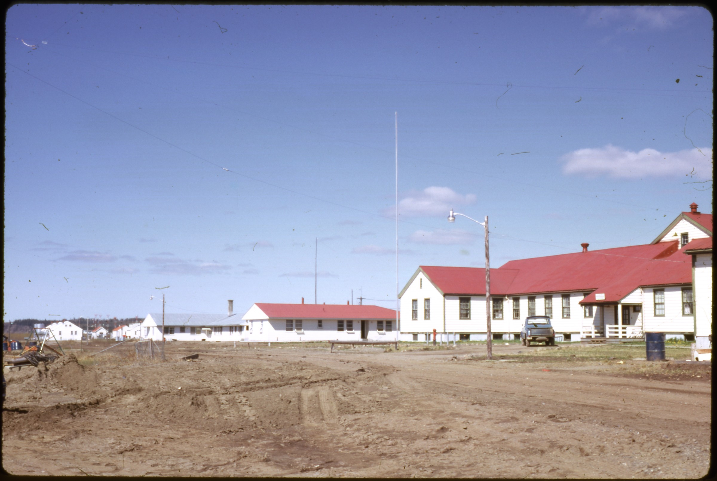 | 2331 — | [white buildings with playground equipment at left; print date Jul 62. At AFN 2016, buildings identified as (right to left) hospital, men’s quarters, nurses’ quarters for elders, and FAA buildings] |
| 2332 — | [Wien Alaska Airlines airplane taxiing on landing strip, “Arctic Line Fairbanks” on nose; print date Jul 62] Hughes | |
| 2333 — | 1967 [Wien Alaska Airlines Douglas DC-3 airplane tail number N21748 on landing strip, “City of Nome” painted on nose] | |
| 2334 — | [view across gravel area to row of houses and buildings, metal barrels in background left; 1967] | |
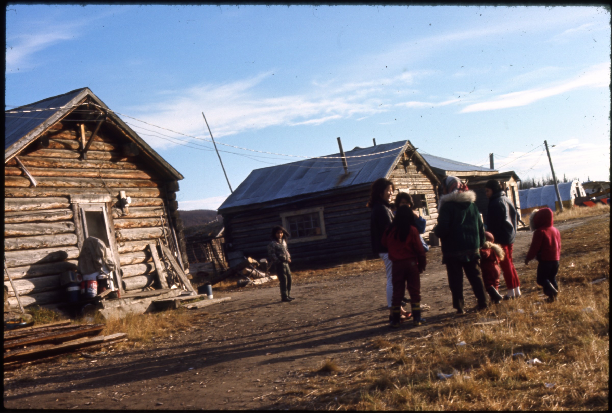 | 2335 — | [villagers standing outside log cabin, Quonset hut in background; 1967] |
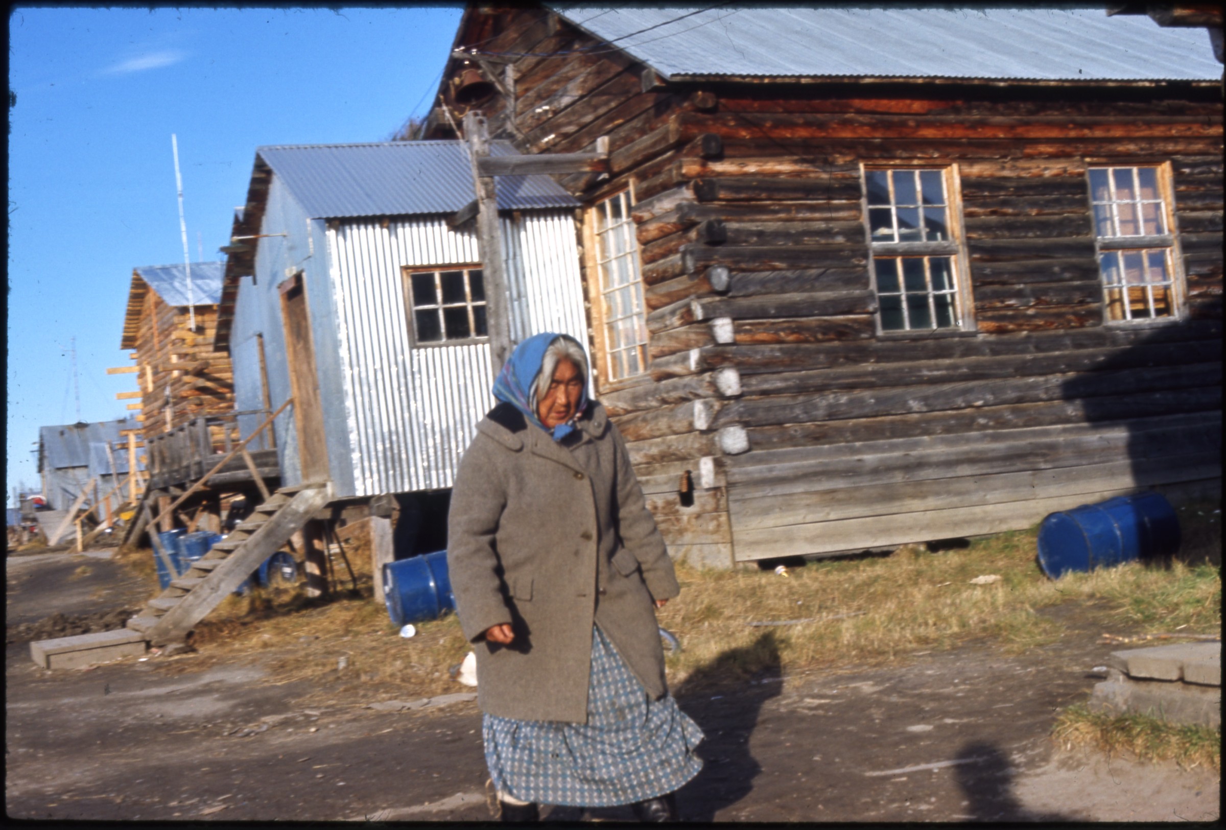 | 2336 — | [Alaska Native woman wearing headscarf and woolen coat walking past log cabin with corrugated metal arctic entry, metal barrels on ground; 1967. At AFN 2016, identified as Julia Cleaver Isaac Oldman] |
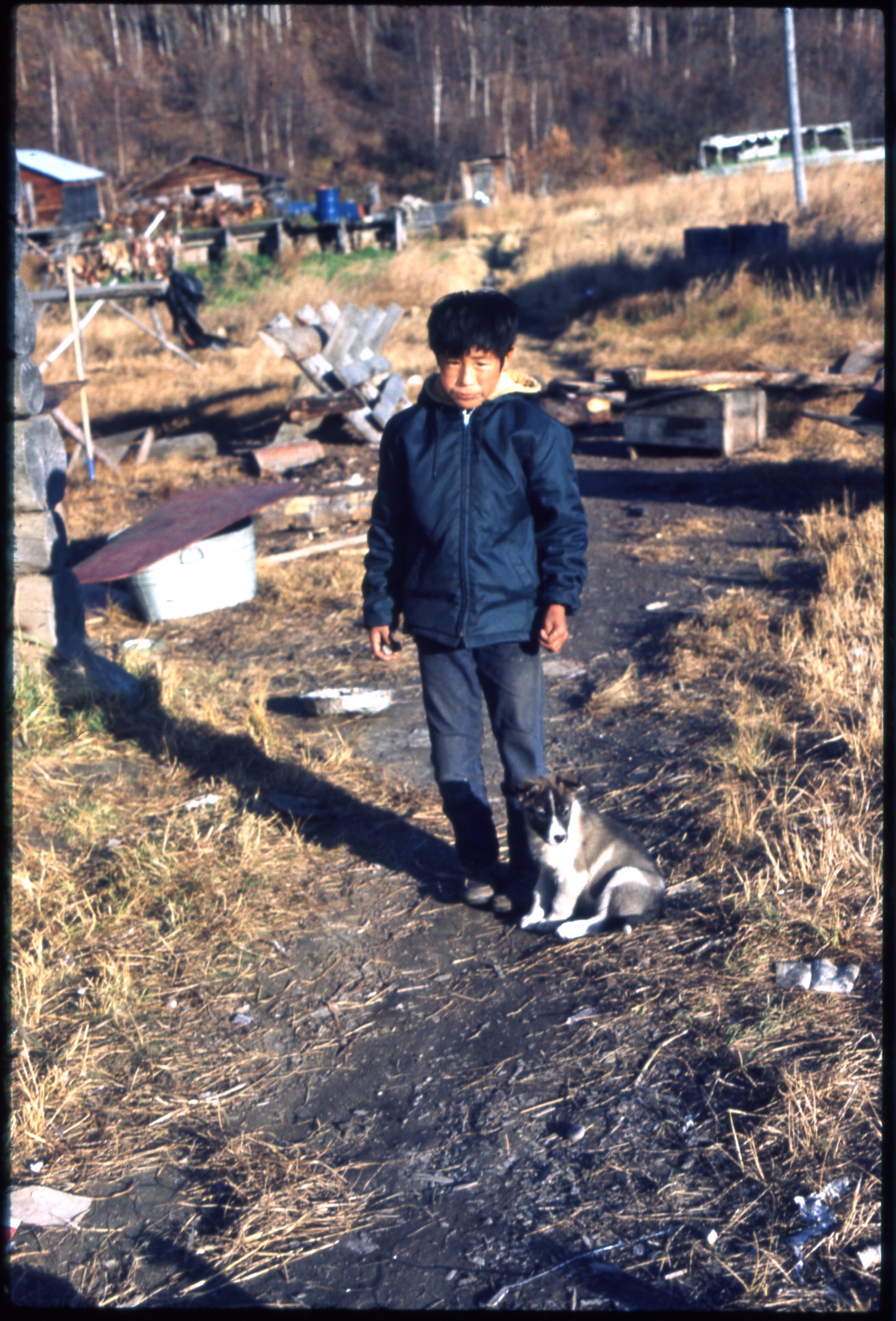 | 2337 — | [Alaska Native boy with puppy dog, buildings in background; 1967. At AFN 2016, identified as possibly Jimmy Beetus] |
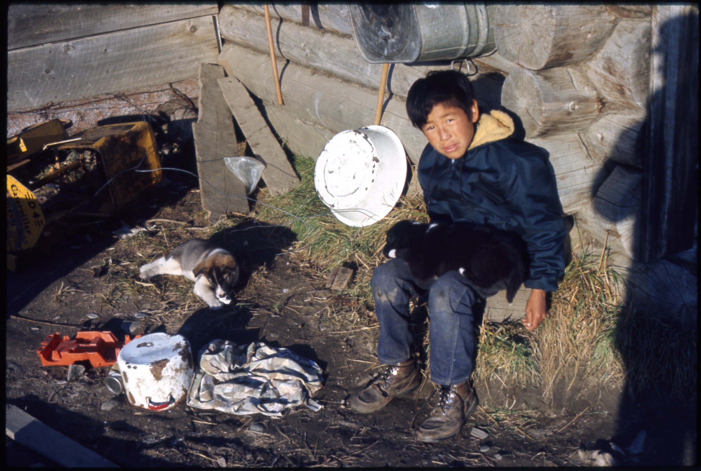 | 2338 — | [Alaska Native boy with puppy dogs outside log cabin, wash basins on wall; 1967] |
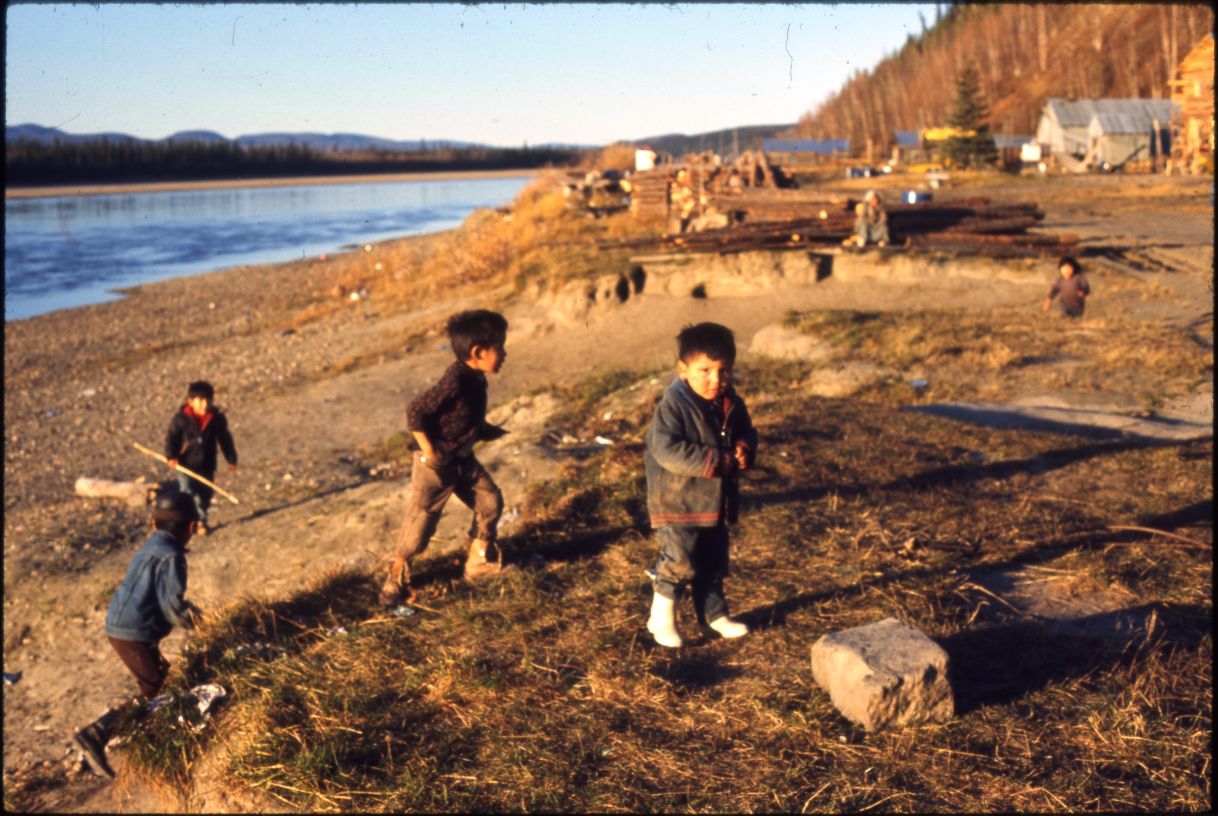 | 2339 — | [young Alaska Native children playing on riverbank; 1967. At AFN 2016, boy looking at camera tentatively identified as Bob Beetus] |
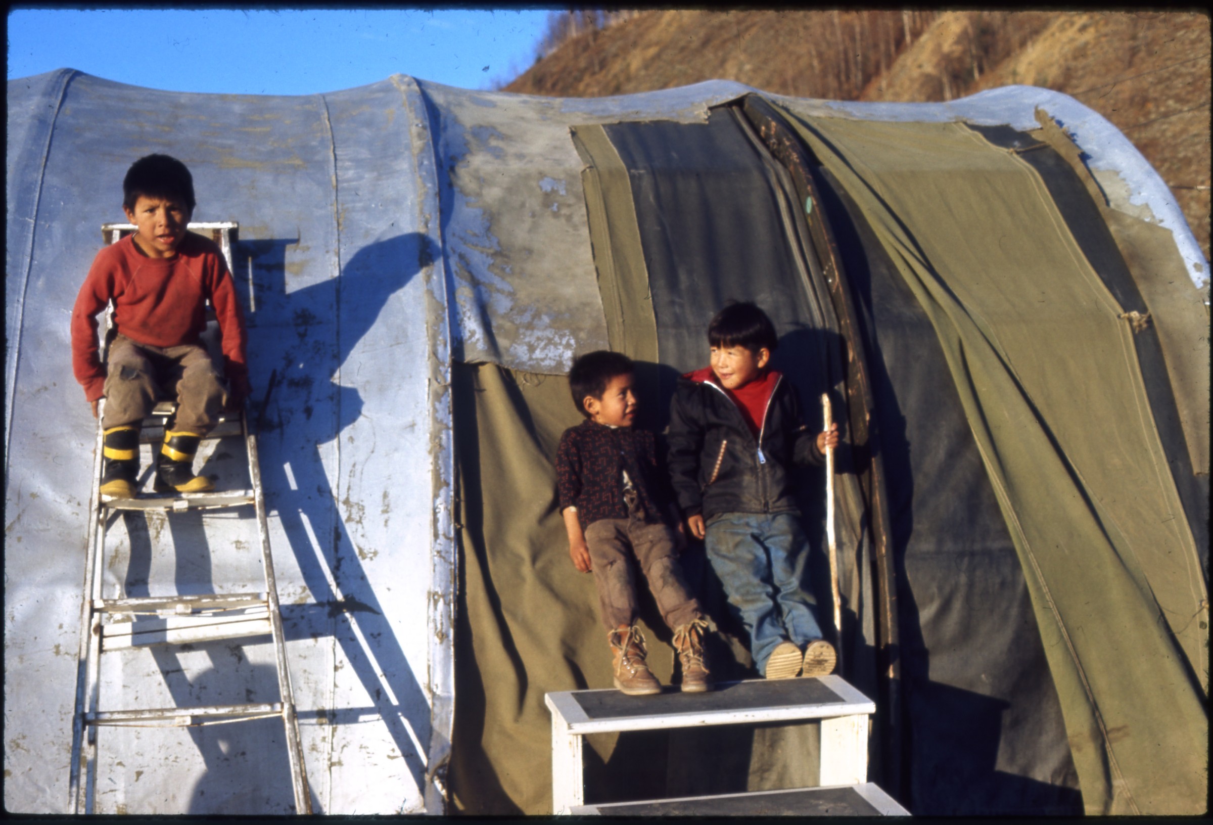 | 2340 — | [three young Alaska Native boys next to Quonset hut, boy at left standing on ladder, boys at right on moveable steps; 1967] |
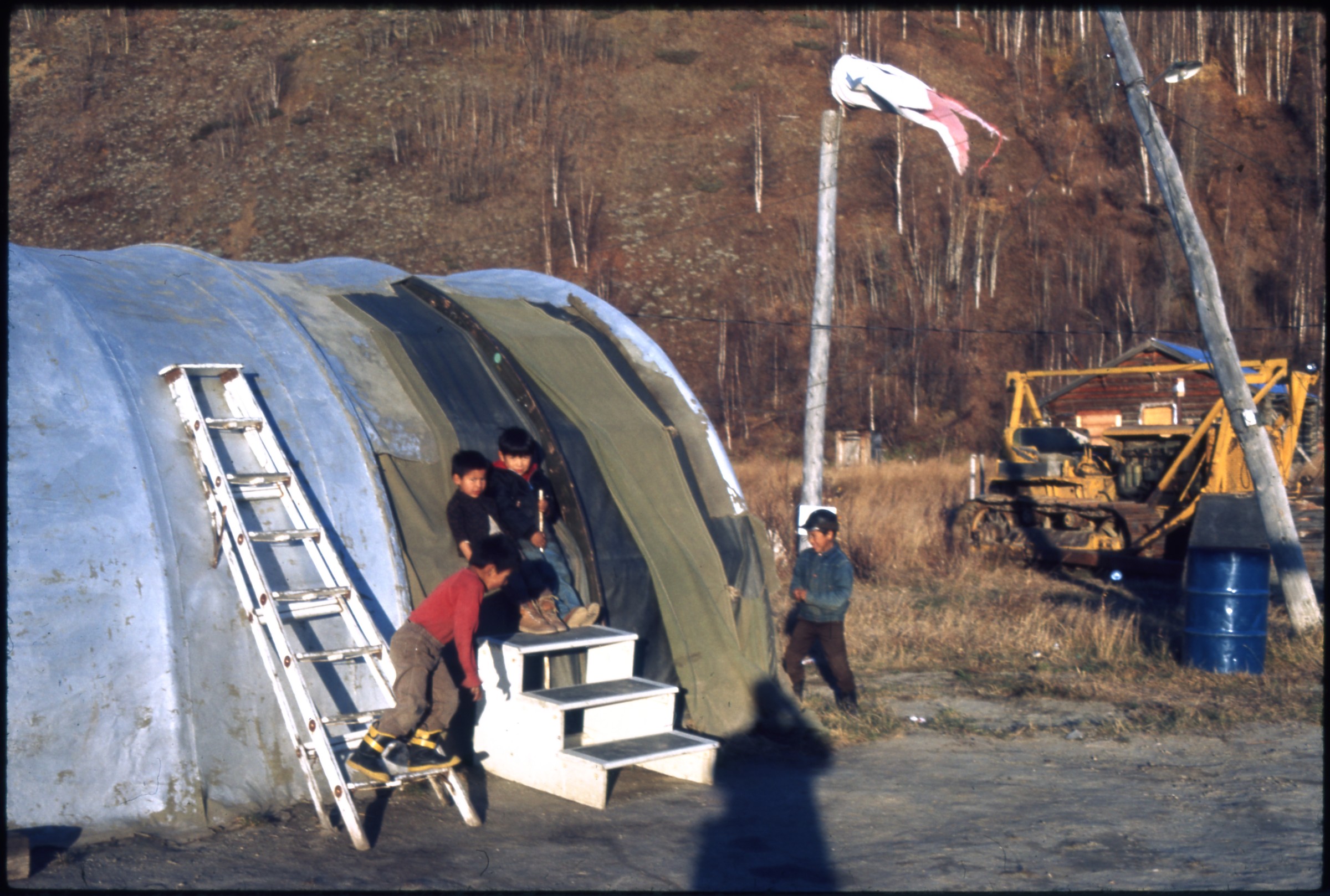 | 2341 — | [four young Alaska Native boys next to Quonset hut, boy at left standing on ladder, boys at right on moveable steps, windsock on pole in center, heavy equipment at right, photographer’s shadow in foreground; 1967] |
| 2342 — | [puppy dogs in yard next to log cabin, person visible in cabin window; 1967] | |
| 2343 — | [view down riverbank, meat drying on rack next to fish cleaning table at left, fuel wood pile in center, children standing next to skiff at right; 1967] | |
| 2344 — | [three children running on gravel beach along riverbank, skiff tied at right; 1967] | |
| 2345 — | [view down riverbank, with log cabins at right, wood piles and metal barrels in center, woman standing next to drying rack in background; 1967] | |
 | 2346 — | [children playing on gravel beach next to skiff; 1967] |
| 2347 — | [young Alaska Native boy fishing with stick and line on gravel beach next to skiff; 1967] | |
 | 2348 — | [children playing on gravel beach next to skiff; 1967] |
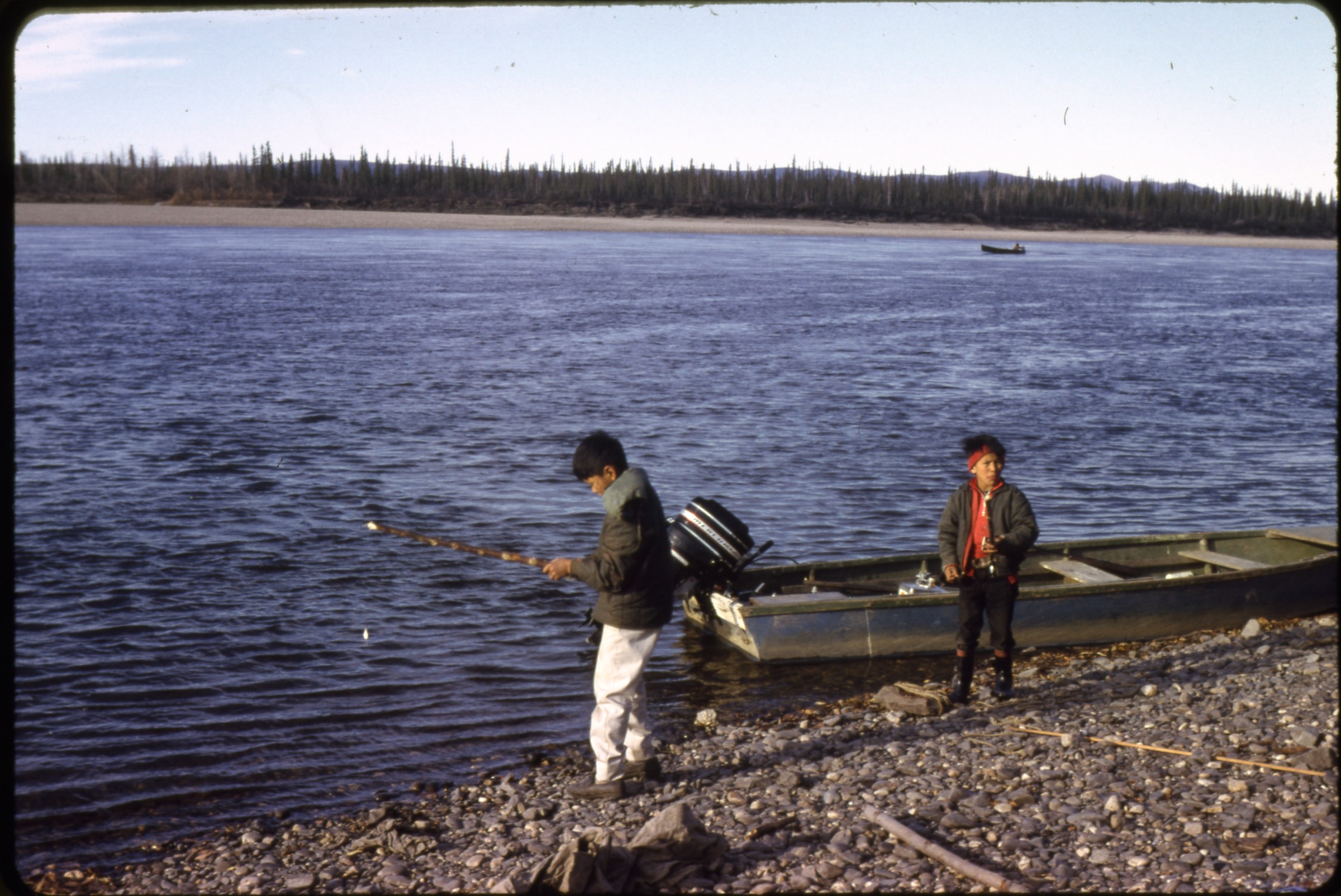 | 2349 — | [two Alaska Native boys fishing with stick and line on gravel beach next to skiff; 1967] |
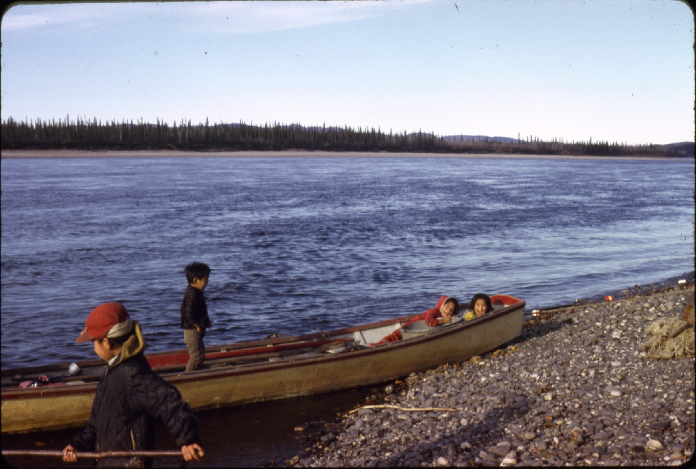 | 2350 — | [Alaska Native children playing on skiff on gravel beach; 1967] |
| 2351 — | [log cache, drying rack, and log pile in yard; 1967] McGrath | |
| 2352 — | Oct. 1957 [man standing in entrance of McGuire Tavern, possibly Jack McGuire, antlers mounted on wall, pile of supplies at right] | |
| 2353 — | [street view, with Morris Roadhouse, Lamp Post Cocktail Lounge, and Harris Inn at right, two children playing in road, fuel wood pile at left] | |
| 2354 — | [barge and skiffs at dock on riverbank] | |
| 2355 — | [exterior of McGrath Tavern and McGrath Roadhouse] | |
| 2356 — | [view across gravel landing strip at airport, with three small airplanes parked in distance, metal barrels and buildings next to river] | |
| 2357 — | [street view, with Morris Roadhouse, Lamp Post Cocktail Lounge, and Harris Inn at left, metal barrels at right] | |
| 2358 — | [street view, with house and McGrath Trading Post at right] Road trip to Alaska, 1947 | |
| 2359 — | Alcan 1947 [map of Western Canada and Alaska, with yarn and thumb tacks indicating route] | |
| 2360 — | [two-story log building with sign “U.S. Customs Immigration Offices” and flagpole] | |
| 2361 — | [automobiles at Canadian customs, sign for Carway Café and Cabins at left, Carway, Alberta] | |
| 2362 — | Kuskanax [military vehicles parked outside log building, possibly camp, with sign over entrance “Kuskanax Meals Lunches,” possibly Nakusp, B.C.?] | |
| 2363 — | [view across field to buildings and grain elevators] | |
| 2364 — | [street view, with businesses at left, grain elevators at right, Athabasca, B.C.?] | |
| 2365 — | [view down dirt road, truck parked at left, Slave Lake sign in foreground, buildings in background] | |
| 2366 — | [view from car ferry to far riverbank, men and automobile in foreground, Smoky River?] | |
| 2367 — | [men and automobile on car ferry, Smoky River?] | |
| 2368 — | [automobile exiting car ferry, Smoky River?] | |
| 2369 — | [view down hill on dirt road to car ferry, Smoky River?] | |
| 2370 — | [milepost on edge of field, with mileages to Edmonton, Peace River, Sturgeon Lake, Grande Prairie] | |
| 2371 — | [road sign next to yard, houses and truck in background, Dawson Creek, Peace River, and Grande Prairie listed on sign] | |
| 2372 — | [road sign on utility pole, “1 mi. to Pouce Coupe, B.C. Government Headquarters,” south of Dawson Creek] | |
| 2373 — | [Pouce Coupe Trading Co., E. Hunter General Merchant, with signs for Buckingham Fine Cut tobacco and Export Cigarettes] | |
| 2374 — | [view across bridge at Peace River, mile 35, sign in foreground] | |
| 2375 — | [street scene with businesses including Titus General Merchant, Fort St. John, mile 49] | |
| 2376 — | [street scene with businesses and boardwalk at left, small red outbuilding with sign “Fort St. John Fire Dept.”, milepost in foreground with mileages to Montney, Ft. Nelson, Watson Lake, Whitehorse, Fairbanks] | |
| 2377 — | [road sign “Welcome to Fort St. John”] | |
| 2378 — | [street scene with trucks and automobiles parked outside of businesses including Spinney Trucking and Leach’s Tire-Radiator Service, Fort St. John?] | |
| 2379 — | [view across small bridge at Blanchard River, mile 93] | |
| 2380 — | [warehouses at Alaska Highway maintenance camp, mile 101] | |
| 2381 — | [bridge at Sikanni River, mile 138] | |
| 2382 — | [view down gravel highway at mile 175, automobile in foreground] | |
| 2383 — | [BYN bus stop at camp, possibly Trutch, mile 201] | |
| 2384 — | [log cabins in grove, with sign at right “Dine at Lum-Abner, Cabins,” mile 233] | |
| 2385 — | [log cabins and gas station, gasoline pump at left, signs reading “Lum-Abner,” “Cabins- Rooms,” “Coca-Cola,” “B-A Service Products,” “Goodyear Tires”] | |
| 2386 — | [Hudson’s Bay Company, with flagpole and weather vane, possibly old Fort Nelson, mile 296] | |
| 2387 — | [view down gravel highway lined with utility poles, service area at left, sign at right for RCAF Detachment Fort Nelson, mile 300] | |
| 2388 — | [sign “Royal Canadian Air Force Fort Nelson B.C. Elevation 1240 feet,” building in grove at right, sign for garage at left] | |
| 2389 — | [view down highway to suspension bridge, possibly Liard River Bridge, mile 496] | |
| 2390 — | [view across bridge at Smith River, mile 513.3] | |
| 2391 — | [automobile and pickup truck parked outside wooden building with sign “B.Y.N. Staging Route Post Coal River Mile 533”] | |
| 2392 — | [interpretive sign next to highway bridge at Contact Creek, mile 588] | |
| 2393 — | [wood-sided station wagon and bus parked outside Liard Lodge, with signs for “B.Y.N. Staging Route Post,” “Café” and “Meals,” gasoline pump at right, mile 620] | |
| 2394 — | [gasoline pump and log cabins, Liard Lodge, mile 620] | |
| 2395 — | [log church with bell tower, swing set at right, log cabin at left, directional sign in foreground for “Trading Post” and “Mission”, possibly Lower Post at mile 620] | |
| 2396 — | [Yukon-B.C. border sign, mile 627] | |
| 2397 — | [sign for “Watson Lake Hotel, Trading Post, Beer Parlor, Dining Room, Gas & Oil,” log building at right, mile 635] | |
| 2398 — | [milepost signs at Watson Lake] | |
| 2399 — | [milepost signs at right, sign for Watson Lake Aerodrome at left, structures and storage tank in background] | |
| 2400 — | [milepost signs at Watson Lake] | |
| 2401 — | [automobiles parked outside Watson Lake Hotel] | |
| 2402 — | [bird’s eye view of buildings along dirt highway, water in background, possibly junction to Watson Lake or Teslin? Cf. .2416] | |
| 2403 — | [closer view of log roadhouse seen in .2402] | |
| 2404 — | [closer view of log cabins seen in .2402] | |
| 2405 — | [closer view of log roadhouse and garden seen in .2402] | |
| 2406 — | [log roadhouse at right, horses in paddock at left, metal barrels in center. Cf. .2402] | |
| 2407 — | [automobiles outside Watson Lake Hotel in winter; later than 1947] | |
| 2408 — | [view across Upper Liard River bridge, mile 642.6] | |
| 2409 — | [view across highway to Upper Liard Hotel, gasoline pump in front of lodge, garage at left] | |
| 2410 — | [signs on highway in front of Upper Liard Lodge, reading “Garage Expert Mechanic Welding Tires Tubes Gas & Oil,” “Heated Storage,” “The Bush Statler Diner-Tavern,” “Fishing Licence [sic] Here”] | |
| 2411 — | [view across Upper Liard River bridge, mile 642.6] B3 | |
| 2412 — | [view across bridge at Smart River, mile 759] | |
| 2413 — | [view across bridge at Nisutlin River, mile 803.5] | |
| 2414 — | [signs along highway, reading “Welcome to 804 Rooms Meals Gas Oils Welding Garage Accommodations Boating and Fishing” and “High Pressure Gas Line,” fireweed in foreground, buildings in background, mile 804] | |
| 2415 — | [sign along highway for “Taylor & Drury General Merchants Teslin Y.T.,” mile 804.5] | |
| 2416 — | [bird’s eye view of building with sign for Taylor & Drury, log building under construction at right, water in background, Teslin] | |
| 2417 — | [view across water to town in distance, possibly Carcross, mile 865.5] | |
| 2418 — | [view across bridge at Yukon River, building at right, mile 897.4] | |
| 2419 — | [automobile stopped on highway at mile 918] | |
| 2420 — | [bird’s eye view of maintenance camp or military camp near large bridge, possibly Whitehorse, mile 919] | |
| 2421 — | [view down riverbank, two riverboats at dock, one in dry dock at left, Whitehorse?] | |
| 2422 — | [man straddling railroad track in yard in foreground, paddle steamers in dry dock in background, Whitehorse] | |
| 2423 — | [view down railroad tracks in yard, tanker cars at right, Whitehorse] | |
| 2424 — | [paddle steamer Nasutlin at dock, Whitehorse] | |
| 2425 — | [street scene, automobiles outside businesses including Capitol Theatre, possibly Whitehorse] | |
| 2426 — | [paddle steamer Aksala in dry dock, Whitehorse] | |
| 2427 — | [woman standing next to bow of paddle steamer Yukoner in dry dock, Whitehorse] | |
| 2428 — | [paddle steamer Yukoner in dry dock, Whitehorse] | |
| 2429 — | [street scene, automobiles parked outside businesses, gas station at right, possibly Whitehorse] | |
| 2430 — | [Royal Canadian Mounted Police station, with buildings and Quonset hut, Whitehorse?] | |
| 2431 — | [street scene, automobiles parked outside businesses including Whitehorse Grill, Whitehorse] | |
| 2432 — | [street scene, automobiles parked outside businesses including The Inn and Burns & Co. Butchers, possibly Whitehorse] | |
| 2433 — | [log cabins along road, Whitehorse] | |
| 2434 — | [log buildings on corner lot with sign “Christ Church, the Old Log Church,” Whitehorse] | |
| 2435 — | [two-story log home with striped awnings at the corner of Steele St. and Third Ave., Whitehorse] | |
| 2436 — | [log cabins along road, Jeep parked at right, Whitehorse] | |
| 2437 — | [log buildings along highway, with sign at right “Champagne Chambers & Davis Trading Post and General Merchant,” Champagne Landing, mile 974] | |
| 2438 — | [spirit houses in graveyard, Champagne Landing] | |
| 2439 — | [woman walking next to Indian spirit houses in graveyard, Champagne Landing] | |
| 2440 — | [signpost at highway junction, indicating direction to Fairbanks and Haines, possibly Haines Junction, mile 1016] | |
| 2441 — | [road sign for Burwash Landing Hotel-Café, mile 1093] | |
| 2442 — | [road signs reading “21 miles to Snag” and “Royal Canadian Air Force Intermediate Aerodrome Snag 16 mi.”, summer, near mile 1188] | |
| 2443 — | [road sign, “Royal Canadian Air Force Intermediate Aerodrome Snag 16 mi.”, spring] | |
| 2444 — | [view down driveway to lodge, sign in foreground for “Nell Kelly’s Roadhouse Meals Cabins Drinks Beaver Creek Trading Post,” mile 1202] | |
| 2445 — | [boundary markers along highway, Alaska-Yukon border, mile 1221] | |
| 2446 — | [automobile parked at gas station, with signs reading “Imperial Gal. 65 [cents] Per, Store Café We Sell For Less,” “Sweet Caporal Cigarettes,” “Ogden’s Fine Cut Tobacco,” “Dominion Royal Tires”] | |
| 2447 — | [automobiles at highway checkpoint, sign at left reading “Stop RCMP Police Control Station”] | |
| 2448 — | [small building along highway, sign at left for RCMP, mountain in distance] | |
| 2449 — | [church buildings along highway] | |
| 2450 — | [view down dirt highway, possibly railroad cars at left, businesses at right, possibly Alberta] | |
| 2451 — | [automobiles and trucks parked at roadhouse or camp] | |
| 2452 — | [gasoline pump in front of buildings, possible roadhouse or camp] | |
| 2453 — | [automobiles parked in front of roadhouse, antique wagon at left] | |
| 2454 — | [walled tents and buildings in pine grove along dirt road] | |
| 2455 — | [view across river to camp or roadhouse with cabins] | |
| 2456 — | [view across field to buildings, possibly homestead] | |
| 2457 — | [view down gravel road to log buildings, possibly Champagne Landing?] | |
| 2458 — | [view down dirt road, buildings in far distance, possibly Alberta] | |
| 2459 — | [view down dirt road through town, small garden at right, possibly Alberta] | |
| 2460 — | [two buildings along highway, fuel wood pile in back] | |
| 2461 — | [buildings, possible maintenance camp along highway] | |
| 2462 — | [bird’s eye view of hydraulic mining operation, buildings in distance] | |
| 2463 — | [row of houses along gravel road, mountains in distance] | |
| 2464 — | [similar to .2463] | |
| 2465 — | [trucks and supplies at maintenance camp] | |
| 2466 — | [buildings at maintenance camp, spools of wire on ground in center] | |
| 2467 — | [similar to .2466] | |
| 2468 — | [bird’s eye view of maintenance camp or military camp] | |
| 2469 — | [bird’s eye view of storage tanks at maintenance camp or processing plant] | |
| 2470 — | [dilapidated log cabins behind wooden fence along gravel highway, lake in background, mountains in distance, possibly Champagne Landing] | |
| 2471 — | [dilapidated log cabins behind wooden fence along gravel highway, lake in background, mountains in distance, possibly Champagne Landing] | |
| 2472 — | [cluster of log cabins, boat at right] | |
| 2473 — | [view down hill to small wooden bridge over river] | |
| 2474 — | [bird’s eye view of long, low continuous span bridge over river or lake] | |
| 2475 — | [truss bridge over river] | |
| 2476 — | [view down gravel highway to truss bridge over river] | |
| 2477 — | [scenic of highway with mountains] | |
| 2478 — | [scenic of highway with mountains] | |
| 2479 — | [scenic of highway with mountains] | |
| 2480 — | [scenic of highway, automobile in foreground, building in distance] | |
| 2481 — | [scenic, with river canyon and bridge in distance at right, military vehicle on highway at left] | |
| 2482 — | [scenic of highway through flat area, automobile at left, Alberta?] | |
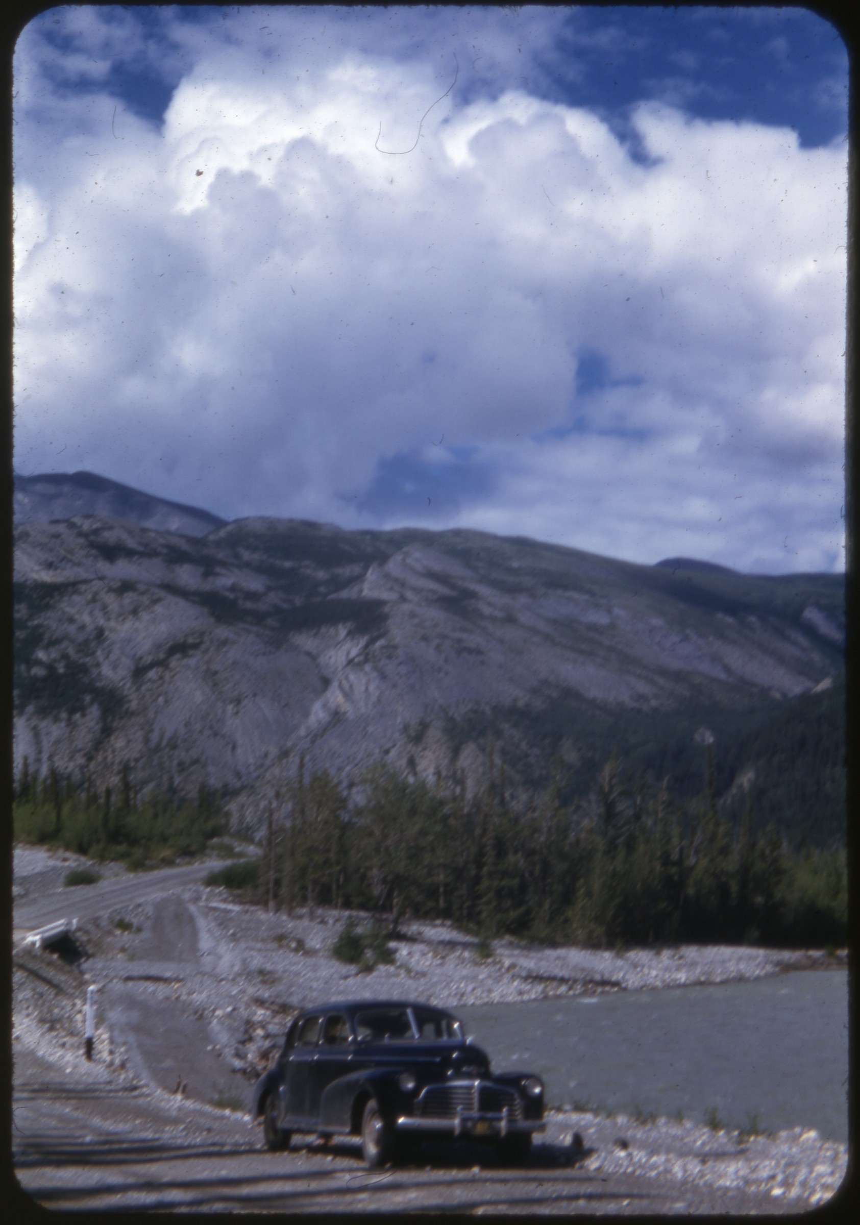 | 2483 — | [automobile parked on highway, small bridge over river at right, mountains in background] |
| 2484 — | [bird’s eye view of highway through mountainous area, automobile parked in center, buildings in distance] | |
| 2485 — | [scenic of highway in mountainous area] | |
| 2486 — | [automobile parked on highway in forested area] | |
| 2487 — | [scenic of highway through taiga, mountains in background] | |
| 2488 — | [woman walking across highway in mountainous area, small tripod at right] | |
| 2489 — | [scenic of highway in mountainous area] | |
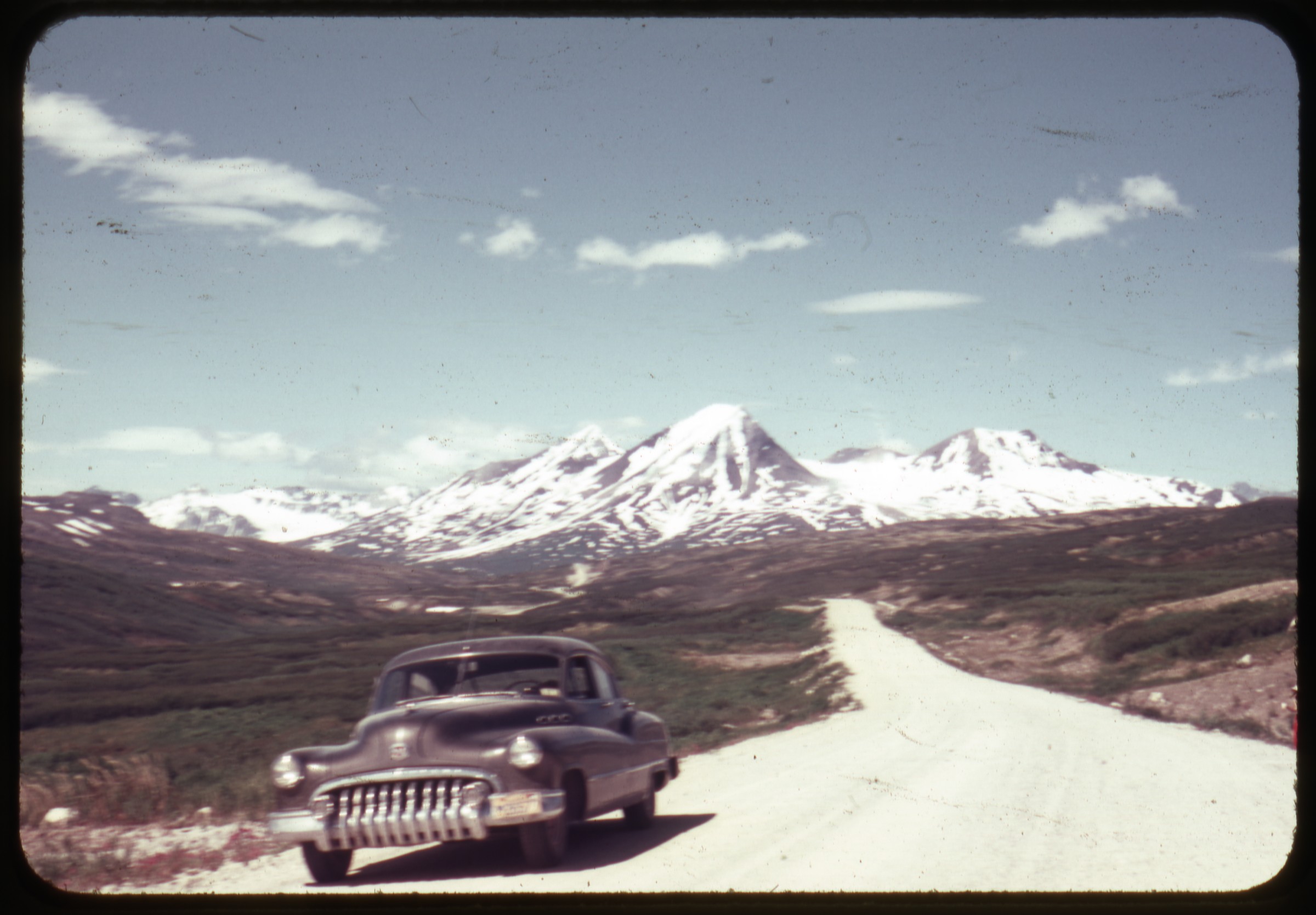 | 2490 — | [automobile parked on highway in mountainous area] |
| 2491 — | [scenic of mountains, automobile in foreground] | |
| 2492 — | [scenic of highway in mountainous area, buildings in middle ground] | |
| 2493 — | [scenic of lake or river and mountains, automobile in foreground] | |
| 2494 — | [bird’s eye view of river canyon, automobile parked on riverbank at right] | |
| 2495 — | [scenic of lake, automobile in foreground, buildings in middle ground right with windmill] | |
| 2496 — | [scenic of highway with lake and mountains] | |
| 2497 — | [two men posed with antlers and sled frame next to Quonset hut] | |
| 2498 — | [man in military uniform standing next to dressed carcass laid out on overturned boat, truck in background] | |
| 2499 — | [woman washing her hands in rocky stream, thermos on rocks] | |
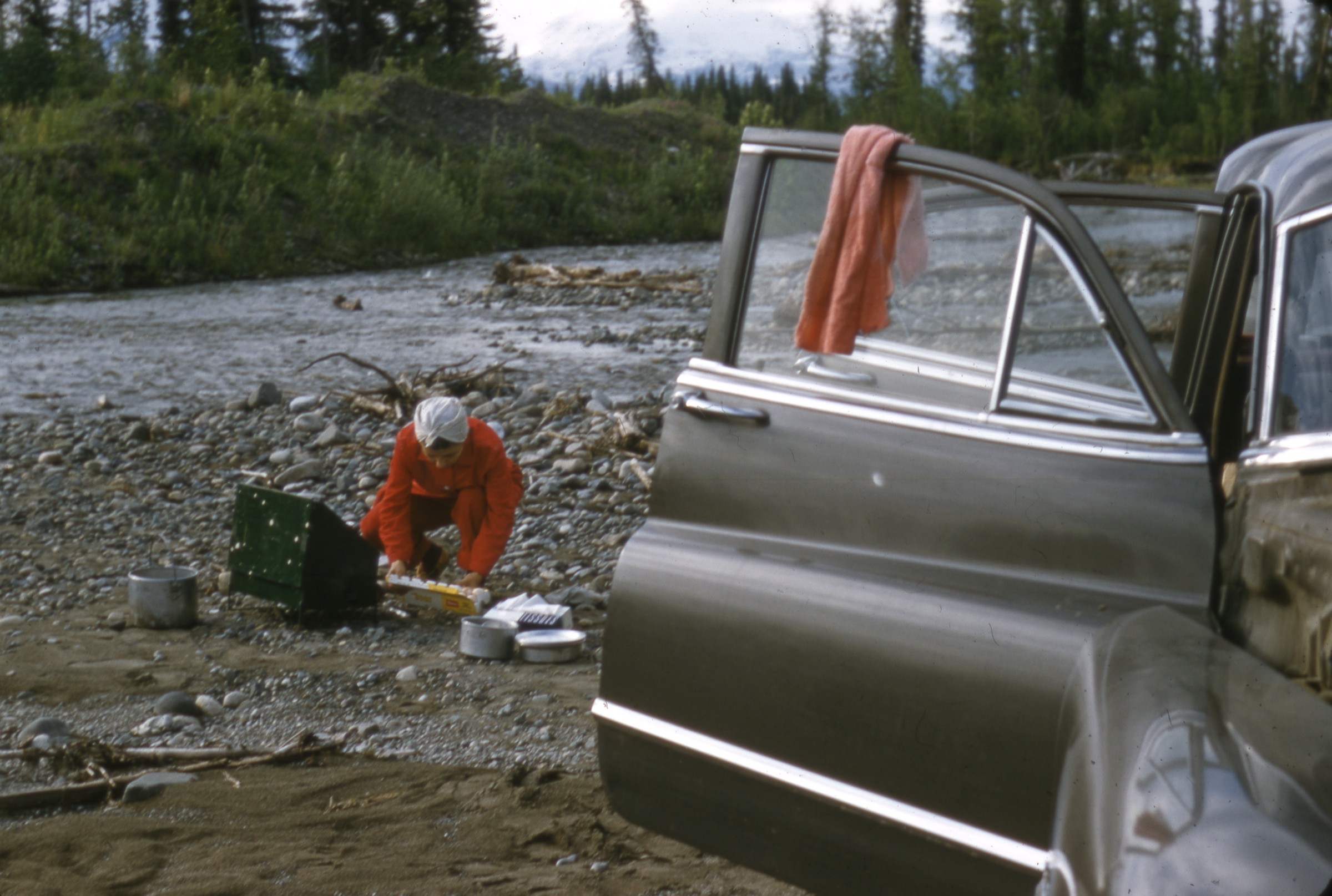 | 2500 — | [woman preparing meal on propane camp stove on gravel riverbank along creek, automobile in foreground] Boundary |
| 2501 — | [two men looking at bear skin nailed to wall of Alaska-Yukon Border Bar, snowshoes and airplane propeller propped against wall, antlers mounted over entrance, boards and ladders piled at left] | |
| 2502 — | [log cabin with signs “Boundary, Alaska” and “Boundary Lodge,” wagon wheel and bicycle in foreground] | |
| 2503 — | [exterior of Boundary Lodge, with weather vane on roof, wagon wheels and bicycle in front, trucks parked at right, metal barrels at left] | |
| 2504 — | [view down road past cabins and outbuildings] | |
| 2505 — | [view down dirt road across grassy hills] Dawson and Dawson Creek | |
| 2506 — | Dawson Creek, 1947 [railroad depot, railroad cars on tracks at left, Orlo J. Reid Cartage truck in foreground] | |
| 2507 — | [Mile 0 milepost, Dawson Creek, B.C.] | |
| 2508 — | [bird’s eye view of Dawson, Yukon] | |
| 2509 — | [bird’s eye view of Dawson] | |
| 2510 — | [dilapidated building, possibly Dawson] | |
| 2511 — | [dilapidated buildings including 3 rd Ave. Blacksmith Shop, Dawson] | |
| 2512 — | [antique automobile in yard, Dawson] | |
| 2513 — | [small white crosses with names in cemetery, three fresh graves in foreground, Dawson] | |
| 2514 — | [view down gravel road past dilapidated buildings, Dawson] | |
| 2515 — | [dilapidated buildings including 3 rd Ave. Blacksmith Shop and Red Feather Saloon, Dawson] | |
| 2516 — | [dilapidated hotel, Dawson] | |
| 2517 — | [automobile parked at Stop sign across from Mme. Tremblay’s Store, Dawson] | |
| 2518 — | [street scene with businesses including Mme. Tremblay’s Store, Dawson] | |
| 2519 — | [street scene, with J. & T. Adair Wholesale Hardware building at left, sign for Caley’s in distance, Dawson] | |
| 2520 — | [man looking at restored antique wagon outside Dawson Artscraft store] | |
| 2521 — | [dilapidated building with sign “No. 4 Warehouse store opposite K.T.M. Co. store that sells most everything,” restored antique steam pumper fire engine at left, Dawson] | |
| 2522 — | [woman looking at restored antique steam pumper fire engine, Dawson] | |
| 2523 — | [restored antique steam pumper fire engine, laundry on clothesline in background, Dawson] | |
| 2524 — | [man and woman in pilot house of riverboat] | |
| 2525 — | [boat deck, possibly car ferry, man visible in pilot house at left] | |
| 2526 — | [view from car ferry looking back to shore, group of people sitting next to tractor, metal barrels on riverbank, buildings in background] | |
| 2527 — | [dredge and tailings pile] | |
| 2528 — | [woman standing on dredge] | |
| 2529 — | [bird’s eye view of man in riverboat approaching small platforms in river] | |
| 2530 — | [close-up of dredge] | |
| 2531 — | [close-up of dredge] | |
| 2532 — | [dredge, man with shirt off at right] | |
| 2533 — | [dredge, with dilapidated buildings in foreground, tailings piles at right] | |
| 2534 — | [log cabins in wooded area, small wooden pedestrian bridge at right] | |
| 2535 — | [view down river, fish camp and paddle steamers in distance at left] | |
| 2536 — | [fish camp on riverbank, with fish trap out of water] | |
| 2537 — | [man and woman looking at fish trap on riverbank] | |
| 2538 — | [paddle steamers including Julia B. dry docked along riverbank, Dawson City] | |
| 2539 — | [close-up of sternwheel on paddle steamer, Dawson City] | |
| 2540 — | [man operating small riverboat, Dawson City] | |
| 2541 — | [car ferry under way on river, Dawson City] | |
| 2542 — | [car ferry under way on river, Dawson City] | |
| 2543 — | [distant view of dredge and tailings piles; print date Jul 64] | |
| 2544 — | [view of mining operation, tailings piles in foreground, buildings in distance; print date Jul 64] | |
| 2545 — | [bird’s eye view of mined area, dredge at far right; print date Jul 64] | |
| 2546 — | [buildings, outbuildings, and automobiles, possibly at mining operation; print date Jul 64] | |
| 2547 — | [view across river to Dawson waterfront, riverboat dry docked at right; print date Jul 64] | |
| 2548 — | [car ferry under way on river; print date Jul 64] | |
| 2549 — | [motor home loading onto car ferry McQuesten; print date Jul 64] | |
| 2550 — | [dredge and tailings piles in wooded area; print date Jul 64] | |
| 2551 — | [tourists inside hall for show, possibly Gaslight Follies; print date Jul 64] | |
| 2552 — | [tourists gathered around gambling hall recreation, with man in gold rush era costume; print date Jul 64] | |
| 2553 — | [tourists gathered around gambling hall recreation, with man in gold rush era costume; print date Jul 64] | |
| 2554 — | [theater show in progress; print date Jul 64] | |
| 2555 — | [theater show in progress; print date Jul 64] | |
| 2556 — | [theater show in progress; print date Jul 64] | |
| 2557 — | [woman in gold rush era costume; print date Jul 64] | |
| 2558 — | [painted theater backdrop, “Welcome to Dawson”; print date Jul 64] | |
| 2559 — | [theater show in progress; print date Jul 64] | |
| 2560 — | [bird’s eye view of stage with painted theater backdrop, “Welcome to Dawson”; print date Jul 64] | |
| 2561 — | [theater show in progress; print date Jul 64] | |
| 2562 — | [young man in gold rush era costume sitting at piano; print date Jul 64] | |
| 2563 — | [waitress in gold rush era costume; print date Jul 64] | |
| 2564 — | [bartender in gold rush era costume; print date Jul 64] | |
| 2565 — | [street scene, with automobiles parked outside Flora Dora Café; print date Jul 64] | |
| 2566 — | [street scene, banner over street advertising Mme. Tremblay’s Store; print date Jul 64] | |
| 2567 — | [exterior of Robert Service’s cabin; print date Jul 64] | |
| 2568 — | [street scene; print date Jul 64] | |
| 2569 — | [bird’s eye view of river valley; print date Jul 64] | |
| 2570 — | [view across beach to riverboat getting under way, sternwheel of paddle steamer in left foreground; print date Jul 64] | |
| 2571 — | [bird’s eye view of river valley; print date Jul 64] | |
| 2572 — | [sign for Jack London Exhibit next to picket fence and sign for Jack London Centre; print date Jul 89] | |
| 2573 — | [tourists on boardwalk in front of log cache and log cabin with sod roof; print date Jul 89] | |
| 2574 — | [signs for Jack London Centre and Jack London Square behind white picket fence; print date Jul 89] | |
| 2575 — | [street scene, banner for Gaslight Follies over street, post office at left; print date Jul 89] | |
| 2576 — | [street scene, post office on corner across street; print date Jul 89] | |
| 2577 — | [street scene, banner for Gaslight Follies over street; print date Jul 89] | |
| 2578 — | [street scene, sign for post office in foreground, Mme. Tremblay’s Store across street; print date Jul 89] | |
| 2579 — | Robert Service cabin [tourists sitting outside cabin; print date Jul 89] | |
| 2580 — | [horse-drawn carriage on street; print date Jul 89] | |
| 2581 — | [rear view of horse-drawn carriage going down street; print date Jul 89] | |
| 2582 — | [street scene with Westminster Hotel and Midnight Sun Hotel; print date Jul 89] | |
| 2583 — | [street scene with Westminster Hotel and Midnight Sun Hotel; print date Jul 89] | |
| 2584 — | [paddle steamer Keno in dry dock; print date Jul 89] | |
| 2585 — | [view down riverbank, small boats tied at right, warehouses at left, large boulder on path in center foreground; print date Jul 89] | |
| 2586 — | [automobiles and campers in parking lot next to buildings with signs for “Gifts” and “Café”; print date Jul 89] Klondike Highway | |
| 2587 — | [view down railroad tracks to paddle steamer Tutshi in dry dock, Carcross; print date Aug 80] | |
| 2588 — | [service station on highway, with trucks parked outside building with Michelin sign and Shell gasoline station; print date Jul 89] | |
| 2589 — | [view down highway in rain, maintenance camp or police station at right; print date Jul 89] | |
| 2590 — | [tourists aboard paddle steamer Klondike in dry dock; print date Jul 89] | |
| 2591 — | [view across gravel parking area along river to family picnicking next to pickup truck with camper shell and motorhome; print date Jul 89] | |
| 2592 — | [van parked next to boat launch on river; print date Jul 89] | |
| 2593 — | [exterior of Stewart Crossing Lodge; print date Jul 89] | |
| 2594 — | [distant view of automobiles parked outside of log lodge on highway, sign for Whispering Willows RV Campground; print date Jul 89] | |
| 2595 — | [view across highway to trucks parked outside of Stewart Crossing Lodge, with gasoline pumps; print date Jul 89] | |
| 2596 — | [woman walking towards log building, possibly Whispering Willows RV Campground; print date Jul 89] Cassiar Highway | |
| 2597 — | [motorhome on dirt highway, bridge in foreground; print date Jul 82] | |
| 2598 — | [children on bicycles outside Dease Lake Service; print date Jul 82] | |
| 2599 — | [motorhome on highway headed toward Esso gas station and hotel; print date Jul 82] | |
| 2600 — | [woman standing next to monument with wooden arch carved with “Jade Capital of the World”, Lillooet?; print date Jul 82] | |
| 2601 — | [street scene with automobiles, pedestrians, and buildings; print date Jul 82] | |
| 2602 — | [view across parking area on street to large communications antenna; print date Jul 82] | |
| 2603 — | [street scene with provincial buildings at left; print date Jul 82] | |
| 2604 — | [trucks parked outside Cassiar Community Church; print date Jul 82] | |
| 2605 — | [Cassiar Centennial Arena, flagpole at right; print date Jul 82] | |
| 2606 — | [view around corner on highway to mining operation; print date Jul 82] B4 Unidentified locations | |
| 2607 — | Homer TACAN, Apr. 1956 [truck parked outside small building in spring, metal barrels on ground, equipment on roof, tactical air navigation system] | |
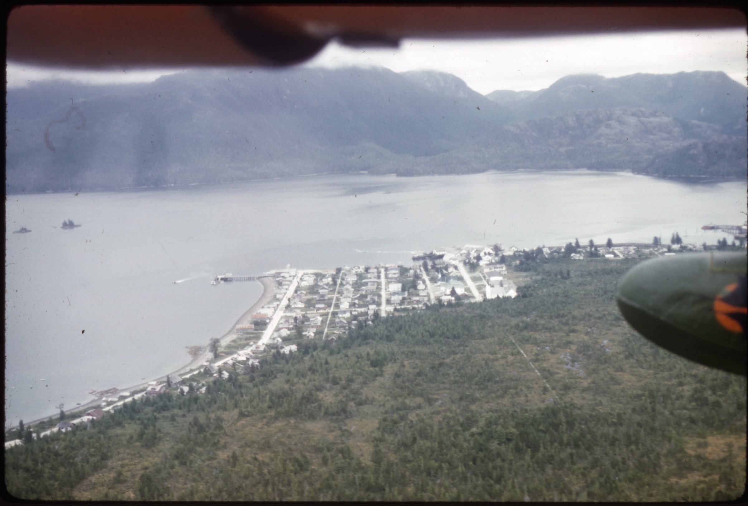 | 2608 — | [aerial of town on water; print date Aug 61; at AFN 2016, identified as Metlakatla on Annette Island, with Duncan church in right foreground of town] |
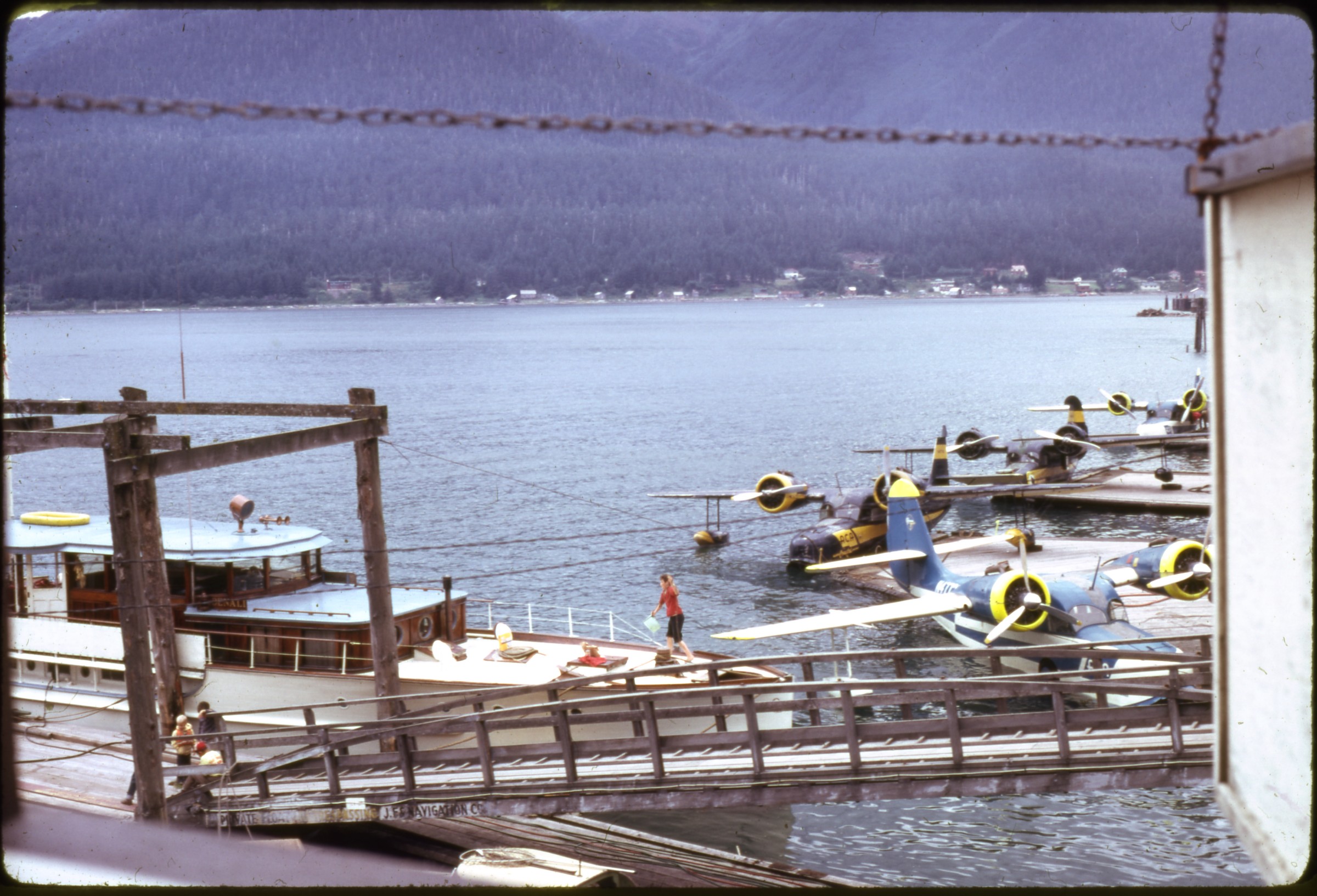 | 2609 — | [large boat and amphibious airplanes at docks on channel; print date Aug 61. At AFN 2016, identified as Juneau docks looking toward Douglas, boat docked in left foreground as M/V Princeton Hall] |
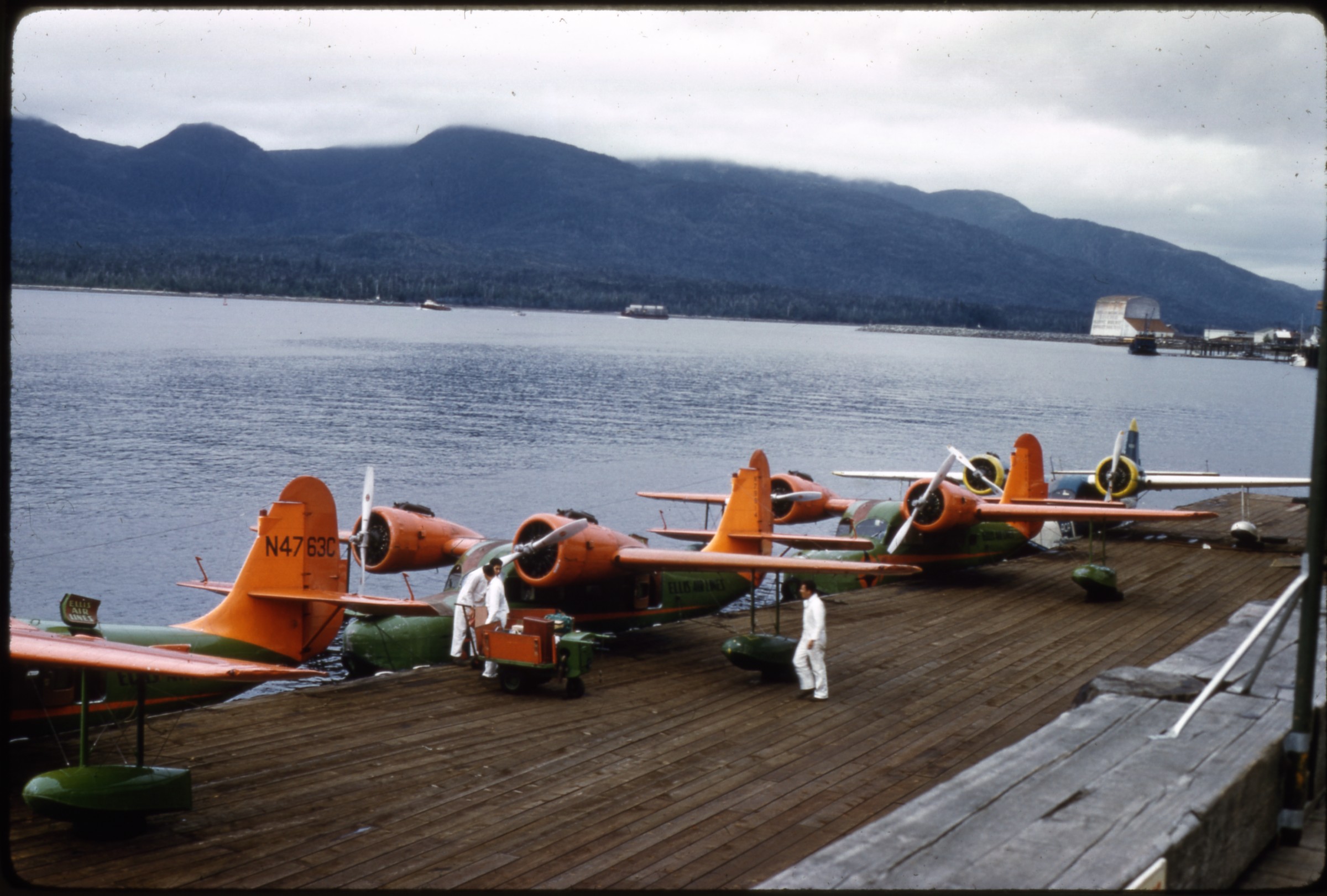 | 2610 — | [crewmen working on Ellis Air Lines amphibious airplanes on dock in channel; print date Aug 61. At AFN 2016, identified as Ketchikan] |
| 2611 — | [Ellis Air Lines amphibious airplane on dock; print date Aug 61] | |
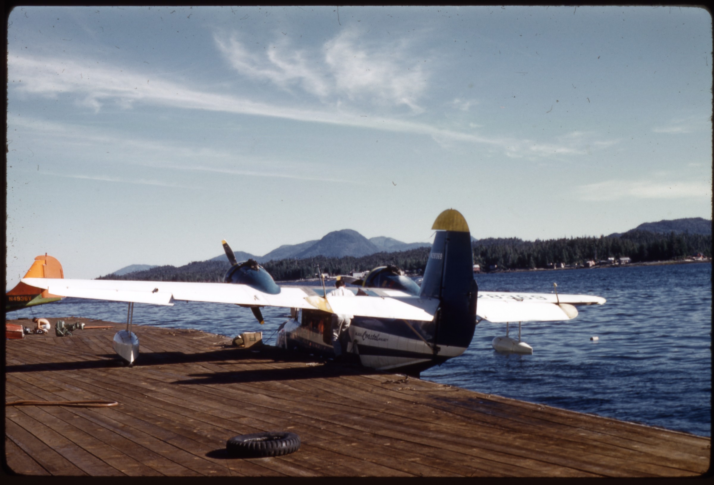 | 2612 — | [Alaska Coastal Airlines Grumman Goose amphibious airplane tail number N28369 at dock; print date Aug 61. At AFN 2016, identified as Ketchikan, with Annette Island in background] |
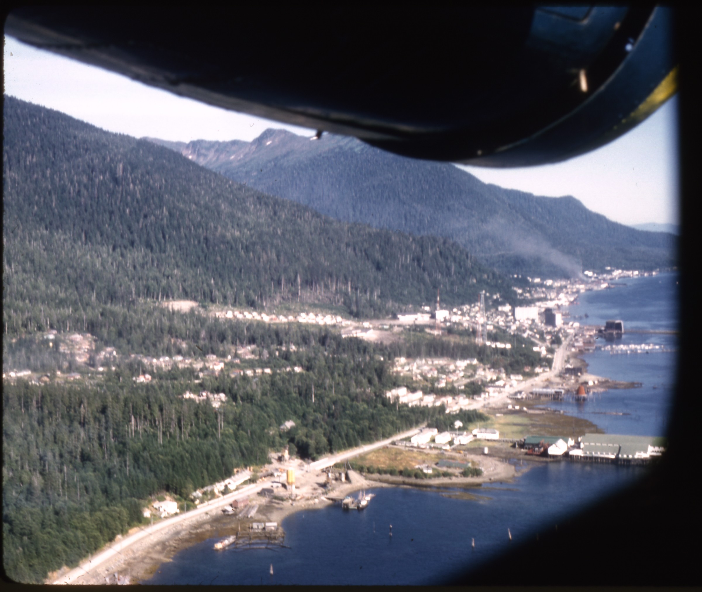 | 2613 — | [aerial of town on channel; print date Aug 61. At AFN 2016, identified as Ketchikan] |
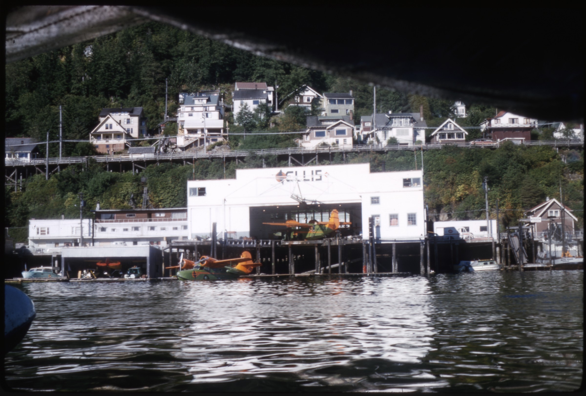 | 2614 — | [Ellis Air Lines hangar at docks, with amphibious airplanes; print date Aug 61. At AFN 2016, identified as Ketchikan] |
| 2615 — | [Ellis Air Lines Grumman Goose amphibious airplane tail number N79901 at hangar; print date Aug 61] | |
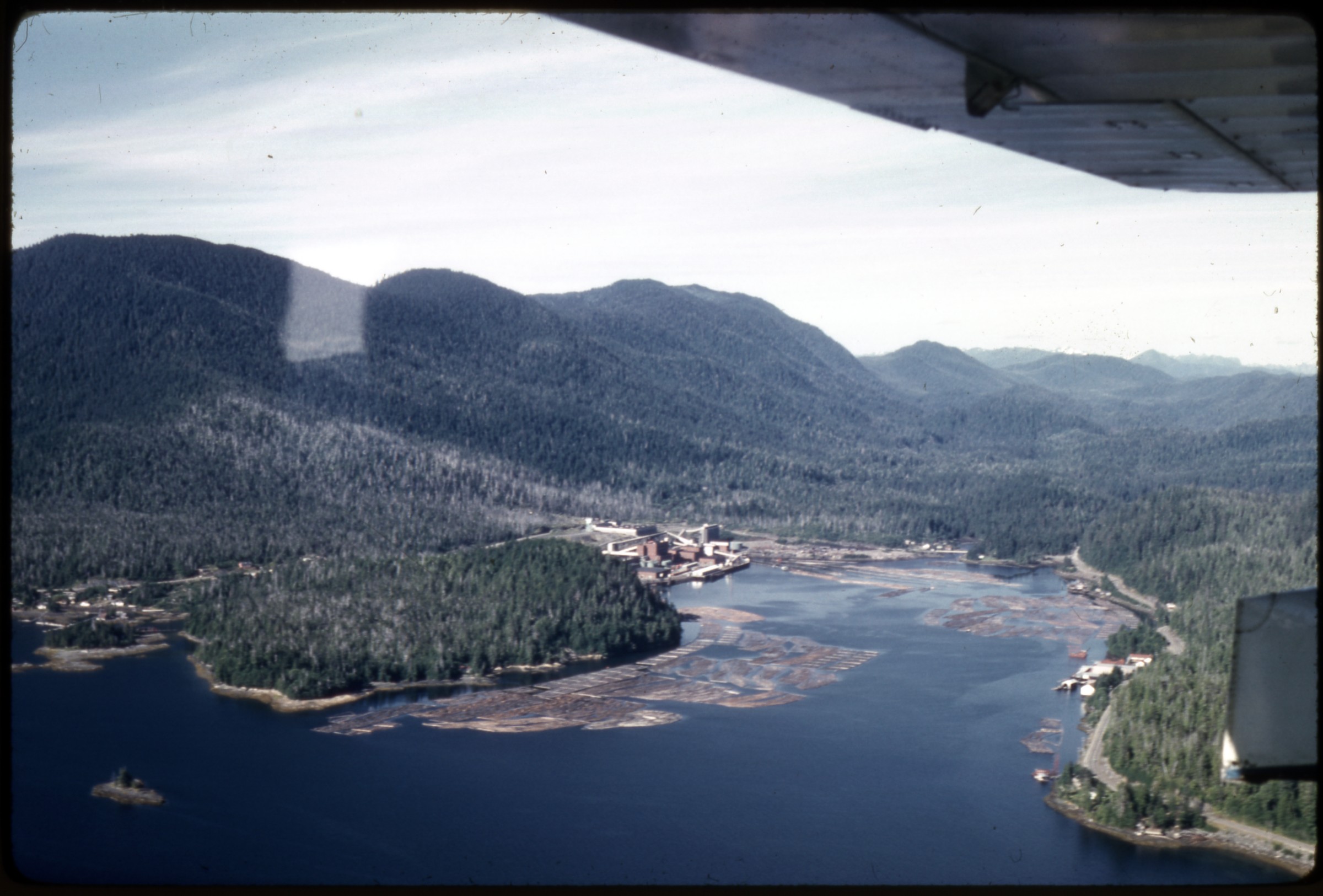 | 2616 — | [aerial of lumber mill on coastline; print date Aug 61. At AFN 2016, identified as Ward Cove, Ketchikan Pulp Company pulp mill] |
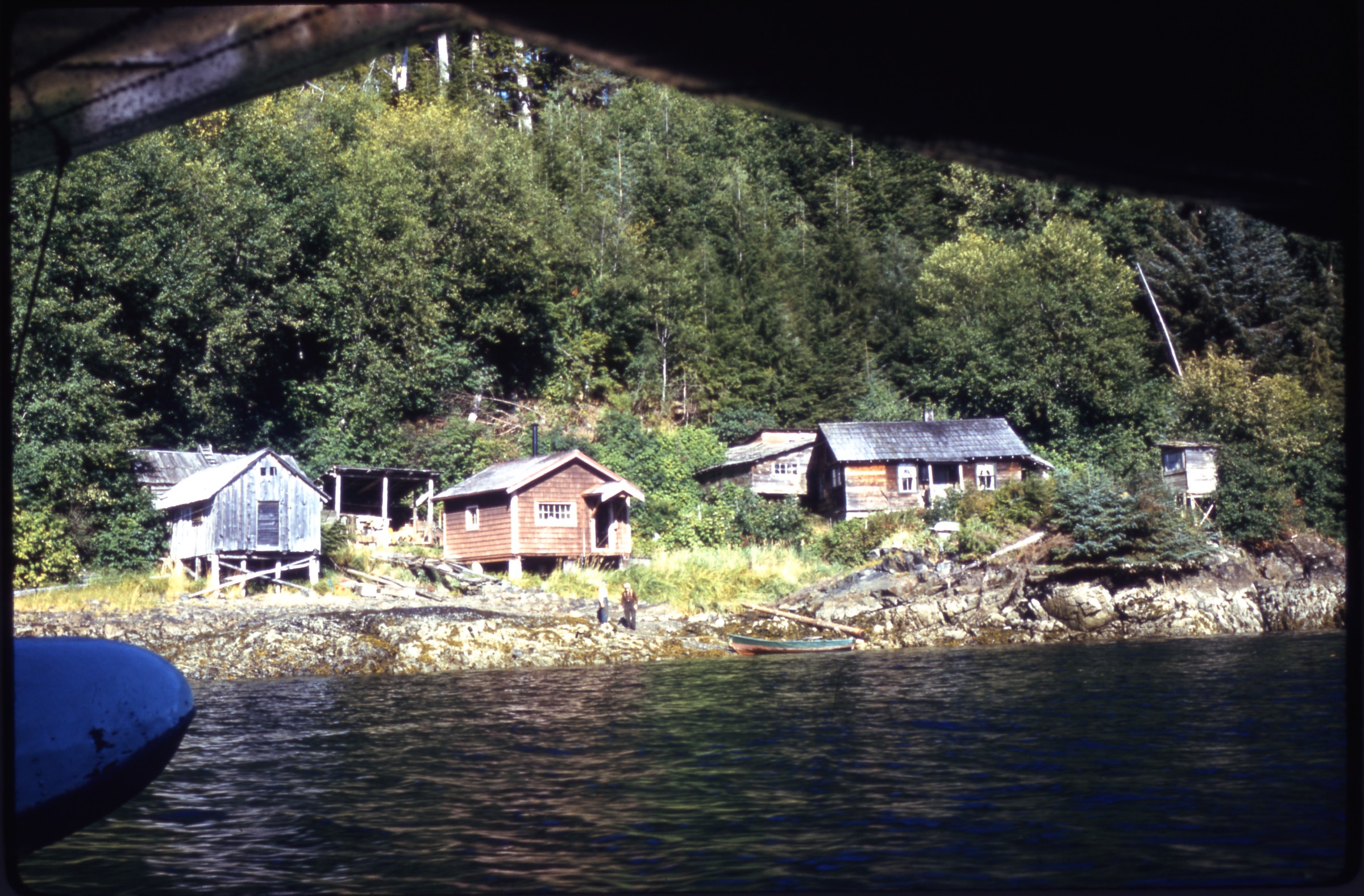 | 2617 — | [homes along channel, float of amphibious airplane in foreground; print date Aug 61. At AFN 2016, identified as Tenakee, man on shore possibly Tenakee Bill with his skiff in center] |
| 2618 — | [abandoned railroad or mining equipment in field, probably Yakutat & Southern Railroad] | |
| 2619 — | [dilapidated buildings in field, Yakutat & Southern Railroad?] | |
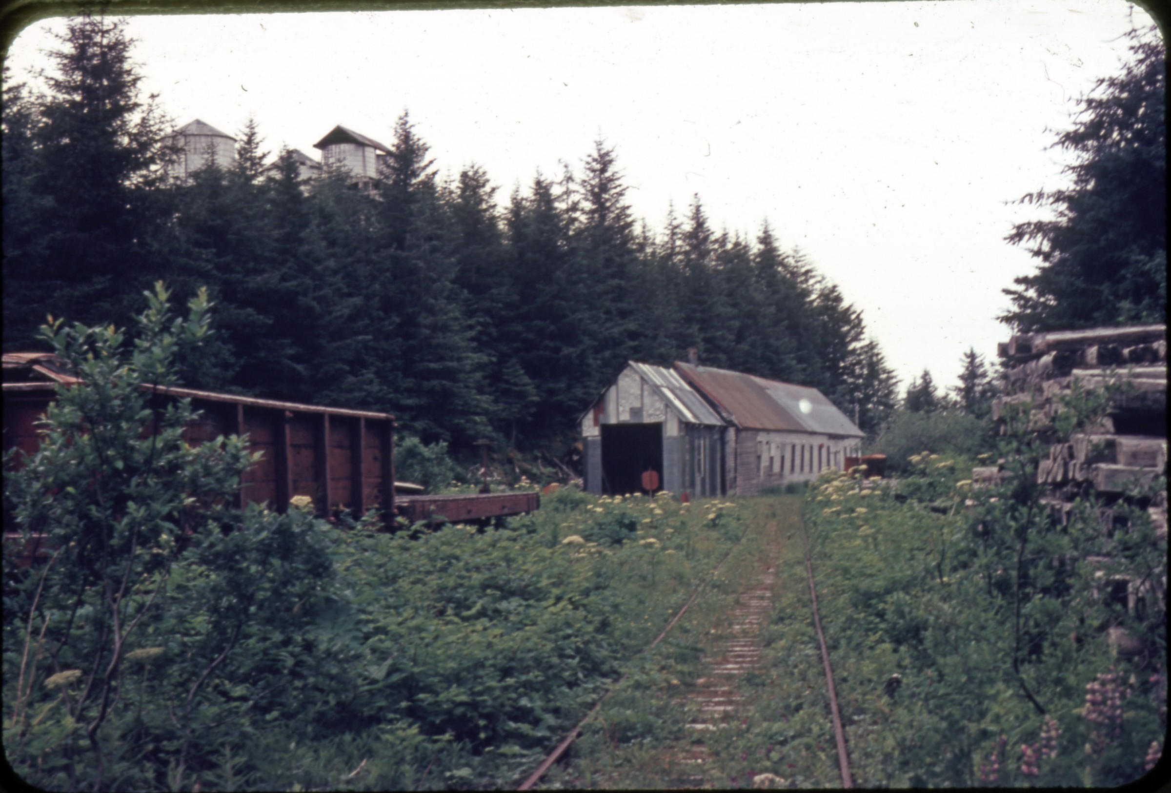 | 2620 — | [view down abandoned railroad tracks to dilapidated buildings in field. At AFN 2016, identified as Yakutat & Southern Railroad roundhouse] |
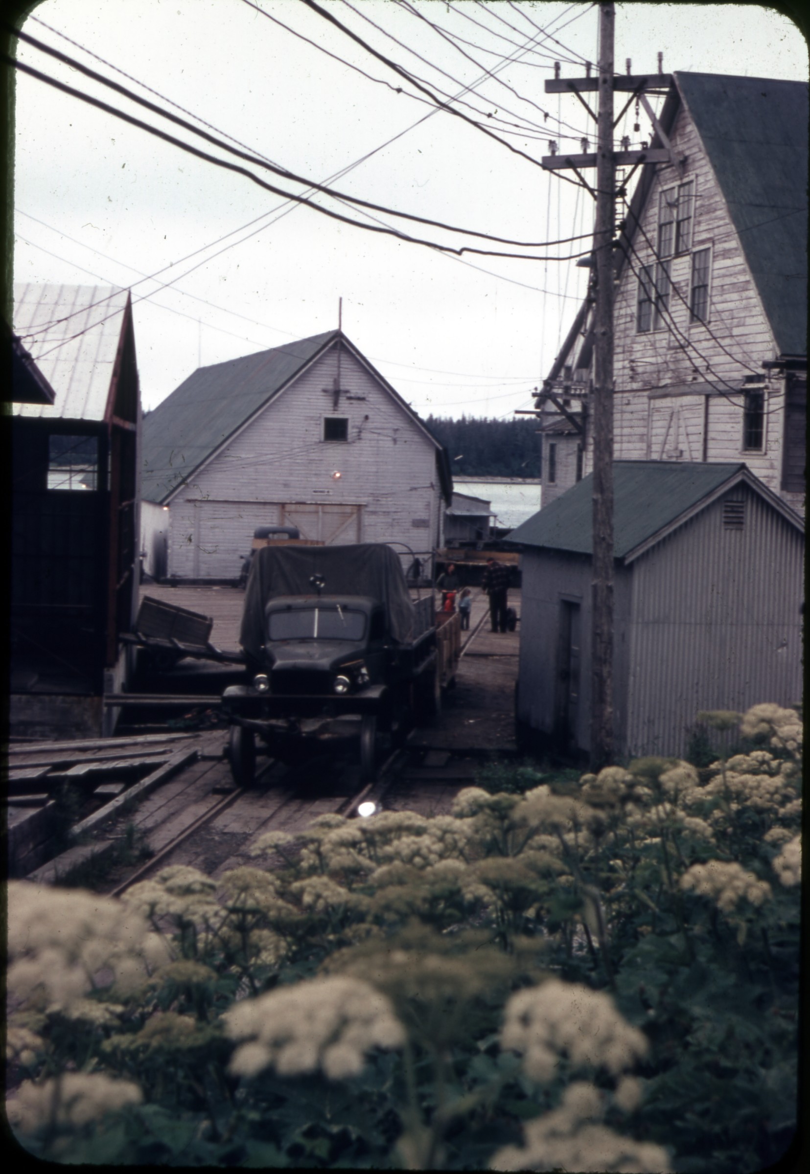 | 2621 — | [truck parked on railroad tracks between buildings on dock area, Yakutat & Southern Railroad at Yakutat docks?] |
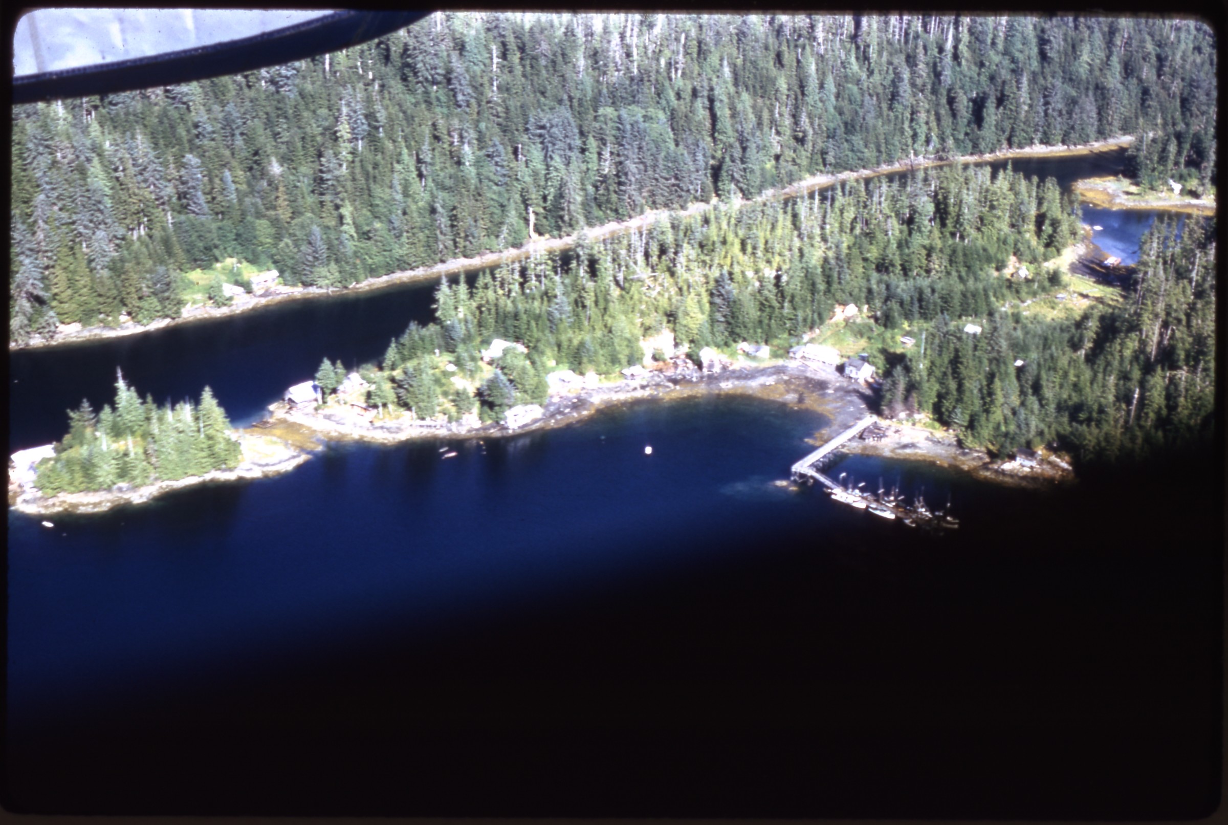 | 2622 — | [aerial of community on channel; print date Aug 61. At AFN 2016, identified as Meyers Chuck, with the state dock in foreground, Back Chuck in right background] |
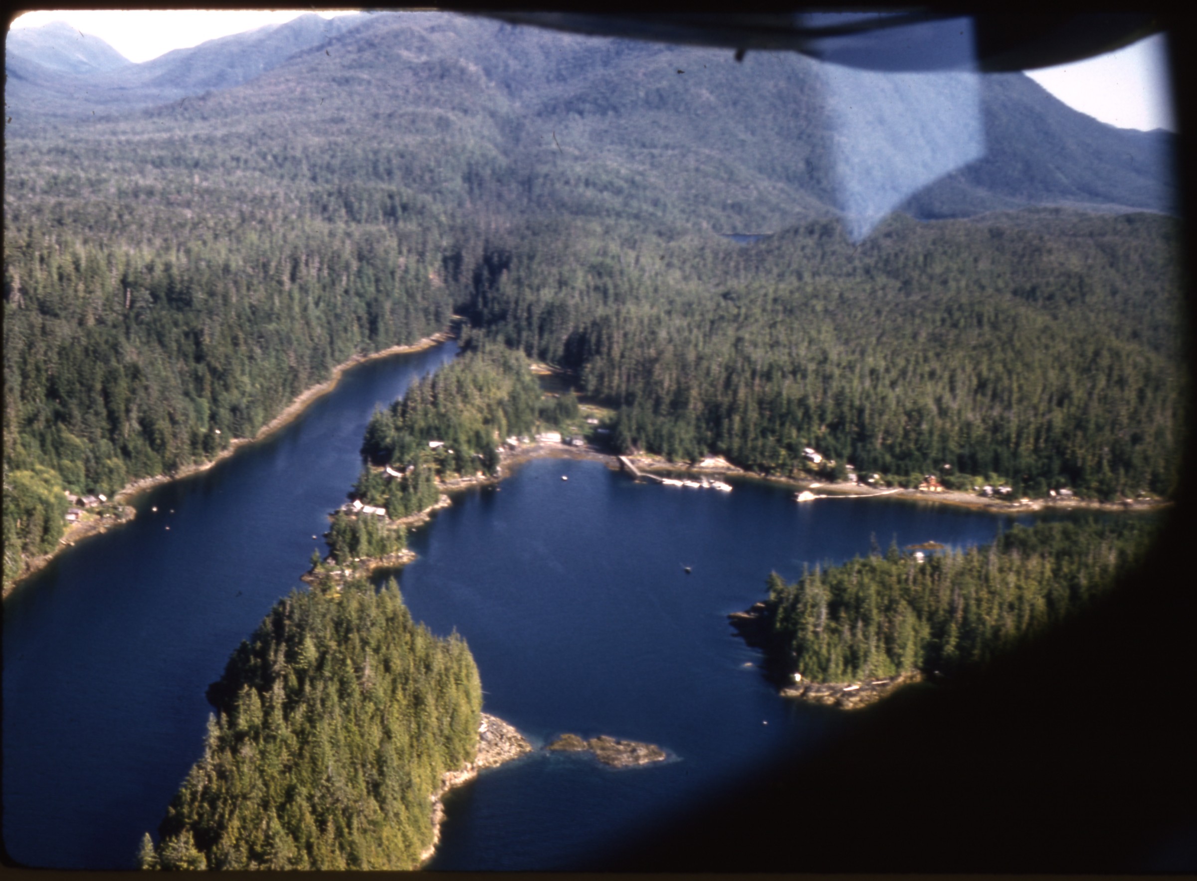 | 2623 — | [aerial of community on channel; print date Aug 61. At AFN 2016, identified as Meyers Chuck, with red-and-white general store along waterfront at right] |
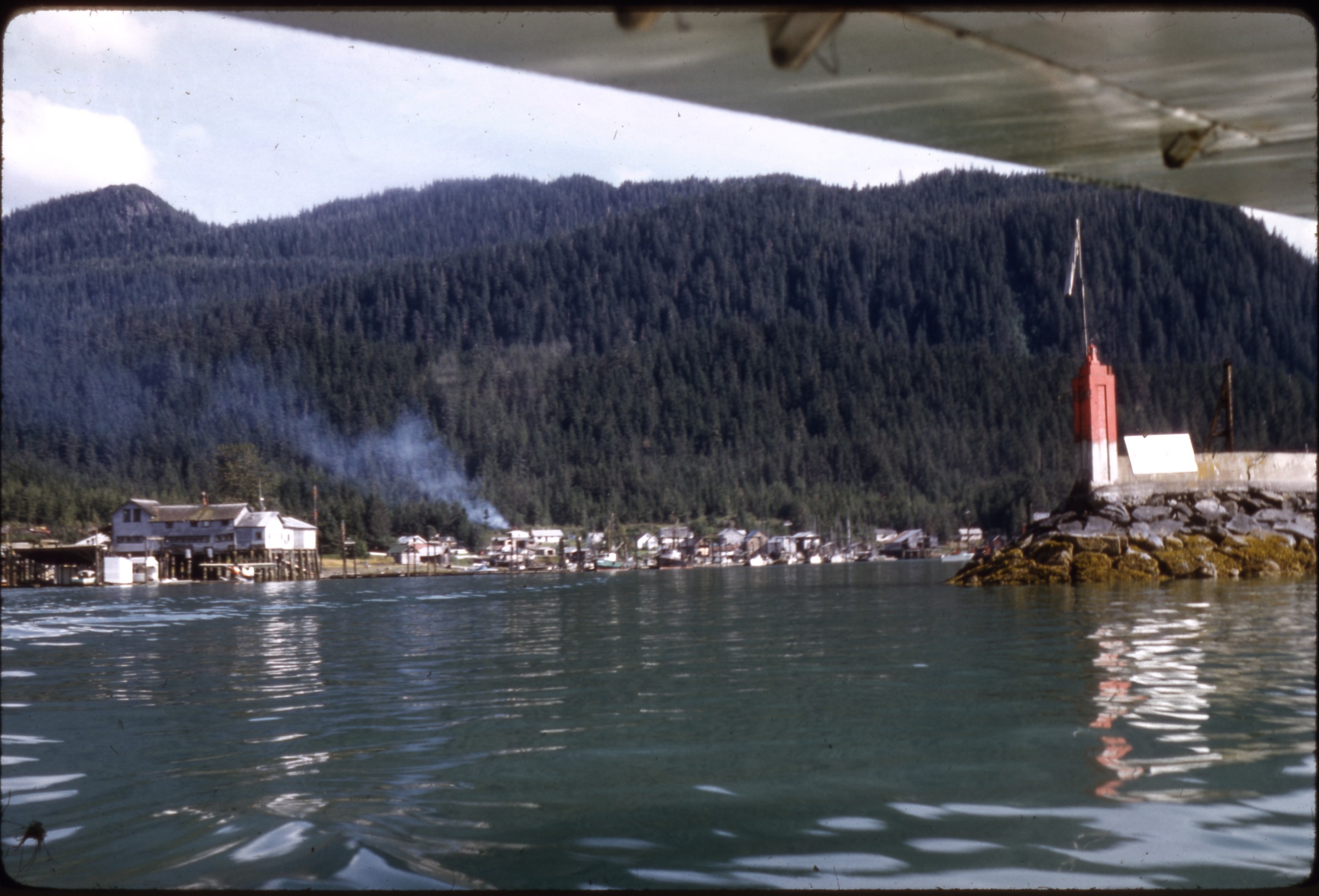 | 2624 — | [view of town waterfront from amphibious airplane; print date Aug 61. At AFN 2017, location identified as Wrangell] |
 | 2625 — | [aerial of landing strip; print date Nov 64] |
| 2626 — | [aerial of landing strip; print date Nov 64] | |
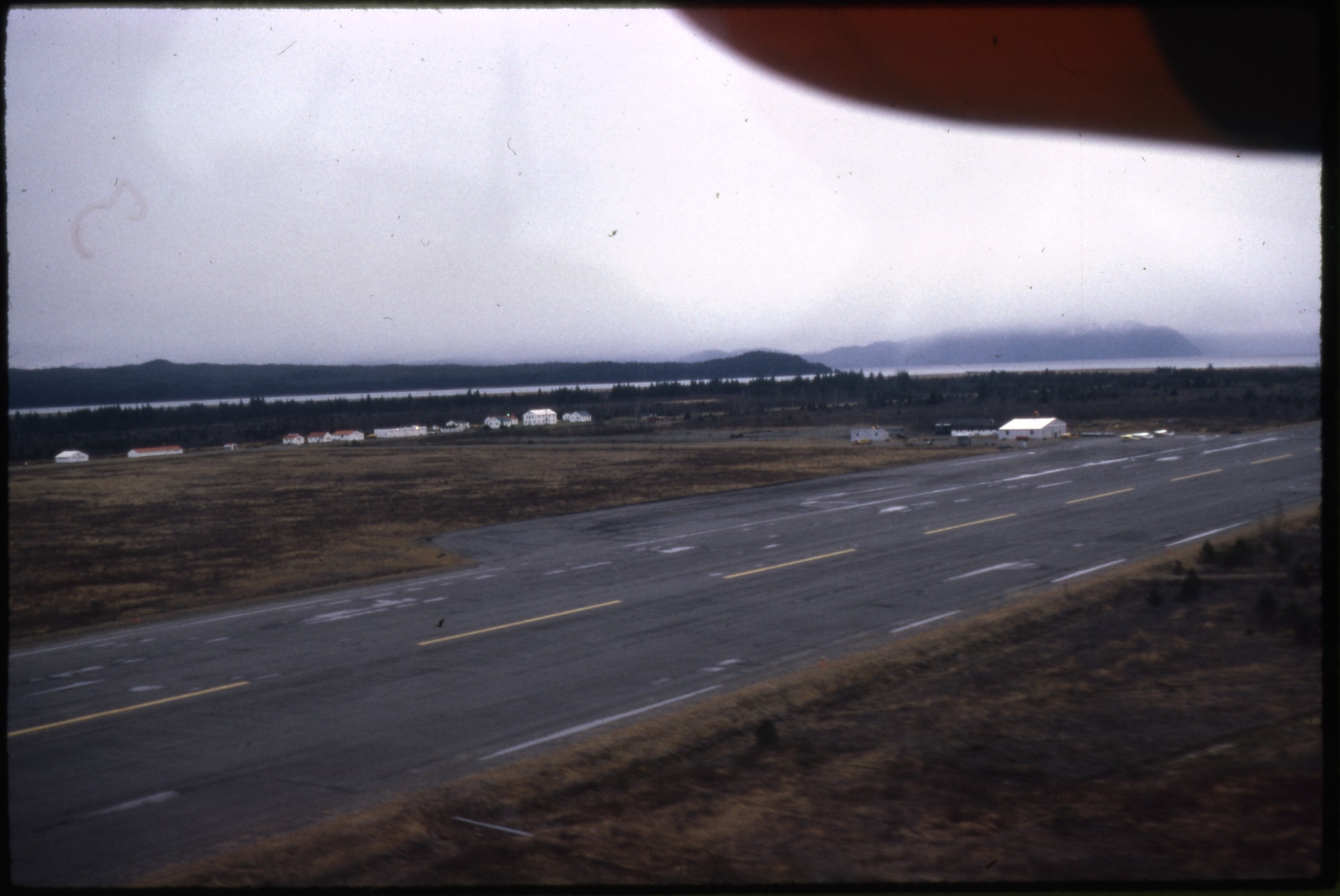 | 2627 — | [aerial of landing strip, buildings in middle ground; print date Nov 64. At AFN 2017, location tentatively identified as Homer] |
| 2628 — | [aerial of buildings next to landing strip; print date Nov 64] | |
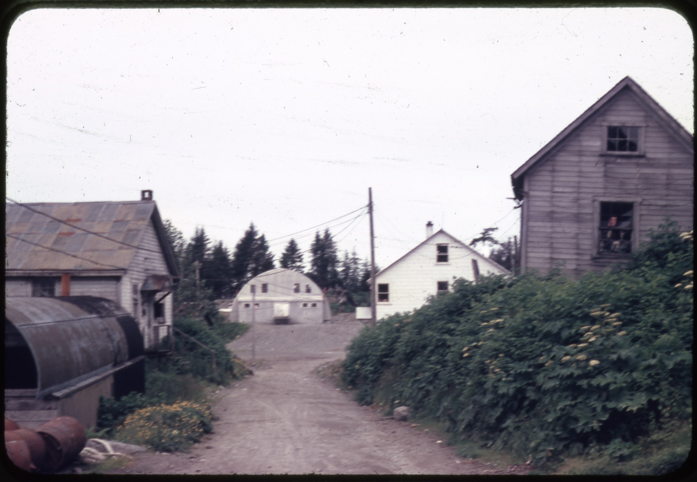 | 2629 — | [view down dirt road to Quonset hut and buildings. At AFN 2017, location identified as Yakutat, with jail and old church at left, community center in center background, and white building as Mallott’s store] |
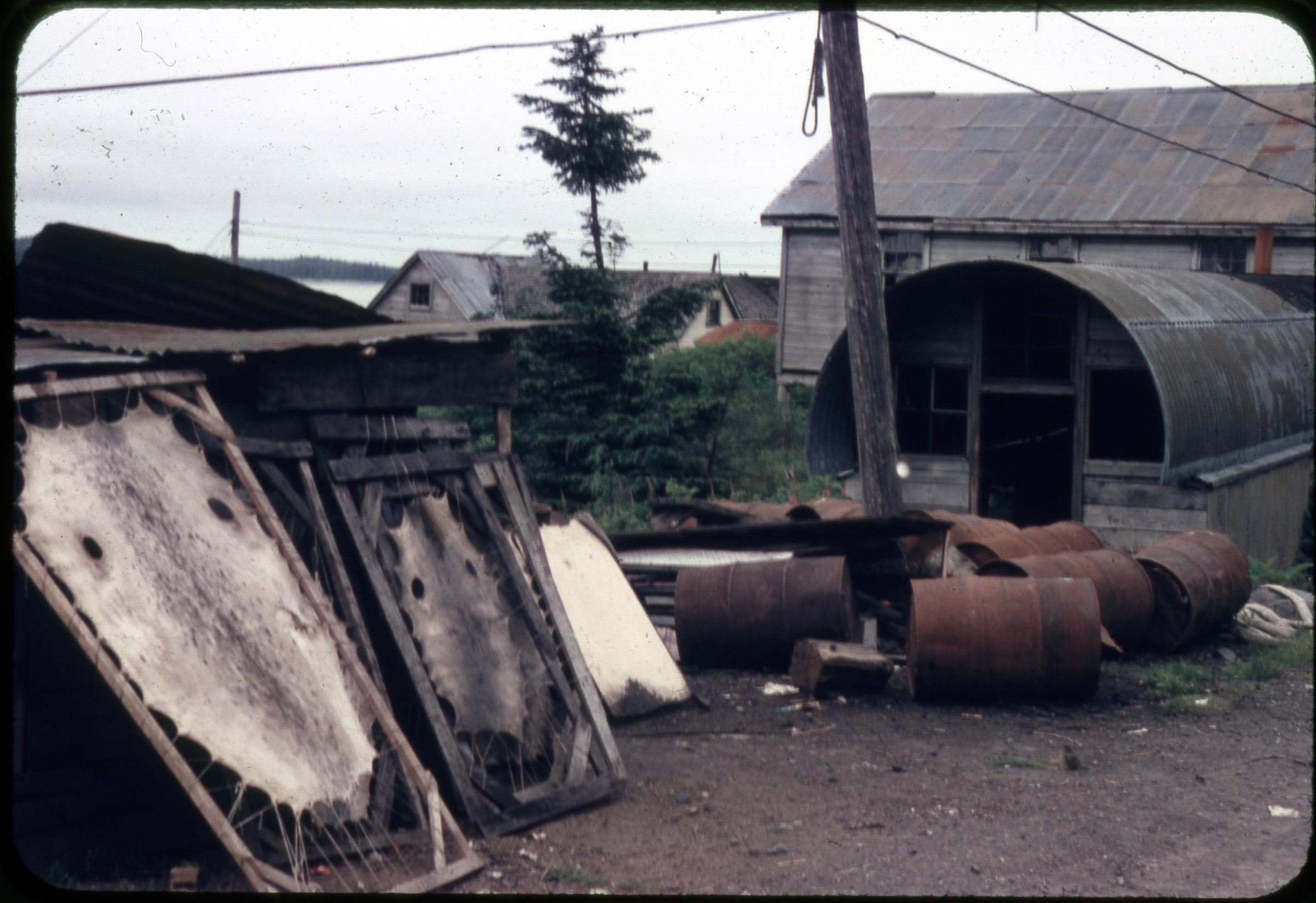 | 2630 — | [skins on drying racks next to Quonset hut, metal barrels on ground. At AFN 2017, location tentatively identified as Yakutat] |
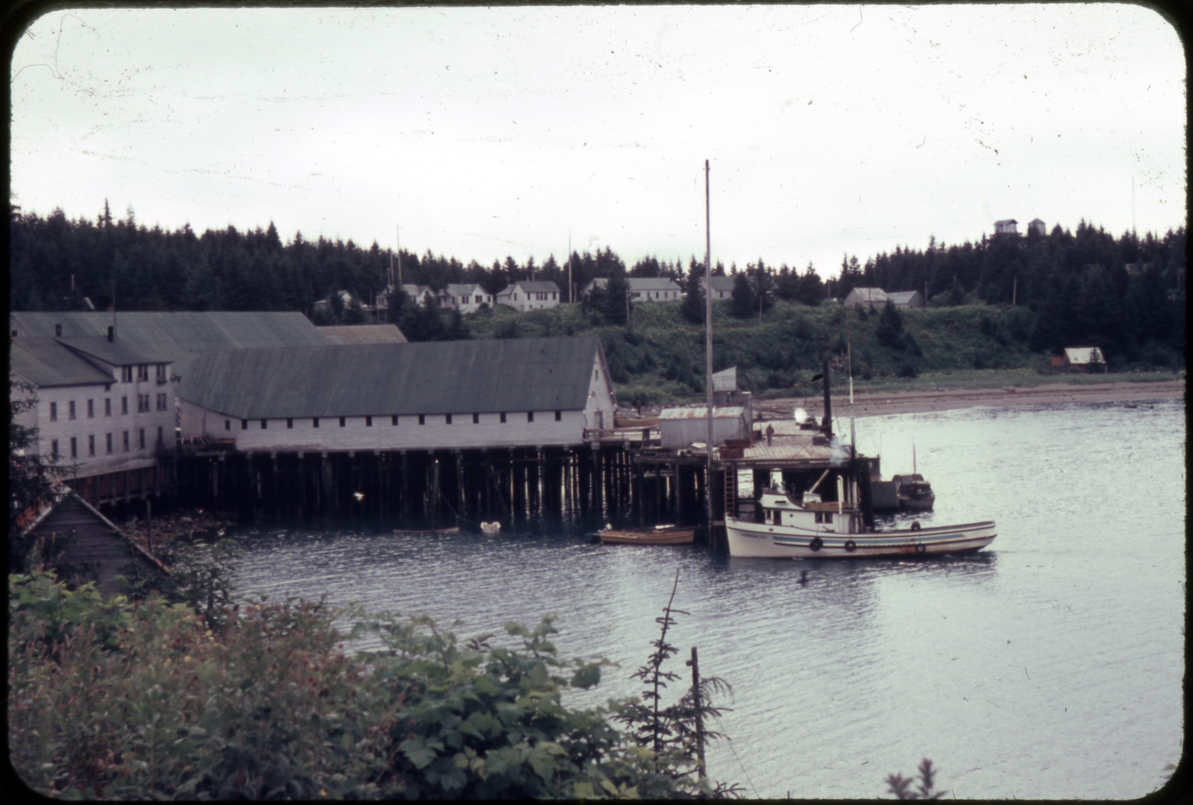 | 2631 — | [cannery buildings and dock, houses on bluff in background. At AFN 2016, identified as cannery at Haines in early 1960s, with Hansen boat at dock] |
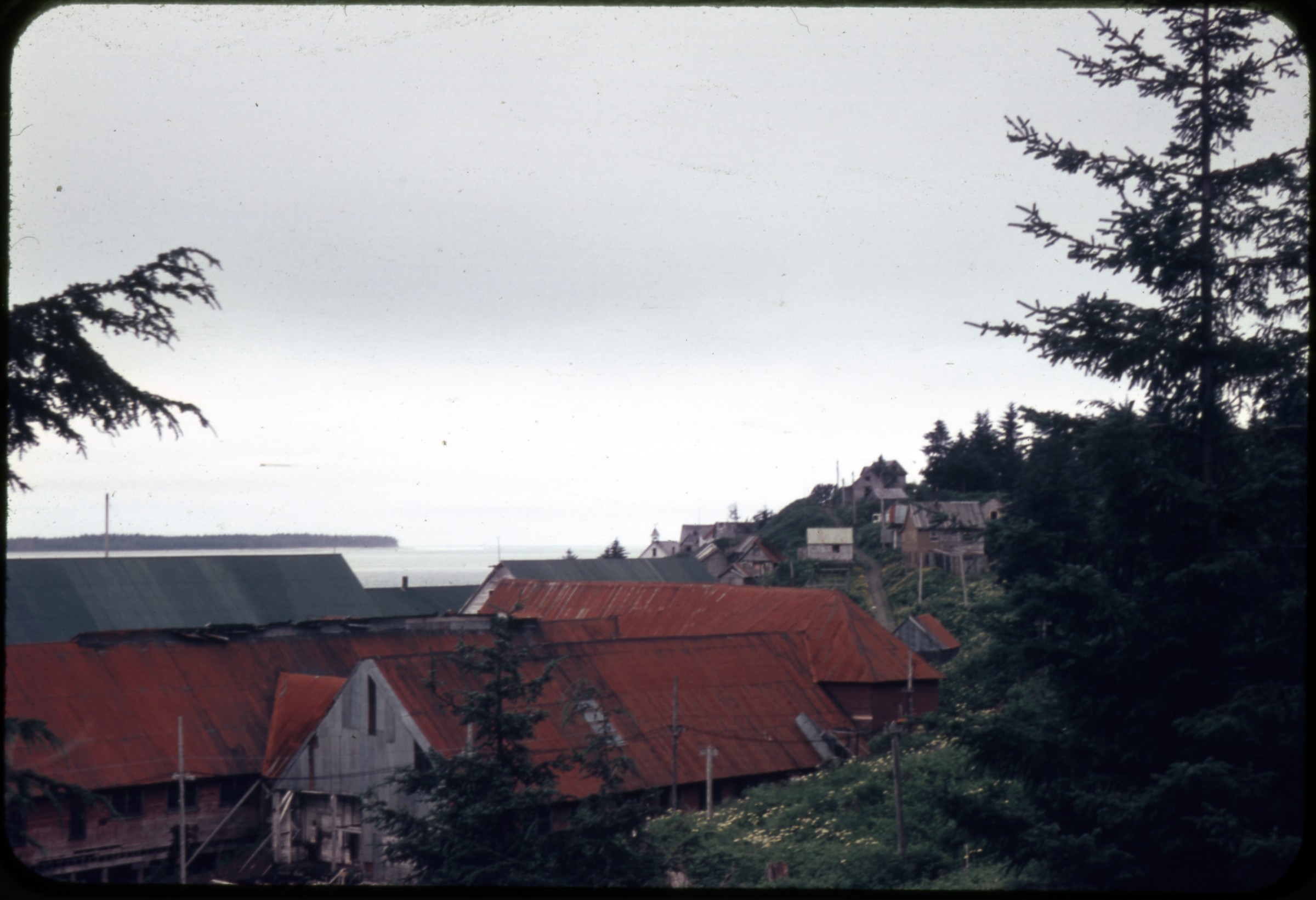 | 2632 — | [bird’s eye view of red roofs, possibly of cannery buildings, houses on bluff at right, At AFN 2017, location tentatively identified as Klawock] |
| 2633 — | [sign painted above door on building, reading “Notice Private Property Anyone Using This Railroad Does So at His Own Risk”, Yakutat & Southern Railroad?] | |
| 2634 — | [dilapidated building in field] | |
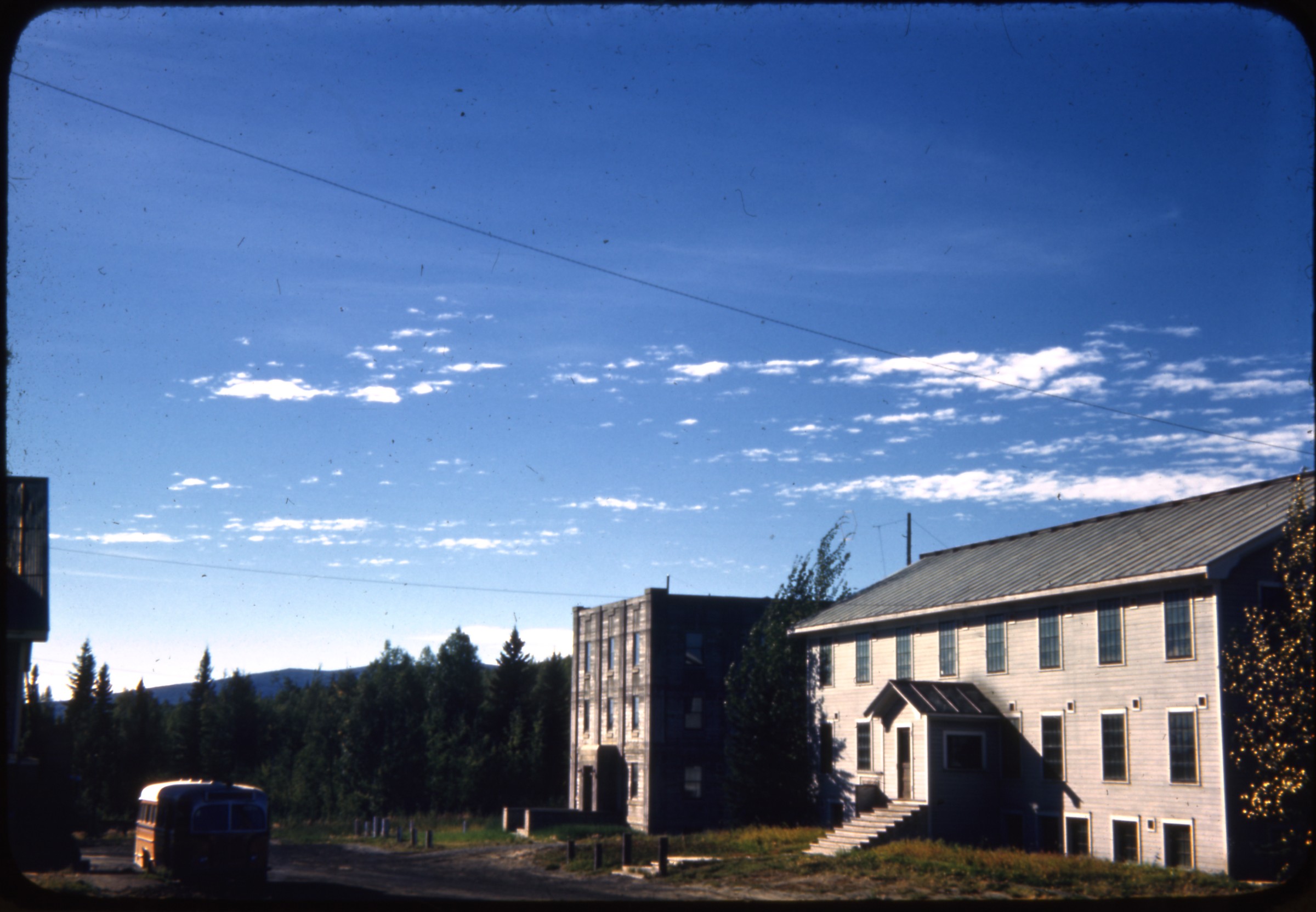 | 2635 — | [two three-story buildings on road] |
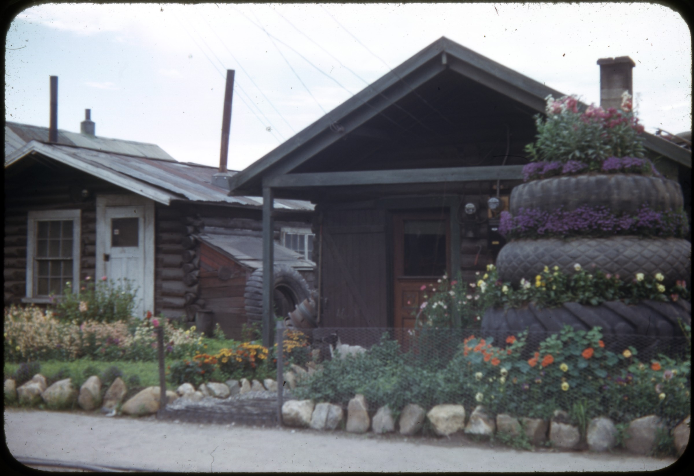 | 2636 — | [two log cabins with small flower gardens in front. At AFN 2016, location suggested as Fort Yukon. At AFN 2017, location suggested as Fairbanks] White Alice/DEW Line Sites |
| 2637 — | Summit TACAN, June 1956 [metal barrels on taiga, communication towers in background, tactical air navigation system] | |
| 2638 — | Summit TACAN, June 1956 [metal barrels on taiga, mountains in distance] | |
| 2639 — | Summit TACAN, June 1956 [metal barrels on taiga, communication towers in background] | |
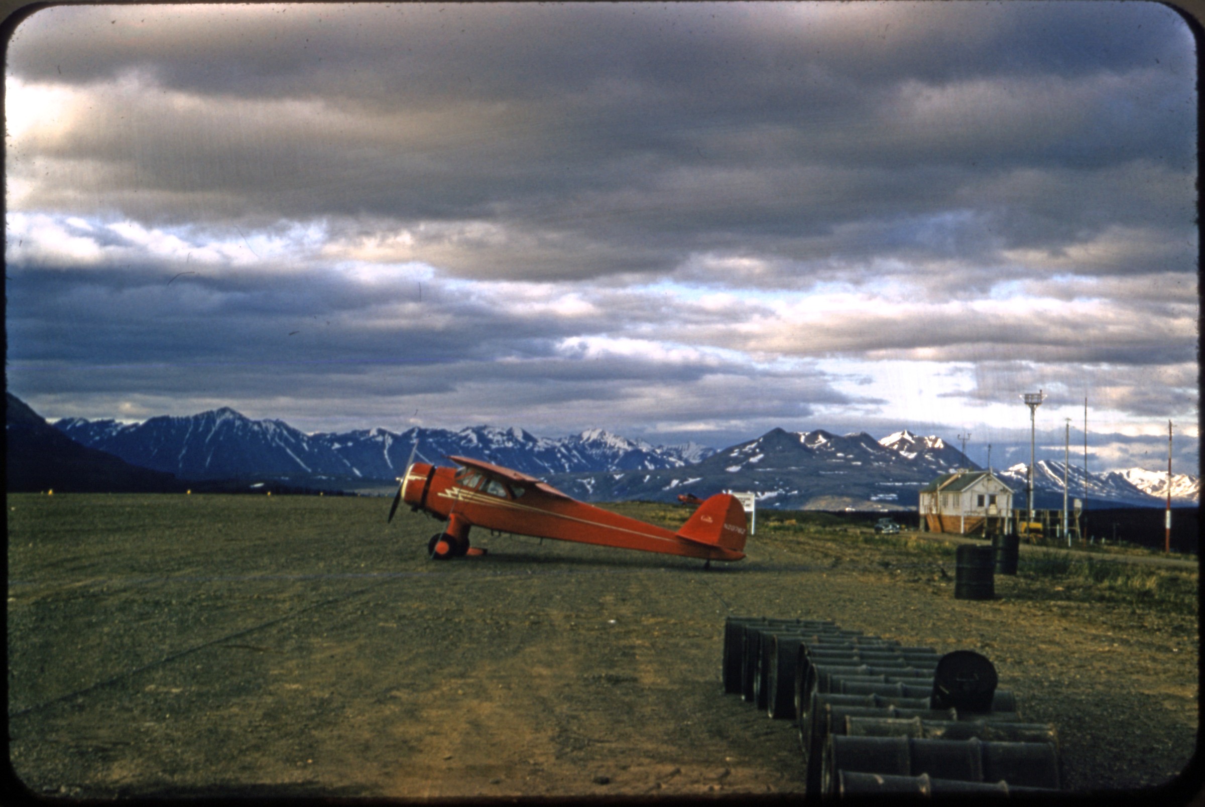 | 2640 — | Summit TACAN, June 1956 [airplane on airstrip, building and antennas at right. At AFN 2017, identified as summit at Broad Pass near Cantwell, and Panorama Mountain in left background] |
| 2641 — | Summit TACAN, June 1956 [housing in foreground, mountains in background] | |
| 2642 — | Middleton Island, Sept. 2, 1956 [men with trucks and heavy equipment on gravel road] | |
| 2643 — | Middleton Island, Sept. 2, 1956 [Northern Consolidated Airlines airplane on gravel airstrip] | |
| 2644 — | Middleton Island, Sept. 2, 1956 [view across tundra to ship in ocean] | |
| 2645 — | Middleton Island, Sept. 2, 1956 [view down gravel road to radomes and buildings] | |
| 2646 — | Middleton Island, Sept. 2, 1956 [trucks and heavy equipment parked outside warehouse building] | |
| 2647 — | Middleton Island, Sept. 2, 1956 [aerial view of island, with radar site in center] | |
| 2648 — | Middleton Island, Sept. 2, 1956 [aerial view of island with radar station on bluff, ship in ocean] | |
| 2649 — | Middleton Island, Sept. 2, 1956 [aerial view of island with radar station on bluff, ship in ocean, airplane wing in foreground] | |
| 2650 — | Middleton Island, Sept. 2, 1956 [aerial view of island with ship in ocean] | |
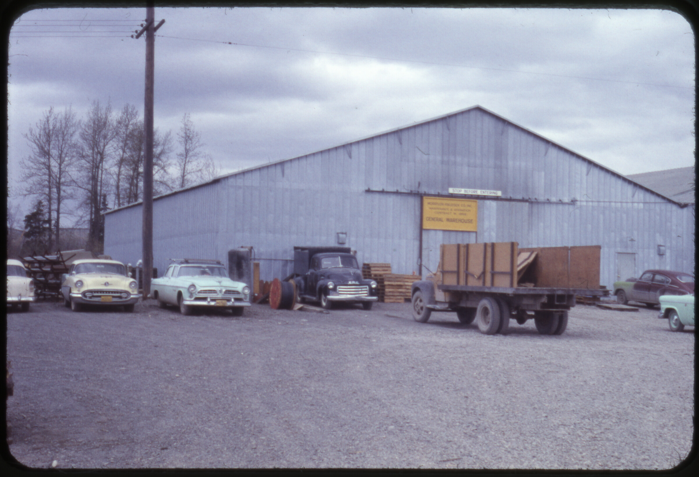 | 2651 — | White Alice construction, Fall 1956 [trucks and automobiles parked outside Morrison- Knudsen Inc. General Warehouse building with sign “Stop Before Entering”] |
| 2652 — | White Alice construction, Fall 1956 [tarped piles of supplies in yard] | |
| 2653 — | White Alice construction, Fall 1956 [automobiles parked outside warehouse] | |
| 2654 — | White Alice construction, Fall 1956 [view across gravel yard to military trucks parked next to housing] | |
| 2655 — | White Alice construction, Fall 1956 [gas canisters stacked in yard] | |
| 2656 — | White Alice construction, Fall 1956 [view across gravel lot to buildings] | |
| 2657 — | Kalakaket, July 1957 [building and tropospheric scatter antenna] | |
| 2658 — | Kalakaket, July 1957 [bird’s eye view of buildings in foreground, communications station in distance] | |
| 2659 — | Kalakaket, July 1957 [bird’s eye view of communications station on Kalakaket Creek] | |
| 2660 — | Kalakaket, July 1957 [barges and tug tied to riverbank, metal barrels on shore] | |
| 2661 — | Big Mountain, Aug. 2, 1957 [aerial of airstrip on Iliamna Lake] | |
| 2662 — | Big Mountain, Aug. 2, 1957 [building and antennas at radio relay station, upper camp] | |
| 2663 — | Big Mountain, Aug. 2, 1957 [building and storage tanks, lake in distance, upper camp] | |
| 2664 — | Big Mountain, Aug. 2, 1957 [building and antennas, upper camp] | |
| 2665 — | Big Mountain, Aug. 2, 1957 [truck on dirt road passing Quonset huts, lower camp] | |
| 2666 — | Big Mountain, Aug. 2, 1957 [Quonset huts and buildings, lower camp] | |
| 2667 — | Big Mountain, Aug. 2, 1957 [truck parked next to piles of supplies along dirt road] | |
| 2668 — | Big Mountain, Aug. 2, 1957 [airplane landing on airstrip, metal barrels in foreground] | |
| 2669 — | Big Mountain, Aug. 2, 1957 [Northern Consolidated Airlines Douglas DC-3 airplane tail number N21748 on gravel airstrip, truck parked at left] | |
| 2670 — | Big Mountain, Aug. 2, 1957 [Alaska Airlines airplane tail number N1310[M?] on gravel airstrip, pile of metal barrels in background, building in left foreground] | |
| 2671 — | Big Mountain, Aug. 2, 1957 [aerial view of communications station on hilltop] | |
| 2672 — | Aniak, July ’58 [view from airstrip to buildings and equipment in distance] | |
| 2673 — | Aniak site, Feb. ’57 [antennas and storage tank in winter] | |
| 2674 — | Anvil Mt. from old 10 th radio relay site, July ’58 [tropospheric scatter antennas on hilltop, Anvil Mountain] | |
| 2675 — | Site sternwheeler, Big Mt., Aug. ’58 [paddle steamer under way near Big Mountain] | |
| 2676 — | Ed Evans, Big Mt., Aug. ’58 [man walking on airstrip next to Beechcraft Model 18 airplane tail number N80494] | |
| 2677 — | Boswell Bay, Feb. ’57 [aerial view of coastline] | |
| 2678 — | Boswell Bay, July ’58 [aerial of radar site on hilltop] | |
| 2679 — | Boswell Bay, July ’58 [aerial of radar site on hilltop] | |
| 2680 — | Boswell Bay, July ’58 [view from amphibious airplane on water to buildings on shore] | |
| 2681 — | Boswell Bay, July ’58 [view from amphibious airplane on water to buildings on shore] | |
| 2682 — | Boswell Bay, July ’58 [men standing next to amphibious airplane on shore, small boat anchored in bay] | |
| 2683 — | Cape Romanzof, July ’58 [aerial view of airstrip] | |
| 2684 — | Cape Romanzof, July ’58 [aerial view of radar site on mountain] | |
| 2685 — | Cape Romanzof radome from W/A site, July ’58 [view along mountain ridge to radar site] | |
| 2686 — | Cape Romanzof, July ’58 [aerial view of dirt road leading to lower camp] | |
| 2687 — | Council, July ’58 [aerial of road and buildings on bend in Niukluk River] | |
| 2688 — | Granite Mt., July ’58 [view across gravel area to buildings, Granite Mountain] | |
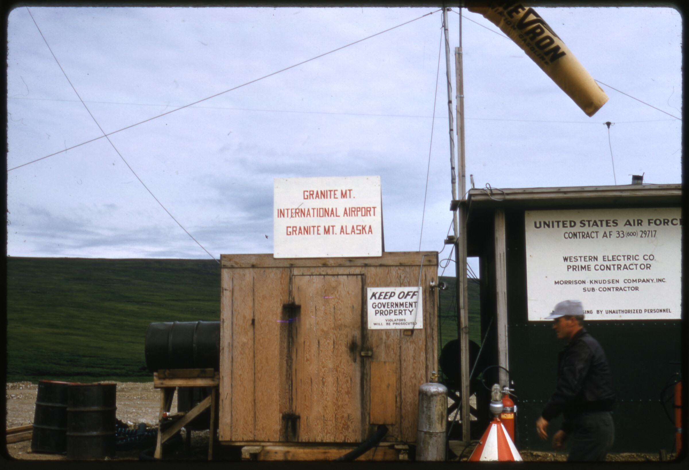 | 2689 — | Granite Mt., July ’58 [man standing next to small buildings, with signs for Granite Mountain International Airport and United States Air Force Contract number and contractor, windsock in center] |
| 2690 — | Granite Mt., July ’58 [aerial view of airstrip at Granite Mountain, scree pile on mountaintop in foreground] | |
| 2691 — | Granite Mt. approach, July ’58 [aerial view of airstrip at Granite Mountain] | |
| 2692 — | Granite Mt. LB-30, July ’58 [airplane landing on airstrip at Granite Mountain] | |
| 2693 — | Granite Mt., July ’58 [aerial view of radar site on Granite Mountain] | |
| 2694 — | Indian Mt. [aerial view of airstrip at Indian Mountain] | |
| 2695 — | Indian Mt. [aerial view of radar site on Indian Mountain] | |
| 2696 — | Kotzebue, Aug. ’58 [aerial view of airstrip] | |
| 2697 — | KC construction camp [aerial view of camp in winter, Kalakaket Creek?] | |
| 2698 — | McGrath, July ’58 [buildings at right, airstrip at left, air stairs in foreground, Tatalina] | |
| 2699 — | McGrath, July ’58 [airplane on airstrip, man in center taking photograph with camera, truck parked at left, Tatalina] | |
| 2700 — | Red fox, Newenham, July ’58 [blurry fox at base of tropospheric scatter antenna] | |
| 2701 — | Cape Newenham, July ’58 [aerial of mountain tops poking out of fog, airplane wing in foreground] | |
| 2702 — | Point Spencer, Aug. ’58 [aerial of spit of land extending into Bering Sea] | |
| 2703 — | Sledge Island [aerial of island in frozen sea] | |
| 2704 — | Sparrevohn Mt., July ’58 [aerial of radar site on Sparrevohn Mountain] | |
| 2705 — | Rad[?] shop, Sparrevohn Mt., July ’58 [Quonset huts and wooden buildings] | |
| 2706 — | Tatalina, July ’58 [pile of debris and cable spools on ground] | |
| 2707 — | Tatalina, July ’58 [aerial of lower and upper camps] | |
| 2708 — | Tatalina, July ’58 [aerial of lower and upper camps] | |
| 2709 — | Tin City, Aug. ’58 [aerial of airstrip] | |
| 2710 — | Tin City, Aug. ’58 [aerial of lower camp] | |
| 2711 — | Tin City, Aug. ’58 [aerial of lower camp] | |
| 2712 — | Tin City, Aug. ’58 [aerial of upper camp] | |
| 2713 — | Unalakleet AFS, July ’58 [aerial of road and upper camp] | |
| 2714 — | [man in cook’s hat and apron standing in doorway of mobile housing unit] | |
| 2715 — | Dutch Harbor, Mar. 1959, Driftwood Bay [aerial of radar site on mountain, airplane wing in foreground] | |
| 2716 — | Dutch Harbor, Mar. 1959, Driftwood Bay [aerial of buildings on coastline] | |
| 2717 — | Dutch Harbor, Mar. 1959, Driftwood Bay [aerial of buildings on spit of land] | |
| 2718 — | Dutch Harbor, Mar. 1959, Driftwood Bay [aerial of buildings on coastline] | |
| 2719 — | Dutch Harbor, Mar. 1959, Driftwood Bay [radome and tropospheric scatter antennas on hilltop] | |
| 2720 — | Dutch Harbor, Mar. 1959, Driftwood Bay [aerial of spit of land] | |
| 2721 — | Dutch Harbor, Mar. 1959, Driftwood Bay [radome building] | |
| 2722 — | Dutch Harbor, Mar. 1959, Driftwood Bay [view across gravel airstrip to buildings] | |
| 2723 — | Dutch Harbor, Mar. 1959, Driftwood Bay [view down gravel airstrip to radar site on hilltop, windsock in middle ground] | |
| 2724 — | Dutch Harbor, Mar. 1959, Driftwood Bay [aerial of radar site in winter] | |
| 2725 — | Dutch Harbor, Mar. 1959, Driftwood Bay [aerial of buildings in lower camp in winter] | |
| 2726 — | Dutch Harbor, Mar. 1959, Driftwood Bay [aerial of radar site in winter] | |
| 2727 — | Dutch Harbor, Mar. 1959, Driftwood Bay [aerial of lower camp in winter] | |
| 2728 — | Dutch Harbor, Mar. 1959, Driftwood Bay [aerial of lower camp in winter] | |
| 2729 — | Dutch Harbor, Mar. 1959, Driftwood Bay [three men standing near antenna, truck parked at right] | |
| 2730 — | Dutch Harbor, Mar. 1959, Driftwood Bay [aerial of lower camp in winter] | |
| 2731 — | Dutch Harbor, Mar. 1959, Driftwood Bay [view across airstrip to bluff along coastline in winter, airplane tail in left foreground] | |
| 2732 — | Dutch Harbor, Mar. 1959, Driftwood Bay [truck parked next to Reeve Aleutian Airways Douglas DC-3 airplane tail number N91016 in winter] | |
| 2733 — | Dutch Harbor, Mar. 1959, Driftwood Bay [aerial of coastline in winter] | |
| 2734 — | Dutch Harbor, Mar. 1959, Driftwood Bay [warehouse buildings in lower camp] | |
| 2735 — | Dutch Harbor, Mar. 1959, Driftwood Bay [view down road in winter, water tank on hill at left, buildings at right. Cf. .2738] | |
| 2736 — | Dutch Harbor, Mar. 1959, Driftwood Bay [sunken barge or boat in bay in winter] | |
| 2737 — | Dutch Harbor, Mar. 1959, Driftwood Bay [view along coastline in winter] | |
| 2738 — | Dutch Harbor, Mar. 1959, Driftwood Bay [similar to .2735, truck parked at left] | |
| 2739 — | Dutch Harbor, Mar. 1959, Driftwood Bay [buildings along airstrip in winter, hangar in center with insignia, possibly of 714 th Aircraft Control & Warning squadron] | |
| 2740 — | Dutch Harbor, Mar. 1959, Driftwood Bay [aerial of coastline in winter] | |
| 2741 — | Aleutian Islands, Mar. 1959 [aerial of radar site in winter] | |
| 2742 — | Aleutian Islands, Mar. 1959 [aerial of radar site in winter, with radome and tropospheric scatter antennas] | |
| 2743 — | Aleutian Islands, Mar. 1959 [view down road, airplane on airstrip in middle ground] | |
| 2744 — | Aleutian Islands, Mar. 1959 [row of housing units along road] | |
| 2745 — | Aleutian Islands, Mar. 1959 [aerial of radar site in winter] | |
| 2746 — | Cape Newenham, June 30, 1959 [view up to radar site on hilltop, building at far left] | |
| 2747 — | Cape Newenham, June 30, 1959 [trucks and heavy equipment parked next to building at upper camp] | |
| 2748 — | Cape Newenham, June 30, 1959 [building at right, storage tank at left, upper camp] | |
| 2749 — | Cape Newenham, June 30, 1959 [man standing near damaged Quonset huts, coverings torn and frames showing, debris on ground] | |
| 2750 — | Cape Newenham, June 30, 1959 [debris pile including gas canisters, cable spools] | |
| 2751 — | Cape Newenham, June 30, 1959 [trucks and heavy equipment left to rust on coastline] | |
| 2752 — | Cape Newenham, June 30, 1959 [bird’s eye view of barge landed on beach, debris in foreground] | |
| 2753 — | Cape Newenham, June 30, 1959 [trucks and heavy equipment in camp] | |
| 2754 — | Cape Newenham, June 30, 1959 [barge in bay] | |
| 2755 — | Cape Newenham, June 30, 1959 [men standing next to building T5-212, damaged Quonset hut at left] | |
| 2756 — | Cape Newenham, June 30, 1959 [damaged Quonset huts] | |
| 2757 — | Cape Newenham, June 30, 1959 [view down row of damaged Quonset huts, truck parked on road at left] | |
| 2758 — | Cape Newenham, June 30, 1959 [damaged Quonset hut and building, building T5-208 in foreground] | |
| 2759 — | Cape Newenham, June 30, 1959 [men standing amid debris in front of damaged Quonset huts] | |
| 2760 — | Cape Newenham, June 30, 1959 [aerial of radar site] | |
| 2761 — | Kalakaket Creek, June 1959 [Morrison-Knudsen Co. Consolidated B-24 Liberator airplane tail number N92MK crashed on tundra] | |
| 2762 — | Kalakaket Creek, June 1959 [Morrison-Knudsen Co. Consolidated B-24 Liberator airplane tail number N92MK crashed on tundra] | |
| 2763 — | Kalakaket Creek, June 1959 [Morrison-Knudsen Co. Consolidated B-24 Liberator airplane tail number N92MK crashed on tundra] | |
| 2764 — | Kalakaket Creek, June 1959 [two men standing next to Quonset hut with damage to corner of shell, mattress pulled through hole, second Quonset hut in background left] | |
| 2765 — | Kalakaket Creek, June 1959 [man standing next to damaged wall of building, Quonset huts in background] | |
| 2766 — | Tatalina, June 1959 [radome and antennas on hills, building and supplies next to gravel road in foreground] | |
| 2767 — | Tatalina, June 1959 [truck parked next to building and supplies seen in .2766] | |
| 2768 — | Tatalina, June 1959 [row of Quonset huts, boulders in foreground] | |
| 2769 — | Tatalina, June 1959 [truck parked outside of Quonset hut, pile of fuel wood at left, metal barrels at right] | |
| 2770 — | Tatalina, June 1959 [two radomes on hilltop, building next to gravel road in middle ground] | |
| 2771 — | Aniak/Bethel, July 1959 [building and four tropospheric scatter antennas] | |
| 2772 — | Aniak/Bethel, July 1959 [man standing next to sign for Civil Aeronautics Administration Dept. of Commerce Aniak] | |
| 2773 — | Probably Nome [building with radome and three tropospheric scatter antennas] | |
| 2774 — | Probably Nome [closer view of building with radome and tropospheric scatter antennas] | |
| 2775 — | Probably Nome [trucks parked outside building with radome, tropospheric scatter antenna at left] | |
| 2776 — | Probably Nome [buildings along gravel road] | |
| 2777 — | Probably Nome [distant view of Quonset huts on tundra] | |
| 2778 — | Probably Nome [building with radome and tropospheric scatter antenna] | |
| 2779 — | Probably Nome [building with radome] | |
| 2780 — | Clear, June 1960 [aerial of Air Force station] | |
| 2781 — | Clear, June 1960 [men standing next to Air Force airplane tail number 49215] | |
| 2782 — | Clear, June 1960 [aerial of station] | |
| 2783 — | Clear, June 1960 [aerial of station] | |
| 2784 — | Gold King Creek, Sept. 1960 [man feeding black bear cub, trucks and supplies in background] | |
| 2785 — | Gold King Creek, Sept. 1960 [man feeding black bear cub on chain] | |
| 2786 — | Gold King Creek, Sept. 1960 [four men standing next to mobile office unit] | |
| 2787 — | Gold King Creek, Sept. 1960 [heavy equipment on tundra] | |
| 2788 — | Gold King Creek, Sept. 1960 [view across airstrip, airplane parked at right, communications tower at left next to building, man walking in middle ground] | |
| 2789 — | Gold King Creek, Sept. 1960 [men standing next to Wien Airlines Douglas DC-3 airplane tail number N21769] | |
| 2790 — | Gold King Creek, Sept. 1960 [Alaska Airlines Beechcraft C18S airplane tail number N8032H on airstrip] | |
| 2791 — | Gold King Creek, Sept. 1960 [view across airstrip to Quonset huts and equipment, airplane parked at right] | |
| 2792 — | Gold King Creek, Sept. 1960 [building and communications tower, airplane parked at right] | |
| 2793 — | Unalakleet AC & W, Sept. 1960 [aerial of Aircraft Control & Warning station] | |
| 2794 — | Unalakleet AC & W, Sept. 1960 [aerial of site] | |
| 2795 — | Unalakleet AC & W, Sept. 1960 [aerial of site] | |
| 2796 — | Unalakleet AC & W, Sept. 1960 [aerial of site] | |
| 2797 — | Unalakleet AC & W, Sept. 1960 [five men standing next to airplane] | |
| 2798 — | Murphy Dome, Sept. 1960 [view down road in winter to radomes on hilltop] | |
| 2799 — | Cape Lisburne/Pt. Hope, Sept. 1960 [aerial of spit of land] | |
| 2800 — | Cape Lisburne/Pt. Hope, Sept. 1960 [view out airplane window on airstrip, truck parked at right, small building at left] | |
| 2801 — | Cape Lisburne/Pt. Hope, Sept. 1960 [truck and small building on airstrip, “Cape Lisburne” painted on building] | |
| 2802 — | Cape Lisburne/Pt. Hope, Sept. 1960 [view down airstrip on coastline] | |
| 2803 — | Cape Lisburne/Pt. Hope, Sept. 1960 [aerial of site] | |
| 2804 — | Cape Lisburne/Pt. Hope, Sept. 1960 [aerial of site] B5 | |
| 2805 — | Annette-Smuggler Cove site, Metlakatla, offloading Tom[?] [Harbor?] of WECO spec, to Ketchikan, Dec. 13-15, 1960 [aerial of site, airplane float in foreground] | |
| 2806 — | Annette-Smuggler Cove site, Metlakatla, offloading Tom[?] [Harbor?] of WECO spec, to Ketchikan, Dec. 13-15, 1960 [Air Force airplane tail number 54567 on airstrip, radome behind, Quonset hut at left] | |
| 2807 — | Annette-Smuggler Cove site, Metlakatla, offloading Tom[?] [Harbor?] of WECO spec, to Ketchikan, Dec. 13-15, 1960 [crates of supplies piled next to building, communications tower in background, truck on road at right] | |
| 2808 — | Annette-Smuggler Cove site, Metlakatla, offloading Tom[?] [Harbor?] of WECO spec, to Ketchikan, Dec. 13-15, 1960 [men standing next to crates of supplies] | |
| 2809 — | Annette-Smuggler Cove site, Metlakatla, offloading Tom[?] [Harbor?] of WECO spec, to Ketchikan, Dec. 13-15, 1960 [automobiles parked next to airstrip, two airplanes on runway including Grumman Goose airplane tail number N2751A, radome in center background, hangar at left] | |
| 2810 — | Annette-Smuggler Cove site, Metlakatla, offloading Tom[?] [Harbor?] of WECO spec, to Ketchikan, Dec. 13-15, 1960 [crewman walking towards Pacific Northern Airlines airplane on airstrip, amphibious airplane in background] | |
| 2811 — | Annette-Smuggler Cove site, Metlakatla, offloading Tom[?] [Harbor?] of WECO spec, to Ketchikan, Dec. 13-15, 1960 [view across airstrip to hangar, Pacific Northern Airlines airplane at right] | |
| 2812 — | Annette-Smuggler Cove site, Metlakatla, offloading Tom[?] [Harbor?] of WECO spec, to Ketchikan, Dec. 13-15, 1960 [amphibious airplanes parked between hangars at airstrip] | |
| 2813 — | Annette-Smuggler Cove site, Metlakatla, offloading Tom[?] [Harbor?] of WECO spec, to Ketchikan, Dec. 13-15, 1960 [aerial of radar site on mountaintop] | |
| 2814 — | Annette-Smuggler Cove site, Metlakatla, offloading Tom[?] [Harbor?] of WECO spec, to Ketchikan, Dec. 13-15, 1960 [men walking past crates of supplies next to warehouse building] | |
| 2815 — | Annette-Smuggler Cove site, Metlakatla, offloading Tom[?] [Harbor?] of WECO spec, to Ketchikan, Dec. 13-15, 1960 [crates of supplies next to building, tropospheric scatter antenna across road at right] | |
| 2816 — | Annette-Smuggler Cove site, Metlakatla, offloading Tom[?] [Harbor?] of WECO spec, to Ketchikan, Dec. 13-15, 1960 [view down road to small boat harbor] | |
| 2817 — | Annette-Smuggler Cove site, Metlakatla, offloading Tom[?] [Harbor?] of WECO spec, to Ketchikan, Dec. 13-15, 1960 [view down shoreline to cannery or processing facility] | |
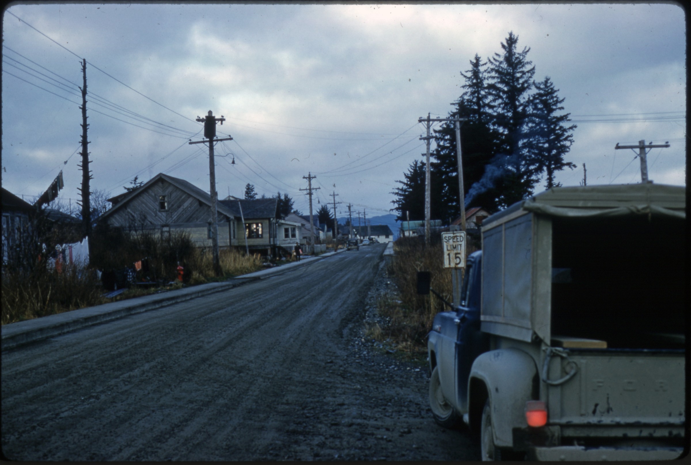 | 2818 — | Annette-Smuggler Cove site, Metlakatla, offloading Tom[?] [Harbor?] of WECO spec, to Ketchikan, Dec. 13-15, 1960 [street view, with houses at left, truck parked in right foreground. At AFN 2016, identified as Atkinson Street in Metlakatla, with Atkinson house at left, cannery housing visible at end of street] |
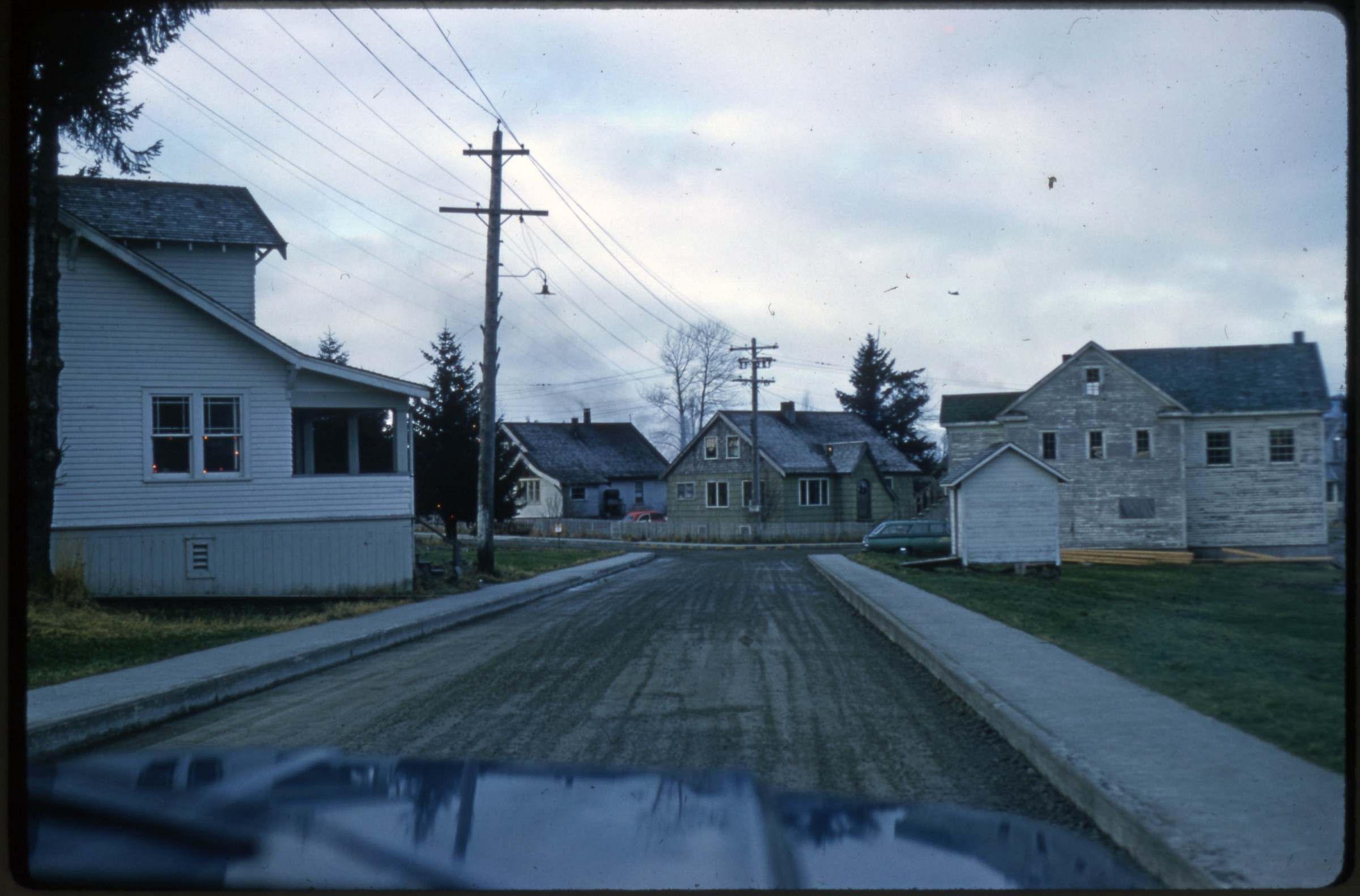 | 2819 — | Annette-Smuggler Cove site, Metlakatla, offloading Tom[?] [Harbor?] of WECO spec, to Ketchikan, Dec. 13-15, 1960 [street view in residential area. At AFN 2016, identified as Metlakatla, with old clinic at left, old Council chambers at right] |
| 2820 — | Annette-Smuggler Cove site, Metlakatla, offloading Tom[?] [Harbor?] of WECO spec, to Ketchikan, Dec. 13-15, 1960 [small boat harbor and docks] | |
| 2821 — | Annette-Smuggler Cove site, Metlakatla, offloading Tom[?] [Harbor?] of WECO spec, to Ketchikan, Dec. 13-15, 1960 [similar to .2820] | |
| 2822 — | Annette-Smuggler Cove site, Metlakatla, offloading Tom[?] [Harbor?] of WECO spec, to Ketchikan, Dec. 13-15, 1960 [cranes moving supplies on docks] | |
| 2823 — | Annette-Smuggler Cove site, Metlakatla, offloading Tom[?] [Harbor?] of WECO spec, to Ketchikan, Dec. 13-15, 1960 [Foss tug at dock] | |
| 2824 — | Annette-Smuggler Cove site, Metlakatla, offloading Tom[?] [Harbor?] of WECO spec, to Ketchikan, Dec. 13-15, 1960 [cranes offloading supplies from barges, truck parked on dock] | |
| 2825 — | Annette-Smuggler Cove site, Metlakatla, offloading Tom[?] [Harbor?] of WECO spec, to Ketchikan, Dec. 13-15, 1960 [similar to .2824] | |
| 2826 — | Annette-Smuggler Cove site, Metlakatla, offloading Tom[?] [Harbor?] of WECO spec, to Ketchikan, Dec. 13-15, 1960 [two amphibious airplanes on airstrip, including Grumman Goose airplane tail number N2751A] | |
| 2827 — | Duncan Canal-Petersburg acceptance, 16-18 Dec. ’60 [view from dock to Quonset hut on shore at left, snow on dock, boat tied next to small building in foreground right, photographer’s shadow in foreground] | |
| 2828 — | Duncan Canal-Petersburg acceptance, 16-18 Dec. ’60 [view from dock to truck parked on shore at right, snow on dock, boat tied next to small building in foreground right, photographer’s shadow in foreground] | |
| 2829 — | Duncan Canal-Petersburg acceptance, 16-18 Dec. ’60 [view down snow-covered dock to amphibious airplane, boat tied at left] | |
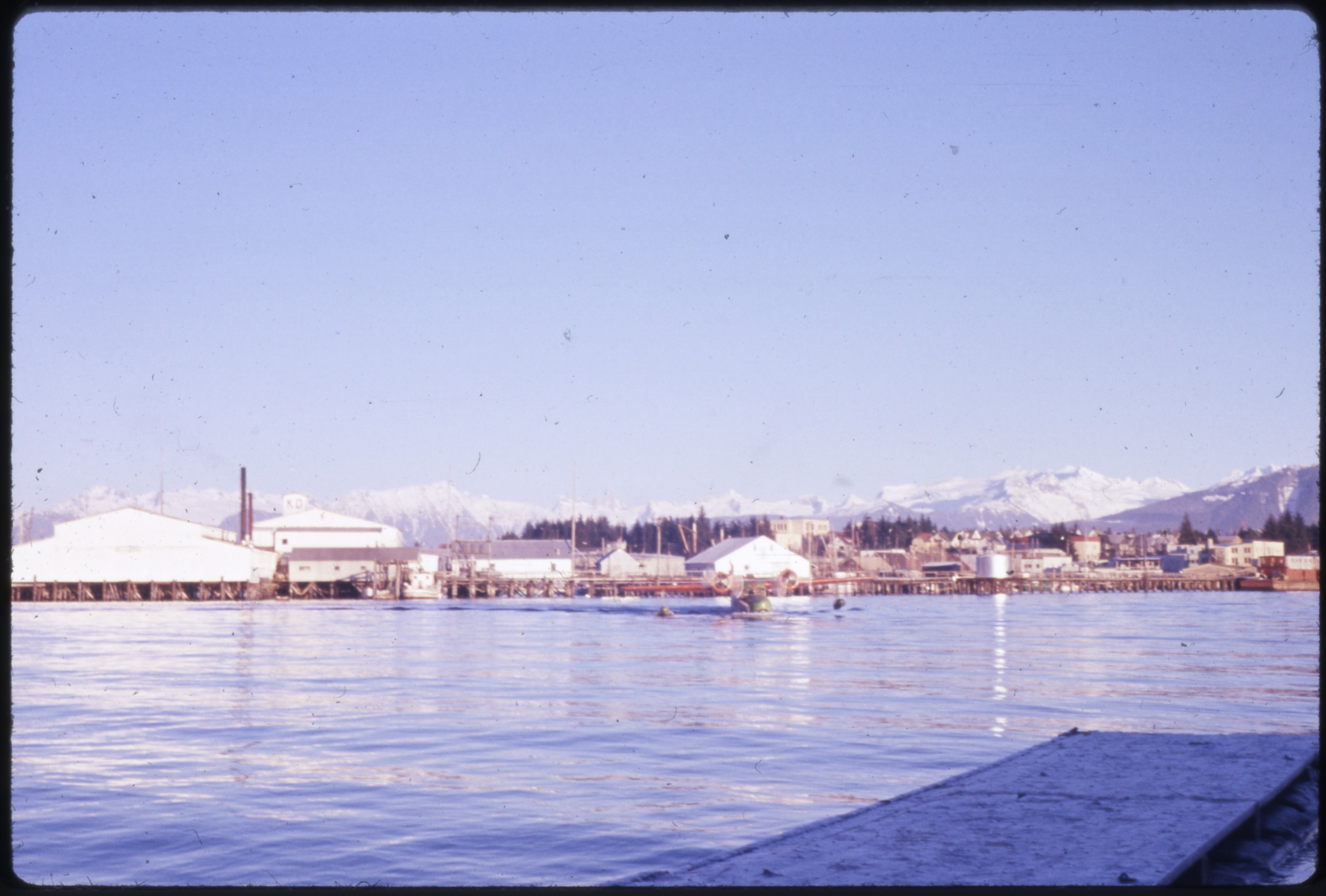 | 2830 — | Duncan Canal-Petersburg acceptance, 16-18 Dec. ’60 [view of waterfront from ship or amphibious airplane. At AFN 2016, identified as Petersburg] |
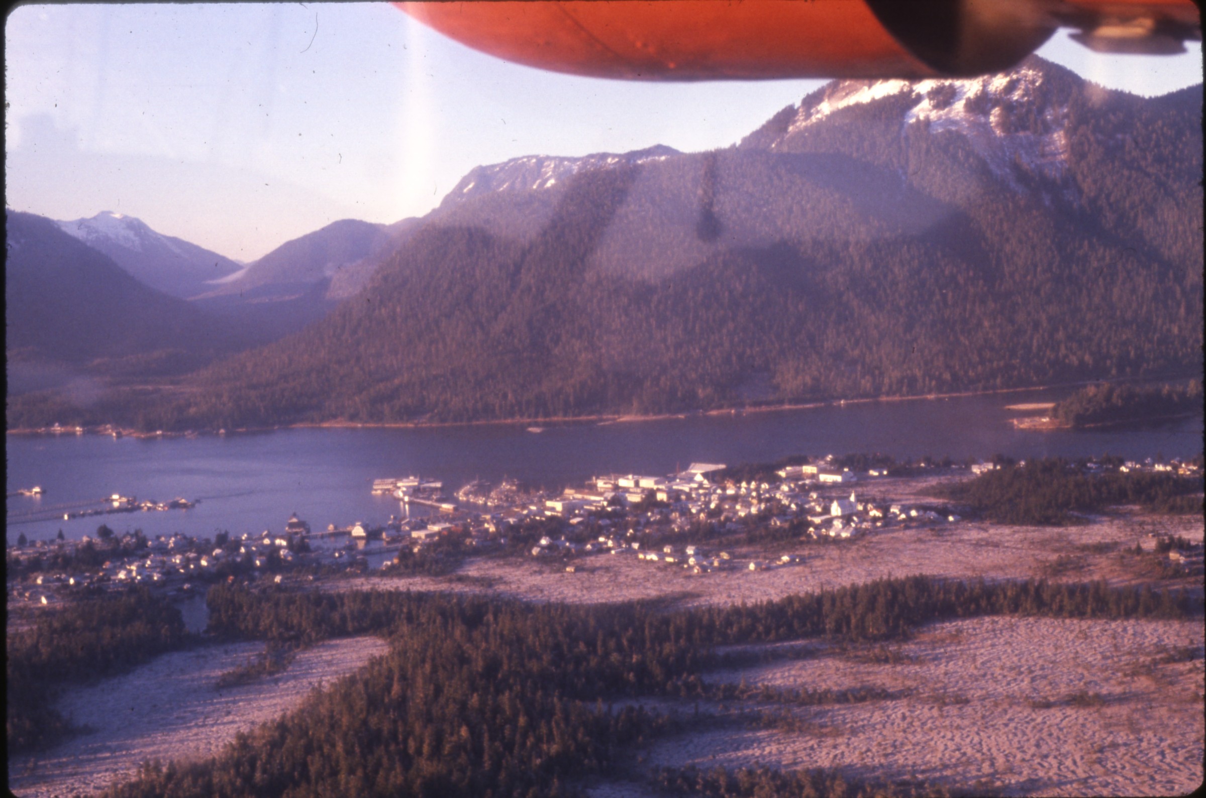 | 2831 — | Duncan Canal-Petersburg acceptance, 16-18 Dec. ’60 [aerial of town. At AFN 2017, identified as Petersburg] |
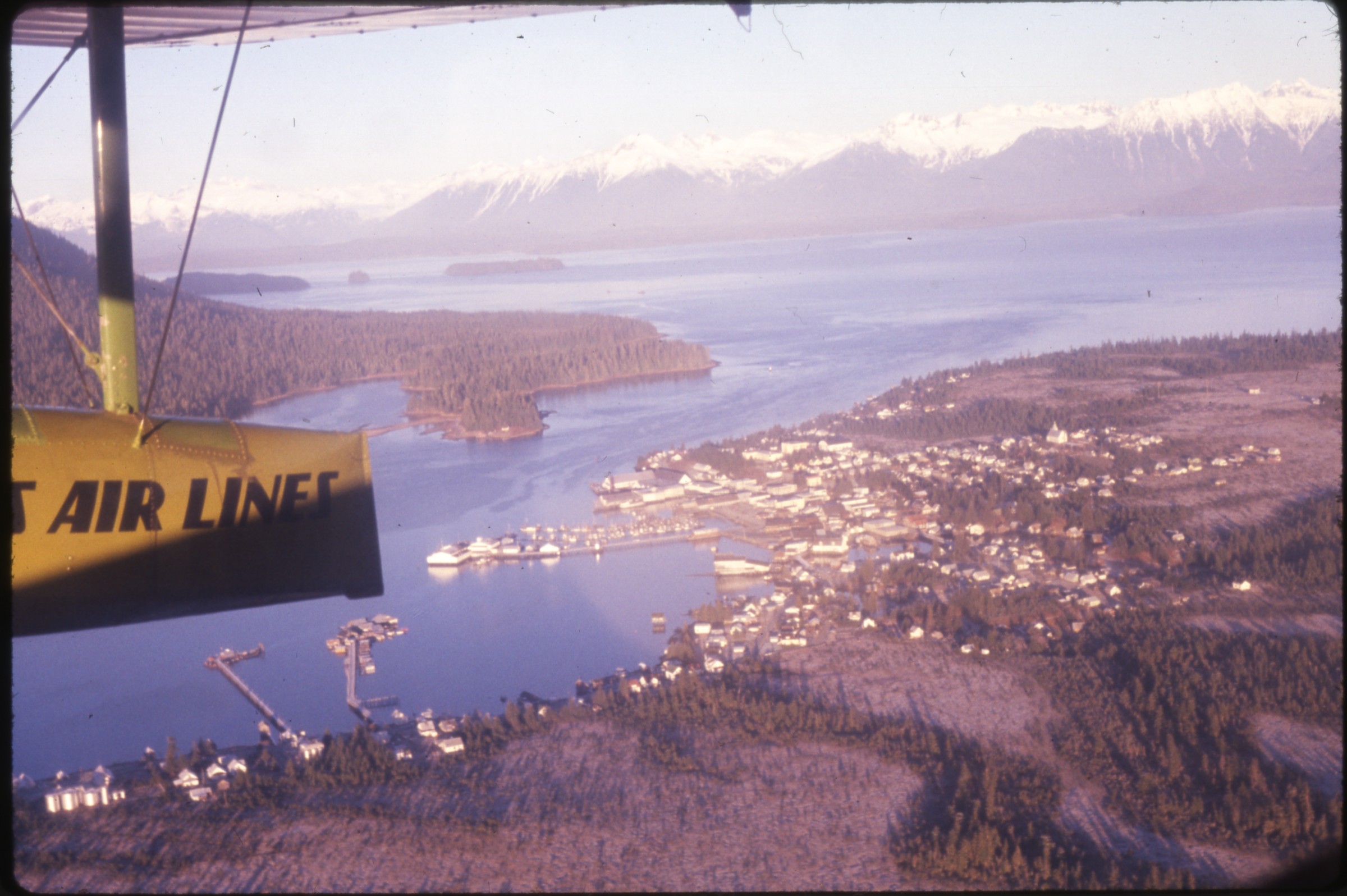 | 2832 — | Duncan Canal-Petersburg acceptance, 16-18 Dec. ’60 [aerial of town, airplane float in foreground. At AFN 2016, identified as Petersburg] |
| 2833 — | Duncan Canal-Petersburg acceptance, 16-18 Dec. ’60 [aerial of Quonset hut and buildings on spit of land] | |
| 2834 — | Duncan Canal-Petersburg acceptance, 16-18 Dec. ’60 [storage tank and small building on dirt road along shoreline] | |
| 2835 — | Duncan Canal-Petersburg acceptance, 16-18 Dec. ’60 [view down dirt road along shoreline, washed out in distance] | |
| 2836 — | Duncan Canal-Petersburg acceptance, 16-18 Dec. ’60 [view down dirt road along shoreline, truck parked at site of washout] | |
| 2837 — | Duncan Canal-Petersburg acceptance, 16-18 Dec. ’60 [distant view of tug and barge in channel, dock in middle ground] | |
| 2838 — | Duncan Canal-Petersburg acceptance, 16-18 Dec. ’60 [view along shoreline, tug and barge in channel at left] | |
| 2839 — | Duncan Canal-Petersburg acceptance, 16-18 Dec. ’60 [dirt road dead-ending at Quonset hut on shoreline, barge in channel at left] | |
| 2840 — | Duncan Canal-Petersburg acceptance, 16-18 Dec. ’60 [view down row of housing units along dirt road, photographer’s shadow in foreground] | |
| 2841 — | Duncan Canal-Petersburg acceptance, 16-18 Dec. ’60 [crates of supplies next to building at right, tropospheric scatter antenna at left, automobile parked next to communications tower in center] | |
| 2842 — | Duncan Canal-Petersburg acceptance, 16-18 Dec. ’60 [truck parked next to tarped piles of supplies next to building at left, tropospheric scatter antenna at right] | |
| 2843 — | Duncan Canal-Petersburg acceptance, 16-18 Dec. ’60 [aerial of docks, buildings, and storage tanks] | |
| 2844 — | Duncan Canal, Jan. ’61 [aerial of hilltop site in winter] | |
| 2845 — | Duncan Canal, Jan. ’61’60 [aerial of site in winter, with tropospheric scatter antennas] | |
| 2846 — | Duncan Canal, Jan. ’61 [aerial of site in winter, with tropospheric scatter antennas] | |
| 2847 — | Duncan Canal, Jan. ’61 [aerial of site in winter, with tropospheric scatter antennas] | |
| 2848 — | Juneau-DNC-Wrangell-[Chuck?]-KTN-Annette-PSBG, Aug. 11-15, 1961 [view of Quonset hut on shore from amphibious airplane, Duncan Canal?] | |
| 2849 — | Juneau-DNC-Wrangell-[Chuck?]-KTN-Annette-PSBG, Aug. 11-15, 1961 [milepost with mileages to locations including Annette 21 miles, Petersburg, Wrangell, Juneau, and Sitka] | |
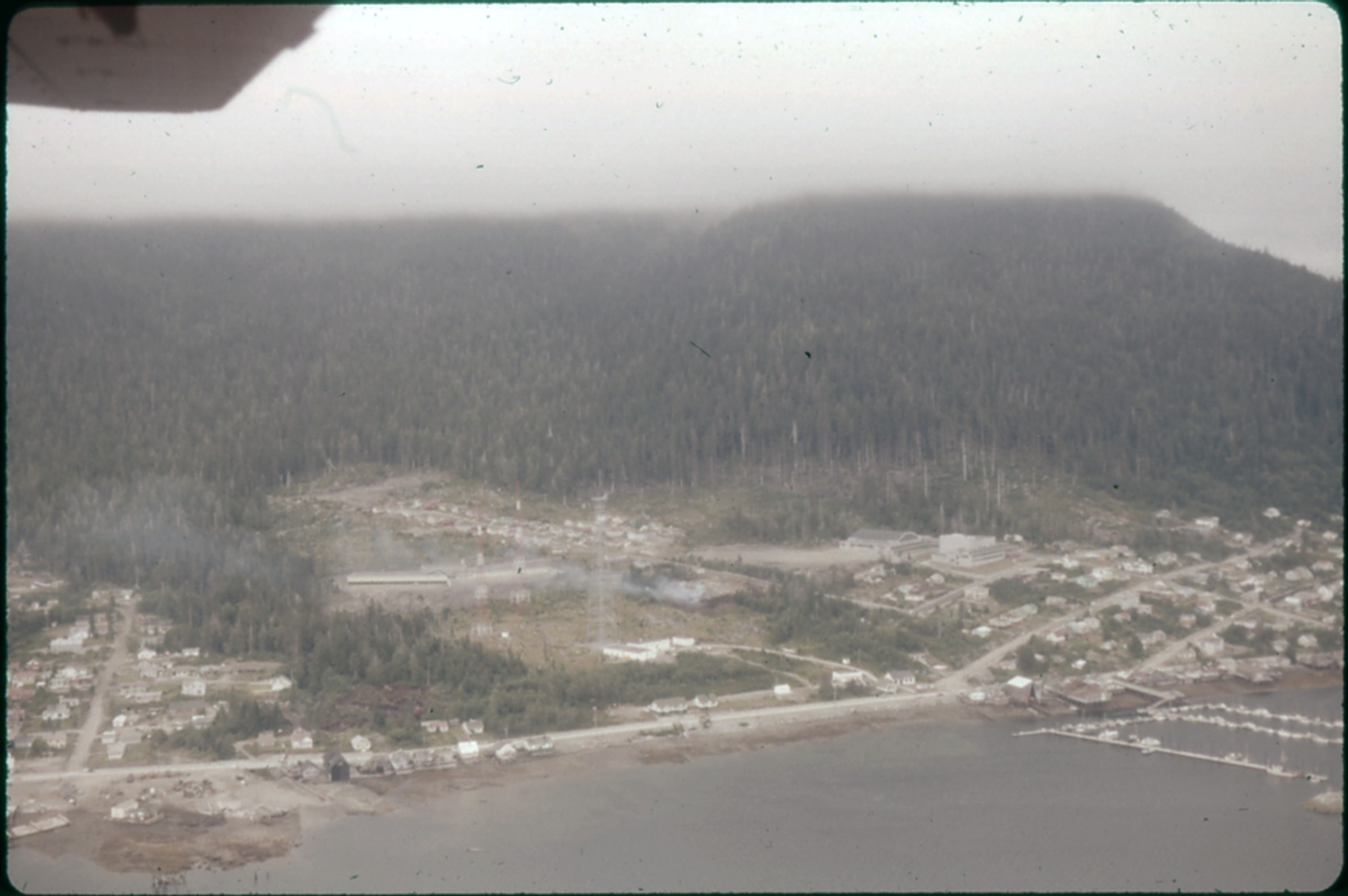 | 2850 — | Juneau-DNC-Wrangell-[Chuck?]-KTN-Annette-PSBG, Aug. 11-15, 1961 [aerial of town on coastline. At AFN 2017, location tentatively identified as Petersburg] |
| 2851 — | Juneau-DNC-Wrangell-[Chuck?]-KTN-Annette-PSBG, Aug. 11-15, 1961 [Alaska Coastal Airlines Grumman Goose airplane N4762C at dock, men on dock and on airplane] | |
| 2852 — | Juneau-DNC-Wrangell-[Chuck?]-KTN-Annette-PSBG, Aug. 11-15, 1961 [truck and shipping container on gravel beach, smoke at right possibly from burning debris] | |
| 2853 — | Juneau-DNC-Wrangell-[Chuck?]-KTN-Annette-PSBG, Aug. 11-15, 1961 [view from gravel shore out over water, small building at right] | |
| 2854 — | Juneau-DNC-Wrangell-[Chuck?]-KTN-Annette-PSBG, Aug. 11-15, 1961 [buildings at hilltop site] | |
| 2855 — | Juneau-DNC-Wrangell-[Chuck?]-KTN-Annette-PSBG, Aug. 11-15, 1961 [Quonset hut and equipment in forested area] | |
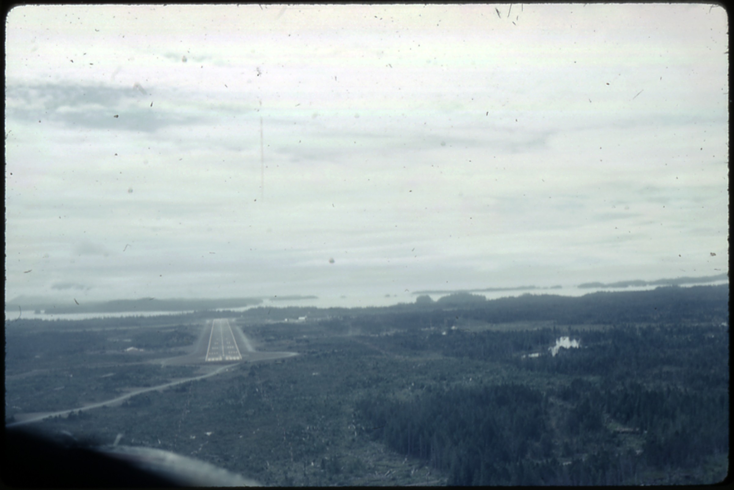 | 2856 — | Juneau-DNC-Wrangell-[Chuck?]-KTN-Annette-PSBG, Aug. 11-15, 1961 [aerial of airstrip. At AFN 2016, identified as Klawock] |
| 2857 — | Juneau-DNC-Wrangell-[Chuck?]-KTN-Annette-PSBG, Aug. 11-15, 1961 [aerial of airstrip] | |
| 2858 — | Juneau-DNC-Wrangell-[Chuck?]-KTN-Annette-PSBG, Aug. 11-15, 1961 [aerial of airstrip, with airplanes on ground, hangar at right, Annette?] | |
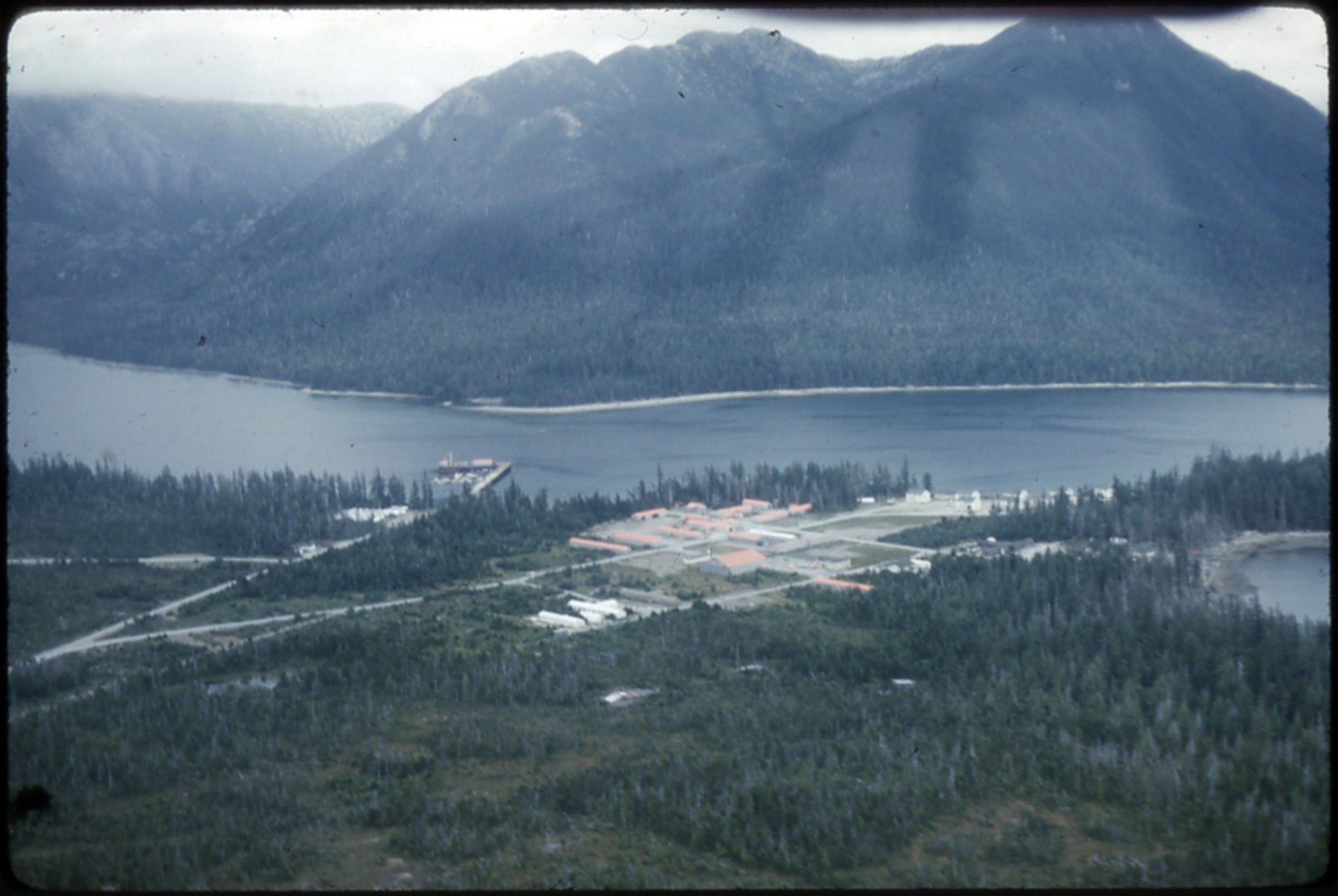 | 2859 — | Juneau-DNC-Wrangell-[Chuck?]-KTN-Annette-PSBG, Aug. 11-15, 1961 [aerial of site on coastline. At AFN 2016, identified as Annette Island, with Army housing with red roofs, FAA housing at far right] |
| 2860 — | Bear Creek, May 1962 [distant aerial of site on river. Cf. .1870] | |
| 2861 — | Bear Creek, May 1962 [pipes leading into building next to tropospheric scatter antenna] | |
| 2862 — | Bear Creek, May 1962 [microwave radar and tropospheric scatter antennas next to building] | |
| 2863 — | Bear Creek, May 1962 [automobiles and heavy equipment parked between microwave radar antenna and storage tank, buildings in background] | |
| 2864 — | Bear Creek, May 1962 [view across gravel clearing, metal barrels in right background] | |
| 2865 — | Bear Creek, May 1962 [metal barrels piled next to small structure in front of building at left, automobile and truck parked in center, Quonset huts in right background] | |
| 2866 — | Bear Creek, May 1962 [view across clearing to Quonset huts and building] | |
| 2867 — | Bear Creek, May 1962 [two tropospheric scatter antennas] | |
| 2868 — | Bear Creek, May 1962 [automobiles parked next to microwave radar antenna at right, building and tropospheric scatter antenna at left] | |
| 2869 — | Pedro Dome, 1962 [four tropospheric scatter antennas around building] | |
| 2870 — | MiDAS & Harding Lake sites, June 1962 [distant aerial of site on river. Cf. .1860] | |
| 2871 — | MiDAS & Harding Lake sites, June 1962 [building and three tropospheric scatter antennas] | |
| 2872 — | MiDAS & Harding Lake sites, June 1962 [automobiles parked outside long low building with signs for Eureka, Trading Post, Blacksmith Shop, [?] Saloon, signs at right for Chevron Gasoline and “Beer & Liquor To Go!”] | |
| 2873 — | MiDAS & Harding Lake sites, June 1962 [view down highway, mountains in distance] | |
| 2874 — | MiDAS & Harding Lake sites, June 1962 [distant view of radome, highway at left] | |
| 2875 — | MiDAS & Harding Lake sites, June 1962 [men standing next to building at hilltop site] | |
| 2876 — | MiDAS & Harding Lake sites, June 1962 [man walking near tractor and automobile on hilltop site] | |
| 2877 — | MiDAS & Harding Lake sites, June 1962 [truck climbing up dirt road to hilltop site, chain-link fence at left] | |
| 2878 — | [DNC?], June 1964 [aerial of communications site in forested area near coastline, Duncan Canal?] | |
| 2879 — | [DNC?], June 1964 [two men unloading gas canisters from Alaska Coastal-Ellis Airlines Grumman Goose airplane tail number N68157 on beach] | |
| 2880 — | [DNC?], June 1964 [two men unloading gas canisters from Alaska Coastal-Ellis Airlines Grumman Goose airplane tail number N68157 on beach, storage tank in background] | |
| 2881 — | Duncan Canal, Mona Lisa resupply, 14 Nov. 1964 [barge and tug near beach] | |
| 2882 — | Duncan Canal, Mona Lisa resupply, 14 Nov. 1964 [men unloading barge Skilak on beach] | |
| 2883 — | Duncan Canal, Mona Lisa resupply, 14 Nov. 1964 [men unloading equipment from barge] | |
| 2884 — | Duncan Canal, Mona Lisa resupply, 14 Nov. 1964 [men unloading equipment from barge] | |
| 2885 — | Duncan Canal, Mona Lisa resupply, 14 Nov. 1964 [men unloading barge Skilak on beach] | |
| 2886 — | Duncan Canal, Mona Lisa resupply, 14 Nov. 1964 [men unloading barge Skilak on beach] | |
| 2887 — | Juneau, Hoonah, Gustavus, Duncan Canal, Nov. 64 [view of site from amphibious airplane, boat coming out to meet airplane at right] | |
| 2888 — | Juneau, Hoonah, Gustavus, Duncan Canal, Nov. 64 [view of site from amphibious airplane] | |
| 2889 — | Juneau, Hoonah, Gustavus, Duncan Canal, Nov. 64 [Quonset hut un winter, door open, truck parked inside] | |
| 2890 — | Juneau, Hoonah, Gustavus, Duncan Canal, Nov. 64 [two tropospheric scatter antennas and small building on hilltop site in winter] | |
| 2891 — | Juneau, Hoonah, Gustavus, Duncan Canal, Nov. 64 [building and storage tank on hilltop site in winter] | |
| 2892 — | Duncan Canal, July ’66 [barge, tug, and floatplane at small dock on beach] | |
| 2893 — | Duncan Canal, July ’66 [man with fawn in equipment yard. Cf. .43] | |
| 2894 — | Duncan Canal, July ’66 [man and dog with fawn in equipment yard. Cf. .43] | |
| 2895 — | Duncan Canal, July ’66 [man feeding fawn with bottle in equipment yard. Cf. .43] | |
| 2896 — | Duncan Canal, July ’66 [man smoking cigarette petting fawn inside building, dog standing nearby. Cf. .43] | |
| 2897 — | Duncan Canal, July ’66 [man wearing cook’s hat and apron with fawn and dog in equipment yard. Cf. .43] | |
| 2898 — | Utopia-Hughes-FBX, 1967 [aerial of washed out bridge in fall, highway in center, buildings on both sides of road and river] | |
| 2899 — | Utopia-Hughes-FBX, 1967 [aerial of highway and river] | |
| 2900 — | Utopia-Hughes-FBX, 1967 [aerial of construction site in wooded area] | |
| 2901 — | Utopia-Hughes-FBX, 1967 [aerial of housing, Indian Mountain?] | |
| 2902 — | Utopia-Hughes-FBX, 1967 [aerial of dirt road up hill] | |
| 2903 — | Utopia-Hughes-FBX, 1967 [road sign reading “The 708 th A.C. & W. Squadron bids you welcome, Utopia Creek, Indian Mountain, Alaska,” building at right] | |
| 2904 — | Utopia-Hughes-FBX, 1967 [bird’s eye view of housing and dirt road, pile of metal barrels in foreground] | |
| 2905 — | Utopia-Hughes-FBX, 1967 [bird’s eye view of housing and dirt road, debris pile in foreground] | |
| 2906 — | Utopia-Hughes-FBX, 1967 [airplane landing on airstrip, Piper PA-22 Tri-Pacer airplane tail number N4549A parked at left] | |
| 2907 — | Utopia-Hughes-FBX, 1967 [distant view of radar site on hilltop] | |
| 2908 — | Utopia-Hughes-FBX, 1967 [radome and building] | |
| 2909 — | Utopia-Hughes-FBX, 1967 [bird’s eye view of buildings next to landing strip] | |
| 2910 — | Utopia-Hughes-FBX, 1967 [small airplane landing at Indian Mountain airstrip, building with sign for Utopia at right] | |
| 2911 — | Utopia-Hughes-FBX, 1967 [Wien Airlines de Havilland DHC-2 Beaver airplane tail number N3790G on airstrip, windsock at center] | |
| 2912 — | Utopia-Hughes-FBX, 1967 [aerial of airstrip] | |
| 2913 — | Utopia-Hughes-FBX, 1967 [several airplanes on ground at airstrip] | |
| 2914 — | Utopia-Hughes-FBX, 1967 [buildings, storage tanks, and microwave radar antennas at hilltop site] | |
| 2915 — | Utopia-Hughes-FBX, 1967 [two men standing next to truck parked outside building at hilltop site] Guide updated: January 2, 2018 |