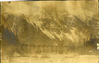
| | 1 — | Treadwell Mines, Douglas Island. Juneau, Alaska [published images from a book or
magazine]
Leaf 2: |
| | 2 — | Dyea—Apr. 1898 [bridge across Taiya River in foreground, small boat with white sail next
to bridge, town in background] |
| | 3 — | [Skagway wharves, one with building at end with “Empire Theatre” sign]
|
| | 4 — | Outfits on the Beach—Dyea [this is a cropped version of a well-known image by E. A.
Hegg; see Murray Morgan, One Man’s Gold Rush (Seattle: Univ. of Washington, 1967), p. 48] |
| | 5 — | Building Boats on Lake Bennett [tents, lumber and men next to frozen lake]
Leaf 3: |
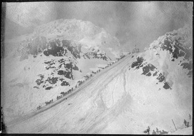
| | 6 — | Chilcoot Summit Looking So. 3063 [feet elevation. Men and supplies along trail, and
cables for aerial tramway] |
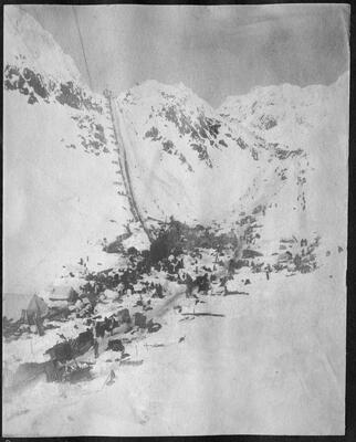
| | 7 — | Outfit on Top [supplies, men, dogs, with tram cables in middle of image] |
| | 8 — | Canyon City 9 mi from Dyea [tents and frame buildings, one with sign “The Packers Rest /
Sample Room. / Rose & Hagaman] |
| | 9 — | [mounted figure on horse, leading four or five packhorses across lake or shallow river]
Leaf 4: |
| 10 — | Bridge on Wagon Rd. 4 1/3 [miles] from Skagway [image of same Brackett’s Wagon
Road bridge across the Skagway River, under construction, is in Cynthia Brackett Driscoll, One
Woman’s Gold Rush: Snapshots from Mollie Brackett’s Lost Photo Album, 1898-1899
(Kalamazoo, MI: Oak Woods Media, 1996), p. 45] |
| | 11 — | Snow Slide Apr. 3 98 [men next to Chilkoot Trail, building, power poles and tramway
supports visible, with Chilkoot Pass in distance] |
| | 12 — | [men hauling loaded sleds across frozen lake—Canadian side of Chilkoot Trail?] |
| | 13 — | Profanity Hill 1 mile from Summit [Chilkoot Trail, man in foreground sitting on sled,
tramway with large payload in background]
Leaf 5: |
| 14 — | Loading P[ac]k train 9 M from Dyea [same image is in Robert L. Spude, Chilkoot Trail:
Historic Data (Fairbanks: Cooperative Park Studies Unit, 1980), p. 90, captioned “Beginning of
Switchbacks, 1898” and credited to the Seattle Historical Society]
Leaf 6: |
| | 15 — | Porcupine Hill 5 ½ [miles] from Skagway [Chilkoot Trail in foreground, no people]
Leaf 7: |
| 16 — | Climbing Chilcoot Summit Last Climb to Top |
| | 17 — | 1 ½ [miles] down from White Pass—Pack Train [winter scene] |
| | 18 — | Dog Team Lake Linderman Elev 2140 [photo in bad condition]
Leaf 8: |
| 19 — | The Scales At The Summitt 3373 [feet elevation]
Leaf 9: |
| | 20 — | Lake Bennett from Linderman [late winter scene]
Leaf 10: |
| | 21 — | Sled Breaker Lake Lind[eman] [men and sleds next to rough trail during breakup] |
| | 22 — | Crater Lake [men and supplies in foreground, Chilkoot Pass in background] |
| | 23 — | Finnigins [Finnegan’s] P[oin]t. 4 ¼ [miles] from Dyea [two men on trail]
|
| | 24 — | Highest Pt. White Pass [tents, trail, flag]
Leaf 11: |
| | 25 — | Lake Linderman Portage bet. L. L. and L. Bennett |
| | 26 — | Stone House 1 ½ [miles] toward Summitt from Sheep Camp [Chilkoot Trail with horses,
power poles, tramline supports] |
| | 27 — | In Canyon 9 ½ [miles] from Dyea [tent, men, horses and mules. Compare .54]
Leaf 12: |
| | 28 — | [two men with overturned sled, breakup on Chilkoot Trail?] |
| | 29 — | [Indians mounted on horses, tipi in background] |
| | 30 — | [Indians on horses, log fence in background] |
| | 31 — | [priest standing in overgrown field or cemetery facing large crucifix, stone wall with cross
in background]
Leaf 13: |
| | 32 — | [lake and steep mountains] |
| | 33 — | [similar to .32] |
| | 34 — | [lake and two boats in distance; compare .38] |
| | 35 — | [Catholic mission buildings?] |
| | 36 — | [buildings on rocky shore with sandy beach in front]
Leaf 14: |
| | 37 — | [mountain with glacier on its side—Canadian Rockies?] |
| | 38 — | Off Malaspina Glacier, about 9:30pm [image is of lake or ocean with boats in distance;
compare .34] |
| | 39 — | [mountain with frozen stream at base—Canadian Rockies?] |
| | 40 — | On the Stony Indian Reservation. LJ Steele. [two figures on horseback] |
| | 41 — | Stony Indian. LJ Steele. [Indian with braids, tipi in background] |
| | 42 — | [three Indian women kneeling in front of tipi] |
| | 43 — | A Stony Indian camp [Indians and tipi] |
| | 44 — | Near the summit of Mt. Blanc—LJ Steele |
| | 45 — | Descent from _____ _____ (Mont. Blanc Range). Jumping a bergschrund. LJ S[teele?] |
| | 46 — | [three tipis] |
| | 47 — | The summit of Mont Blanc. 7:30am. July 1901. LJ Steele |
| | 48 — | [roped figure on mountain]
Leaf 15: |
| | 49 — | 8 m[iles] from Summitt [three figures on trail cleared through stony plain—Chilkoot
Trail?] |
| | 50 — | Paridice Valley 4 ¾ [miles] from Lake Lind[eman] [melting Chilkoot Trail] |
| | 51 — | Sheep Camp 15 m[iles] from Dyea. Last camping ground on s[outh] side of summit.
Timber Line. [buildings with tramline and tower visible]
Leaf 16: |
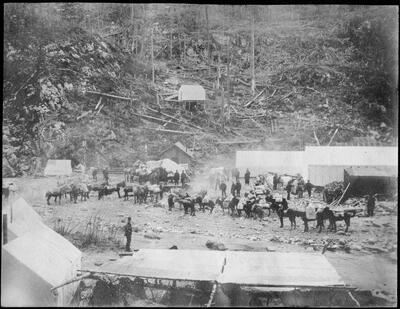
| | 52 — | A Bad Hill 5 m[iles] from Skagway [horses and men, on Chilkoot Trail?]
|
| | 53 — | 7/8 [mile] from Summitt [horse pulling sled with man in it, two other figures] |
| | 54 — | Canyon 9 m[iles] from Dyea [men with three loaded mules. Compare .27]
[Detached from the album]
Booklet. “A Descriptive Reading on Alaska: Illustrated by 12 Lantern Slides,” (Philadelphia:
William H. Rau, 1890)
Brochure. “The Klondike Region,” (St. Paul, MN?: Northern Pacific Railroad, 1897) [see
WorldCat record 29592988]
Leaf 17: |
| | 55 — | [mountain scene, features labeled in ink: “Chaba [River] S. Branch” and “W. Br.” The
Chaba River is a tributary of the Athabasca River in Alberta, Canada] |
| | 56 — | [mountain scene, feature labeled “Big Peek?”] |
| | 57 — | [mountain scene, features labeled “Big Peak (?)” and “Atha[basca] Pass is behind this
Peek”]
Leaf 18: |
| | 58 — | Illisnick Unalaska [view of Unalaska, or Illiuliuk village from the water, a rowboat with
two figures in foreground] |
| | 59 — | [cemetery with Orthodox crosses and American flag] |
| | 60 — | Proyazoff [Pribilof Island fur seals?] |
| | 61 — | Yakutat Bay [group of dugout canoes and rowboats in front of houses on beach] |
| | 62 — | Study of Stony Indian girl. LJ Steele |
| | 63a — | Indian teepee Stony Indian Reservation. LJ Steele |
| | 63b — | Stony Indian Family [four Indians in front of tipi; same as .65] |
| | 64 — | two Indian women, one the same as in .62 |
| | 65 — | same as .63b |
| | 66 — | Stony Indian [Indian man mounted on horse] |
| | 67 — | [Indian woman and man in front of tipi] |
| | 68 — | [Indian kneeling next to horse] |
| | 69 — | [figure with rifle standing next to tipi]
Leaf 19:
[Correspondence relating to the Alaska-Snettisham Gold Mining Company]
John N. Tisdale, President, to Henry G. Bryant, December 28, 1903
Announcement to the stockholders, December 18, 1903
Leaf 20:
Announcement to the stockholders, undated
Announcement of a special meeting, October 13, 1903
Letter regarding bond offer, December 22, 1903.
John N. Tisdale to Henry G. Bryant, February 1, 1901
Stock certificate, Alaska-Snettisham Gold Mining Company, 50 shares to Henry G. Bryant,
April 25, 1900
John N. Tisdale to Henry G. Bryant, December 15, 1903
Leaf 21: |
| | 70 — | Dutch Harbor [figures standing and seated in a circle, Unalaska village and two ships in
background] |
| | 71 — | [Unalaska? Russian Orthodox church in distance] |
| | 72 — | [Russian blockhouse, Sitka] |
| | 73 — | [large skin boat being rowed by eight men, sailing ship in background]
Separate from original album: |
| | 74 — | [hot spring/geyser] |
| | 75 — | [man and three women next to rocky stream] |
| | 76 — | [three men standing with dead woodland caribou—Henry Bryant with guides?] |
| | 77 — | [stock certificate: Alaska-Snettisham Gold Mining Company, 100 shares to Henry G.
Bryant, November 19, 1900] |
| | 78 — | [newspaper clipping: THE MINERS WHO FAILED, Chicago: Oct. 3, year?]
Guide written April 26, 2012 |


