| | 1 — | .62 – [slides corresponding to Alyeska Pipeline Oil Company, “General Slide Presentation.”
See text in B5 for individual captions. Missing presentation slides 2, 8, 14, 20, 22-24, 30-31, 34,
36-37, 39, 46, 54, 56, 65-66. Handwritten caption sheet indicates Brendle removed these
slides for a later slide show] |
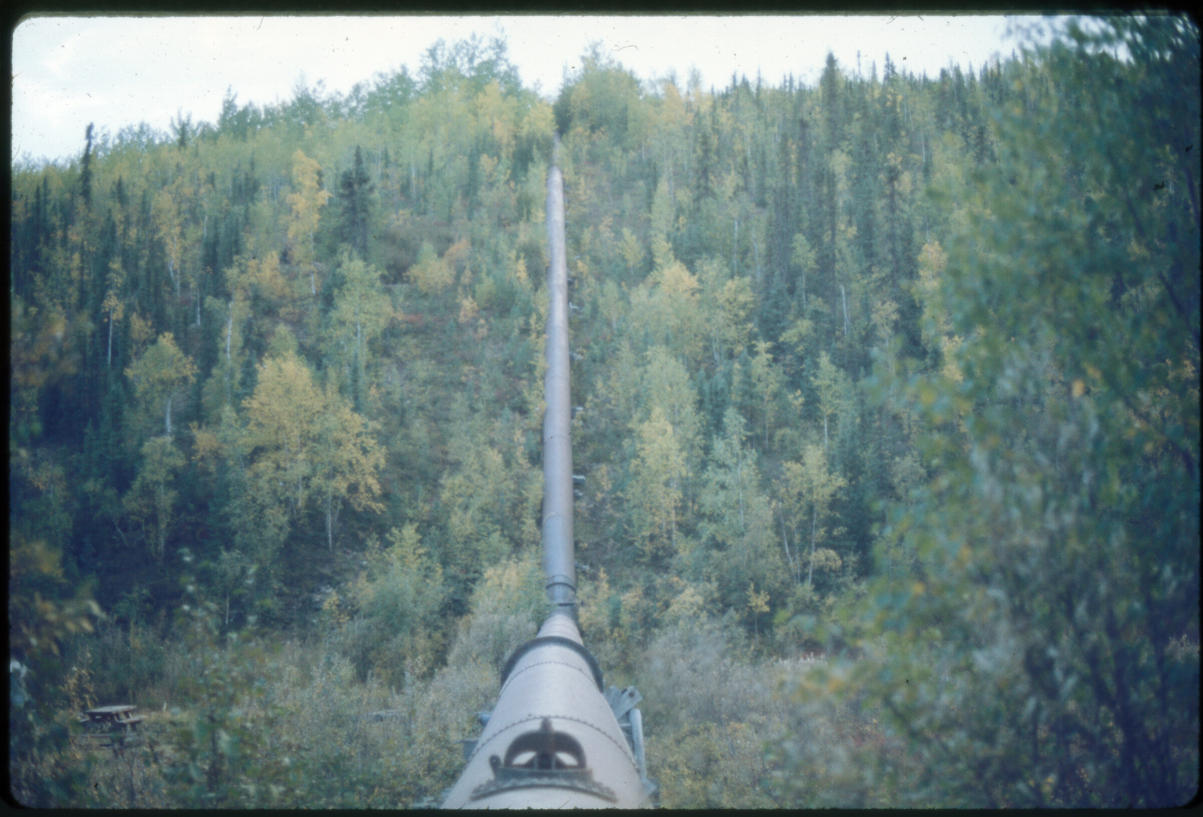
| | 63 — | B-1. Near Valdez [single stump in densely forested area; print date Nov 70. Cf. .140] |
| | 64 — | B-2. Dense timber, Valdez area [aerial view of forest; print date Nov 70] |
| | 65 — | B-4. Brushed line hwy xing, Hogan’s Hill so. [view of forest from shoulder of road, flags
on brush in foreground; print date Nov 70] |
| | 66 — | B-5. Brushed line hwy xing, Hogan’s Hill no. [view of forest; print date Nov 70] |
| | 67 — | B-6. 3’ brushed line from air, Little Tonsina area [aerial view, snow-covered mountains in
distance; print date Nov 70] |
| | 68 — | B-7. Typ. clearing, Copper R. basin [aerial view of cut through forest; print date Nov 70] |
| | 69 — | B-8. Clearing near Copper Center [aerial view of cut through forest, light snow cover;
print date Nov 70] |
| | 70 — | B-9. Rich. Hwy. xing, Little Tonsina area [aerial view of cut and Richardson Highway, light
snow cover; print date Nov 70]
|
| | 71 — | B-10. Leaner [leaning pine tree; print date Nov 70] |
| | 72 — | B-11. Leaner tree [cut tree held up by surrounding trees; print date Nov 70] |
| | 73 — | B-12. Dbl. brushed line, Little Tonsina R. area [aerial view of Richardson Highway, left,
and double cut at right, light snow cover; print date Nov 70] |
| | 74 — | B-8. [scenic of braided river in mountainous area, light snow cover, probably Little
Tonsina River; print date Nov 70] |
| | 75 — | C-1. 26 G 10 [Bell 412 helicopter landing equipment in clearing, two men on ground near
supplies] |
| | 76 — | C-3. [Prinoth Go-Tract tracked vehicle carrying crane or drilling equipment in clearing
with light snow cover; print date Nov 70] |
| | 77 — | C-4. [dense forest and brush] |
| | 78 — | C-1. Tsina use & GS B.M. 27 F 2 [aerial of mountains, light snow cover] |
| | 79 — | C-3. PA from air [aerial of pink marker on tundra] |
| | 80 — | C-4. Brendle 1. PA from air [aerial of pink marker in forest, transmission lines in lower
frame; print date Sep 70] |
| | 81 — | C-5. PA 143 from air [aerial of pink marker in forest, transmission lines at right; print date
Sep 70] |
| | 82 — | C-6. Brendle 2. PA from ground [wooden marker with pink tape in brush, marker PA 142-
C TAPS] |
| | 83 — | C-6. FML benchmark [wooden markers with pink tape on gravel road; print date Oct 70] |
| | 84 — | C-7. PA and PG [wooden markers with pink tape in brush; print date Sep 70. Cf. .97] |
| | 85 — | C-8. Typical PG & RPs [aerial of pink markers on taiga; print date Nov 70] |
| | 86 — | E-1. Helicopter support [Kenai Air Service Bell 206 JetRanger helicopter 1463W on
ground; print date Nov 70] |
| | 87 — | E-2. Standard Goose [Grumman Goose amphibious airplane at airstrip; print date Nov
70] |
| | 88 — | N-10. 47. [close-up of equipment buried in snow; print date Apr 71] |
| | 89 — | R-1. Pipeline crossing of Little Tonsina R. [aerial of frozen river bend; print date Nov 70 |
| | 90 — | R-2. Hess Cr. pipeline crossing [aerial of river bend in summer; print date Nov 70] |
| | 91 — | R-3. Goldstream Cr. [aerial of winding river, light snow cover; print date Nov 70] |
| | 92 — | R-4. Chatanika R. crossing [aerial of winding river in summer; print date Nov 70] |
| | 93 — | R-5. Phelan Cr. crossing [aerial of Richardson Highway, river valley, mountains, rainbow;
print date Oct 70] |
| | 94 — | R-6. Klutina R. crossing [aerial of river and cut, buildings along road in lower frame, light
snow cover, Copper Center area; print date Nov 70] |
| | 95 — | R-7. Yukon R. xing [aerial of frozen river; print date Nov 70] |
| | 96 — | R-8. Klutina R., no. bank [aerial of steep bluff along river, light snow cover; print date Nov
70] |
| | 97 — | S-8. [PA and PG markers in brush; print date Sep 70. Cf. 84] |
| | 98 — | T-1. State map [Alaska map, “Trans Alaska Pipeline System, Prudhoe Bay-Valdez, 1969”;
print date Nov 70] |
| | 99 — | T-2. Lowe R.-Thompson Pass [aerial of river valley; print date Nov 70] |
| | 100 — | T-3. Lowe R. alignment [aerial of cut passing above tree line up mountains, light snow
cover; print date Nov 70]
|
| | 101 — | T-4. Align s. end Keystone Canyon [aerial of river valley, light snow cover; print date Nov
70] |
| | 102 — | T-5. Location above Keystone Canyon [aerial of Richardson Highway, light snow cover;
print date Mar 71] |
| | 103 — | T-5. Location above Keystone Canyon [same as .102; print date Nov 70] |
| | 104 — | T-7. Lowe R.-Thompson Pass area [aerial of Richardson Highway through river valley,
light snow cover; print date Nov 70] |
| | 105 — | T-8. Align. to bench above Lowe R. [aerial of Richardson Highway, light snow cover;
print date Nov 70] |
| | 106 — | T-9. Bench above Lowe R. [aerial of Richardson Highway, light snow cover; print date
Nov 70] |
| | 107 — | T-13. Tsina Valley [aerial of river valley, light snow cover; print date Nov 70] |
| | 108 — | T-14. Little Tonsina area [aerial of Richardson Highway and pipeline cut, light snow
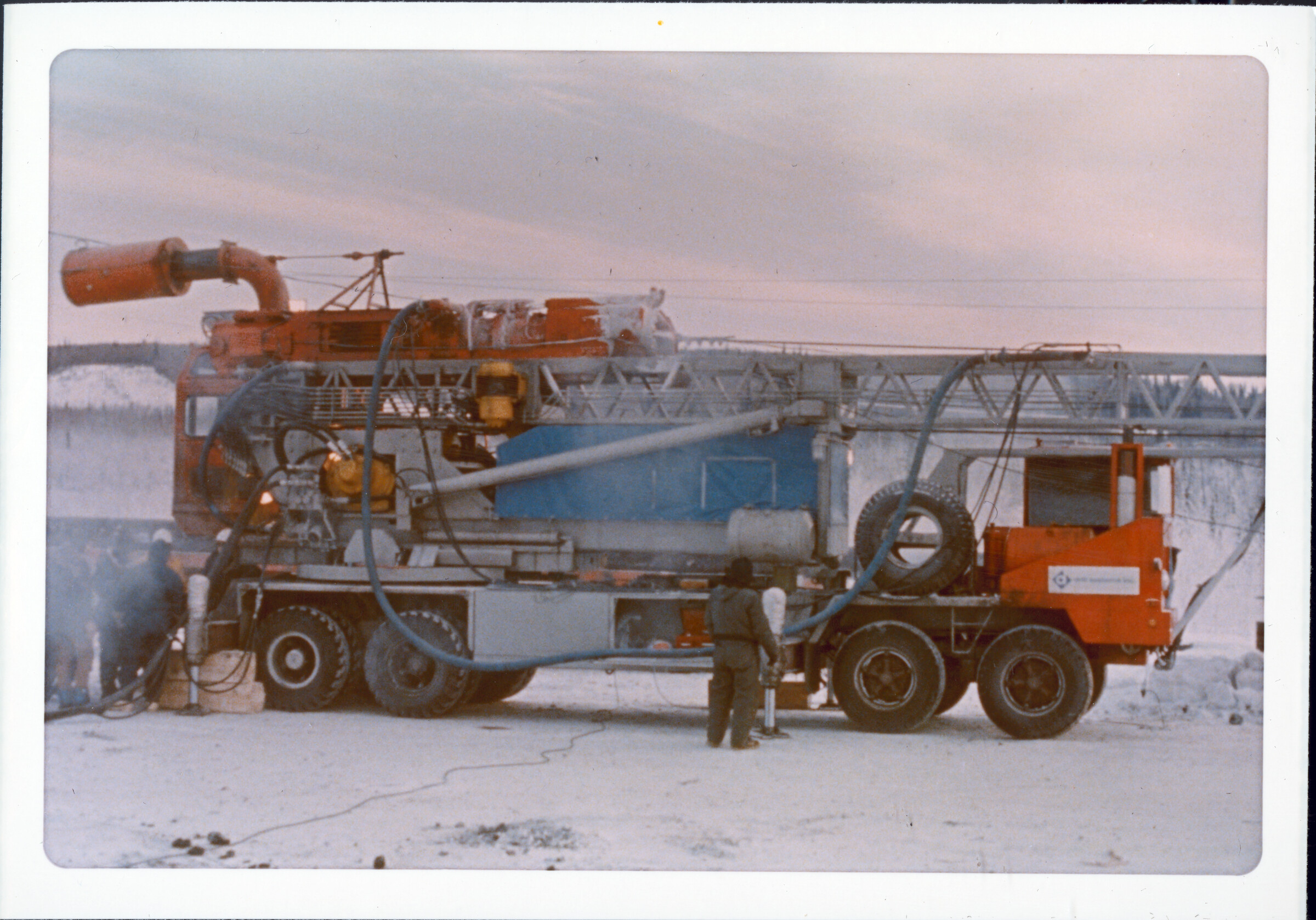
cover; print date Nov 70] |
| | 109 — | T-15. Typ. flat terrain, Copper R. basin [aerial of Richardson Highway, light snow cover;
print date Nov 70] |
| | 110 — | T-16. Typ. potholes, Copper R. basin [aerial of cut through forest and clearings, frozen
kettles, light snow cover; print date Nov 70] |
| | 111 — | T-16a. Cleared line no. from Hogan’s Hill [aerial of cut through forest; print date Nov 70] |
| | 112 — | T-17. Align. Summit Lake area [aerial of cut across snowy tundra; print date Nov 70] |
| | 113 — | T-18. Alig. on ridge to Delta R. [aerial of river valley in winter; print date Nov 70] |
| | 114 — | T-19. Pipeline, Delta R. [aerial of Richardson Highway and cut through river valley in
winter; print date Nov 70] |
| | 115 — | T-20. Pipeline location, Delta R. [aerial of Richardson Highway and cut through river
valley in winter; print date Nov 70] |
| | 116 — | T-21. Typical terrain no. Black Rapids [aerial of Richardson Highway and cut through
river valley in winter; print date Nov 70] |
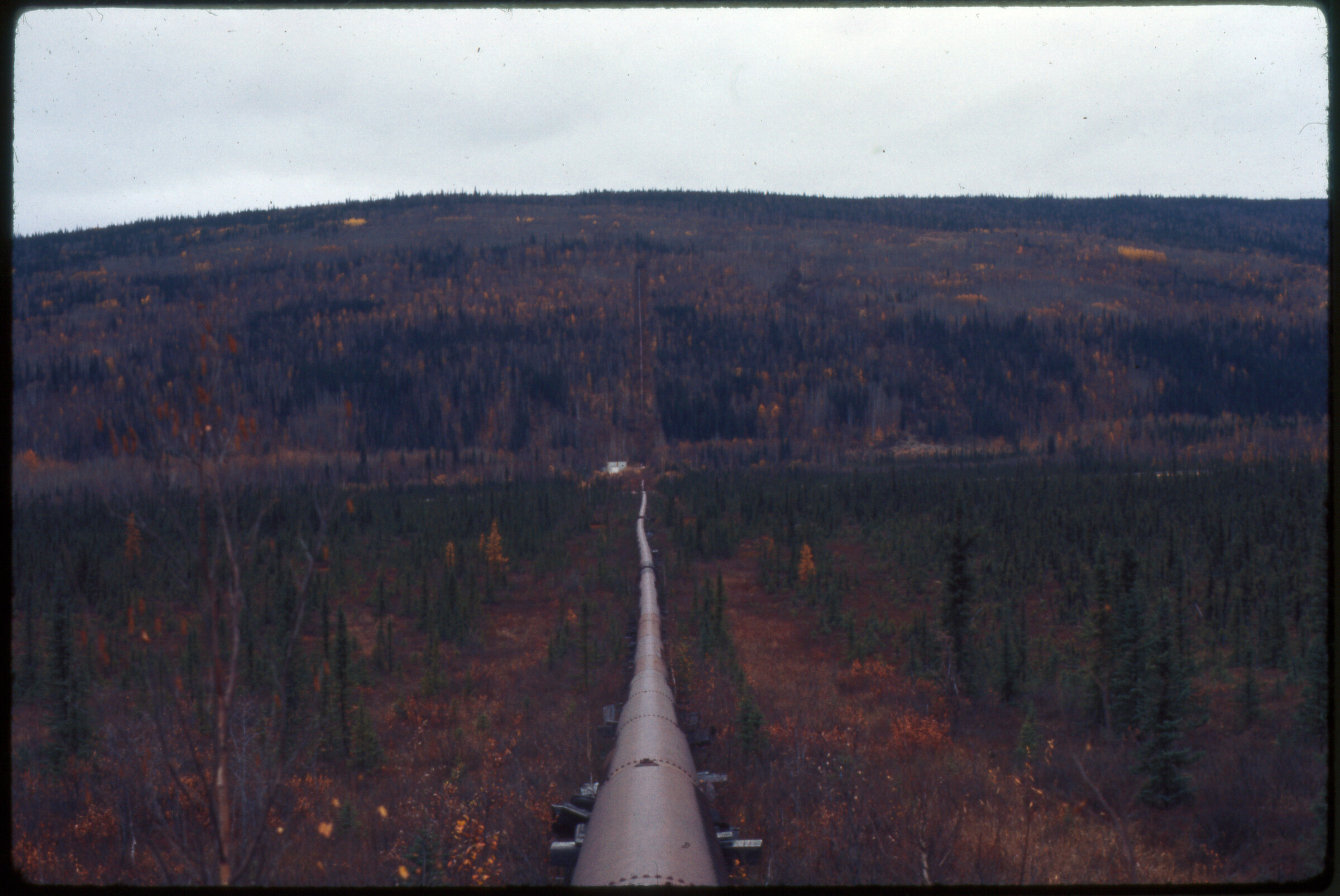
| | 117 — | T-22. Terrain Ft. Greely area [aerial of Richardson Highway and cut in winter; print date
Nov 70] |
| | 118 — | T-23. Shaw Cr. flats [aerial of cut in winter; print date Nov 70] |
| | 119 — | T-24. Shaw Cr. flats, clear & expl. Trail [aerial of cut in winter; print date Nov 70.
Original image blurry] |
| | 120 — | T-25. Typ. terrain Goldstream north [aerial of landscape, light snow cover; print date
Nov 70. Original image blurry] |
| | 121 — | T-26. Typ. ridge location of pipeline no. of Goldstream [aerial of landscape, light snow
cover; print date Nov 70. Original image blurry] |
| | 122 — | T-27. Exp. trail & p.l. ridge location [aerial of cut, light snow cover; print date Nov 70.
Original image blurry] |
| | 123 — | T-28. Isom Cr. and valley crossing [aerial of cut, Dalton Highway at right, light snow
cover; print date Nov 70] |
| | 124 — | T-29. Winter surveying conditions so. of Yukon R. [aerial of forest with hoar frost; print
date Nov 70] |
| | 125 — | X-4. [man exiting Bechtel Rolligon RD-85 “Experimental,” airplane at left; print date Sep
72]
[Tentative caption information for Y series images based on data on numbered slide ID sheet
typed on Brendle Tile Company letterhead] |
| | 126 — | Y-4. [scenic of lake, light snow on mountains in background] |
| | 127 — | Y-5. Thompson Pass [scenic of tundra; print date Nov 70] |
| | 128 — | Y-6. Tsina R. [arrows] route [aerial of river through forested area; print date Nov 70] |
| | 129 — | Y-7. Tonsina R. [aerial of river in summer, buildings along road at left; print date Nov 70] |
| | 130 — | Y-8. Glennallen [aerial of town on Glenn Highway; print date Nov 70]] |
| | 131 — | Y-9. Paxson Lodge [automobiles parked outside of roadhouse; print date Nov 70] |
| | 132 — | Y-10. Paxson L. [scenic of Paxson Lake with tundra and mountains; print date Nov 70] |
| | 133 — | Y-11. Mi. 213. Looking no. [view down gravel river bed, mountains and Richardson
Highway at right, Delta River?] |
| | 134 — | Y-13. N-18 [fractured ground, permafrost or archaeological site?] |
| | 135 — | Y-14. N-19. 57 [man standing next to tarp-covered table holding archeological artifacts
uncovered during pipeline construction, North Slope? print date Apr 71] |
| | 136 — | Y-16. Water area along pipeline route, Salcha-Chena R. [aerial of landscape and small
lake in summer; print date Nov 70] |
| | 137 — | Y-17. Yukon R. crossing [aerial of river in summer; print date Nov 70] |
| | 138 — | Y-18. 15. [stacks of pipeline in yard, Valdez? print date Sep 70] |
| | 139 — | Y-19. Keystone Canyon [aerial of Richardson Highway and Horsetail Falls in summer;
print date Nov 70] |
| | 140 — | Y-22. B-3. Typical 3d brushed line [single stump in densely forested area, mountains in
distance; print date Sep 70. Cf. .63] |
| | 141 — | Y-23. E-3. BLM heliport, Fairbanks [man wearing heavy winter clothing standing
outdoors, helicopter at right, building in background left, Bob Johnson? print date Nov 70] |
| | 142 — | Y-24. RCB. Rakes Landing [building foundation, wheels and axles, and metal barrels
along river bank, former roadhouse site along Eagle-Valdez Military Trail; print date May 71.
Cf. .1021] |
| | 143 — | Y-25. RCB. Rakes Landing lodge [dilapidated log building with broken windows; print
date May 71. Cf. .1019] |
| | 144 — | Y-26. [aerial of cut through forest in summer, trails near Pump Station 6? print date Sep
73] |
| | 145 — | Y-27. [aerial of cut in fall, Tatalina River rehabilitation area? print date Sep 71] |
| | 146 — | Y-28. RCB. Icing, Elliott Hwy. [close-up of cross-section of earth showing ice; print date
May 71] |
| | 147 — | Y-29. X-61. RCB. Box X. Livengood Road icings [ice seeps along road, hose and narrow
pipe at left, culvert thaw equipment? print date Apr 71] |
| | 148 — | Y-31. RCB. Lost Creek culvert [ice in corrugated metal culvert pipes; print date May 71] |
| | 149 — | Y-32. RCB. Lost Creek, high water [equipment parked on dirt road next to flooded area;
print date May 71] |
| | 150 — | Y-33. RCB. Lost Creek, road washout [aerial of flooded road and land; print date May
71] |
| | 151 — | Y-34. RCB. Lost Creek, road washout [aerial of flooded road and land; print date May
71]
|
| | 152 — | Y-35. RCB. Lost Creek washout [man standing amid gravel piles along damaged
roadway, helicopter landing behind him; print date May 71] |
| | 153 — | Y-36. [wooden marker in snow in forested area, footprints along trail, survey line? print
date Apr 73] |
| | 154 — | Y-38. [aerial of cleared area in forest, borrow area hole? print date Sep 71] |
| | 155 — | Y-39. N-1. [close-up of wooden marker in hole drilled in earth, vertical support member
auger hole? Print date Sep 71. Cf. .157] |
| | 156 — | Y-40. RCB. ’68 Trail so. of Yukon R. [flooding in clear-cut area, trail thaw Pump Station
6? Print date May 71] |
| | 157 — | Y-41. [similar to .155, vertical support member auger hole? Print date Sep 71] |
| | 158 — | Y-42. RCB. Rehab vicinity, P.S. #6 [men working in trees, laying boughs over trail; print
date May 71] |
| | 159 — | Y-43. 17. RCB. Box X. Yukon R. crossing [aerial of equipment on trail across frozen river;
print date Apr 71] |
| | 160 — | Y-45. [view down trail through forested area, with light snow cover, trail rehab at Pump
Station 6? print date May 71] |
| | 161 — | Y-46. [backhoe on side of dirt road; print date May 71] |
| | 162 — | Y-47. N-2. Happy Valley [aerial of construction camp; print date Mar 71] |
| | 163 — | Y-49. 8020H [equipment on dirt strip, snow on hills in background, Chandalar airstrip?
print date May 74] |
| | 164 — | Y-50. 9057S [fire-damaged trees, Hess Creek fire area? print date Aug 74] |
| | 165 — | Y-51. 9072Q. AK cotton & Hess Cr. fire [burn area after ground thaw, with leaning trees;
print date Aug 74] |
| | 166 — | Y-52. 9070S. [similar to .165; print date Aug 74] |
| | 167 — | Y-53. [aerial of cut through forested areas, Tatalina rehabilitation area? print date Sep
73] |
| | 168 — | Y-54. RCB. ’68 trail south of Yukon River [view down cut through forested area, Tatalina
rehabilitation area? print date Sep 71] |
| | 169 — | Y-55. [man standing in clearing, helicopter landing at left, small flooded area in
foreground, Tatalina rehabilitation area? print date Sep 73] |
| | 170 — | Y-56. X-58. RCB. Tatalina area rehab, before [man holding briefcase seated on
hummocks along trail in forested area; print date May 71] |
| | 171 — | Y-59. [view down cut through trees, tall grasses growing, man standing near helicopter
in middle distance, Tatalina rehabilitation area? print date Sep 73] |
| | 172 — | Y-60. [man standing in cut grown in with tall grasses, Tatalina rehabilitation area? print
date Sep 73] |
| | 173 — | Y-61. [view down cut through trees, tall grasses growing, Tatalina rehabilitation area?
print date Sep 73] |
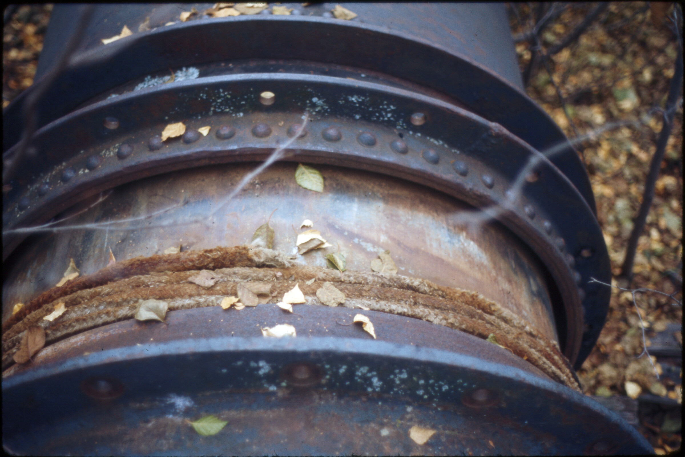
| | 174 — | Y-62. [steep cut covered with cloth, small staked patches at base of cut, man walking at
left, experimental insulation? print date Sep 73] |
| | 175 — | Y-63. [steep cut covered with cloth and hay, experimental insulation? print date Sep 73] |
| | 176 — | Y-64. Road to Yukon R. [view down gravel road in winter, ice seeping out of cut at left,
ice cut Hess Creek area? Print date Nov 70]
|
| | 177 — | Y-66. N-21. 25. [view down gravel road in summer, ice seeping out of cut at left, ice cut
Haul Road?] |
| | 178 — | Y-68. RCB. Ice cut Haul Road [man standing under overhanging ice and earth; print date
May 71. Original image blurry] |
| | 179 — | Y-71. RCB. Waste area typical [aerial of gravel road through forested area, rehabilitated
spoil areas? print date Sep 71. Original image blurry] |
| 180 — | Y-72. [view down pipeline through forested area, Davidson Ditch? Caption on typed
sheet: “48” water line built in 1925 no. of Fairbanks”] |
| 181 — | Y-73. [men walking in tall grasses next to sections of pipeline, Davidson Ditch; print date
Sep 73] |
| 182 — | Y-74. [section of pipeline in forested area, Davidson Ditch; print date Sep 73] |
| 183 — | Y-75. [view down pipeline across flat area and up hillside in distance, building in middle
ground, Davidson Ditch; print date Sep 73] |
| | 184 — | Y-76. [bend in pipeline at rise amid birch trees, Davidson Ditch; print date Sep 73.
Original image blurry] |
| 185 — | Y-77. [close-up of raised section of pipeline, man standing atop pipe, Davidson Ditch;
print date Sep 73] |
| 186 — | Y-78. [deteriorated wood supports for pipeline, Davidson Ditch; print date Sep 73] |
| 187 — | Y-79. [section of pipeline on concrete supports, Davidson Ditch power plant? print date
Sep 73] |
| 188 — | Y-80. [close-up of welds and rope on pipeline section, Davidson Ditch power plant?
print date Sep 73] |
| | 189 — | Y-81. [view down river to man standing on bridge in middle ground, flotsam and
driftwood in water in foreground, Hess Creek bridge? print date Sep 73] |
| | 190 — | Y-82. [aerial of road bridge over river, flotsam and driftwood piled up against pilings,
Hess Creek bridge? print date Sep 73] |
| | 191 — | Y-83. [similar to .190, Hess Creek bridge? print date Sep 73] |
| | 192 — | Y-84. RCB. Hess Cr. bridge log jam [flotsam and driftwood piled up against bridge
pilings, flooded area at right, truck and crane on gravel road at left; print date May 71. Cf.
.1036] |
| | 193 — | Y-85. [view across bridge on gravel road, sign in foreground “Bridge May Be Unsafe,
Cross At Your Own Risk,” traffic barricades at far end of bridge, Hess Creek bridge; print date
Sep 73] |
| | 194 — | Y-86. [view across bridge showing deformation due to pressure on one side from log
jam, automobile and crane parked at far end, Hess Creek bridge; print date Sep 73] |
| | 195 — | Y-87. [man standing on bridge, sign in foreground “Bridge May Be Unsafe, Cross At Your
Own Risk,” traffic barricades at far end of bridge, Hess Creek bridge; print date Sep 73] |
| | 196 — | Y-88. [close-up of debris piled up underneath bridge, Hess Creek bridge; print date Sep
73] |
| | 197 — | Y-89. [close-up of bridge pilings, Hess Creek bridge; print date Sep 73] |
| | 198 — | Y-93. N-12. 32. [close-up of tundra grasses, area rehabilitation?] |
| | 199 — | Y-94. N-13. 9. [aerial of fractured tundra landscape, North Slope?] |
| | 200 — | Y-98. N-4. [BLM sign, “Johnny Horizon says, This Land is Your Land, Keep It Clean!”]
B2
[Pipeline alphanumeric series] |
| | 201 — | 9909 [aerial of road or pump station construction site, several bulldozers on forested
hillside; print date Oct 75] |
| | 202 — | 9909 [aerial of road or pump station construction, possibly debris washout along
forested hillside; print date Oct 75] |
| | 203 — | 9909 [similar to .202; print date Oct 75] |
| | 204 — | 9909 [aerial close-up of debris washout from construction; print date Oct 75] |
| | 205 — | 9909 [close-up of mud and runoff water; print date Oct 75] |
| | 206 — | 9909 [aerial of pipeline river crossing under construction, with piers being sunk into
river; print date Oct 75] |
| | 207 — | 9909 [close-up of runoff pond; print date Oct 75] |
| | 208 — | 9909 [close-up of runoff or ground thaw in disturbed area, bulldozer in background;
print date Oct 75] |
| | 209 — | 9909 [close-up of runoff; print date Oct 75] |
| | 210 — | 9909 [black bear crossing dirt road, grader or other equipment at left; print date Oct
75]
|
| | 211 — | 9272D [aerial of construction site in forested area; print date Dec 74] |
| | 212 — | 9272F [aerial close-up of cleared land around construction site in forested area; print
date Dec 74] |
| | 213 — | 9272H [aerial of construction site in forested area; print date Dec 74] |
| | 214 — | 9272I [aerial of construction site in forested area; print date Dec 74] |
| | 215 — | 9272J [aerial of construction site in forested area, temporary buildings or freight
containers at left; print date Dec 74] |
| | 216 — | 9272K [aerial of construction site in forested area, freight containers at right; print date
Dec 74] |
| | 217 — | 9272K [aerial of construction site in forested area; print date Dec 74]
|
| | 218 — | 9449 [aerial of convoy on road in winter, with pilot car and tractor-trailer hauling
oversize material; print date Oct 75] |
| | 219 — | 9449 [aerial of gravel road and pad in forested area in winter, equipment on pad; print
date Oct 75] |
| | 220 — | 949 [aerial of gravel road through forested area in winter; print date Oct 75] |
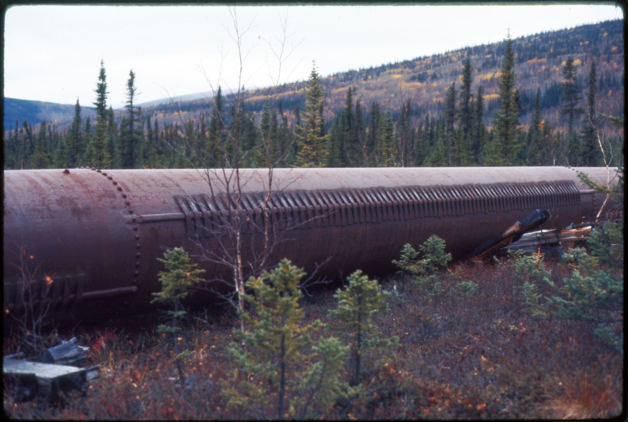
| | 221 — | 9449 [close-up of equipment, photographer’s shadow in foreground; print date Oct 75] |
| | 222 — | 9449 [close-up of Drill Systems Inc. vehicle in winter; print date Oct 75] |
| | 223 — | 9449 [two men wearing hard hats walking past drill rig in winter, truck parked at right;
print date Oct 75] |
| | 224 — | 9449 [large group of men in hard hats standing around drill rig in summer, pickup trucks
and school bus parked at right; print date Oct 75] |
| | 225 — | 9449 [convoy of tractor-trailers and fuel truck on road in winter; print date Oct 75] |
| | 226 — | 9449 [convoy with tractor-trailer carrying oversize load and automobile on road in
winter; print date Oct 75]
|
| | 227 — | 9949 [automobile stopped on road in winter, man walking along verge at right,
overflow on road in foreground; print date Oct 75] |
| | 228 — | 9449 [view down road in winter, ice in ditch along tree line; print date Oct 75] |
| | 229 — | 9449 [close-up of wooden markers in ground, drill bit at left; print date Oct 75]
|
| | 230 — | 9538 [truck parked next to large supports in staging area in winter, possibly Yukon River
bridge girders; print date Oct 75] |
| | 231 — | 9538 [truck parked next to metal culverts or pipe underpass in staging area in winter;
print date Oct 75] |
| | 232 — | 9538 [interior of corrugated metal building, with ladder; print date Oct 75] |
| | 233 — | 9538 [equipment marked PS6 inside corrugated metal building, probably Pump Station
6; print date Oct 75] |
| | 234 — | 9538 [pipeline sections in staging area in taiga in winter; print date Oct 75] |
| | 235 — | 9538 [bird’s eye view of construction site in winter, with cranes and freight containers,
road in distance; print date Oct 75. Cf. .237] |
| | 236 — | 9538 [mobile drilling rig on rise in forested area in winter; print date Oct 75] |
| | 237 — | 9538 [view down cut to construction site seen in .235, winter; print date Oct 75] |
| | 238 — | 9538 [pit in forested area in winter; print date Oct 75] |
| | 239 — | 9538 [close-up of small ice-covered boulder, possibly fractured off rock at right; print
date Oct 75] |
| | 240 — | 9538 [bear tracks in snow; print date Oct 75]
|
| | 241 — | 9840 [close-up of heavy equipment in forested area in summer; print date Oct 75. Cf.
.700] |
| | 242 — | 9840 [water-filled earthen pit; print date Oct 75] |
| | 243 — | 9840 [workers installing sections of pipeline, several yellow umbrellas on equipment;
print date Oct 75] |
| | 244 — | 9840 [close-up of runoff in disturbed area; print date Oct 75] |
| | 245 — | 9840 [close-up of disturbed earth below construction site, showing different soils and
water seeps; print date Oct 75] |
| | 246 — | 9840 [fox on gravel road through forested area; print date Oct 75. Cf. .698]
|
| | 247 — | 9910 [bird’s eye view of worker wearing hard hat and protective vest walking along
girders, Yukon River bridge pier #3 footing; print date Oct 75. Cf. .711] |
| | 248 — | 9910 [rebar for bridge construction, two workers standing in background, Yukon River
bridge; print date Oct 75. Cf. .714] |
| | 249 — | 9910 [close-up of rebar and wood framing, Yukon River bridge; print date Oct 75. Cf.
.713] |
| | 250 — | 9910 [workers wearing hard hats and protective vests walking along wood frame over
rebar, Yukon River bridge; print date Oct 75. Cf. .712] |
| | 251 — | 9910 [female worker wearing hard hat, protective vest, and blue jeans holding camera
and standing on rebar, Yukon River bridge; print date Oct 75. Cf. .717] |
| | 252 — | 9910 [close-up of rebar and steel beams, Yukon River bridge; print date Oct 75. Cf. .722]
|
| | 253 — | 9910 [barges, tugs, and machinery in water, erecting footings for Yukon River bridge;
print date Oct 75. Cf. .275, .723] |
| | 254 — | 9910 [similar to .253; print date Oct 75] |
| | 255 — | 9910 [view from shore of bridge piling construction, Yukon River bridge; print date Oct
75] |
| | 256 — | 9910 [similar to .255; print date Oct 75] |
| | 257 — | 9910 [view down gravel road in forested area, passing trucks kicking up dust, two
workers standing near bulldozers in ditch in middle ground, piles of gravel along tree line at
right; print date Oct 75] |
| | 258 — | 9910 [worker wearing hard hat sitting on cooler on side of gravel road through taiga,
pipeline laid in ditch at right, backhoe dumping dirt into ditch; print date Oct 75. Cf. .706] |
| | 259 — | 9910 [close-up of water seep in rock outcropping, Yukon River bridge footing? print
date Oct 75. Cf. .715] |
| | 260 — | 9910 [worker wearing hard hat and protective vest standing amid rebar and girders
near cofferdam wall seeping water onto rock outcropping below, Yukon River bridge footing?
print date Oct 75. Cf. .716]
|
| | 261 — | 9933 [close-up of underside of elevated section of pipeline, two men conversing at
right; print date Oct 75] |
| | 262 — | 9933 [workers wearing hard hats standing next to ditch filled with water, man in middle
ground possibly measuring water level; print date Oct 75. Cf. .737] |
| | 263 — | 9933 [close-up of water in ditch; print date Oct 75. Cf. .739] |
| | 264 — | 9933 [workers wearing hard hats standing next to ditch filled with water, man in middle
ground possibly measuring water level, man at far end taking photographs, section of pipeline
suspended at road level at right, second man with camera on road; print date Oct 75. Cf. .738] |
| | 265 — | 9933 [workers burying pipeline in ditch along road in forested area, road roller
compacting dirt in ditch, backhoe in foreground; print date Oct 75] |
| | 266 — | 9933 [Caterpillar crane lowering section of pipeline into ditch along road in forested
area, man standing in foreground, other workers in ditch; print date Oct 75. Cf. .735] |
| | 267 — | 9933 [workers gathered along ditch, Buffalo-Bomag road roller compacting dirt over
buried pipeline; print date Oct 75. Cf. .733]
|
| | 268 — | 9953 [close-up of sand bags lining small creek; print date Oct 75] |
| | 269 — | 9953 [rocks and downed trees, possibly sinkhole; print date Oct 75] |
| | 270 — | 9953 [Link-Belt tracked vehicle on gravel road next to ditch, section of pipeline in ditch;
print date Oct 75. Cf. .730] |
| | 271 — | 9953 [close-up of pitted skin of pipeline; print date Oct 75. Cf. .742] |
| 272 — | 9953 [workers on heavy equipment in forested area lowering mechanism over four
metal vertical support members in ground; print date Oct 75. According to Martin Finnesand,
mechanism might be a hydraulic VSM pipe expander, used to expand the pipes on the bottom
to prevent frost-induced movement. Cf. .752] |
| | 273 — | 9953 [more distant view of vertical support member installation seen in .272; print date
Oct 75] |
| | 274 — | 9953 [aerial of road construction in forested area in autumn; print date Oct 75]
|
| | 275 — | 9953 [barges, tugs, and machinery in water, Yukon River bridge construction; print date
Oct 75. Cf. .253, .755] |
| | 276 — | 9953 [similar to .275; print date Oct 75] |
| | 277 — | 9953 [aerial of Yukon River bridge construction; print date Oct 75] |
| | 278 — | 9953 [aerial of tundra; print date Oct 75]
|
| | 279 — | 10086 [winter close-up of vertical support members and heat pipes with thermal
radiators; print date Feb 76] |
| | 280 — | 10086 [winter close-up of vertical support members with angled shoes; print date Feb
76. Cf. .782] |
| | 281 — | 10086 [winter close-up of vertical support members and insulation module; print date
Feb 76]
|
| | 282 — | 10087 [winter close-up of excavated section of pipeline, showing weld; print date Feb
76. Cf. .790] |
| | 283 — | 10087 [view down road shoulder in winter, small bridge at right, backhoe and other
heavy equipment at left possibly removing ice jam, oncoming vehicles and trees in
background; print date Feb 76. Cf. .799] |
| | 284 — | 10087 [close-up of elevated section of pipeline with accumulated ice or rime; print date
Feb 76. Cf. .802] |
| | 285 — | 10087 [close-up of ice chunks, possibly broken up from creek in background; print date
Feb 76. Cf. .800] |
| | 286 — | 10087 [winter view down road through forested area, view from excavation to heavy
equipment on shoulder in distance, utility poles at left; print date Feb 76] |
| | 287 — | 10087 [bird’s eye view of pump station construction; print date Feb 76. Cf. .796]
|
| | 288 — | 10113 [aerial view of dump truck convoy hauling snow on dirt road through forested
area; print date Feb 76] |
| | 289 — | 10113 [aerial of same road as in .288; print date Feb 76] |
| 290 — | 10113 [aerial of construction site in winter, school bus at left approaching parking area
with heavy equipment at right, thawing or wetting equipment for snow pad in center? print
date Feb 76. Cf. .815] |
| | 291 — | 10113 [similar to .290, slightly different perspective; print date Feb 76. Cf. .814]
|
| | 292 — | 10224 [winter view down section of pipeline, several metal floats affixed to pipe, floats
possibly being filled by hoses, heavy equipment parked near trees at right, Chena River
crossing? print date May 76. Cf. .818] |
| | 293 — | 10224 [close-up of section of pipeline with affixed floats, heavy equipment in
background; print date May 76. Cf. .820] |
| | 294 — | 10224 [close-up of supports along bottom of pipeline to be sunk under water; print
date May 76. Cf. .819] |
| | 295 — | 10224 [workers and heavy equipment at construction site; print date May 76] |
| | 296 — | 10224 [view down row of vertical support members in winter; print date May 76]
|
| | 297 — | 10224 [similar to .296, showing overflow ice in foreground, breakup of snow pad? Print
date May 76] |
| | 298 — | 10224 [similar to .296; print date May 76] |
| | 299 — | 10224 [view down section of elevated pipeline along road in winter; print date May 76] |
| | 300 — | 10224 [close-up of section of ground cleared of snow; print date May 76] |
| | 301 — | 10224 [view along section of pipeline downhill in forested area, heavy equipment at
bottom of hill in distance; print date May 76] |
| | 302 — | 10224 [scenic of trees and low hills in winter; print date May 76] |
| | 303 — | 10224 [winter aerial of pipeline burial, Chena River crossing? Print date May 76. Cf.
.821]
|
| | 304 — | 10252 [top of microwave tower, RCA tower at Pump Station 6? print date May 76. Cf.
.840] |
| | 305 — | 10252 [worker climbing microwave tower, floodlights at right; print date May 76. Cf.
.839] |
| | 306 — | 10252 [workers at base of microwave tower, buildings in background; print date May
76. Cf. .838] |
| | 307 — | 10252 [burying section of pipeline in ice-filled ditch; print date May 76. Cf. .842] |
| | 308 — | 10252 [view down ice-filled ditch next to dirt road, concrete saddles piled at right; print
date May 76. Cf. .843]
|
| | 309 — | 10283 [close-up of low vertical support member; print date May 76. Cf. .858] |
| | 310 — | 10283 [close-up of vertical support members and heat pipes with thermal radiators;
print date May 76. Cf. .859] |
| 311 — | 10283 [view down section of elevated pipeline heading downhill; print date May 76. Cf.
.853] |
| | 312 — | 10283 [heavy equipment next to section of elevated pipeline; print date May 76. Cf.
.861] |
| | 313 — | 10283 [similar to .312] |
| | 314 — | 10283 [similar to .312] |
| | 315 — | 10283 [metal hopper underneath elevated section of pipeline, thermal radiators on
ground at right; print date May 76. Cf. .864] |
| | 316 — | 10283 [dump trucks dumping gravel into large pit; print date May 76. Cf. .850] |
| | 317 — | 10283 [view down cleared right-of-way in winter, worker standing next to pipeline
emerging from ground at right; print date May 76. Cf. .855] |
| | 318 — | 10283 [view down elevated section of pipeline, bulldozer at right; print date May 76] |
| | 319 — | 10283 [view along elevated section of pipeline headed downhill in forested area; print
date May 76] |
| | 320 — | 10283 [close-up of permafrost layer; print date May 76. Cf. .849] |
| | 321 — | 10283 [man standing next to permafrost layer in cut; print date May 76. Cf. .848]
|
| | 322 — | 10325 [close-up of pipeline lying on gravel; print date Jul 76. Cf. .875] |
| | 323 — | 10325 [excavated area, with permafrost layer in cut at back, shovels on rocks at right,
near Hughes? print date Jul 76. Cf. .880]
|
| | 324 — | 10325 [view down elevated section of pipeline, showing thawing snow pad at Globe
Creek? print date Jul 76. Cf. .870] |
| | 325 — | 10325 [similar to .324; print date Jul 76] |
| | 326 — | 10325 [similar to .324; print date Jul 76] |
| | 327 — | 10325 [two men walking past Caterpillar tractor in deep mud, cables attached to
bulldozer leading out of frame at right, vertical support members in background, near
Chatanika? print date Jul 76. Cf. .329, .868] |
| | 328 — | 10325 [workers and heavy equipment next to vertical support members, reels of cable
in center being drawn out of frame at right, worker at center with camera; print date Jul 76.
Cf. .865] |
| | 329 — | 10325 [Caterpillar tractor in deep mud, cables attached to excavator or other heavy
machinery at right, vertical support members in center; print date Jul 76. Cf. .327]
|
| | 330 — | 10326C. [workers in deep ditch using hand shovels to bury section of pipeline,
spectators looking on; print date Jun 76. Cf. .888] |
| | 331 — | 10326F. [close-up of slope in forested area in winter showing fissures in ice; print date
Jun 76. Cf. .891] |
| | 332 — | 10326G. [close-up of snow and overflow ice around pine trees next to elevated section
of pipeline; print date Jun 76. Cf. .892] |
| | 333 — | 10326H. [pile of dirt between snow and overflow ice in trees and section of pipeline;
print date Jun 76. Cf. .893] |
| | 334 — | 10326K. [side of cut, showing permafrost layer, water at base of cut, photographer’s
shadow in foreground, something protruding from cut? print date Jun 76. Cf. .896] |
| | 335 — | 10326L. [view down water-filled ditch next to section of pipeline on low supports; print
date Jun 76. Cf. .897] |
| | 336 — | 10326P. [close-up of deep water-filled ditch, excavator at far end; print date Jun 76. Cf.
.901] |
| | 337 — | 10326Q. [aerial of erosion on cleared hillside in forested area; print date Jun 76. Cf.
.902]
|
| | 338 — | 10362G. [i.e., 10362F. pump station construction with microwave tower; print date Jun
76. Cf. .908] |
| | 339 — | 10326G. [pump station or camp construction, large housing units on rise in background;
print date Jun 76. Cf. .909] |
| | 340 — | 10362J. [surge tank construction at pump station; print date Jun 76. Cf. .912] |
| | 341 — | 10362K. [vertical support members leading down to pump station construction area,
low hills in distance; print date Jun 76. Cf. .913] |
| | 342 — | 10362L. [pump station construction, two men standing in rebar next to long section of
pipe; print date Jun 76. Cf. .914] |
| | 343 — | 10362M. [pump station construction, crane lifting steel beams into place, control
building? Print date Jun 76. Cf. .915] |
| | 344 — | 10362N. [close-up of partially wetted ground; print date Jun 76. Cf. .916] |
| | 345 — | 10362P. [caption from handwritten list: “Tiny’s nightmare flow.” View down bare slope
to ponded water at base; print date Jun 76. Cf. .918]
|
| | 346 — | 10362S. [close-up of section of pipe on gravel area in winter, steel damaged at open
end; print date Jun 76. Cf. .921]
|
| | 347 — | 10438A. [view down shoulder of dirt road in spring, ground damp, ice ditch near North
Lost Creek? Cf. .923] |
| | 348 — | 10438C. [similar to .347, with truck and backhoe on road; print date Aug 76. Cf. .925] |
| | 349 — | 10438D. [close-up of hole in ground; print date Aug 76. Cf. .926] |
| | 350 — | 10438F. [close-up of permafrost in hole; print date Aug 76. Cf. .928] |
| | 351 — | 10438H. [similar to .350; print date Aug 76. Cf. .930] |
| | 352 — | 10438I. [similar to .350; print date Aug 76. Cf. .931] |
| | 353 — | 10438J. [close-up of sheets on insulation around metal pipe, insulation covered with
thin layer of dirt; print date Aug 76. Cf. .932]
|
| | 354 — | 10439A. [distant view of bulldozer on steep cut in forested area; print date Aug 76. Cf.
.934] |
| | 355 — | 10439H. [black bear on gravel pad in forested area; print date Aug 76. Cf. .940] |
| | 356 — | 10439I. [similar to .355; print date Aug 76. Cf. .941] |
| | 357 — | 10439N. [caption on handwritten sheet: “Comp. for launching pigs.” Workers standing
near two Joy compressors on flatbed trailers, pig launcher on section of pipeline in ditch at
right, pickup trucks parked at left; print date Aug 76. Cf. .946] |
| 358 — | 10439O. [workers with crane and heavy equipment in right-of-way through birch trees,
man wearing hard hat walking near pipe clamp at left, possibly pig equipment; print date Aug
76. Cf. .947]
|
| | 359 — | 10468A. [view down cleared right-of-way in forested area in summer; print date Aug
76. Cf. .948] |
| | 360 — | 10468B. [bulldozer and other heavy equipment leveling ground in right-of-way; print
date Aug 76. Cf. .949] |
| | 361 — | 10468C. [close-up of turned earth in right-of-way; print date Aug 76. Cf. .950] |
| | 362 — | 10468E. [close-up of running water at bottom of ditch; print date Aug 76. Cf. .952] |
| | 363 — | 10468F. [man standing on edge of right-of-way through forested area; print date Aug
76. Cf. .953] |
| 364 — | 10468H. [view along elevated section of pipeline crossing hill in forested area, crane,
bulldozer, and pickup trucks in middle ground; print date Aug 76. Cf. .955] |
| | 365 — | 10468J. [Joy compressors on flatbed trailers in forested area, plastic sheeting over work
area at right, pickup trucks parked at left; print date Aug 76. Cf. .957] |
| | 366 — | 10468K. [Joy compressors on flatbed trailers in forested area, man standing next to
metal tank or float at left, plastic sheeting over scaffolding above uncovered section of buried
pipeline at right; print date Aug 76. Cf. .958] |
| | 367 — | 10468L. [four hydraulic units piping water from river or lake, four metal barrels floating
in water; print date Aug 76. Cf. .959] |
| | 368 — | 10468M. [man inspecting vertical support members along elevated section of pipeline
in forested area, possibly showing VSM settlement; print date Aug 76. Cf. .960]
|
| | 369 — | 10468N. [close-up of underside of elevated section of pipeline showing settlement of
vertical support members; print date Aug 76. Cf. .961] |
| | 370 — | 10468O. [caption on handwritten sheet: “VSM settlement.” similar to .369; print date
Aug 76. Cf. .962]
|
| | 371 — | 10500F. [view down uncovered section of buried pipeline, metal tanks and heavy
equipment parked at left; print date Aug 76. Cf. .968] |
| | 372 — | 10500G. [close-up of uncovered section of buried pipeline; print date Aug 76. Cf. .969] |
| | 373 — | 10500J. [close-up of gravel or scree piles near elevated section of pipeline through
taiga, possibly showing slide area? print date Aug 76. Cf. .972] |
| | 374 — | 10500K. [bears moving away from dirt pile along right-of-way through forested area;
print date Aug 76. Cf. .973] |
| | 375 — | 10500L. [view from hillside to pipeline right-of-way in distance travelling up steep rise
in forested area; print date Aug 76. Cf. .974]
|
| | 376 — | 30 A6 B [two men standing along rehabilitated right-of-way in forested area, man at
right wearing eyeglasses and smoking cigarette, man at left wearing knitted cap. Cf. .1023] |
| | 377 — | 30 A7 A [scenic in forested area in autumn, possibly showing rehabilitated right-of-way] |
| | 378 — | 30 A7 D [similar to .377] |
| | 379 — | 44 D6 [hoses filling bladder storage tanks at camp, man standing on General Rivers
Stewart fuel tanker truck in background, pipe sections piled at left and right, wooden crate
marked Pedco Sag]
B3
[Unindexed slides arranged by date]
1970 |
| | 380 — | Gulkana R. [aerial in summer; print date Nov 70] |
| | 381 — | Gulkana R. [aerial in summer; print date Nov 70] |
| | 382 — | Exploration trail [aerial in summer; print date Nov 70] |
| | 383 — | No. side Hogans Hill, looking no. [aerial of Hogan Hill in summer, Richardson Highway at
left; print date Nov 70] |
| | 384 — | Delta R. [view down gravel riverbed; print date Nov 70] |
| | 385 — | Donnelly Dome [aerial; print date Nov 70] |
| | 386 — | Phelan Cr., Delta R. junction [view down gravel riverbed, Richardson Highway at right,
snow-dusted mountains in background; print date Nov 70] |
| | 387 — | Tsina R. crossing, looking no. [garbage and debris in scree area along Richardson
Highway; print date Nov 70] |
| | 388 — | [Center line symbol] at Flood Cr. [survey marker with pink and yellow tape on rock pile
near brush; print date Nov 70] |
| | 389 — | Hwy. Dept. camp, Thompson Pass [garages, dump trucks, and fuel tanks at sharp bend
in Richardson Highway; print date Nov 70] |
| | 390 — | [Center line symbol] of pipeline route, Thompson Pass no. [aerial of Richardson
Highway in winter, black dots inked onto slide, possibly showing proposed pipeline route;
print date Nov 70]
|
| | 391 — | T-10. Align. over Thompson Pass [winter aerial showing right-of-way; print date Nov 70]
1971 |
| | 392 — | [view down cleared right-of-way through forested area in winter; print date May 71] |
| | 393 — | [similar to .392; print date May 71] |
| | 394 — | [close-up of small flooded areas in cleared right-of-way; print date May 71] |
| | 395 — | [similar to .392; print date May 71] |
| | 396 — | [similar to .394; print date May 71] |
| | 397 — | [similar to .394; print date May 71] |
| | 398 — | [similar to .394; print date May 71] |
| | 399 — | [view down right-of-way through forested area with fresh snow cover; print date May
71] |
| | 400 — | [survey marker with pink tape in clearing in forested area in winter; print date May 71] |
| | 401 — | [four men working with hand tools near survey marker seen in .400; print date May 71] |
| | 402 — | Rehab vicinity P.S. #6. R.C.B. [close-up of rehabilitated right-of-way; print date May 71] |
| | 403 — | [hand drill stuck into ground in rehabilitated right-of-way; print date May 71] |
| | 404 — | [aerial of right-of-way through forested area in winter; print date May 71] |
| | 405 — | [similar to .404] |
| | 406 — | [aerial of heavy equipment on road in winter, possibly Richardson Highway; print date
May 71] |
| | 407 — | [similar to .406, possibly showing overflow area; print date May 71] |
| | 408 — | Waste area, Lost Creek. R.C.B. [close-up of small creek in forested area in winter, dead
grasses on banks, hose in foreground; print date May 71] |
| | 409 — | [aerial of small creek in forested area in winter, possibly showing runoff; print date May
71] |
| | 410 — | Job [aerial of creek and overflow in forested area in winter; print date May 71] |
| | 411 — | [aerial of right-of-way through forested area in autumn; print date Sep 71] |
| | 412 — | [aerial of mobile drilling rig in forested area in autumn; print date Sep 71] |
| | 413 — | [close-up of cut bank; print date Sep 71] |
| | 414 — | [aerial showing erosion on cleared hillside in forested area; print date Sep 71. Original
image blurry] |
| | 415 — | [aerial of construction camp; print date Sep 71] |
| | 416 — | Waste area P-1030, aerial view. R.C.B. [aerial of clearing on hillside in forested area;
print date Sep 71] |
| | 417 — | Waste area P-1030, thermal erosion. R.C.B. [close-up of clearing in forested area; print
date Sep 71] |
| | 418 — | Waste area P-1030, thermal erosion. R.C.B. [grasses sprouting in clearing in forested
area; print date Sep 71] |
| | 419 — | Waste area P-1030, water exit. R.C.B. [close-up of seep; print date Sep 71] |
| | 420 — | [scenic of creek in forested area; print date Sep 71]
[1972] |
| | 421 — | [aerial of landing strip in winter; print date May 72] |
| | 422 — | [aerial of forested hills; print date Nov 72]
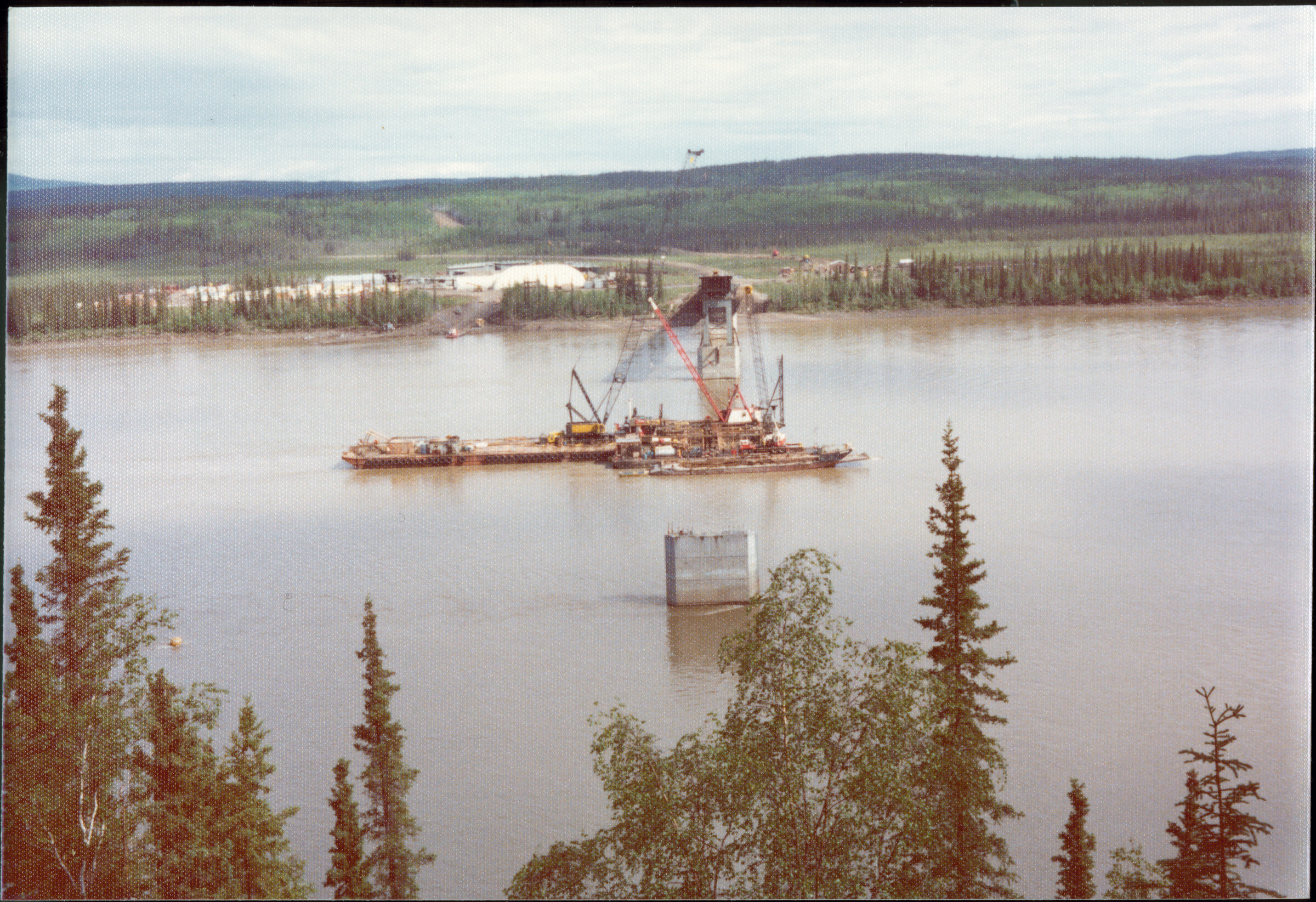
|
| | 423 — | [aerial with parallel rights-of-way on forested hills; print date Nov 72]
[1973] |
| | 424 — | [aerial of road through hills in winter; print date Apr 73] |
| | 425 — | [aerial of forested area in winter; print date Apr 73] |
| | 426 — | [aerial of forested area in winter; print date Apr 73] |
| | 427 — | [similar to .426; print date Apr 73] |
| | 428 — | [aerial of road in winter, possibly Richardson Highway in Thompson Pass area; print
date Apr 73] |
| | 429 — | [scenic of snow-covered mountains and hazy sun in winter; print date Apr 73] |
| | 430 — | [aerial of forested area in winter; print date Apr 73] |
| | 431 — | [similar to .430; print date Apr 73] |
| | 432 — | [similar to .430; print date Apr 73] |
| | 433 — | [aerial of forested area in winter; print date Apr 73] |
| | 434 — | [similar to .433; print date Apr 73] |
| | 435 — | [survey marker in snow near low brush; print date Apr 73] |
| | 436 — | [close-up of survey marker; print date Apr 73] |
| | 437 — | [two men with mobile drilling rig on road shoulder, possibly drilling post holes or taking
samples, metal barrels at right, RM consultants pickup truck in background; print date Apr 73] |
| | 438 — | [similar to .437; print date Apr 73] |
| 439 — | [large instrument on road shoulder, with gauges and hoses, possibly hydraulic power
source for boring tools; print date Apr 73] |
| | 440 — | [aerial of mobile drilling rig in forested area in winter; print date Apr 73] |
| | 441 — | [similar to .440; print date Apr 73] |
| | 442 — | [close-up of wooden tie lying in grasses and mosses; print date Apr 73] |
| | 443 — | [scenic of tall grasses with pine trees in background; print date Apr 73] |
| | 444 — | [aerial of disposal site in forested area in autumn; print date Sep 73] |
| | 445 — | [similar to .444; print date Sep 73] |
| | 446 — | [similar to .444; print date Sep 73] |
| | 447 — | [aerial of construction site or camp on rise in forested area in autumn with two long
warehouse buildings in foreground; print date Sep 73] |
| | 448 — | [similar to .444; print date Sep 73] |
| | 449 — | [aerial of gravel road in autumn, possibly showing rehabilitated areas at left; print date
Sep 73] |
| | 450 — | [aerial of gravel road in autumn, showing rehabilitation on cuts at right; print date Sep
73] |
| | 451 — | [similar to .444; print date Sep 73] |
| | 452 — | [similar to .444; print date Sep 73] |
| | 453 — | [similar to .444; print date Sep 73] |
| | 454 — | [close-up of netting anchoring tall grasses, man standing at right; print date Sep 73] |
| | 455 — | [close-up of netting and downed timber in rehabilitated clearing; print date Sep 73] |
| | 456 — | [close-up of downed timber and brush in rehabilitated area; print date Sep 73] |
| | 457 — | [close-up of downed timber over bare ground; print date Sep 73] |
| | 458 — | [similar to .457]
|
| | 459 — | [close-up of netting anchoring ground in rehabilitated area; print date Sep 73] |
| | 460 — | [close-up of downed timber, netting, and sheeting in rehabilitated area; print date Sep
73] |
| | 461 — | [underside of bridge over river, showing steel girders; print date Sep 73] |
| | 462 — | [scenic with small pond in forested area; print date Sep 73] |
| | 463 — | [scenic of forested area, possibly showing rehabilitation; print date Sep 73] |
| | 464 — | [aerial of rehabilitated rights-of-way through forested area; print date Sep 73] |
| | 465 — | [similar to .464; print date Sep 73] |
| | 466 — | [similar to .464; print date Sep 73] |
| | 467 — | [rehabilitated right-of-way in brushy area in autumn; print date Sep 73] |
| | 468 — | [aerial of downed timber in forested area near road, at right; print date Sep 73] |
| | 469 — | [aerial of rehabilitated or overgrown trails in forested area; print date Sep 73]
[1975] |
| | 470 — | [compressed gas canisters on metal sled in foreground, Caterpillar crane suspending
equipment over section of pipeline, wheeled cage mounted on pipe, possibly taping? Print
date Sep 75] |
| | 471 — | [workers in hard hats and coveralls standing along section of pipe emptying supplies
from cardboard boxes, heavy equipment in background, applying protective tape; print date
Sep 75. Cf. .685] |
| | 472 — | [two men, one wearing hard hat and dress shirt, one wearing jacket and sunglasses,
standing next to section of pipeline, heavy equipment at left, unit mounted on pipe in
background possibly taping machine; print date Sep 75] |
| | 473 — | [four men standing on concrete saddle on section of pipeline in ditch, two men wearing
hard hats, two men at left possibly same men as in .472, preparatory to burial; print date Sep
75] |
| | 474 — | [view down section of pipeline in ditch before burial, cranes lowering pipeline into ditch
in distance; print date Sep 75] |
| | 475 — | [man wearing suit standing next to ditch, section of pipeline about to be buried, truck
and backfill machine on road in background; print date Sep 75] |
| | 476 — | [workers wearing hard hats standing next to section of pipeline in ditch, heavy
equipment at left; print date Sep 75] |
| | 477 — | [close-up of section of pipeline in ditch before burial; print date Sep 75] |
| | 478 — | [view down ditch partially filled with water and dirt, workers working on section of
pipeline being staged at left, welders completing joints, welding tent over section of pipe in
background, snow-covered mountains in distance; print date Sep 75] |
| | 479 — | [view down ditch with partially buried pipeline, section emerging from gravel cover into
water-filled ditch in foreground, sections of pipe staged at left preparatory to lowering into
ditch, snow-covered mountains in background, man walking out of frame at right; print date
Sep 75] |
| | 480 — | [man wearing hard hat standing in hole eroded out of gravel road, possibly by river at
left; print date Sep 75. Cf. .625]
|
| | 481 — | [view down gravel road or right-of-way with survey markers, gravel pile, and small
puddles along shoulder at left, man wearing hard hat walking near pickup truck in middle
ground, low hills in distance; print date Sep 75. Cf. .622] |
| | 482 — | [small bulldozer in bottom of water-filled ditch; print date Sep 75. Cf. .651] |
| | 483 — | [view into deep ditch in forested area, men near ladder at bottom of ditch, other men
standing near excavator in background, bottom of ditch possibly filled with concrete for
insulation; print date Sep 75. Cf. .628] |
| | 484 — | [scenic with survey marker in rehabilitated area in foreground, river and hills in
distance; print date Sep 75] |
| | 485 — | [moose at edge of small pond in forested area; print date Sep 75. Cf. .611] |
| | 486 — | [view over small pine trees to rehabilitated disposal site; print date Sep 75] |
| | 487 — | [rehabilitated clearing in taiga, with green tape lying in water-filled ruts in foreground,
snow-covered mountains in background; print date Sep 75] |
| | 488 — | [close-up of rehabilitated clearing; print date Sep 75] |
| | 489 — | [aerial of camp or supply depot in forested area, with piles of pipe and heavy
equipment; print date Sep 75] |
| | 490 — | [aerial of intersecting gravel roads and rectangular pad area; print date Sep 75] |
| | 491 — | [aerial of intersecting gravel roads in forested river valley; print date Sep 75] |
| | 492 — | [aerial of disposal site in forested area; print date Sep 75] |
| | 493 — | [aerial of road or right-of-way near silted river bed; print date Sep 75] |
| | 494 — | [aerial of rehabilitated disposal area below active disposal site; print date Sep 75] |
| | 495 — | [aerial of pump station construction, with housing at left, tanks in center, building
foundations at right; print date Sep 75] |
| | 496 — | [aerial of camp housing, pond at right; print date Sep 75] |
| | 497 — | [aerial of bridge construction, probably E.L. Patton Bridge on Yukon River; print date
Sep 75] |
| | 498 — | [aerial of rehabilitated disposal area along river; print date Sep 75] |
| | 499 — | [similar to .498; print date Sep 75] |
| | 500 — | [aerial of accident site, heavy equipment off road in winter; print date Sep 75. Cf. 681] |
| | 501 — | [aerial of convoy on dirt road through taiga in winter, dump trucks hauling gravel; print
date Sep 75. Cf. .503, .666] |
| | 502 — | [aerial of dirt road through taiga in winter, showing culvert of four pipes at stream
crossing; print date Sep 75. Cf. .668] |
| | 503 — | [similar to .501; print date Sep 75]
[no date, after September 1975] |
| | 504 — | [scenic of rolling hills in autumn] |
| | 505 — | [view down paved road lined with birch trees] |
| | 506 — | [scenic of gravel river bed in autumn] |
| | 507 — | [scenic of forested area in autumn] |
| | 508 — | [view down elevated section of pipeline through forested area in autumn] |
| | 509 — | [view across elevated section of pipeline to lake in background] |
| | 510 — | [low aerial of river and small lake in forested area in autumn, possibly Yukon River] |
| | 511 — | [aerial of river in autumn, possibly Yukon River]
|
| | 512 — | [similar to .511] |
| | 513 — | [view down dirt road and elevated section of pipeline through forested area in autumn] |
| | 514 — | [aerial of forested area in autumn] |
| | 515 — | [scenic of tundra with rock outcroppings] |
| | 516 — | [aerial of forested area in autumn] |
| | 517 — | [aerial of small bridge over river, construction sites on either bank, Hess Creek?] |
| | 518 — | [aerial of camp in forested area, road at left] |
| | 519 — | [aerial of E.L. Patton Bridge on Yukon River after completion] |
| | 520 — | [aerial of E.L. Patton Bridge on Yukon River] |
| | 521 — | [aerial of forested area in autumn] |
| | 522 — | [aerial of road or right-of-way in forested area in autumn] |
| | 523 — | [aerial of forested area in autumn]
[no date, circa 1972-1975] |
| | 524 — | Extras, equip. [close-up of drill bit. Cf. .1066] |
| | 525 — | [man wearing heavy winter jacket with name “Bud” written on back standing next to
hole drilling equipment. Cf. .1068] |
| | 526 — | [tracked trencher vehicle in clearing in winter. Cf. .1075] |
| | 527 — | [Rolligon-type all-terrain vehicle in clearing in winter. Cf. .1078] |
| | 528 — | [tracked trencher vehicle in clearing in winter. Original image blurry. Cf. .1077] |
| | 529 — | [close-up of saw blade on trencher. Cf. .1076] |
| | 530 — | [mobile drilling rig in taiga in winter] |
| | 531 — | [workers with small Bechtel tank loaded on flatbed trailer with tundra tires, domed
building in background, winter] |
| | 532 — | [similar to .531]
Prints
B4 |
| | 533 — | 6943. Little Tonsina reroute, hole #3, helicopter rig, 11-21-72. R.C.B. [aerial of mobile
drilling rig in winter] |
| | 534 — | 6943. Little Tonsina reroute, hole #4, helicopter rig, 11-21-72. R.C.B. [mobile drilling rig
in winter. Cf. .1045] |
| | 535 — | 6943. Little Tonsina reroute, hole #2, helicopter rig, 11-21-72. R.C.B. [mobile drilling rig
in winter] |
| | 536 — | 6943. Little Tonsina reroute, hole #2, helicopter rig, 11-21-72. R.C.B. [aerial of mobile
drilling rig in winter]
|
| | 537 — | 7077G. [view down area cleared for road, snow-covered mountains in distance; print
date Mar 74] |
| | 538 — | 7077I. [similar to .537, photographer’s shadow in foreground; print date Mar 74]
|
| | 539 — | 9170B. [scenic of pine trees] |
| | 540 — | 9170C. [view down gravel road in forested area] |
| | 541 — | 9170D. [view down cleared right-of-way through forested area, bulldozer at right]
|
| | 542 — | 9170E. [similar to .541] |
| | 543 — | 9170F. [similar to .541] |
| | 544 — | 9170H. [bird’s eye view of bulldozer on cleared right-of-way in forested area, lake in
background at left] |
| | 545 — | 9170I. [bulldozers clearing land in forested area] |
| | 546 — | 9170K. [grader equipment in clearing in forested area, lake or river in background] |
| | 547 — | 9170L. [view down into pit in clearing, grader in background at left, photographer’s
shadow in foreground] |
| | 548 — | 9170M. [view across clearing to road construction in distance, forested rolling hills in
background] |
| | 549 — | 9170N. [view across clearing to road construction in distance, lake or river in
background] |
| | 550 — | 9170O. [grader equipment in clearing, dirt pile at left, trees in distance, lake or river in
background at right, photographer’s shadow in foreground] |
| | 551 — | 9170P. [graders and bulldozer clearing land in forested area] |
| | 552 — | 9170Q. [workers with grader in clearing in forested area] |
| | 553 — | 9170R. [graders clearing land] |
| | 554 — | 9170S. [view down cleared road or right-of-way to heavy equipment near trees in
distance, lake or river in background] |
| | 555 — | 9170T. [similar to .9170R] |
| | 556 — | 9170U. [view down cleared road or right-of-way to man walking near grader, bulldozer
in background at left]
|
| | 557 — | 9272D. [aerial of cleared land in forested area; print date Dec 74] |
| | 558 — | 9272F. [aerial of downed timber next to cleared land; print date Dec 74] |
| | 559 — | 9272G. [aerial of construction site in forested area; print date Dec 74] |
| | 560 — | 9272H. [aerial of construction site in forested area; print date Dec 74] |
| | 561 — | 9272I. [aerial of construction site in forested area; print date Dec 74] |
| | 562 — | 9272J. [aerial of construction site in forested area; print date Dec 74] |
| | 563 — | 9272J. [aerial of construction site in forested area; print date Dec 74. Not same as .562] |
| | 564 — | 9272K. [aerial of construction site in forested area; print date Dec 74]
|
| | 565 — | 9771A. [close-up of rocky ground; print date Jun [75?]] |
| | 566 — | 9771B. Mica in trench test pit, Wickersham Dome area [marker in cut] |
| | 567 — | 9771C. Mica in trench test pit, Wickersham Dome area [man bending down to pick up
rock sample] |
| | 568 — | 9771D. Twin otter off Livengood airstrip [view down gravel airstrip to airplane at left] |
| | 569 — | 9771E. Twin otter off Livengood airstrip [view down gravel airstrip to airplane at left] |
| | 570 — | 9771F. Twin otter off Livengood airstrip [airplane parked next to gravel airstrip] |
| | 571 — | 9771G. Parker drill on Sherman tank undercarriage [two men standing next to Parker
Drilling mobile rig in clearing] |
| | 572 — | 9771H. Rotary percussion Parker drill rig [close-up of drill bit] |
| | 573 — | 9771I. Parker rotary percussion drill head [close-up of drill bit on ground with ruler for
size comparison]
|
| | 574 — | 9771J. [close-up of runoff in cleared area] |
| | 575 — | 9771K. Thermal thaw, D.S. 66-6 [runoff in forested area] |
| | 576 — | 9771L. Thermal thaw, D.S. 66-6 [similar to .575] |
| | 577 — | 9771M. [close-up of large puddle in clearing] |
| | 578 — | 9771N. [close-up of runoff in clearing] |
| | 579 — | 9771O. Wagon drill [workers in ditch directing drill suspended from crane on road at
left] |
| | 580 — | 9771P. “Cat” backhoe [worker standing next to Caterpillar excavator digging ditch along
road] |
| | 581 — | 9771Q. [Alyeska Pipeline truck on road in foreground, heavy equipment at left, smoke
in trees in background, forest fire?] |
| | 582 — | 9771R. Shop at P.S. #8 [inflatable building at pump station, wooden structures at right] |
| | 583 — | 9771S. Tanks at P.S. #8 [storage tanks under construction at pump station]
|
| | 584 — | 9772A. [aerial of lake in forested area; print date Jun [75?]] |
| | 585 — | 9772B. Klondike Mining Co. reservoir, no. of Livengood [similar to .584. Cf. .641] |
| | 586 — | 9772C. Klondike Mining Co. reservoir, no. Livengood [similar to .584] |
| | 587 — | 9772L. [aerial of right-of-way or road] |
| | 588 — | 9772M. Hess Creek [aerial of winding river and right-of-way or road] |
| | 589 — | 9772N. [aerial of right-of-way or road, with cut at left] |
| | 590 — | 9772O. P.S. #6 @ Yukon River [aerial of pump station, airstrip, and road, river in
background] |
| | 591 — | 9772P. D.S. 77-4B [aerial of rehabilitated disposal site below active site] |
| | 592 — | 9772Q. Yukon R. bridge & no. landing for hovercraft barge [aerial of E.L. Patton Bridge
under construction] |
| | 593 — | 9772R. [close-up of cut, photographer’s shadow with two others in foreground] |
| | 594 — | 9772S. [close-up of cut] |
| | 595 — | 9772T. Unsuitable fill placed in P.S. #6, Dec. ’74 [men standing near gravel pile] |
| | 596 — | 9772U. Ice-rich cut south bank of Yukon R. bridge [view down gravel road to
construction near Yukon River in distance, cut bank at left showing permafrost] |
| | 597 — | 9772V. [close-up of runoff and erosion in cut bank] |
| | 598 — | 9772W. Silt from ice-rich cut, so. abutment of Yukon R. bridge [runoff between piles of
dirt, construction near Yukon River in background, metal barrels and other supplies on
ground] |
| | 599 — | 9772X. Ice-rich cut at so. abutment of Yukon R. bridge [tree-topped cut showing
permafrost] |
| | 600 — | 9772Y. [view along cut, runoff at base] |
| | 601 — | 9772Z. Ice-rich cut of so. abutment of Yukon R. bridge [view along cut showing
permafrost] |
| | 602 — | 9772A1. Ice-rich cut, south abutment of Yukon R. bridge [tree-topped cut showing
permafrost] |
| | 603 — | 9772B1. [man standing in rocky clearing in forested area]
|
| | 604 — | 9805A. Heater & taping machine [three workers next to section of pipeline being
wrapped with protective coating; print date July 75] |
| | 605 — | 9805B. Taping machine [similar to .604; print date July 75] |
| | 606 — | 9805C. Taping machine [wrapped pipe, machine dispensing tape at left; print date July
75] |
| | 607 — | 9805D. Taping machine [workers gathered around wrapped pipe, machine dispensing
tape at right; print date July 75] |
| | 608 — | 9805E. Start of taping in Eielson area – stream crossings [section of wrapped pipe; print
date July 75] |
| | 609 — | 9805F. Start of taping – side boom cats [view down wrapped pipe to Caterpillar cranes;
print date July 75] |
| | 610 — | 9805G. [close-up of wrapped pipe showing uneven taping; print date July 75] |
| | 611 — | 9805H. Moose along work pad [moose in small lake; print date July 75. Cf. .485] |
| | 612 — | 9805I. Moose along work pad [similar to .611; print date July 75] |
| | 613 — | 9805J. Moose along work pad [similar to .611; print date July 75] |
| | 614 — | 9805K. No trespassing [hand-lettered signs in brush, reading “Private Road No
Trespassing Violators Will Be Prosecuted, Trespassers Will Be Shot, Keep Out, No Shooting
Livestock”; print date July 75] |
| | 615 — | 9805L. Archeological diggings, M.S. 71-1 [dirt piles in clearing; print date July 75] |
| | 616 — | 9805M. [bird’s eye view of forested area; print date July 75] |
| | 617 — | 9805N. [section of wrapped pipe; print date July 75] |
| | 618 — | 9805O. Taping [section of wrapped pipe; print date July 75] |
| | 619 — | 9805P. Taping [close-up of wrapped pipe showing uneven tape; print date July 75] |
| | 620 — | 9805Q. Taping [close-up of wrapped pipe showing uneven tape; print date July 75]
|
| | 621 — | 9806A. [view down cleared right-of-way, showing small puddles in foreground; print
date July 75] |
| | 622 — | 9806B. Work pad and trench test pit [view down gravel road or right-of-way with
survey markers, gravel pile, and small puddles along shoulder at left, man wearing hard hat
walking near pickup truck in middle ground, low hills in distance; print date July 75. Cf. .481] |
| | 623 — | 9806C. Scalping [survey markers in cleared and graded area; print date July 75] |
| | 624 — | 9806D. [runoff area amid small trees and brush; print date July 75] |
| | 625 — | 9806E. Thermal degradation, D.S. 66-6 [man wearing hard hat standing in hole eroded
out of gravel road; print date July 75. Cf. .480] |
| | 626 — | 9806F. Thermal thaw, D.S. 66-6 [view across seep area, man walking near automobile
on road in background; print date July 75] |
| | 627 — | 9806G. [man standing next to furrow in cleared area; print date July 75] |
| | 628 — | 9806H. Trenching [view into deep ditch in forested area, men near ladder at bottom of
ditch, other men standing near excavator in background, bottom of ditch possibly filled with
concrete for insulation; print date July 75. Cf. .483] |
| | 629 — | 9806I. [close-up of hole filling with water, showing permafrost; print date July 75] |
| | 630 — | 9806J. [close-up of cut showing permafrost; print date July 75] |
| | 631 — | 9806K. Rehab, D.S. 77-4B [view across rehabilitated clearing; print date July 75] |
| | 632 — | 9806L. Rehab, D.S. 77-4B [similar to .631; print date July 75]
|
| | 633 — | 9806M. Ice cut so. abutment Yukon R. bridge [view along cut showing permafrost,
automobile at right; print date July 75] |
| 634 — | 9806N. Caisson for pier #4, Yukon R. bridge [view through pine trees to construction of
E.L. Patton Bridge; print date July 75] |
| | 635 — | 9806O. Rehab, D.S. 77-4B [view across forested area to clearing; print date July 75] |
| | 636 — | 9806P. Caisson pier #4, Yukon R. bridge [aerial of barges or hovercraft in Yukon River,
E.L. Patton Bridge construction; print date July 75] |
| | 637 — | 9806Q. [aerial of two long warehouse buildings along road, disposal site at left, river in
background; print date July 75] |
| | 638 — | 9806R. [aerial of road and rehabilitated disposal site, river in background; print date
July 75] |
| | 639 — | 9806S. [aerial of mobile drilling rig on tundra; print date July 75] |
| | 640 — | 9806T. [closer view of site in .639; print date July 75] |
| | 641 — | 9806U. Res. for Klondike Mining, no. Livingood [aerial of reservoir; print date July 75] |
| | 642 — | 9806V. [similar to .640; print date July 75]
|
| | 643 — | 9807B. Work pad [view down cleared right-of-way through forested area; print date
July 75] |
| | 644 — | 9807A. Work pad [cleared right-of-way; print date July 75] |
| | 645 — | 9807C. Work pad [similar to .643; print date July 75] |
| | 646 — | 9807D. Yukon R. bridge, hovercraft no. dock [aerial of E.L. Patton Bridge construction,
work camp at left; print date July 75] |
| | 647 — | 9807E. Yukon R. bridge, hovercraft no. dock [aerial of E.L. Patton Bridge construction,
dock at upper left; print date July 75] |
| | 648 — | 9807F. ½ million cu. yard disposal site, P.S. #7 [aerial of rehabilitated disposal site, river
in background; print date July 75] |
| | 649 — | 9807G. ½ million cu. yard disposal area @ P.S. #6 [aerial of rehabilitated disposal site,
pump station at left, Yukon River at right; print date July 75] |
| | 650 — | 9807H. P.S. #6 and camp, Yukon R. [aerial of pump station, Yukon River at right; print
date July 75] |
| | 651 — | 9807I. Case dozer in pipe trench [small bulldozer in bottom of water-filled ditch; print
date July 75. Cf. .482] |
| | 652 — | 9807J. Case dozer in pipe trench [view down water-filled ditch to small bulldozer, heavy
equipment on road in background; print date July 75] |
| | 653 — | 9807K. [survey markers in cleared right-of-way, photographer’s shadow in foreground;
print date July 75] |
| | 654 — | 9807L. Test pit [mound next to water-filled pit in forested area; print date July 75] |
| | 655 — | 9807M. [view down cleared right-of-way through taiga, mound at right; print date July
75] |
| | 656 — | 9807N. [close-up of cleared right-of-way through taiga; print date July 75] |
| | 657 — | 9807O. [cut bank in taiga; print date July 75] |
| | 658 — | 9807P. [close-up of water-filled pit; print date July 75] |
| | 659 — | 9807Q. [similar to .658; print date July 75]
|
| | 660 — | 9807R. [view down cleared right-of-way, furrow in foreground, heavy equipment in
distance; print date July 75] |
| | 661 — | 9807S. Stuck, no. slope Wickersham Dome [man tying rope to automobile mired in
mud; print date July 75] |
| | 662 — | 9807T. “Cat” tow [two men with Caterpillar bulldozer pulling Alyeska Pipeline
automobile out of mud; print date July 75] |
| | 663 — | 9807U. Cat tow [similar to .662; print date July 75] |
| | 664 — | 9807V. [timber pile next to cleared right-of-way through taiga; print date July 75]
|
| | 665 — | 9823A. [aerial of rolling hills in winter; print date July 75] |
| | 666 — | 9823B. [aerial of road construction in taiga, with convoy of dump trucks hauling gravel
at right, bulldozer at left; print date July 75. Cf. .501] |
| | 667 — | 9823C. [aerial of road construction in taiga, with dump trucks, bulldozer, and pickup
truck; print date July 75] |
| | 668 — | 9823D. [aerial of dirt road through taiga in winter, showing culvert of four pipes at
stream crossing; print date July 75. Cf. .502] |
| | 669 — | 9823E. [aerial, more distant view of site in .668; print date July 75] |
| | 670 — | 9823F. [similar to .668; print date July 75] |
| | 671 — | 9823G. [aerial directly over road at site in .668; print date July 75] |
| | 672 — | 9823H. [aerial of road construction in taiga, convoy of dump trucks hauling gravel; print
date July 75] |
| | 673 — | 9823I. [aerial of cleared right-of-way through taiga in winter; print date July 75] |
| | 674 — | 9823J. [similar to .673; print date July 75] |
| | 675 — | 9823K. [aerial of road through taiga in winter, truck kicking up dust; print date July 75] |
| | 676 — | 9823L. [aerial of road through taiga at small river crossing; print date July 75] |
| | 677 — | 9823M. [aerial of cleared right-of-way in winter; print date July 75] |
| | 678 — | 9823N. [aerial of right-of-way through forested area in winter, showing overflow areas;
print date July 75] |
| | 679 — | 9823O. [aerial of right-of-way through forested area in winter; print date July 75] |
| | 680 — | 9823P. [aerial of right-of-way in winter, with mobile drilling rig, tractor-trailer, school
bus, pickup truck; print date July 75] |
| | 681 — | 9823Q. [aerial of accident site, heavy equipment off road in winter; print date July 75.
Cf. 500] |
| | 682 — | 9823R. [similar to .681; print date July 75] |
| | 683 — | 9823S. [similar to .681; print date July 75]
|
| | 684 — | 9840A. [close-up of wrapped pipe showing taping, caption on handwritten sheet reads
“silt boil inad. pad”; print date July 75] |
| | 685 — | 9840B. [section of pipeline being wrapped with protective tape, workers wearing hard
hats taking supplies out of cardboard boxes, Caterpillar crane and wooden crates loaded on
metal sleds at right; print date July 75. Cf. .471] |
| | 686 — | 9840C. [similar to .684, caption on handwritten sheet: “Green line tape”; print date July
75]
|
| | 687 — | 9840D. [close-up of wrapped pipe showing uneven taping, caption on handwritten
sheet: “Green line tape application”; print date July 75] |
| | 688 — | 9840E. [similar to .687, caption on handwritten sheet reads “German drill”; print date
July 75] |
| | 689 — | 9840F. [similar to .687, caption on handwritten sheet reads “pipe bending”; print date
July 75] |
| | 690 — | 9840G. [similar to .687, caption on handwritten sheet reads “pipe bending”; print date
July 75] |
| | 691 — | 9840H. [view down cleared right-of-way through forested area, two men walking near
pickup truck at right, one man carrying camera, heavy equipment in distance; print date July
75] |
| | 692 — | 9840I. [close-up of seep in cut; print date July 75] |
| | 693 — | 9840J. [similar to .692; print date July 75] |
| | 694 — | 9840K. [close-up of water-filled pit; print date July 75] |
| | 695 — | 9840L. [runoff in ditch next to construction site at right; print date July 75] |
| | 696 — | 9840M. [heave in gravel along right-of-way, probably silt boil; print date July 75] |
| | 697 — | 9840N. [close-up of silt boil; print date July 75] |
| | 698 — | 9840O. [fox on gravel road through forested area; print date July 75. Cf. .246] |
| | 699 — | 9840P. [similar to .698; print date July 75] |
| | 700 — | 9840Q. [close-up of heavy equipment in forested area in summer; print date July 75. Cf.
.241] |
| | 701 — | 9840R. [worker with heavy equipment in forested area; print date July 75] |
| | 702 — | 9840S. [workers installing vertical support members, one man standing on top of shoe,
one man suspended in cage, crane at left, men wearing hard hats at right; print date July 75] |
| | 703 — | 9840T. [workers with heavy equipment along open section of pipeline in taiga, crane
supporting unit on pipeline at left, cables spooling off reels on small metal frame at right,
possibly bending pipeline or doing interior welds; print date July 75] |
| | 704 — | 9840U. [workers with heavy equipment along open section of pipeline in taiga, crane
supporting unit on pipeline in background, man guiding cables into pipe at left, possibly
bending pipeline or doing interior welds; print date July 75] |
| | 705 — | 9840V. [workers with heavy equipment along section of pipeline, machine with coiled
front end, possibly pig launcher? Print date July 75]
|
| | 706 — | 9910A. [worker wearing hard hat sitting on cooler on side of gravel road through taiga,
wrapped pipeline laid in ditch at right, backhoe dumping dirt into ditch; print date Aug 75. Cf.
.258] |
| | 707 — | 9910B. [view down ditch freshly covered with gravel, bulldozer in ditch, trucks on road
in distance; print date Aug 75] |
| | 708 — | 9910C. [aerial of pipeline being installed in step forested area; print date Aug 75] |
| | 709 — | 9910D. [aerial of right-of-way in forested area; print date Aug 75] |
| | 710 — | 9910E. [close-up of wooden timbers, bridge foundation? print date Aug 75] |
| | 711 — | 9910F. [bird’s eye view of worker wearing hard hat and protective vest walking along
girders, Yukon River bridge pier #3 footing; print date Aug 75. Cf. .247]
|
| | 712 — | 9910G. [two workers wearing hard hats and protective vests walking along wood frame
over rebar, Yukon River bridge; print date Oct 75. Cf. .250] |
| | 713 — | 9910H. [rebar and timbers, Yukon River bridge; print date Aug 75] |
| | 714 — | 9910I. [rebar for bridge construction, two workers standing in background, Yukon River
bridge; print date Aug 75. Cf. .248] |
| | 715 — | 9910J. [close-up of water seep in rock outcropping, Yukon River bridge footing; print
date Aug 75. Cf. .259] |
| | 716 — | 9910K. [worker wearing hard hat and protective vest standing amid rebar and girders
near cofferdam wall seeping water onto rock outcropping below, Yukon River bridge footing?
print date Aug 75. Cf. .260] |
| | 717 — | 9910L. [female worker wearing hard hat, protective vest, and blue jeans holding camera
and standing on rebar, Yukon River bridge; print date Aug 75. Cf. .251] |
| | 718 — | 9910M. [close-up of water seep in rock outcropping, ladder in foreground, Yukon River
bridge footing; print date Aug 75] |
| | 719 — | 9910N. [close-up of water seep in rock outcropping, Yukon River bridge footing; print
date Aug 75] |
| | 720 — | 9910O. [close-up of rebar and wood framing, Yukon River bridge; print date Aug 75] |
| | 721 — | 9910P [close-up of curved rebar, Yukon River bridge; print date Aug 75] |
| | 722 — | 9910Q. [close-up of rebar and steel beams, Yukon River bridge; print date Aug 75. Cf.
.252] |
| | 723 — | 9910R [barges, tugs, and machinery in water, erecting footings for Yukon River bridge;
print date Aug 75. Cf. .253] |
| | 724 — | 9910S [similar to .723; print date Aug 75] |
| | 725 — | 9910T [Yukon River bridge construction, pulley system from bank to pier, pine tree in
foreground; print date July 75] |
| | 726 — | 9910U [similar to .725; print date Aug 75]
|
| | 727 — | 9933A. [flooded area in brush; print date Aug 75] |
| | 728 — | 9933B. [similar to .727; print date Aug 75] |
| | 729 — | 9933C. [similar to .727; print date Aug 75] |
| | 730 — | 9933D. [Link-Belt tracked vehicle on gravel road next to water-filled ditch, partially
buried section of pipeline in ditch; print date Aug 75. Cf. .270] |
| | 731 — | 9933E. [view down water-filled ditch, dragline excavator dumping gravel into ditch in
background, pickup trucks parked at right; print date Aug 75] |
| | 732 — | 9933F. [workers wearing hard hats standing in ditch and on road next to dragline
excavator, burying section of pipeline; print date Aug 75] |
| | 733 — | 9933G. [workers gathered along ditch, Buffalo-Bomag road roller compacting dirt over
buried pipeline; print date Aug 75. Cf. .267] |
| | 734 — | 9933H. [small bulldozer next to ditch, workers watching Buffalo-Bomag road roller
compacting dirt over buried pipeline; print date Aug 75] |
| | 735 — | 9933I. [Caterpillar crane lowering section of pipeline into ditch along road in forested
area, man standing in foreground, other workers in ditch; print date Aug 75. Cf. .266] |
| | 736 — | 9933J. [view down into lined, water-filled ditch; print date Aug 75]
|
| | 737 — | 9933K. [workers wearing hard hats standing next to ditch filled with water, man in
middle ground possibly measuring water level; print date Aug 75. Cf. .262] |
| | 738 — | 9933L. [workers wearing hard hats standing next to ditch filled with water, man in
middle ground possibly measuring water level, man at far end taking photographs, section of
pipeline suspended at road level at right, second man with camera on road; print date Aug 75.
Cf. .264] |
| | 739 — | 9933M. [close-up of water in ditch; print date Aug 75. Cf. .263] |
| | 740 — | 9933N. [close-up of underside of pipeline; print date Aug 75] |
| | 741 — | 9933O. [similar to .740, two men standing at right; print date Aug 75] |
| | 742 — | 9933P. [close-up of pitted skin of pipeline; print date Aug 75]
|
| | 743 — | 9953A. [aerial of road passing supply depot or disposal site on river; print date Aug 75?] |
| | 744 — | 9953B. [aerial of E.L. Patton Bridge construction on Yukon River] |
| | 745 — | 9953C. [similar to .744] |
| | 746 — | 9953D. [view down section of pipeline being wrapped in insulation, pickup truck at left] |
| | 747 — | 9953E. [close-up of brush along right-of-way] |
| | 748 — | 9953F. [similar to .747] |
| | 749 — | 9953G. [water-filled pit in forested area] |
| | 750 — | 9953H [view down right-of-way through taiga, mobile drilling rig in distance,
automobile parked next to vertical support members in foreground] |
| | 751 — | 9953I. [mobile drilling rig near vertical support members, possibly pipe expander] |
| | 752 — | 9953J. [workers on heavy equipment in forested area lowering mechanism over four
metal vertical support members in ground, possibly hydraulic VSM pipe expander. Cf. .272] |
| | 753 — | 9953K. [aerial of rolling hills] |
| | 754 — | 9953L. [aerial of landscape] |
| | 755 — | 9953M. [barges, tugs, and machinery in water, Yukon River bridge construction. Cf.
.275] |
| | 756 — | 9953N. [similar to .755] |
| | 757 — | 9953O. [seep in disposal site gravel, vehicles in background] |
| | 758 — | 9953P. [aerial of road construction in forested area in autumn, with several graders] |
| | 759 — | 9953Q [similar to .758] |
| | 760 — | 9953R. [steep slope of disposal site, autumn trees in background] |
| | 761 — | 9953S. [distant view of bulldozer on steep slope of disposal site] |
| | 762 — | 9953T. [sand bags along riverbank] |
| | 763 — | 9953U. [low aerial of seep or water outflow in construction area or disposal site, coil of
hose near barrels in center, man walking at left] |
| | 764 — | 9953V. [scree and downed timber, person standing out of frame at left]
|
| | 765 — | 10030A. [distant aerial of E.L. Patton Bridge over Yukon River; print date Oct 75] |
| | 766 — | 10030B. [aerial of pump station construction; print date Oct 75] |
| | 767 — | 10030C. [aerial of construction or disposal site; print date Oct 75] |
| | 768 — | 10030D. [automobile parked next to elevated pipeline block valve; print date Oct 75] |
| | 769 — | 10030E. [manipulator applying insulation to section of pipeline, crane at left; print date
Oct 75]
|
| | 770 — | 10030F. [aerial of EL. Patton Bridge construction on Yukon River; print date Oct 75] |
| | 771 — | 10030G. [two bulldozers on dirt road in winter; print date Oct 75] |
| | 772 — | 10030H. [view down steep hillside from dirt road in winter; print date Oct 75] |
| | 773 — | 10030I. [fox on road through forested area in winter; print date Oct 75] |
| | 774 — | 10030J. [fox on side of road in winter; print date Oct 75] |
| | 775 — | 10030K. [view down elevated section of pipeline in winter, automobiles and school bus
parked near crane lowering long pole into vertical support member; print date Oct 75] |
| | 776 — | 10030L. [view down rehabilitated right-of-way in winter, moose in distance; print date
Oct 75] |
| | 777 — | 10030M. [similar to .776; print date Oct 75] |
| | 778 — | 10030N. [similar to .776; print date Oct 75] |
| | 779 — | 10030O. [similar to .776; print date Oct 75]
|
| | 780 — | 10086A. [low sun and thin haze over forested landscape in winter; print date Nov 75?] |
| | 781 — | 10086B. [close-up of vertical support members in winter] |
| | 782 — | 10086C. [close-up of vertical support members showing angled shoes. Cf. .280] |
| | 783 — | 10086D. [close-up of ruts in ground with light snow cover] |
| | 784 — | 10086E. [close-up of dirty snow] |
| | 785 — | 10086F. [close-up of vertical support members in winter] |
| | 786 — | 10086G. [view down road in winter, ruts in foreground, valley in distance] |
| | 787 — | 10086H. [similar to .783] |
| | 788 — | 10086I. [similar to .783] |
| | 789 — | 10086J. [view down road to sunset in winter]
|
| | 790 — | 10087A. [winter close-up of excavated section of pipeline, showing weld; print date Nov
75? Cf. .282] |
| | 791 — | 10087B. [similar to .790] |
| | 792 — | 10087C. [view down road in winter, excavated pit in foreground, heavy equipment in
distance] |
| | 793 — | 10087D. [pump station under construction in winter, with steel building frames] |
| | 794 — | 10087E. [similar to .793] |
| | 795 — | 10087F. [pump station under construction in winter, with microwave tower, plastic
sheeting over section at left, steel building frames at right] |
| | 796 — | 10087G. [bird’s eye view of pump station construction, with microwave tower. Cf. .287] |
| | 797 — | 10087H. [aerial of road in winter] |
| | 798 — | 10087I. [aerial of pipeline right-of-way up steep hill] |
| | 799 — | 10087J. [view down road shoulder in winter, small bridge at right, backhoe and other
heavy equipment at left possibly removing ice jam, oncoming vehicles and trees in
background. Cf. .283] |
| | 800 — | 10087K. [close-up of ice chunks, possibly broken up from creek in background. Cf. .285] |
| | 801 — | 10087L. [close-up of ice in creek] |
| | 802 — | 10087M. [close-up of elevated section of pipeline with accumulated ice or rime. Cf.
.284] |
| | 803 — | 10087N. [similar to .802]
|
| | 804 — | 10087O. [view down ditch in winter, concrete saddles on section of pipeline in ditch,
worker standing near crane maneuvering pipeline in distance] |
| | 805 — | 10087P. [welders working on pipeline in ditch in winter]
|
| | 806 — | 10113A. [aerial of right-of-way in winter; print date Dec 75] |
| | 807 — | 10113B. [aerial of convoy of dump trucks hauling snow on dirt road in winter; print date
Dec 75] |
| | 808 — | 10113C. [close-up of vehicle tracks in snow on winter road through taiga; print date Dec
75] |
| | 809 — | 10113D. [view down winter road through taiga to heavy equipment in distance, man
standing in foreground left; print date Dec 75] |
| | 810 — | 10113E. [aerial of dump truck and bulldozers on right-of-way, possibly building snow
pad; print date Dec 75] |
| | 811 — | 10113F. [aerial of right-of-way through taiga in winter; print date Dec 75] |
| | 812 — | 10113G. [aerial of right-of-way through taiga in winter, showing overflow areas; print
date Dec 75] |
| | 813 — | 10113G. [distant aerial of construction site; print date Dec 75. Cf. .290. Not same as
.812] |
| | 814 — | 10113H [aerial of construction site in winter, school bus approaching parking area with
heavy equipment in background, thawing or wetting equipment for snow pad in center? print
date Dec 75. Cf. .291] |
| | 815 — | 10113I [similar to .814, slightly different perspective; print date Dec 75. Cf. .290]
|
| | 816 — | 10224A. [view down right-of-way, with workers near dragline excavator at center, other
heavy equipment in distance, handwritten caption on sheet: “Chena R. crossing”; print date
Mar 76] |
| | 817 — | 10224B. [cranes lowering section of pipeline into ditch in taiga, snow or ice at bottom
of ditch, handwritten caption on sheet: “Snow pad Globe Cr.”; print date Mar 76] |
| | 818 — | 10224C. [winter view down section of pipeline, several metal floats affixed to pipe,
floats possibly being filled by hoses, heavy equipment parked near trees at right, handwritten
caption on sheet: “Launching Chena cros.”; print date Mar 76. Cf. .292] |
| | 819 — | 10224D. [close-up of supports along bottom of pipeline to be sunk under water,
handwritten caption on sheet: “Launching Chena cros.”; print date Mar 76. Cf. .294] |
| | 820 — | 10224E. [close-up of section of pipeline with affixed floats, heavy equipment in
background; print date May 76. Cf. .293] |
| | 821 — | 10224F. [winter aerial of pipeline burial, Chena River crossing; print date May 76. Cf.
.303] |
| | 822 — | 10224G. [similar to .821; print date Mar 76] |
| | 823 — | 10224H [winter aerial of section of pipeline with attached floats prior to sinking, Chena
River crossing; print date May 76] |
| | 824 — | 10224I. [winter aerial of pipeline burial, Chena River crossing; print date May 76] |
| | 825 — | 10224J. [night view down section of pipeline in ditch; print date May 76] |
| | 826 — | 10224K. [view down elevated section of pipeline in forested area in winter; print date
May 76]
|
| | 827 — | 10224L. [similar to .826; print date May 76] |
| | 828 — | 10224M. [similar to .826; print date May 76] |
| | 829 — | 10224N. [winter scenic of hills in forested area; print date May 76] |
| | 830 — | 10224O. [view down row of vertical support members in forested area in winter,
overflow area in middle ground; print date May 76] |
| | 831 — | 10224P. [closer view of overflow seen in .830; print date May 76] |
| | 832 — | 10224Q. [similar to .831; print date May 76] |
| | 833 — | 10224R. [flooding in cleared area, snow banks at back, trees in distance; print date May
76] |
| | 834 — | 10224S. [close-up of gravel and possibly silt boil along edge of right-of-way in winter;
print date May 76]
|
| | 835 — | 10252D. [workers standing near small bulldozer smoothing out gravel in ditch, section
of pipeline visible in foreground, vehicles parked near trees at right; print date Apr 76] |
| | 836 — | 10252E. [similar to .835, open end of pipe in foreground; print date Apr 76] |
| | 837 — | 10252F. [view down section of pipeline in ice-filled ditch, workers walking near vehicles
at left; print date Apr 76] |
| | 838 — | 10252L [workers at base of microwave tower, buildings in background, RCA tower at
Pump Station 6? Print date Apr 76. Cf. .306] |
| | 839 — | 10252N [worker climbing microwave tower, floodlights at right; print date Apr 76. Cf.
.305] |
| | 840 — | 10252P [top of microwave tower; print date Apr 76. Cf. .304] |
| | 841 — | 10252Q [worker climbing microwave tower; print date Apr 76] |
| | 842 — | 10252R [burying section of pipeline in ice-filled ditch; print date Apr 76. Cf. .307] |
| | 843 — | 10252S [view down ice-filled ditch next to dirt road, concrete saddles piled at right;
print date Apr 76. Cf. .308]
|
| | 844 — | 10253C [low aerial of construction site, with Link-Belt excavators, bulldozers, pickup
trucks, and other heavy equipment at river crossing or washout site, ice-filled water at top;
print date May 76] |
| | 845 — | 10253M. [night view down section of pipeline in ditch in forested area; print date May
76]
|
| | 846 — | 10283A. [distant view of automobile parked next to drilling rig digging holes for vertical
support members along right-of-way on rise, caption on handwritten sheet: “Buttress Wilbur
Cr.”; print date Apr 76] |
| | 847 — | 10283B. [automobile parked next to drilling rig digging holes along right-of-way, caption
on handwritten sheet: “Hughes drill”; print date Apr 76] |
| | 848 — | 10283C [man standing next to permafrost layer in cut; print date Apr 76. Cf. .321] |
| | 849 — | 10283D [close-up of permafrost layer; print date Apr 76. Cf. .320] |
| | 850 — | 10283E [dump trucks dumping gravel into large pit; print date Apr 76. Cf. .316] |
| | 851 — | 10283F. [bulldozer in pit in forested area in winter; print date Apr 76] |
| | 852 — | 10283G. [bulldozer in pit, plastic sheeting covering one wall of pit; print date Apr 76]
|
| | 853 — | 10283H. [view down section of elevated pipeline heading downhill; print date Apr 76.
Cf. .311] |
| | 854 — | 10283I [similar to .853; print date Apr 76] |
| | 855 — | 10283J [view down cleared right-of-way in winter, worker standing next to pipeline
emerging from ground at right; print date Apr 76. Cf. .317] |
| | 856 — | 10283K [close-up of pipeline emerging from ground in forested area in winter; print
date Apr 76] |
| | 857 — | 10283L [view along elevated section of pipeline in forested area in winter; print date
Apr 76] |
| | 858 — | 10283M [close-up of low vertical support member; print date Apr 76. Cf. .309] |
| | 859 — | 10283N [close-up of vertical support members and heat pipes with thermal radiators;
print date May 76. Cf. .310] |
| | 860 — | 10283O [view down section of elevated pipeline heading downhill; print date Apr 76] |
| | 861 — | 10283P [Link-Belt crane, tanker truck, and pickup truck next to section of elevated
pipeline; print date Apr 76. Cf. .312] |
| | 862 — | 10283Q [similar to .861; print date Apr 76] |
| | 863 — | 10283R [view along elevated section of pipeline in forested area in winter; print date
Apr 76] |
| | 864 — | 10283S [metal hopper underneath elevated section of pipeline, thermal radiators on
ground at right; print date Apr 76. Cf. .315]
|
| | 865 — | 10325A [workers and heavy equipment next to vertical support members, reels of cable
in center being drawn out of frame at right, worker at center with camera, caption on
handwritten sheet: “Snow pad Globe Cr.”; print date Apr 76. Cf. .328] |
| 866 — | 10325B [workers and heavy equipment along right-of-way, pickup truck at right, flatbed
truck with compressor at left, machine in center possibly laying cable or anode wire for
corrosion prevention; print date Apr 76] |
| | 867 — | 10325C [close-up of cables or wires attached to two bulldozers; print date Apr 76] |
| | 868 — | 10325D [two men walking past Caterpillar tractor in deep mud, cables attached to
bulldozer leading out of frame at right, vertical support members in background; print date
Apr 76. Cf. .327] |
| | 869 — | 10325E [similar to .868; print date Apr 76] |
| | 870 — | 10325F [view down elevated section of pipeline, showing thawing snow pad at Globe
Creek? print date Apr 76. Cf. .324] |
| | 871 — | 10325G [similar to .870; print date Apr 76] |
| | 872 — | 10325H [view down elevated section of pipeline in forested area in winter; print date
Apr 76] |
| | 873 — | 10325I [pile of debris and garbage in snow, photographer’s shadow in foreground; print
date Apr 76] |
| | 874 — | 10325J [similar to .870; print date Apr 76] |
| | 875 — | 10325K [close-up of section of pipe on gravel; print date Apr 76. Cf. .322] |
| | 876 — | 10325L [close-up looking through section of pipe on gravel; print date Apr 76] |
| | 877 — | 10325M [close-up of corrugated metal skin of pipe; print date Apr 76] |
| | 878 — | 10325N [similar to .875; print date Apr 76]
|
| | 879 — | 10325O [dirt pile and snow in forested area; print date Apr 76] |
| | 880 — | 10325P [excavated area, with permafrost layer in cut at back, shovels on rocks at right,
section of pipeline in foreground; print date Apr 76. Cf. .323] |
| | 881 — | 10325Q [view down gravel road in forested area, frozen area at left; print date Apr 76] |
| | 882 — | 10325R [view down gravel road in forested area, frozen overflow at right; print date
Apr 76] |
| | 883 — | 10325S [sections of pipeline split open and lying on cleared right-of-way; print date Apr
76] |
| | 884 — | 10325T [worker wearing hard hat standing next to mobile drilling rig on cleared right-
of-way, second worker walking towards rig, worker behind wheel of pickup truck parked at
right, school bus in distance; print date Apr 76] |
| | 885 — | 10325U [pickup trucks parked next to mobile drilling rig, low hills in distance; print date
Apr 76]
|
| | 886 — | 10326A [large puddles in sunken area of gravel road, stream or overflow in background,
automobile parked at left; print date Apr 76] |
| | 887 — | 10326B [view along fissure under light snow cover; print date Apr 76] |
| | 888 — | 10326C [workers in deep ditch using hand shovels to bury section of pipeline,
spectators looking on; print date Apr 76. Cf. .330] |
| | 889 — | 10326D [view down partially buried section of pipeline in ditch through taiga; print date
Apr 76] |
| | 890 — | 10326E [similar to .888; print date Apr 76] |
| | 891 — | 10326F [close-up of slope in forested area in winter showing fissures in ice; print date
Apr 76. Cf. .331] |
| | 892 — | 10326G [close-up of snow and overflow ice around pine trees next to elevated section
of pipeline; print date Apr 76. Cf. .332] |
| | 893 — | 10326H [pile of dirt between snow and overflow ice in trees and section of pipeline;
print date Apr 76. Cf. .333] |
| | 894 — | 10326I [crane lifting block valve next to elevated section of pipeline in forested area;
print date Apr 76] |
| | 895 — | 10326J [block valve sitting next to elevated section of pipeline in forested area, caption
on handwritten sheet: “Valve so. P.S. #8”; print date Apr 76] |
| | 896 — | 10326K [side of cut, showing permafrost layer, water at base of cut, photographer’s
shadow in foreground, something protruding from cut? print date Apr 76. Cf. .334] |
| | 897 — | 10326L [view down water-filled ditch next to section of pipeline on low supports; print
date Apr 76. Cf. .335] |
| | 898 — | 10326M [similar to .897; print date Apr 76] |
| | 899 — | 10326N [similar to .897; print date Apr 76] |
| | 900 — | 10326O [close-up of earthen berms directing water into or out of ditch; print date Apr
76] |
| | 901 — | 10326P [close-up of deep water-filled ditch, excavator at far end; print date Apr 76. Cf.
.336] |
| | 902 — | 10326Q [aerial of erosion on cleared hillside in forested area; print date Apr 76. Cf.
.337]
|
| | 903 — | 10362A [man wearing plaid shirt walking between two large piles of earth, small frozen
stream of water in foreground, forested valley in distance; print date May 76] |
| | 904 — | 10362B [[close-up of ground between two large piles of earth, with chunks of
permafrost or snow; print date May 76] |
| | 905 — | 10362C [close-up of cut; print date May 76] |
| | 906 — | 10362D [similar to .903; print date May 76] |
| | 907 — | 10362E [close-up of disturbed ground; print date May 76] |
| | 908 — | 10362F [pump station construction with microwave tower at left; print date May 76. Cf.
.338] |
| | 909 — | 10362G [pump station or camp construction, large housing units on rise in background;
print date May 76. Cf. .339] |
| | 910 — | 10362H [surge tank construction at pump station, vertical support members for
pipeline in distance at left; print date May 76] |
| | 911 — | 10362I [surge tank construction at pump station, man walking across cleared area in
foreground, housing units on rise in distance; print date May 76] |
| | 912 — | 10362J [bird’s eye view of surge tank construction at pump station; print date May 76.
Cf. .340] |
| | 913 — | 10362K [vertical support members leading down to pump station construction area,
low hills in distance; print date May 76. Cf. .341] |
| | 914 — | 10362L [bird’s eye view of pump station construction, two men standing in rebar next
to long section of pipe; print date May 76. Cf. .342] |
| | 915 — | 10362M [pump station construction, crane lifting steel beams into place, control
building? Print date May 76. Cf. .343] |
| | 916 — | 10362N [close-up of partially wetted ground; print date Apr 76. Cf. .344] |
| | 917 — | 10362O [caption from handwritten list: “Tiny’s nightmare flow.” View up bare slope,
water seeping from ground, possibly disposal site; print date May 76] |
| | 918 — | 10362P [caption from handwritten list: “Tiny’s nightmare flow.” View down bare slope
to ponded water at base; print date May 76. Cf. .345] |
| | 919 — | 10362Q [bird’s eye view of stand of pine trees, gravel road at back, debris pile or scree
at right; print date May 76] |
| | 920 — | 10362R [distant view of cut on hillside along right-of-way through forested area,
showing water flow down slope, construction supplies piled in middle ground at left; print
date May 76] |
| | 921 — | 10362S [close-up of section of pipe on gravel area in winter, steel damaged at open
end; print date May 76. Cf. .346] |
| | 922 — | 10362T [similar to .921; print date May 76]
|
| | 923 — | 10438A. [view down shoulder of dirt road in spring, ground damp, ice ditch north Lost
Creek? Print date Jun 76. Cf. .347] |
| | 924 — | 10438B [caption on handwritten sheet: “Ice ditch no. Lost Creek.” View down shoulder
of dirt road in spring, ground damp, men, pickup trucks, and heavy equipment at left; print
date Jun 76] |
| | 925 — | 10438C. [similar to .923, with truck and backhoe on road; print date Jun 76. Cf. .348]
|
| | 926 — | 10438D. [close-up of hole in ground; print date Jun 76. Cf. .349] |
| | 927 — | 10438E [caption on handwritten sheet: “Ice ditch no. Lost Creek.” Similar to .926; print
date Jun 76] |
| | 928 — | 10438F. [close-up of permafrost in hole; print date Jun 76. Cf. .350] |
| | 929 — | 10438G [caption on handwritten sheet: “Ice ditch no. Lost Creek.” Close-up of hole in
ground, tracks of bulldozer in background; print date Jun 76] |
| | 930 — | 10438H. [similar to .927; print date Jun 76. Cf. .351] |
| | 931 — | 10438I. [similar to .927; print date Jun 76. Cf. .352] |
| | 932 — | 10438J. [close-up of sheets on insulation around vertical support members, insulation
covered with thin layer of dirt; print date Jun 76. Cf. .353] |
| | 933 — | 10438K [similar to .932, with man in foreground; print date Jun 76]
|
| | 934 — | 10439A [distant view of bulldozer on steep cut in forested area; print date Jun 76. Cf.
.354] |
| | 935 — | 10439C [view down cleared right-of-way through hilly forested area, man and woman
walking near scattered lumber in foreground, green school bus parked at left, excavators at
right; print date Jun 76] |
| | 936 — | 10439G [close-up of cut; print date Jun 76] |
| | 937 — | 10439D [view down cleared right-of-way through forested area, sections of pipeline
staged at right; print date Jun 76] |
| | 938 — | 10439E [view up to rise on gravel road or right-of-way in forested area, two pieces of
lumber in foreground; print date Jun 76] |
| | 939 — | 10439F [view down runoff gully along edge of right-of-way, vertical support members
and pieces of pipeline at left; print date Jun 76] |
| | 940 — | 10439H. [black bear on gravel pad in forested area; print date Jun 76. Cf. .355] |
| | 941 — | 10439I. [caption on handwritten sheet: “Pig cleaning.” Similar to .940; print date Jun 76.
Cf. .356] |
| | 942 — | 10439J [two Joy compressors, pile of wooden crates, and short section of pipe with
cones on both ends, possibly pig? print date Jun 76] |
| | 943 — | 10439K [close-up of erosion or seep in cleared area next to building or supplies; print
date Jun 76] |
| | 944 — | 10439L [similar to .943; print date Jun 76] |
| | 945 — | 10439M [caption on handwritten sheet: “Pig launcher.” Bird’s eye view of capped
section of pipeline in ditch in forested area, cages on either side of pipeline, workers standing
near heavy equipment at left; print date Jun 76] |
| | 946 — | 10439N [caption on handwritten sheet: “Comp. for launching pigs.” Workers standing
near two Joy compressors on flatbed trailers, pig launcher on section of pipeline in ditch at
right, pickup trucks parked at left; print date Jun 76. Cf. .357] |
| | 947 — | 10439O [workers with crane and heavy equipment in right-of-way through birch trees,
man wearing hard hat walking near pipe clamp at left, possibly part of pig equipment; print
date Aug 76. Cf. .358]
|
| | 948 — | 10468A [view down cleared right-of-way in forested area in summer; print date Jun 76.
Cf. .359]
|
| | 949 — | 10468B [bulldozer and other heavy equipment leveling ground in right-of-way; print
date Jun 76. Cf. .360] |
| | 950 — | 10468C [close-up of turned earth in right-of-way; print date Jun 76. Cf. .361] |
| | 951 — | 10468D [caption on handwritten sheet: “Ice lenses no. Lost Creek.” View down ditch
cut; print date Jun 76] |
| | 952 — | 10468E [close-up of running water at bottom of ditch; print date Jun 76. Cf. .362] |
| | 953 — | 10468F [man standing on edge of right-of-way through forested area; print date Jun 76.
Cf. .363] |
| | 954 — | 10468G [view across gravel lot to garbage piled next to tall circular vent or filter? print
date Jun 76] |
| | 955 — | 10468H [view along elevated section of pipeline crossing hill in forested area, crane,
bulldozer, and pickup trucks in middle ground; print date Jun 76. Cf. .364] |
| | 956 — | 10468I [view along cleared right-of-way in forested area, pipeline on low supports at
right, small lake in valley in middle distance; print date Jun 76] |
| | 957 — | 10468J [Joy compressors on flatbed trailers in forested area, plastic sheeting over work
area at right, pickup trucks parked at left; print date Jun 76. Cf. .365] |
| | 958 — | 10468K [Joy compressors on flatbed trailers in forested area, man standing next to
metal tank or float at left, plastic sheeting over scaffolding above uncovered section of buried
pipeline at right; print date Jun 76. Cf. .366] |
| | 959 — | 10468L [four hydraulic units piping water from river or lake, four metal barrels floating
in water; print date Jun 76. Cf. .367] |
| | 960 — | 10468M [man inspecting vertical support members along elevated section of pipeline in
forested area, possibly showing VSM settlement; print date Jun 76. Cf. .368] |
| | 961 — | 10468N [close-up of underside of elevated section of pipeline showing settlement of
vertical support members; print date Jun 76. Cf. .369] |
| | 962 — | 10468O [caption on handwritten sheet: “VSM settlement.” similar to .961; print date
Jun 76. Cf. .370]
|
| | 963 — | 10500A [view down uncovered section of buried pipeline, pickup trucks, metal tanks
and heavy equipment parked at left; print date Jul 76] |
| | 964 — | 10500B [similar to .963; print date Jul 76] |
| | 965 — | 10500C [similar to .963; print date Jul 76] |
| | 966 — | 10500D [two men standing with backs to camera, man on left wearing plaid shirt and
blue jeans, man on right wearing dress shirt and slacks, uncovered section of buried pipeline in
background; print date Jul 76] |
| | 967 — | 10500E [similar to .963; print date Jul 76] |
| | 968 — | 10500F [view down uncovered section of buried pipeline, metal tanks and heavy
equipment parked at left; print date Jul 76. Cf. .371] |
| | 969 — | 10500G [close-up of uncovered section of buried pipeline; print date Jul 76. Cf. .372] |
| | 970 — | 10500H [series of circular holes in gravel pile; print date Jul 76] |
| | 971 — | 10500I [bird’s eye view of elevated section of pipeline in wide gravel area, pine trees on
rise in background; print date Jul 76] |
| | 972 — | 10500J [close-up of gravel or scree piles near elevated section of pipeline through taiga,
possibly showing slide area? print date Jul 76. Cf. .373]
|
| | 973 — | 10500K [bears moving away from dirt pile along right-of-way through forested area;
print date Jul 76. Cf. .374] |
| | 974 — | 10500L. [view from hillside to pipeline right-of-way in distance travelling up steep rise
in forested area; print date Jul 76. Cf. .375]
|
| | 975 — | 10671A [close-up of uncovered section of buried pipeline, showing damage to
protective tape; print date Aug 76] |
| | 976 — | 10671B [similar to .975, with photographer’s shadow in foreground; print date Aug 76] |
| | 977 — | 10671C [similar to .975; print date Aug 76] |
| | 978 — | 10671D [view across gravel road to cut, pine trees on top of cut, river crossing in
distance at right; print date Aug 76] |
| | 979 — | 10671E [interior of pump station, workers wearing hard hats standing next to stairwell
next to area covered in plastic sheeting; print date Aug 76] |
| | 980 — | 10671F [surge tank construction at pump station, photographer wearing hard hat
standing in foreground with back to camera; print date Aug 76] |
| | 981 — | 10671G [distant view of pump station construction, microwave tower at right, river in
background, probably Pump Station 6 on the Yukon River; print date Aug 76] |
| | 982 — | 10671H [large gravel piles and debris in clearing in forested area, probably disposal site;
print date Aug 76] |
| | 983 — | 10671I [similar to .982, with group of people in distance; print date Aug 76] |
| | 984 — | 10671J [close-up of ice lenses in cut; print date Aug 76] |
| | 985 — | 10671K [similar to .984; print date Aug 76] |
| | 986 — | 10671L [scree and downed tree in forested area; print date Aug 76] |
| | 987 — | 10671M [pipe culvert protruding from roadbed or right-of-way in forested area; print
date Aug 76] |
| | 988 — | 10671N [closer view of .987; print date Aug 76] |
| | 989 — | 10671O [close-up of two vertical support members in shallow pit in cleared area; print
date Aug 76] |
| | 990 — | 10671P [view down ditch alongside section of pipeline lying on right-of-way through
forested area, crane and tanker truck at right, preparation for pipeline burial? print date Aug
76] |
| | 991 — | 10671Q [disturbed earth at tree line along right-of-way in forested area, sand bags and
lumber at left; print date Aug 76] |
| | 992 — | 10671R [disturbed earth near trees, photographer’s shadow in foreground; print date
Aug 76] |
| | 993 — | 10671S [dirt piles along right-of-way through forested area, workers walking near
pickup trucks in distance; print date Aug 76] |
| | 994 — | 10671T [dirt piled against dead trees along right-of-way through forested area, workers
walking near pickup trucks in distance; print date Aug 76] |
| | 995 — | 10671U [dirt piled against dead trees along right-of-way through forested area, hoses
and equipment in distance; print date Aug 76]
|
| | 996 — | 10673A [similar to .993; print date Aug 76] |
| | 997 — | 10673B [similar to .993, with grader or bulldozer in distance; print date Aug 76]
|
| | 998 — | 10673C [similar to .994; print date Aug 76] |
| | 999 — | 10673D [green school bus marked “Price” parked near tree line in cleared area; print
date Aug 76] |
| | 1000 — | 10673E [man holding tape measure squatting next to vertical support member,
showing movement from thawing; print date Aug 76] |
| | 1001 — | 10673F [close-up of vertical support member attached to pipeline, showing tears in
insulation due to movement from thawing; print date Aug 76] |
| | 1002 — | 10673G [similar to .1001; print date Aug 76] |
| | 1003 — | 10673H [view out of automobile window of vertical support members and shoes; print
date Aug 76] |
| | 1004 — | 10673I [close-up of shoe on vertical support member; print date Aug 76] |
| | 1005 — | 10673J [close-up of tape measure on slide plate, probably showing movement; print
date Aug 76] |
| | 1006 — | 10673K [close-up of slide plate; print date Aug 76] |
| | 1007 — | 10673L [close-up of floor or platform, pen set at right for comparison; print date Aug
76] |
| | 1008 — | 10673M [view along side of elevated section of pipeline, between vertical support
members and pipe, possibly showing displacement; print date Aug 76] |
| | 1009 — | 10673N [view from beneath elevated section of pipeline down right-of-way through
forested area, pipeline heading up rise in distance; print date Aug 76] |
| | 1010 — | 10673O [close-up of point at which elevated section of pipeline enters ground and
becomes buried pipeline, heavy equipment in distance near trees; print date Aug 76] |
| | 1011 — | 10673P [two men next to pipeline at point of entering ground, one man smoking pipe
and squatting down holding card out to measure height of pipeline from ground, trees and
heavy equipment in background; print date Aug 76] |
| | 1012 — | 10673Q [close-up of pipeline entering ground, measuring tape placed under pipeline
to measure height, notepad and pen on ground in foreground; print date Aug 76] |
| | 1013 — | 10673R [workers along elevated section of pipeline in forested area, installing thermal
radiators onto vertical support members, pipeline heading up rise in distance; print date Aug
76]
|
| | 1014 — | Little Tonsina area, Alaska [scenic of snow-covered mountains, trees in foreground;
print date Nov 72] |
| | 1015 — | [view from boat of river barge with dual outboard motors; print date Sep 72] |
| | 1016 — | [more distant view of .1015; print date Sep 72] |
| | 1017 — | [automobiles and trailer in campground; print date Sep 72] |
| | 1018 — | [steel truss bridge over river; print date Sep 72]
[Images .1019-1089 from envelope labeled “Little Tonsina Reroute”] |
| | 1019 — | [Rakes Landing lodge? dilapidated log building with broken windows; print date Nov
7[0?]. Cf. .143] |
| | 1020 — | [man wearing blue jacket standing on edge of right-of-way through forested area;
print date Nov 7[0?]]
|
| | 1021 — | [Rakes Landing? building foundation, wheels and axles, and metal barrels along river
bank; print date Nov 70. Cf. .142] |
| | 1022 — | [remains of dilapidated log bridge; print date Dec 70] |
| | 1023 — | [two men standing along rehabilitated right-of-way in forested area, man at right
wearing eyeglasses and smoking cigarette, man at left wearing knitted cap; print date Dec 70.
Cf. .376] |
| | 1024 — | [man wearing knitted cap standing along rehabilitated right-of-way in forested area;
print date Dec 70] |
| | 1025 — | [view of rehabilitated right-of-way in forested area; print date Dec 70] |
| | 1026 — | [downed timber and brush in rehabilitated area; print date Dec 70] |
| | 1027 — | [similar to .1026; print date Dec 70] |
| | 1028 — | [similar to .1026; print date Dec 70] |
| | 1029 — | [similar to .1026; print date Dec 70] |
| | 1030 — | [view of rehabilitated right-of-way in forested area; print date Nov 7[0?]] |
| | 1031 — | [four men cutting timber in rehabilitated right-of-way in forested area; print date Nov
7[0?]] |
| | 1032 — | [two men climbing up steep eroded bank, one man carrying camera; print date Nov
7[0?]] |
| | 1033 — | [close-up of flooding or seep in forested area; print date Nov 7[0?]] |
| | 1034 — | [close-up of rehabilitated right-of-way in forested area; print date Nov 7[0?]] |
| | 1035 — | [aerial view of rehabilitated right-of-way in forested area; print date Nov 7[0?]] |
| | 1036 — | [Hess Creek bridge log jam, flotsam and driftwood piled up against bridge pilings,
flooded area at right, truck and crane on gravel road at left; print date Nov 7[0?]. Cf. .192] |
| | 1037 — | [flotsam and driftwood piled up against Hess Creek bridge pilings; print date Nov
7[0?]] |
| | 1038 — | [aerial of road through forested area; print date Nov 7[0?]. Original image blurry] |
| | 1039 — | [aerial of rehabilitated right-of-way in forested area; print date Dec 70] |
| | 1040 — | [similar to .1039; print date Dec 70] |
| | 1041 — | [similar to .1039; print date Dec 70] |
| | 1042 — | [similar to .1039; print date Dec 70] |
| | 1043 — | 6943. Little Tonsina, revised route, 11-21-72 R.C.B. [aerial of rights-of-way through
taiga in winter; print date Nov 72] |
| | 1044 — | [aerial of four vertical support members on pad in forested area; print date Dec 70] |
| | 1045 — | 6943. Little Tonsina reroute, hole #4, 11-21-72. R.C.B. [aerial of mobile drilling rig in
winter; print date Nov 72. Cf. .534] |
| | 1046 — | 6943. Little Tonsina reroute, hole #4, artesian flow to tributary of L. Tonsina, 11-21-72
[low aerial of overflow in forested area in winter, airplane wing struts in foreground; print
date Nov 72] |
| | 1047 — | Little Tonsina reroute, hole #4, artesian flow from hole, 11-21-72. R.C.B. [closer view
of .1046; print date Nov 72] |
| | 1048 — | [distant aerial of heavy equipment on frozen river, probably early construction of E.L.
Patton Bridge on Yukon River; print date Nov 7[?]] |
| | 1049 — | [aerial of mobile drilling rig at end of right-of-way through forested area in winter;
print date Nov 7[?]]
|
| | 1050 — | [low aerial of excavator and bulldozer clearing ground in winter; print date Nov 7[?]] |
| | 1051 — | [aerial of landscape in winter, with tree line, low hills; print date Nov 7[?]] |
| | 1052 — | [distant aerial of right-of-way in winter; print date Nov 7[?]] |
| | 1053 — | [three men approaching helicopter in clearing in winter, pilot visible inside; print date
Nov 7[?]] |
| | 1054 — | 6943. Little Tonsina reroute, hole #4, artesian flow from hole, 11-21-72 [view across
clearing in winter, helicopter parked at left; print date Nov 72] |
| | 1055 — | [man standing with two pairs of snowshoes next to continuous track multi-passenger
snowmachine on taiga in winter, man visible in driver’s seat; print date Nov 7[?]] |
| | 1056 — | [view of rehabilitated right-of-way in forested area, workers in distance; print date
Nov 7[?]] |
| | 1057 — | [mobile drilling rig on right-of-way through forested area in winter, workers standing
near pickup truck; print date Nov 7[?]] |
| | 1058 — | [equipment parked on dirt road next to flooded area; print date Nov 7[?]] |
| | 1059 — | [mobile drilling rig and pickup trucks in clearing in winter; print date Nov 7[?]] |
| | 1060 — | 6943. Little Tonsina reroute, hole #2, artesian flow approx. 5 gal/min, 11-21-72. R.C.B.
[close-up of drill bit in ground; print date Nov 72] |
| | 1061 — | 6943. Little Tonsina reroute, hole #4, artesian flow est. 5 gal/min, 11-21-72. R.C.B.
[similar to .1060; print date Nov 72] |
| | 1062 — | 6943. [similar to .1060; print date Nov 72] |
| | 1063 — | [close-up of frozen culvert or ditch; print date Nov 7[?]] |
| | 1064 — | [close-up of open flame next to open pipe in frozen culvert or ditch; print date Nov
7[?]] |
| | 1065 — | [close-up of rocks and pipes in culvert; print date Nov 7[?]] |
| | 1066 — | [close-up of drill bit; print date Jan 74. Cf. .524] |
| | 1067 — | 6943. Little Tonsina reroute, hole #2, artesian flow, 11-21-72. R.C.B. [close-up of man’s
bunny boot next to seep in winter; print date Nov 72] |
| | 1068 — | [man wearing heavy winter jacket with name “Bud” written on back standing next to
hole drilling equipment; print date Jan 74. Cf. .525] |
| | 1069 — | [mobile drilling rig in taiga in winter, two workers wearing hard hats standing next to
flatbed trailer carrying gas tank; print date Jan 74] |
| | 1070 — | [worker wearing hard hat standing at rear of mobile drilling rig or pile driver in winter,
man fitting unit onto rig, hoses protruding from machine at right; print date Jan 74. Cf. .1071] |
| 1071 — | [workers standing next to mobile drilling rig or pile driver in winter; print date Jan 74] |
| | 1072 — | [close-up of top of mobile drilling rig or pile driver; print date Jan 74] |
| | 1073 — | [workers standing next to mobile drilling rig or pile driver in operation; print date Jan
74] |
| | 1074 — | [distant view of mobile drilling rig or pile driver in winter, low hills in background; print
date Jan 74] |
| | 1075 — | [tracked trencher vehicle in clearing in winter; print date Jan 74. Cf. .526] |
| | 1076 — | [close-up of saw blade on trencher; print date Jan 74. Cf. .529] |
| | 1077 — | [tracked trencher vehicle in clearing in winter. Original image blurry; print date Jan 74.
Cf. .528] |
| | 1078 — | [all-terrain Delta-3 transport vehicle in clearing in winter; print date Jan 74. Cf. .527]
|
| | 1079 — | [two workers attaching cables from bulldozer under ice to two bulldozers on firm
ground at river crossing; print date Nov 7[?]] |
| | 1080 — | [two men with pickup truck on road through taiga in winter, possibly airplane at right;
print date Nov 7[?]] |
| | 1081 — | [worker setting up tripod in snow, possibly for surveying, man wearing pistol in
holster; print date Nov 7[?]] |
| | 1082 — | [man placing core sample in Coleman ice chest; print date Nov 7[?]] |
| | 1083 — | [aerial of mobile drilling rig, bulldozers, and all-terrain vehicle in forested area in
winter; print date Nov 7[?]] |
| | 1084 — | [mobile drilling rig next to flooded area on taiga in winter, two workers standing next
to drill bit on ground behind rig, propane canister and other equipment at edge of water,
surveyor standing next to pickup truck at left; print date Nov 7[?]] |
| | 1085 — | [close-up of mobile drilling rig on taiga in winter, bit going into pipe in ground; print
date Nov 7[?]. Cf. .1087] |
| | 1086 — | [worker wearing hard hat and coveralls standing next to mobile drilling rig as bit is
driving into snow; print date Nov 7[?]] |
| | 1087 — | [three workers wearing heavy clothing standing next to drilling rig shown in .1085;
print date Nov 7[?]] |
| | 1088 — | [diver in wetsuit with name “Bill” preparing to enter water through hole in ice, two
workers assisting at left; print date Nov 7[?]] |
| | 1089 — | [four braces staged in position on frozen river beneath bridge on road; print date Nov
7[?]]
[Images .1090-1113 from envelope labeled “Wickersham Dome fire trails.” Probably 1973] |
| | 1090 — | 4-10 [aerial of Wickersham Dome] |
| | 1091 — | 4-12 [aerial of Wickersham Dome, smoke rising from cut] |
| | 1092 — | 4-17 [low aerial of burn along cut] |
| | 1093 — | 4-19 [low aerial of burn along cut] |
| | 1094 — | 6-20 [aerial of cut] |
| | 1095 — | 11-10 [low aerial of burn along cut] |
| | 1096 — | 11-12 [aerial of cut] |
| | 1097 — | 11-9 [aerial of cut] |
| | 1098 — | 11-16 [low aerial of cut, showing flooding?] |
| | 1099 — | 11-14 [low aerial of cut, showing flooding?] |
| | 1100 — | 11-17 [low aerial of cut, showing flooding?] |
| | 1101 — | 6-7 [low aerial of cut, showing flooding?] |
| | 1102 — | 6-11 [low aerial of cut, showing drainage channels] |
| | 1103 — | 6-12 [aerial of cut] |
| | 1104 — | 6-16 [low aerial of cut] |
| | 1105 — | 4-8 [aerial of burn] |
| | 1106 — | 11-3 [low aerial of truck on cut in burn] |
| | 1107 — | 11-4 [similar to .1106] |
| | 1108 — | 4-9 [similar to .1106] |
| | 1109 — | 1-21 [low aerial of burn]
|
| | 1110 — | 1-20 [aerial of cut through burn, smoke rising near truck in distance] |
| | 1111 — | 11-11 [aerial of burn] |
| | 1112 — | 11-7 [aerial of cut] |
| | 1113 — | 11-2 [low aerial of burn]
[Images .1114-1120 from envelope labeled “Ralph Brendle’s photos of waste areas near Lost
Creek and Sta. 1039 L [arrow] Y Road”] |
| | 1114 — | [low aerial of clearing in forested area; print date Nov 7[0?]] |
| | 1115 — | [close-up of snow and ice in small creek bed; print date Nov 7[0?]] |
| | 1116 — | [close-up of fissures in ground sparsely covered with grasses; print date Nov 7[0?]] |
| | 1117 — | [view down creek paralleling dirt road, washout above culvert in foreground; print
date Nov 7[0?]] |
| | 1118 — | [close-up of disturbed ground with tufts of grasses, downed timber in background;
print date Nov 7[0?]] |
| | 1119 — | [downed timber and sparse ground cover on disturbed ground, tree line in
background; print date Nov 7[0?]] |
| | 1120 — | [aerial of roadway flooding in forested area; print date Nov 7[0?]]
[Hess Creek vertical support member damage] |
| | 1121 — | Dogs from check valve that failed (shut), Hess Creek [close-up of valve parts. Color
Polaroid] |
| | 1122 — | 4” inside dia., 6 ¼” outside [close-up of valve parts. Color Polaroid] |
| | 1123 — | Cross beam down, Hess Creek [close-up of shoe on vertical support member. Color
Polaroid] |
| | 1124 — | Anchor moved north, Hess Creek [close-up of vertical support members. Color
Polaroid] |
| | 1125 — | Shoe driven down on cross beam, Hess Creek [close-up of shoe on vertical support
member. Color Polaroid] |
| | 1126 — | 48” jumped over VSM & down on ground, 3 bents, Hess Creek [close-up of downed
section of pipeline. Color Polaroid] |
| | 1127 — | View of damaged area at Hess Creek [view along damaged section of pipeline in
winter, workers and pickup trucks along right-of-way at right. Color Polaroid]] |
| | 1127 — | Dent from 48” coming down on cross beam, Hess Creek [close-up of pipe and vertical
support member. Color Polaroid] |
| | 1129 — | Shoe driven down on cross beam at Hess Creek [close-up of vertical support member,
light snow on top of pipe. Color Polaroid] |
| | 1130 — | [similar to .1129. Color Polaroid] |
| | 1131 — | [worker standing next to damaged vertical support members with thermal radiators,
stack of wooden crates holding up pipeline at right. Color Polaroid]
[Tanana River crossing, 1975] |
| | 1132 — | [view along the bottom of the pipeline as it crosses the Tanana River] |
| | 1133 — | [view down river to pipeline crossing, one pillar of cable suspension bridge at left]
|
| | 1134 — | [view of both pillars of cable suspension bridge, large crane in center, utility poles at
left] |
| | 1135 — | [bend and rise in pipeline before one pillar of bridge] |
| | 1136 — | [close-up of crane hook lifting metal cage from construction yard next to bridge,
bulldozer next to pillar in background] |
| | 1137 — | [view up to manipulator machine hanging in air] |
| | 1138 — | [crane lowering manipulator onto platform] |
| | 1139 — | [manipulator holding sheet of insulation, being hauled back up] |
| | 1140 — | [manipulator with bent insulation sheet being lowered into place above pipeline] |
| | 1141 — | [manipulator applying insulation to pipeline] |
| | 1142 — | [workers standing next to manipulator, checking fit of insulation over pipeline]
[Publications]
B5
F1: “General Slide Presentation,” Alyeska Pipeline, no date
Guide written: April 20, 2015 |