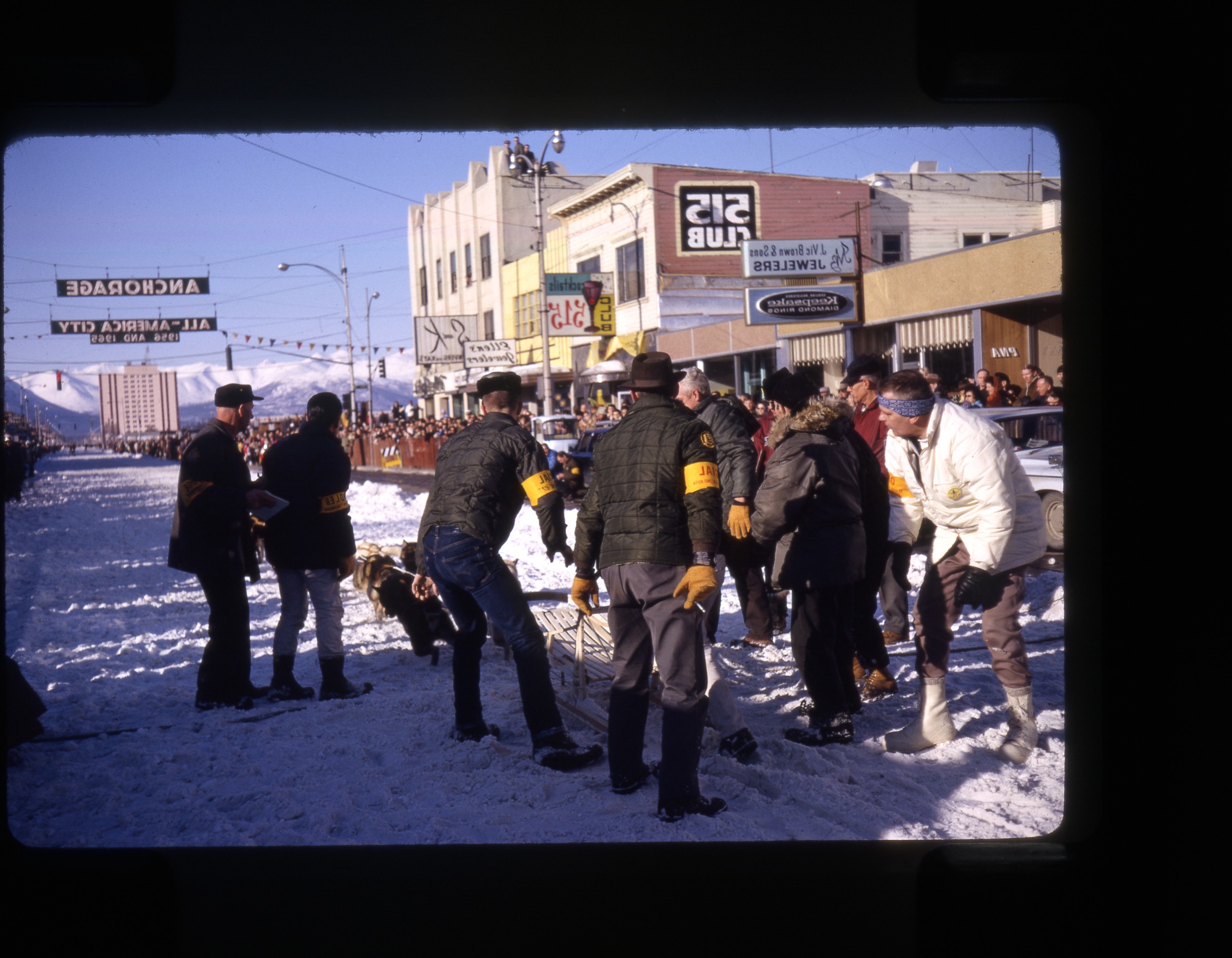
| | 1 — | .3 – [crowds gathered around U.S. Air Force aircraft, including B-36 Convair number 751 and
Troop Carrier prop plane number 03[5?], on tarmac at unidentified airport]
1964 |
| | 4 — | [young man, possibly Doug Deane, standing outside abandoned building with sign for
Whitehouse cabins, Yukon River; print date Sep 64] |
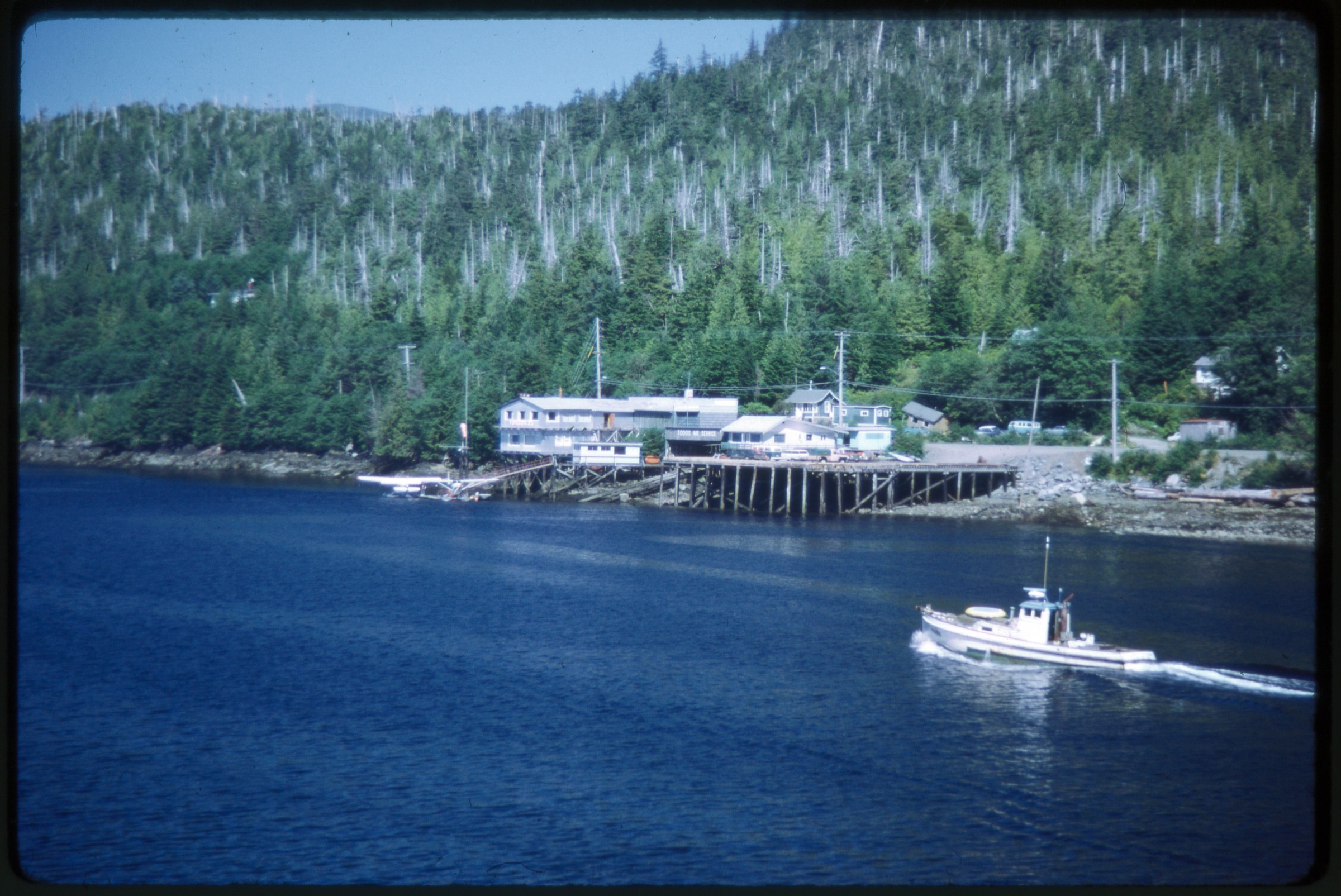
| | 5 — | [riverboat Keno, drydocked, with sign for Klondike Nites, Dawson; print date Sep 64] |
| | 6 — | [street view, probably Dawson as seen from Keno, RV park at left, signs for businesses;
print date Sep 64] |
| | 7 — | [Bonanza Mining Museum, Dawson; print date Sep 64] |
| | 8 — | [interpretive sign for the riverboat Keno; print date Sep 64] |
| | 9 — | [Winaut’s Store, Dawson; print date Sep 64] |
| | 10 — | [log building, with boardwalk and firewood pile in front, probably Dawson; print date Sep
64] |
| | 11 — | [two men standing on Dawson City ferry Campbell; print date Sep 64] |
| | 12 — | [log cabin and wood-frame house along boardwalk, probably Dawson; print date Sep 64] |
| | 13 — | [white wood-frame house with red corrugated metal roof, probably Dawson; print date
Sep 64] |
| | 14 — | [Masonic Temple, Dawson; print date Sep 64] |
| | 15 — | [Dawson City ferry Campbell coming into dock, ferry master building at right with signs
for hours, No Loitering, and “Ferry to Yukon-Alaska Boundary, Alaska Highway, Narrow Road
Drive Careful,” bicycle leaned against barrels in front of building; print date Sep 64] |
| | 16 — | [young man on Dawson City ferry Campbell, Doug Deane? print date Sep 64] |
| | 17 — | [scenic of rolling hills, automobile on dirt road in foreground; print date Sep 64] |
| | 18 — | [scenic of rolling hills, automobile on dirt road in foreground; print date Sep 64] |
| | 19 — | [view down dirt road through rolling hills, sign “Slow” in foreground; print date Sep 64] |
| | 20 — | [“Entering Yukon” border highway sign; print date Sep 64] |
| | 21 — | [young man, possibly Doug Deane, standing next to sign reading “Stop, You are now
entering ‘Top of the World’ Skyline Drive [...]”; print date Sep 64] |
| | 22 — | [stone marker, International Boundary Line U.S.-Canada; print date Sep 64] |
| | 23 — | [abandoned gold dredge; print date Sep 64] |
| | 24 — | [Santa Claus House, North Pole; print date Sep 64] |
| | 25 — | [Fairbanks street scene, corner of First and Cushman, with Alaska Highway mile 1523
marker, Chena River bridge, public phone booth, Immaculate Conception Church in
background; print date Sep 64]
|
| | 26 — | [exterior, Museum of the North, University of Alaska Fairbanks, flower garden in front,
military Jeep parked at right; print date Sep 64] |
| | 27 — | [University of Alaska Fairbanks campus, with Bunnell and Duckering Buildings; print date
Sep 64] |
| | 28 — | [Wickersham Hall, University of Alaska Fairbanks; print date Sep 64] |
| | 29 — | [view down braided river valley; print date Sep 64] |
| | 30 — | [moose feeding in flooded area with utility pole; print date Sep 64] |
| | 31 — | [two moose feeding in flooded area with utility pole; print date Sep 64] |
| | 32 — | [bison grazing on grass, University of Alaska Fairbanks campus; print date Sep 64] |
| | 33 — | [bison grazing on grass, University of Alaska Fairbanks campus; print date Sep 64] |
| | 34 — | [bison crossing gravel road, University of Alaska Fairbanks campus; print date Sep 64] |
| | 35 — | [house and outbuilding with lawn, Fairbanks or Anchorage? print date Sep 64] |
| | 36 — | [entrance sign for Elmendorf Air Force Base, “Top Cover for America;” print date Sep 64] |
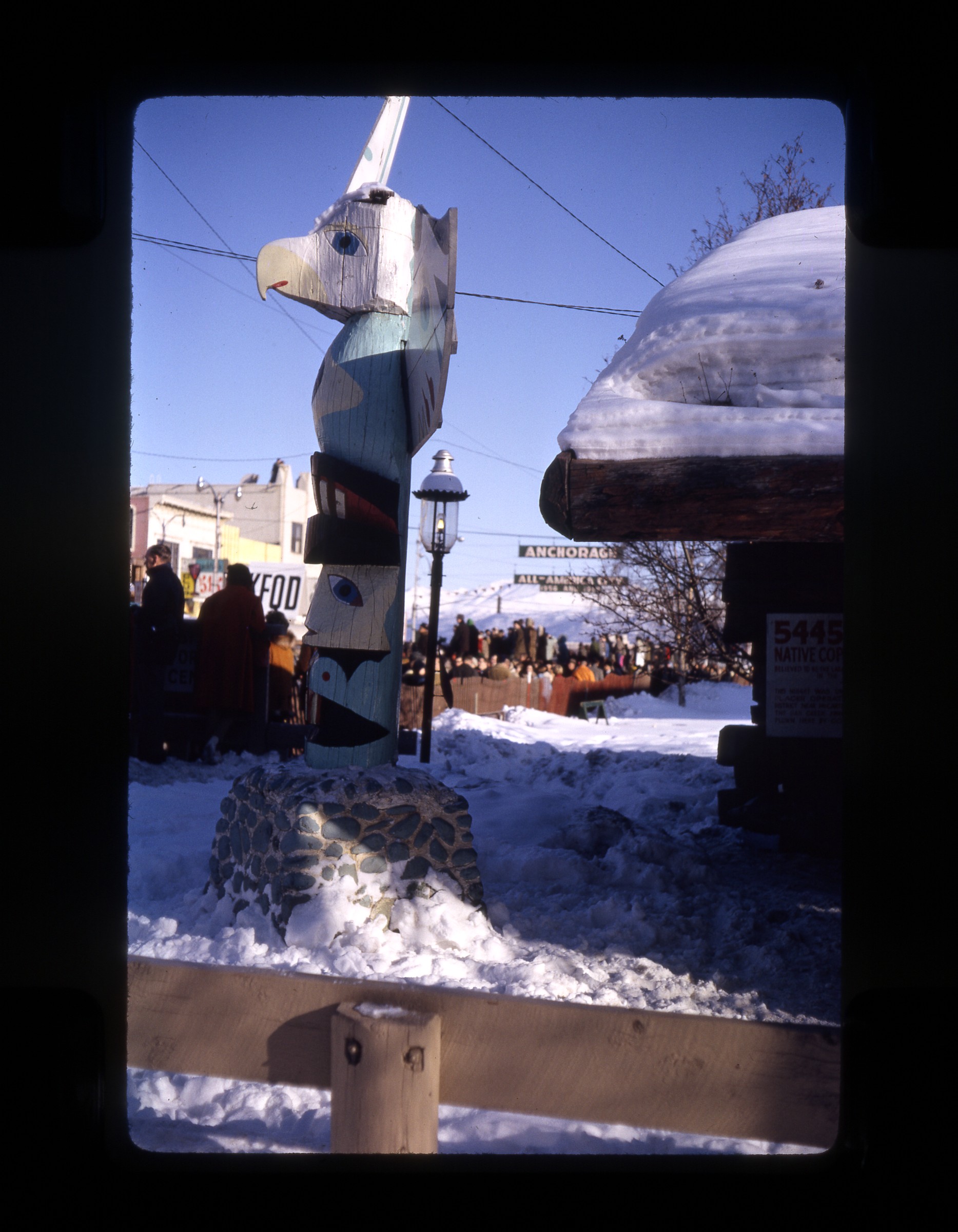
| | 37 — | [totem pole on lawn, Elmendorf? Print date Sep 64] |
| | 38 — | [building 5-504 with white picket fence, residence for Alaska Air Command senior
officers, Elmendorf Air Force Base; print date Sep 64] |
| | 39 — | [Headquarters, Alaskan Command, Elmendorf Air Force Base; print date Sep 64] |
| | 40 — | [large building, Elmendorf Air Force Base; print date Sep 64]
1965 |
| | 41 — | [scenic with sun shining through hoar frost on trees; print date Mar 65] |
| | 42 — | [snow piled in yard of Deane residence in Anchorage, automobile parked in front, with
engine block heater cord running over snow; print date Mar 65] |
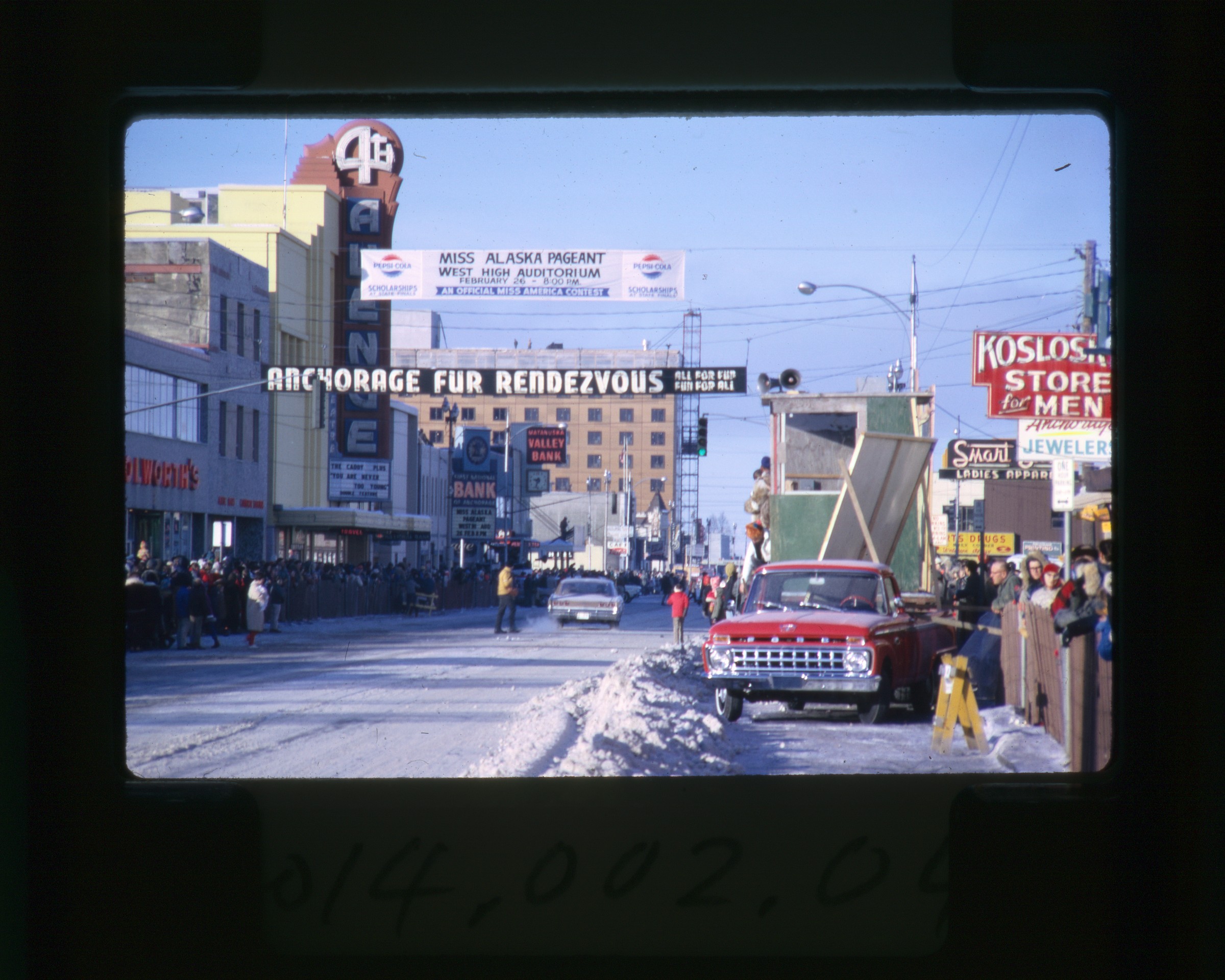
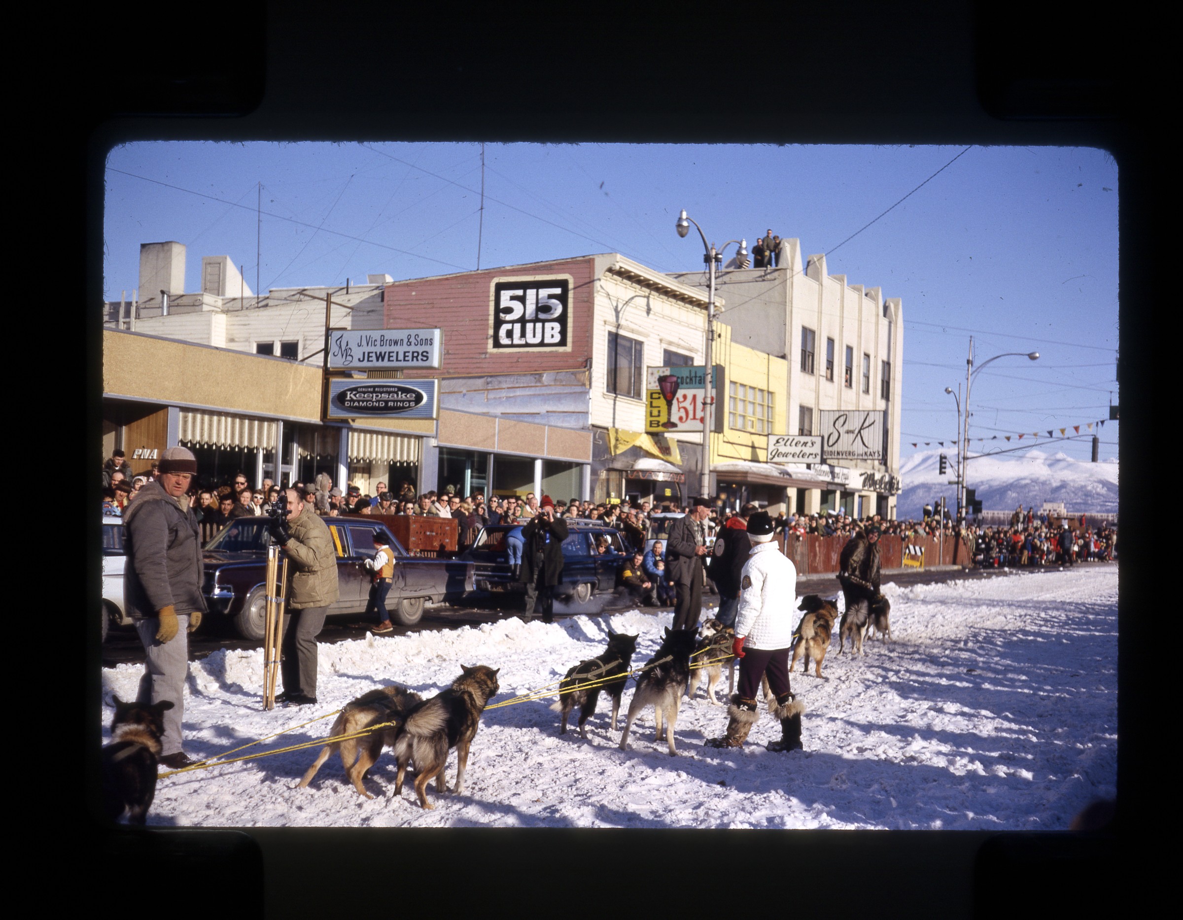
| 43 — | [Fourth Avenue street scene, Fur Rendezvous, spectators lining street, probably watching
World Championship Sled Dog Races, signs for businesses including Woolworth’s, 4th Avenue
Theatre, First National Bank of Anchorage, Matanuska Valley Bank, Smart Shop, Koslosky’s,
Anchorage Jewelers; print date Mar 65] |
| | 44 — | [man in sealskin coat on horseback, Fur Rendezvous; print date Mar 65] |
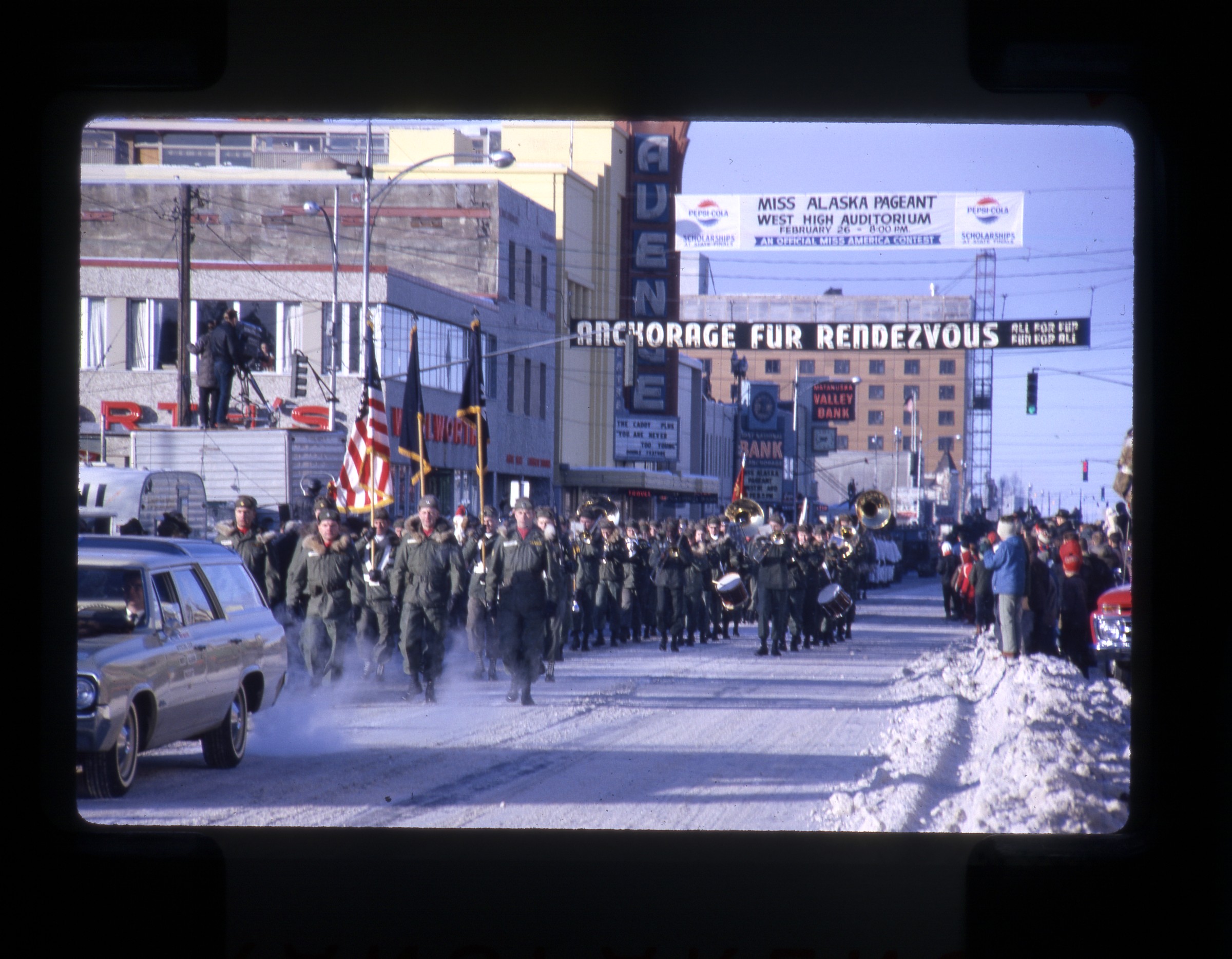
| 45 — | [Army color guard and marching band on Fourth Avenue passing Woolworth’s and 4th
Avenue Theatre, Fur Rendezvous; print date Mar 65] |
| | 46 — | [Army tanks on Fourth Avenue passing Woolworth’s and 4th Avenue Theatre, Fur
Rendezvous; print date Mar 65] |
| | 47 — | [close-up of Army tanks on Fourth Avenue passing Woolworth’s and 4th Avenue Theatre,
Fur Rendezvous; print date Mar 65] |
| | 48 — | [Army unit on Fourth Avenue passing Woolworth’s and 4th Avenue Theatre, Fur
Rendezvous; print date Mar 65] |
| | 49 — | [Air Force marching band on Fourth Avenue passing Woolworth’s and 4th Avenue
Theatre, Fur Rendezvous; print date Mar 65] |
| | 50 — | [African-American military unit marching on Fourth Avenue passing Woolworth’s and 4th
Avenue Theatre, Fur Rendezvous; print date Mar 65] |
| | 51 — | [Nona’s School of Dance students marching on Fourth Avenue past Woolworth’s; print
date Jul 65] |
| | 52 — | [men and women on horseback riding down Fourth Avenue past Woolworth’s, banner
over street for Miss Alaska Pageant; print date Jul 65]
|
| | 53 — | [parade float of musher and dog team on Fourth Avenue passing Woolworth’s; print date
Jul 65] |
| | 54 — | [color guard on horseback riding down Fourth Avenue past Woolworth’s; print date Jul
65] |
| | 55 — | [East Anchorage High School Key Club float on Fourth Avenue passing Woolworth’s; print
date Jul 65] |
| | 56 — | [side view of Cook Inlet Native Association float on Fourth Avenue; print date Jul 65] |
| | 57 — | [back end of Cook Inlet Native Association float on Fourth Avenue; print date Jul 65] |
| | 58 — | [Fur Rendezvous parade on Fourth Avenue, automobile in front with banner for roller
rink, Rondy Queen riding on hood of second automobile, passing businesses including Chugiak
Optical Service, Alaskan Stationers, The Club & Café, Pioneer Club; print date Jul 65] |
| | 59 — | [close-up of Fur Rendezvous parade float of Anchorage Midnight Sun [?]; print date Jul
65] |
| | 60 — | [two men at shooting range, possibly in old quarry or on military base, one man kneeling
down to use scope sight; print date Jul 65] |
| | 61 — | [man shooting rifle at gun range, same location as in .60; print date Jul 65] |
| | 62 — | [young men at shooting range, targets along gravel bank at back, mountains in distance,
same location as in .60; print date Jul 65] |
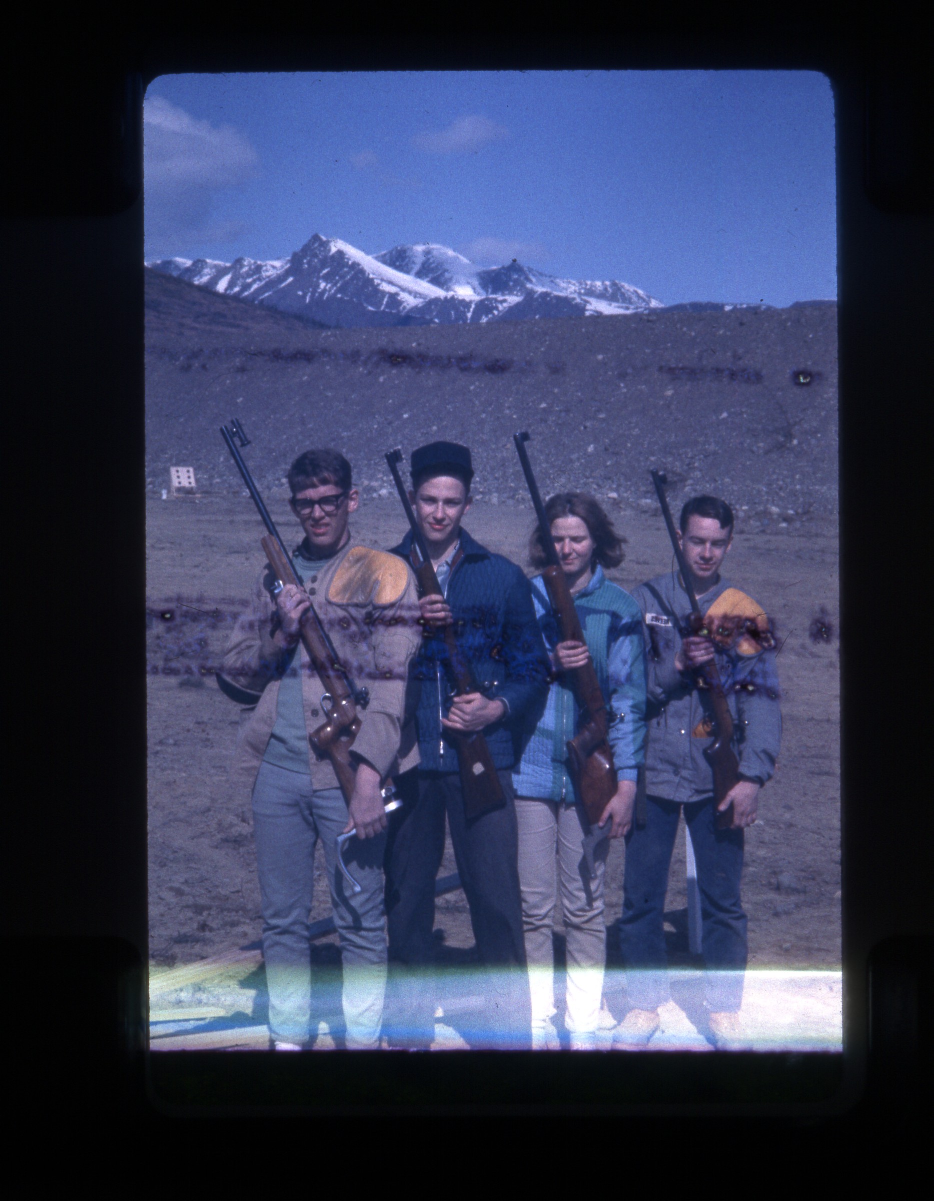
| 63 — | [three young men and one young woman posed with rifles at shooting range, same
location as in .60; print date Jul 65] |
| | 64 — | [young man, Doug Deane? standing next to Alaska Dept. of Highways interpretive sign on
climate; print date Jul 65] |
| | 65 — | [exterior of Meekin’s Roadhouse, with totem pole and flagpole, mile 110 Glenn Highway;
print date Dec 65] |
| | 66 — | [young man, Doug Deane? standing next to automobile parked on gravel road,
mountains in distance; print date Dec 65] |
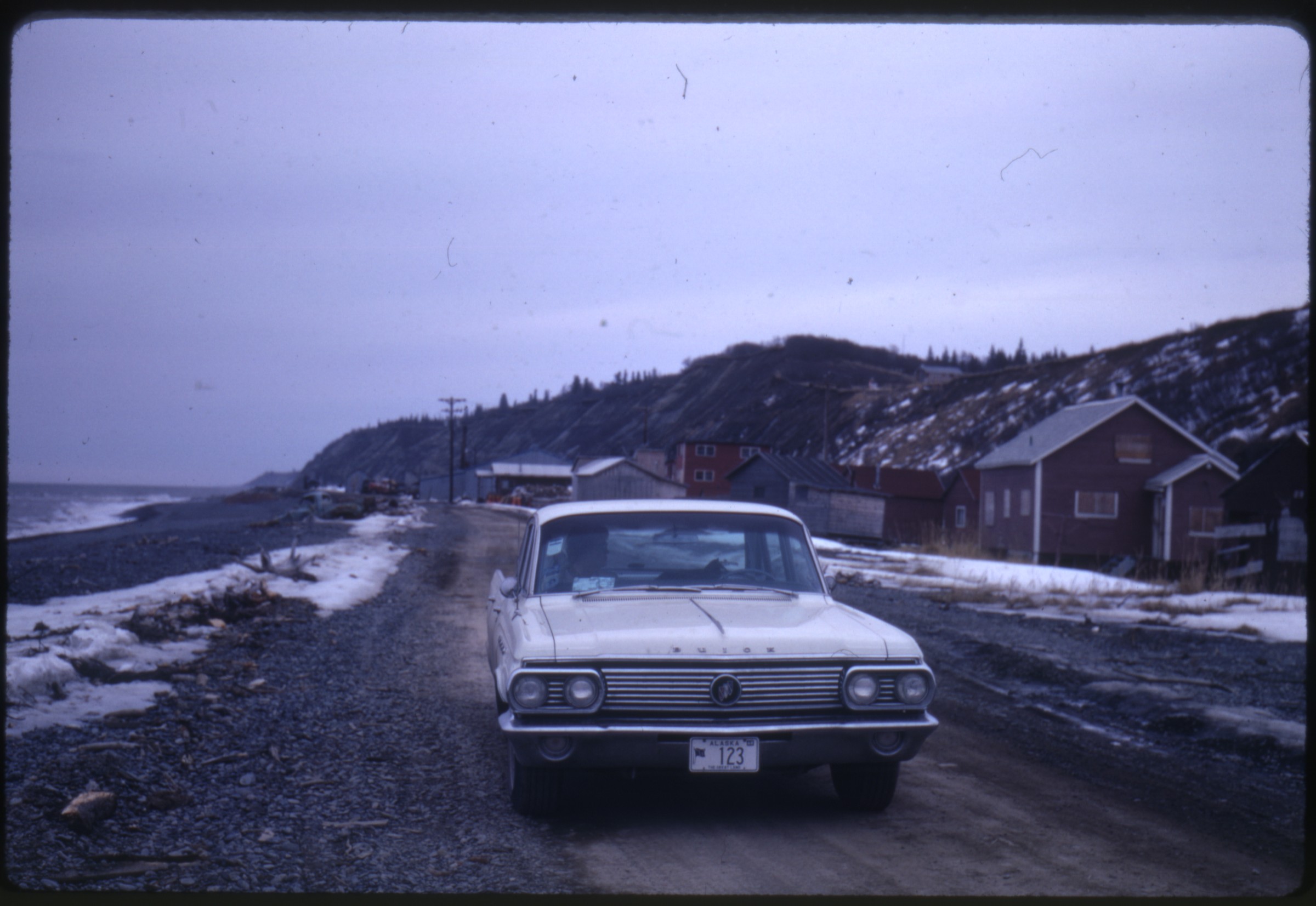
| | 67 — | [view down gravel road, utility poles at right, mountains in distance; print date Dec 65] |
| | 68 — | [automobile parked on gravel road next to sign for Boutillier Summit, mile 1049.8 Alaska
Highway; print date Dec 65] |
| | 69 — | [automobile parked on gravel road next to sign for Soldier’s Summit, mile 1061 Alaska
Highway; print date Dec 65] |
| | 70 — | [young man, Doug Deane? standing next to Alaska Dept. of Highways interpretive sign on
highway construction; print date Jul 65]
1966 |
| | 71 — | [bridge over Aishihik River, mile 996.3 Alaska Highway; print date Jun 66] |
| | 72 — | [woman sitting in automobile parked on side of Richardson Highway, snow-covered
mountains in distance; print date Jun 66] |
| | 73 — | [view down Richardson Highway to sharp turn, snow-covered mountain; print date Jun
66] |
| | 74 — | [view down gravel road paralleling braided river bed, probably along Richardson
Highway; print date Jun 66] |
| | 75 — | [scenic of creek, snow and pine trees on mountain slope, probably along Richardson
Highway; print date Jun 66]
|
| | 76 — | [scenic of mountains along Richardson Highway; print date Jun 66] |
| | 77 — | [view down Richardson Highway, with snow markers and road signs for Alaska 4 and
curves; print date Jun 66] |
| | 78 — | [Alaska 4 sign on Richardson Highway; print date Jun 66] |
| | 79 — | [Worthington River sign and utility pole along Richardson Highway; print date Jun 66] |
| | 80 — | [scenic of mountains along Richardson Highway; print date Jun 66] |
| | 81 — | [scenic of snow drift and bank rot along Richardson Highway; print date Jun 66] |
| | 82 — | [Alaska Dept. of Highways interpretive sign for Old Wortmann’s Camp, Richardson
Highway; print date Jun 66] |
| | 83 — | [Alaska Dept. of Highways interpretive sign for Old Goat Trail, Richardson Highway; print
date Jun 66] |
| | 84 — | [Alaska Dept. of Highways interpretive sign for Old Railroad Tunnel, Richardson Highway;
print date Jun 66] |
| | 85 — | [Old Valdez, with boat in foreground, abandoned buildings in background; print date Jun
66] |
| | 86 — | [Old Valdez, boat Gulf King in foreground, burned oil tanks in background; print date Jun
66] |
| | 87 — | [automobile parked outside log roadhouse, with neon signs for beer in windows, antlers
in yard and bear skin nailed to building exterior, probably Richardson Highway; print date Jun
66] |
| | 88 — | [road sign “Your Highway Taxes at Work,” Richardson Highway; print date Jun 66] |
| | 89 — | [road sign “You are now entering Northwest Highway System maintained by Dept. of
Public Works, Headquarters Whitehorse, Yukon Terr.”; print date Jun 66] |
| | 90 — | [roadside mileage marker, with mileage to multiple destinations including Canada
Customs (84), Alaska Border (103) and Seattle (1963); print date Jun 66] |
| | 91 — | [log cabin, small sign on fence in front, unidentified location; print date Jun 66] |
| | 92 — | [road sign for Soldier’s Summit, mile 1061 Alaska Highway; print date Jun 66] |
| | 93 — | [woman, possibly Alma Deane, behind wheel of automobile parked on gravel road
paralleling lake or river, probably Alaska Highway; print date Jun 66] |
| | 94 — | [view down gravel road to lake, probably Alaska Highway; print date Jun 66] |
| | 95 — | [log cabin with signs for Goodyear Tires, probably service station on Alaska Highway;
print date Jun 66] |
| | 96 — | [dilapidated log A-frame bridge over narrow creek, Canyon Creek Bridge? print date Jun
66] |
| | 97 — | [log cabin and cache; print date Jun 66] |
| | 98 — | [remnants of old trail through wooded area; print date Jun 66] |
| | 99 — | [view down narrow gravel road, mountains in distance; print date Jun 66] |
| | 100 — | [spirit houses in Russian Orthodox cemetery, mountains in distance, Watson Lake?;
print date Jun 66] |
| | 101 — | [fork and knife set on grave marker reading “William Fraser born May 28, 1928, killed
Dec. 12, 1961 at Watson Lake”; print date Jun 66] |
| | 102 — | [log building and fencing; print date Jun 66] |
| | 103 — | [log building with sign for “Store,” corrugated metal on back end, barrels, chairs, and
toy wagon in front, microwave tower in distance; print date Jun 66]
|
| | 104 — | [interpretive marker for Champagne, Yukon, mile 968 Alaska Highway; print date Jun
66] |
| | 105 — | [close-up of Buick with Alaska plates and Volkswagen Beetle with Yukon plates in
parking lot; print date Jun 66] |
| | 106 — | [steamboat Klondike in dry dock, Whitehorse; print date Jun 66] |
| | 107 — | [steamboats Casca and Whitehorse in dry dock, Whitehorse; print date Jun 66] |
| | 108 — | [Yukon Historical Society MacBride Museum, Whitehorse; print date Jun 66] |
| | 109 — | [Locomotive 51, White Pass & Yukon Route, MacBride Museum; print date Jun 66] |
| | 110 — | [White Pass & Yukon Route headquarters in Whitehorse, large log building with signs
for Yukon Travel Bureau Information and Canadian Pacific Airlines; print date Jun 66] |
| | 111 — | [plaque of coat of arms on side of building, with Canadian national motto A mari usque
ad mare; print date Jun 66] |
| | 112 — | [Whitehorse street scene, WP & YR headquarters at end of street, automobiles and
signs for businesses including Murdock’s, Yukon Rexall Drugs; print date Jun 66] |
| | 113 — | [Deane’s Buick parked on residential street with several houses, Whitehorse? print date
Jun 66] |
| | 114 — | [railroad station, with White Pass & Yukon Route passenger car on track, WP & YR truck
parked in lot; print date Jun 66] |
| | 115 — | [men gathered around White Pass & Yukon Route Locomotive 92 on track, pulling
freight; print date Jun 66] |
| | 116 — | [White Pass & Yukon Route caboose 907 with thunderbird design on side; print date Jun
66] |
| | 117 — | [Deane’s Buick loaded onto flatbed railcar outside of White Pass & Yukon Route
headquarters, Whitehorse; print date Jun 66] |
| | 118 — | [White Pass & Yukon Route Locomotive 92 on track, pulling tank cars; print date Jun 66] |
| | 119 — | [portrait of elderly man and woman on railroad platform, Whitehorse; print date Jun
66] |
| | 120 — | [Deane’s Buick loaded onto flatbed railcar; print date Jun 66] |
| | 121 — | [view down railroad tracks, holding pond at right, White Pass & Yukon Route; print date
Jun 66] |
| | 122 — | [view along side of White Pass & Yukon Route train on track, with freight and tank cars;
print date Jun 66] |
| | 123 — | [view from rear of train up to locomotive and flatbed hauling automobiles, White Pass
& Yukon Route; print date Jun 66] |
| | 124 — | [steamboat Tutshi in dry dock at Carcross; print date Jun 66] |
| | 125 — | [Locomotive The Duchess on display at Carcross; print date Jun 66] |
| | 126 — | [log cabins with mountains in background, probably Carcross; print date Jun 66] |
| | 127 — | [elderly couple on platform at train station in Carcross; print date Jun 66] |
| | 128 — | [view from rear of train up to locomotive and flatbed hauling automobiles, White Pass
& Yukon Route; print date Jun 66] |
| | 129 — | [scenic of lake and mountains, probably White Pass & Yukon Route; print date Jun 66] |
| | 130 — | [border marker, British Columbia-Yukon border, as seen from train; print date Jun 66] |
| | 131 — | [view from rear of train up to locomotive on siding, White Pass & Yukon Route; print
date Jun 66]
|
| | 132 — | [White Pass & Yukon Route locomotive and passengers cars (including 264 Lake
Aishihik) on siding, conductor walking up track; print date Jun 66] |
| | 133 — | [view down railroad track on narrow line between rock wall and water, White Pass &
Yukon Route; print date Jun 66] |
| | 134 — | [White Pass & Yukon Route conductor leaning on flatbed car carrying Deane’s Buick and
another automobile; print date Jun 66] |
| | 135 — | [view along side of White Pass & Yukon Route train on track, with freight and tank cars;
print date Jun 66] |
| | 136 — | [view down track to railroad station on lake shore, Bennett? print date Jun 66] |
| | 137 — | [scenic of river, White Pass & Yukon Route; print date Jun 66] |
| | 138 — | [passengers on platform at Bennett station, White Pass & Yukon Route; print date Jun
66] |
| | 139 — | [view down track to snow-covered mountains, White Pass & Yukon Route; print date
Jun 66] |
| | 140 — | [view down track to entrance of tunnel 920B, White Pass & Yukon Route; print date Jun
66] |
| | 141 — | [view through covered bridge 520A, with abandoned building at left, White Pass &
Yukon Route; print date Jun 66] |
| | 142 — | [view down track to entrance of tunnel 519A, White Pass & Yukon Route; print date Jun
66] |
| | 143 — | [“Trail of ‘98” marker next to track, White Pass & Yukon Route; print date Jun 66] |
| | 144 — | [wrecked automobiles on slope next to track, probably from old derailment, White Pass
& Yukon Route; print date Jun 66] |
| | 145 — | [view along side of train to locomotive crossing steel trestle bridge, White Pass & Yukon
Route; print date Jun 66] |
| | 146 — | [close-up of steel support structures anchored into rock for bridge on White Pass &
Yukon Route; print date Jun 66] |
| | 147 — | [steel trestle bridge, White Pass & Yukon Route; print date Jun 66] |
| | 148 — | [view along side of train to wooden snow shelter on track, White Pass & Yukon Route;
print date Jun 66] |
| | 149 — | [scenic along White Pass & Yukon Route; print date Jun 66] |
| | 150 — | [view along side of train to locomotive, White Pass & Yukon Route; print date Jun 66] |
| | 151 — | [rock formations along White Pass & Yukon Route; print date Jun 66] |
| | 152 — | [young man, possibly Doug Deane, standing on steps of White Pass & Yukon Route
passenger car; print date Jun 66] |
| | 153 — | [conductor posed next to White Pass & Yukon Route passenger car; print date Jun 66] |
| | 154 — | [view down track to tunnel, White Pass & Yukon Route; print date Jun 66] |
| | 155 — | [view of locomotive from rear of train navigating U-turn, White Pass & Yukon Route;
print date Jun 66] |
| | 156 — | [scenic along White Pass & Yukon Route; print date Jun 66] |
| | 157 — | [waterfall along White Pass & Yukon Route; print date Jun 66] |
| | 158 — | [message painted into rocks, “On to Alaska with Buchanan,” White Pass & Yukon Route;
print date Jun 66] |
| | 159 — | [waterfall along White Pass & Yukon Route; print date Jun 66]
|
| | 160 — | [Skagway street scene, with Arctic Brotherhood building and The Trail Bench Gifts; print
date Jun 66] |
| | 161 — | [Golden North Hotel, Skagway; print date Jun 66] |
| | 162 — | [man walking in front of White Pass & Yukon locomotive on tracks at Skagway; print
date Jun 66] |
| | 163 — | [Alaska Marine Highway ferry Taku at Skagway dock; print date Jun 66] |
| | 164 — | [Skagway street scene, with boardwalks and signs for Photo Shop, Bakery Coffee Store;
print date Jun 66] |
| | 165 — | [exterior of Brownie’s Bakery Coffee Bar, Skagway; print date Jun 66] |
| | 166 — | [Skagway street scene with totem pole outside Kirmses Curios, sign for F.O.E. No. 25;
print date Jun 66] |
| | 167 — | [young man and woman on boardwalk next to sign for Skagway Overlook; print date
Jun 66] |
| | 168 — | [bird’s eye view of Skagway from overlook; print date Jun 66] |
| | 169 — | [bird’s eye view of Skagway docks from overlook; print date Jun 66] |
| | 170 — | [mileage marker for Chilkoot Trail; print date Jun 66] |
| | 171 — | [scenic, probably Skagway River; print date Jun 66] |
| | 172 — | [abandoned homestead, with wood-frame house at right, fields at left, mountains in
background, Skagway area; print date Jun 66] |
| | 173 — | [view down gravel road paralleling river, probably Skagway River; print date Jun 66] |
| | 174 — | [totem pole on boardwalk outside store, possibly Kirmses Curios in Skagway; print date
Jun 66] |
| | 175 — | [dilapidated White Pass & Yukon Route locomotive 73 in yard, Skagway? print date Jun
66] |
| | 176 — | [view down boardwalk in residential area, with manicured trees and bench made with
two wagon wheels, Skagway; print date Jun 66] |
| | 177 — | [totem poles outside Kimses Curios, Bank of Alaska in background, Skagway; print date
Jun 66] |
| | 178 — | [Skagway City Hall; print date Jun 66] |
| | 179 — | [White Pass & Yukon Route train cars on dock next to freighter, Skagway; print date Jun
66] |
| | 180 — | [Alaska Marine Highway ferry Matanuska at Skagway dock; print date Jun 66] |
| | 181 — | [young man, possibly Doug Deane, on ferry; print date Jun 66] |
| | 182 — | [close-up of ferry deck; print date Jun 66] |
| | 183 — | [close-up of nameplate for ferry Matanuska; print date Jun 66] |
| | 184 — | [view of Skagway from docks; print date Jun 66] |
| | 185 — | [close-up of ferry deck; print date Jun 66] |
| | 186 — | [White Pass & Yukon Route passenger cars 222 and 216 on track; print date Jun 66] |
| | 187 — | [Juneau waterfront as seen from ferry, with federal building at left, Coastal-Ellis Airlines
floatplane dock at right; print date Jun 66] |
| | 188 — | [houses along Gastineau Channel, with Juneau Douglas Bridge at right; print date Jun
66] |
| | 189 — | [view of Juneau from ferry approaching dock; print date Jun 66] |
| | 190 — | [similar to .189]
|
| | 191 — | [scenic from deck of ferry; print date Jun 66] |
| | 192 — | [ferry deck with sign for Liferaft Station; print date Jun 66] |
| | 193 — | [scenic from ferry; print date Jun 66] |
| | 194 — | [scenic from ferry; print date Jun 66] |
| | 195 — | [bow of ferry with American flag and man holding camera at right; print date Jun 66] |
| | 196 — | [Five Finger Lighthouse; print date Jun 66]
B2 |
| | 197 — | [scenic from aboard Canadian commercial flag ship M/V Northland Prince; print date
Jun 66. The ship, built in 1963 in Vancouver, BC, early in its life served the logging village of
Ocean Falls, a community between Vancouver Island and Prince Rupert, and well inland, at the
end of Cousins Inlet] |
| | 198 — | [birds, boats, and flotsam seen from deck of Northland Prince; print date Jun 66] |
| | 199 — | [on deck of Northland Prince; print date Jun 66] |
| | 200 — | [scenic from Northland Prince; print date Jun 66] |
| | 201 — | [passengers sitting in lawn chairs on bow of Northland Prince, with Canadian flag; print
date Jun 66] |
| | 202 — | [complex of buildings, possibly small lighthouse, as seen from Northland Prince; print
date Jun 66] |
| | 203 — | [closer view of complex in .202, with docks, funicular next to long staircase, storage
tanks, small boat; print date Jun 66] |
| | 204 — | [close-up of deck, Northland Prince; print date Jun 66] |
| | 205 — | [M/V Island Prince passing Northland Prince; print date Jun 66] |
| | 206 — | [closer view of Island Prince; print date Jun 66] |
| | 207 — | [scenic from Northland Prince; print date Jun 66] |
| | 208 — | [RivTow barge loaded with cargo passing Northland Prince; print date Jun 66] |
| | 209 — | [crewmen on deck of Northland Prince; print date Jun 66] |
| | 210 — | [tug, [Florence ?] passing Northland Prince; print date Jun 66] |
| | 211 — | [scenic from Northland Prince; print date Jun 66] |
| | 212 — | [newsprint carrier M/V Besseggen passing Northland Prince; print date Jun 66] |
| | 213 — | [view from deck of Northland Prince; print date Jun 66] |
| | 214 — | [Ocean Falls, as seen from Northland Prince; print date Jun 66] |
| | 215 — | [Ocean Falls small boat harbor and buildings as seen from Northland Prince; print date
Jun 66] |
| | 216 — | [close-up of Ocean Falls buildings; print date Jun 66] |
| | 217 — | [small boat harbor and Ocean Falls courthouse as seen from Northland Prince; print
date Jun 66] |
| | 218 — | [view of Ocean Falls from deck of Northland Prince, with dam in background, sign for
Hudson Bay Company in middle, and man standing in public telephone booth in foreground;
print date Jun 66] |
| | 219 — | [Volkswagen Beetle being hoisted on to deck of Northland Prince, sign for Crown
Zellerbach Pulp and Paper Mill in background; print date Jun 66] |
| | 220 — | [view from deck of Northland Prince; print date Jun 66] |
| | 221 — | [ferry and dock with low fog on water as seen from Northland Prince; print date Jun 66]
|
| | 222 — | [Canadian National Steamship Company ferry passing Northland Prince; print date Jun
66] |
| | 223 — | [passengers on decks of Northland Prince as seen from dock; print date Jun 66] |
| | 224 — | [passenger decks of Northland Prince as seen from dock; print date Jun 66] |
| | 225 — | [cargo on deck of Northland Prince; print date Jun 66] |
| | 226 — | [young man, possibly Doug Deane, on deck of Northland Prince; print date Jun 66] |
| | 227 — | [young man, possibly Doug Deane, near railing and lifebuoy on deck of Northland
Prince; print date Jun 66] |
| | 228 — | [scenic from Northland Prince; print date Jun 66] |
| | 229 — | [scenic from Northland Prince; print date Jun 66] |
| | 230 — | [scenic with glacier, from Northland Prince; print date Jun 66] |
| | 231 — | [fishing boat passing Northland Prince; print date Jun 66] |
| | 232 — | [crabbing boat St. Mark passing Northland Prince; print date Jun 66] |
| | 233 — | [unidentified small boat harbor as seen from Northland Prince; print date Jun 66] |
| | 234 — | [captain on deck of Northland Prince; print date Jun 66] |
| | 235 — | [view from deck of passengers debarking and luggage being unloaded, Northland
Prince; print date Jun 66] |
| | 236 — | [crewman at hatch on deck of Northland Prince; print date Jun 66] |
| | 237 — | [view of channel markers in water, from Northland Prince; print date Jun 66] |
| | 238 — | [close-up of channel marker #37 as seen from Northland Prince; print date Jun 66] |
| | 239 — | [channel markers, seen from Northland Prince; print date Jun 66] |
| | 240 — | [channel markers and scenery from Northland Prince; print date Jun 66] |
| | 241 — | [scenic from Northland Prince; print date Jun 66] |
| | 242 — | [houses along Inside Passage as seen from Northland Prince; print date Jun 66] |
| | 243 — | [docks with crab pots, lumber, crates, men loading cargo, buildings along water line in
background, as seen from Northland Prince; print date Jun 66] |
| | 244 — | [houses and buildings of unidentified town, American flag flying in distance, from
Northland Prince; print date Jun 66] |
| | 245 — | [Japan Line freighter at unidentified dock, from Northland Prince; print date Jun 66] |
| | 246 — | [Alaska Marine Highway ferry Taku passing Northland Prince; print date Jun 66] |
| | 247 — | [closer view of Taku; print date Jun 66] |
| | 248 — | [another view of Taku; print date Jun 66] |
| | 249 — | [stern of Northland Prince, with Canadian flag; print date Jun 66] |
| | 250 — | [ship, [Homer?], passing Northland Prince; print date Jun 66] |
| | 251 — | [tug, M/S Gulf Joan, at dock, seen from Northland Prince, Butedale? print date Jun 66] |
| | 252 — | [waterfall from Northland Prince; print date Jun 66] |
| | 253 — | [seine boat Cape Ball at Canadian Fishing Co. dock, Butedale, as seen from Northland
Prince; print date Jun 66] |
| | 254 — | [view of decks of Northland Prince as seen from dock; print date Jun 66] |
| | 255 — | [cargo being offloaded from Northland Prince, men on dock, Butedale? print date Jun
66] |
| | 256 — | [lifeboat on deck of Northland Prince; print date Jun 66] |
| | 257 — | [lifebuoy on railing of Northland Prince; print date Jun 66]
|
| | 258 — | [Haida double mortuary pole in foreground carved by Bill Reid and Doug Cranmer,
totem pole and mortuary house in background, UBC Museum of Anthropology, Vancouver;
print date Jun 66] |
| | 259 — | [woman looking at information on sign board at right near Bill Reid-carved Haida
memorial pole, mortuary house in background, UBC Museum of Anthropology, Vancouver;
print date Jun 66] |
| | 260 — | [Haida totem pole topped by frontal board, Bill Reid and Doug Cranmer carvers, UBC
Museum of Anthropology, Vancouver] |
| | 261 — | [Buick parked on gravel road next to sign reading “You are now entering Northwest
Highway System maintained by Dept. of Public Works, Headquarters Whitehorse, Yukon
Terr.”; print date Dec 66] |
| | 262 — | [distinctive rock outcropping, probably along Alaska Highway; print date Dec 66] |
| | 263 — | [view down gravel road through rolling hills with oncoming automobile, Alaska
Highway; print date Dec 66] |
| | 264 — | [Buick parked on Tetsa No. 2 River bridge, mile 384.9 Alaska Highway; print date Dec
66] |
| | 265 — | [view down gravel road with utility poles, Stone Mountain in distance, Alaska Highway;
print date Dec 66] |
| | 266 — | [Stone Mountain, utility poles in foreground, Alaska Highway; print date Dec 66] |
| | 267 — | [buildings along gravel road, heavy equipment in parking lot, Stone Mountain in
background, Alaska Highway; print date Dec 66] |
| | 268 — | [scenic along Alaska Highway; print date Dec 66] |
| | 269 — | [road sign for Summit Lake, mile 392.5 Alaska Highway; print date Dec 66] |
| | 270 — | [scenic along Alaska Highway; print date Dec 66] |
| | 271 — | [bird’s eye view of braided river valley, Alaska Highway; print date Dec 66] |
| | 272 — | [bridge on Alaska Highway; print date Dec 66] |
| | 273 — | [braided river along Alaska Highway; print date Dec 66] |
| | 274 — | [service area on Alaska Highway, with sign for Esso gasoline, automobile pulling U-Haul
trailer parked in lot; print date Dec 66] |
| | 275 — | [posted speed sign for Muncho Lake Section, mile 424-496 Alaska Highway; print date
Dec 66] |
| | 276 — | [bird’s eye view of river canyon, Alaska Highway; print date Dec 66] |
| | 277 — | [view down gravel road to Stone Mountain, Alaska Highway; print date Dec 66] |
| | 278 — | [view down gravel road paralleling river, truck on road ahead, Alaska Highway; print
date Dec 66] |
| | 279 — | [building at right, sign reading “Muncho Lake” with logo of Canadian National Railway,
road sign for school crossing, Alaska Highway; print date Dec 66] |
| | 280 — | [Maintenance Camp 456, Muncho Lake, Alaska Highway; print date Dec 66] |
| | 281 — | [Muncho Lake; print date Dec 66] |
| | 282 — | [Muncho Lake; print date Dec 66] |
| | 283 — | [Muncho Lake; print date Dec 66] |
| | 284 — | [Muncho Lake Lodge, log and stone roadhouse with “Café” sign, police car parked in lot,
Alaska Highway; print date Dec 66] |
| | 285 — | [Liard River suspension bridge, buildings visible on far side; print date Dec 66]
|
| | 286 — | [automobile parked next to road sign for Coal River Section, Northwest Highway
System; print date Dec 66] |
| | 287 — | [close-up of structure in river, possibly small dam; print date Dec 66] |
| | 288 — | [scenic of Alaska Highway, gravel road with trees, mountains; print date Dec 66] |
| | 289 — | [road sign for Contact Creek, mile 588.1 Alaska Highway; print date Dec 66] |
| | 290 — | [road sign, Leaving the Yukon Territory; print date Dec 66] |
| | 291 — | [signposts at Watson Lake; print date Dec 66] |
| | 292 — | [close-up of signposts at Watson Lake; print date Dec 66] |
| | 293 — | [unidentified roadhouse and service station on Alaska Highway, two large log buildings
and one wood-frame building, gas pumps at right; print date Dec 66] |
| | 294 — | [large steel truss bridge over river, possibly Upper Liard River Bridge; print date Dec 66] |
| | 295 — | [interpretive sign for Yukon River, small bridge at left; print date Dec 66] |
| | 296 — | [view down gravel road, with small red road sign “1 Killed Here 1956,” rolling hills in
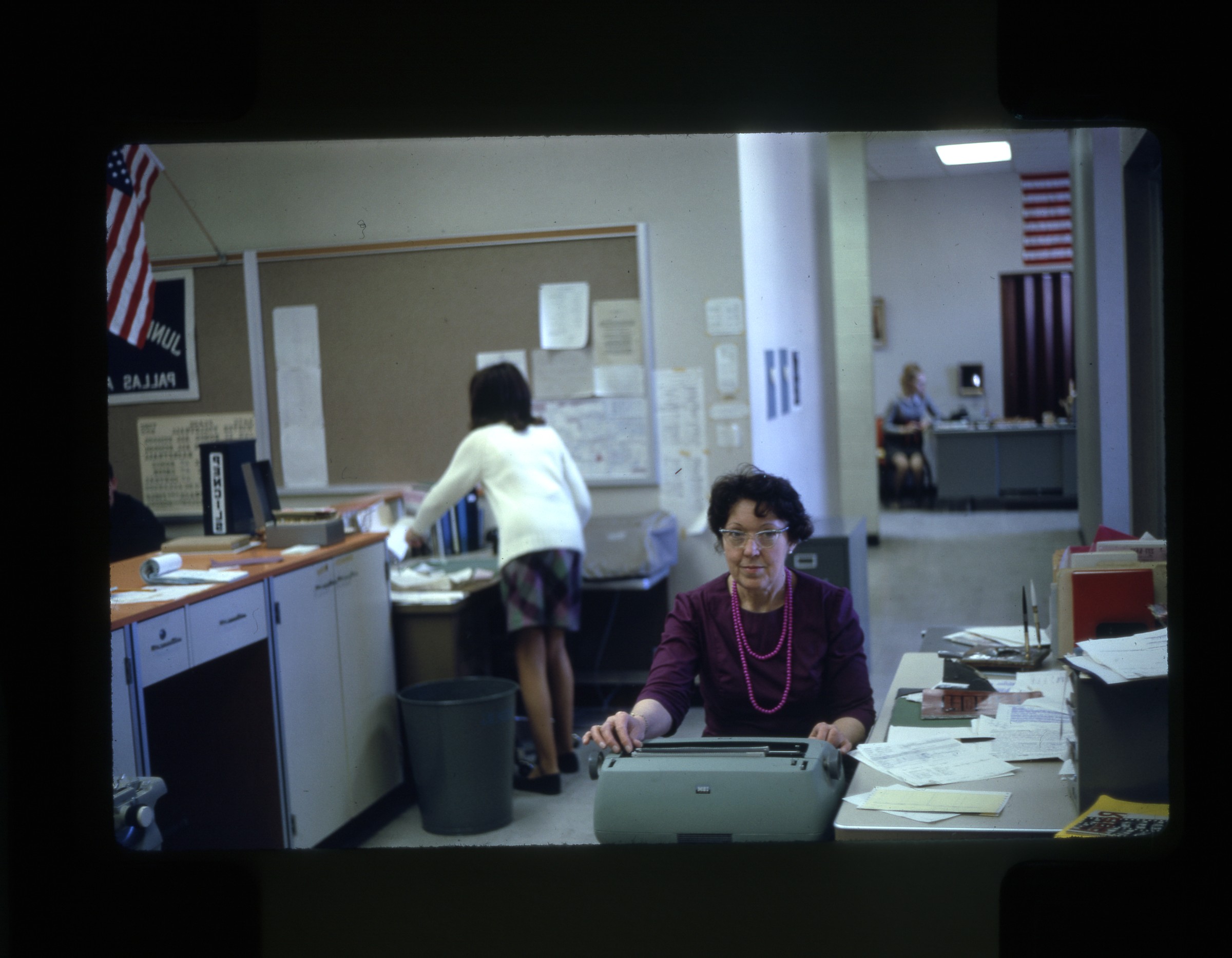
distance; print date Dec 66] |
| | 297 — | [bridge at Takhini River, mile 946.3 Alaska Highway; print date Dec 66] |
| | 298 — | [water truck siphoning water out of roadside pond, grader in distance at right, Alaska
Highway construction crew; print date Dec 66] |
| | 299 — | [wood-frame building under construction at unidentified location, fireweed in
foreground; print date Dec 66] |
| | 300 — | [view down gravel road through rolling hills, probably Alaska Highway; print date Dec
66] |
| | 301 — | [abandoned log cabin and fallen cache, probably along Alaska Highway, automobiles on
road at right; print date Dec 66] |
| | 302 — | [log cabin at unidentified location; print date Dec 66] |
| | 303 — | [view down gravel road through hills, cabins visible in distance, truck with camper in
oncoming lane, probably Alaska Highway; print date Dec 66] |
| | 304 — | [view down gravel road to small bridge, mountains in distance, probably Alaska
Highway; print date Dec 66] |
| | 305 — | [view down gravel road with mountains in distance, probably Alaska Highway; print
date Dec 66] |
| | 306 — | [buildings behind wood fence, sign for “Research Branch Experimental Farm, Canada
Dept. of Agriculture,” Whitehorse? print date Dec 66] |
| | 307 — | [unidentified roadhouse, log building with sign for Café and Store, smaller log cabin
with sign for Orange Crush, automobiles parked near gas pumps at right, Mackintosh Lodge?
print date Dec 66] |
| | 308 — | [view down gravel road at right, with old road at left, probably Alaska Highway; print
date Dec 66] |
| | 309 — | [view down gravel road, lake and mountains in distance, probably Kluane Lake; print
date Dec 66] |
| | 310 — | [scenic of Kluane Lake; print date Dec 66] |
| | 311 — | [view down gravel road, bridge in middle distance, mountains in background, Kluane
Lake; print date Dec 66] |
| | 312 — | [sign for Sheep Mountain, Kluane Lake Game Sanctuary; print date Dec 66] |
| | 313 — | [scenic of small rock outcropping in Kluane Lake; print date Dec 66]
|
| | 314 — | [scenic of Kluane Lake; print date Dec 66] |
| | 315 — | [house or cabins on shore of Kluane Lake; print date Dec 66] |
| | 316 — | [Kluane Lake School and other buildings, some under construction, on shore of Kluane
Lake; print date Dec 66] |
| | 317 — | [two burl sculptures, one with moose antlers attached; print date Dec 66. Cf. .1133] |
| | 318 — | [log roadhouse and Chevron gas station, with signs for Tubeless Tire Service, Standard
Oil Products, and “Husky pups for sale,” Sheep Mountain Motel and Café? print date Dec 66] |
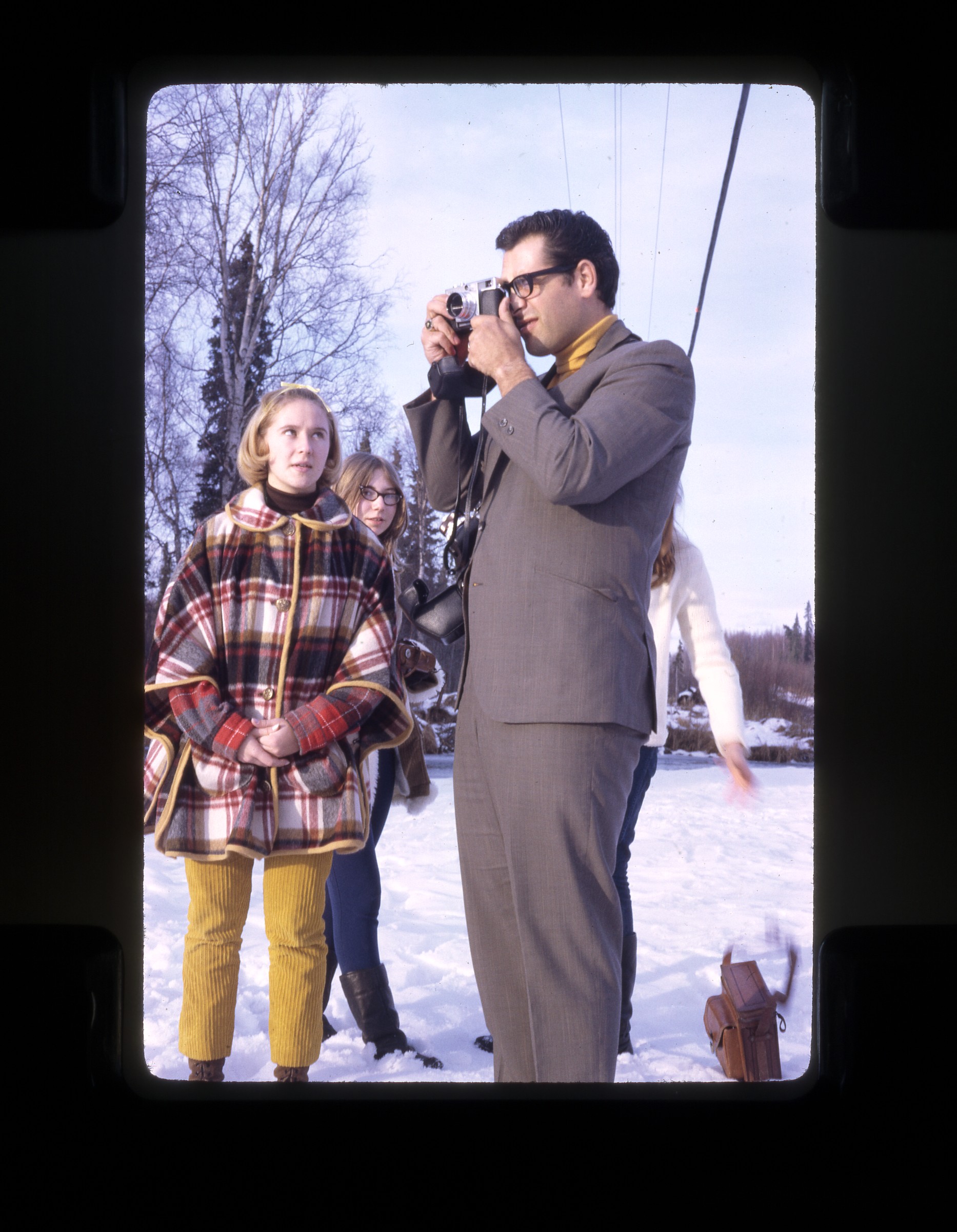
| | 319 — | [view down paved road, mountain in distance; print date Dec 66] |
| | 320 — | [scenic of river valley and mountains, Alaska Highway; print date Dec 66] |
| | 321 — | [mile markers for Girdwood and Portage, Seward Highway; print date Dec 66]
1967 |
| | 322 — | [1967 Fur Rendezvous street scene looking east on Fourth Avenue with All-America City
banner hanging over street, spectators on sidewalks, Alaska Native Hospital and Chugach
Mountains in distance; print date Mar 67] |
| | 323 — | [musher Andy Simon of Allakaket wearing bib #1 passing spectators on Fourth Avenue,
World Championship Sled Dog Races; print date Mar 67] |
| | 324 — | [musher, possibly Lester Erhart, wearing bib #2 passing spectators on Fourth Avenue,
World Championship Sled Dog Races; print date Mar 67] |
| | 325 — | [musher wearing bib #3 on Fourth Avenue, passing spectators and businesses including
McKinley Gifts, Stewart’s Photo Shop, and J. Vic Brown & Sons Jewelers, World Championship
Sled Dog Races; print date Mar 67] |
| | 326 — | [World Championship Sled Dog Races musher wearing bib #4 getting team ready on
Fourth Avenue, with spectators and businesses including Koslosky’s Store, McKinley Gifts,
Stewart’s Photo Shop, and J. Vic Brown & Sons Jewelers, banners over street for Miss Alaska
Pageant and Fur Rendezvous; print date Mar 67] |
| | 327 — | [view looking east on Fourth Avenue, with musher wearing bib #4 getting team ready,
spectators on sidewalks, World Championship Sled Dog Races; print date Mar 67] |
| | 328 — | [World Championship Sled Dog Races musher wearing bib #5 on Fourth Avenue, with
spectators and businesses including Koslosky’s Store, McKinley Gifts, and Stewart’s Photo
Shop, banners over street for Miss Alaska Pageant and Fur Rendezvous; print date Mar 67] |
| | 329 — | [World Championship Sled Dog Races musher getting team ready on Fourth Avenue,
with spectators and businesses including Smart Shop, Koslosky’s Store, McKinley Gifts, and
Stewart’s Photo Shop; print date Mar 67] |
| | 330 — | [musher wearing bib #13 on Fourth Avenue, passing spectators outside J. Vic Brown &
Sons Jewelers, World Championship Sled Dog Races; print date Mar 67] |
| | 331 — | [musher and handlers at starting line on Fourth Avenue, race map set up in front of
Smart Shop, Carlquist Jewelers, and Koslosky’s Store, World Championship Sled Dog Races;
print date Mar 67] |
| | 332 — | [spectators and cameraman on Fourth Avenue outside Club Paris watching World
Championship Sled Dog Races; print date Mar 67] |
| | 333 — | [two handlers with dog team harnessed to Alaskan Air Command sled, on Fourth
Avenue passing spectators and businesses including Ellen’s Jewelers and Seidenverg & Kay’s,
World Championship Sled Dog Races; print date Mar 67]
|
| 334 — | [handlers getting team ready on Fourth Avenue near businesses including J. Vic Brown
& Sons Jewelers, 515 Club, Ellen’s Jewelers, and Seidenverg & Kay’s, World Championship Sled
Dog Races; print date Mar 67] |
| | 335 — | [handlers getting team ready at starting line, with race map at right outside Smart Shop,
World Championship Sled Dog Races; print date Mar 67] |
| | 336 — | [musher wearing bib #19 and handlers getting team ready on Fourth Avenue,
spectators lining street outside businesses including J. Vic Brown & Sons Jewelers, 515 Club,
Ellen’s Jewelers, Seidenverg & Kay’s, and National Bank of Alaska, McKinley Apartments in
distance, World Championship Sled Dog Races; print date Mar 67] |
| | 337 — | [handlers getting Earl Norris’ team ready at starting line, musher standings on board in
front of Stewart’s Photo Shop, World Championship Sled Dog Races; print date Mar 67] |
| 338 — | [handlers getting team ready on Fourth Avenue, spectators lining street outside
businesses including J. Vic Brown & Sons Jewelers, 515 Club, Ellen’s Jewelers, and Seidenverg
& Kay’s, cameraman near sled at left, World Championship Sled Dog Races; print date Mar 67] |
| | 339 — | [handlers getting Earl Norris’ team ready at starting line, musher standings on board in
front of Stewart’s Photo Shop, World Championship Sled Dog Races; print date Mar 67] |
| | 340 — | [handlers getting team ready on Fourth Avenue, spectators lining street outside
businesses including J. Vic Brown & Sons Jewelers, 515 Club, Ellen’s Jewelers, and Seidenverg
& Kay’s, World Championship Sled Dog Races; print date Mar 67] |
| | 341 — | [musher wearing bib #21 talking with handler at starting line on Fourth Avenue outside
J. Vic Brown & Sons Jewelers, World Championship Sled Dog Races; print date Mar 67] |
| | 342 — | [musher wearing bib #21 and handlers getting team ready at starting line, with race
map outside Koslosky’s Store and McKinley Gifts, World Championship Sled Dog Races; print
date Mar 67] |
| 343 — | [totem pole next to Log Cabin Visitors Center on Fourth Avenue; print date Mar 67] |
| | 344 — | [steam locomotive 16 pulling train past street and buildings, probably Ship Creek; print
date Mar 67] |
| | 345 — | [bird’s eye view of musher wearing bib #1 with team on trail, World Championship Sled
Dog Races; print date Mar 67] |
| | 346 — | [musher wearing bib #1 with team on trail crossing street, police car at right, Chugach
Mountains in distance, World Championship Sled Dog Races; print date Mar 67] |
| | 347 — | [bird’s eye view of musher wearing bib #3 with team on trail, several spectators with
cameras, World Championship Sled Dog Races; print date Mar 67] |
| | 348 — | [musher wearing bib #3 with team on trail crossing street, police officers at right,
Chugach Mountains in distance, World Championship Sled Dog Races; print date Mar 67] |
| | 349 — | [musher wearing bib #3 with team on trail crossing street, basket sponsored by Alaska
Sales & Service, automobiles, small Quonset hut, and other buildings in background, Chugach
Mountains in distance, World Championship Sled Dog Races; print date Mar 67] |
| | 350 — | [musher with team on trail crossing street, police officer at right, automobiles and
buildings in background, Chugach Mountains in distance, World Championship Sled Dog
Races; print date Mar 67] |
| | 351 — | [musher wearing bib #5 with team on trail, Chugach Mountains in distance, World
Championship Sled Dog Races; print date Mar 67]
|
| | 352 — | [George Attla Jr., wearing bib #6, with team on trail, basket sponsored by J.C. Penney,
World Championship Sled Dog Races; print date Mar 67] |
| | 353 — | [musher wearing bib #12 with team on trail, World Championship Sled Dog Races; print
date Mar 67] |
| | 354 — | [musher wearing bib #11 with team on trail, World Championship Sled Dog Races; print
date Mar 67] |
| | 355 — | [boy and girl in blue robes carrying National Honor Society flames; print date Apr 67] |
| | 356 — | [three students standing behind table with banner for Aurora Chapter, National Honor
Society; print date Apr 67] |
| | 357 — | [similar to .356] |
| | 358 — | [choral group singing at National Honor Society induction; print date Apr 67] |
| | 359 — | [student lighting candle on table with banner for Aurora Chapter, National Honor
Society; print date Apr 67] |
| | 360 — | [students holding candles at National Honor Society induction; print date Apr 67] |
| | 361 — | [young man speaking at podium during National Honor Society induction; print date Apr
67] |
| | 362 — | [student posed with parents at National Honor Society induction; print date Apr 67] |
| | 363 — | [women at banquet table at National Honor Society induction, with cakes and cups;
print date Apr 67] |
| | 364 — | [student posed with parents at National Honor Society induction; print date Apr 67] |
| | 365 — | [crowd gathered at banquet table at National Honor Society induction; print date Apr
67] |
| | 366 — | [student posed with cup near banquet table at National Honor Society induction; print
date Apr 67] |
| | 367 — | [student at lectern in classroom, “Wild Animals of the Arctic” written on chalkboard,
view of Chugach Mountains out window; print date Apr 67] |
| | 368 — | [four girls and one woman standing in front of poster reading “Put Honor Society
Sweets in your pipe and smoke it;” print date Apr 67] |
| | 369 — | [students standing next to props, drama class? print date Apr 67] |
| | 370 — | [similar to .369] |
| | 371 — | [similar to .369, one student holding sign reading “Act-3”] |
| | 372 — | [group portrait of students in costume; print date Apr 67] |
| | 373 — | [similar to .372] |
| | 374 — | [similar to .372] |
| | 375 — | [museum display on Aleuts; print date Apr 67] |
| | 376 — | [museum display on Eskimos; print date Apr 67] |
| | 377 — | [museum display on Tlingits and Haida; print date Apr 67] |
| | 378 — | [museum display on Native peoples of Alaska; print date Apr 67] |
| | 379 — | [museum display on Alaska in the 1920s; print date Apr 67] |
| | 380 — | [museum display on Russian America; print date Apr 67] |
| | 381 — | [museum display on Native Alaskan art; print date Apr 67] |
| | 382 — | [museum display on Athabascans; print date Apr 67] |
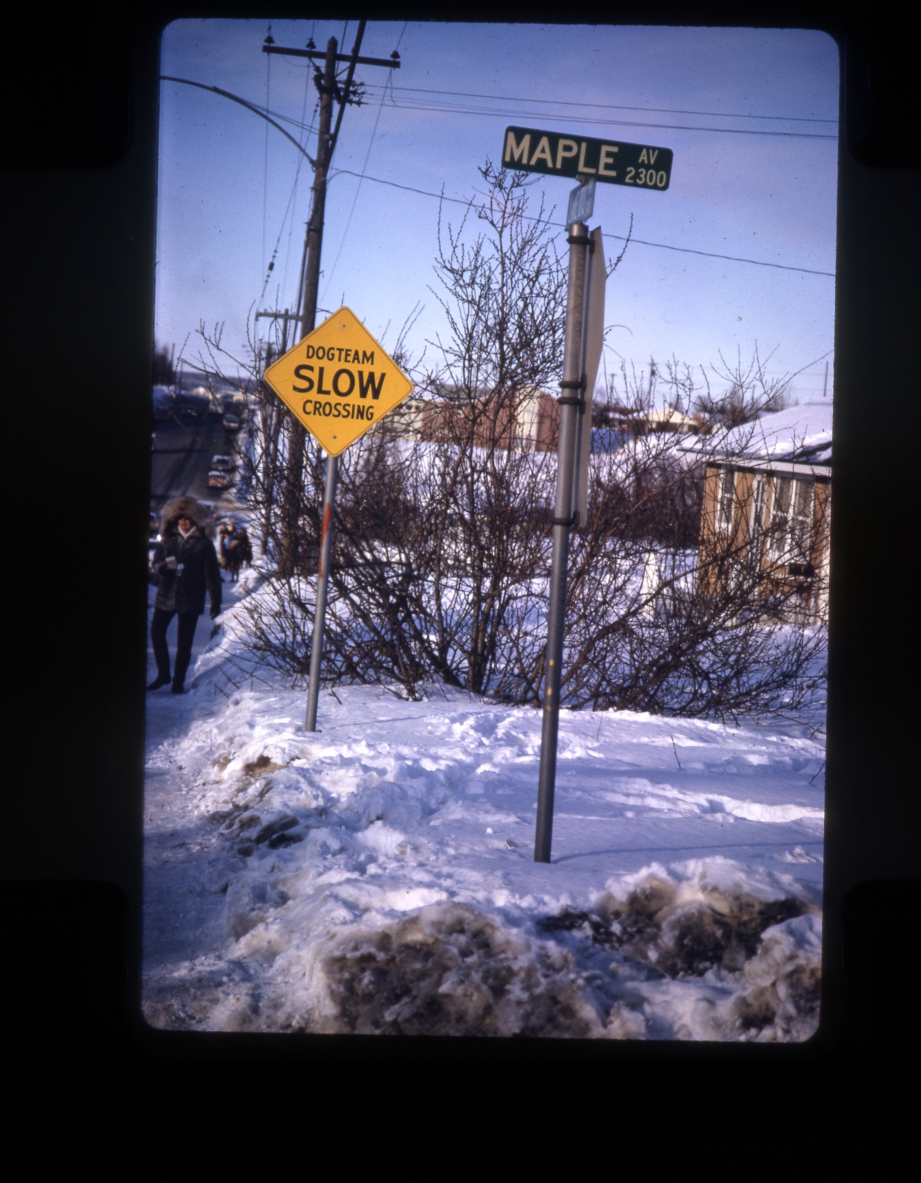
| 383 — | [street scene at corner of Lake Otis and Maple, with road sign “Slow Dog team
Crossing”; print date Apr 67]
|
| | 384 — | [musher Stanley Barney with team on trail, basket sponsored by the Fraternal Order of
Eagles Aerie 3154, spectators and automobiles in background, Chugach Mountains in distance;
print date Apr 67] |
| | 385 — | [exterior of East Anchorage High School with school sign, road sign for Psychiatric
Institute, Providence Hospital, and Alaska Methodist University in foreground, Chugach
Mountains in background; print date Apr 67] |
| | 386 — | [exterior of East Anchorage High School; print date Apr 67] |
| | 387 — | [log cache outside of Rabbit Creek Inn; print date May 67] |
| | 388 — | [totem pole outside of Rabbit Creek Inn; print date May 67] |
| | 389 — | [young man, possibly Doug Deane, standing next to totem pole outside of Rabbit Creek
Inn; print date May 67] |
| | 390 — | [Alaska Marine Highway ferry Tustumena at dock with mountains in distance, Seward?
print date May 67] |
| | 391 — | [small boat harbor, mountains in distance, Seward? print date May 67] |
| | 392 — | [similar to .391] |
| | 393 — | [Alaska Railroad passenger car No. 5, “Seward,” with sign for Chamber of Commerce
Information Cache, Seward? print date May 67]
B3 |
| | 394 — | [road sign, The Arctic Watershed, from here all streams flow north to the Arctic Ocean;
print date Aug 67] |
| | 395 — | [interpretive marker, 49th Parallel; print date Aug 67] |
| | 396 — | [scenic of mountains along paved highway, railroad tracks at right; print date Aug 67] |
| | 397 — | [scenic of mountains and clouds or smoke from forest fire; print date Aug 67] |
| | 398 — | [scenic of mountains and hanging glacier, tall deciduous trees in foreground; print date
Aug 67] |
| | 399 — | [scenic of mountain and hanging glacier; print date Aug 67] |
| | 400 — | [dam and bridge on unidentified river, building and RV on bank at right, Canadian flag
flying; print date Aug 67] |
| | 401 — | [scenic of mountains along paved highway; print date Aug 67] |
| | 402 — | [totem pole in field, deciduous trees on high bluff in background; print date Aug 67] |
| | 403 — | [two totem poles outside buildings, automobile parked outside, two people looking at
poles; print date Aug 67] |
| | 404 — | [interpretive marker for Skeena River boats; print date Aug 67] |
| | 405 — | [Prince Rupert ferry entrance, with automobiles in line and signs for Alaska Ferry
Patrons, totem pole at center; print date Aug 67] |
| | 406 — | [scenic of Inside Passage taken from ferry, crewman or passenger standing in bow of
boat; print date Aug 67] |
| | 407 — | [channel marker, Inside Passage; print date Aug 67] |
| | 408 — | [scenic of Inside Passage taken from ferry, crewman or passenger standing in bow of
boat; print date Aug 67] |
| | 409 — | [scenic of Inside Passage; print date Aug 67] |
| | 410 — | [similar to .409]
|
| | 411 — | [captain on upper ferry deck, passengers on lower decks, all looking at dock during ferry
approach; print date Aug 67] |
| | 412 — | [scenic of Inside Passage; print date Aug 67] |
| | 413 — | [Inside Passage lighthouse, probably Sentinel Island; print date Aug 67] |
| | 414 — | [Inside Passage lighthouse, probably Eldred Rock; print date Aug 67] |
| | 415 — | [scenic with glacier terminus, Inside Passage; print date Aug 67] |
| | 416 — | [scenic with glacier terminus, Inside Passage; print date Aug 67] |
| | 417 — | [scenic with hanging glacier, Inside Passage; print date Aug 67] |
| | 418 — | [scenic of Inside Passage; print date Aug 67] |
| | 419 — | [scenic of Inside Passage; print date Aug 67] |
| | 420 — | [passengers on ferry deck below lifeboat Taku No. 2; print date Aug 67] |
| | 421 — | [large freighter at unidentified dock, Haines?; print date Aug 67] |
| | 422 — | [sign for U.S. Army Petroleum Distribution Office, USARAL Support Command, Station
No. 5, Destruction Bay, Mile 1080 Alaska Highway; print date Aug 67] |
| | 423 — | [view down gravel road to small bridge with road sign, probably Quill Creek? print date
Aug 67] |
| | 424 — | [log cabins along Alaska Highway at unidentified services stop; print date Aug 67] |
| | 425 — | [Travellers Services hotel, restaurant, and Chevron gas station, automobile on paved
road in front near sign Credit Cards Accepted; print date Aug 67] |
| | 426 — | [scenic on Alaska Highway, with gravel road, mountains, trees; print date Aug 67]
1968 |
| | 427 — | [exterior of log roadhouse with sign for Rapids Hunting Lodge, two sled frames on roof,
automobile parked outside of new addition at left, Richardson Highway; print date Jan 68] |
| | 428 — | [interpretive marker for Black Rapids Glacier, “Galloping Glacier;” print date Jan 68] |
| | 429 — | [glacier terminus; print date Jan 68] |
| | 430 — | [view of broad glacier and river; print date Jan 68] |
| | 431 — | [similar to .430] |
| | 432 — | [exterior of Deane’s house at 2526 Sprucewood in Anchorage in winter; print date Jan
68] |
| | 433 — | [hoar frost on trees along Sprucewood in Anchorage; print date Jan 68] |
| | 434 — | [rear of building with automobiles, Jeeps, and military truck parked in lot, laundry on
clothesline at left, on Elmendorf? print date Jan 68] |
| | 435 — | [street scene, military housing on Elmendorf, chalk drawings on paved street,
playground in distance; print date Jan 68] |
| | 436 — | [playground and military housing on Elmendorf; print date Jan 68] |
| | 437 — | [exterior of Alcantra Youth Camp, mountains in distance; print date Apr 68] |
| | 438 — | [log cabin and flag pole, Alcantra Youth Camp; print date Apr 68] |
| | 439 — | [scenic of mountains and trees; print date Apr 68] |
| | 440 — | [rear view of log cabin and totem pole, mountains in distance, Alcantra Youth Camp;
print date Apr 68] |
| | 441 — | [single-story building and flag pole, Alcantra Youth Camp; print date Apr 68] |
| | 442 — | [log cabin, totem pole, and Quonset huts, Alcantra Youth Camp; print date Apr 68]
|
| | 443 — | [totem pole and Quonset huts, one labeled “School,” Alcantra Youth Camp; print date
Apr 68] |
| | 444 — | [single-story building with sign for School, with log cabin bearing house panel at right,
totem pole and flag pole, mountains in distance, Alcantra Youth Camp; print date Apr 68] |
| | 445 — | [students walking past single-story building, log cabin, two totem poles, and flag pole in
background, mountains in distance, Alcantra Youth Camp; print date Apr 68] |
| | 446 — | [student riding bicycle in dirt yard in front of Quonset huts and single-story building,
one hut labeled “Country Club,” Alcantra Youth Camp; print date Apr 68] |
| | 447 — | [automobiles and trucks parked outside of log cabin, mountains in distance, Alcantra
Youth Camp; print date Apr 68] |
| | 448 — | [sign for Alcantra Youth Conservation Camp and School; print date Apr 68] |
| | 449 — | [young woman standing in hallway, thermostat and “Charge-Out List” on wall at right,
Romig Junior High? print date Apr 68] |
| 450 — | [woman seated at desk, pencil sharpener on wall at left, sink in background, Romig
Junior High? print date Apr 68] |
| 451 — | [woman seated at typewriter in office, Romig Junior High? print date Apr 68] |
| | 452 — | [young boy sitting against wall under two flags and banner for National Junior Honor
Society Pallas Athena Chapter, Romig Junior High? print date Apr 68] |
| | 453 — | [man seated at desk, Romig Junior High? print date Apr 68] |
| | 454 — | [woman seated at desk talking with student, Romig Junior High? print date Apr 68] |
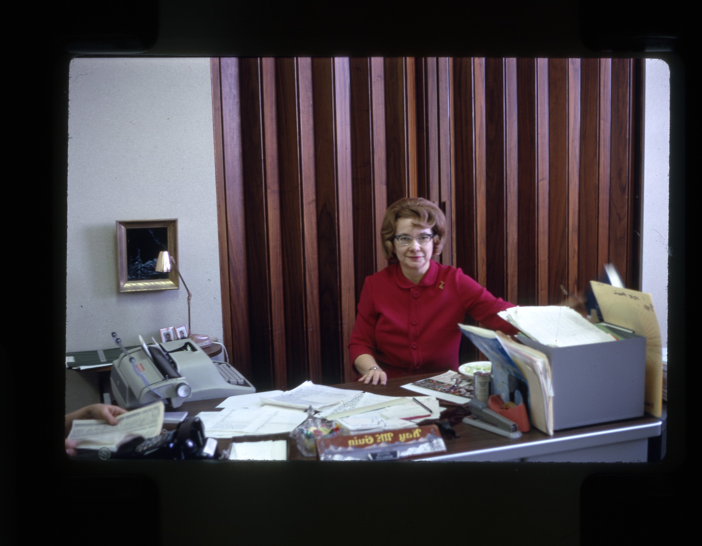
| 455 — | [Kay McGuin seated at desk, typewriter at right, Romig Junior High? print date Apr 68] |
| | 456 — | [students in cafeteria, large paintings on wall, Romig Junior High? print date Apr 68] |
| | 457 — | [students in cafeteria, Romig Junior High? print date Apr 68] |
| | 458 — | [similar to .456] |
| | 459 — | [display case labeled “Homemade Instruments” in hallway, Romig Junior High? print
date Apr 68] |
| | 460 — | [display case labeled “Transportation” in hallway, Romig Junior High? print date Apr 68] |
| | 461 — | [display case with Colonial era exhibits in hallway, Romig Junior High? print date Apr 68] |
| | 462 — | [sign on wall, “Who’s What?,” Romig Junior High? print date Apr 68] |
| | 463 — | [students cutting up chicken, home economics class, Romig Junior High? print date Apr
68] |
| | 464 — | [sign on wall “Strictly for the Birds,” Romig Junior High? print date Apr 68] |
| | 465 — | [three people hooking trailer with snowmachine to automobile on side of Seward
Highway; print date May 68] |
| | 466 — | [view down Seward Highway to mountain peak, sign at right for “National Forest
Recreation Site Ahead;” print date May 68] |
| | 467 — | [scenic along Seward Highway; print date May 68] |
| | 468 — | [snow banks along Seward Highway, truck with camper approaching; print date May 68] |
| | 469 — | [interpretive marker for “Oil Country,” Swanson River Unit No. 1; print date May 68] |
| | 470 — | [interpretive marker for Chigmit Mountains; print date May 68] |
| | 471 — | [log cabin, probably along Sterling Highway; print date May 68] |
| | 472 — | [interpretive marker for Homer; print date May 68] |
| | 473 — | [automobiles parked outside Heady Hotel, woman in doorway, Homer; print date May
68]
|
| | 474 — | [Dolores N and other boats in small boat harbor in foreground with buildings behind,
Russian Orthodox Church on bluff above, Ninilchik? print date May 68] |
| 475 — | [Deane’s Buick on dirt road along shoreline, buildings at right, high bluff above, Kenai
Peninsula, Ninilchik? print date May 68] |
| | 476 — | [road sign for 1947 Kenai Burn; print date May 68] |
| | 477 — | [scenic of partially frozen lake on Kenai Peninsula; print date May 68] |
| | 478 — | [snow gauge in field; print date May 68]
1969 |
| | 479 — | [Matanuska Glacier; print date Jan 69] |
| | 480 — | [scenic of creek and mountain peak; print date Jan 69] |
| | 481 — | [scenic of small lake and mountains, possibly airstrip on opposite bank; print date Jan
69] |
| | 482 — | [bird’s eye view of river valley; print date Jan 69] |
| | 483 — | [scenic of glacial river and mountain peak; print date Jan 69] |
| | 484 — | [student in classroom holding camera; print date Jan 69] |
| | 485 — | [Alaska Methodist University campus in winter, possibly Grant Hall; print date Jan 69] |
| | 486 — | [Atwood Building, Alaska Methodist University; print date Jan 69] |
| | 487 — | [Atwood Building, Alaska Methodist University; print date Jan 69] |
| | 488 — | [four young people standing near frozen Campbell Creek, one boy standing on road
pointing camera, road sign for Campbell Creek at left; print date Jan 69] |
| 489 — | [man wearing suit and turtleneck pointing camera while three young girls look on, one
girl wearing plaid poncho; print date Jan 69] |
| | 490 — | [scenic of bend in road, building on curve, mountain in background; print date Jan 69] |
| | 491 — | [scenic of Turnagain Arm; print date Jan 69] |
| 492 — | [portrait of young girl with camera on strap around her neck; print date Jan 69] |
| | 493 — | [man wearing suit and turtleneck lying on ground taking photograph of spent shot gun
casing; print date Jan 69] |
| | 494 — | [man wearing suit and turtleneck holding camera, three young girls standing nearby;
print date Jan 69] |
| | 495 — | [scenic of Cook Inlet with structure in water, possibly floating dock? print date Jan 69] |
| 496 — | [portrait of young boy with camera on strap around his neck, young girl pointing
camera in background; print date Jan 69] |
| | 497 — | [teachers seated at tables in home economics classroom, probably waiting to be served
by students, Romig Junior High? print date Jan 69] |
| | 498 — | [students in home economics classroom, Romig Junior High? print date Jan 69] |
| | 499 — | [student filling coffee cups from urn, Romig Junior High? print date Jan 69] |
| | 500 — | [student choir on stage, girl at piano at left, woman leading group at right; Romig Junior
High? print date Jan 69] |
| | 501 — | [similar to .500] |
| | 502 — | [ferry terminal, ticket office and totem pole at left, passengers on sidewalk, recreational
vehicle with California plates in foreground, M/V Queen of Prince Rupert at dock, Kelsey Bay?
print date Feb 69] |
| | 503 — | [M/V Queen of Prince Rupert at dock, Kelsey Bay? print date Feb 69]
|
| | 504 — | [view of ships in small boat harbor from aboard M/V Queen of Prince Rupert, Kelsey
Bay? print date Feb 69] |
| | 505 — | [captain and two crewmen at bow of M/V Queen of Prince Rupert preparing to depart,
Kelsey Bay? print date Feb 69] |
| | 506 — | [lifeboat Queen of Prince Rupert No. 2; print date Feb 69] |
| | 507 — | [totem pole in yard in residential area, Prince Rupert? print date Feb 69] |
| | 508 — | [three totem poles outside an office building, Prince Rupert? print date Feb 69] |
| | 509 — | [exterior of building with signs for “Chinese Freemason Grand Lodge” and “Cathay
Take-Out Chinese Smorgasbord,” Prince Rupert? print date Feb 69] |
| | 510 — | [Alaska Marine Highway ferry Wickersham, CN railroad freight cars on dock at right,
Prince Rupert; print date Feb 69] |
| | 511 — | [totem pole next to road sign for B.C. Ferries Prince Rupert Ticket Office, Wickersham
just visible at right; print date Feb 69] |
| | 512 — | [Inside Passage lighthouse, possibly Cape Decision; print date Feb 69] |
| | 513 — | [scenic of Inside Passage from ferry deck; print date Feb 69] |
| | 514 — | [scenic with hanging glacier; print date Feb 69] |
| | 515 — | [scenic with hanging glacier; print date Feb 69] |
| | 516 — | [view down unpaved road, with mountains; print date Feb 69] |
| | 517 — | [similar to .516] |
| | 518 — | [scenic with tundra, hanging glacier] |
| | 519 — | [herd of horses on unpaved road; print date Feb 69] |
| | 520 — | [Kluane Lake, with interpretive marker; print date Feb 69] |
| | 521 — | [unidentified log roadhouse with Chevron Standard gas station, probably Alaska
Highway; print date Feb 69] |
| | 522 — | [house exterior with picket fence, deciduous trees, unidentified location; print date Feb
69] |
| | 523 — | [totem pole next to utility pole in residential area; print date Feb 69] |
| | 524 — | [entrance sign for Elmendorf AFB “Top Cover for America;” print date Feb 69] |
| | 525 — | [exterior of house at 2526 Sprucewood in summer; print date Feb 69] |
| | 526 — | [residential back yard in winter, with greenhouse, snow on tarped boat; print date Feb
69] |
| | 527 — | [U.S. Air Force Military Airlift Command prop plane with tail number 5206 and second
airplane on tarmac at Elmendorf; print date Jun 69] |
| | 528 — | [Reeve Aleutian Airways Curtiss-Wright C-46 Commando airplane N1651M on tarmac,
cargo stacked at right, hangar in background; print date Jun 69] |
| | 529 — | [similar to .528] |
| | 530 — | [cargo being driven across tarmac towards USAF airplane, Elmendorf; print date Jun 69] |
| | 531 — | [USAF Fire Protection fire truck No. 12 with number 63D902 on door in front of
Elmendorf fire department; print date Jun 69] |
| | 532 — | [V-1 Buzz Bomb on display at Elmendorf, hangar in background; print date Jun 69] |
| | 533 — | [Headquarters 21st Composite Wing 21st Air Base Group, Elmendorf; print date Jun 69] |
| | 534 — | [base housing, building 20-960, Elmendorf; print date Jun 69] |
| | 535 — | [automobile parked outside base housing, Elmendorf; print date Jun 69] |
| | 536 — | [two fishing boats in dry dock in winter, unidentified location; print date Jun 69]
|
| | 537 — | [fishing boats Patty Lee and Rena C. in dry dock in winter; print date Jun 69] |
| | 538 — | [Alaska Railroad locomotive No. 1 on display outside Anchorage headquarters; print
date Jun 69] |
| | 539 — | [totem pole near locomotive No. 1, with sign reading “Chilkat Totem Pole Chief of Wolf
Clan Sitting on Wolf;” print date Jun 69] |
| | 540 — | [small totem pole outside Alaska Railroad headquarters, Anchorage; print date Jun 69] |
| | 541 — | [Watson Lake Signposts; print date Aug 69] |
| | 542 — | [road sign for Bear Creek Summit, mile 1028.6 Alaska Highway; print date Aug 69] |
| | 543 — | [exterior of Northern Lights Elementary School, with automobiles parked in lot and flag
at half-mast; print date Aug 69] |
| | 544 — | [sign for Federal Aviation Administration Air Route Traffic Control Center 5400 Davis
Hwy., with buildings behind chain-link fence; print date Aug 69] |
| | 545 — | [entrance sign for United States Air Force Elmendorf A.F. Base; print date Aug 69] |
| | 546 — | [view of Anchorage, looking east from mouth of Ship Creek in winter, ice chunks on
mud flats near railroad trestle in foreground, Mt. McKinley Building in middle ground, Chugach
Mountains in distance; print date Aug 69] |
| | 547 — | [Montana Creek Lodge, with automobile parked outside, sign for Chevron gasoline in
foreground; print date Nov 69] |
| | 548 — | [display case in concrete block hallway, with Athabascan artifacts, Romig Junior High?
print date Nov 69]
1970 |
| | 549 — | [Nick Begich standing at a podium in an auditorium; print date Jan 70] |
| | 550 — | [similar to .549] |
| | 551 — | [wrestling team boys sitting on folding chairs in gymnasium, banner “Corral the
Mustangs” on wall in background, Romig Junior High? print date Mar 70] |
| | 552 — | [similar to .551, with coach in foreground; print date Mar 70] |
| | 553 — | [referee and two wrestlers on mat, cheerleaders seated on floor and spectators in
bleachers in background; print date Mar 70] |
| | 554 — | [coach standing near wrestling team sitting in folding chairs, banner “Prevention of
Cruelty to Animals But...” on wall in background; print date Mar 70] |
| | 555 — | [two wrestlers in match, referee on floor next to them, team on chairs in background;
print date Mar 70] |
| | 556 — | [referee holding up arm of winner of match, losing team at right; print date Mar 70] |
| | 557 — | [wrestling team cheering, spectators on bleachers in background; print date Mar 70] |
| | 558 — | [young man and woman standing in hallway next to banner for Sixth Annual Fur
Rendezvous Junior Rifle Championship 1970, Romig Junior High? print date Mar 70] |
| | 559 — | [large group of students posed on auditorium stage with Junior Rifle Championship
banner and trophy; print date Mar 70] |
| | 560 — | [similar to .559] |
| | 561 — | [four students and teacher posed with rifle trophy; print date Mar 70] |
| | 562 — | [basketball team in gymnasium, banner reading “Tear ‘Em Trojans” on wall in
background, Romig Junior High; print date Mar 70] |
| | 563 — | [close-up of students on bleachers in gymnasium; print date Mar 70]
|
| | 564 — | [three men leaning against wall in gymnasium, one wearing Romig button; print date
Mar 70] |
| 565 — | [Fur Rendezvous Queen Rhea Bowman holding crown; print date Mar 70] |
| | 566 — | [gymnasium with large banner for Fur Rendezvous 35th Anniversary; print date Mar 70] |
| | 567 — | [students in costume in front of Rendezvous Anniversary banner; print date Mar 70] |
| | 568 — | [two women at podium in gymnasium; print date Mar 70] |
| | 569 — | [two women and man at podium in gymnasium; print date Mar 70] |
| | 570 — | [Fur Rendezvous Queen Rhea Bowman holding crown, costumed students applauding;
print date Mar 70] |
| | 571 — | [Fur Rendezvous Queen Rhea Bowman standing at podium; print date Mar 70] |
| | 572 — | [Fur Rendezvous Queen Rhea Bowman standing at podium holding crown, school band
in background; print date Mar 70] |
| | 573 — | [Fur Rendezvous Queen Rhea Bowman holding crown, woman with microphone
standing next to American flag at left; print date Mar 70] |
| | 574 — | [Fur Rendezvous Queen Rhea Bowman and another woman standing at podium; print
date Mar 70] |
| | 575 — | [exterior of building, probably school, basketball hoop in background at left, automobile
parked in foreground, Chugach Mountains in distance; print date Apr 70] |
| | 576 — | [view down paved highway through canyon with road sign for falling rock, Glenn
Highway? print date Apr 70] |
| | 577 — | [scenic view along Glenn Highway; print date Apr 70] |
| | 578 — | [scenic view along Glenn Highway; print date Apr 70] |
| | 579 — | [log buildings, heavy equipment parked at left, small sign in foreground reading “C.L.
Hayes;” print date Apr 70] |
| | 580 — | [exterior of Tazlina Glacier Lodge in winter, Volkswagen Beetle and pickup truck parked
outside; print date Apr 70] |
| | 581 — | [exterior of log church in summer, probably Kenai Peninsula; print date Sep 70] |
| | 582 — | [Col. Carl Ben Eielson monument, Eielson Air Force Base; print date Apr 70] |
| | 583 — | [close-up of plaque on Eielson monument; print date Apr 70] |
| | 584 — | [close-up of another plaque on Eielson monument; print date Apr 70] |
| | 585 — | [interpretive marker for Eielson Air Force Base; print date Apr 70] |
| | 586 — | [Santa Claus sign, Welcome to Santa Claus House North Pole Alaska;” print date Apr 70] |
| | 587 — | [sign for North Pole Post Office; print date Apr 70] |
| | 588 — | [exterior of Santa Claus House; print date Apr 70] |
| | 589 — | [entrance to North Pole Post Office; print date Apr 70] |
| | 590 — | [sign for Headquarters 171 Infantry Brigade, Fort Wainwright; print date Apr 70] |
| | 591 — | [soldier walking past tank parked next to sign for Echo Troop 16th Cavalry; print date
Apr 70] |
| | 592 — | [heavy guns parked next to sign for 2nd Bn 15th Artillery; print date Apr 70] |
| | 593 — | [Mile 1523 Alaska Highway marker in Fairbanks, with Immaculate Conception Church in
background; print date Apr 70] |
| | 594 — | [Chena Ice Classic Official Time Clocks; print date Apr 70] |
| | 595 — | [bridge, probably Tanana River Bridge at Nenana; print date Apr 70] |
| | 596 — | [Nenana Ice Classic tripod on frozen Tanana River; print date Apr 70]
|
| | 597 — | [River Gaging and Flood Warning Station on Tanana River, tripod on ice in background;
print date Apr 70] |
| | 598 — | [Nenana Ice Pool watch house and tower; print date Apr 70] |
| | 599 — | [riverboat in dry dock at Nenana; print date Apr 70] |
| | 600 — | [tripod on Tanana River; print date Apr 70] |
| | 601 — | [Alaska Railroad depot at Nenana, with station sign, pick-up truck parked outside,
freight, tank, and flatbed cars in background; print date Apr 70] |
| | 602 — | [riverboat Yukon docked in Nenana; print date Apr 70] |
| | 603 — | [riverboat Tanana docked in Nenana; print date Apr 70] |
| | 604 — | [view from deck of riverboat of several boats in dry dock underneath Tanana River
Bridge at Nenana, boats include Taku Chief and Skookum; print date Apr 70] |
| | 605 — | [riverboats Tanana and Yukon at Nenana; print date Apr 70] |
| | 606 — | [Taku Chief and Skookum in dry dock at Nenana; print date Apr 70] |
| | 607 — | [scenic along highway, snowy mountain range; print date Apr 70] |
| | 608 — | [similar to .607] |
| | 609 — | [scenic of winter creek; print date Apr 70] |
| | 610 — | [scenic of winter creek, highway at right; print date Apr 70] |
| | 611 — | [military vehicles on snow field, possibly setting up antennas, mountains in distance;
print date Apr 70] |
| | 612 — | [interpretive marker for Richardson Highway; print date Apr 70] |
| | 613 — | [Summit Lake Lodge, automobiles parked outside; print date Apr 70] |
| | 614 — | [wood-frame cabin in winter, probably along Richardson Highway; print date Apr 70] |
| | 615 — | [unidentified roadhouse, partially visible sign reads “[?] Lodge,” Richardson Highway;
print date Apr 70] |
| | 616 — | [Paxson Roadhouse, automobiles parked in lot; print date Apr 70] |
| | 617 — | [view down highway showing snow banks and possibly temporary overflow ice dam;
print date Apr 70]
B4 |
| | 618 — | [Wilson Air Service Piper Cub N3836Z on airstrip with two other airplanes, automobile
on airstrip, mountains in distance, unidentified location; print date Apr 70] |
| | 619 — | [exterior of Richardson Roadhouse, log cache in foreground, signs for Schlitz and
Hamm’s Beer; print date Apr 70] |
| | 620 — | [exterior of Richardson Roadhouse, signs for Schlitz and Hamm’s Beer, wagon wheels,
barrels, and ladder outside; print date Apr 70] |
| | 621 — | [man wearing bunny boots and knit cap and smoking a pipe preparing to ice fish,
houses visible on opposite shore; print date Apr 70] |
| | 622 — | [two men wearing coveralls preparing to ice fish, Jeep and fishing shack on ice in
background; print date Apr 70] |
| | 623 — | [dogs standing on kennels in dog yard, sled on rack next to greenhouse in background;
print date Apr 70] |
| | 624 — | [old log cabin in winter, possibly part of Atlasta House; print date May 70] |
| | 625 — | [Kenworth semi trailer in wooded area in winter, possibly parked near Atlasta House;
print date May 70]
|
| | 626 — | [Atlasta House on Glenn Highway, sign in foreground, snowmachine parked in front of
building in background; print date May 70] |
| | 627 — | [student pointing rifle in school hallway in front of trophy cases, Romig Junior High?
print date May 70] |
| | 628 — | [students seated in gymnasium, four boys in Junior ROTC uniforms in foreground,
Romig Junior High? print date May 70] |
| | 629 — | [Junior ROTC color guard on stage, Romig Junior High? print date May 70] |
| | 630 — | [interpretive marker for 1964 Earthquake along Seward Highway; print date May 70] |
| | 631 — | [scenic of Turnagain Arm; print date May 70] |
| | 632 — | [scenic of snowslide on hillside along Seward Highway; print date May 70] |
| | 633 — | [scenic of Portage Lake; print date May 70] |
| | 634 — | [ice chunks in Portage Lake; print date May 70] |
| | 635 — | [similar to .634] |
| | 636 — | [view down in Portage Valley; print date May 70] |
| | 637 — | [road sign for Portage Glacier; print date May 70] |
| | 638 — | [sign for Turnagain Pass Snowplay Area with avalanche danger; print date May 70] |
| | 639 — | [snow gauge; print date May 70] |
| | 640 — | [scenic of lake along Seward Highway; print date May 70] |
| | 641 — | [interpretive marker for Andy Simons Mountain; print date May 70] |
| | 642 — | [view down to curve in railroad tracks in winter; print date May 70] |
| | 643 — | [Alaska Marine Highway ferry Tustumena at dock, people fishing along pier, Seward?
print date May 70] |
| | 644 — | [Alaska Marine Highway ferry, possibly Tustumena, at dock, Seward? print date May 70] |
| | 645 — | [boats pulled on shore, sign for Coffland Brothers Company, oil tanks in background,
Seward? print date May 70] |
| | 646 — | [dock crane, automobile parked in foreground, Seward? print date May 70] |
| | 647 — | [Coast Guard buoy tender Sorrel at dock, Seward? print date May 70] |
| | 648 — | [buoys on dock, Seward? print date May 70] |
| | 649 — | [Coast Guard buoy tender Sorrel at dock, Seward? print date May 70] |
| | 650 — | [scenic of lake; print date May 70] |
| | 651 — | [man fishing from ice shelf along river; print date May 70] |
| | 652 — | [abandoned log cabin, Portage? print date May 70] |
| | 653 — | [view down gravel road to Mt. McKinley; print date May 70] |
| | 654 — | [view down gravel road past “Road Closed” sign; print date May 70] |
| | 655 — | [log cabin, Talkeetna? print date May 70] |
| | 656 — | [exterior of B & K Trading Co. and post office, Talkeetna; print date May 70] |
| | 657 — | [rock riprap and remains of pier along river; print date May 70] |
| | 658 — | [abandoned Portage Garage; print date May 70] |
| | 659 — | [scenic of Turnagain Arm; print date May 70] |
| | 660 — | [scenic of Turnagain Arm; print date May 70] |
| | 661 — | [scenic of Turnagain Arm; print date May 70] |
| | 662 — | [log cabin, Hope? print date May 70] |
| | 663 — | [log cabin and wood-frame cabin, Hope? print date May 70] |
| | 664 — | [Methodist Church, water pump in foreground, Hope; print date May 70]
|
| | 665 — | [wood-frame building, Hope? print date May 70] |
| | 666 — | [scenic of Turnagain Arm; print date May 70] |
| | 667 — | [bird’s eye view of Kodiak looking towards water, Holy Resurrection Church at left; print
date Jul 70] |
| | 668 — | [ship Beachcomber, formerly Princess Norah, at dock in Kodiak, automobiles in parking
lot; print date Jul 70] |
| | 669 — | [scenic of surf; print date Jul 70] |
| | 670 — | [scenic of surf; print date Jul 70] |
| | 671 — | [scenic of coastline; print date Jul 70] |
| | 672 — | [scenic of coastline; print date Jul 70] |
| | 673 — | [scenic of coastline, parking area in foreground; print date Jul 70] |
| | 674 — | [men repairing fishing nets; print date Jul 70] |
| | 675 — | [bird’s eye view of residential area, Kodiak; print date Jul 70] |
| | 676 — | [exterior of Kodiak Inn, Volkswagen Beetle and bus parked outside; print date Jul 70] |
| | 677 — | [bird’s eye view of Kodiak small boat harbor; print date Jul 70] |
| | 678 — | [Kodiak docks, with B & B Fisheries building at right; print date Jul 70] |
| | 679 — | [microwave tower in field; print date Jul 70] |
| | 680 — | [cattle in pasture, Kodiak Island; print date Jul 70] |
| | 681 — | [horses in paddock, Kodiak Island; print date Jul 70] |
| | 682 — | [wood-frame building painted bright red, people and automobiles at left, Kodiak Island;
print date Jul 70] |
| | 683 — | [fishing boat Stardust in dry dock; print date Jul 70] |
| | 684 — | [scenic of coastline; print date Jul 70] |
| | 685 — | [bird’s eye view of flooded area along shoreline; print date Jul 70] |
| | 686 — | [scenic of surf; print date Jul 70] |
| | 687 — | [scenic of surf; print date Jul 70] |
| | 688 — | [scenic of coastline; print date Jul 70] |
| | 689 — | [Kenai Municipal Airport terminal with sign for Western Airlines; print date Jul 70] |
| | 690 — | [scenic of river and mountain peak, log cabin in distance at left; print date Sep 70] |
| | 691 — | [scenic of river and mountains; print date Sep 70] |
| 692 — | [bird’s eye view of boat launch with shacks, floatplane, and trailers in gravel lot,
buildings on bluff above, probably Pedersen’s Moose River Resort at the confluence of the
Moose and Kenai Rivers; print date Sep 70] |
| | 693 — | [Western Airlines airplane on airstrip, Kenai? print date Sep 70] |
| | 694 — | [Russian Orthodox Church, probably Holy Assumption of the Virgin Mary, Kenai; print
date Sep 70] |
| | 695 — | [entrance gate with Russian and English greetings, sign for “Russian Orthodox Church
established 1846,” Holy Assumption of the Virgin Mary, Kenai? print date Sep 70] |
| | 696 — | [Church of the Dormition, Kenai; print date Sep 70] |
| | 697 — | [plaques for Fort Kenay and Fort or Redoubt St. Nicholas; print date Sep 70] |
| | 698 — | [cabin and cache, Fort Kenay; print date Sep 70] |
| | 699 — | [entrance gate to Fort Kenay, with heavy gun and buildings in background; print date
Sep 70] |
| | 700 — | [interpretive marker for Kasilof; print date Sep 70]
|
| | 701 — | [bird’s eye view of buildings, beach, Cook Inlet, and Chigmit Mountains, boats and
hoisting machinery on beach, near Cape Kasilof? print date Sep 70] |
| | 702 — | [Transfiguration of Our Lord Chapel, Ninilchik; print date Sep 70] |
| | 703 — | [wood-frame building with boarded-up doorway, second building in background,
Ninilchik; print date Sep 70] |
| | 704 — | [slough at Ninilchik, with houses and boats, Transfiguration of Our Lord Chapel on bluff
in background; print date Sep 70] |
| | 705 — | [interpretive marker for Chigmit Mountains; print date Sep 70] |
| | 706 — | [scenic with Cook Inlet, Chigmit Mountains; print date Sep 70] |
| | 707 — | [similar to .706] |
| | 708 — | [interpretive marker for Homer; print date Sep 70] |
| | 709 — | [totem poles and mortuary pole, hand-lettered sign for “Vegas Art & Gift Show” at left,
Homer? print date Sep 70] |
| | 710 — | [totem next to building with “Vegas House” painted on roof, “Vegas Gift Shop” on wall,
Homer; print date Sep 70] |
| | 711 — | [interpretive marker for Homer Spit; print date Sep 70] |
| | 712 — | [US Coast Guard buoy tender Ironwood at dock, Homer? print date Sep 70] |
| | 713 — | [small dock on river, wagon wheels near tree at right; print date Sep 70] |
| | 714 — | [man fishing in gravelly river; print date Sep 70] |
| | 715 — | [scenic with lake, mountains; print date Sep 70] |
| | 716 — | [log cabin, Kenai Peninsula; print date Sep 70] |
| | 717 — | [scenic with lake and mountains, driftwood in foreground; print date Sep 70] |
| | 718 — | [Homer airport terminal with sign for Western Airlines as seen from inside airplane;
print date Sep 70] |
| | 719 — | [Western Airlines Lockheed L-188 Electra airplane N7139C on tarmac, Homer; print
date Sep 70] |
| | 720 — | [scenic of coastline; print date Sep 70] |
| | 721 — | [US Coast & Geodetic Survey Pathfinder OSS 30 at dock, ship [TF?] 110 behind,
unidentified location; print date Sep 70] |
| | 722 — | [heavy artillery next to building on coastline, Kodiak? print date Sep 70] |
| | 723 — | [Holy Resurrection Cathedral, Kodiak; print date Sep 70] |
| | 724 — | [close-up of Holy Resurrection Cathedral, Kodiak; print date Sep 70] |
| | 725 — | [Baranov Museum, Kodiak; print date Sep 70] |
| 726 — | [man and two women wearing robes and headdresses, Tlingit dancers, Romig Junior
High gymnasium; print date Nov 70; at AFN 2014, man identified as Jimmy Marks] |
| 727 — | [man drumming, elder woman singing, and two women dancing, Tlingit dancers, Romig
Junior High gymnasium; print date Nov 70; at AFN 2014, people identified as, left to right,
Carmen Quinto Plunkett, Jennie Marks, Johnny Marks] |
| 728 — | [men and women dancing, Tlingit dancers, Romig Junior High gymnasium; print date
Nov 70; at AFN 2014, identified as, left to right, ?, Elsie Austin Green, Florence Marks Shakely,
Jimmy Marks] |
| | 729 — | [rear view of robe being worn by dancer, Tlingit dancers, Romig Junior High gymnasium;
print date Nov 70]
|
| 730 — | [women dancers, Tlingit dancers, Romig Junior High gymnasium; print date Nov 70; at
AFN 2014, identified as, left to right, Celeste Worl, Kathy Isturis, Elsie Austin Green, Florence
Marks Shakely] |
| 731 — | [dancers, singer and drummer at rest, audience in bleachers in background, Tlingit
dancers, Romig Junior High gymnasium; print date Nov 70; at AFN 2014, identified as, left to
right, Johnny Marks, Rosita Worl, Jimmy Marks, Jennie Marks] |
| 732 — | [dancers and singer at rest, audience in bleachers in background, Tlingit dancers, Romig
Junior High gymnasium; print date Nov 70; at AFN 2014, man identified as Jimmy Marks,
woman seated in chair as Jennie Marks] |
| | 733 — | [rear view of robes being worn by dancers, Tlingit dancers, Romig Junior High
gymnasium; print date Nov 70] |
| | 734 — | [rear view of robe being worn by dancer, woman speaking at podium in background,
Tlingit dancers, Romig Junior High gymnasium; print date Nov 70] |
| | 735 — | [rear view of robe being worn by dancer, Tlingit dancers, Romig Junior High gymnasium;
print date Nov 70] |
| 736 — | [dancers, drummer, and singer, Tlingit dancers, Romig Junior High gymnasium; print
date Nov 70; at AFN 2014, identified as, left to right, ?, Jennie Marks, Johnny Marks, Rosita
Worl, Jimmy Marks] |
| | 737 — | [female dancer, American flag in background, Tlingit dancers, Romig Junior High
gymnasium; print date Nov 70] |
| 738 — | [dancers, singer and drummer in background, Tlingit dancers, Romig Junior High
gymnasium; print date Nov 70; at AFN 2014, identified as Florence Marks Shakely (left) and
Elsie Austin Green from Kake (right)] |
| 739 — | [female dancers, Tlingit dancers, Romig Junior High gymnasium; print date Nov 70; at
AFN 2014, identified as Edna Belardie (left) and Kathy Isturis (right)] |
| | 740 — | [dancers at rest, rear view of robe being worn by dancer, Tlingit dancers, Romig Junior
High gymnasium; print date Nov 70] |
| 741 — | [dancers, singer, and drummer, Tlingit dancers, Romig Junior High gymnasium; print
date Nov 70; at AFN 2014, identified as, left to right, ?, Jennie Marks, Johnny Marks, Rosita
Worl, Jimmy Marks] |
| | 742 — | [dancers, singer, and drummer at rest, Tlingit dancers, Romig Junior High gymnasium;
print date Nov 70] |
| | 743 — | [dancers, singer, and drummer, Tlingit dancers, Romig Junior High gymnasium; print
date Nov 70] |
| | 744 — | [Tlingit dancers, Romig Junior High gymnasium; print date Nov 70] |
| | 745 — | [Tlingit dancers, Romig Junior High gymnasium; print date Nov 70] |
| | 746 — | [Tlingit dancers, Romig Junior High gymnasium; print date Nov 70] |
| | 747 — | [rear view of robe being worn by dancer, Tlingit dancers, Romig Junior High gymnasium;
print date Nov 70] |
| | 748 — | [students learning dance moves from Tlingit dancers, Romig Junior High gymnasium;
print date Nov 70] |
| 749 — | [student standing next to female dancer encouraging participation, Tlingit dancers,
Romig Junior High gymnasium; print date Nov 70. At AFN 2016, regalia designs identified as
Emma Marks beadwork]
|
| | 750 — | [close-up of female dancer, Tlingit dancers, Romig Junior High gymnasium; print date
Nov 70] |
| | 751 — | [two women holding up Chilkat blanket, Tlingit dancers, Romig Junior High gymnasium;
print date Nov 70] |
| | 752 — | [two young girls holding up Chilkat blanket, Tlingit dancers, Romig Junior High
gymnasium; print date Nov 70] |
| | 753 — | [dancers displaying Chilkat blankets, drummer squatting at left; Tlingit dancers, Romig
Junior High gymnasium; print date Nov 70] |
| | 754 — | [dancer in bird costume, Tlingit dancers, Romig Junior High gymnasium; print date Nov
70] |
| | 755 — | [rear view of robe being worn by dancer, Tlingit dancers, Romig Junior High gymnasium;
print date Nov 70] |
| | 756 — | [rear view of robes being worn by dancers, Tlingit dancers, Romig Junior High
gymnasium; print date Nov 70] |
| | 757 — | [Tlingit dancers, Romig Junior High gymnasium; print date Nov 70] |
| | 758 — | [Tlingit dancers and drummer, Romig Junior High gymnasium; print date Nov 70] |
| | 759 — | [female dancers, Tlingit dancers, Romig Junior High gymnasium; print date Nov 70]
1971 |
| | 760 — | [view down paved highway to mountains; print date Apr 71] |
| | 761 — | [similar to .760] |
| | 762 — | [view down paved highway, oncoming traffic, buildings in distance; print date Apr 71] |
| | 763 — | [view down paved highway in wooded area; print date Apr 71] |
| | 764 — | [view down paved highway to mountains; print date Apr 71] |
| | 765 — | [view down paved highway to valley and mountains; print date Apr 71] |
| | 766 — | [scenic from highway, with tracks in snow, mountains; print date Apr 71] |
| | 767 — | [sign for Eklutna Power Plant; print date Apr 71] |
| | 768 — | [view down paved road to farm buildings, Matanuska Valley; print date Apr 71] |
| | 769 — | [cattle in pasture next to barn, “Herd King” painted on silo at right; print date Apr 71] |
| | 770 — | [scenic of frozen lake; print date Apr 71] |
| | 771 — | [similar to .770] |
| | 772 — | [road sign for King Neptune Lodge, log building in distance; print date Apr 71] |
| | 773 — | [view down paved highway in wooded area; print date Apr 71] |
| | 774 — | [Geophysical Service Inc. (GSI) truck on highway; print date Apr 71] |
| | 775 — | [Nodwell tracked vehicle in wooded area; print date Apr 71] |
| | 776 — | [view down paved highway to mountains; print date Apr 71] |
| | 777 — | [scenic of frozen lake and mountains, buildings along shore in distance; print date Apr
71] |
| | 778 — | [view down paved road to mountains, farm at left; print date Apr 71] |
| | 779 — | [houses and farm buildings, mountains in background; print date Apr 71] |
| | 780 — | [view down paved highway to mountains; print date Apr 71] |
| | 781 — | [railroad track across mud flats, Alaska Railroad; print date Apr 71] |
| | 782 — | [frozen waterfalls along paved highway; print date Apr 71]
|
| | 783 — | [scenic view of Turnagain Arm at low tide, Alaska Railroad track and Seward Highway at
right; print date Apr 71] |
| | 784 — | [scenic of frozen creek, mountains in distance; print date Apr 71] |
| | 785 — | [Alaska Railroad bridge over small creek, Turnagain Arm at left; print date Apr 71] |
| | 786 — | [view down Seward Highway, automobiles in turnout at left; print date Apr 71] |
| | 787 — | [scenic of Turnagain Arm at low tide; print date Apr 71] |
| | 788 — | [scenic of Turnagain Arm; print date Apr 71] |
| | 789 — | [scenic along Seward Highway; print date Apr 71] |
| | 790 — | [scenic of Turnagain Arm at low tide; print date Apr 71] |
| | 791 — | [Portage Lake in winter; print date Apr 71] |
| | 792 — | [Austrian Skiing Expedition’s Volkswagen bus in Portage Lake parking lot, with
advertisements for Komperdell, Dachstein International, Strickmeister, and Wagner & Reinert;
print date Apr 71] |
| | 793 — | [two people walking across frozen Portage Lake; print date Apr 71] |
| | 794 — | [person walking near Portage Glacier terminus; print date Apr 71] |
| | 795 — | [abandoned Portage Garage in winter; print date Apr 71] |
| | 796 — | [Matanuska Glacier; print date Jul 71] |
| | 797 — | [similar to .796] |
| | 798 — | [Matanuska Glacier and river outflow; print date Jul 71] |
| | 799 — | [view down paved highway to Moose Creek, buildings at left with microwave tower,
mountain in distance; print date Jul 71] |
| | 800 — | [scenic with braided river, mountains; print date Jul 71] |
| | 801 — | [scenic with bend in river, highway bridge and buildings in distance; print date Jul 71] |
| | 802 — | [scenic with river, mountains; print date Jul 71] |
| | 803 — | [eroded bluffs along gravel highway; print date Jul 71] |
| | 804 — | [Kluane Lake, gravel highway in foreground; print date Jul 71] |
| | 805 — | [scenic of lake, building along shoreline at left, mountains in distance; print date Jul 71] |
| | 806 — | [interpretive marker for Kluane Lake; print date Jul 71] |
| | 807 — | [log cabin near Kluane Lake; print date Jul 71] |
| | 808 — | [road sign for Kluane Game Sanctuary; print date Jul 71] |
| | 809 — | [Kluane Lake; print date Jul 71] |
| | 810 — | [view down road to Kluane Lake, oncoming traffic; print date Jul 71] |
| | 811 — | [Macintosh Lodge, mile 1022 Alaska Highway; print date Jul 71] |
| | 812 — | [road sign for Haines, Fairbanks, Anchorage, buildings in background, Haines Junction;
print date Jul 71] |
| | 813 — | [Haines Junction street scene, with gas station at left, automobiles, and signs for Haines
Junction Inn, Brewster House, Coca-Cola, Sprite, Chevron; print date Jul 71]] |
| | 814 — | [automobile stopped by road sign “This road to Haines, Alaska only connecting with
ferry system;” print date Jul 71] |
| | 815 — | [scenic view down gravel road, mountain in distance; print date Jul 71] |
| | 816 — | [U.S. Army Alaska Supply Command Petroleum Division Blanchard River Station; print
date Jul 71] |
| | 817 — | [road sign “Entering Yukon Territory;” print date Jul 71]
|
| | 818 — | [view down gravel highway, snow markers on side of road, mountain in distance; print
date Jul 71] |
| | 819 — | [bridge at Goat Creek, mile 79.5 Haines Road; print date Jul 71] |
| | 820 — | [scenic of rushing creek along highway; print date Jul 71] |
| | 821 — | [scenic of mountains along highway; print date Jul 71] |
| | 822 — | [similar to .821] |
| | 823 — | [Canada Dept. of Public Works Maintenance Camp 75 Haines Road; print date Jul 71] |
| | 824 — | [Haines Road Summit, mile 65.3; print date Jul 71] |
| | 825 — | [scenic view down gravel road, mountain in distance; print date Jul 71] |
| | 826 — | [U.S. Army Alaska Supply Command Petroleum Division Border Station; print date Jul
71] |
| | 827 — | [two-story housing unit at border; print date Jul 71] |
| | 828 — | [Pleasant Camp border crossing; print date Jul 71] |
| | 829 — | [road sign, “Welcome to the USA, Report for Inspection, Haines, Alaska;” print date Jul
71] |
| | 830 — | [scenic view of water, mountains; print date Jul 71]
B5 |
| | 831 — | [lifeboats suspended from decks of large ship at dock, Haines? print date Sep 71] |
| | 832 — | [ship stern with signs in Greek and English, Haines? print date Sep 71] |
| | 833 — | [scenic of water and mountains; print date Sep 71] |
| | 834 — | [sign for Chilkoot Lake Wayside-Campground, Haines; print date Sep 71] |
| | 835 — | [scenic of water, waterfall, mountains; print date Sep 71] |
| | 836 — | [scenic of water and mountains, driftwood in foreground, building on opposite shore;
print date Sep 71] |
| | 837 — | [logging operation, with cut lumber, dump truck, sawdust piles; print date Sep 71] |
| | 838 — | [Alaska Marine Highway ferry Matanuska at dock; print date Sep 71] |
| | 839 — | [similar to .838] |
| | 840 — | [scenic of Inside Passage; print date Sep 71] |
| | 841 — | [three tugs and log raft, Inside Passage; print date Sep 71] |
| | 842 — | [closer view of tugs and log raft; print date Sep 71] |
| 843 — | [view from ferry of buildings at unidentified village, Inside Passage; print date Sep 71; at
AFN 2014, location identified as Petersburg] |
| 844 — | [docks at unidentified town, floatplanes parked at right, Inside Passage; print date Sep
71; at AFN 2014, location tentatively identified as Petersburg, with cannery at left] |
| | 845 — | [ferry dock at Inside Passage stop; print date Sep 71] |
| | 846 — | [close-up of ferry dock ramp; print date Sep 71] |
| 847 — | [view from docks of unidentified Inside Passage town; print date Sep 71; in 2014,
location identified as Haines] |
| | 848 — | [close-up of sign for M/V Matanuska; print date Sep 71] |
| | 849 — | [LTI truck approaching ferry on docks; print date Sep 71] |
| | 850 — | [channel markers as seen from ferry; print date Sep 71] |
| 851 — | [houses of unidentified Inside Passage village; print date Sep 71. At AFN 2015, location
identified as Wrangell, with Alaska Native Brotherhood Hall or cannery in center, home of
Sarah and Francis “Bummy” Churchill at upper left, Hillyers house at middle center, Arvis and
Gladys Dailey house at right] |
| | 852 — | [sign on dock, “Welcome to the Great Land, William A. Egan, Governor of Alaska;” print
date Sep 71] |
| | 853 — | [three crewmen operating winch on ferry deck; print date Sep 71] |
| | 854 — | [large freighter at docks of lumber company, Ketchikan? print date Sep 71] |
| | 855 — | [docks and town buildings, Ketchikan? print date Sep 71] |
| | 856 — | [scenic of lake, sign in foreground for Monashee Mtn. Coldstream Valley, Silver Star
Mountain, Kalamalka Lake; print date Sep 71] |
| | 857 — | [totem pole near building, Prince Rupert area? print date Nov 71] |
| | 858 — | [building with Conestoga wagon roof and large figure of wagon driver, unidentified
location; print date Nov 71] |
| | 859 — | [scenic of lake; print date Nov 71] |
| | 860 — | [scenic of river canyon; print date Nov 71] |
| | 861 — | [interpretive marker for Cariboo Waggon Road; print date Nov 71] |
| | 862 — | [view down narrow paved road, road sign “Railroad below do not roll rocks;” print date
Nov 71] |
| | 863 — | [bird’s eye view of river canyon with railroad tracks on both sides; print date Nov 71] |
| | 864 — | [scenic of river canyon; print date Nov 71] |
| | 865 — | [bird’s eye view of river canyon with railroad tracks on both sides; print date Nov 71] |
| | 866 — | [Hell’s Gate Airtram building; print date Nov 71] |
| | 867 — | [bird’s eye view of parking area along road at Hell’s Gate; print date Nov 71] |
| | 868 — | [bird’s eye view of river canyon with railroad tracks on far side; print date Nov 71] |
| | 869 — | [interpretive marker for 1905 Thompson River landslide; print date Nov 71] |
| | 870 — | [interpretive marker for paddlewheelers on Fraser River; print date Nov 71] |
| | 871 — | [automobiles on ferry at river crossing, Lytton Ferry? print date Nov 71] |
| | 872 — | [sign for Quesnel & District Tourist Bureau & Museum; print date Nov 71] |
| | 873 — | [scenic of hanging glacier; print date Nov 71] |
| | 874 — | [truck on bridge over river rapids, building at right, two people on fish ladder or trap on
water; print date Nov 71. Cf. 1008] |
| | 875 — | [river rapids; print date Nov 71] |
| | 876 — | [river canyon; print date Nov 71] |
| | 877 — | [scenic with river and mountains; print date Nov 71] |
| | 878 — | [interpretive marker for Skeena River; print date Nov 71] |
| | 879 — | [Prince Rupert, with church at right, provincial building at left? print date Nov 71] |
| | 880 — | [bird’s eye view of Northland Dock, Prince Rupert; print date Nov 71] |
| | 881 — | [sign, Welcome to Prince Rupert;” print date Nov 71] |
| | 882 — | [totem pole next to road sign for British Columbia & Alaska Ferries; print date Nov 71] |
| | 883 — | [automobiles in line for Alaska Ferry Patrons, totem pole at right; print date Nov 71] |
| | 884 — | [Alaska Marine Highway ferry Taku at dock, Prince Rupert; print date Nov 71] |
| | 885 — | [view of small boat harbor and docks from ferry; print date Nov 71] |
| | 886 — | [fishing boat Haida Queen passing ferry; print date Nov 71] |
| | 887 — | [view of town, including two high-rise buildings, from ferry, Ketchikan? print date Nov
71]
|
| | 888 — | [view from ferry of dock and small boat harbor, radio tower at left, Ketchikan? print
date Nov 71] |
| | 889 — | [view of Ketchikan from ferry; print date Nov 71] |
| | 890 — | [small motor boat passing ferry; print date Nov 71] |
| | 891 — | [fishing boat Wilhelmina passing ferry; print date Nov 71] |
| | 892 — | [unidentified fishing boat passing ferry; print date Nov 71] |
| | 893 — | [scenic of Inside Passage; print date Nov 71] |
| | 894 — | [ferry crewman preparing to dock; print date Nov 71] |
| | 895 — | [Russian Bishop’s House, abandoned building with sign, “Former Russian Orphanage,
built 1862,” Sitka; print date Nov 71] |
| | 896 — | [St. Peter’s-by-the-Sea Episcopal Church, Sitka; print date Nov 71] |
| | 897 — | [Sheldon Jackson Museum, Sitka; print date Nov 71] |
| | 898 — | [Administration Building, Sheldon Jackson College; print date Nov 71] |
| | 899 — | [Sitka small boat harbor, print date Nov 71] |
| | 900 — | [Kaagwaantaan Wolf house post on display, Sitka National Historical Park; print date
Nov 71] |
| | 901 — | [Kaagwaantaan Mother Eagle house post next to American flag, Sitka National Historical
Park; print date Nov 71] |
| | 902 — | [Chilkat blanket on display, Sitka National Historical Park? print date Nov 71] |
| | 903 — | [Chilkat blanket, Tlingit crest hat, and staff on display, Sitka National Historical Park?
print date Nov 71] |
| | 904 — | [scenic of coastline; print date Nov 71] |
| | 905 — | [house panel over doorway, Sitka National Historical Park? print date Nov 71] |
| | 906 — | [house post lying on ground, Sitka National Historical Park; print date Nov 71] |
| | 907 — | [similar to .906] |
| | 908 — | [totem pole lying on ground, top of Saanaheit pole? Sitka National Historical Park; print
date Nov 71] |
| | 909 — | [totem lying on ground, Sitka National Historical Park; print date Nov 71] |
| | 910 — | [sign for Sitka National Monument; print date Nov 71] |
| | 911 — | [scenic of shoreline at Sitka National Historical Park; print date Nov 71] |
| | 912 — | [sign for Sitka National Monument at left, shoreline at right; print date Nov 71] |
| | 913 — | [Tlingit canoe on display outdoors in Sitka, sign for Standard gas station in background;
print date Nov 71] |
| | 914 — | [house on small rock outcropping, Sitka; print date Nov 71] |
| | 915 — | [small boat harbor, Sitka; print date Dec 71] |
| | 916 — | [Sitka Pioneers’ Home; print date Dec 71] |
| | 917 — | [close-up of statue outside Sitka Pioneers’ Home; print date Dec 71] |
| | 918 — | [similar to .917] |
| | 919 — | [totem pole and anchor at Totem Square, Sitka; print date Dec 71] |
| | 920 — | [house on small rock outcropping, Sitka; print date Dec 71] |
| | 921 — | [bird’s eye view of roof of Sitka Pioneers’ Home and Sitka Hotel; print date Dec 71] |
| | 922 — | [bird’s eye view of Sitka, mountains in background; print date Dec 71] |
| | 923 — | [sign for Baranof Castle Hill Historic Site; print date Dec 71]
|
| | 924 — | [street scene, with automobiles and school bus outside Sitka Hotel, signs for Alaska
Airlines, Kincaid’s Bakery, Colonial, and B.P.O.E.; print date Dec 71] |
| | 925 — | [Alaska Marine Highway ferry Taku at dock, Sitka; print date Dec 71] |
| | 926 — | [similar to .925] |
| | 927 — | [passengers walking onto ferry Taku, Sitka; print date Dec 71] |
| | 928 — | [view down gravel highway, Haines Road? print date Dec 71] |
| | 929 — | [sign for Haines Road Summit; print date Dec 71] |
| | 930 — | [sign for Kluane Game Sanctuary; print date Dec 71] |
| | 931 — | [scenic along Alaska Highway; print date Dec 71] |
| | 932 — | [fish trap along Alaska Highway; print date Dec 71] |
| | 933 — | [log cabin, tipi, and roadside stand with hand-lettered sign, “Handmade ‘Yukon’
Souvenirs for Sale;” print date Dec 71] |
| | 934 — | [log cabin under construction; print date Dec 71] |
| | 935 — | [drying rack; print date Dec 71] |
| | 936 — | [abandoned log cabin; print date Dec 71] |
| | 937 — | [burl sculptures; print date Dec 71] |
| | 938 — | [view down gravel road to lake, log cabin at left; print date Dec 71] |
| | 939 — | [scenic of lake and mountain, highway at left; print date Dec 71] |
| | 940 — | [scenic of rushing water, mountains, Kluane River? print date Dec 71] |
| | 941 — | [scenic of flooded Kluane River, milepost 1115 in foreground; print date Dec 71] |
| | 942 — | [Our Lady of Grace Catholic Church, Beaver Creek; print date Dec 71] |
| | 943 — | [sign, “Beaver Creek, Yukon, most westerly community in Canada;” print date Dec 71] |
| | 944 — | [sign, Entering Yukon Territory; print date Dec 71] |
| | 945 — | [automobile parked next to Alaska sign; print date Dec 71] |
| | 946 — | [international boundary marker; print date Dec 71] |
| | 947 — | [interpretive plaque at international boundary; print date Dec 71] |
| | 948 — | [interpretive marker, “Facts on Alaska;” print date Dec 71] |
| | 949 — | [sign, Welcome to Alaska; print date Dec 71] |
| | 950 — | [U.S. Border Inspection Station, with hand-lettered sign in foreground, “Closed Under
Construction;” print date Dec 71] |
| | 951 — | [U.S. Post Office Border Branch next to log cabin with moose antlers mounted on wall,
Thompson’s Camp; print date Dec 71]
1972 |
| | 952 — | [group of women seated at table drinking coffee, probably cafeteria staff, Romig Junior
High; print date Mar 72] |
| | 953 — | [man and woman seated at table, possibly teachers at Romig Junior High; print date
Mar 72] |
| | 954 — | [man wearing red vest and mukluks standing in office, Romig Junior High; print date
Mar 72] |
| | 955 — | [man and three women in costume in classroom, Romig Junior High; print date Mar 72] |
| | 956 — | [two women in costume in hallway, Romig Junior High; print date Mar 72] |
| | 957 — | [man in costume in hallway, Romig Junior High; print date Mar 72]
|
| | 958 — | [man from .957 and woman in costume in hallway, Romig Junior High; print date Mar
72] |
| | 959 — | [man from .957 and second man in costume standing next to painting, Romig Junior
High; print date Mar 72] |
| | 960 — | [exterior of 2526 Sprucewood in winter; print date Mar 72] |
| | 961 — | [winter scenic with creek, Chugach Mountains in background, Chester Creek? print date
Mar 72] |
| | 962 — | [bird’s eye view of Ship Creek area in winter, with Alaska Railroad headquarters, Port of
Anchorage, Cook Inlet in distance, photographer’s shadow in foreground; print date Mar 72] |
| | 963 — | [Alaska Railroad locomotive No. 1 outside headquarters; print date Mar 72] |
| | 964 — | [similar to .963] |
| | 965 — | [Chilkat Totem Pole and Locomotive No. 1 outside Alaska Railroad headquarters; print
date Mar 72] |
| | 966 — | [totem pole outside Alaska Railroad headquarters; print date Mar 72] |
| | 967 — | [Chilkat Totem Pole and Locomotive No. 1, with Anchorage Tower and Westward Hotel
in background; print date Mar 72] |
| | 968 — | [Alaska Railroad locomotive 1512 with train in Anchorage station; print date Mar 72] |
| | 969 — | [Reeve Aleutian Airways airplane on tarmac; print date Mar 72] |
| | 970 — | [similar to .962] |
| | 971 — | [sign for Elmendorf Air Force Base, “Top Cover for America;” print date Mar 72] |
| | 972 — | [wood-shingle building in winter, Chugach Mountains in background; print date Mar 72] |
| | 973 — | [winter scenic with creek, Chugach Mountains in background, Chester Creek? print date
Mar 72] |
| | 974 — | [similar to .973] |
| | 975 — | [bird’s eye view of Ship Creek in winter, with school buses parked at right, Alaska
Railroad tracks and base housing in background; print date Mar 72] |
| | 976 — | [exterior of 2526 Sprucewood in winter; print date Mar 72] |
| | 977 — | [bird’s eye view of Ship Creek area in winter, with Alaska Railroad headquarters, Port of
Anchorage, Cook Inlet in distance, photographer’s shadow in foreground; print date Mar 72] |
| 978 — | [eight-story building in winter, Anchorage; print date Apr 72; in 2014, identified as
Elmendorf Air Force Base hospital] |
| | 979 — | [exterior of Clark Junior High; print date Apr 72] |
| | 980 — | [road sign for Palmer, Glennallen, and Palmer Alt.; print date Apr 72] |
| | 981 — | [view down Glenn Highway in winter; print date Apr 72] |
| | 982 — | [Montana Creek Lodge, automobiles and truck parked outside, three children playing in
parking lot; print date Apr 72] |
| | 983 — | [truck parked outside of building with sign “Baptist Mission Welcome,” Glenn Highway?
print date Apr 72] |
| | 984 — | [road sign, Entering Denali State Park; print date Apr 72] |
| | 985 — | [Mt. McKinley; print date Apr 72] |
| | 986 — | [winter scenic in Denali; print date Apr 72] |
| | 987 — | [Mt. McKinley; print date Apr 72] |
| | 988 — | [snowmachine parked outside of Cantwell Café; print date Apr 72] |
| | 989 — | [snowmachine parked next to sign for Turnagain Pass Snowplay Area; print date Apr 72]
|
| | 990 — | [Athabasca Glacier; print date Sep 72] |
| | 991 — | [bird’s eye view of parking area, Athabasca Glacier? print date Sep 72] |
| | 992 — | [similar to .990] |
| | 993 — | [two people at terminus of Athabasca Glacier, with warning sign; print date Sep 72] |
| | 994 — | [glacier crevasse; print date Sep 72] |
| | 995 — | [man standing near glacier outflow; print date Sep 72] |
| | 996 — | [glacial moraine; print date Sep 72] |
| | 997 — | [close-up of scratches on rock face from glacier; print date Sep 72] |
| | 998 — | [glacier terminus, with small footbridge in foreground; print date Sep 72] |
| | 999 — | [scenic of glacier; print date Sep 72] |
| | 1000 — | [man and woman standing next to truck and camper with Ontario license plates, both
holding cameras, deer standing in road; print date Sep 72] |
| | 1001 — | [deer in grass; print date Sep 72] |
| | 1002 — | [woman and young man standing next to automobile, both holding cameras, deer
standing in road; print date Sep 72] |
| | 1003 — | [mountain goats on hillside; print date Sep 72] |
| | 1004 — | [similar to .1003] |
| | 1005 — | [CN U-1-a Locomotive 6015 on display, Jasper? print date Sep 72] |
| | 1006 — | [scenic of mountain peak, clouds, trees; print date Sep 72] |
| | 1007 — | [farm buildings, barn at right, mountains and hanging glacier in background; print date
Sep 72] |
| | 1008 — | [automobiles and camper crossing bridge over river rapids, building at right, people on
fish ladder or trap on water; print date Sep 72. Cf. 874] |
| | 1009 — | [totem pole in yard next to building; print date Sep 72] |
| | 1010 — | [two totem poles in yard next to houses; print date Sep 72] |
| | 1011 — | [scenic of river, mountains; print date Sep 72] |
| | 1012 — | [interpretive marker for Skeena River boats; print date Sep 72] |
| | 1013 — | [American Indian clan community house, unidentified location; print date Sep 72] |
| | 1014 — | [scenic of river, mountains; print date Sep 72] |
| | 1015 — | [fishing boat Golden Bay tied at small floating dock, towers carrying transmission wires
across water in distance, mountains in background; print date Sep 72] |
| | 1016 — | [petroglyph or wall painting of totem figure, unidentified location near Prince Rupert;
print date Sep 72] |
| | 1017 — | [similar to .1016] |
| | 1018 — | [interpretive marker for K’Shian, Skeena River; print date Sep 72] |
| | 1019 — | [totem pole next to playground, Prince Rupert? print date Sep 72] |
| | 1020 — | [totem pole outside business, provincial building in background, Prince Rupert; print
date Sep 72] |
| | 1021 — | [two totem poles outside business, Prince Rupert; print date Sep 72] |
| | 1022 — | [sign, Welcome to Prince Rupert; print date Sep 72] |
| | 1023 — | [totem pole on road median, Prince Rupert; print date Sep 72] |
| | 1024 — | [Inside Passage scenic, bow of ferry in foreground; print date Sep 72]
|
| 1025 — | [fishing boat passing ferry, dock with float planes, buildings, and automobiles on
shore, unidentified location; print date Sep 72. At AFN 2016, identified as Todd’s Air Service
near Ketchikan] |
| | 1026 — | [Standard Oil Company of California dock at left, U.S. Coast Guard dock at right, buoy
tender number 389 at dock, fishing boat passing in foreground, oil storage tanks in
background; print date Sep 72] |
| | 1027 — | [fishing boat passing ferry, Mobil sign on dock in background; print date Sep 72] |
| | 1028 — | [bulk carrier Sincere No. 3 taking on lumber at KSM dock, Ketchikan; print date Sep 72] |
| | 1029 — | [fishing boat Gloria 2 passing docks, lumber in water in background, Ketchikan; print
date Sep 72] |
| | 1030 — | [fishing boats including Long Island at Tongass dock, Gilmore Hotel and Revilla Theatre
in background, Ketchikan; print date Sep 72] |
| | 1031 — | [similar to .1030] |
| | 1032 — | [Ketchikan buildings, Alaska Marine Highway ferry terminal at left? print date Sep 72] |
| | 1033 — | [close-in view of Alaska Marine Highway ferry dock, Ketchikan buildings, docks,
storage tanks, and communications tower in background; print date Sep 72] |
| | 1034 — | [gravel pit or construction site as seen from ferry, fishing boat passing in foreground;
print date Sep 72] |
| 1035 — | [unidentified cannery buildings at dock, sign in foreground reading “This lifeboat and
davits donated to the State of Alaska by Foss Launch & Tug Co. to aid in the training of marine
employees of the Alaska Marine Highway;” print date Sep 72; at AFN 2016, identified as Sunny
Point Cannery in Ketchikan] |
| | 1036 — | [Alaska Marine Highway ferry Matanuska at dock, children playing in water in
foreground; print date Sep 72] |
| | 1037 — | [scenic of Inside Passage; print date Sep 72] |
| | 1038 — | [deck of Matanuska; print date Sep 72] |
| | 1039 — | [deck of Matanuska; print date Sep 72] |
| | 1040 — | [scenic of Inside Passage, with American flag on ferry stern; print date Sep 72] |
| | 1041 — | [close-up of Matanuska sign; print date Sep 72] |
| | 1042 — | [Alaska Marine Highway ferry passing ferry, possibly Taku; print date Sep 72] |
| | 1043 — | [sign on dock, “Welcome to the Great Land, William A. Egan Governor of Alaska,”
automobile parked at left, ferry Matanuska in background; print date Sep 72] |
| | 1044 — | [painted totem on sign next to Juneau ferry terminal building with automobile parked
outside; print date Sep 72] |
| | 1045 — | [same totem sign as in .1044 from opposite side, with Matanuska at dock in
background, Juneau; print date Sep 72] |
| | 1046 — | [Alaska Marine Highway ferry Matanuska at dock, Juneau; print date Sep 72] |
| | 1047 — | [float plane passing ferry dock, tail number N97702, Juneau; print date Sep 72] |
| | 1048 — | [painted totem on sign next to advertisement for Juneau Gold Mine Tour; print date
Sep 72] |
| | 1049 — | [Juneau dock sign, “Welcome to the Great Land;” print date Sep 72] |
| | 1050 — | [painted totem on sign, boats in harbor in background; print date Sep 72] |
| | 1051 — | [Juneau ferry terminal, automobiles in parking lot, painted totem sign at right,
buildings in background; print date Sep 72]
|
| | 1052 — | [similar to .1051] |
| | 1053 — | [Juneau waterfront, with docks, boats at anchor, buildings in background; print date
Sep 72] |
| | 1054 — | [view of Juneau from stern of ferry, with American flag in foreground, Coastal Ellis
docks and building under construction at right in distance, Juneau Douglas Bridge at left; print
date Sep 72] |
| | 1055 — | [scenic of glacier, Inside Passage; print date Sep 72] |
| | 1056 — | [scenic of waterfall, Inside Passage; print date Sep 72]
B6 |
| | 1057 — | [sign, “Welcome to the Great Land, William E. Egan Governor of Alaska,” next to
building next to water in winter, Homer? print date Nov 72] |
| | 1058 — | [Alaska Marine Highway ferry Tustumena at dock in background, automobile parked in
lot next to building and “Welcome to the Great Land” sign in foreground, Homer? print date
Nov 72] |
| | 1059 — | [winter scenic with mountains, lake or river in distance; print date Nov 72] |
| | 1060 — | [Knik River in winter, with sign in foreground; print date Nov 72] |
| | 1061 — | [scenic with mountains, mailbox in foreground; print date Nov 72] |
| | 1062 — | [view down highway in winter, mountains in distance; print date Nov 72] |
| | 1063 — | [view from Hatcher Pass in winter, Matanuska Valley in distance; print date Nov 72] |
| | 1064 — | [view down road in winter, looking towards Hatcher Pass; print date Nov 72] |
| | 1065 — | [building mostly buried in snow, Independence Mine? print date Nov 72] |
| | 1066 — | [Independence mine buildings; print date Nov 72] |
| | 1067 — | [Independence Mine buildings; print date Nov 72] |
| | 1068 — | [two men with skis and ski poles near Independence Mine building; print date Nov 72] |
| | 1069 — | [snowmachines and pickup truck parked outside of Independence Mine Lodge; print
date Nov 72] |
| | 1070 — | [Independence Mine buildings; print date Nov 72] |
| | 1071 — | [view of Matanuska Valley from Independence Mine; print date Nov 72] |
| | 1072 — | [skiers on slope behind Independence Mine building; print date Nov 72] |
| | 1073 — | [Knik Hall in winter; print date Nov 72] |
| | 1074 — | [single-story wood-frame house, oil barrels, wheelbarrow and tricycle outside, small
totems nailed to walls next to entrance; print date Nov 72] |
| | 1075 — | [scenic with Chugach Mountains, Knik Arm; print date Nov 72] |
| | 1076 — | [Alaska Railroad bridge over river in Matanuska Valley, Knik or Matanuska River? print
date Nov 72] |
| | 1077 — | [bird’s eye view of river valley and mountains, Matanuska Valley? print date Nov 72] |
| | 1078 — | [bird’s eye view of rushing creek and mountains, Matanuska Valley? print date Nov 72] |
| | 1079 — | [bird’s eye view of creek canyon and mountains, Matanuska Valley? print date Nov 72] |
| | 1080 — | [winter scenic with mountains, mine tailing piles in foreground? print date Nov 72] |
| | 1081 — | [sign for Mount McKinley National Park; print date Nov 72] |
| | 1082 — | [scenic with river, mountains; print date Nov 72] |
| | 1083 — | [scenic of Parks Highway through river canyon; print date Nov 72] |
| | 1084 — | [scenic of river canyon, Alaska Railroad tunnel on opposite bank; print date Nov 72]
|
| | 1085 — | [woman standing next to Alaska Highway Mile 1523 marker in Fairbanks; print date
Nov 72] |
| | 1086 — | [scenic view of broad river valley; print date Nov 72] |
| | 1087 — | [interpretive marker for Northern Terminus of the Alcan; print date Nov 72] |
| | 1088 — | [Alaska Highway Mile 1422 marker, Delta Junction; print date Nov 72] |
| | 1089 — | [scenic view of river in winter; print date Nov 72] |
| | 1090 — | [interpretive marker for Richardson Highway; print date Nov 72]
1973 |
| | 1091 — | [man and woman in school office, Romig Junior High? print date May 73] |
| | 1092 — | [portrait of man seated in school office, dictionary at left, pencil sharpener on wall at
right; print date May 73] |
| | 1093 — | [same man as in .1092] |
| 1094 — | [exterior of large building with fenced, paved yard and tall lighting, possibly
correctional facility? print date May 73] |
| | 1095 — | [same man as in .1092 in storage area, with supplies, snowshoes, bullhorn, steel
shelving; print date May 73] |
| | 1096 — | [woman standing next to painting in hallway, Romig Junior High? print date May 73] |
| | 1097 — | [young man standing next to painting in hallway, Romig Junior High? print date May
73] |
| | 1098 — | [Alaska Railroad rotary snowplow No. 3 and locomotive 1507; print date May 73] |
| | 1099 — | [similar to .1098, with caboose 1074 at left; print date May 73] |
| | 1100 — | [Trans Alaska Pipeline System pipe piled in yard in winter, Valdez? print date May 73] |
| | 1101 — | [similar to .1100] |
| | 1102 — | [frozen waterfall along Richardson Highway; print date May 73] |
| | 1103 — | [frozen waterfall, automobile parked in foreground; print date May 73] |
| | 1104 — | [temporary dam structure at base of frozen waterfall to prevent overflow on highway;
print date May 73] |
| | 1105 — | [frozen Bridal Veil Falls; print date May 73] |
| | 1106 — | [road sign for Bridal Veil Falls; print date May 73] |
| | 1107 — | [frozen Bridal Veil Falls, with sign; print date May 73] |
| | 1108 — | [frozen Bridal Veil Falls; print date May 73] |
| | 1109 — | [scenic of river canyon; print date May 73] |
| | 1110 — | [interpretive marker for Marshall Pass; print date May 73] |
| | 1111 — | [interpretive marker for “Old Wortman’s Camp;” print date May 73] |
| | 1112 — | [road sign for Thompson Pass; print date May 73] |
| | 1113 — | [interpretive marker for Mount Billy Mitchell; print date May 73] |
| | 1114 — | [scenic of broad river canyon, Copper River? print date May 73] |
| | 1115 — | [similar to .1114, highway at right; print date May 73] |
| | 1116 — | [street scene with abandoned building and automobile, Chitina; print date May 73] |
| | 1117 — | [ghost painted on exterior of log building, Chitina; print date May 73] |
| | 1118 — | [interpretive marker for Chitina; print date May 73] |
| | 1119 — | [interpretive marker for Edgerton Cutoff; print date May 73] |
| | 1120 — | [scenic of broad river valley, Copper River? print date May 73]
|
| | 1121 — | [interpretive marker for Copper Center; print date May 73] |
| | 1122 — | [pickup truck parked at service area along highway, including signs for Bishop’s
Grocery, Sporting Goods, Clothing, Hub of Alaska Café, Union 76 gas pumps at left,
Glennallen? print date May 73] |
| | 1123 — | [Inside Passage lighthouse, probably Eldred Rock; print date Jun 73] |
| | 1124 — | [similar to .1123] |
| | 1125 — | [scenic of waterfall, Inside Passage; print date Jun 73] |
| | 1126 — | [scenic of hanging glacier, Inside Passage; print date Jun 73] |
| | 1127 — | [view down gravel highway, snow markers along road, mountains in distance, Haines
Road? print date Jun 73] |
| | 1128 — | [scenic with tundra, mountains, Haines Road? print date Jun 73] |
| | 1129 — | [scenic with small lake, glaciers, Haines Road? print date Jun 73] |
| | 1130 — | [highway mileage marker, Haines Junction? print date Jun 73] |
| | 1131 — | [scenic with lake, mountains, Kluane Lake? print date Jun 73] |
| | 1132 — | [log cabin at base of mountain, fireweed and firewood at right; print date Jun 73] |
| | 1133 — | [burl sculptures, with cabins along lake shore in background; print date Jun 73. cf.
.317] |
| | 1134 — | [stone marker, “In memory of 1st Lt. R.R. Small Co F 18 Eng Rgt died in line of duty Aug
9 1942;” print date Jun 73] |
| | 1135 — | [automobile parked outside large, new log roadhouse; print date Jun 73] |
| | 1136 — | [automobiles and bus in queue at U.S. Border Inspection Station, Alaska Highway;
print date Jun 73] |
| | 1137 — | [scenic of river valley; print date Jun 73] |
| | 1138 — | [scenic of river valley; print date Jun 73] |
| | 1139 — | [residential street in Anchorage in winter with hoar frost on trees, probably
Sprucewood; print date Jun 73] |
| | 1140 — | [similar to .1139] |
| | 1141 — | [scenic of Turnagain Arm from Seward Highway, Volkswagen Beetle on road; print
date Jun 73] |
| | 1142 — | [similar to .1141] |
| | 1143 — | [view down Seward Highway, oncoming traffic, Alaska Railroad tracks at right; print
date Jun 73] |
| | 1144 — | [Holy Assumption of the Virgin Mary Church, Kenai; print date Jun 73] |
| | 1145 — | [Church of the Dormition, Kenai; print date Jun 73] |
| | 1146 — | [Holy Assumption of the Virgin Mary Church, Kenai; print date Jun 73] |
| | 1147 — | [scenic with river, trees, mountains; print date Jun 73]
1974 |
| | 1148 — | [Alaska Marine Highway ferry Tustumena at dock, Homer? print date May 74] |
| | 1149 — | [view of Alaska Railroad track along lake, taken from shoulder of highway; print date
May 74] |
| | 1150 — | [view down paved highway to junction, bus stopped near junction, mountains in
distance; print date May 74] |
| | 1151 — | [Mt. McKinley; print date May 74]
|
| | 1152 — | [winter scenic of river valley and mountains; print date May 74] |
| | 1153 — | [view down paved highway to curve, mountains in distance; print date May 74] |
| 1154 — | [Igloo Hotel, Cantwell; print date May 74] |
| | 1155 — | [Alaska Railroad crossing of Parks Highway in foreground, mountains in distance; print
date May 74] |
| | 1156 — | [reindeer with large collar feeding out of metal barrel; print date May 74] |
| | 1157 — | [sign for Mount McKinley National Park; print date May 74] |
| | 1158 — | [Parks Highway through river canyon, road signs for No Parking and Slide Area; print
date May 74] |
| | 1159 — | [Nenana Ice Classic tripod on frozen Nenana River; print date May 74] |
| | 1160 — | [woman standing next to Nenana Ice Pool tower; print date May 74] |
| | 1161 — | [St. Mark’s Episcopal Mission, Nenana; print date May 74] |
| | 1162 — | [automobile parked next to Nenana Ice Pool Watchman Shack and tower; print date
May 74] |
| | 1163 — | [building with signs for Pioneers of Alaska Igloo No. 17 and Nenana Dog Mushers
Assn.; print date May 74] |
| | 1164 — | [Nenana River bridge; print date May 74] |
| | 1165 — | [Alaska Highway Mile 1523 marker, Fairbanks; print date May 74] |
| | 1166 — | [log cache with snowshoes and sled frames, Richardson Roadhouse in background;
print date May 74] |
| | 1167 — | [Alaska Highway Mile 1422 marker, Delta Junction; print date May 74] |
| | 1168 — | [interpretive marker for Northern Terminus of the Alcan; print date May 74] |
| | 1169 — | [wedding party posed inside Russian Orthodox church, possibly Holy Resurrection
Cathedral, Kodiak; print date Oct 74] |
| | 1170 — | [Russian Orthodox priest standing near banquet table in wood-paneled room, possibly
Kodiak; print date Oct 74] |
| | 1171 — | [priest standing inside Russian Orthodox church, possibly Holy Resurrection Cathedral,
Kodiak; print date Oct 74] |
| | 1172 — | [priest and another man standing near icon inside Russian Orthodox church, possibly
Holy Resurrection Cathedral, Kodiak; print date Oct 74] |
| | 1173 — | [priest opening Bible on stand inside Russian Orthodox church, possibly Holy
Resurrection Cathedral, Kodiak; print date Oct 74] |
| | 1174 — | [close-up of cover of Bible at Russian Orthodox church, possibly Holy Resurrection
Cathedral, Kodiak; print date Oct 74] |
| | 1175 — | [exterior of Holy Resurrection Cathedral, Kodiak; print date Oct 74] |
| | 1176 — | [bear statue outside building, possibly Madsen Bronze Bear in front of Harbormaster
Building, Kodiak; print date Oct 74]
1976 |
| | 1177 — | [scenic of water, Bird Point? print date Nov 76] |
| | 1178 — | [scenic of Turnagain Arm at low tide; print date Nov 76] |
| | 1179 — | [scenic of glacial river; print date Nov 76] |
| | 1180 — | [Portage Glacier; print date Nov 76] |
| | 1181 — | [ice chunks in Portage Lake, glacier visible above; print date Nov 76]
|
| | 1182 — | [hanging glacier, Portage Valley? print date Nov 76] |
| | 1183 — | [scenic of mountains; print date Nov 76] |
| | 1184 — | [totem pole outside building, Girdwood? print date Nov 76] |
| | 1185 — | [ski runs and tram at Alyeska in summer; print date Nov 76] |
| | 1186 — | [similar to .1184] |
| | 1187 — | [Ted Stevens standing at podium in classroom, with students sitting on chairs,
blackboard, piano, Alaskan and American flags; print date Nov 76] |
| | 1188 — | [similar to .1187] |
| | 1189 — | [similar to .1187, student with camera in front row] |
| | 1190 — | [close-up of Ted Stevens at podium; print date Nov 76] |
| | 1191 — | [Ted Stevens at podium, students in seats; print date Nov 76]
1977 |
| | 1192 — | [display of photographs of masks on interior wall; print date Jan 77] |
| | 1193 — | [totem pole on display inside building, sign on wall at left for Law Library; print date
Jan 77] |
| | 1194 — | [wall mural with three masked dancers; print date Jan 77] |
| | 1195 — | [three-story log cabin surrounded by scaffolding, two- and one-story log cabins in
front of it, Whitehorse; print date Sep 77] |
| | 1196 — | [Yukon Legislative Building, with sign “Government of Yukon,” Whitehorse; print date
Sep 77] |
| | 1197 — | [totem pole outside building; print date Sep 77. Cf. .1230] |
| | 1198 — | [bird’s eye view of river canyon, small bridge in distance, Miles Canyon; print date Sep
77] |
| | 1199 — | [interpretive marker for Miles Canyon; print date Sep 77] |
| | 1200 — | [Robert Lowe Bridge over Miles Canyon; print date Sep 77] |
| | 1201 — | [Miles Canyon; print date Sep 77] |
| | 1202 — | [similar to .1201] |
| | 1203 — | [view across Robert Lowe Bridge; print date Sep 77] |
| | 1204 — | [log cabin with antlers on sod roof, motorbike and dump truck parked outside, oil
barrels, tire, and other items in yard, mountains in background; print date Sep 77] |
| | 1205 — | [log cabin next to road, door painted “Home, House of the Holy ‘Good’ Looks is
Within;” print date Sep 77] |
| | 1206 — | [small cabins, possibly spirit houses, behind wire fence; print date Sep 77] |
| | 1207 — | [small A-frame wooden bridge, Canyon Creek Bridge; print date Sep 77] |
| | 1208 — | [road sign for Mayfield Creek, mile 618.7 Alaska Highway; print date Sep 77] |
| | 1209 — | [interpretive marker for Kluane Lake; print date Sep 77] |
| | 1210 — | [mountain sheep on highway; print date Sep 77] |
| | 1211 — | [bird’s eye view of lake; print date Sep 77] |
| | 1212 — | [two log cabins with sod roofs and log cache; print date Sep 77] |
| | 1213 — | [log cabin and wood-frame house, lake in background; print date Sep 77] |
| | 1214 — | [automobile parked in front of sign for Alas/kon Border Lodge, log buildings in
background, Beaver Creek; print date Sep 77]
|
| | 1215 — | [man walking near motorcycle parked outside Canada Customs building, Beaver Creek;
print date Sep 77] |
| | 1216 — | [saddled stuffed moose in fenced enclosure with sign “Bucky, Tok, Alaska,” motel and
gift store in background; print date Sep 77. Cf. .1219] |
| | 1217 — | [log cache, log building in background; print date Sep 77] |
| | 1218 — | [log cabin with antlers on roof overhang, small plaque near door; print date Sep 77] |
| | 1219 — | [similar to .1216] |
| | 1220 — | [modified Quonset hut, Our Lady of the Way Catholic Mission, Haines Junction; print
date Sep 77] |
| | 1221 — | [scenic of lake, probably Kluane Lake; print date Sep 77] |
| | 1222 — | [Lachlan Taylor Burwash Memorial under shingle-roofed canopy with burl posts; print
date Sep 77] |
| | 1223 — | [automobiles, trucks, and campers parked outside Burwash Lodge, lake in background;
print date Sep 77] |
| | 1224 — | [burl sculpture in foreground, log cabins in background, White River Lodge? print date
Sep 77] |
| | 1225 — | [sign for “Beaver Creek, Yukon, Most Westerly Community in Canada;” print date Sep
77] |
| | 1226 — | [scenic of Tetlin National Wildlife Refuge; print date Sep 77] |
| | 1227 — | [scenic of Wrangell Mountains; print date Sep 77] |
| | 1228 — | [automobile and pickup truck with cap parked outside Gakona Lodge & Trading Post
and Kelly’s Corner garage; print date Sep 77] |
| | 1229 — | [interpretive marker for Old Dawson Trail; print date Sep 77] |
| | 1230 — | [totem pole outside building; print date Sep 77. Cf. .1197] |
| | 1231 — | [automobile parked next to road sign, “Pavement Ends;” print date Sep 77] |
| | 1232 — | [interpretive marker for Yukon Trail; print date Sep 77] |
| | 1233 — | [scenic of lake and mountains; print date Sep 77] |
| | 1234 — | [scenic of lake, with highway running along curving shore; print date Sep 77] |
| | 1235 — | [locks on unidentified lake, possibly Soo Locks; print date Sep 77] |
| | 1236 — | [freighter Thomas Wilson in locks; print date Sep 77]
Commercial slides |
| | 1237 — | 3P-1. Totem poles in Saxman Park, Ketchikan, Alaska. Photo by Emil Muench. Vacation
Films |
| | 1238 — | 3P-2. Rock Oyster totem, Ketchikan, Alaska. Photo by Emil Muench. Vacation Films |
| | 1239 — | 3P-3. Eagle & Raven totems Wrangel [sic], Alaska. Photo by Emil Muench. Vacation
Films |
| | 1240 — | 3P-4. Detail of totem carving, Ketchikan, Alaska. Photo by Emil Muench. Vacation Films |
| | 1241 — | 3P-5. Totem at ferry dock. Photo by Reggie Hibshman. Vacation Films |
| | 1242 — | 3L-1. Sea Serpent and Bear Up Mountain totems, Wrangell, Alaska. Vacation Films |
| | 1243 — | 3L-2. Kadashan Crane and Redsnapper totems, Wrangell, Alaska. Vacation Films |
| | 1244 — | 3L-3. Detail of Sun totem, Tlingit Indian homes bkgrd, Wrangel [sic], Alaska. Vacation
Films |
| | 1245 — | 3L-4. Sun & Sea Lion Prince totems, Wrangel [sic], Alaska. Vacation Films
|
| | 1246 — | 3L-5. Wrangell. Vacation Films [dock in foreground, houses behind] |
| | 1247 — | S889. Fireweed splendor. Plastichrome Super-Slide |
| | 1248 — | S1657. Trapper’s cabin in Brooks Range. Plastichrome Super-Slide [woman wearing
parka with fur ruff standing outside log cabin in winter] |
| | 1249 — | S1658. Husky sled dogs at rest. Plastichrome Super-Slide |
| | 1250 — | S1659. Moon rise over Brooks Range. Plastichrome Super-Slide |
| | 1251 — | S1660. Ice fishing with gill nets. Plastichrome Super-Slide [same woman as in .1248
with young boy pulling fish out of net near ice hole, snowshoes in snow] |
| | 1252 — | S1669. Aerial of Mendenhall Glacier near Juneau. Plastichrome Super-Slide |
| 1253 — | S1670. Chilkat Indian dancers from Haines. Plastichrome Super-Slide [men and women
wearing regalia standing on lawn outside house] |
| | 1254 — | S1671. Aerial of famous Skagway, Alaska. Plastichrome Super-Slide |
| | 1255 — | S1672. Main street of famous Skagway, Alaska. Plastichrome Super-Slide |
| | 1256 — | S1998. Arctic sled dogs. Plastichrome Super-Slide [same dogs as in .1249, same
woman as in .1248] |
| | 1257 — | S1999. The Alaskan “Midnight Sun” time lapse on June 21st. Plastichrome Super-Slide |
| | 1258 — | S2000. Winter full moon at 12 noon in Arctic Alaska. Plastichrome Super-Slide [person
standing outside log cabin. cf. 1248] |
| | 1259 — | S2001. Arctic silhouette, Native trapper. Plastichrome Super-Slide [person wearing
parka and snowshoes carrying rifle] |
| | 1260 — | S2002. Kahictna Glacier, left mt., Foraker, right Mt. McKinley. Plastichrome Super-Slide
[i.e. Kahiltna Glacier, aerial] |
| | 1261 — | S2008. Alaskan food and equipment cache. Plastichrome Super-Slide [log cache in
winter] |
| | 1262 — | S2009. Sunrise at 1:30 a.m. Plastichrome Super-Slide |
| | 1263 — | S2010. Sunset over delta river flats. Plastichrome Super-Slide |
| | 1264 — | S2011. 5,445 pound native copper nugget, 99 ¾% pure. Plastichrome Super-Slide
[Anchorage Log Cabin Visitors Center] |
| | 1265 — | S3199. Alaskan Eskimo and “friends.” Plastichrome Super-Slide [young person wearing
fur parka holding two puppies] |
| 1266 — | S3200. Colorful Alaskan Eskimos and their handiwork. Plastichrome Super-Slide
[Alaska Native man, woman, and child sitting outdoors, all wearing parkas, man carving ivory
using traditional bow drill, woman sewing mukluks. At AFN 2015, identified as Sam Mogg and
wife Mary Mogg, possibly with daughter Midge, probably Nome, early 1950s] |
| 1267 — | S3201. Alaskan Eskimo children. Plastichrome Super-Slide [portrait of two young girls,
river in background]
B7 |
| 1268 — | S3202. Alaskan Eskimo girl. Plastichrome Super-Slide [woman wearing fur parka and
beaded mittens waving; at AFN 2014, woman identified as Beatrice Richards, former Miss
Kotzebue] |
| 1269 — | S3203. Eskimo children. Plastichrome Super-Slide [four young children sitting in sled
frame] |
| | 1270 — | S3204. Fur auction, Anchorage. Plastichrome Super-Slide [auctioneer on platform]
|
| | 1271 — | S3205. Alaska trappers gear. Plastichrome Super-Slide [close-up of sled frame and
snowshoes] |
| | 1272 — | S3206. Alaskan trappers cabin and food cache. Plastichrome Super-Slide [log cabin
with antlers and snowshoes in winter, log cache at right] |
| | 1273 — | S3221. Granite Creek. Plastichrome Super-Slide [gravel bars and driftwood in
foreground, mountains in distance] |
| | 1274 — | S3223. Mt. McKinley. Plastichrome Super-Slide |
| | 1275 — | S3224. Alaskan sunset. Plastichrome Super-Slide |
| | 1276 — | S3225. Lake Kenai on Seward Highway. Plastichrome Super-Slide [gravel road in
foreground] |
| | 1277 — | S3226. Sunset. Plastichrome Super-Slide |
| | 1278 — | S3227. Sled dogs against midnight sun. Plastichrome Super-Slide [musher and team on
winter trail, mountains in distance] |
| | 1279 — | S3228. Mendenhall Glacier Juneau, Alaska. Plastichrome Super-Slide [two people on
observation deck at terminus] |
| | 1280 — | S037B1. Alaskan Wildlife. Dall rams. Pana-Vue Slide |
| | 1281 — | S037B2. Alaskan Wildlife. Red fox pups. Pana-Vue Slide |
| | 1282 — | S037B3. Alaskan Wildlife. Bull moose. Pana-Vue Slide |
| | 1283 — | S037B4. Alaskan Wildlife. Dall ram. Pana-Vue Slide |
| | 1284 — | S037B2. Alaskan Wildlife. Bull caribou. Pana-Vue Slide |
| | 1285 — | S0112. Ketchikan, Alaska. Fishing fleet. Pana-Vue Slide [small boat harbor] |
| | 1286 — | S0113. Ketchikan, Alaska. Giant pulp mill. Pana-Vue Slide [Ketchikan Pulp Mill docks,
floating logs in foreground] |
| | 1287 — | S0121. Ketchikan, Alaska. Community house. Pana-Vue Slide [clan house, Totem Bight
State Historical Park] |
| | 1288 — | S0122. Ketchikan, Alaska. Indian totem poles. Pana-Vue Slide [Totem Bight State
Historical Park] |
| | 1289 — | S0123. Ketchikan, Alaska. Indian craftsmanship. Pana-Vue Slide [woman seated at
table painting small carved totem poles for tourist trade] |
| | 1290 — | S0131. Juneau, Alaska. City and Inside Passage. Pana-Vue Slide [aerial] |
| | 1291 — | S0133. Juneau, Alaska. Mendenhall Glacier. Pana-Vue Slide [woman and two children
seated on boulder near terminus] |
| | 1292 — | S0141. Mendenhall Glacier, Alaska. Mendenhall Lake. Pana-Vue Slide |
| | 1293 — | S0143. Mendenhall Glacier, Alaska. Icebergs. Pana-Vue Slide |
| | 1294 — | S0144. Mendenhall Glacier, Alaska. From Auke Lake. Pana-Vue Slide |
| | 1295 — | S0151. White Pass & Yukon R.R. Bennett Lake. Pana-Vue Slide [Locomotive 92 pulling
out of railroad station] |
| | 1296 — | S0152. White Pass & Yukon R.R. Old prospector. Pana-Vue Slide [man panning] |
| | 1297 — | S0153. White Pass & Yukon R.R. Famous White Pass. Pana-Vue Slide |
| | 1298 — | S0154. White Pass & Yukon R.R. Into the Yukon Territory. Pana-Vue Slide |
| | 1299 — | S0155. White Pass & Yukon R.R. Narrow gauge train. Pana-Vue Slide [Locomotive 92
pulling train on ferry dock, steamship in background] |
| | 1300 — | S0161. Sitka, Alaska. Alaska’s 1st capital. Pana-Vue Slide [view of Pioneer’s Home from
across water]
|
| | 1301 — | S0162. Sitka, Alaska. Old Russian church. Pana-Vue Slide [exterior of St. Michael the
Archangel Cathedral] |
| | 1302 — | S0163. Sitka, Alaska. Russian Orthodox. Pana-Vue Slide [priest standing inside St.
Michael the Archangel Cathedral] |
| | 1303 — | S0172. Sitka, Alaska. Fishing fleet. Pana-Vue Slide [small boat harbor] |
| | 1304 — | S0173. Sitka, Alaska. Pioneer’s Home. Pana-Vue Slide [with Totem Square in
foreground] |
| | 1305 — | S0181. Katmai Nat’l. Mon., Alaska. A crater lake. Pana-Vue Slide [aerial] |
| | 1306 — | S0182. Katmai Nat’l. Mon., Alaska. Float plane fishing. Pana-Vue Slide [man and
woman standing on and fishing from airplane floats] |
| | 1307 — | S0183. Katmai Nat’l. Mon., Alaska. Alaska brown bear. Pana-Vue Slide [bird’s eye view
of bears fishing in creek] |
| | 1308 — | S0184. Katmai Nat’l. Mon., Alaska. Unexplored crater lake. Pana-Vue Slide [aerial] |
| | 1309 — | S0185. Katmai Nat’l. Mon., Alaska. Oil drilling rig. Pana-Vue Slide [man wearing
brimmed hat talking with man wearing hard hat next to rig, dog at left] |
| | 1310 — | S0191. Anchorage, Alaska. Fourth Avenue. Pana-Vue Slide [street scene with
pedestrians and automobiles including [?] Airways bus, banners over street for Fur
Rendezvous and All-America City, signs for businesses including Smart Shop, Frank Carlquist
Jeweler, Mode O’Day, Farrel’s, J. Vic Brown & Sons Jewelers, 515 Club, Pacific Northern
Airlines] |
| | 1311 — | S0192. Anchorage, Alaska. 14-story apartment. Pana-Vue Slide [McKinley Apartments
with log cabins in foreground] |
| | 1312 — | S0193. Anchorage, Alaska. Turnagain-by-the-sea. Pana-Vue Slide [four children with
two bicycles in street, houses and camper in background] |
| | 1313 — | S0194. Anchorage, Alaska. Matanuska Valley dairy farm. Pana-Vue Slide [cows in
enclosure, man with calf in foreground, mountains in background] |
| | 1314 — | S0201. Anchorage, Alaska. International airport. Pana-Vue Slide [airplanes on tarmac,
air traffic control tower in background] |
| | 1315 — | S0202. Anchorage, Alaska. Alaska Range. Pana-Vue Slide [aerial] |
| | 1316 — | S0203. Anchorage, Alaska. Portage Glacier. Pana-Vue Slide |
| | 1317 — | S0211. Anchorage, Alaska. Lake Hood. Pana-Vue Slide [floatplanes along shore] |
| | 1318 — | S0212. Anchorage, Alaska. Swimming, Lake Hood. Pana-Vue Slide [sunbathers and
waders at beach] |
| | 1319 — | S0213. Anchorage, Alaska. Matanuska Valley cabbage. Pana-Vue Slide |
| | 1320 — | S0221. Mount McKinley, Alaska. Top of the continent. Pana-Vue Slide |
| | 1321 — | S0222. Mount McKinley, Alaska. Caribou. Pana-Vue Slide |
| | 1322 — | S0223. Mount McKinley, Alaska. Moon over McKinley. Pana-Vue Slide |
| | 1323 — | S0224. Mount McKinley, Alaska. Mirror Lake. Pana-Vue Slide |
| | 1324 — | S0225. Mount McKinley, Alaska. Aerial Alaska Range – Mt. McKinley. Pana-Vue Slide |
| | 1325 — | S0231. Mount McKinley, Alaska. Wonder Lake. Pana-Vue Slide [two men sitting in
foreground] |
| | 1326 — | S0232. Mount McKinley, Alaska. Polychrome Pass. Pana-Vue Slide |
| | 1327 — | S0233. Mount McKinley, Alaska. Alaska Range. Pana-Vue Slide |
| | 1328 — | S0234. Mount McKinley, Alaska. From Stoney Pass. Pana-Vue Slide
|
| | 1329 — | S0235. Mount McKinley, Alaska. Cloud covered peak. Pana-Vue Slide [aerial] |
| | 1330 — | S0241. Fairbanks, Alaska. Terminus – Alaska RR. Pana-Vue Slide [two young boys
looking at Locomotive No. 1 near the Alaska Railroad depot] |
| | 1331 — | S0242. Fairbanks, Alaska. Modern motel. Pana-Vue Slide [man standing next to
Rambler station wagon in parking lot of hotel] |
| | 1332 — | S0243. Fairbanks, Alaska. Second Avenue. Pana-Vue Slide [street scene with
pedestrians and automobiles, banner over street for Golden Days, signs for businesses
including Griffin’s, Model Café, Carr’s, Kuppenheimer Clothes, Economy Café, Empress
Theater, Mecca Bar] |
| | 1333 — | S0244. Fairbanks, Alaska. Summer sky at midnight. Pana-Vue Slide [Chena River
Bridge] |
| | 1334 — | S0251. Fairbanks, Alaska. University of Alaska Campus. Pana-Vue Slide [man and two
women looking at book on campus sidewalk] |
| | 1335 — | S0253. Fairbanks, Alaska. Mining students – Univ. of Alaska. Pana-Vue Slide [two men
wearing hard hats, headlamps, jackets, and blue jeans drilling inside shaft] |
| | 1336 — | S0261. Alaska gold. Gold dredge. Pana-Vue Slide [Gold Dredge #10, Ester?] |
| | 1337 — | S0262. Alaska gold. G.I. prospector. Pana-Vue Slide [soldier in uniform with pistol in
side holster panning in creek] |
| | 1338 — | S0263. Alaska gold. Nuggets worth $5,200. Pana-Vue Slide |
| | 1339 — | S0264. Alaska gold. Old “Gold Dust Bought” sign. Pana-Vue Slide |
| | 1340 — | S0271. Nome, Alaska. Thawing permafrost. Pana-Vue Slide [men at mining operation
thawing ground, buildings and supplies in background] |
| | 1341 — | S0272. Nome, Alaska. Abandoned gold dredge. Pana-Vue Slide |
| | 1342 — | S0273. Nome, Alaska. Midnight sun. Pana-Vue Slide [time-lapse photography] |
| | 1343 — | S0281. Kodiak, Alaska. City harbor. Pana-Vue Slide [bird’s eye view] |
| | 1344 — | S0282. Kodiak, Alaska. Russian church. Pana-Vue Slide [exterior of Holy Resurrection
Cathedral] |
| | 1345 — | S0283. Kodiak, Alaska. Interior of church. Pana-Vue Slide [Holy Resurrection Cathedral] |
| | 1346 — | S0284. Kodiak, Alaska. Alaska king crab. Pana-Vue Slide |
| | 1347 — | S0285. Kenai, Alaska. Oil drilling near city. Pana-Vue Slide [man wearing hard hat and
overalls working in drill rig. Same image as .1348] |
| | 1348 — | S0285. Kodiak, Alaska. Oil drilling near city. Pana-Vue Slide [man wearing hard hat and
overalls working in drill rig. Same image as .1347] |
| | 1349 — | S0291. Eskimo crafts. Kayak and harpoon. Pana-Vue Slide [man wearing gut parka
sitting in kayak on beach] |
| | 1350 — | S0292. Eskimos – Barrow, Alaska. Dipping candlefish. Pana-Vue Slide [two young boys
wearing rubber boots and parkas with fur ruffs standing in surf] |
| | 1351 — | S0293. Eskimos – Barrow, Alaska. Midnight sun. Pana-Vue Slide [woman silhouetted in
foreground] |
| 1352 — | S0301. Eskimo crafts. Drilling ivory tusks. Pana-Vue Slide [man wearing fur parka and
mukluks seated outdoors using traditional bow drill to carve cribbage board, other tools at his
feet; at AFN 2014, identified as Paul Tiulana of King Island] |
| 1353 — | S0302. Eskimo crafts. Making moccasins. Pana-Vue Slide [woman wearing fancy fur
parka and mukluks seated indoors, shoes including oogruk mukluks and bleached seal skin
moccasins at right, small child at left, seal skins on wall in background; at AFN 2014, identified
as Mary Patunac of King Island and her granddaughter Jennifer Patunac] |
| 1354 — | S0303. Eskimo crafts. Fur-lined parkas. Pana-Vue Slide [two woman posed near water,
one carrying baby; at AFN 2014, woman at right identified as Martha Adams Hopson, woman
carrying baby tentatively identified as Edith Nageak, location as Barrow] |
| 1355 — | S0304. Eskimo crafts. Carving ivory. Pana-Vue Slide [two elders seated indoors, one
man wearing parka with fur ruff working on nearly finished cribbage board, man wearing fur
parka and mukluks smoothing tusk; at AFN 2014, men identified as King Island Chief Aulaġana
(John Olarana) and Thomas Sagmighunna] |
| | 1356 — | S0311. Nome, Alaska. Nome to Wales plane. Pana-Vue Slide [women and children
gathered around airplane tail number N44899, buildings in background] |
| | 1357 — | S0312. Nome, Alaska. Drying walrus hides. Pana-Vue Slide [large wooden frames set
up against side of house] |
| 1358 — | S0313. Eskimos, Wales. Husky puppies. Pana-Vue Slide [two young boys wearing fur
parkas, one also wearing saddle shoes, holding puppies] |
| | 1359 — | S0321. Eskimos, Unalakleet. Wind-driven generators. Pana-Vue Slide [village scene
with windmill, log house and cache, barrels, sawhorses, lumber, and other supplies in yard] |
| | 1360 — | S0322. Eskimos – Barrow, Alaska. Drying fish. Pana-Vue Slide [young boy holding fish
standing on sled frame in yard, net piled on sled, drying rack at left, dog in front of log cabin at
right] |
| | 1361 — | S0323. Eskimo husky. Husky dog team. Pana-Vue Slide [dogs in harness lying on beach] |
| 1362 — | S0331. Eskimos – Kotzebue. Drying salmon. Pana-Vue Slide [young boy wearing parka
with fur ruff standing in front of drying rack. At AFN 2015, identified as Nereus Harris Jr.] |
| 1363 — | S0332. Eskimos – Kotzebue. Mending fish nets. Pana-Vue Slide [elder man working on
nets; at AFN 2014, man identified as Eugene Sours] |
| | 1364 — | S0333. Eskimos – Kotzebue. Blanket toss. Pana-Vue Slide |
| | 1365 — | S0341. Eskimo whaling, Alaska. The whaling boat. Pana-Vue Slide [whale carcass near
shore, several men and boys standing in water or on boat] |
| | 1366 — | S0343. Eskimo whaling, Alaska. Preparing to cut. Pana-Vue Slide [crowd gathered
around whale carcass on tundra] |
| | 1367 — | S0342. Eskimo whaling, Alaska. Humpback whale. Pana-Vue Slide [crowd gathered
around whale carcass, men attaching tow rope at right] |
| 1368 — | S0344. Eskimo whaling, Alaska. Awaiting “muktuk” feast. Pana-Vue Slide [women and
children gathered around pot and pile of muktuk strips] |
| 1369 — | S0351. Eskimo whaling, Alaska. Stripping the blubber. Pana-Vue Slide [crowd gathered
around men cutting whale meat; at AFN 2014, man standing at right tentatively identified as
Luther Leavitt Sr.; at AFN 2015, man wearing blue parka and white cap in background at right
identified as Daniel Okomailuk of Barrow; at AFN 2016, man at left identified as Henry Akpik] |
| | 1370 — | S0352. Eskimos – Barrow, Alaska. Cutting whale blubber. Pana-Vue Slide [woman in
print parka with fur ruff using ulu to cut muktuk, pipeline in distance] |
| 1371 — | S0353. Eskimos – Barrow, Alaska. Chewing “muktuk.” Pana-Vue Slide [three young
boys eating, one wearing Western style jacket, one wearing zippered jacket with fur ruff, one
wearing kuspuk with fur ruff. At AFN 2016, boy at right identified as William Kogak] |
| | 1372 — | S0361. Eskimo husky. Husky pups. Pana-Vue Slide
|
| | 1373 — | S0362. Eskimo husky. Man’s best friend. Pana-Vue Slide |
| | 1374 — | S0363. Eskimo husky. The dog sled. Pana-Vue Slide [musher with team on winter trail] |
| | 1375 — | S0364. Eskimo husky. Boy and his puppy. Pana-Vue Slide [boy wearing fur parka with
geometric decoration holding puppy] |
| | 1376 — | S0371. Alaskan wildlife. Caribou. Pana-Vue Slide |
| | 1377 — | S0372. Alaskan wildlife. American bison. Pana-Vue Slide |
| | 1378 — | S0373. Alaskan wildlife. Young moose. Pana-Vue Slide |
| | 1379 — | S0381. Alaskan wildlife. Arctic fox. Pana-Vue Slide |
| | 1380 — | S0382. Alaskan wildlife. Mountain sheep. Pana-Vue Slide |
| | 1381 — | JH25L. Anchorage, Alaska. Alaska Methodist University. Pana-Vue Slide [Grant Hall] |
| | 1382 — | JH0091. Alaska. Map. Pana-Vue Slide |
| | 1383 — | JH0092. Alaska. Big 49th state. Pana-Vue Slide [map] |
| | 1384 — | JH0093. Alaska. Alaskan flag. Pana-Vue Slide |
| | 1385 — | JH100A1. Alaskan wildlife. Alaskan wolf. Pana-Vue Slide |
| | 1386 — | JH100A2. Alaskan wildlife. Alaskan reindeer. Pana-Vue Slide |
| | 1387 — | JH100A3. Alaskan wildlife. Fur seal harem. Pana-Vue Slide |
| | 1388 — | JH100A4. Alaskan wildlife. Alaskan lynx. Pana-Vue Slide |
| | 1389 — | JH100A5. Alaskan wildlife. Alaskan wolverine. Pana-Vue Slide [with kill] |
| | 1390 — | JH100B1. Alaskan wildlife. Red fox. Pana-Vue Slide |
| | 1391 — | JH100B2. Alaskan birds. Ptarmigan – state bird. Pana-Vue Slide |
| | 1392 — | JH100B3. Alaskan wildlife. Caribou. Pana-Vue Slide |
| | 1393 — | JH100B4. Alaskan wildlife. Polar bear. Pana-Vue Slide |
| | 1394 — | JH100B5. Alaskan wildlife. Grizzly bear. Pana-Vue Slide |
| | 1395 — | JH100B6. Alaskan wildlife. Sea lions. Pana-Vue Slide |
| | 1396 — | JH100C1. Alaskan wildlife. Moose feeding. Pana-Vue Slide |
| | 1397 — | JH100C2. Alaskan wildlife. Buffalo, near Big Delta. Pana-Vue Slide |
| | 1398 — | JH100C3. Eskimo Museum. Moose – fighting. Pana-Vue Slide |
| | 1399 — | JH100C4. Alaskan wildlife. Musk ox. Pana-Vue Slide |
| | 1400 — | JH100C5. Alaskan wildlife. Brown bear. Pana-Vue Slide |
| | 1401 — | JH100F1. Alaskan wildlife. Brown bear fishing. Pana-Vue Slide |
| | 1402 — | JH100F2. Alaskan wildlife. Alaskan sea lions. Pana-Vue Slide |
| | 1403 — | JH100F3. Alaskan wildlife. Alaskan bull moose. Pana-Vue Slide |
| | 1404 — | JH100F4. Alaskan wildlife. Alaskan Dall sheep. Pana-Vue Slide |
| | 1405 — | JH100F5. Alaskan wildlife. Parka squirrel. Pana-Vue Slide |
| | 1406 — | JH100H1. Arctic animals. Two polar bears. Pana-Vue Slide |
| | 1407 — | JH100H2. Arctic animals. Walrus island. Pana-Vue Slide [herd on shore]
B8 |
| | 1408 — | JH100H3. Arctic animals. Fur seal pup. Pana-Vue Slide |
| | 1409 — | JH100H4. Arctic animals. Arctic fox. Pana-Vue Slide |
| | 1410 — | JH100J1. Alaskan birds. Alaskan puffin murre. Pana-Vue Slide |
| | 1411 — | JH100J2. Alaskan birds. Alaskan Canadian goose. Pana-Vue Slide |
| | 1412 — | JH100J3. Alaskan birds. Arctic murres. Pana-Vue Slide |
| | 1413 — | JH100J4. Alaskan birds. Alaskan house for birds. Pana-Vue Slide [snow on birdhouse]
|
| | 1414 — | JH102A1. Alaskan glacier. Portage Glacier & ice. Pana-Vue Slide |
| | 1415 — | JH120AA1. Fairbanks flood. Downtown section. Pana-Vue Slide [aerial, 1967?] |
| | 1416 — | JH120AA2. Fairbanks flood. 4th Avenue. Pana-Vue Slide [street scene with
automobiles, signs for Prudential Insurance, Wards, Transamerica Title] |
| | 1417 — | JH120AA3. Fairbanks flood. Penney’s parking lot. Pana-Vue Slide [bird’s eye view of
automobiles in parking lot] |
| | 1418 — | JH120AA4. Fairbanks flood. Distribution of food – U. of A. Pana-Vue Slide [men,
women, and children on building steps, some with armloads of supplies] |
| | 1419 — | JH126A1. Eskimo dancers. Raven dance. Pana-Vue Slide [dancer wearing mask and
kuspuk] |
| | 1420 — | JH126A2. Eskimo dancers. Whispering dance. Pana-Vue Slide [two dancers wearing
masks and kuspuks, banner on wall for “The [King Is?]land Eskimo Dancers”] |
| | 1421 — | JH126A3. Eskimo dancers. Witch doctor dance. Pana-Vue Slide [dancer wearing mask
and kuspuk] |
| | 1422 — | JH126A4. Eskimo dancers. Invitation dance. Pana-Vue Slide [man and woman wearing
kuspuks] |
| | 1423 — | JH126A5. Eskimo dancers. Dance mask. Pana-Vue Slide [dancer wearing mask and
kuspuk] |
| | 1424 — | JH126B1. Eskimo dancers. Caribou hunting dance. Pana-Vue Slide [man and drummers
outside the Gilded Cage in Anchorage] |
| | 1425 — | JH126B2. Eskimo dancers. Eskimo boy – muscle dance. Pana-Vue Slide [boy and
drummers outside the Gilded Cage in Anchorage] |
| | 1426 — | JH126B3. Eskimo dancers. Beaver dance. Pana-Vue Slide [man and drummers outside
the Gilded Cage in Anchorage] |
| | 1427 — | JH126B4. Eskimo dancers. Eskimo ladies dancing. Pana-Vue Slide [women and
drummers outside the Gilded Cage in Anchorage] |
| | 1428 — | JH126B5. Eskimo dancers. Bear dance. Pana-Vue Slide [man and drummers outside the
Gilded Cage in Anchorage] |
| | 1429 — | JH1001. Animals of Alaska. Dall sheep – Mt. McKinley N. P. Pana-Vue Slide |
| | 1430 — | JH1002. Animals of Alaska. Moose – cow and calf. Pana-Vue Slide |
| | 1431 — | JH1003. Animals of Alaska. Alaskan lynx. Pana-Vue Slide |
| | 1432 — | JH1004. Animals of Alaska. Wolf attacks bear. Pana-Vue Slide |
| | 1433 — | JH1005. Arctic animals. Hair seal. Pana-Vue Slide |
| | 1434 — | JH1006. Animals of Alaska. Trapper and wolverine. Pana-Vue Slide [man removing
wolverine from trap, knife and rifle in case in snow] |
| | 1435 — | JH1011. Alaskan wild flower. Forget-me-not, state flower. Pana-Vue Slide |
| | 1436 — | JH1012. Alaskan wild flower. Wild rose. Pana-Vue Slide |
| | 1437 — | JH1013. Alaskan wild flower. Fireweed. Pana-Vue Slide |
| | 1438 — | JH1014. Alaskan wild flower. Shooting star. Pana-Vue Slide |
| | 1439 — | JH1015. Alaskan wild flower. Arctic poppy. Pana-Vue Slide |
| | 1440 — | JH1021. Alaskan glacier. Portage Glacier. Pana-Vue Slide |
| | 1441 — | JH1022. Alaskan glacier. Portage Glacier. Pana-Vue Slide |
| | 1442 — | JH1023. Alaskan glacier. Portage Glacier. Pana-Vue Slide
|
| | 1443 — | JH1024. Alaskan glacier. Glacier ice cube. Pana-Vue Slide [man on snowshoes standing
near glacial formation] |
| | 1444 — | JH1031. Juneau, Alaska. The beautiful capitol. Pana-Vue Slide [bird’s eye view with
Juneau Douglas Bridge in distance] |
| | 1445 — | JH1032. Juneau, Alaska. Moon over the capitol. Pana-Vue Slide [bird’s eye view in
winter] |
| | 1446 — | JH1033. Juneau, Alaska. Bird’s eye view. Pana-Vue Slide [aerial] |
| | 1447 — | JH1034. Juneau, Alaska. Juneau & Douglas, Alaska. Pana-Vue Slide [aerial] |
| | 1448 — | JH1035. Juneau, Alaska. Gastineau Channel & Juneau. Pana-Vue Slide [bird’s eye view] |
| | 1449 — | JH1081. Seward, Alaska. City center. Pana-Vue Slide [Fourth Avenue street scene with
automobiles and pedestrians] |
| | 1450 — | JH1082. Seward, Alaska. Ferry landing. Pana-Vue Slide [Alaska Marine Highway ferry
Tustumena at dock] |
| | 1451 — | JH1083. Seward, Alaska. Moose Pass sunset. Pana-Vue Slide |
| | 1452 — | JH1084. Seward, Alaska. Boat harbor & Kenai Mts. Pana-Vue Slide |
| | 1453 — | JH1085. Seward, Alaska. Netting salmon. Pana-Vue Slide [close-up of two men in boat] |
| | 1454 — | JH1091. Alaskan glaciers. Glacier Bay National Monument. Pana-Vue Slide [aerial] |
| | 1455 — | JH1092. Mendenhall Glacier. Aerial view near Juneau. Pana-Vue Slide [with Coastal-
Ellis amphibious airplane] |
| | 1456 — | JH1093. Kahictna Glacier – Left Mt. Foraker – Right Mt. McKinley. Pana-Vue Slide
[aerial of Kahiltna Glacier] |
| | 1457 — | JH1101. Mt. Alyeska – winter. Terminal – mile-long lift. Pana-Vue Slide [view of
Roundhouse from chair lift] |
| | 1458 — | JH1102. Mt. Alyeska – winter. Chair lift. Pana-Vue Slide [four skiers on ground waving
to two in chair] |
| | 1459 — | JH1103. Mt. Alyeska – summer. Chair lift. Pana-Vue Slide [two people riding lift over
rocky outcropping] |
| | 1460 — | JH1104. Mt. Alyeska – summer. Sun deck view. Pana-Vue Slide [bird’s eye view of
Turnagain Arm] |
| | 1461 — | JH1105. Mt. Alyeska – summer. Chair lift view. Pana-Vue Slide [people riding lift in
foreground, Turnagain Arm in distance] |
| | 1462 — | JH1111. Nome, Alaska. Aerial. Pana-Vue Slide |
| | 1463 — | JH1112. Nome, Alaska. Main street. Pana-Vue Slide [street scene with parked
automobiles and pedestrians, banners hung over street] |
| | 1464 — | JH1113. Nome, Alaska. King Island – sisters. Pana-Vue Slide [two Alaska Native women
wearing print kuspuks and headscarves, both carrying children, standing on beach with tent in
background] |
| | 1465 — | JH1114. Nome, Alaska. Gold train and Anvil Mt. Pana-Vue Slide [Curly Q Railroad next
to building with sign for Little Creek] |
| | 1466 — | JH1115. Nome, Alaska. Nome’s Gold Beach. Pana-Vue Slide [scenic of coastline] |
| | 1467 — | JH1121. Kodiak, Alaska. Harbor and city. Pana-Vue Slide [bird’s eye view, two large
ships at dock] |
| | 1468 — | JH1122. Kodiak, Alaska. Fishing fleet. Pana-Vue Slide [boats at dock, including Secord
No. 1, Masonic, Pacific Wave, Nanceda]
|
| | 1469 — | JH1123. Kodiak, Alaska. Ferry loading. Pana-Vue Slide [Alaska Marine Highway ferry
Tustumena at dock] |
| | 1470 — | JH1124. Kodiak Crab Festival. Seal skinning contest. Pana-Vue Slide |
| | 1471 — | JH1125. Near Kodiak. Sea lions. Pana-Vue Slide |
| 1472 — | JH1131. Alaskan Eskimos. Alaskan beauty queen. Pana-Vue Slide [Alaska Native
woman in fur-trimmed dress standing next to totem pole near City Hall on Fourth Avenue in
Anchorage] |
| 1473 — | JH1132. Alaskan Eskimos. Happy children. Pana-Vue Slide [close-up of six young girls
wearing headscarves; at AFN 2014, three girls in front identified as, left to right, Violet
Lötscher, Francis Imorgan, and Rosemary Akeya of Savoonga] |
| 1474 — | JH1133. Alaskan Eskimos. Serious girls. Pana-Vue Slide [two young children, one
wearing fur parka and knitted cap, one wearing print kuspuk with fur trim and knitted cap; at
AFN 2014, child at right identified as Joyce Thompson Fagin, Vestal family, location as
Kotzebue] |
| | 1475 — | JH1134. Alaskan Eskimos. Eskimo boy and friend. Pana-Vue Slide [young boy wearing
parka with fur ruff standing with dog outside log cabin] |
| 1476 — | JH1135. Alaskan Eskimos. Ready to go hunting. Pana-Vue Slide [three young men on
ice with skin boat carrying outboard motor. At AFN 2016, location identified as Diomede or
Savoonga] |
| | 1477 — | JH1141. Alaskan sunset. Dog team in the Arctic. Pana-Vue Slide |
| | 1478 — | JH1142. Alaskan winter. Snowbound in Alaska. Pana-Vue Slide [cabin partially buried
in snow] |
| | 1479 — | JH1143. Alaskan colors. Fall scene in Alaska. Pana-Vue Slide [scenic of lake and trees] |
| | 1480 — | JH1145. Alaskan scene. Beautiful food cache. Pana-Vue Slide [log cache in summer] |
| | 1481 — | JH1144. Alaskan winter. Northern lights. Pana-Vue Slide |
| | 1482 — | JH1162. Haines, Alaska. Chilkat Long House. Pana-Vue Slide [longhouse wall screen] |
| | 1483 — | JH1201. Fairbanks, Alaska. Aerial view. Pana-Vue Slide |
| | 1484 — | JH1202. Fairbanks, Alaska. Mileage marker. Pana-Vue Slide [Alaska Highway mile
1523] |
| | 1485 — | JH1203. Fairbanks, Alaska. Fairbanks at night. Pana-Vue Slide [street view with neon
signs for Clark’s Alaskan Curios, First Federal Savings, Lacey St. Theater] |
| | 1486 — | JH1204. Fairbanks, Alaska. Felix Pedro, gold discoverer. Pana-Vue Slide [monument] |
| | 1487 — | JH1205. Fairbanks, Alaska. Dewline reflector. Pana-Vue Slide [D.E.W. dish] |
| | 1488 — | JH1211. Fairbanks, Alaska. 5th Avenue. Pana-Vue Slide [aerial] |
| | 1489 — | JH1212. Fairbanks, Alaska. Aerial view. Pana-Vue Slide |
| | 1490 — | JH1213. Fairbanks, Alaska. International airport. Pana-Vue Slide [aerial] |
| | 1491 — | JH1221. University of Alaska Museum. Brown bear. Pana-Vue Slide |
| | 1492 — | JH1222. University of Alaska Museum. Household equipment. Pana-Vue Slide |
| | 1493 — | JH1223. University of Alaska Museum. Hare robe. Pana-Vue Slide |
| | 1494 — | JH1224. University of Alaska Museum. Gut parka. Pana-Vue Slide |
| | 1495 — | JH1225. University of Alaska Museum. Animal horn couch. Pana-Vue Slide |
| | 1496 — | JH1241. Discovery trip. River boat on Chena River. Pana-Vue Slide |
| | 1497 — | JH1242. Discovery trip. History talk. Pana-Vue Slide
|
| | 1498 — | JH1243. Discovery trip. Flat bottom boat. Pana-Vue Slide [men in skiff with outboard
motor passing Discovery] |
| | 1499 — | JH1244. Discovery trip. Drying salmon, Nenana River. Pana-Vue Slide |
| | 1500 — | JH1245. Discovery trip. Indian food cache. Pana-Vue Slide |
| 1501 — | JH1261. Arctic Alaska. Skin drum. Alaska Airlines. Pana-Vue Slide [man wearing kuspuk
and mukluks standing on beach holding drum; at AFN 2014, location identified as Point Hope] |
| 1502 — | JH1262. Arctic Alaska. Orchestra & dancers. Alaska Airlines. Pana-Vue Slide [male
drummers seated on beach, women wearing kuspuks standing behind them. Cf. .1505; at AFN
2014, location identified as Kotzebue, woman standing second from left tentatively identified
as Baldwin, seated male drummers tentatively identified as Sheldon [second from left] and
Wood or Commack [second from right]; at AFN 2015, woman seated at right identified as
Agnes Kunnuk] |
| | 1503 — | JH1263. Arctic Alaska. Face mask dancer. Pana-Vue Slide [King Island dancer wearing
mask and large mittens] |
| 1504 — | JH1264. Arctic Alaska. Eskimo dancers. Alaska Airlines. Pana-Vue Slide [two men
wearing feather headdresses and large mittens standing on beach, dancer wearing wolf mask
crouched between them; at AFN 2015, identified as King Island dancers Bernard Kataxac (left)
and John Thomas (right), dancers wearing Eagle and Wolf costumes] |
| 1505 — | JH1265. Arctic Alaska. Eskimo harmony. Alaska Airlines. Pana-Vue Slide [male
drummers seated on beach. Cf. .1502. At AFN 2015, drummer second from right identified as
Frank Okpealuk] |
| | 1506 — | JH1271. Alaskan Command. Headquarters building. Pana-Vue Slide [Elmendorf Air
Force Base, Anchorage] |
| | 1507 — | JH1272. Alaskan Command. Elmendorf Air Force Base. Pana-Vue Slide [aerial] |
| | 1508 — | JH1273. Alaskan Command. Fort Richardson. Pana-Vue Slide [aerial] |
| | 1509 — | JH1274. Alaskan Command. Elmendorf AFB Hospital. Pana-Vue Slide [aerial] |
| | 1510 — | JH1275. Alaskan Command. Barracks on base. Pana-Vue Slide |
| | 1511 — | JH1301. Wrangell Mountains. At Sunset. Pana-Vue Slide [winter scene from highway] |
| | 1512 — | JH1302. Beautiful Mountains. Mt. Sanford & Mt. Drum. Pana-Vue Slide [summer
scene, river in foreground] |
| | 1513 — | JH1303. Tok Cut-Off. Mt. Sanford. Pana-Vue Slide |
| | 1514 — | JH1304. Tok Cut-Off. Mt. Drum. Pana-Vue Slide |
| | 1515 — | JH1305. Tok, Alaska. Port of entry. Pana-Vue Slide [Alaska Information Center building] |
| | 1516 — | JH1311. Glenn Highway. Lion Head on Glenn. Pana-Vue Slide [parking lot in
foreground, Matanuska Glacier in distance] |
| | 1517 — | JH1312. Glenn Highway. Matanuska Glacier. Pana-Vue Slide |
| | 1518 — | JH1313. Glenn Highway. Matanuska Glacier. Pana-Vue Slide |
| | 1519 — | JH1314. Glenn Highway. Matanuska Glacier. Pana-Vue Slide |
| | 1520 — | JH1312. Glenn Highway. Sheep Mountain. Pana-Vue Slide |
| | 1521 — | FK11. Alaskan Earthquake. Anchorage area. Pana-Vue Slide [Fourth Avenue street
scene, with Hobby Lobby and D & D Café] |
| | 1522 — | FK12. Alaskan Earthquake. Anchorage area. Pana-Vue Slide [Fourth Avenue street
scene with Sedalia Shine Parlor]
|
| | 1523 — | FK13. Alaskan Earthquake. Anchorage area. Pana-Vue Slide [damage to building on
Fourth Avenue, possibly Bagoy’s Florist] |
| | 1524 — | FK14. Alaskan Earthquake. Anchorage area. Pana-Vue Slide [house in residential area] |
| | 1525 — | FK15. Alaskan Earthquake. Anchorage area. Pana-Vue Slide [damage to Cordova
Building] |
| | 1526 — | FK21. Alaskan Earthquake. Anchorage area. Pana-Vue Slide [damage to Alaska Sales &
Service] |
| | 1527 — | FK22. Alaskan Earthquake. Anchorage area. Pana-Vue Slide [building damage, possibly
Hillside Apartments] |
| | 1528 — | FK23. Alaskan Earthquake. Anchorage area. Pana-Vue Slide [damage to Denali
Theater] |
| | 1529 — | FK24. Alaskan Earthquake. Anchorage area. Pana-Vue Slide [damage to building,
automobiles parked outside] |
| | 1530 — | FK25. Alaskan Earthquake. Anchorage area. Pana-Vue Slide [damage in Ship Creek
area, with sign for Berry’s Service] |
| | 1531 — | FK31. Alaskan Earthquake. Anchorage-Seward Hwy. area. Pana-Vue Slide [damage to
building, possibly Government Hill school] |
| | 1532 — | FK32. Alaskan Earthquake. Anchorage-Seward Hwy. area. Pana-Vue Slide [similar to
.1531] |
| | 1533 — | FK33. Alaskan Earthquake. Anchorage-Seward Hwy. area. Pana-Vue Slide [building
damage, concrete blocks piled in parking lot] |
| | 1534 — | FK34. Alaskan Earthquake. Anchorage-Seward Hwy. area. Pana-Vue Slide [damaged
bridge, possibly Twentymile River Bridge] |
| | 1535 — | FK35. Alaskan Earthquake. Anchorage-Seward Hwy. area. Pana-Vue Slide [crack in
highway pavement] |
| | 1536 — | SX25E1. Fairbanks, Alaska. University of Alaska. Pana-Vue Slide [bird’s eye view of
Cushman Street, with signs for businesses including Carr’s, Kuppenheimer Clothes, Lavery’s
Office Building] |
| | 1537 — | SX25E2. Fairbanks, Alaska. Fish wheel in Chena River. Pana-Vue Slide [park, log cabin,
and other buildings on bank] |
| | 1538 — | SX25M1. Ninilchik, Alaska. Russian Church. Pana-Vue Slide [Transfiguration of Our Lord
Chapel] |
| | 1539 — | SX25M2. Homer, Alaska. Small boat harbor. Pana-Vue Slide |
| 1540 — | SX25M3. Ninilchik, Alaska. A view of Cook Inlet & village. Pana-Vue Slide |
| | 1541 — | SX25M4. Mt. Redoubt. View from Homer-Kenai Highway. Pana-Vue Slide [view across
Cook Inlet]
Guide updated: October 26, 2016 |