| 1 — | Ship Creek house, 1947 [exterior of residence in summer] | |
| 2 — | Joe, 1951 [sitting in door of automobile] | |
| 3 — | Anchorage, 1952, 4th & Gambell [Dodge-Plymouth car dealer, two men on car lot, one brushing automobile with duster] | |
| 4 — | Anchorage 1953 [woman in costume riding paint horse down street, house and spectators in background; Shrine Circus?] | |
| 5 — | Anchorage, 1951 [1953? Man in red suit leading elephants carrying costumed women, some bearing paper advertisements including one reading “Hunter Bar,” building visible in background] | |
| 6 — | Anchorage, 1953 [woman in costume riding elephant down street, buildings visible in background] | |
| 7 — | Anchorage, 1953 [mother and two children watch automobile ride by, with two women in costume and two men, one with Shriners hat, automobiles and buildings in background, Providence Hospital in distance?] | |
| 8 — | Anchorage, 1953 [man leading costumed woman on paint horse down street, with spectators and buildings in background] | |
| 9 — | Anchorage, 1951 [1953? Man in red suit leading elephants carrying costumed women, some bearing paper advertisements including one reading “Hunter Bar,” buildings visible in background, Providence Hospital in distance?] | |
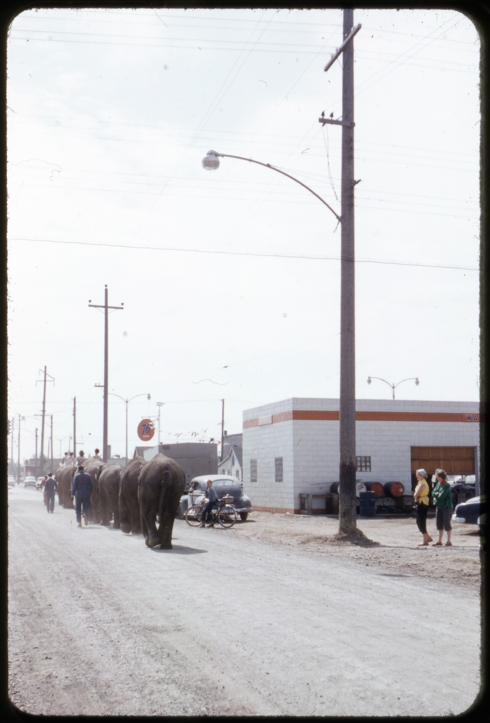 | 10 — | Anchorage, 1953 [elephants parading down street past buildings including Union 76 gas station] |
| 11 — | Anchorage, 1951 [1953? Circus parade on Fourth Avenue passing businesses including Oyster Loaf, J.C. Morris Real Estate, Tom’s Radio, Commercial Stationers, Players Café] | |
| 12 — | Palmer, 1953 [scenic view with hay stacked in field in foreground, mountains in distance] | |
| 13 — | Palmer Fair, 1953 [people looking at new model automobiles on display, with signs for Dodge and Plymouth hanging on grandstand in background] | |
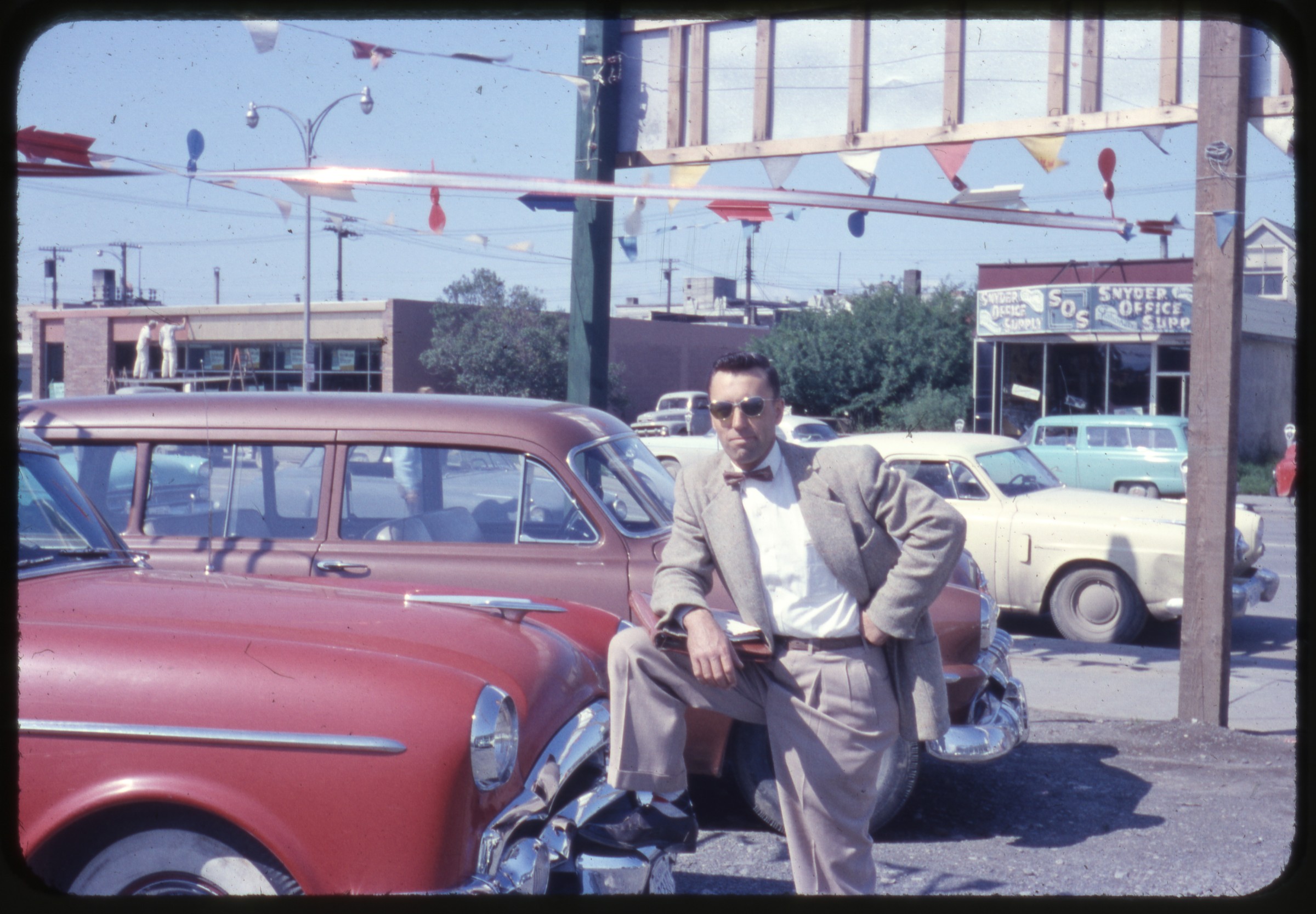 | 14 — | Dave, Anch., 1953 [man in business suit with one foot up on fender of automobile in car lot, Snyder Office Supply visible in background] |
| 15 — | [snow-covered pine trees next to house, from box labeled “Anchorage snow storm of 1954”] | |
| 16 — | [car dealership with automobiles buried in snow, icicles hanging from building roof, “Anchorage snow storm of 1954”] | |
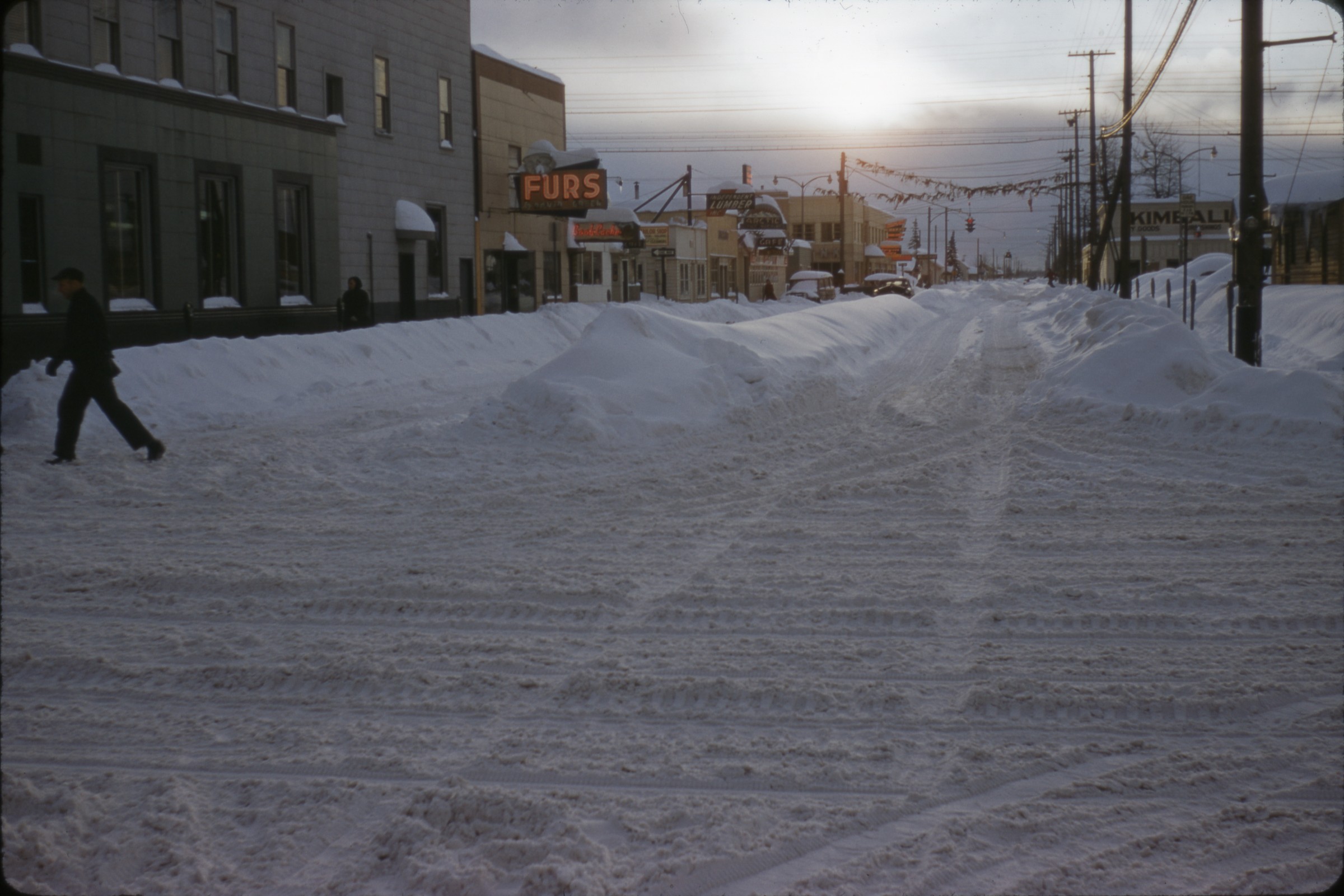
| 17 — | [street scene, probably F Street in Anchorage, with snow, pedestrians, automobiles, and signs for businesses including Ward W. Wells and Clark’s Paint Store, “Anchorage snow storm of 1954”] | |
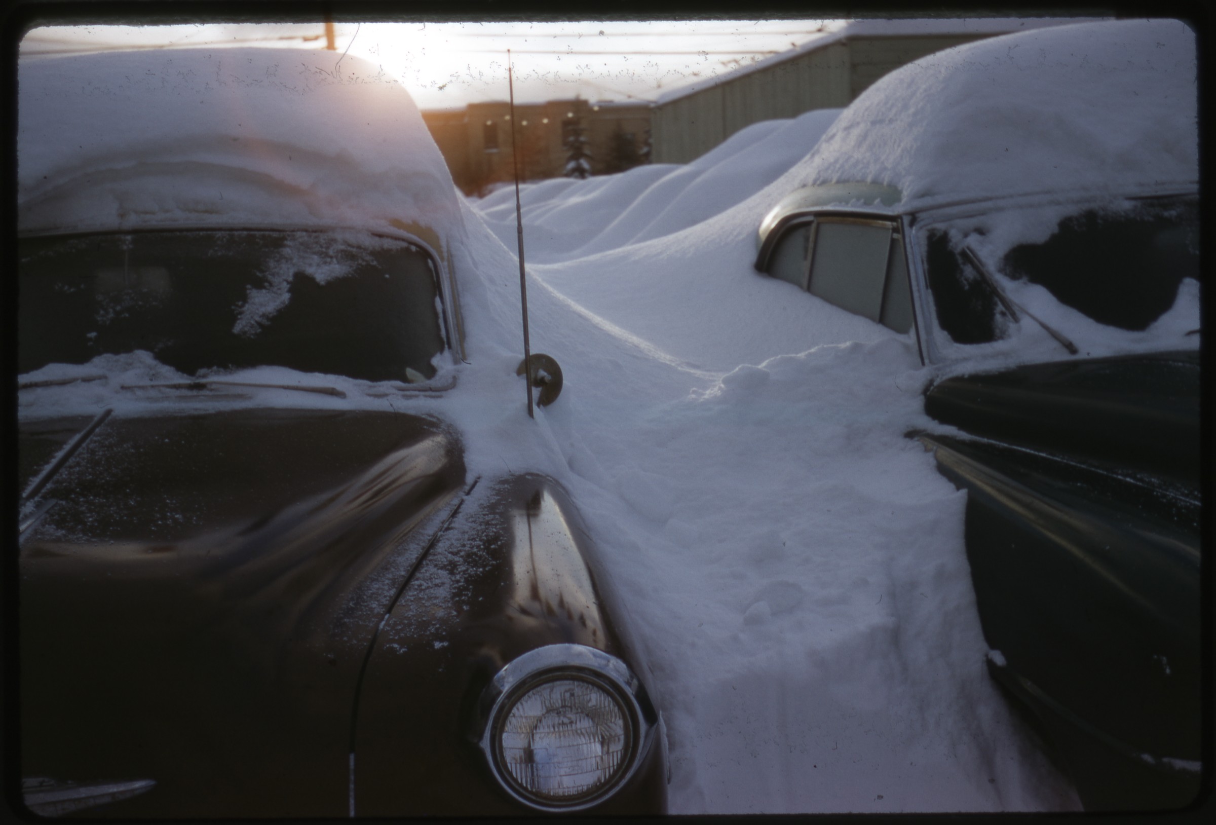
| 18 — | [automobiles buried in snow, buildings visible in background, “Anchorage snow storm of 1954”] | |
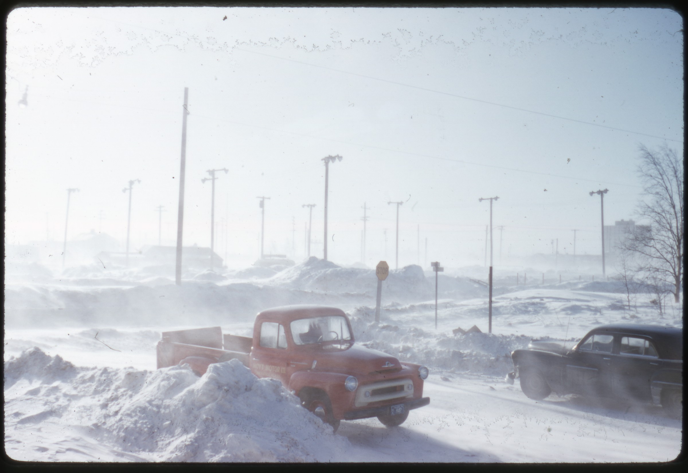
| 19 — | 5th & D St., Anch. [men shoveling snow outside Hoyt Motor Co., “Anchorage snow storm of 1954”] | |
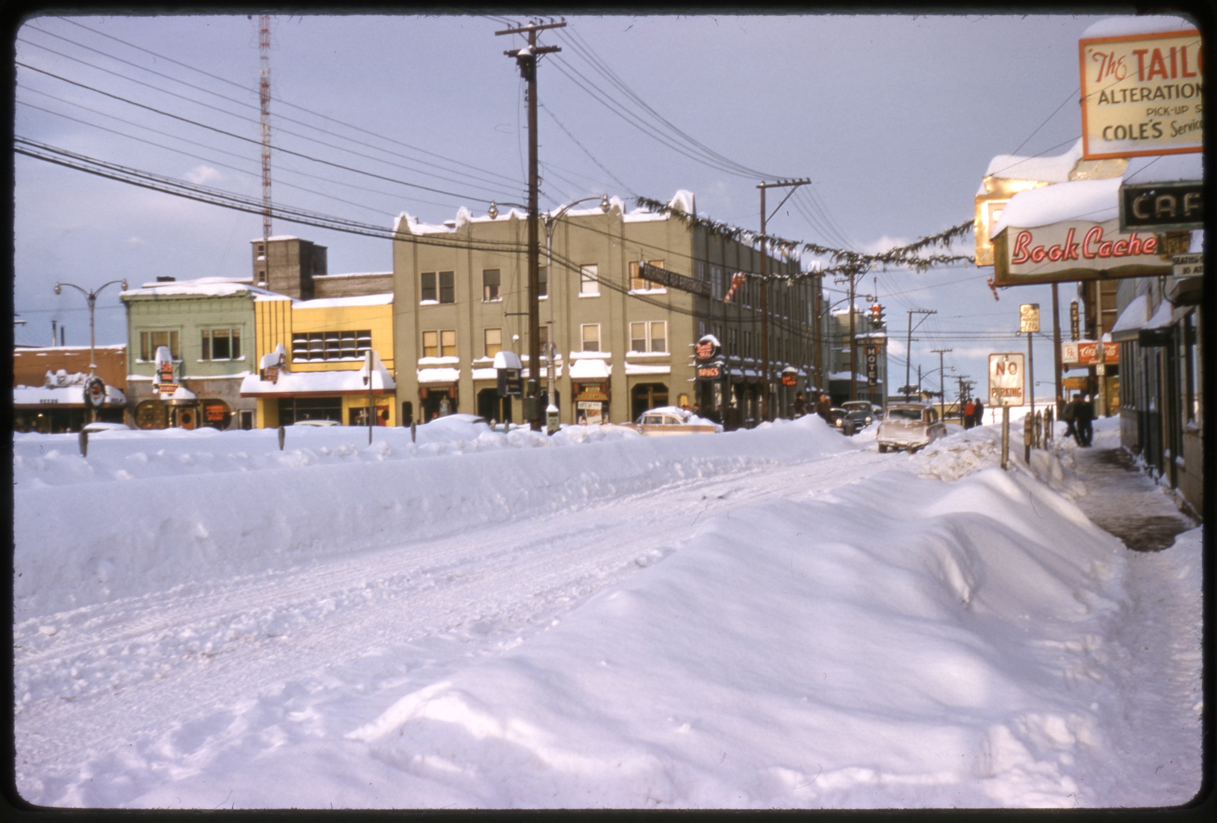
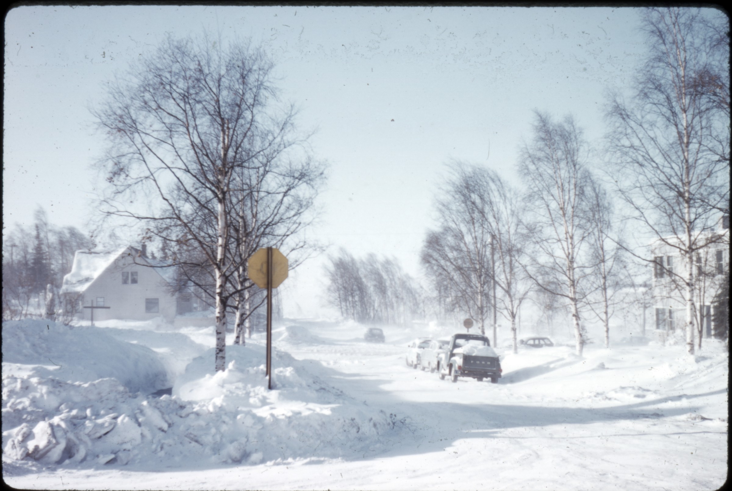
 | 20 — | [Fifth Avenue street scene, with snow, pedestrians, automobiles, and signs for businesses including Kimball’s, Independent Lumber, and Book Cache, “Anchorage snow storm of 1954”] |
 | 21 — | [street scene, E Street at Fourth Avenue, with snow, automobiles, and signs for businesses including Book Cache, Rexall Drugs, and 515 Club, “Anchorage snow storm of 1954”] |
 | 22 — | [two automobiles buried in snow, “Anchorage snow storm of 1954”] |
| 23 — | [street scene at Fifth Avenue and D Street with snow, pedestrians, and Loussac-Sogn Building with sign for Rand Shoes Finley’s, “Anchorage snow storm of 1954”] | |
 | 24 — | [residential area with houses, snow, “Anchorage snow storm of 1954”] |
 | 25 — | [residential area with blowing snow, houses, automobiles, “Anchorage snow storm of 1954”; in 2014, location tentatively identified as Westchester Lagoon area with Kenai Building at right] |
 | 26 — | [street scene with blowing snow, automobiles, utility poles, “Anchorage snow storm of 1954”] |
| 27 — | [similar to .26] | |
| 28 — | [airplanes damaged in snow storm in front of hangars including Alaska Freight Lines and Airport Machinery Co., with truck parked at left, Merrill Field, “Anchorage snow storm of 1954”] | |
| 29 — | [truck parked near damaged airplane outside Alaska Freight Lines hangar, Merrill Field, “Anchorage snow storm of 1954”] | |
| 30 — | [damaged airplane outside Alaska Freight Lines hangar, Merrill Field, “Anchorage snow storm of 1954”] | |
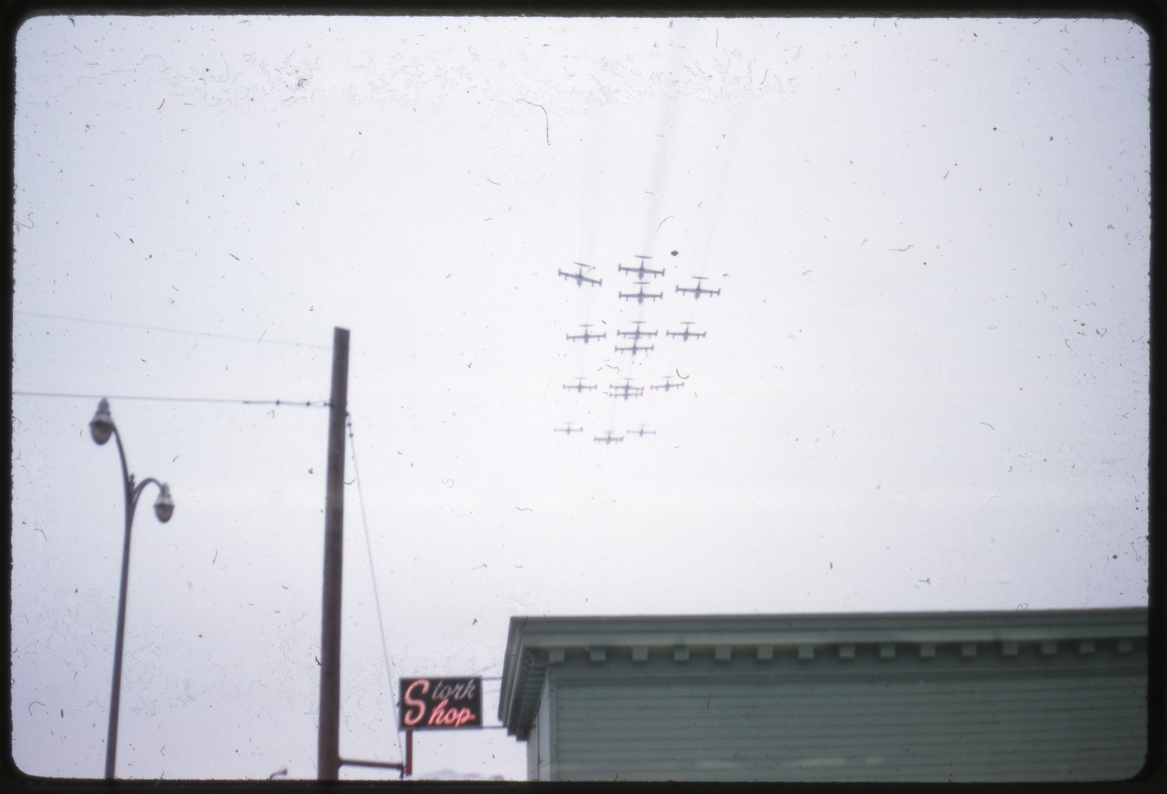 | 31 — | [airplanes flying overhead, sign for Stork Shop, Fur Rendezvous? “Anchorage snow storm of 1954”] |
| 32 — | [Weaver Bros. Inc. truck pulling parade float for Anchorage P.B.W.C., with igloo, dogsled, people in fur parkas, Fur Rendezvous? “Anchorage snow storm of 1954”] | |
| 33 — | [antique car in parade carrying men and sign “Where in the H is the Miners & Trappers Ball?” passing Snyder Office Supply, Fur Rendezvous, “Anchorage snow storm of 1954”] | |
| 34 — | [street scene of Fourth Avenue at E Street with pedestrians, automobiles, and signs for businesses including Ship Creek Market, Esquire Shop, Pacific Northern Airlines, Rexall Drugs, and Hewitt’s Drug Store, Fur Rendezvous? “Anchorage snow storm of 1954”] | |
| 35 — | [street scene of Fourth Avenue at D Street with pedestrians, automobiles, and signs for businesses including Verna’s Café and Kennedy Hardware, Fur Rendezvous? “Anchorage snow storm of 1954”] | |
| 36 — | Lake Spenard, Anch. [sunbathers on beach, 1955?] | |
| 37 — | Lake Spenard, Anch. [sunbathers on beach and swimmers in water, 1955?] | |
| 38 — | 4th Ave., Anchorage [street scene looking east to Chugach Mountains, with automobiles and signs for businesses including Inlet Hotel and Columbia Lumber] | |
 | 39 — | [three people and four folding chairs on lawn overlooking Cook Inlet; in 2014, location identified as Lyn Ary Park on Cook Onlet] |
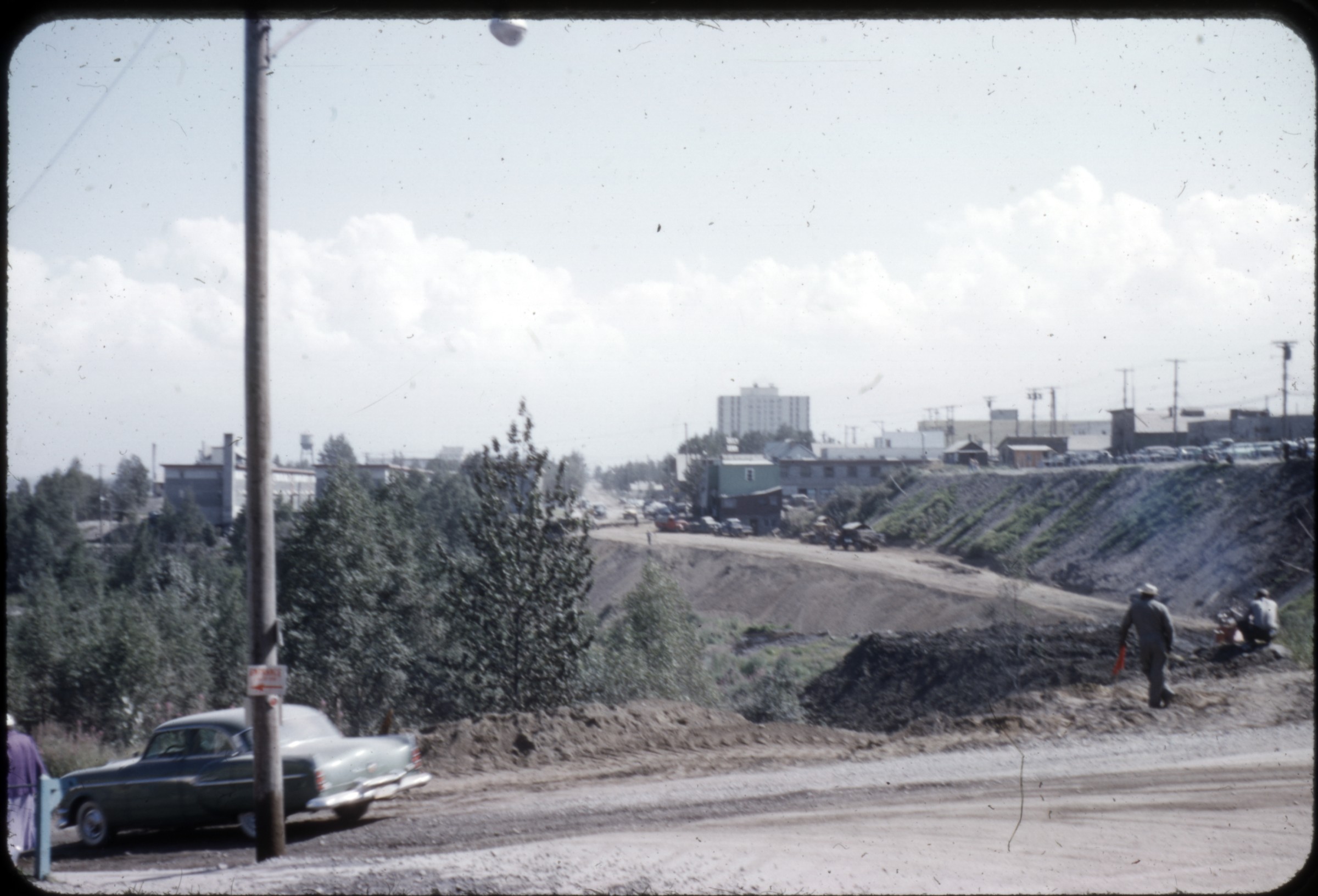 | 40 — | [road construction, workmen and equipment on dirt road, water tower and McKinley Apartments visible in distance; in 2014, location identified as C Street in foreground] |
| 41 — | [man in suit and bowtie standing in doorway] | |
| 42 — | 4th Ave., Anch. [street scene with McKinley Apartments] | |
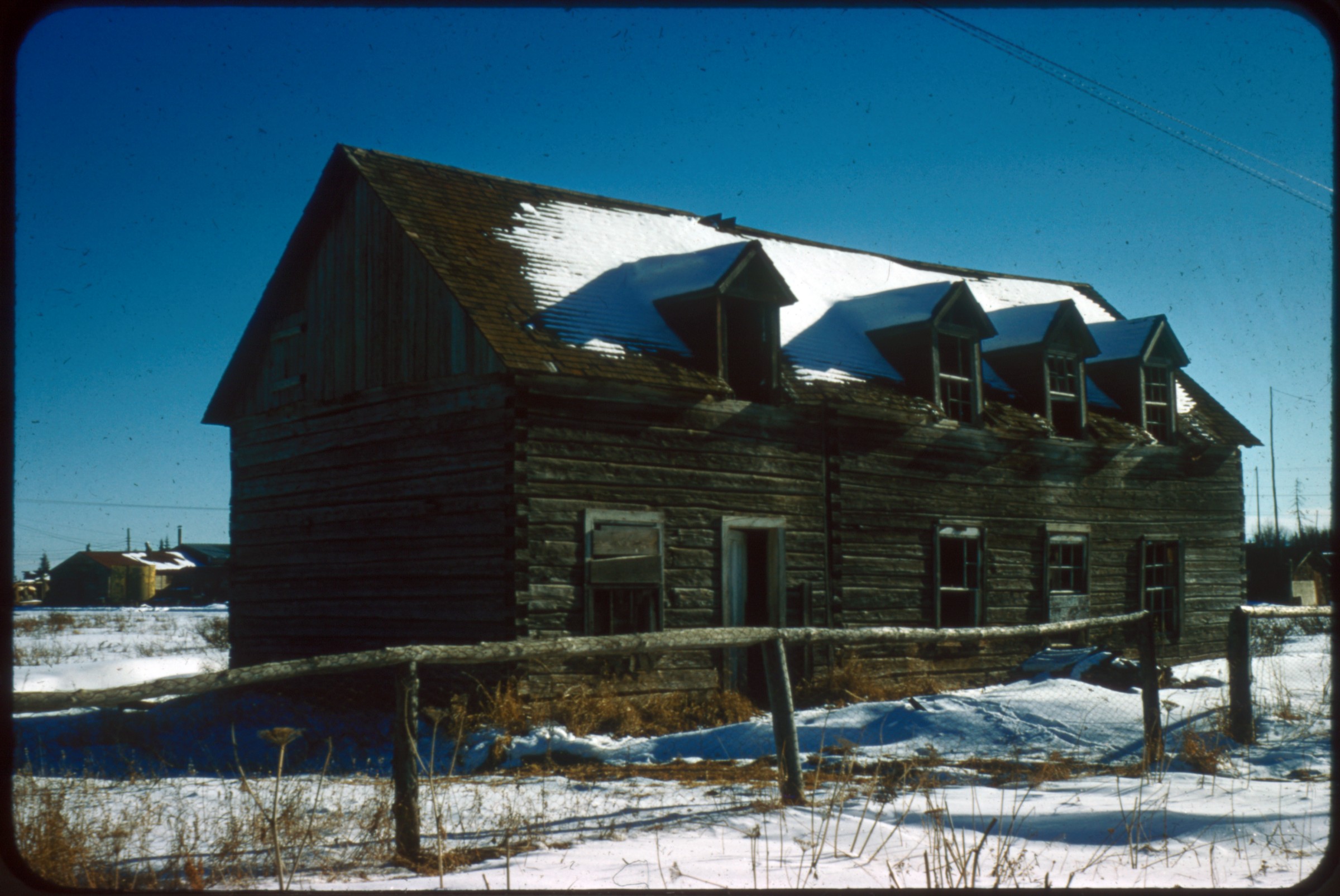
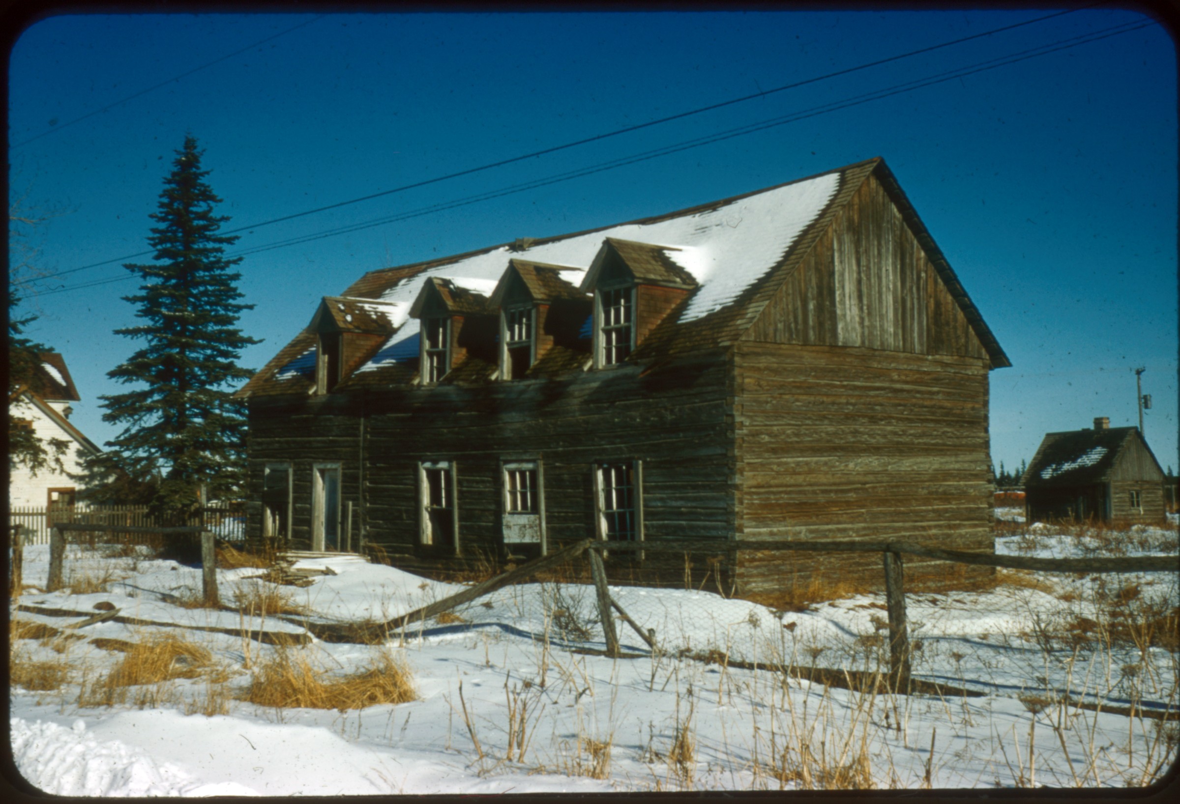
| 43 — | [log building with faded sign reading “Hope [?] Hall,” firewood stacked on porch, Hope?] | |
| 44 — | [flower and vegetable garden, man in background] | |
| 45 — | [flower garden] | |
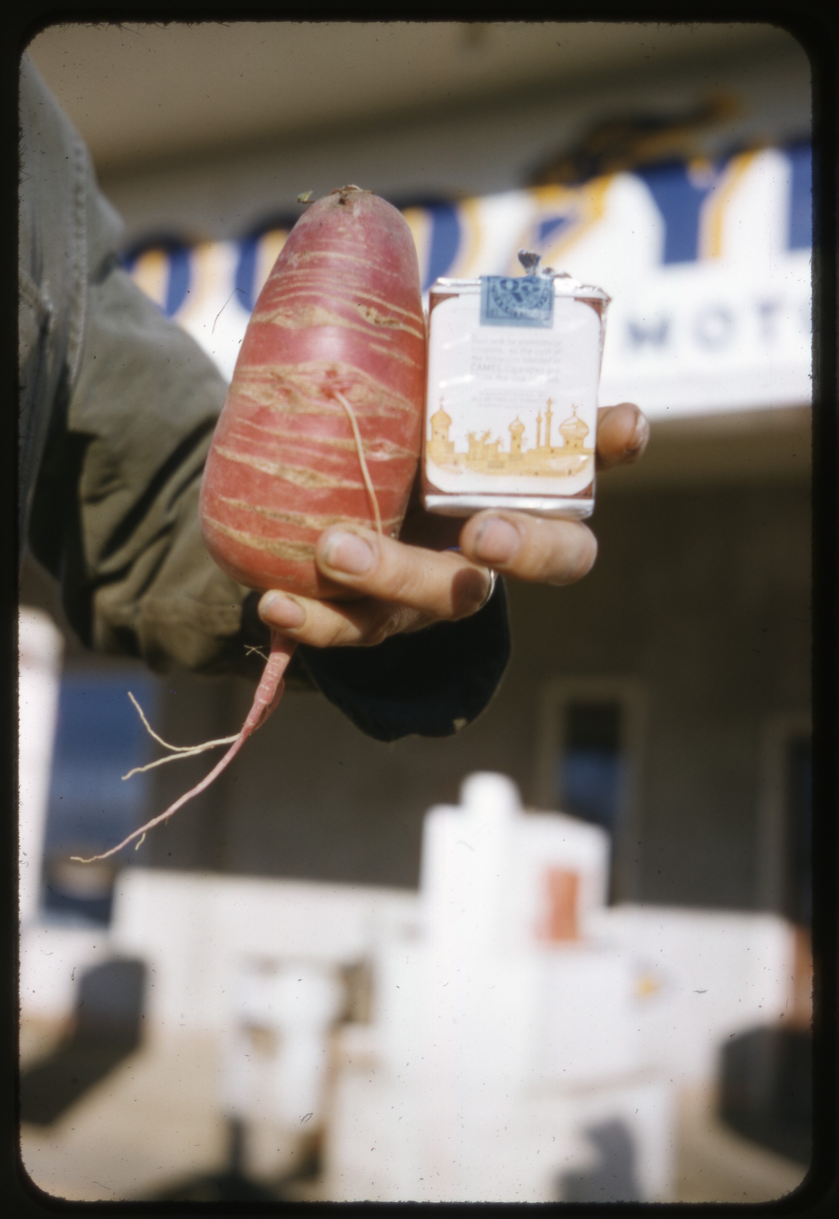 | 46 — | [man’s hand holding cigarette pack and carrot that is wider than pack] |
| 47 — | [view of Port of Anchorage from Second Avenue, with Alaska Railroad depot and headquarters, possibly cannery complex in background, Cook Inlet and Knik Arm in distance] | |
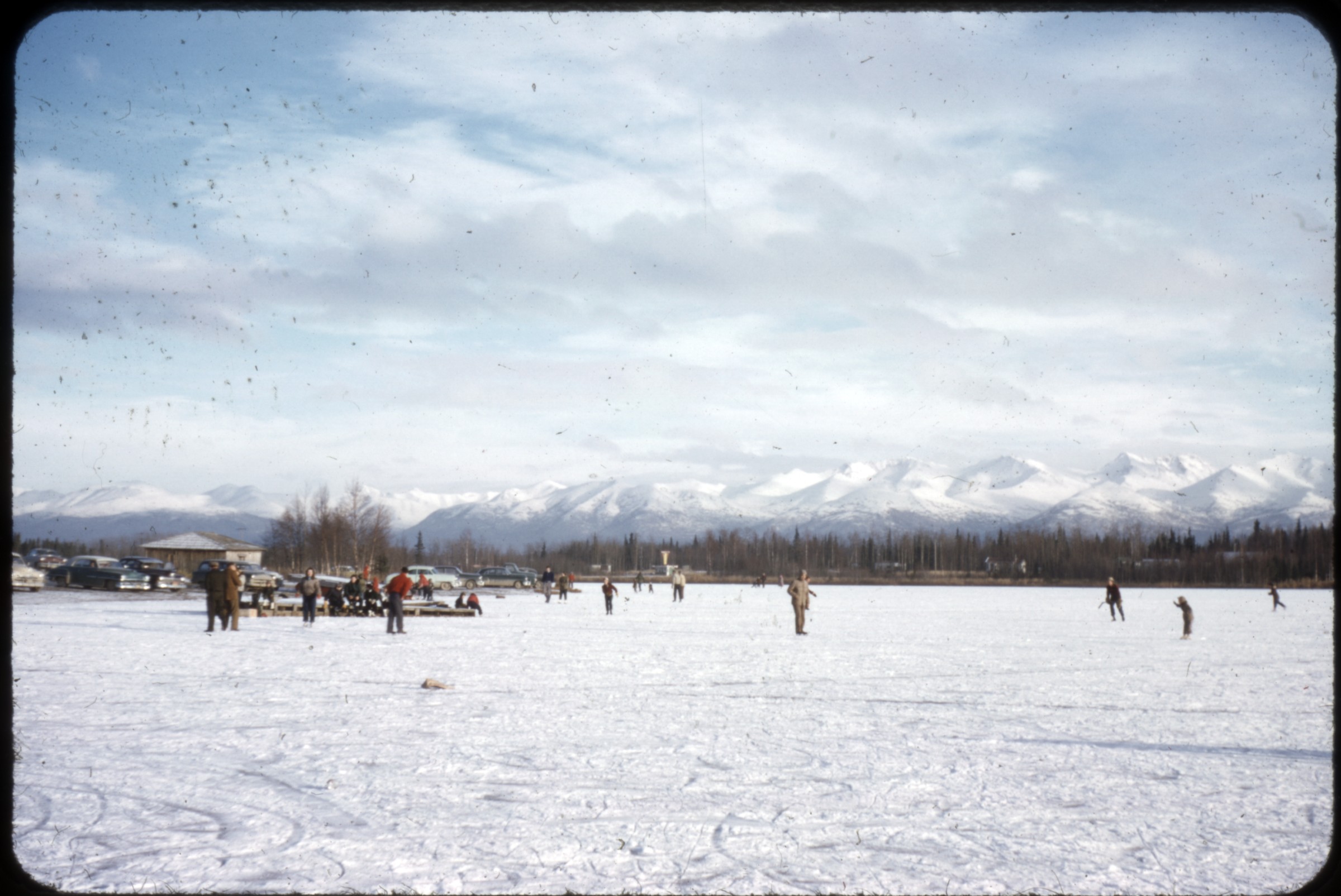 | 48 — | [skaters on frozen lake, automobiles parked at left near small building, Chugach Mountains in distance; in 2014, location identified as Lake Spenard] |
| 49 — | [Fifth Avenue winter street scene, with automobiles, Hansen Plumbing, McKinley Apartments, Union 76 gas station] | |
| 50 — | 4th Ave., Anch. [street view with Christmas decorations, automobiles, and signs for businesses including First National Bank, Bert’s Drug Store, Empress Theater] | |
| 51 — | Getchel Hotel, 4th Ave & E St. [sic] [street scene at Fourth Avenue and F Street, with Christmas decorations, pedestrians, automobiles, and businesses including Gitchell Hotel, Smart Shop, City Hall] | |
| 52 — | 3rd & E St., Anch., jail on right [winter street scene with automobiles, Chugach Mountains in distance] | |
| 53 — | Ship Creek home, 1956 [cinder block house, winter, automobile in driveway] | |
| 54 — | Talkeetna [winter view of town buildings along road, mountains in background; actually Hope?] | |
| 55 — | Hope, ’55 [automobile parked on street outside U.S. Post Office, Hope, Alaska, in winter] | |
| 56 — | Anchorage, 1955, 5th & D St [street scene with automobiles, Loussac-Sogn Building, and businesses including Finley’s Shoes, Paul’s Jewelry] | |
| 57 — | [aerial view of unidentified coastal town, probably Southeast, 1957?] | |
| 58 — | [similar to .57] | |
| 59 — | [aerial view of snow-capped mountains along coast, probably Southeast, 1957?] | |
| 60 — | [winter street scene, unidentified town, with automobiles, pedestrian, and buildings] | |
 | 61 — | [aerial view of roads in winter, frozen waterway at left; in 2014, identified as Anchorage Natural Gas pipeline, now belonging to ENSTAR] |
| 62 — | [road in winter, with hills beyond, Arctic Valley] | |
 | 63 — | Arctic Valley [skiers gearing up at bottom of hill in foreground, skiers on tow-rope in background] |
| 64 — | [Portage Lake and Glacier in winter] | |
| 65 — | [Portage Lake and Glacier in winter] | |
| 66 — | [two people at Portage Lake and Glacier in winter] | |
| 67 — | [Portage Lake and Glacier in winter] | |
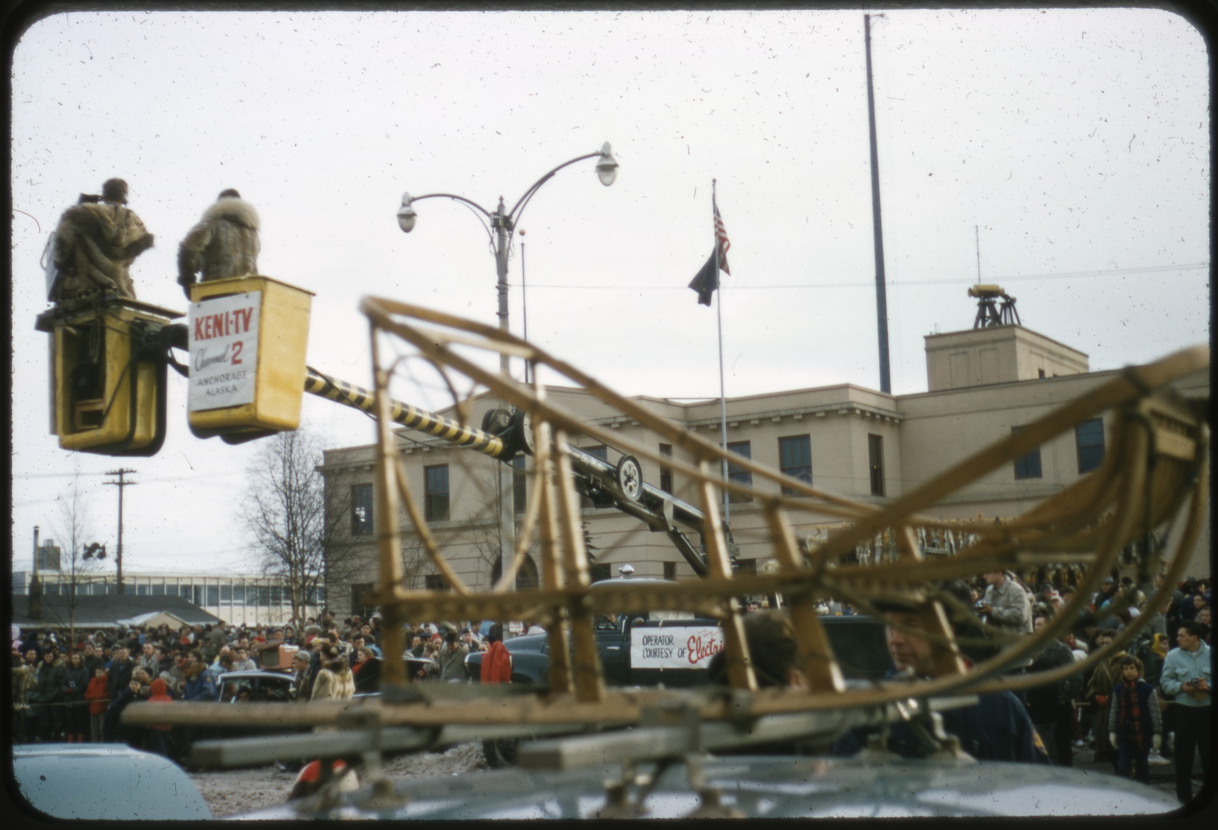 | 68 — | [Anchorage street scene, with dogsled on top of car in foreground, crowds of people and KENI television camera crane outside federal building on Fourth Avenue, Fur Rendezvous?] |
| 69 — | [blanket toss jumper in air, with federal building visible behind, Anchorage Fur Rendezvous?] | |
 | 70 — | Kenai [winter view of two wood-frame buildings] |
 | 71 — | Kenai [winter street scene with town buildings, including Kenai Drugs] |
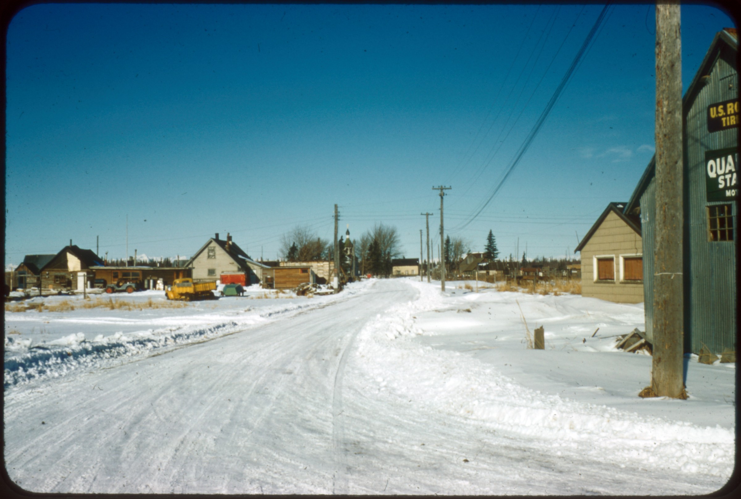 | 72 — | Kenai [winter street scene with buildings, trucks parked in lot, possibly automotive shop at right] |
 | 73 — | [Kenai winter scene with fences in foreground, buildings in middle distance, mountains in background] |
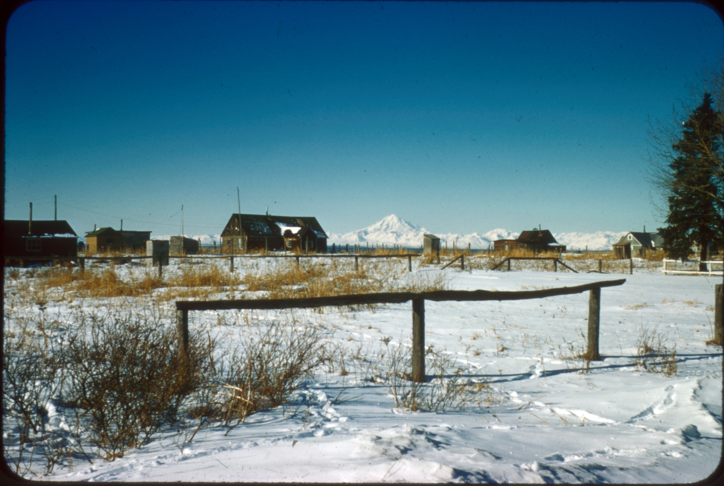
 | 74 — | Russian orphanage, Kenai [dilapidated two-story wooden building in winter] |
 | 75 — | Kenai [wooden buildings in old town, including St. Nicholas Russian Orthodox Chapel] |
 | 76 — | Russian orphanage, Kenai |
| 77 — | [airplane with tail number N21856 on landing strip in winter, with truck and equipment parked at left, Kenai?] | |
| 78 — | Portage Glacier, 1960 | |
| 79 — | Sand Point, 1961 [exterior of St. Nicholas Russian Orthodox Chapel] | |
| 80 — | Joe ’72 [portrait photograph of Joe Crusey] | |
| 81 — | Joe ’72 [similar to .80] | |
| 82 — | Hoyt Motors, Lloyd & Rudy [four men inside at service counter for automotive shop, with automobile in bay at right, 1950s?] | |
| 83 — | [woman hiking along snowy ridge, no date] | |
| 84 — | [exterior of Kessler, Hillstrand & Crusey insurance company, winter, car lot at left, mid- 1950s?] [Dawson, Yukon, 1956-1961] | |
| 85 — | Dawson City, 1956 [street scene with pedestrians, automobiles, and businesses including White Pass Hotel, The Grill Chinese Food, Rexall Drugs] | |
| 86 — | [view of dirt road through hilly area, trip to Dawson, print date Jul 61] | |
| 87 — | [view across Yukon River with Dawson on far bank, print date Jul 61] | |
| 88 — | [view across Yukon River with Dawson on far bank, Chevrolet automobile with Alaska plate in foreground, print date Jul 61] | |
| 89 — | [car ferry approaching across Yukon River, print date Jul 61] | |
| 90 — | [Chevrolet automobile with Alaska plate boarding ferry on Yukon River, print date Jul 61] | |
| 91 — | [men and automobile on ferry McQuesten, print date Jul 61] | |
| 92 — | [view from dock, with Yukon Saw Mill Co. sawmill building on shore, print date Jul 61] | |
| 93 — | [Dawson street scene with automobiles and businesses including Westminster Hotel, print date Jul 61] | |
| 94 — | [three men standing inside the tire of large vehicle labeled United States Army Transportation Corps, print date Jul 61] | |
| 95 — | [gold dredge, print date Jul 61] | |
| 96 — | [gold dredge, print date Jul 61] | |
| 97 — | [gold dredge, print date Jul 61] | |
| 98 — | [men lying in sleeping bags on floor of dilapidated building or boat, print date Jul 61] | |
| 99 — | [ruins, possibly riverboat graveyard near Dawson, print date Jul 61] | |
| 100 — | [ruins, possibly riverboat graveyard near Dawson, print date Jul 61] | |
| 101 — | [dilapidated riverboat, possibly at riverboat graveyard near Dawson, print date Jul 61] | |
| 102 — | [view of pilothouse of the Julia B., possibly at riverboat graveyard near Dawson, print date Jul 61] | |
| 103 — | [dilapidated riverboats, possibly at riverboat graveyard near Dawson, print date Jul 61] | |
| 104 — | [Dawson street scene, with man standing outside boarded-up business, print date Jul 61] | |
| 105 — | [Masonic temple, Dawson, print date Jul 61] | |
| 106 — | [dilapidated building, Dawson, print date Jul 61] | |
| 107 — | [street scene in Dawson, with Mme. Tremblay’s Store and Canadian Pacific Airlines, print date Jul 61] | |
| 108 — | [boarded-up building with sign for Cribbs, the Rexall Store, print date Jul 61] | |
| 109 — | [boarded-up building with sign for J & T Adair Wholesale Hardware, print date Jul 61] | |
| 110 — | [boarded-up building with sign for Picobac tobacco, print date Jul 61] | |
| 111 — | [boat No. 40 Kingfisher on grass outside boarded-up building with sign for Red Feather Saloon, print date Jul 61] | |
| 112 — | [boarded-up building with sign for Red Feather Saloon, print date Jul 61] | |
| 113 — | [boarded-up building, Dawson, print date Jul 61] | |
| 114 — | [boarded-up buildings, Dawson, print date Jul 61] | |
| 115 — | [trees growing up around boarded-up building with sign “Guns Ammunition Hardware”, print date Jul 61] | |
| 116 — | [Dawson street scene, with hill in background, print date Jul 61] | |
| 117 — | [wagon, Dawson, print date Jul 61] | |
| 118 — | [boarded-up building with sign for The American, print date Jul 61] | |
| 119 — | [scenery, trip to Dawson, print date Jul 61] | |
| 120 — | [scenery, trip to Dawson, print date Jul 61] | |
| 121 — | [scenery, trip to Dawson, print date Jul 61] | |
| 122 — | [scenery, trip to Dawson, print date Jul 61] | |
| 123 — | [scenery, trip to Dawson, print date Jul 61] | |
| 124 — | [scenery with glacier, Matanuska? trip to Dawson, print date Jul 61] | |
| 125 — | [man standing near two automobiles parked in overlook with glacier, Matanuska? trip to Dawson, print date Jul 61] | |
| 126 — | [moonrise over mountains, trip to Dawson, print date Jul 61] | |
| 127 — | [man standing next to automobile parked on riverbank, supplies spread on ground, highway in background, trip to Dawson, print date Jul 61] | |
| 128 — | [man washing face in river water, highway in background, trip to Dawson, print date Jul 61] | |
| 129 — | [three men entering Parker House roadhouse, Tok, trip to Dawson, print date Jul 61] | |
| 130 — | [view out windshield of bear crossing highway, trip to Dawson, print date Jul 61] | |
| 131 — | [bird’s eye view of Pedro Gold Dredge, Chicken, trip to Dawson, print date Jul 61] | |
| 132 — | [four men standing near small gold mining plant, Taylor Highway, trip to Dawson, print date Jul 61] | |
| 133 — | [people standing near small gold mining plant, print date Jul 61] | |
| 134 — | [water draining into pan at small gold mining plant, print date Jul 61] | |
| 135 — | [dump truck loading dirt into small gold mining plant, people standing near plant below, print date Jul 61] | |
| 136 — | [scenery, Taylor Highway, trip to Dawson, print date Jul 61] | |
| 137 — | [debris, probably near Jack Wade dredge, Taylor Highway, trip to Dawson, print date Jul 61] | |
| 138 — | [Jack Wade Dredge, Taylor Highway, trip to Dawson, print date Jul 61] | |
| 139 — | [two men on Jack Wade Dredge, Taylor Highway, trip to Dawson, print date Jul 61] | |
| 140 — | [two men near Jack Wade Dredge, Taylor Highway, trip to Dawson, print date Jul 61] | |
| 141 — | [man standing in doorway of boarded-up building with sign for “Office”, street sign for 1st Ave., Dawson, print date Aug 61] | |
| 142 — | [woman and three children loading or unloading boats on bank of Yukon River, fourth child in boat in foreground, river ferry in background, trip to Dawson, print date Aug 61] | |
| 143 — | [four Athapascan children on river shore near kayak, supplies on ground, bulldozer parked next to Canadian Customs house in background, Dawson, print date Aug 61] | |
| 144 — | [three men and two automobiles outside Yukon Saw Mill Co. building, Dawson, print date Aug 61] | |
| 145 — | [Yukon River ferry crossing, with automobile parked near signs reading “Welcome to Dawson City Heart of the Klondike” and “Dawson City Ferry Closing Hours,” print date Aug 61] | |
| 146 — | [man on bulldozer in mown field, probably near Yukon River ferry crossing at Dawson, print date Aug 61] [Ohio, 1943] | |
| 147 — | Tom & Joe, Sidney, Ohio, 1943 [two young men, one in military uniform] Prints [Alaska Earthquake, 1964] | |
| 148 — | Kodiak, 1964 earthquake [downed trees and debris in foreground, partially submerged buildings and vehicles in background; cf. 196] [Contact prints] | |
| 149 — | [Anchorage street scene, with pedestrians and automobiles] | |
| 150 — | [surveyor’s tripod in street in front of buildings with earthquake damage] | |
| 151 — | [damaged homes in residential area, probably Turnagain] | |
| 152 — | [people walking past damaged apartment building, with equipment and debris pile in foreground, other buildings in background] | |
| 153 — | [automobile in residential driveway with heaved pavement] | |
| 154 — | [heaved pavement, with buildings in distance] | |
| 155 — | [street scene, Fourth Avenue looking east, with automobiles and damaged buildings including D & D Café, Sportsman’s Club, Frisco Café, McKinley Apartments in distance] | |
| 156 — | [damage to McLain’s Camera Center building] | |
| 157 — | [damage to McLain’s Camera Center building] | |
| 158 — | [building damage] | |
| 159 — | [view of J.C. Penney parking structure from across Fifth Avenue, with signs for businesses including Nerland’s, Craig’s, Singer, Book Cache] | |
| 160 — | [Fifth Avenue street scene looking east, with pedestrians and businesses including J.C. Penney, Nerland’s, Igloo Native Arts and Crafts, Craig’s, Singer, Book Cache] | |
| 161 — | [Fourth Avenue street scene looking west, with pedestrians and businesses including D & D Café, Mac’s Foto, Scandinavian Club, Sam’s Liquor Store, Alaska Trading Post Loans, Safari Hotel, Sedalia Shine Parlor] | |
| 162 — | [Fourth Avenue street scene with signs for Home Cooking, Anchorage Pawn Shop Loans, Denali Grill] | |
| 163 — | [Fourth Avenue street scene with businesses including Safari Hotel, Sedalia Shine Parlor, Union Leader, Denali Grill] | |
| 164 — | [Fourth Avenue street scene with Pawn Shop Loans, Scandinavian Club, Anchorage Arcade, Sam’s Liquor Store, Safari Hotel, Union Leader] | |
| 165 — | [Fourth Avenue street scene with D & D Café, Sportsman’s Club, Frisco Bar & Café, BJ’s Billiards] | |
| 166 — | [Fourth Avenue street scene with Hobby Lobby, Koslosky’s] | |
| 167 — | [damage to J.C. Penney parking structure and Singer, Fourth Avenue] | |
| 168 — | [trucks in front of J.C. Penney parking structure, including Shanteri’s storefront] | |
| 169 — | [Fifth Avenue street scene with Army soldiers at barricade in front of First Federal Savings, with businesses including Golden Horseshoe] | |
| 170 — | [damage to First Federal Savings building] | |
| 171 — | [Fourth Avenue street scene with Bagoy’s, Green Dragon, Bowling Emporium, Turf Sport Center] | |
| 172 — | [damage to Flowers by Bagoy building] | |
| 173 — | [woman standing behind large snow pile] | |
| 174 — | [snow piled against house to roof level] | |
| 175 — | [work crew in open truck bed loading or unloading on street, with automobiles and buildings visible] | |
| 176 — | [heaved pavement with buildings in background] | |
| 177 — | [damaged building] | |
| 178 — | [Fifth Avenue street scene with automobiles, trucks, and businesses including J.C. Penney parking structure, HFC Loans] | |
| 179 — | [rock slide on Seward Highway partially covering Alaska Railroad tracks along Turnagain Arm] | |
| 180 — | [snow and mud in lot in front of building, oil barrels and other materials in yard, Turnagain Arm area?] | |
| 181 — | [trucks outside McLain’s Camera Center] | |
| 182 — | [Fourth Avenue street scene with Northern Jewelers, Hobby Lobby, Koslosky’s, Pioneer Loan Co., D & D Café] | |
| 183 — | [Fourth Avenue street scene with automobiles, pedestrians, hoisting equipment, and businesses including McLain’s Camera Center, Northern Jewelers, Hobby Lobby, Koslosky’s, Pioneer Loan Co., D & D Café] | |
| 184 — | [after start of demolition of Fourth Avenue buildings including Sportsman’s Club] | |
| 185 — | [Fourth Avenue street scene with automobiles, pedestrians, hoisting equipment, and businesses including McLain’s Camera Center, Northern Jewelers, Hobby Lobby, Koslosky’s, Pioneer Loan Co., D & D Café, BJ’s Billiards] | |
| 186 — | [heaved pavement in foreground, buildings in middle ground, Cook Inlet in distance; possibly Fourth Avenue] | |
| 187 — | [bird’s eye view of damaged dock or heaved earth in waterway near Kodiak; cf. 198] | |
| 188 — | [bird’s eye view from roadway of damaged dock or heaved earth in waterway, with buildings along shore, Kodiak; cf. 198] | |
| 189 — | [badly damaged building with marker “5” on pole in front, Anchorage?] | |
| 190 — | [workmen on damaged building, with Craning Service truck parked in front] | |
| 191 — | [Mitch Bennett Co. crane lifting section of damaged building, workmen visible, Cook Inlet in background?] | |
| 192 — | [street scene near Fourth Avenue and D Street with businesses including Mutual of New York, Mary Lou’s Café, Howard’s Gunshop, Mehner’s Restaurant, Pacific Finance Loans, Television Rendezvous, and J.C. Penney] | |
| 193 — | [“Life” van parked outside multi-story building with earthquake damage] | |
| 194 — | [damaged homes, Kodiak] | |
| 195 — | [damaged homes, Kodiak] | |
| 196 — | [damaged homes, Kodiak; similar to .148] | |
| 197 — | [fishing boats washed onto shore and lying near buildings, Kodiak] | |
| 198 — | [damaged dock or heaved earth in waterway near Kodiak, cf. .187-188] | |
| 199 — | [damage to McKinley Apartments] | |
| 200 — | [Fourth Avenue pavement damage, blurry, cf. 186] Guide updated: November 5, 2014 |