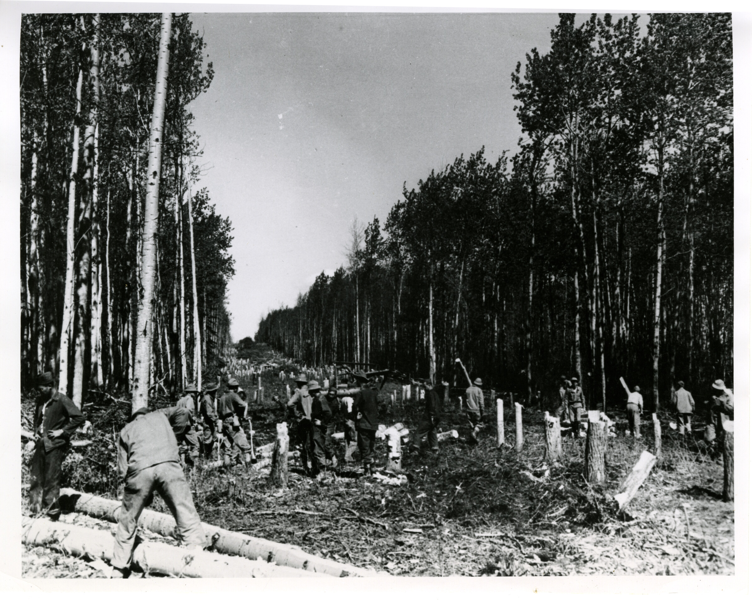
 | 1 — | Cutting highway path – A wide path is cut through a grove of trees for the Alcan Highway during the early construction days in 1942. Photo courtesy Canadian Army [same as .24] |
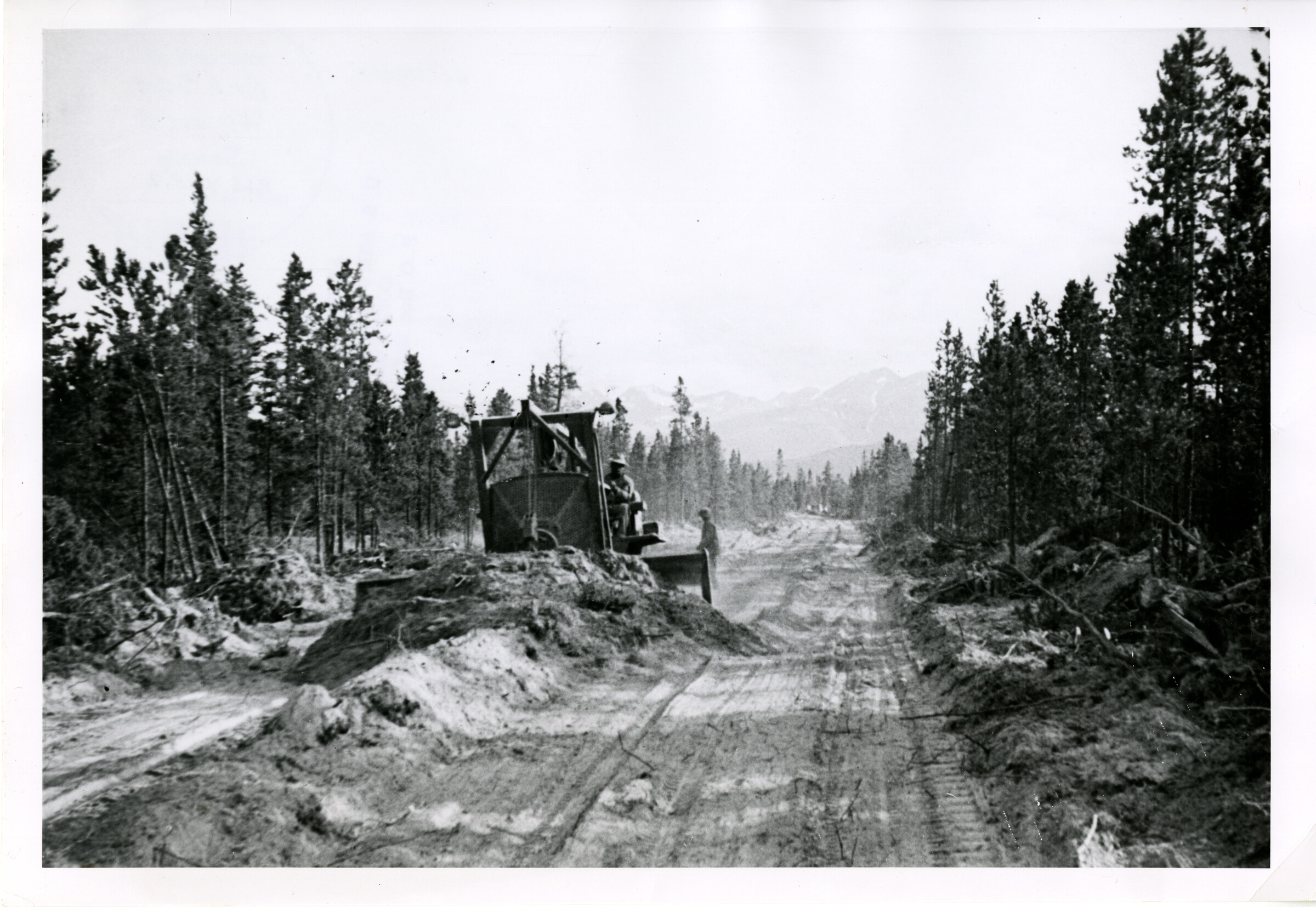 | 2 — | Pioneer Rd. – This photo shows the 1 st rough pioneer road on the Alcan Highway during its construction days in World War II. Later this rough road was to become a smoothly graveled highway traveled by thousands of tourists. [US Army photograph] |
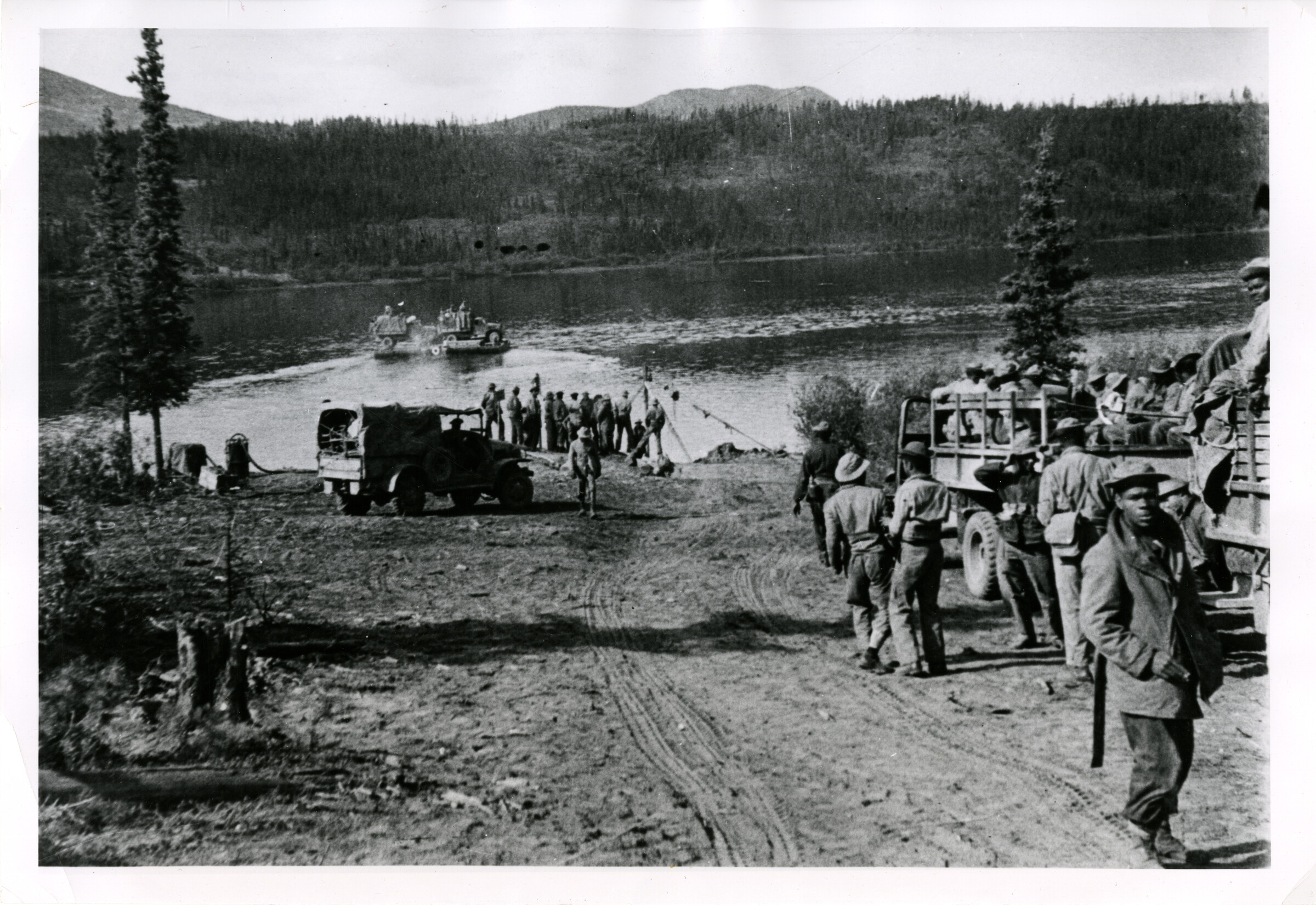 | 3 — | Engineer Construction troops couldn’t wait for bridges as they rushed work on the AK Highway during WWII. Here trucks are shown crossing the Teslin River at Johnsons Crossing using a pontoon ferry. Nov. 20 is the 15 th anniversary of the completion of the AK Highway. [US Army photograph] |
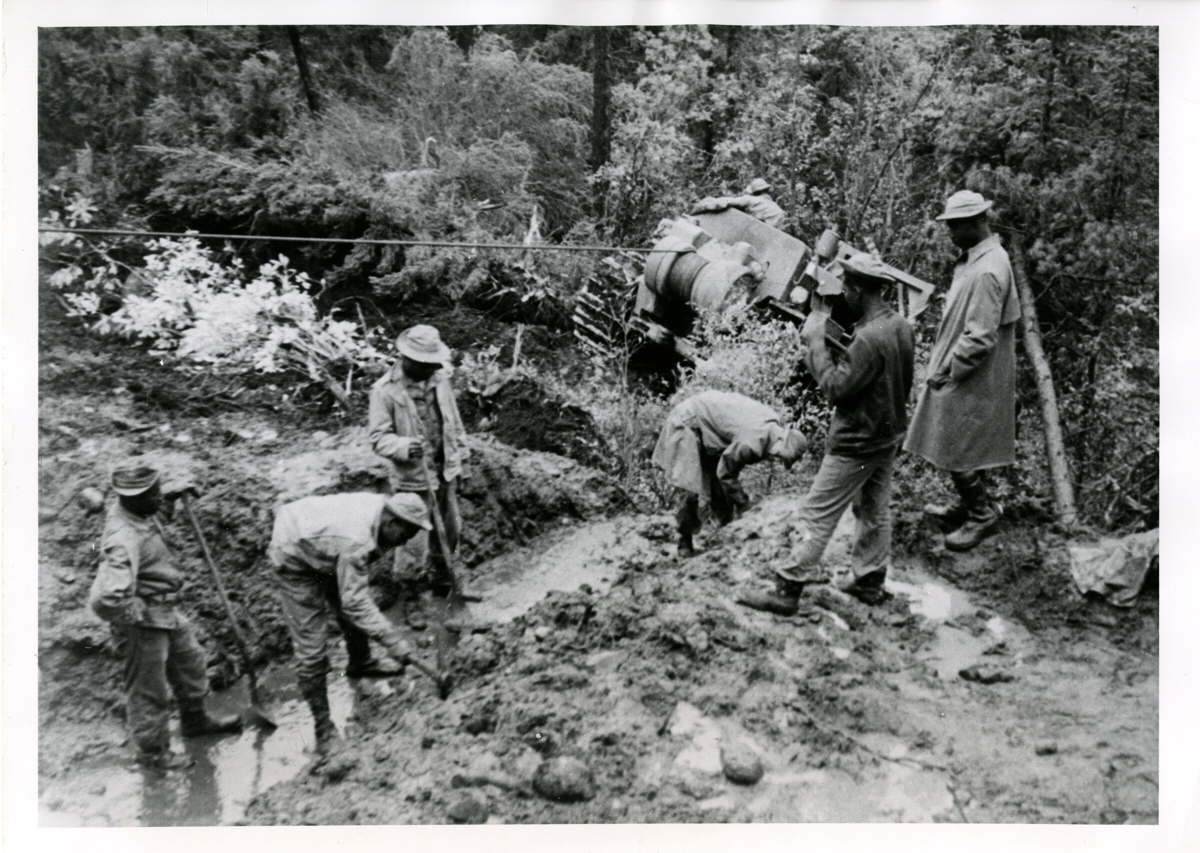 | 4 — | Mud was a major enemy during construction of the AK Highway in WWII by the U.S. Army Engineers. Here a mired bulldozer winches itself out, as soldiers of Co. D 93 rd Engineer Regiment dig a culvert emplacement during the early construction days. [US Army photograph] |
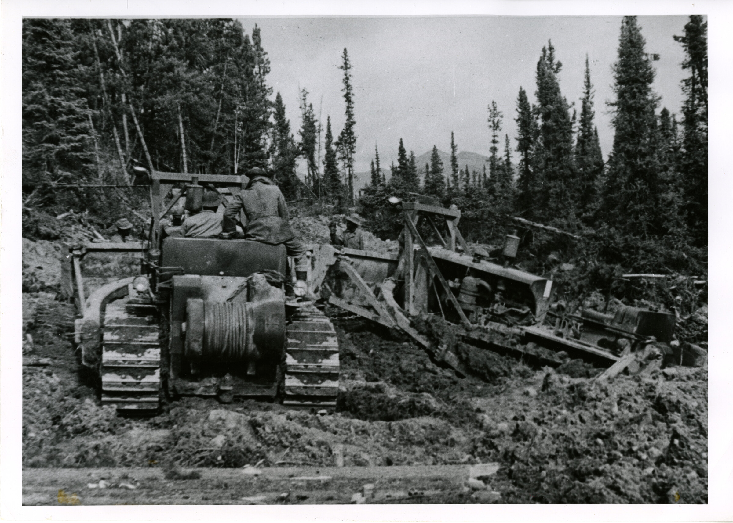 | 5 — | Mired in the mud – Permanently frozen ground, which turned into a bottomless bog when cleared of topsoil, presented 1 of the major problems during construction of the AK Highway by the U.S. Army Engineers. Here one D-8 tractor is shown mired in the Alcan mud 67 miles east of Teslin, Y.T., during the construction days. Nov. 20 is the 15 th anniversary of the completion of the 1,600 mi. long highway built by Corps of Engineers troops. [US Army photograph] |
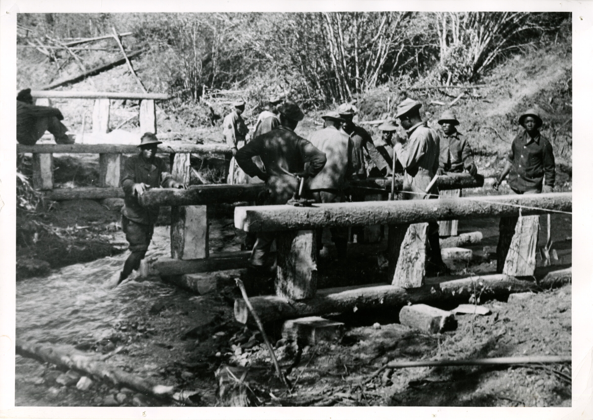 | 6 — | Alcan bridge building – Hundreds of northern streams, many of which turned into raging torrents in the spring, had to be crossed in building the AK Highway. Shown in the photo is a rough-hewn bridge being put in over Goose Creek, 12 miles north of Teslin, Y.T. [US Army photograph] |
| 7 — | Coal River bridge – Early day bridge is shown under construction on the Alcan Highway about 50 miles from Lower Liard. This same bridge was washed out later by high water & replaced by a permanent steel structure. [US Army photograph] | |
| 8 — | Spring break up on the Alcan Highway during the early construction days of WWII. Mud was one of the major enemies which had to be conquered in completing the 1,600 mile-long highway to AK. [US Army photograph] | |
| 9 — | Winter camp on Alcan – This is the winter camp during construction days of the Alcan Highway of Co. B, 341 st Engineer Regiment. The men were working through the winter building a 25 mile access road to an emergency flight strip 25 miles north of Charlie Lake, St. John, British Columbia. [US Army photograph] | |
| 10 — | Snow on the Alcan – Cold weather was a major enemy in construction of the AK Highway during WWII. This photo shows the 1 st snows on the pioneer road of the Alcan during construction days. The Highway passes near Snag, Y.T., which has recorded a temperature of 81.4 degrees below zero. [US Army photograph] | |
| 11 — | Soldier’s Summit as it looks today is shown in this photograph. This spot was the site of the formal dedication ceremony opening the AK Highway on Nov. 20, 1942. Soldier’s Summit is located on the shore of Kluane Lake in Y.T. at mile 1061. Bare hillside to the left of present day highway is where the historical ceremony was held. Above can be seen cut bank marking location of the original Alcan pioneer road. [US Army photograph] | |
| 12 — | 4000 miles to Tokyo – This Alcan signpost was erected during the construction days of WWII at the “Y” junction near Watson Lake. [US Army photograph] | |
| 13 — | Died in line of duty – This monument at mile 1116.6 on the AK Highway is to one of the unsung heroes of the construction days of the Alcan Highway. The inscription reads “1 st Lt. R.R. Small, died in line of duty, Aug. 9, 1942.” [US Army photograph] | |
| 14 — | Canadian Customs – Autos traveling the present day AK Highway are shown stopped for inspection by Canadian Customs near the border between Yukon Territory & AK. [US Army photograph] | |
| 15 — | Hands across the border – A Canadian & U.S. Army officer exchange a handshake during formal dedication ceremony for the AK Highway on Nov. 20, 1942 [US Army photograph] | |
| 16 — | Dedication ceremonies – Brig. Gen. James A. O’Connor, commanding the U.S. Northwest Service command, is shown speaking at the formal dedication ceremony opening the Alaska Highway at Soldier’s Summit in the Yukon Territory on November 20, 1942. Photo courtesy Canadian Army | |
| 17 — | Late in September 1942, this truck was driven up the Alcan from Dawson Creek to Whitehorse – the 1 st truck to make the entire trip. [US Army photograph] | |
| 18 — | First convoy, Whitehorse to Fairbanks, Nov. 20, 1942, Fairbanks Freight | |
| 19 — | Nov. 20, 1942 – A bleak and cold day. The Alcan Highway was formally dedicated at a joint American-Canadian ceremony held atop Soldiers Summit, mile 1057, overlooking frozen Kluane Lake. The road was officially open and the 340 th Engineer Regiment had played an important part in that military engineering feat. | |
| 20 — | The official Canadian-American opening of the AK Highway. Approved by NW Service Command, U.S. Army [National Film Board photograph] | |
| 21 — | Work proceeded in 2 directions from several different locations along the route. Advance parties working from these intermediate points were supplied by pack trains such as the one shown in this picture. Pack trains were the only means of transportation which could cover the terrain before improvements were made. [horses] | |
| 22 — | Close behind the survey parties came the dozers which pushed and uprooted jack pine, poplar, and spruce as the road proceeded through the wooded northland. These machines were kept in operation around the clock as the engineers fought to finish the project before the 1 Dec. deadline. | |
| 23 — | Muskeg (unconsolidated vegetable matter) was an ever present problem, as piece after piece of equipment became mired during construction. Because muskeg cannot support a load, it was impossible to build a road upon it, & when found along the route it was either removed or bypassed. The highway was located initially with the aid of aerial photography which proved to be very valuable in spotting the larger areas of muskeg. | |
| 24 — | Whenever possible the first clearing was done several days ahead of the main construction crews. Usually a path of 50 to 100 feet wide was cleared to give the sun a chance to dry out the sodden ground. The men shown in this photograph are clearing away the felled timber. Note the number of stumps which must be removed before grading may begin. [same as .1] | |
| 25 — | The logistical problem was greatly reduced by using the materials at hand and improvising to the fullest extent. Timber cut along the route was used to build the box culvert shown in this photograph. Culverts of the type shown were designed to handle the spring thaw, which, combined with the torrential rains, made a quagmire of the entire project during the months of April and May. | |
| 26 — | The Alcan Highway crosses rugged terrain which varies from high, rocky mountains to muskeg-filled lowlands. When a road must cross such terrain, the amount of earthwork involved is tremendous. Engineers with modern equipment like the towed scraper shown in this picture moved 1,000s of cubic yds. of earth to bring the road to proper grade. | |
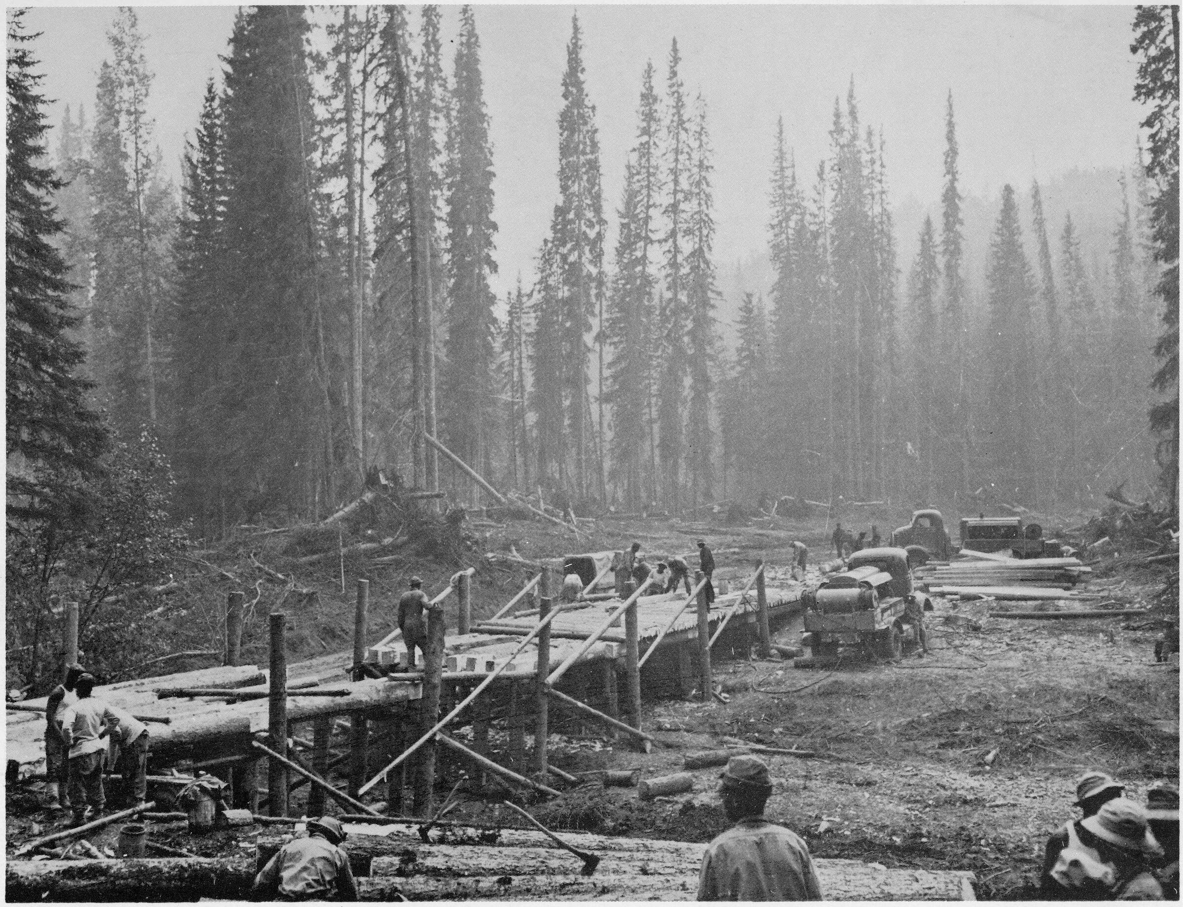 | 27 — | Dozens of streams and lakes both large and small, had to be spanned as the road progressed. Practically every type of timber structure was used to provide a crossing, but the type most often used was the timber trestle bridge. This photo shows a trestle bridge during construction and illustrates the use of the timber immediately adjacent to the bridge site. |
| 28 — | A convoy of supply trucks is shown moving over a section of the Alcan Highway. The completion of this strategic project meant that supplies could get to the many airfields and army camps in this area without being subjected to the hazards of submarine warfare. 1- 13985 Army Fort Belvoir, Va. 7 June 57 2,500 Guide written: June 24, 2016 |